Maps
to
776
921
80
1,003
10
9
2
1
1
1
2,926
2,181
476
3
289
34
10
127
7
35
9
2
5
3
4
2
991
16
13
11
4
106
44
31
19
17
1,003
1,003
1,003
63
12
11
10
6
Maps For Sale
Period: Mid-20th Century
Period: 17th Century
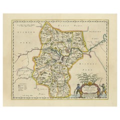
17th-Century Original Antique Map of Hunan and Hubei Provinces, China – by Blaeu
Located in Langweer, NL
Title: 17th-Century Antique Map of Hunan and Hubei Provinces, China – "Hvqvang" by Blaeu, Richly Detailed and Illustrated
Description: This beautiful 17th-century map of the regions that now comprise Hunan and Hubei Provinces, historically referred to as "Hvqvang," was created by Johannes Blaeu and published in 1655 as part of the *Novus Atlas Sinensis*. This map, drawn with input from Jesuit missionary Martino Martini, provides a meticulous representation of central China’s geography, capturing its rivers, towns, and mountainous terrain.
The Yangtze River (Changjiang) is prominently featured, emphasizing the region’s importance as a vital waterway for trade and transportation. Wuhan, now a modern metropolis, and Changsha, the capital of Hunan Province, were historically significant cities that appear on the map. The area is also notable for its fertile lands and contributions to China’s agricultural prosperity, particularly in rice and tea production.
The decorative cartouche in the lower-right corner features two figures in traditional Chinese attire standing amid bamboo, symbolizing the cultural and natural richness of the region. Blaeu’s map combines precision and artistry, with vibrant hand-coloring distinguishing boundaries and geographical features. The copperplate engraving ensures fine detail, making this map a remarkable historical artifact.
Condition: Near excellent. Clean impression with vivid hand-coloring. Wide margins with minor age-toning appropriate for its age.
Framing Tips: Use a neutral double mat and a gilt or dark wood frame to enhance the presentation. UV-protective glass is recommended to preserve the vivid hand-coloring and intricate engraving details.
Hunan and Hubei, historically referred to as "Hvqvang," are known for their strategic location along the Yangtze River and their cultural and economic significance in Chinese history. The region’s fertile lands have supported extensive rice cultivation, earning it the title of one of China’s "breadbaskets." Hubei, with Wuhan at its center, has long been a hub of transportation and trade, owing to the convergence of the Yangtze and Han Rivers. Hunan, with Changsha as its capital, is known for its rich cultural heritage and contributions to Chinese literature and art.
Important places in the region include Wuhan, an ancient trade center, and Changsha, known for its historical sites and cultural prominence. The Yangtze River, a key feature on the map, highlights the region’s historical importance as a major waterway for commerce and agriculture. Other notable features include Dongting Lake, a vital ecological and cultural landmark, and the surrounding mountainous areas that have shaped the region’s history and development.
Keywords: antique map of Hunan, Hubei map, Hvqvang map, Yangtze River map, 17th-century Chinese map...
Category
1650s Antique Maps
Materials
Paper
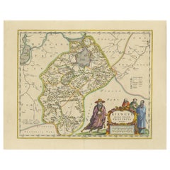
17th-Century Antique Map of Jiangxi (Kiangsi) Province, China – by Blaeu
Located in Langweer, NL
Title: 17th-Century Antique Map of Jiangxi Province, China – "Kiangsi" by Blaeu, Detailed and Vibrantly Colored
Description: This detailed 17th-century map of Jiangxi Province, historically referred to as "Kiangsi," was created by Johannes Blaeu and published in 1655 as part of the *Novus Atlas Sinensis*. Jiangxi, located in southeastern China, is known for its cultural heritage, scenic landscapes, and significant contributions to Chinese history.
The map meticulously charts Jiangxi’s geography, including mountain ranges, rivers, and cities, with place names rendered in Latin. Poyang Lake, one of the largest freshwater lakes in China, is prominently depicted, emphasizing the region’s ecological and economic importance. The map also highlights key cities such as Nanchang, the provincial capital, which has long been a cultural and political center, and Jingdezhen, globally famous as the center of Chinese porcelain production.
The decorative cartouche in the lower-right corner features traditional Chinese figures, adding cultural depth to the map. Blaeu’s craftsmanship is evident in the precise copperplate engraving and the vibrant hand-coloring, which enhances the boundaries and natural features, making this map both a functional document and a work of art.
Condition: Nearly excellent. Sharp impression with vivid hand-coloring. Wide margins with minor age-toning appropriate for its age.
Framing Tips: Use a neutral double mat and an ornate gilt or dark wood frame to highlight the map’s historical and artistic value. UV-protective glass is recommended to preserve the hand-coloring and intricate details.
Jiangxi, historically referred to as "Kiangsi," is famous for its rich cultural history, stunning landscapes, and economic contributions. It has been a key region for porcelain production, with Jingdezhen renowned as the "Porcelain Capital" of the world. Poyang Lake, featured prominently on the map, is vital for fishing, transportation, and its ecological significance. The province’s location along the Gan River has historically made it an important transportation corridor. Nanchang, the provincial capital, is noted for its historical landmarks and political significance in modern Chinese history.
Keywords include: antique map of Jiangxi, Kiangsi map, Poyang Lake, Jingdezhen porcelain, 17th-century China map...
Category
1650s Antique Maps
Materials
Paper
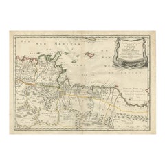
Rare Antique Map of 'Barbarie' or Northern Africa, 1655
Located in Langweer, NL
Antique map titled 'Partie de la Coste de Barbarie en Africque ou sont les Royaumes de Tunis et Tripoli et Pays Circomvoisins'. This map depicts North Africa with Malta and originate...
Category
17th Century Antique Maps
Materials
Paper
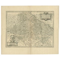
Antique Map of the Region of Étampes and Sens by Janssonius, c.1650
Located in Langweer, NL
Antique map titled 'Gastinois et Senonois'. Old map of the region of Étampes and Sens, France. It shows the cities of Sens, Melun, Étampes, Orleans, Fontainebleau, Montargis and othe...
Category
17th Century Antique Maps
Materials
Paper
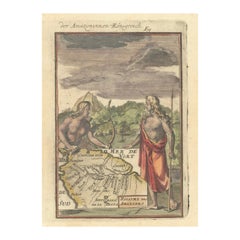
1684 Mallet Map of Amazon River & Kingdom of Amazons – Hand Colored, Miniature
Located in Langweer, NL
This map, titled 'Royaume des Amazones', was created by Alain Manesson Mallet and published in 1684 in a German edition of *Beschreibung des Gantzen Welt-Kreisses*, a renowned work d...
Category
1680s Antique Maps
Materials
Paper
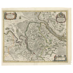
Johannes Janssonius' 17th-Century Map of the Duchy of Bremen in Germany
Located in Langweer, NL
The map titled "Ducatus olim Episcopatus Bremensis et ostiorum Albis et Visurgis Fluviorum novissima Descriptio" by Johannes Janssonius provides a rich historical and geographical il...
Category
1650s Antique Maps
Materials
Paper
Antique Map of the of the Course of the Albis River 'or Elbe River'
Located in Langweer, NL
Antique map titled 'Albis Fluvius Germaniae celebris A Fontiubus Ad Ostia, Cum Fluminibus ab utroque latere in illum fluenibus descriptus'. Detailed map of the course of the Albis Ri...
Category
Mid-17th Century Antique Maps
Materials
Paper
Antique Map of the Area Around Venice in Italy by H. Hondius, circa 1606
By Gerard Mercator, Jodocus Hondius
Located in Langweer, NL
Attractive and early map of the area around Venice, Italy. With South-Tirol in the North, areas of Krain (Slovenia), Croatia, Ferrara, Modena and Piacenza. In the east with areas aro...
Category
Early 17th Century Antique Maps
Materials
Paper
Rare Hand-Colored Map of Lorraine and Barrois, France by Frederik De Wit c. 1688
Located in Langweer, NL
Title: Rare Hand-Colored Map of Lorraine and Barrois by Frederik De Wit c. 1688
Description: This remarkable 17th-century map, titled "Generalis Lotharingiae Ducatus," offers a deta...
Category
1680s Antique Maps
Materials
Paper
Antique Map of the Region of Nivernais by Janssonius, 1657
Located in Langweer, NL
Antique map of France titled 'Carte du Païs et Duché de Nivernois'. Decorative map of the Nivernais region, part of Burgundy, France. This map originates from 'Atlas Novus, Sive Thea...
Category
17th Century Antique Maps
Materials
Paper
Original 17th-Century Antique Map of Henan (Honan) Province, China – by Blaeu
Located in Langweer, NL
17th-Century Antique Map of Henan Province, China – "Honan" by Blaeu, with Detailed Cartography and Artistic Cartouches
Description: This exceptional 17th-century map of Henan Province, historically referred to as "Honan," was created by Johannes Blaeu and published in 1655 as part of the *Novus Atlas Sinensis*. Henan, located in central China, is known as the cradle of Chinese...
Category
1650s Antique Maps
Materials
Paper
North & South America: A 17th Century Hand-colored Map by Jansson & Goos
Located in Alamo, CA
A 17th century hand-colored map of North & South America entitled "Americae Descriptio" by the cartographer Johannes Jansson, published in Jansson's Atlas Minor in Amsterdam in 1628....
Category
1620s Dutch Antique Maps
Materials
Paper
Rare Hand-Colored Map of Champagne and Brie, France, by Frederik De Wit c. 1688
Located in Langweer, NL
Title: Rare Hand-Colored Map of Champagne and Brie by Frederik De Wit c. 1688
Description: This exquisite 17th-century map, "Champagne et Brie," beau...
Category
1680s Antique Maps
Materials
Paper
1690 Frederick de Wit Sea Chart of Hudson Bay, Baffin Bay and Greenland
Located in Langweer, NL
Title: c. 1690 Frederick de Wit Sea Chart of Hudson Bay, Baffin Bay, and Greenland - Engraved by Romeyn de Hooghe
This striking sea chart by Frederick de Wit, titled "Septemtrionali...
Category
1690s Antique Maps
Materials
Paper
Old Antique Map of the East Indies and Southeast Asia, ca.1644
Located in Langweer, NL
Antique map titled 'India quae Orientalis dicitur, et Insulae adiacentes'.
Old map of the East Indies and Southeast Asia showing the area between India in the West and parts of Japan, the Marianas and New Guinea/Australia in the East. This map is dedicated to D. Christophorus Thisius by Henricus...
Category
1640s Antique Maps
Materials
Paper
Mid-Century World Map Globe Table Light or Lamp
Located in Miami, FL
Good quality world map globe lamp.
If you are looking for stylish and beautiful quality item to upgrade your interior (whether at home or in your office) then this Parisian globe...
Category
Mid-20th Century French Mid-Century Modern Maps
Materials
Chrome
1767 D’Anville Map of the Holy Land: Ancient Divisions and Biblical Geography
Located in Langweer, NL
Ancient Map of Palestine or the Holy Land by D'Anville (1767)
This detailed map, created by the renowned French cartographer Jean Baptiste Bourguignon d'Anville in 1767, depicts the...
Category
1670s Antique Maps
Materials
Paper
Antique Print of Hanseatic City of Lübeck in Northern Germany by Merian, c.1650
Located in Langweer, NL
Antique print titled 'Lubecca, Lübeck'. A bird's eye view of Lubeck, the northern German city in Schleswig-Holstein. This print originates from 'Topographia Saxoniae Inferioris'.
Ar...
Category
17th Century Antique Maps
Materials
Paper
Antique Map of the Island of Djerba by Coronelli '1691'
Located in Langweer, NL
Antique map titled 'Isola e Castello di Gerbi'. Original antique map of the Island of Djerba, Tunisia, in Africa. Includes an inset of the Djerba Castle in upper right. This map orig...
Category
Late 17th Century Antique Maps
Materials
Paper
17th Century Nautical Chart of Skagerrak and Øresund by Johannes van Keulen
Located in Langweer, NL
This map titled *Pascaret van Schager-Rack de Bælt en de Sondt* was created by the prominent Dutch cartographer Johannes van Keulen and published in Amsterd...
Category
Late 17th Century Antique Maps
Materials
Paper
Antique Miniature Map of the Roman Province of Illyricum 'Dalmatia'
Located in Langweer, NL
Antique miniature map titled 'Illyricum'. Original small map of Illyricum. The Roman province of Illyricum stretched from the Drilon River (the Drin, in...
Category
Early 17th Century Antique Maps
Materials
Paper
Rare Original Antique Ptolemy Map of Ceylon, Present Day Sri Lanka
Located in Langweer, NL
Original antique map titled 'Tab XII Asiae Taprobanam (..)'. For this map of Toprobana (Sri Lanka), Ptolemy drew on the accounts of travelers and sailors and though the information was secondhand and often inaccurate, it represented the most advanced account of the world's geography at that time. This map depicts the island with the typical misconceptions of the period with the enlarged island straddling the Equator and nearly divided by a ridge of mountains. A small part of India is incorrectly shown in the northeast corner of the map and a spurious coastline labeled Gangem fills the upper right corner. The stipple engraved sea contains an oriental ship...
Category
Late 17th Century Antique Maps
Materials
Paper
Dutch Conquest of Rio Grande, Brazil (1633) Under Prince Frederick Hendrick
Located in Langweer, NL
The image is an engraving titled “VEROVERINGE VAN RIO GRANDE IN BRASIL ANNO 1633.” This historical print depicts the Dutch conquest of Rio Grande in Brazil, known today as Natal, dur...
Category
1690s Antique Maps
Materials
Paper
Globe, Solid Rotating Brass Frame with Spinning Globe
Located in Dallas, TX
Globe, solid rotating brass frame with spinning globe, faux hardstone.
Category
Mid-20th Century French Maps
Materials
Brass
Antique Map of the City of Geldern by Blaeu, 1649
Located in Langweer, NL
Antique map titled 'Gelre'. Old map of the city of Geldern, Germany. This map originates from 'Toonneel der Steden van de Vereenighde Nederlanden' by J. Blaeu.
Artists and Engrav...
Category
17th Century Antique Maps
Materials
Paper
Very Rare Antique Print of the City of Nice in France, c.1700
Located in Langweer, NL
Antique print titled 'Nicaea Civitas'. Original antique print with a view of the city of Nice, France. Rare in this edition. Source unknown, to be determined.
Artists and Engraver...
Category
17th Century Antique Maps
Materials
Paper
Antique Map of Morocco Showing Towns of Marakesh, Taradant and Fez, 1636
Located in Langweer, NL
Antique map titled 'Fezzae et Marocchi regna Africae Celeberrima'. Map of Morocco, showing large fortified towns of Marakesh, Taradante and Fez, towns, mountains, rivers, lakes, etc....
Category
17th Century Antique Maps
Materials
Paper
Large Map of Castile's Southern Realms - Granada, Andalusia, and Murcia, 1652
Located in Langweer, NL
This antique map, titled 'Les Etats de la Couronne de Castille', represents the southern regions of the Crown of Castile, specifically the territories of Andalusia, Granada, and Murc...
Category
Mid-17th Century Antique Maps
Materials
Paper
Antique Sea Chart of Hudson Bay and Arctic Canada by Van Keulen, circa 1681
Located in Langweer, NL
Antique map titled 'Pascaarte vande Noorderzee Custen van America (..)'. Sea chart of Hudson Bay and Arctic Canada. Compass roses, loxodromic lines, and ships decorate the oceans and...
Category
Late 17th Century Antique Maps
Materials
Paper
17th Century Hand Colored Map of the Liege Region in Belgium by Visscher
Located in Alamo, CA
An original 17th century map entitled "Leodiensis Episcopatus in omnes Subjacentes Provincias distincté divisusVisscher, Leodiensis Episcopatus" by Nicolaes Visscher II, published in Amsterdam in 1688. The map is centered on Liege, Belgium, includes the area between Antwerp, Turnhout, Roermond, Cologne, Trier and Dinant.
This attractive map is presented in a cream-colored mat measuring 30" wide x 27.5" high. There is a central fold, as issued. There is minimal spotting in the upper margin and a tiny spot in the right lower margin, which are under the mat. The map is otherwise in excellent condition.
The Visscher family were one of the great cartographic families of the 17th century. Begun by Claes Jansz Visscher...
Category
Late 17th Century Dutch Antique Maps
Materials
Paper
A Handsome & Detailed Map of the Duchy of Mecklenburg & Pomerania, Germany, 1680
Located in Langweer, NL
Antique map titled 'Ducatus Meklenburgicus in quo sunt Ducatus Vandaliae et Meklenburgi Ducatus et Comitatus Swerinensis.'
A handsome and detailed map of the Duchy of Mecklenburg...
Category
1680s Antique Maps
Materials
Paper
Original Antique Hand- Map of Africa by Allard '1697'
Located in Langweer, NL
Antique map titled 'Novissima et Perfectissima Africae (..)'. Beautiful large map of Africa. This is the 3rd state of the map, with climate notation add...
Category
Late 17th Century Antique Maps
Materials
Paper
Original Antique Engraving of a Horse Race at a Japanese Racing Track, 1669
Located in Langweer, NL
Description: Antique print, titled: 'Japansche Ren-baanen.' -
View of a race at a Japanese (horse) racing track. A man runs beside a horse (the horse's rein in his hand). A man w...
Category
1660s Antique Maps
Materials
Paper
Rare Map of Kildin Island in Russia Plus Engraving of Seal Hunting, 1614
Located in Langweer, NL
Insula Kilduyn. Orig. copper-engraving after details from J. H. van Linschoten's map taken from his account of the three expeditions undertaken by Willem Barents in 1594, in an attem...
Category
Early 17th Century Antique Maps
Materials
Paper
1606 Hand-Colored Woodcut Map of Sumatra from Ramusio’s Delle Navigationi
Located in Langweer, NL
This is a fascinating woodcut map titled *Taprobana*, depicting the island of Sumatra, hand-colored, and published in Venice in 1606. The map originates from Giovanni Battista Ramusi...
Category
Early 1600s Antique Maps
Materials
Paper
Antique Map of India and Southeast Asia by Sanson '1654'
Located in Langweer, NL
Antique map titled 'Partie Meridionale de l'Inde'. Early map of India and Southeast Asia. The map shows most of modern India, Bangladesh and Burma, the whole of Sri Lanka, Thailand, ...
Category
Mid-17th Century Antique Maps
Materials
Paper
Antique Map of Stavoren by Priorato, 1673
Located in Langweer, NL
Antique map titled 'Staveren'. Original antique map of the city of Stavoren, Friesland, the Netherlands. This map orginates from 'Teatro del Belgio (..)', published in Frankfurt am Main in 1673 by Gualdo Priorato. Artists and Engravers: Author: Galeazzo Gualdo Priorato (1606-1678) entered military service at a very young age and served in Flanders under the Prince of Orange. After his retirement, he authored several historical accounts including the Teatro del Belgio, which described the Catholic/Protestant wars in Belgium and Netherlands during the seventeenth century. His superb plans do not show the internal layout of the cities, except for showing the locations of the major churches. Instead the emphasis is on the fortification, as well as on the surrounding site, rivers and canals...
Category
17th Century Antique Maps
Materials
Paper
Antique Map of the Region of Oldenburg, Germany
By Willem Blaeu
Located in Langweer, NL
Antique map titled 'Oldenburg Comitatus'. Detailed old map of Oldenburg, Germany. The map also shows Bremen and the Jade Bight. Published by W. Blaeu, circa 1640. Willem Jansz. Blaeu...
Category
Mid-17th Century Antique Maps
Materials
Paper
Circa 1659 Johannes Blaeu Map: Ducatus Silesiae Ligniciensis, Legnica Region
Located in Langweer, NL
Circa 1659 Johannes Blaeu Map: Ducatus Silesiae Ligniciensis, Legnica Region
This hand-colored map from circa 1659 by Johannes Blaeu, titled "Ducatus Silesiae Ligniciensis," depicts the region centered around Legnica (Lignitz) in southwestern Poland.
It extends to include the cities of Lublin, Jawor, and Lwówek Śląski.
The map features decorative elements such as a title cartouche adorned with a putto, garlands of fruit, and birds, and a distance scale cartouche that includes a hunter with his dogs.
This map is dedicated to Georgius Rodulfus, the Duke of Silesia, by Ionas Scultetus, reflecting the map's historical context and noble patronage.
It includes Spanish text on the verso, indicating publication between 1659 and 1672. Measuring 20.9 inches wide by 16.3 inches high, the map is in excellent condition with a sharp impression, full contemporary color, and a large watermark of the god Atlas. Minor details include a bit of printer's ink residue at the right and slight marginal soiling.
Keywords:
- Johannes Blaeu map
- Silesia historical map
- Legnica (Lignitz) map
- 17th-century Poland map...
Category
1650s Antique Maps
Materials
Paper
Antique Map of Turkey with Cyprus and Greece Islands by N. Sanson, circa 1652
Located in Langweer, NL
Antique map of Turkey, Anatolie with Cyprus and the Greece islands. Attractive scrolled title cartouche to top right corner. Blank verso.
Category
Mid-17th Century Antique Maps
Materials
Paper
Antique Engraving with a Plan of Rhodes, Greece, 1688
Located in Langweer, NL
Description: Antique map, titled: 'Rhodos.' - Plan of Rhodes, Greece. This map originates from 'Nauwkeurige Beschrijving der eilanden in de in de Archipel der Middellantsche Zee', by...
Category
1680s Antique Maps
Materials
Paper
17th-Century Map of Sri Lanka (Ceylon) by Mercator & van den Keere, 1630
Located in Langweer, NL
This captivating 17th-century map titled "Zeilan ou Ceilon Isle" (Ceylon/Sri Lanka) was engraved by Petrus Kaerius (van den Keere) and published in Mercator's "Atlas Minor," edited b...
Category
1630s Antique Maps
Materials
Paper
Map of Languedoc-Roussillon and Provence in France and Piedmont in Italy, c1680
Located in Langweer, NL
Title: Antique map titled 'La basse Partie du Gouvernement de Languedoc, environne des Frontiers des Gouverns de Provence, de Dauphine de Lyonnais et de Guienne et Gascogne ; Les Fro...
Category
1680s Antique Maps
Materials
Paper
Antique Map of the Cape Verde Islands, Africa, ca.1670
Located in Langweer, NL
Antique map titled 'Pascaert van de Soute Eylanden ofte Ilhas de Cabo Verde'.
This map depicts the Cape Verde Islands (Africa). Islands titled 'Ile de B...
Category
1670s Antique Maps
Materials
Paper
Antique Map of Japan by A.M. Mallet, 1683
Located in Langweer, NL
A charming late 17th century French map with a very decorative title cartouche showing trumpet-blowing cherubs, by Allain Manneson Mallet (1630-1706), a well traveled military engine...
Category
Late 17th Century Antique Maps
Materials
Paper
The Principality of Dombes: A 17th-Century Cartographic Jewel by Jan Jansson
Located in Langweer, NL
The text on the map "La principaute de Dombes; J. van den Eynde sculpit.; La Principavte de Dombes" indicates that it is a map of the principality of Dombes, engraved by J. van den E...
Category
1630s Antique Maps
Materials
Paper
Antique Lithography Map, Oxfordshire, English, Framed Cartography, Robert Morden
Located in Hele, Devon, GB
This is an antique lithography map of Oxfordshire. An English, framed atlas engraving of cartographic interest by Robert Morden, dating to the late 17th century and later.
Superb l...
Category
Late 17th Century British William and Mary Antique Maps
Materials
Paper
Old Print of Standia, a Greek Island 'Heraklion, Crete, Greece, Balkans', 1688
Located in Langweer, NL
Antique print Greece titled 'Het Eilant Standia'. Old print of the island Standia, near Crete, Greece. This print originates from 'Nauwkeurige Bes...
Category
17th Century Antique Maps
Materials
Paper
Antique Map of India and the Gulf of Bengal by Mallet, c.1686
Located in Langweer, NL
Antique map titled ?Partie Orientale de la Terre Ferme de l'Inde Moderne. Small map of India and the Gulf of Bengal. This map originates from a German edition of 'Description de l' Univers'.
Artists and Engravers: Alain Manesson Mallet (1630-1706) was a French cartographer and engineer. He started his career as a soldier in the army of Louis XIV, became a Sergeant-Major in the artillery and an Inspector of Fortifications. He also served under the King of Portugal, before returning to France, and his appointment to the court of Louis XIV. His military engineering and mathematical background led to his position teaching mathematics at court. His 'Description de L'Universe' contains a wide variety of information, including star maps...
Category
17th Century Antique Maps
Materials
Paper
Antique Map of Nottinghamshire by Speed, 1676
Located in Langweer, NL
Antique map titled 'The Countie of Nottingham (..)'. Map of Nottinghamshire, England. Includes an inset town plan of Nottingham. This map originates from 'Theatre of Great Britaine' ...
Category
17th Century Antique Maps
Materials
Paper
Antique Map of Epirus 'Albania, Greece' by J. Janssonius, circa 1650
Located in Langweer, NL
This map covers the northwestern coast of Greece and part of present-day Albania. The map was drawn by Johannes Wilhelm Laurenberg, a mathematician and historian who produced several...
Category
Mid-17th Century Antique Maps
Materials
Paper
Circa 1659 Willem Blaeu Map: Southwestern Switzerland with Geneva & Lakes
Located in Langweer, NL
Circa 1659 Willem Blaeu Map: Southwestern Switzerland with Geneva & Lakes
This detailed map from circa 1659 by Willem Blaeu, titled "Das Wiflispurgergow," highlights the southwestern region of Switzerland.
It features significant landmarks such as Geneva, Lake Geneva (Lacus Lemannus), Lake Neuchatel, Lake Biel, Bern, Freiburg, and Lake Thuner.
Based on the work of Gerard Mercator, this map is published with Spanish text on the verso, dating from the period between 1659 and 1672.
Measuring 19.9 inches wide by 15.1 inches high, the map is rendered in full contemporary color on a bright sheet that bears a large watermark of the god Atlas.
The condition is excellent, with a sharp impression, short centerfold separations at the top and bottom margins, and an archivally repaired tear in the right margin.
Keywords:
- Willem Blaeu map
- Gerard Mercator
- 17th-century Switzerland map...
Category
1650s Antique Maps
Materials
Paper
An Original Antique Mid-17th Century Blaeu Map of Styria in Southeastern Austria
Located in Langweer, NL
This is an antique map of Styria (referred to as “Stiria” or “Steyrmarck”), published by the renowned Dutch cartographer Willem Janszoon Blaeu (often simply “Blaeu”). The first editi...
Category
1640s Antique Maps
Materials
Paper
Antique Plan of the Siege of Grave by Guicciardini, c.1608
Located in Langweer, NL
Antique map titled 'Hic est situs oppidi Grauiae (..)'. Bird's eye view plan of Grave, The Netherlands, Holland. Showing the siege of Grave in the year 1602. Source unknown, to be de...
Category
17th Century Antique Maps
Materials
Paper
Mapping the Heart of France: Willem Blaeu's 17th Century Île-de-France, ca.1650
Located in Langweer, NL
This original antique map titled "Le Gouvernement de l'Isle de France" represents the Île-de-France region, which historically was one of the provinces of France and contained the ci...
Category
1650s Antique Maps
Materials
Paper
Antique Map of the Berchtesgaden Region by Scherer, 1699
Located in Langweer, NL
Antique map titled 'Principat et praepositura Berchtesgadensis (..).' Detailed uncommon map of the Berchtesgaden region in southern Bavaria, Germany. Source unknown, to be determined...
Category
17th Century Antique Maps
Materials
Paper
Old Map of the American Railroad Network and All Weather Roads on Verso, 1931
Located in Langweer, NL
This is the “New Census Edition” of Clason’s United States Green Guide. It features two large maps of the United States on a single sheet.
The recto map shows the complete road net...
Category
1930s Vintage Maps
Materials
Paper
Antique Map of the Region of Bresse by Hondius, circa 1630
Located in Langweer, NL
Antique map titled 'Bresse'. Old map of the former region of Bresse, France. It is located in the regions of Auvergne-Rhône-Alpes and Bourgogne-Franche-Comté of eastern France. This ...
Category
Mid-17th Century Antique Maps
Materials
Paper
