Maps
to
2,380
2,816
114
2,933
26
12
1
1
1
1
2,926
2,181
476
3
289
34
10
127
7
35
9
2
5
3
4
2
2,917
33
20
4
3
199
72
63
34
31
2,933
2,933
2,933
63
24
16
13
13
Maps For Sale
Period: 18th Century and Earlier
Period: 1910s
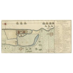
Antique Colored Engraving of Madras 'Chennai' and Fort St. George in India, 1751
Located in Langweer, NL
Antique print titled 'Plan de Madras et du Fort St. Georges'. Plan of the city of Madras (or Chennai), the capital of the state of Tamil Nadu, India. Also shows a plan of Fort St. Ge...
Category
18th Century Antique Maps
Materials
Paper
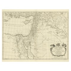
1773 John Blair Map of the Ancient Holy Land: Tribes, Journeys, and Empires
Located in Langweer, NL
Title: 1773 John Blair Map of the Ancient Holy Land: Tribes, Journeys, and Empires
This exceptional map by John Blair, published in London in 1773, offers a richly detailed view o...
Category
1770s Antique Maps
Materials
Paper
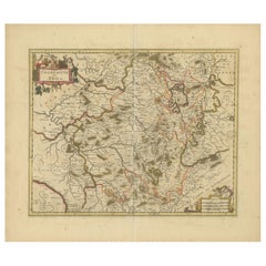
Rare Hand-Colored Map of Champagne and Brie, France, by Frederik De Wit c. 1688
Located in Langweer, NL
Title: Rare Hand-Colored Map of Champagne and Brie by Frederik De Wit c. 1688
Description: This exquisite 17th-century map, "Champagne et Brie," beau...
Category
1680s Antique Maps
Materials
Paper
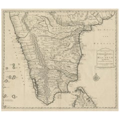
Map of Choromandel & Malabar, Incl Kerala, Tamil Nadu & Part of Sri Lanka, 1726
Located in Langweer, NL
Antique map titled 'Nieuwe kaart van Choromandel ende Malabar.'
Original antique map of Southern India documenting the VOC's areas of influence. Included is Kerala, Tamil Nadu...
Category
1720s Antique Maps
Materials
Paper
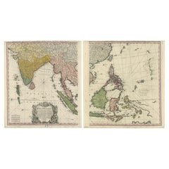
1748 Homann Heirs Double Map of the East Indies and Southeast Asia
Located in Langweer, NL
Title: 1774 Homann Heirs Double Map of the East Indies and Southeast Asia
Description:
This stunning 1774 double map by the Homann Heirs showcases the East Indies and Southeast ...
Category
1740s Antique Maps
Materials
Paper
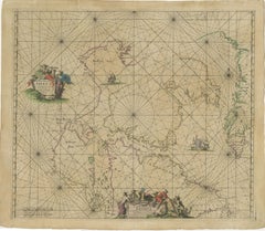
1690 Frederick de Wit Sea Chart of Hudson Bay, Baffin Bay and Greenland
Located in Langweer, NL
Title: c. 1690 Frederick de Wit Sea Chart of Hudson Bay, Baffin Bay, and Greenland - Engraved by Romeyn de Hooghe
This striking sea chart by Frederick de Wit, titled "Septemtrionali...
Category
1690s Antique Maps
Materials
Paper
Original Antique Map of Fez and Morocco
Located in Langweer, NL
Antique map titled 'Karte von Fes und Marócos (..)'. Original old map of Fez (or Fes) and Morocco. Also shows the Strait of Gibraltar. By Friedrich Gottlieb Canzler, published 1799.
Category
Late 18th Century Antique Maps
Materials
Paper
North & South America: A 17th Century Hand-colored Map by Jansson & Goos
Located in Alamo, CA
A 17th century hand-colored map of North & South America entitled "Americae Descriptio" by the cartographer Johannes Jansson, published in Jansson's Atlas Minor in Amsterdam in 1628....
Category
1620s Dutch Antique Maps
Materials
Paper
Original Antique Map of Egypt by Van Dùren '1749'
Located in Langweer, NL
Decorative German antique engraving with titled 'Neue Vorstellung von Aegypten (..)'. It concerns a rare original antique map of Egypt. This map o...
Category
Mid-18th Century Antique Maps
Materials
Paper
Very Large Double Page Detailed Map of Italy and Surrounding Regions, 1794
Located in Langweer, NL
This is a large (two seperate sheets) and detailed map of Italy, including the southern parts of Germany, Dalmatia, the adjacent countries, and the Illyric Islands. The map is titled...
Category
1790s Antique Maps
Materials
Paper
Large Scale Map of Greece, Extending to Cythera with Inset of Macedonia, ca.1786
Located in Langweer, NL
Antique map titled 'Graeciae Antiquae'.
Large scale map of Greece, extends south to the island of Cythera. Inset map shows details of Macedonia. Pu...
Category
1780s Antique Maps
Materials
Paper
Old Antique Map of the East Indies and Southeast Asia, ca.1644
Located in Langweer, NL
Antique map titled 'India quae Orientalis dicitur, et Insulae adiacentes'.
Old map of the East Indies and Southeast Asia showing the area between India in the West and parts of Japan, the Marianas and New Guinea/Australia in the East. This map is dedicated to D. Christophorus Thisius by Henricus...
Category
1640s Antique Maps
Materials
Paper
Rare Antique Engraving of the City of Copenhagen, Denmark, ca.1720
Located in Langweer, NL
Antique print titled 'Copenhagen. Die Königl. Residenz und Haupt Stadt in Dänemark'. Panoramic view of the city of Copenhagen, Denmark. This print, most likely, originates from the s...
Category
18th Century Antique Maps
Materials
Paper
Antique Map of Eastern Seram, Part of the Maluku Island in East Indonesia, 1726
Located in Langweer, NL
Antique map titled 'De Landvoogdy van Amboina met de elf onderhoorige Eylanden.' Detailed map of the eastern part of Seram in Indonesia, part of the Maluku islands. Map of the southe...
Category
18th Century Antique Maps
Materials
Paper
Antique Print of the Malabar Coast of India showing the VOC establishments, 1726
Located in Langweer, NL
Dutch print with the title: Platte Grond van t'Fort Tricoen male met de daar aangelegen Pagoods-Berg (Trincomalee, Sri Lanka)
The map is taken from: 'Oud en Nieuw Oost-Indiën' van François Valentyn.
1) Ottens, Frederik (engraver / etcher)
2) Braam, J. van (publisher)
3) Linden, Gerard onder de (publisher)
MALABAR COAST...
Category
1720s Antique Maps
Materials
Paper
Architectural Antique Print of Various Garden Temples by Le Rouge, c.1785
Located in Langweer, NL
Untitled antique print showing various garden temples. This print originates from 'Jardins Anglo-Chinois à la Mode' by Georg Louis le Rouge. Artists and ...
Category
18th Century Antique Maps
Materials
Paper
The Valley of Inspruck: An 18th-Century Engraved Perspective, 1792
Located in Langweer, NL
Title: "The Valley of Inspruck: An 18th-Century Engraved Perspective"
This elegant original antique engraving, titled "The Valley of Inspruck," showcases a serene view of the Innsbruck Valley. The artwork is delicately rendered, capturing the grandeur of the mountains and the pastoral tranquility of the valley.
The print depicts a detailed landscape scene, replete with towering craggy peaks that loom over a peaceful settlement nestled in the valley. A striking feature is the contrast between the ruggedness of the natural environment and the cultivated lands and architecture, indicating a harmonious coexistence of humanity with nature.
It was published as directed on January 1, 1792, by T & G Egerton of Whitehall for the author. Albanis Beaumont is credited with the original design ('Del.' for delineavit, indicating he drew the initial illustration), and Cornelis Apostool is noted for the engraving work ('Sculp.' for sculpsit, indicating he engraved the image).
The publication of this print during the late 18th century aligns with a time when there was a heightened interest in natural beauty and the picturesque, reflected in the art and literature of the Romantic period. This print would have appealed to those with an appreciation for both the aesthetic and the sublime qualities of the European landscape.
The publication by T & G Egerton, a reputable firm known for their work in the arts, and the involvement of a skilled artist and engraver like Beaumont and Apostool, respectively, underline the quality and desirability of the print. It is a piece that would attract collectors of fine engravings and admirers of European landscapes, offering a window into the aesthetic values and artistic endeavors of the late 18th century.
As a historical piece, this print offers a view into the past, inviting contemplation of the rich cultural and natural heritage of the Innsbruck area. It is a valuable collectible for enthusiasts of antique maps and prints...
Category
Late 18th Century Antique Maps
Materials
Paper
1767 D’Anville Map of the Holy Land: Ancient Divisions and Biblical Geography
Located in Langweer, NL
Ancient Map of Palestine or the Holy Land by D'Anville (1767)
This detailed map, created by the renowned French cartographer Jean Baptiste Bourguignon d'Anville in 1767, depicts the...
Category
1670s Antique Maps
Materials
Paper
Antique Print of Hanseatic City of Lübeck in Northern Germany by Merian, c.1650
Located in Langweer, NL
Antique print titled 'Lubecca, Lübeck'. A bird's eye view of Lubeck, the northern German city in Schleswig-Holstein. This print originates from 'Topographia Saxoniae Inferioris'.
Ar...
Category
17th Century Antique Maps
Materials
Paper
Old 18th Century Composite Map of Key Caribbean Islands with Descriptive Texts
Located in Langweer, NL
Antique map titled 'Dominia Anglorum in praecipuis Insulis Americae ut sunt Insula S. Christophori, Antegoa, Iamaica, Barbados nec non Insulae Bermudes vel Sommers dictae. Die Englis...
Category
1740s Antique Maps
Materials
Paper
Antique Print of the City of Rome, Italy by Münster, C.1580
Located in Langweer, NL
Antique print titled 'Abbildung der Statt Rom/wie sie under Keyser Vespasiano und zu Plinii zeiten gewesen'. Woodcut of ancient Rome. This print originates from Munster's Cosmographi...
Category
16th Century Antique Maps
Materials
Paper
1584 Abraham Ortelius Map of Lower Burgundy, France
Located in Langweer, NL
1584 Abraham Ortelius Map of Lower Burgundy, France
Description of the Map:
This antique map by Abraham Ortelius, titled "Bvrgvndiae Inferioris Qvae Dvcatvs Nomine Censetur Des," w...
Category
16th Century Antique Maps
Materials
Paper
Antique Map of the Island of Djerba by Coronelli '1691'
Located in Langweer, NL
Antique map titled 'Isola e Castello di Gerbi'. Original antique map of the Island of Djerba, Tunisia, in Africa. Includes an inset of the Djerba Castle in upper right. This map orig...
Category
Late 17th Century Antique Maps
Materials
Paper
17th Century Nautical Chart of Skagerrak and Øresund by Johannes van Keulen
Located in Langweer, NL
This map titled *Pascaret van Schager-Rack de Bælt en de Sondt* was created by the prominent Dutch cartographer Johannes van Keulen and published in Amsterd...
Category
Late 17th Century Antique Maps
Materials
Paper
Antique Architectural Print of the Melville House in Fife, Scotland, 1725
Located in Langweer, NL
Antique print titled 'The Elevation of Melvin House in the Shire of Fyfe (..)'.
Old engraving of Melville House in Fife, Scotland. This print originates from 'Vitruvius Britannic...
Category
18th Century Antique Maps
Materials
Paper
Antique Bird's Eye-view Atjien or Atjeh in Aceh in Northern Sumatra, Indonesia
Located in Langweer, NL
Description: Antique print Indonesia titled 'Atsjien'. Bird's eye-view of the Town of Atjien on the northernmost point of Sumatra. This print originates from 'Oud en Nieuw Oost-Indië...
Category
1720s Antique Maps
Materials
Paper
Antique Miniature Map of the Roman Province of Illyricum 'Dalmatia'
Located in Langweer, NL
Antique miniature map titled 'Illyricum'. Original small map of Illyricum. The Roman province of Illyricum stretched from the Drilon River (the Drin, in...
Category
Early 17th Century Antique Maps
Materials
Paper
Old Map Covering All of Southeast Asia from Persia to the Timor Island, 1712
Located in Langweer, NL
Description: Antique map titled 'A New Map of the East Indies'. Old map covering all of Southeast Asia from Persia to the Timor Island, inclusive of the modern day nations of India, ...
Category
1710s Antique Maps
Materials
Paper
Rare Original Antique Ptolemy Map of Ceylon, Present Day Sri Lanka
Located in Langweer, NL
Original antique map titled 'Tab XII Asiae Taprobanam (..)'. For this map of Toprobana (Sri Lanka), Ptolemy drew on the accounts of travelers and sailors and though the information was secondhand and often inaccurate, it represented the most advanced account of the world's geography at that time. This map depicts the island with the typical misconceptions of the period with the enlarged island straddling the Equator and nearly divided by a ridge of mountains. A small part of India is incorrectly shown in the northeast corner of the map and a spurious coastline labeled Gangem fills the upper right corner. The stipple engraved sea contains an oriental ship...
Category
Late 17th Century Antique Maps
Materials
Paper
Dutch Conquest of Rio Grande, Brazil (1633) Under Prince Frederick Hendrick
Located in Langweer, NL
The image is an engraving titled “VEROVERINGE VAN RIO GRANDE IN BRASIL ANNO 1633.” This historical print depicts the Dutch conquest of Rio Grande in Brazil, known today as Natal, dur...
Category
1690s Antique Maps
Materials
Paper
Renaissance Mapping of Sumatra: Featuring Singapore in Münster’s Woodcut, c.1590
Located in Langweer, NL
Description: Antique map titled 'Sumatra ein grosse Insel / so von den alten Geographen Taprobana genennt worden'. Beautiful map of Sumatra and the southern part of Malaysia, with Si...
Category
16th Century Antique Maps
Materials
Paper
Antique Map of Eastern Turkey, Caucasus, Israel through Iraq and part of Arabia
Located in Langweer, NL
Antique map titled 'Nieuwe Kaart van Irak Arabia, Kurdistan, Diarbek, Turkomannia, Syrie en het Heilige Land'. Beautiful map including eastern Turkey, the Caucasus, Israel through Ir...
Category
Mid-18th Century Antique Maps
Materials
Paper
Navigational Chart of Jamaica, Cape Gracias a Dios, and the Mosquito Coast, 1775
Located in Langweer, NL
The map titled "The Island of Jamaica and Cape Gracias a Dios with the Banks (Shows Moskito Kings Party)" illustrates a significant historical period marked by shifting colonial infl...
Category
1770s Antique Maps
Materials
Paper
Antique Map of the City of Geldern by Blaeu, 1649
Located in Langweer, NL
Antique map titled 'Gelre'. Old map of the city of Geldern, Germany. This map originates from 'Toonneel der Steden van de Vereenighde Nederlanden' by J. Blaeu.
Artists and Engrav...
Category
17th Century Antique Maps
Materials
Paper
Very Rare Antique Print of the City of Nice in France, c.1700
Located in Langweer, NL
Antique print titled 'Nicaea Civitas'. Original antique print with a view of the city of Nice, France. Rare in this edition. Source unknown, to be determined.
Artists and Engraver...
Category
17th Century Antique Maps
Materials
Paper
Antique Map of Morocco Showing Towns of Marakesh, Taradant and Fez, 1636
Located in Langweer, NL
Antique map titled 'Fezzae et Marocchi regna Africae Celeberrima'. Map of Morocco, showing large fortified towns of Marakesh, Taradante and Fez, towns, mountains, rivers, lakes, etc....
Category
17th Century Antique Maps
Materials
Paper
Large Map of Castile's Southern Realms - Granada, Andalusia, and Murcia, 1652
Located in Langweer, NL
This antique map, titled 'Les Etats de la Couronne de Castille', represents the southern regions of the Crown of Castile, specifically the territories of Andalusia, Granada, and Murc...
Category
Mid-17th Century Antique Maps
Materials
Paper
Antique Map of Southeast Asia from Persia to the Timor Island, 1712
Located in Langweer, NL
Antique map titled 'A New Map of the East Indies'.
Old map covering all of Southeast Asia from Persia to the Timor Island, inclusive of the modern day nations of India, Ceylon, T...
Category
1710s Antique Maps
Materials
Paper
Spectacular 1770 Bird's-Eye View of Dunkirk Harbor by Basset, with 66 Landmarks
Located in Langweer, NL
This engraving, titled *Vue de Dunkerque du coté de la Mer*, is a spectacular bird's-eye view of Dunkirk from the sea, published by Basset around 1770.
It provides a detailed panor...
Category
1770s Antique Maps
Materials
Paper
Antique Sea Chart of Hudson Bay and Arctic Canada by Van Keulen, circa 1681
Located in Langweer, NL
Antique map titled 'Pascaarte vande Noorderzee Custen van America (..)'. Sea chart of Hudson Bay and Arctic Canada. Compass roses, loxodromic lines, and ships decorate the oceans and...
Category
Late 17th Century Antique Maps
Materials
Paper
A Handsome & Detailed Map of the Duchy of Mecklenburg & Pomerania, Germany, 1680
Located in Langweer, NL
Antique map titled 'Ducatus Meklenburgicus in quo sunt Ducatus Vandaliae et Meklenburgi Ducatus et Comitatus Swerinensis.'
A handsome and detailed map of the Duchy of Mecklenburg...
Category
1680s Antique Maps
Materials
Paper
17th Century Hand Colored Map of the Liege Region in Belgium by Visscher
Located in Alamo, CA
An original 17th century map entitled "Leodiensis Episcopatus in omnes Subjacentes Provincias distincté divisusVisscher, Leodiensis Episcopatus" by Nicolaes Visscher II, published in Amsterdam in 1688. The map is centered on Liege, Belgium, includes the area between Antwerp, Turnhout, Roermond, Cologne, Trier and Dinant.
This attractive map is presented in a cream-colored mat measuring 30" wide x 27.5" high. There is a central fold, as issued. There is minimal spotting in the upper margin and a tiny spot in the right lower margin, which are under the mat. The map is otherwise in excellent condition.
The Visscher family were one of the great cartographic families of the 17th century. Begun by Claes Jansz Visscher...
Category
Late 17th Century Dutch Antique Maps
Materials
Paper
Antique Print of the Batavia Massacre 'Present-Day Jakarta', Indonesia
Located in Langweer, NL
Antique print titled 'Tableau de la Partie de Batavia, ou s'est fait proprement le terrible Massacre des Chinois (..)'. Original antique print of the Batavia massacre. The 1740 Batav...
Category
Mid-18th Century Antique Maps
Materials
Paper
Antique Map of Asia Minor with Cyprus, Syria and Turkey and the Black Sea, 1747
Located in Langweer, NL
Antique map Middle East titled 'A New and accurate map of Anatolia or Asia Minor, with Syria and such other provinces of the Turkish Empire (.....
Category
18th Century Antique Maps
Materials
Paper
Antique Map of Mozambique and Cape of Good Hope with Kingdom Monomotapa, 1780
Located in Langweer, NL
Antique map titled 'Carte Du Canal De Mozambique.' The main map, on the right, covers from the Cape of Good Hope north as far as Zanzibar and modern day Kenya, focusing on the gold r...
Category
18th Century Antique Maps
Materials
Paper
Antique Map Dedicated to British Merchants Trading to North America, ca.1746
Located in Langweer, NL
Description: Antique map titled 'A New Chart of the Coast of New England, Nova Scotia, New France or Canada, with the islands of Newfoundland, Capte Breton, St John's (..)'. Map stre...
Category
1740s Antique Maps
Materials
Paper
Original Antique Hand- Map of Africa by Allard '1697'
Located in Langweer, NL
Antique map titled 'Novissima et Perfectissima Africae (..)'. Beautiful large map of Africa. This is the 3rd state of the map, with climate notation add...
Category
Late 17th Century Antique Maps
Materials
Paper
Limburg Cityscape 1580: Historical Copper Engraving by Braun and Hogenberg
Located in Langweer, NL
Title: Limburgum Oppidum Galliae Belgicae, vulgo Lympurch, gallicè, Lembor Dr.
Type: Print (Copper Engraving)
Circa 1580
Technique: Colored Copper Engraving
Medium: Handmade Paper
S...
Category
16th Century Antique Maps
Materials
Paper
Original Antique Map of England, Ireland, Scotland and Wales
Located in Langweer, NL
Antique map titled 'Les Isles Britanniques, ou sont les Royaumes d Angleterre (..)'. Detailed map of England, Ireland, Scotland and Wales, with French coast and part of the Netherlan...
Category
Early 18th Century Antique Maps
Materials
Paper
Original Engraved Map of Saint Lucia in the West Indies by Bellin, 1758
Located in Langweer, NL
The "Carte de L’Isle de Sainte Lucie" by Jacques Nicolas Bellin, a prominent figure as the Royal Hydrographer and engineer of the French Navy, is a remarkable antique map showcasing ...
Category
1750s Antique Maps
Materials
Paper
Antique Map of Sumatra, Indonesia 'c.1780'
Located in Langweer, NL
Antique map titled 'Neue Karte von der Insel Sumatra'. Extremely rare map of Sumatra, Indonesia. Published circa 1780.
Category
Late 18th Century Antique Maps
Materials
Paper
Original Antique Engraving of a Horse Race at a Japanese Racing Track, 1669
Located in Langweer, NL
Description: Antique print, titled: 'Japansche Ren-baanen.' -
View of a race at a Japanese (horse) racing track. A man runs beside a horse (the horse's rein in his hand). A man w...
Category
1660s Antique Maps
Materials
Paper
Rare Map of Kildin Island in Russia Plus Engraving of Seal Hunting, 1614
Located in Langweer, NL
Insula Kilduyn. Orig. copper-engraving after details from J. H. van Linschoten's map taken from his account of the three expeditions undertaken by Willem Barents in 1594, in an attem...
Category
Early 17th Century Antique Maps
Materials
Paper
Mercator's Ptolemaic Map of Ancient Assyria, Media, and Persia
Located in Langweer, NL
This map, "Asiae I Tab:", features the region corresponding to modern-day Iran and Iraq, intricately depicted in Gerard Mercator's edition of Claudius Ptolemy's "Tabulae Geographicae...
Category
16th Century Antique Maps
Materials
Paper
Antique Map of the City of Dordrecht by Braun & Hogenberg, c.1581
Located in Langweer, NL
Antique map titled 'Dordrecht'. Map of the city of Dordrecht, the Netherlands. Bird's-eye plan view of the city, with many ships and two coats of arms in upper corners. This map orig...
Category
16th Century Antique Maps
Materials
Paper
Beautiful Antique Map with Views of Dendermonde, Belgium, 1735
Located in Langweer, NL
Antique map titled 'Teneramonda vulgo Dendermonde'. Beautiful map with views of Dendermonde, Belgium. This map originates from 'Flandria illustrata, sive provinciae ac comitatus huju...
Category
18th Century Antique Maps
Materials
Paper
Antique Map of South America by Tirion 'circa 1765'
Located in Langweer, NL
Antique map titled 'Kaart van het Onderkoningschap van Peru, zig uitstrekkende over Chili, Paraguay en andere Spaansche Landen: als ook van Brazil en verdere Bezittingen van Portugal...
Category
Mid-18th Century Antique Maps
Materials
Paper
1606 Hand-Colored Woodcut Map of Sumatra from Ramusio’s Delle Navigationi
Located in Langweer, NL
This is a fascinating woodcut map titled *Taprobana*, depicting the island of Sumatra, hand-colored, and published in Venice in 1606. The map originates from Giovanni Battista Ramusi...
Category
Early 1600s Antique Maps
Materials
Paper
