Maps
4
34
to
4
31
3
34
34
34
51
34
16
9
7
6
5
4
4
2
1
1
1
21
12
1
1
28
8
3
1
1
34
32
25
1
2
1
Maps For Sale
Style: Georgian
Style: Rococo
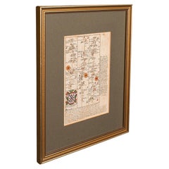
Antique Coaching Road Map, Devon, English, Regional Cartography, Georgian, 1720
Located in Hele, Devon, GB
This is an antique coaching road map of Devon. An English, framed lithograph engraving of regional interest, dating to the early 18th century and later.
Fascinating 18th century hig...
Category
Early 18th Century British Georgian Antique Maps
Materials
Wood
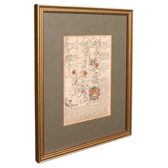
Antique Coaching Road Map, South Devon, English, Framed, Cartography, Georgian
Located in Hele, Devon, GB
This is an antique coach road map of South Devon. An English, framed lithograph engraving of regional interest, dating to the early 18th century and later.
Delightful early 18th cen...
Category
Early 18th Century British Georgian Antique Maps
Materials
Wood
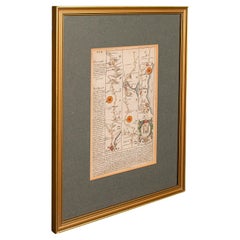
Antique Coach Road Map, East Devon, English, Framed, Cartography, Georgian, 1720
Located in Hele, Devon, GB
This is an antique coach road map of East Devon. An English, framed lithograph engraving of regional interest, dating to the early 18th century and later.
Fascinating 18th century h...
Category
Early 18th Century British Georgian Antique Maps
Materials
Wood
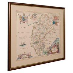
Antique Lithography Map, Cumbria, English, Framed Cartography Interest, Georgian
Located in Hele, Devon, GB
This is an antique lithography map of Cumbria. An English, framed engraving of cartographic interest, dating to the early 18th century and later.
...
Category
Early 18th Century British Georgian Antique Maps
Materials
Wood
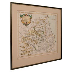
Antique Lithography Map, Durham, English, Framed, Cartography, Early Georgian
Located in Hele, Devon, GB
This is an antique lithography map of Durham. An English, framed engraving of cartographic interest, dating to the early 18th century and later, circa 1720.
Superb lithography of Du...
Category
Early 18th Century British Georgian Antique Maps
Materials
Wood
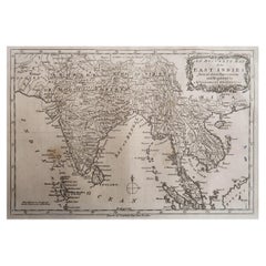
Original Antique Map of India. C.1780
Located in St Annes, Lancashire
Great map of India
Copper-plate engraving
Published C.1780
Three small worm holes to right side of map and one bottom left corner
Unframed.
Category
Early 1800s English Georgian Antique Maps
Materials
Paper
Original Antique Map of Italy. C.1780
Located in St Annes, Lancashire
Great map of Italy
Copper-plate engraving
Published C.1780
Unframed.
Category
Early 1800s English Georgian Antique Maps
Materials
Paper
Original Antique Map of Asia. C.1780
Located in St Annes, Lancashire
Great map of Asia
Copper-plate engraving
Published C.1780
Two small worm holes to right side of map
Unframed.
Category
Early 1800s English Georgian Antique Maps
Materials
Paper
Original Antique Map of South America. C.1780
Located in St Annes, Lancashire
Great map of South America
Copper-plate engraving
Published C.1780
Two small worm holes to left side of map
Unframed.
Category
Early 1800s English Georgian Antique Maps
Materials
Paper
Antique Folding London Map, English, Cartography, Historic, Georgian, Dated 1783
Located in Hele, Devon, GB
This is an antique folding London map. An English, paper on linen cartographical study of the London metropolis and the surrounding area, published in the mid Georgian period, dated ...
Category
Late 18th Century British Georgian Antique Maps
Materials
Linen, Paper
Map Silk Embroidered Western Eastern Hemisphere New Old World Asia America Afri
Located in BUNGAY, SUFFOLK
A rare, late-18th century, silk, embroidered, double hemisphere, world map, blackwork, sampler, showing the tracks of captain cook’s three voyages
- Illustrating public understanding of the world in the late-18th century and the recent discoveries of the time delineating the tracks of Captain Cook’s three voyages.
- Shows the incentive for further exploration during the 19th century as no mass is indicated within the southern polar region, the interior portions of western North America, Africa, and Australia are still relatively void of detail even though California is no longer shown as an island.
- Includes beautifully worked allegories of the four continents Asia, the Americas, Africa & Europe, a cartouche being supported by two angels and a compass
- The cream, silk ground is finely embroidered with a variety of stiches in black, silk threads emulating the black ink on maps.
-“Recent international conflicts and voyages by Captain Cook and others made the study of geography exciting at the time this map was made. Elaborate embroidered maps...
Category
18th Century British Georgian Antique Maps
Materials
Silk
Map Southern Scotland Thomas Conder Alex Hogg 1795
Located in BUNGAY, SUFFOLK
A new map of the southern part of Scotland containing the counties of Stirling, Lanerk, Renfrew, Linlithgow, Edinburgh, Peebles, Haddingtoun, Berwick, Selkirk, Roxburgh, Dumfries, Wigtoun, Kirkudbright & Air
Published by Alex Hogg at the Kings Arms...
Category
18th Century English Georgian Antique Maps
Materials
Paper
Map Lancashire 1793 John Cary engraver 37cm 14 1/2" high
Located in BUNGAY, SUFFOLK
Map of Lancashire by John Cary engraver
published 1st Jan 1793 by J Cary Engraver & Mapseller Strand
in original black and gold classic map frame
Category
18th Century English Georgian Antique Maps
Materials
Paper
Map Berkshire C&J Greenwood Windsor Castle JDower Polling Hundreds
Located in BUNGAY, SUFFOLK
Map of the County of Berkshire from an Actual Survey made in the Years 1822 & 1823 by C&J Greenwood
Published by the Proprietors Greenwood & Co 13 Regent Street Pall Mall London Ju...
Category
19th Century English Georgian Antique Maps
Materials
Paper
Map Wiltshire Joshua Archer Pentonville London framed 35cm 14" high
Located in BUNGAY, SUFFOLK
Map of Wiltshire Drawn & Engraved by Joshua Archer Pentonville London
Window Parts of Wiltshire in Berkshire
Explanation of Salisbury
County Divisions
Category
19th Century English Georgian Antique Maps
Materials
Paper
Map Bedfordshire No 3 General Framed
Located in BUNGAY, SUFFOLK
A general map of Bedfordshire with its hundreds. Measure: 37cm 14 1/2" high
A scale of 5 miles.
in the original green mount and traditional black and gold frame.
charming map with...
Category
18th Century English Georgian Antique Maps
Materials
Paper
Map Kyle Carrick Aireshire Thomas Kitchen 1749
Located in BUNGAY, SUFFOLK
A Map of Kyle & Carrick Aireshire Thomas Kitchen 1749
In original black and gold frame
Just purchased more information to follow
MAKER Thomas Kitchin (1718-1784) English engrave...
Category
18th Century English Georgian Antique Maps
Materials
Paper
Cambridgeshire J Cary
By John Cary
Located in BUNGAY, SUFFOLK
Cambridgeshire published may 1 1814 engraver no 181 strand
Maker John Cary c. 1754 – 1835.
Category
19th Century English Georgian Antique Maps
Materials
Paper
Map Suffolk Southwold Aldeburgh Dunwich Bawdsey Harwich Ipswich
Located in BUNGAY, SUFFOLK
Map Suffolk including many popular destinations on the coast Southwold, Dunwich, Aldeburgh bawdsey felixstowe harwich ipswich.
Charming topography and colouring.
In the original fr...
Category
19th Century European Georgian Antique Maps
Materials
Paper
Map Bedfordshire General Framed
Located in BUNGAY, SUFFOLK
A general map of Bedfordshire with its hundreds
A scale of 5 miles
in the original green mount and traditional black and gold frame. Measures: 36cm 14" high.
Category
18th Century English Georgian Antique Maps
Materials
Paper
Essex John Cary 1787 Cary's New & Correct English Atlas 40cm 16" long gilt frame
By John Cary
Located in BUNGAY, SUFFOLK
Map of Essex by John Cary Engraver
London published as the act directs Sept 1st 1787 by J Cary Engraver Map & Printseller no 188 the corner of Arundel Str...
Category
18th Century English Georgian Antique Maps
Materials
Paper
Map Shropshire Joseph Ellis Robert Sayer Carington Bowles Framed
Located in BUNGAY, SUFFOLK
A modern map of Shropshire Drawn from the latest surveys corrected and improved by the best authorities.
Artist Joseph Ellis sculptor.
Joseph Ellis was an engraver and publisher from Clerkenwell in London and was apprenticed to Richard William Seale in 1749. He is best know to county map collectors for The New English Atlas published in 1765 which was later reissued as Ellis's English Atlas in 1766, 1768 1777, 1786, 1790 and 1796.
Maker carington bowles 1724 - 1793.
Carington Bowles worked in London as a publisher in partnership with his father John Bowles from about 1752 until 1763. Carington Bowles worked as a publisher in partnership with his father John Bowles from about 1752 until 1763 before taking over his uncle's business. His address was 69 St. Pauls Church Yard, London. He worked with a number of well known cartographers of the day including Emanuel Bowen, Thomas Kitchin, Robert Sayer...
Category
18th Century English Georgian Antique Maps
Materials
Paper
Map North Wales Robert Marsden Anglesey
Located in BUNGAY, SUFFOLK
Map of North Wales by Robert Marsden
Including Anglesey
Charming topography and detail and colouring
just purchased more information to follow.
Category
18th Century English Georgian Antique Maps
Materials
Paper
Map Jersey Guernsey Scilly Islands Alderney
Located in BUNGAY, SUFFOLK
Rare map of The Islands of Guernsey and Jersey, including Alderney & the Scilly Islands
just purchased more information to follow
In the original cream mount and gilded frame.
Category
18th Century English Georgian Antique Maps
Materials
Paper
Map Turkey in Europe & Hungary Thomas Kitchin, 1783
Located in BUNGAY, SUFFOLK
Thomas Kitchen (1718 - 1784) : Map of Turkey in Europe & Hungary 1783
Visible sheet within the cream mount 25.5cm., 10" height 20cm., 8"
In an ebonised frame length 33cm. 13", height 28cm., 11"
Kitchin, Thomas (1718 - 1784)
Thomas Kitchin (August 4, 1718 – June 23, 1784) was a London based engraver, cartographer, and publisher. He was born in London to a hat-dyer of the same name. At 14, Kitchin apprenticed under Emanuel Bowen, under whom he mastered the art of engraving. He married Bowen daughter, Sarah Bowen, and later inherited much of his preceptor's prosperous business. Their son, Thomas Bowen Kitchin, also an engraver joined the family business, which thereafter published in Thomas Kitchin and Son. From 1858 or so Kitchin was the engraver to the Duke of York, and from about 1773 acquired the title, 'Royal Hydrographer to King George III.' He is responsible for numerous maps published in the The Star, Gentleman's Magazine, and London Magazine, as well as partnering with, at various times, with Thomas Jefferys, Emmanuel Bowen, Thomas Hinton, Issac Tayor, Andrew Dury, John Rocque, Louis de la Rochette, and Alexander Hogg, among others. Kitchin passed his business on to his son, Thomas Bowen Kitchin, who continued to republish many of his maps well after his death. Kitchin's apprentices included George Rollos...
Category
18th Century English Georgian Antique Maps
Materials
Paper
New Map of North America from the Latest Discoveries, 1763
Located in Philadelphia, PA
A fine antique 18th century map of the North American seaboard.
Entitled "A New Map of North America from the Latest Discoveries 1763".
By the Cartographer/Engraver - John Spil...
Category
Mid-18th Century English Georgian Antique Maps
Materials
Paper
London 1744 Published Watercolour Antique Map of East Africa by Eman Bowen
Located in GB
We are delighted to offer for sale this New and Accurate Map of Nubia & Abissinia, together with all the Kingdoms Tributary Thereto, and bordering upon them published in 1744 by Emanuel Bowen
This is a decorative antique engraved map of East Africa...
Category
1740s English George III Antique Maps
Materials
Paper
Group of Three Early 20th C. French Tabletop Globes on Stands, Including G. Thom
Located in Bridgeport, CT
A very fine group of World Globes on pedestal mounts. All printed paper globes. A large Globe Metrique by G. Thomas, Paris. Mounted on metal on an ebonized wood base. Measures: Height 19", diameter 10"
another large sized one Globe Terrestre...
Category
Early 20th Century French Georgian Maps
Materials
Paper, Wood
English Engraved Hand Colored Map of the North Eastern United States, circa 1817
Located in Hollywood, SC
English copper engraved hand colored map of the North Eastern United States matted under glass in a gilt frame, Early 19th Century. Drawn and Engraved for Thomson's New General Atlas...
Category
1810s English George III Antique Maps
Materials
Paper, Paint, Giltwood, Glass
Large Scale Antique Scroll Map of Lincolnshire, England, Dated 1778
Located in St Annes, Lancashire
Wonderful scroll map of Lincolnshire
By Captain Armstrong, 1778
Copper plate engraving on paper laid on canvas
Original ebonized wood frame with lo...
Category
1770s English Georgian Antique Maps
Materials
Wood, Paper
Large Original Antique Folding Map of Manchester, England, Dated 1793
Located in St Annes, Lancashire
Superb map of Manchester and Salford
Folding map. Printed on paper laid on to the original canvas
Unframed.
Published by C. Laurent, 1793.
...
Category
1790s English Georgian Antique Maps
Materials
Canvas, Paper
Staffordshire 1645 Hand Colored Antique Print Staffordiensis Comitatvs Map
Located in GB
We are delighted to offer for sale this lovely antique Atlas page map of Staffordshire printed in 1645 Amsterdam Staffordiensis Comitatvs Vulgo
This o...
Category
Early 1800s English Georgian Antique Maps
Materials
Paper
Double Sided Northamptonshire 1645 Hand Colored Antique Print Map Rare Find
Located in GB
We are delighted to this lovely antique Atlas page map of Northamptonshire printed in 1645 Amsterdam Staffordiensis Comitatvs Vulgo
I have three of th...
Category
Early 1800s English Georgian Antique Maps
Materials
Paper
Double Sided and Glazed Cheshire 1645 Hand Colored Antique Print Map Rare Find
Located in GB
We are delighted to offer for sale this lovely antique Atlas page map of Cheshire printed in 1645 Amsterdam Staffordiensis Comitatvs Vulgo
I have thre...
Category
Early 1800s English Georgian Antique Maps
Materials
Paper
Recently Viewed
View AllMore Ways To Browse
Antique Sailing Map
Antique Sailing Maps
Bay Area Antique Furniture
West Coat Of Arms
Greek Asia Minor
Hemisphere World Map
Speed Map
Antique Maps Canada
Antique Map Canada
Canada Antique Map
Malaysian Antique
West Indies Map
Blaeu World Map
Charing Cross
Antique Maps Of Canada
Bali Map
Antique Portuguese Plates
Map Of Brazil
