18th Century Collectibles and Curiosities

to
1,731
2,054
2,424
343
2,054
15
1
3,091
2,413
734
42
337
113
35
79
5
6
10
6
16
30
13
6
4
2,002
19
19
14
14
82
52
9
6
6
2,054
2,054
2,054
20
14
13
12
11
Item Ships From: Netherlands
Period: 18th Century
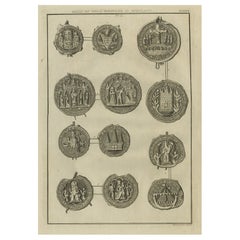
Rare Antique Print of Seals of Royal Boroughs in Scotland, 1792
Located in Langweer, NL
Antique print titled 'Plate XXVII. Seals of Royal Boroughs in Scotland'. Original antique print showing Seals of Royal Boroughs in Scotland. This print originates from 'An Account of...
Category

Antique 18th Century Collectibles and Curiosities

Materials

Paper

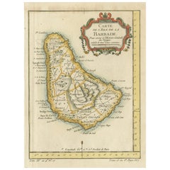
Barbados Island at the Height of the Plantation Economy, Circa 1759
Located in Langweer, NL
Carte de l'Isle de la Barbade by Jacques-Nicolas Bellin (1703–1772), Circa 1759 This rare antique map of Barbados, titled Carte de l'Isle de la Barbad...
Category

Antique 18th Century Collectibles and Curiosities

Materials

Paper

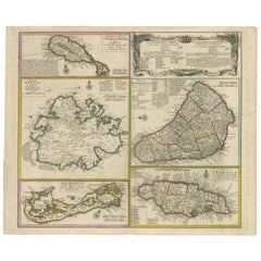
Old 18th Century Composite Map of Key Caribbean Islands with Descriptive Texts
Located in Langweer, NL
Antique map titled 'Dominia Anglorum in praecipuis Insulis Americae ut sunt Insula S. Christophori, Antegoa, Iamaica, Barbados nec non Insulae Bermudes vel Sommers dictae. Die Englis...
Category

Antique 18th Century Collectibles and Curiosities

Materials

Paper

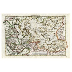
Antique Map of Persia, Georgia and Kazakhstan, ca.1780
Located in Langweer, NL
Antique map titled 'Carte de la Perse, de la Georgie, et de la Tartarie Independante'. Map of Persia, Georgia and Kazakhstan. This map shows current days Georgia, Iran, Irak, Kaz...
Category

Antique 18th Century Collectibles and Curiosities

Materials

Paper

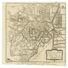
Antique Street Map of the City of Edo 'Modern Tokyo' in Japan
Located in Langweer, NL
Antique map titled 'Plan de Jedo - Platte Grond van Jedo'. A detailed street map of the city of Edo (modern Tokyo) in Japan, originally engraved by Bellin and Schley and reissued for...
Category

Antique 18th Century Collectibles and Curiosities

Materials

Paper

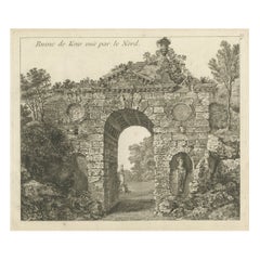
Antique Print of a Ruin of the Kew Gardens in London, England, c.1785
Located in Langweer, NL
Antique print titled 'Ruin de Kew vuë par le Nord'. Copper engraving of a ruin of the Kew gardens. This print originates from 'Jardins Anglo-Chinois à la Mode' by Georg Louis le Rouge. Artists and Engravers: The work of Le Rouge is considered the most important engraved work concerning the history of European gardens during the 18th century. Kew Gardens is a botanic garden in southwest London that houses the "largest and most diverse botanical and mycological collections in the world". Founded in 1840, from the exotic garden at Kew Park, its living collections includes some of the 27,000 taxa curated by Royal Botanic Gardens, Kew, while the herbarium, one of the largest in the world, has over 8.5 million preserved plant...
Category

Antique 18th Century Collectibles and Curiosities

Materials

Paper

Map of Southern Spain Depicting Castile, Andalusia, Granada, Murcia and Valencia
Located in Langweer, NL
Antique map titled 'Partie Meridionale Des Etats de Castille (..)'. Decorative and highly detailed map of the southern part of Castile, Spain, including a decorative cartouche. Publi...
Category

Antique 18th Century Collectibles and Curiosities

Materials

Paper

Moullart-Sanson Map of the Holy Land and Sacred Geography of the Old Testament
Located in Langweer, NL
"1716 Moullart-Sanson Map of the Holy Land and Sacred Geography of the Old Testament" This engraved map, created by Pierre Moullart-Sanson and reissued by Robert de Vaugondy in 1740...
Category

Antique 18th Century Collectibles and Curiosities

Materials

Paper

Spectacular View of the Siege of Jerusalem by King Nebuchadnezzar, ca.1730
Located in Langweer, NL
Antique print titled 'Belegering van Jerusalem door Nebucadnezar (..)'. This original antique print shows the siege of Jerusalem by King Nebucha...
Category

Antique 18th Century Collectibles and Curiosities

Materials

Paper

Antique Map of Italy by R. Bonne, circa 1780
Located in Langweer, NL
Beautiful map of Italy, Corsica, Sardinia and Sicily. Highly detailed, showing towns, rivers, some topographical features and political boundaries. Published by R. Bonne, circa 1780.
Category

Antique 18th Century Collectibles and Curiosities

Materials

Paper

Colonial Silver VOC 'East-India Company' Ingot
Located in Amsterdam, NL
A silver 'V.O.C. AMSTERDAM' ingot circa 1738, with monogram and the assay mark of the Amsterdam Grill family With V.O.C. monogram and the A for Amsterdam. L. approx. 15.5 cm Weight approx. 2000 grams Note: The ingots were salvaged in 2004 from the wreck of the VOC indiaman Rooswijk, equipped by the Amsterdam VOC Chamber. The Rooswijk sank on its second voyage to the Dutch East Indies off the English coast on the Goodwin Sands...
Category

Dutch Antique 18th Century Collectibles and Curiosities

Materials

Sterling Silver

Antique Print of Saint Nilus Kneeling in Prayer, 1762
Located in Langweer, NL
Antique print titled 'S. Nilus a D.N.I.C. Crucifixo ipsi apparente benedictur, et ab impuris tenta tionibus prorsus liberatur'. Scarce plate showing Saint Nilus, kneeling in prayer; in front of him a crucifix; Christ comes alive. This print originates from 'Picturae Dominici Zampierii, vulgo Domenichino, quae extant in sacello sacrae aedi Cryptoferratensi adjuncto tabulis aeneis incisae' published 1762. Artists and Engravers: Made by 'F. Bartolozzi' after 'Domenico Zampieri'. Francesco Bartolozzi...
Category

Antique 18th Century Collectibles and Curiosities

Materials

Paper

Original Antique Map of Fez and Morocco
Located in Langweer, NL
Antique map titled 'Karte von Fes und Marócos (..)'. Original old map of Fez (or Fes) and Morocco. Also shows the Strait of Gibraltar. By Friedrich Gottlieb Canzler, published 1799.
Category

Antique 18th Century Collectibles and Curiosities

Materials

Paper

18th Century Polynesian Hardwood Ula Tavatava or Throwing War Club from Fiji
Located in Amsterdam, NL
A Polynesian hardwood Ula tavatava or throwing war club Fiji, probably 18th century All-over decorated in incised pattern, the bulbous top seems to have a stone grown into it. H. 42 cm Including museum-quality powder-coated stand. Provenance: Private collection, France Polynesian culture is traditionally a culture of power and prestige, and there was a fine line between battle and ceremony. Warrior people par excellence, the Fijians had at their disposal a large panoply of weapons, each for a specific use. The elegant Gata are called gun-sticks by Europeans due to the recognizable form. However, they are designed after a snake, gata in Fijian language. The Ula throwing clubs...
Category

Fijian Antique 18th Century Collectibles and Curiosities

Materials

Hardwood

Old Print of Idols of the Temple of Ablaykit, a Buddhist Monastery in Kazakhstan
Located in Langweer, NL
Antique print titled 'Représentation d'Idoles du Temple d'Ablaikit et caractères Mongoles'. Copper engraving of of Idols of the Temple of Ablaykit and Mongolian characters. Ablaykit ...
Category

Antique 18th Century Collectibles and Curiosities

Materials

Paper

Antique Map of the East Indies by Bonne '1776'
Located in Langweer, NL
Antique map titled 'Indes IVe Feuille'. Very decorative original antique map of the East Indies. Covbers from the Gulf of Siam (Gulf of Thailand) and Malacca (Malaysia) eastward to i...
Category

Antique 18th Century Collectibles and Curiosities

Materials

Paper

Rare Antique Engraving of the City of Copenhagen, Denmark, ca.1720
Located in Langweer, NL
Antique print titled 'Copenhagen. Die Königl. Residenz und Haupt Stadt in Dänemark'. Panoramic view of the city of Copenhagen, Denmark. This print, most likely, originates from the s...
Category

Antique 18th Century Collectibles and Curiosities

Materials

Paper

Antique Map of England and Wales Depicting the Period of the Saxon Heptarchy
Located in Langweer, NL
Antique map titled 'Britain as divided under the Saxon Heptarchy'. An antique copper engraving map of England and Wales by Joseph Ellis depicting the period of the Saxon Heptarchy. E...
Category

Antique 18th Century Collectibles and Curiosities

Materials

Paper

Antique Copper Engraving with a Panoramic View of Mexico City, ca.1760
Located in Langweer, NL
Description: Antique print titled 'Nouveau Mexico'. Copper engraving with a panoramic view of Mexico city. Source unknown, to be determined. Artists and Engravers: Engraved after ...
Category

Antique 18th Century Collectibles and Curiosities

Materials

Paper

Antique Map of France by Mortier 'c.1710'
Located in Langweer, NL
Antique map titled 'Gallia vetus ex C. Iulii Caesaris (..)'. Original antique map of France. Published by P. Mortier, c.1710.
Category

Antique 18th Century Collectibles and Curiosities

Materials

Paper

Detailed Antique Map of the Lower Rhine region, Germany
Located in Langweer, NL
Antique map titled 'S.R.I. Circulus Rhanus Inferior sive Electorum Rheni (..)'. Detailed map of the Lower Rhine region, Germany. The title cartouche in the upper left quadrant featur...
Category

Antique 18th Century Collectibles and Curiosities

Materials

Paper

Antique Print of Egyptian Objects, 1773
Located in Langweer, NL
Untitled print depicting various Egyptian objects including statues. Originates from the first Dutch editon of an interesting travel account of Northern Africa titled 'Reizen en Aanm...
Category

Antique 18th Century Collectibles and Curiosities

Materials

Paper

Antique Map of Southeast Asia from Persia to the Timor Island, 1712
Located in Langweer, NL
Antique map titled 'A New Map of the East Indies'. Old map covering all of Southeast Asia from Persia to the Timor Island, inclusive of the modern day nations of India, Ceylon, T...
Category

Antique 18th Century Collectibles and Curiosities

Materials

Paper

Antique Map of Arabia including Nubia and Abyssinia, also shows the Red Sea
Located in Langweer, NL
Antique map titled 'Nubie et Abissinie'. Original antique map of Nubia, a region along the Nile river, and Abyssinia or the Ethiopian Empire. This map o...
Category

Antique 18th Century Collectibles and Curiosities

Materials

Paper

Antique Map of Italy, Showing Corsica, Sardinia, Croatia, Malta and More, C.1740
Located in Langweer, NL
Antique map titled 'Nieuwe Kaart van Italie na de Nieuwste waarnemingen van de l'Isle en andere.' Attractive detailed map showing Italy as well as Corsica, Sardinia, Minorca, Croat...
Category

Antique 18th Century Collectibles and Curiosities

Materials

Paper

Rare Antique Engraving with Views of Qom and Kashan in Iran, 1711
Located in Langweer, NL
Antique print titled 'Kohm - Kasjan'. Old print with two views: one is Qom, the other Kashan. Both are in Iran (then known as Persia). This print originates from 'Cornelis de Bruins...
Category

Antique 18th Century Collectibles and Curiosities

Materials

Paper

Antique Print of Majorinus Numida, a Bishop of Carthage in Dispute, 1701
Located in Langweer, NL
Antique portrait titled 'Majorinus Numida'. Portrait of Majorinus, a bishop of Carthage in dispute with Ceacilianus. He favored the so-called Donatist sect. He died ca. 329 AD. This print originates from 'Historie der kerken en ketteren van den beginne des Nieuwen Testaments tot aan het jaar onses Heeren 1688 ... In het Neederduyts vertaald' by G. Arnold. Artists and Engravers: Gottfried Arnold (1666 – 1714) was a German Lutheran...
Category

Antique 18th Century Collectibles and Curiosities

Materials

Paper

Old Map of The Mughal Empire and the Indian Peninsula South of the Ganges, 1787
Located in Langweer, NL
This is a historical map titled "L'Empire Du Mogol, Et La Presqu Isle De L'Inde En Deca Du Gange." An original authentic map, created by Rigobert Bonne (1727-1794), an influential ...
Category

Antique 18th Century Collectibles and Curiosities

Materials

Paper

Pl. 4 Antique Print of Various Elements of the Kew Gardens by Le Rouge, c.1785
Located in Langweer, NL
Antique print titled 'Vue du Lac, de l'Orangerie et du Temple d'Eole à Kew (..)'. Copper engraving showing the lake, orangery, temple and pagoda of the Kew gardens. This print origin...
Category

Antique 18th Century Collectibles and Curiosities

Materials

Paper

Senex Map of Castile, Leon & La Mancha in The Spanish Heartland, 1714
Located in Langweer, NL
This antique map, titled "A Map of Old & New Castile from the Observations of Rodrigo Mendes Silva and others," depicts the regions of Old Castile and New Castile in Spain, along with the Kingdom of Leon, Estremadura, La Mancha, among others. The map dates back to the early 18th century, a period marked by significant political shifts and territorial changes in Europe, particularly illustrated by the War of the Spanish Succession (1701–1714) that reshaped Spain’s governance and regional boundaries. The map itself was published in 1714 by John Senex, a prominent English mapmaker, surveyor, globemaker, and geographer of the early eighteenth century. He was apprenticed as a young man to bookseller Robert Clavell and collaborated with notable mapmakers such as Jeremiah Seller and Charles Price. In 1728, Senex's contributions to geography and mapping were recognized when he was elected a Fellow of the Royal Society, an exceptional honor for a mapmaker, underlining his significant role as the Society's engraver and a publisher of maps by Edmund Halley and other notable figures. John Senex is renowned for his English Atlas, first published in the same year as this map, 1714, and continued to be printed until the 1760s. Following his death in 1740, his widow Mary Senex managed the business until 1755. Afterward, the stock passed to William Herbert and Robert Sayer for maps, and to James Ferguson for globes. The map serves not just as a geographical record but also as a historical document, reflecting the territorial divisions significant to Spain's political and economic structure at the time. The focus on Old and New Castile underscores their importance during a transformative era in Spanish history. Here are some potentially significant places and features of this map: 1. **Old Castile (Castilla la Vieja)**: Historically significant as part of the former Kingdom of Castile, this region includes major cities such as Burgos and Valladolid. These cities could be popular search...
Category

Antique 18th Century Collectibles and Curiosities

Materials

Paper

Antique Map of America by Vaugondy, 1778
Located in Langweer, NL
Antique map titled 'Amerique ou Indes Occidentales (..)'. Vaugondy's map of America, pre-dating information from any of the Cook Voyages. The NW Coast of Amer...
Category

Antique 18th Century Collectibles and Curiosities

Materials

Paper

Antique Print with Coastal Views of Kamchatka in The Russian Far East, c.1784
Located in Langweer, NL
Antique print titled 'Views of the Coast of Kamtschatka (..)'. Print with coastal views of Kamchatka including volcanoes. Originates from an edition of Cook's Voyages. Artists and ...
Category

Antique 18th Century Collectibles and Curiosities

Materials

Paper

Rare Hand-Colored Antique Map of Tartary, China and Korea, ca.1741
Located in Langweer, NL
Antique map titled 'A General Map of Eastern and Western Tatary, commonly call'd Tartary; drawn from the Particular Maps of the Jesuit Missionaries'. Rare antique map of Tartary, C...
Category

Antique 18th Century Collectibles and Curiosities

Materials

Paper

Antique Map of South America by De la Harpe '1780'
Located in Langweer, NL
Antique map titled 'Carte de l'Amerique Méridionale'. Original antique map of South America. Note the 'Laguna de Xarayes' is illustrated as the source of the Paraguay river. The laguna is now known as Pantanal, world's largest tropical wetland area. This map orginates from 'Abrégé de l'histoire générale des Voyages' by J.F. de la Harpe.
Category

Antique 18th Century Collectibles and Curiosities

Materials

Paper

Decorative Antique Map of Cyprus and Asia Minor by Christoph Weigel, Circa 1720
Located in Langweer, NL
Title: Asiae Peninsula sive Asia Intra Taurum by Christoph Weigel, Circa 1720 – Decorative Antique Map of Cyprus and Asia Minor Description: Thi...
Category

Antique 18th Century Collectibles and Curiosities

Materials

Paper

Old Print of Aztec deities Vitzliputsli, Tlaloch or Tescalipuca, Mexico, 1723
Located in Langweer, NL
Antique print titled 'Vitzliputsli (..)'. Old print of the Aztec deities Vitzliputsli, Tlaloch or Tescalipuca. Also depicted are Mexican priests. Originates from 'Ceremonies et coutu...
Category

Antique 18th Century Collectibles and Curiosities

Materials

Paper

Antique French Map of Hungary with Decorative Title Cartouche, c.1730
Located in Langweer, NL
Antique map titled 'La Hongrie suivant les Nouvelles Observations (..)'. Antique map of Hungary with decorative title cartouche. Artists and Engravers: ...
Category

Antique 18th Century Collectibles and Curiosities

Materials

Paper

Antique Plan of the City of Bayonne, France
Located in Langweer, NL
Antique map titled 'Plan de Bayonne'. Original old plan of the city of Bayonne, France. This map originates from 'Le Petit Atlas Maritime (..)' by J.N. Bellin. Published 1764. Be...
Category

Antique 18th Century Collectibles and Curiosities

Materials

Paper

Original and Decorative Antique Engraved Map of Finland and Sweden, ca.1720
Located in Langweer, NL
Antique map titled 'Ducatus Uplandiae cum Westmanniae Sudermanniae (..)' This map shows parts of Finland and Sweden. Originally published by Frederick de Wit in the late 1600's. ...
Category

Antique 18th Century Collectibles and Curiosities

Materials

Paper

Old Map of Ancient Spain and Portugal – Hispania Antiqua Featuring Roman Cities
Located in Langweer, NL
Title: "Hispania Antiqua in Tres Praecipuas Partes Divisa: Tarraconensem, Lusitaniam, et Bæticam" by Robert de Vaugondy, 18th Century Description: This beautifully detailed map titl...
Category

Antique 18th Century Collectibles and Curiosities

Materials

Paper

Antique Map of Peloponnesus, Greece by Pierre Antoine Tardieu, 1797
Located in Langweer, NL
This antique map, titled "Carte Ancienne d'Allemagne," represents ancient Germany and surrounding regions. It was published by the well-known Parisian mapmakers and publishers Jean-Baptiste-Louis Clouet and Alexandre Aimé Vuillemin in the late 18th century, specifically in 1787. The map covers the extensive geographical area of ancient Germany, highlighting various tribes and regions known at the time. Key features include: 1. **Geographical Boundaries**: The map outlines the territorial extents of ancient Germany, bordered by Gallia (France) to the west, Sarmatia (parts of Eastern Europe) to the east, and the Italian regions to the south. The northern boundary reaches the Oceanus Germanicus (North Sea) and the Sarmatian Sea (Baltic Sea). 2. **Tribal Regions**: It details numerous ancient Germanic...
Category

Antique 18th Century Collectibles and Curiosities

Materials

Paper

Antique Engraving of Constructing Sun Dials, 1769
Located in Langweer, NL
Antique print of Ferguson's method of constructing sun dials. This print originates from 'The Gentleman's Magazine'. Artists and Engravers: The Gentleman'...
Category

Antique 18th Century Collectibles and Curiosities

Materials

Paper

Very Attractive Antique Map of the World as Planisphere, Shows Cook's Voyages
Located in Langweer, NL
Antique map titled 'Chart of the World, according to Mercators Projection'. This world map shows the various discoveries of Captain James Cook during his 3 voyages between 1768 and 1780, and the English and French Explorers who followed immediately thereafter, including Vancouver and La Perouse. This edition of the map is significantly revised from the editions issued immediately after the official report of Cook's Voyages were integrated into the map, showing better detail in New Zealand, Australia, the Northwest Coast of America and North East coast of Asia, along with Greenland. A new large lake also appears for the first time in the Western part of North America, shortly before the commencement of the Lewis...
Category

Antique 18th Century Collectibles and Curiosities

Materials

Paper

Antique Print of the Marketplace in Anamooka, Tonga Islands, c.1790
Located in Langweer, NL
Antique print titled 'View in Anamooka and the Inhabitants'. Depicts the marketplace that was established in a ring in front of the main house in Anamooka, Tonga - named the Friendly Islands because of his reception when James Cook's third Pacific voyage arrived there in May 1777. Artists and Engravers: Engraved for Bankes's 'New System of Geography'. Published by Royal Authority. Condition: Good, age-related toning. Please study image carefully. Date: c.1790 Overall size: 38.6 x 23.2 cm. Image size: 30.6 x 21.5 cm. A View at Anamooka This engraving after a drawing comes from the official account of Cook's third voyage, 'A voyage to the Pacific Ocean'. Captain James Cook (1728-1779) made three separate voyages to the Pacific (with the ships Endeavour, Resolution, Adventure, and Discovery) and did more than any other voyager to explore the Pacific and Southern Ocean. Cook not only encountered Pacific cultures for the first time, but also assembled the first large-scale collections of Pacific objects to be brought back to Europe. He was killed in Hawaii in 1779. Cook was in Nomuka (Annamooka), Tonga or Friendly Isles from May 1-14, 1777. "On May 2 1777 the expedition reached Nomuka and anchored in the harbour on the north side of the island, which Cook had already used in June 1774. Both ships were in want of refreshments. A camp was erected on shore both as a trading post and a workshop for repairs. Watering, cutting wood...
Category

Antique 18th Century Collectibles and Curiosities

Materials

Paper

Large 1750 Map of the Kingdoms of Spain and Portugal by Robert de Vaugondy
Located in Langweer, NL
1750 Map of the Kingdoms of Spain and Portugal by Robert de Vaugondy Description: This map, titled *"Royaumes d'Espagne et de Portugal,"* was created in 1750 by the esteemed French ...
Category

Antique 18th Century Collectibles and Curiosities

Materials

Paper

Antique Map of the Region of Venice, Italy by F. De Wit, circa 1700
Located in Langweer, NL
Antique map of the Dominion of Venice, extending from Stato di Milano and Genoa to Istria. Including Lake Garda, Venice and Istria.
Category

Antique 18th Century Collectibles and Curiosities

Materials

Paper

Map of Kingdoms of Castile, León, Galicia, Asturias, Biscay and Navarre in Spain
Located in Langweer, NL
Antique map titled 'Partie Septentrionale de la Couronne de Castille (..)'. Decorative and highly detailed map of Northwestern Spain, including Gallicia...
Category

Antique 18th Century Collectibles and Curiosities

Materials

Paper

Old Engraving of the Bairam Celebration, the Easter of the Muslims, 1737
Located in Langweer, NL
Antique print titled 'Le Bairam ou la Paque des Mahometans'. Old print of the Bairam celebration, the Easter of the Muslims. Originates from 'Ceremonies et coutumes Religieuses.....
Category

Antique 18th Century Collectibles and Curiosities

Materials

Paper

Antique Map of China, Korea, Japan and the Northern Philippines, circa 1780
Located in Langweer, NL
Antique map titled 'Carte de l'Empire de la Chine de la Tartarie Chinoise, et du Royaume de Corée'. Interesting and detailed map of China, Korea, Japan and the Northern Philippines. ...
Category

Antique 18th Century Collectibles and Curiosities

Materials

Paper

Antique Print of the Porcelain Pagoda in Nanjing, China, 1736
Located in Langweer, NL
Antique print titled 'La Tour de Porcelaine, Arc de Triomphe'. Old print depicting the Porcelain Pagoda in the Chinese city of Nanjing. It no longer ...
Category

Antique 18th Century Collectibles and Curiosities

Materials

Paper

Antique Map of The Harbour of Acapulco in Mexico, 1749
Located in Langweer, NL
Description: Antique map titled 'Plan van de Haven van Acapulco (..) - Plan du Port d'Acapulco (..)'. Original antique map of the Port of Acapulco on the coast of Mexico in the South...
Category

Antique 18th Century Collectibles and Curiosities

Materials

Paper

Antique Print of a Canoe of Chukotka, Tartary, 1800
Located in Langweer, NL
Antique print titled 'A Canoe of Tchoka, or Segalian Island, opposite the East Coast of Tartary first explored by M. de la Perouse'. Engraving of a canoe of Chukotka, Russia. Source ...
Category

Antique 18th Century Collectibles and Curiosities

Materials

Paper

Antique Print of the Temple of Pythons, Ouidah, Benin, Africa, 1748
Located in Langweer, NL
Antique print titled 'Procession au Temple du Serpent - Ommegang naar den Tempel des Serpents'. Print of the procession at the Temple of Pythons, Ouidah. This print originates from 'Historische beschryving der reizen, of Nieuwe en volkoome verzameling van de aller-waardigste en zeldsaamste Zee- en Landtogten' by P. de Hondt. The Temple of Pythons is a site of historical and modern symbolism and spiritual practice in Ouidah, Benin. The snakes are a major totem for followers of Vodun, a religion practiced by groups of people within West and Central African nations such as Ghana, Togo, and Benin. Vodun became somewhat widespread in southern regions of the New World as a result of the African diaspora. It became the inspiration for other religions such as Louisiana Voodoo and Haitian Vodou...
Category

Antique 18th Century Collectibles and Curiosities

Materials

Paper

Antique Map of Christmas Island by Cook, C.1781
Located in Langweer, NL
Antique map Kiribati titled 'Christmas Island (..)'. Antique map of Christmas Island, also known as Kiritimati. Originates from an edition of Cook's Voyages. Artists and Engravers: Engraved by Duff. Condition: Good, some wear and age-related toning. Please study image carefully. Date: c.1781 Overall size: 27.5 x 21.5 cm. Image size: 20.5 x 18 cm. We sell original antique maps to collectors, historians, educators and interior decorators all over the world. Our collection includes a wide range of authentic antique maps...
Category

Antique 18th Century Collectibles and Curiosities

Materials

Paper

Old Engraving of the Ruins of the Palace of Cleopatra in Old Egypt, Africa
Located in Langweer, NL
This plate shows views of the ruins of the Palace of Cleopatra, Egypt. Source unknown, to be determined. Artists and Engravers: Cornelis de Bruijn (also spelled Cornelius de Bruyn, p...
Category

Antique 18th Century Collectibles and Curiosities

Materials

Paper

Antique Print of Serapis, a Graeco-Egyptian Deity, c.1700
Located in Langweer, NL
Antique print religion titled 'Serapis een vermaarde Godheyd der Egiptenaaren'. Antique print of Serapis, a Greek/Egyptian god. This print originates from 'M...
Category

Antique 18th Century Collectibles and Curiosities

Materials

Paper

Rare Large Etching of a Market of War Horses, Ca.1720
Located in Langweer, NL
Huchtenburg, J. van (1647-1733). Impressive rare large etching of a 'War-" Horse-market. - This print has been professional doubled with Japanes...
Category

Antique 18th Century Collectibles and Curiosities

Old Map of Part of France: Poitou, Berry, Bourbonnais, and Nivernais in 1768
Located in Langweer, NL
The map with text neatly mounted on both sides of the map on the plate, is a section of an old map with accompanying French text. The map mentions several historical French provinces...
Category

Antique 18th Century Collectibles and Curiosities

Materials

Paper

Read More

Medal-Worthy Memorabilia from Epic Past Olympic Games

Get into the games! These items celebrate the events, athletes, host countries and sporting spirit.

Ahoy! You’ve Never Seen a Collection of Sailor Art and Kitsch Quite Like This

French trendsetter and serial collector Daniel Rozensztroch tells us about his obsession with objects related to seafaring men.

Pamela Shamshiri Shares the Secrets behind Her First-Ever Book and Its Effortlessly Cool Interiors

The sought-after designer worked with the team at Hoffman Creative to produce a monograph that beautifully showcases some of Studio Shamshiri's most inspiring projects.

Moroccan Artworks and Objects Take Center Stage in an Extraordinary Villa in Tangier

Italian writer and collector Umberto Pasti opens the doors to his remarkable cave of wonders in North Africa.

Montecito Has Drawn Royalty and Celebrities, and These Homes Are Proof of Its Allure

Hollywood A-listers, ex-pat aristocrats and art collectors and style setters of all stripes appreciate the allure of the coastal California hamlet — much on our minds after recent winter floods.

Whaam! Blam! Pow! — a New Book on Pop Art Packs a Punch

Publishing house Assouline and writer Julie Belcove have teamed up to trace the history of the genre, from Roy Lichtenstein, Andy Warhol and Yayoi Kusama to Mickalene Thomas and Jeff Koons.

The Sparkling Legacy of Tiffany & Co. Explained, One Jewel at a Time

A gorgeous new book celebrates — and memorializes — the iconic jeweler’s rich heritage.

What Makes a Gem-Encrusted Chess Set Worth $4 Million?

The world’s most opulent chess set, weighing in at 513 carats, is literally fit for a king and queen.
Recently Viewed

View All