18th Century Collectibles and Curiosities

to
1,731
2,054
2,424
343
2,054
15
1
3,091
2,413
734
42
337
113
35
79
5
6
10
6
16
30
13
6
4
2,002
19
19
14
14
82
52
9
6
6
2,054
2,054
2,054
20
14
13
12
11
Item Ships From: Netherlands
Period: 18th Century
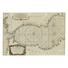
Large Decorative Antique Map of the Mediterranean, ca.1770
Located in Langweer, NL
Antique map titled 'Carte de la Mer Mediterranee en Douze Feuilles'. First map out of twelve fine engraved double-page and folding maps that join to create a large wall map...
Category

Antique 18th Century Collectibles and Curiosities

Materials

Paper

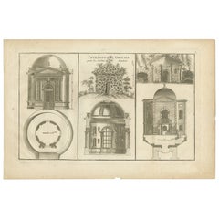
Antique Architectural Print of Pavilions for English Gardens by Le Rouge, 1776
Located in Langweer, NL
Antique print titled 'Pavillons Grottes pour les Jardins Anglais'. Copper engraving showing pavilions for English gardens. This print originates from 'J...
Category

Antique 18th Century Collectibles and Curiosities

Materials

Paper

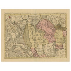
Old Map of the Lower Bishopric of Münster (1726-1750) by Sanson & Ottens, c.1750
Located in Langweer, NL
Historical Map of the Lower Bishopric of Münster (1726-1750) by Sanson & Ottens – Hand-Colored Copperplate Engraving The map titled "BASSE PARTIE DE L'EVESCHE DE MUNSTER" is a detai...
Category

Antique 18th Century Collectibles and Curiosities

Materials

Paper

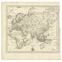
Antique Map of the Eastern Part of the World by Tirion, 1755
Located in Langweer, NL
Antique map titled 'Nieuwe Kaart van het Oostelykste Deel der Weereld, dienende tot Aanwyzing van de Scheepstogten der Nederlanderen naar Oostindië'. Australia (Nieuw Holland) shown ...
Category

Dutch Antique 18th Century Collectibles and Curiosities

Materials

Paper

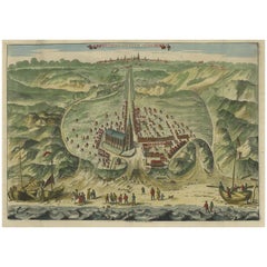
Antique Bird's Eye View of Scheveningen Near The Hague, the Netherlands, 1730
Located in Langweer, NL
Antique print titled 'Afbeeldinge van Schevelinge in den Jaare 1729'. Bird's eye view of Scheveningen near The Hague / Den Haag, the Netherlands. This print originates from 'Beschr...
Category

Antique 18th Century Collectibles and Curiosities

Materials

Paper

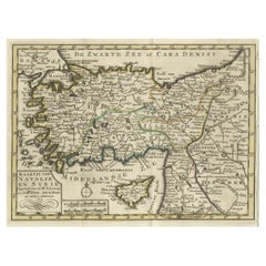
Old Map of Anatolia, part of modern-day Turkey, Armenia and Syria, 1745
Located in Langweer, NL
Title: "Kaartje van Natolie en Syrie opgesteld door de Hr. Lucas en de Hr. Guil de L'Isle en andere auteuren" The title "Kaartje van Natolie en Syrie opgesteld door de Hr. Lucas en...
Category

Antique 18th Century Collectibles and Curiosities

Materials

Paper

Antique Map of Scandinavia by T. Jefferys, circa 1750
Located in Langweer, NL
Antique map titled 'Sweden, Denmark, Norway & Finland'. An original mid-18th century copper engraved antique map of Scandinavia by Thomas Jefferys....
Category

Antique 18th Century Collectibles and Curiosities

Materials

Paper

Engraving of a Map of Florida, the Gulf Coast, Caribbean & Central America, 1728
Located in Langweer, NL
This exceptional antique map, titled "Nouvelle Carte Marine de Toute les Cotes de l´Amerique" and alternatively known as "Nieuwe groote en seer Curieuse Paskaart van Geheel-WestIndie...
Category

European Antique 18th Century Collectibles and Curiosities

Materials

Paper

Print of Garden Pavilions of the Earl of Tilney and Knight Stevenson, c.1785
Located in Langweer, NL
Antique print titled 'Pavillon pour les jardins (..)'. Copper engraving showing the pavilions of the Earl of Tilney and Knight Stevenson. Earl Tylney, of Castlemaine in the Count...
Category

Antique 18th Century Collectibles and Curiosities

Materials

Paper

Antique Original Engraving of Chinese Vessels in the 18th Century, 1765
Located in Langweer, NL
Description: Plate no.34: 'Vaisseaux chinois.' (Chinese vessels.) This original auhentic plate originates from: 'Reize rondom de werreld, Gedaan in de jaaren 1740 tot 1744, door den ...
Category

Antique 18th Century Collectibles and Curiosities

Materials

Paper

Original Antique Engraving of A Jewish Priest, 1709
Located in Langweer, NL
Antique print titled 'La Representation du Grand Pontise'. Old print depicting a Jewish Priest. This print originates from 'Introduction à l'écriture sainte, où l'on traite tout ...
Category

Antique 18th Century Collectibles and Curiosities

Materials

Paper

1700 Guillaume Delisle Map: Western Mediterranean & Moorish North Africa
Located in Langweer, NL
1700 Guillaume Delisle Map: Western Mediterranean & Moorish North Africa This hand-colored map from 1700 by Guillaume Delisle, titled "In Notitiam Ecclesiasticam Africae Tabula Geographica," offers a detailed look at the regions under Moorish control during the later medieval period. It encompasses the northern African coast from Morocco to Libya, the Iberian Peninsula, and the western Mediterranean, including notable islands such as Sardinia, Corsica, Malta, the Balearics, and Sicily, where a smoking Mount Etna is depicted. The map is embellished with three decorative cartouches, adding artistic flair to the detailed geographical renderings. Engraved by Jean Baptiste Liebaux, the map measures 25.2 inches wide by 19.1 inches high. It features a sharp impression with contemporary outline color, later enhanced cartouches, and is printed on a bright sheet with a Society of Jesus watermark. The condition is very good, with an archivally repaired centerfold separation at the bottom and light toning along the edges. Keywords: - Guillaume Delisle map - Western Mediterranean historical map - Northern Africa map...
Category

Antique 18th Century Collectibles and Curiosities

Materials

Paper

Old Map of the Western Region of the Kingdom of Algiers, Algeria, 1773
Located in Langweer, NL
Antique map titled 'Kaart van het Westelyk Gedeelte van het Ryk van Algiers'. Old map of the western region of the Kingdom of Algiers, Algeria. Originates from the first Dutch ed...
Category

Antique 18th Century Collectibles and Curiosities

Materials

Paper

Germany and the Borders of Empire: Bodenehr’s Map of the Holy Roman World, 1710
Located in Langweer, NL
Title: Germany and Surrounding Realms by Gabriel Bodenehr, circa 1710 This striking copperplate engraving, titled "S. Imperium Romano-Germanicum, Teutschland mit Seinen Angräntzende...
Category

Antique 18th Century Collectibles and Curiosities

Materials

Paper

Antique Plan of the Region of Cassis, France
Located in Langweer, NL
Antique map titled 'Plan de Cassis et environs'. Original plan of the region of Cassis, France. This map originates from 'Le Petit Atlas Maritime (..)' by J.N. Bellin. Published 1764...
Category

Antique 18th Century Collectibles and Curiosities

Materials

Paper

Utrecht city plan
Located in UTRECHT, UT
“Platte grond der Stad Utrecht vertonende alle Gragten, Straaten, Stegen, Gangen, Markten, en plaatsen der openbare Gebouwen”, engraving published by Johannes van Schoonhoven in Amst...
Category

Dutch Other Antique 18th Century Collectibles and Curiosities

Materials

Paper

Antique Print of the Jewish Feast or Commemoration of the Passover, 1725
Located in Langweer, NL
Description: Antique print titled 'Het Pascha der Jooden'. Print of the Jewish Pesach / Passover. Pascha, Passover, Hebrew Pesa? or Pesach, in Judaism, holiday commemorating the ...
Category

Antique 18th Century Collectibles and Curiosities

Materials

Paper

Antique Panoramic View of the Town of Malacca, Malaysia, 1726
Located in Langweer, NL
Antique print Malaysia titled 'De Stad Malacka'. Decorative panoramic view of the town of Malacca with European vessels in the foreground. The old C...
Category

Antique 18th Century Collectibles and Curiosities

Materials

Paper

Rare Antique Map of the Rio De La Plata, Buenos Ayres, Brazil, ca.1760
Located in Langweer, NL
Description: Antique map titled 'De Ingang van Rio de la Plata, Waar aan de Stad Buenos Ayres ligt, in Zuid-Amerika'. A map showing the Rio de la Plata es...
Category

Antique 18th Century Collectibles and Curiosities

Materials

Paper

Original 18th-Century Map of Southern Austria, Carinthia, Carniola, and Styria
Located in Langweer, NL
title: 18th-Century Map of Southern Austria, Carinthia, Carniola, and Styria by Robert de Vaugondy Description: This finely engraved 18th-century map by Gilles Robert de Vaugondy ...
Category

Antique 18th Century Collectibles and Curiosities

Materials

Paper

Rare 1730 Roman Empire Map by Moll - Detailed and Engraved Masterpiece
Located in Langweer, NL
An Historical Map of the Roman Empire and the Neighbouring Barbarous Nations by Herman Moll - Circa 1730 This grand and historically significant map of the Roman Empire was create...
Category

Antique 18th Century Collectibles and Curiosities

Materials

Paper

Antique Map of Northeastern India, Nepal, Bhutan, Assam and Bangladesh
Located in Langweer, NL
Antique map titled 'De Land-Reyse door Benedictus Goes, van Lahor gedaan, door Tartaryen na China'. Interesting map showing the region of northeastern India, Nepal, Bhutan, Assam and...
Category

Antique 18th Century Collectibles and Curiosities

Materials

Paper

Antique Ptolemaic Map of Ceylon or nowadays Sri Lanka
Located in Langweer, NL
Antique map titled 'Tab XII. Asiae Taprobanam'. Ptolemaic map of Sri Lanka. Ptolemy drew on the accounts of travelers and sailors and though the information was secondhand and often ...
Category

Antique 18th Century Collectibles and Curiosities

Materials

Paper

Antique Map of the West-Frisian Part of Independant Friesland by Halma, 1718
Located in Langweer, NL
Antique map Friesland titled 'Pars I Frisiae Liberae (..)'. Old map of Friesland, the Netherlands. This map depicts the West-Frisian part of independant Friesland. Originates from 'U...
Category

Antique 18th Century Collectibles and Curiosities

Materials

Paper

Decorative Ancient World Map with Large Parts of the World Still Unknown, c 1731
Located in Langweer, NL
Interesting ancient map of the world, based upon Strabo. The Southern tip of Africa is undiscovered. No sign of Japan, the Korean Peninsula or Australia and Oceana. Excellent NE Pass...
Category

Antique 18th Century Collectibles and Curiosities

Materials

Paper

Map of Saint Helena Island: Early 18th-Century Copper Engraving by F. Bernard
Located in Langweer, NL
Map of Saint Helena Island: Early 18th-Century Copper Engraving by F. Bernard This rare and beautifully detailed copper engraving of Saint Helena Island dates from around 1722 and...
Category

Antique 18th Century Collectibles and Curiosities

Materials

Paper

18th Century Map of Upper Guinea: Kingdoms and Coastal Regions of West Africa
Located in Langweer, NL
This is an antique map depicting the coastal regions of West Africa, specifically the Gulf of Guinea and surrounding areas, including parts of what is now Senegal, Guinea, Sierra Leo...
Category

Antique 18th Century Collectibles and Curiosities

Materials

Paper

Map of Europe Highlighting Ancient and Modern Geographical Divisions (1794)
Located in Langweer, NL
Map of Europe Highlighting Ancient and Modern Geographical Divisions (1794). Germany, France, Italy, Spain, and the British Isles – Map by D’Anville (1794). This detailed 18th-cent...
Category

Antique 18th Century Collectibles and Curiosities

Materials

Paper

Rare North Atlantic and Caribbean Sea Chart: Newfoundland to Venezuela, 1745
Located in Langweer, NL
This impressive map titled "Terra Neuf, en de Custen van Nieu Vranckryck, Nieuw Engeland... Venezuela," published by Louis Renard in 1745, captures the North Atlantic coastline, enco...
Category

Antique 18th Century Collectibles and Curiosities

Materials

Paper

Antique Map of Peru by van der Aa, 'circa 1720'
Located in Langweer, NL
Antique map titled 'Le Perou, Grand Pays de l Amerique Meridionale (..)'. Decorative map of Peru including portions of Ecuador and northern Chile and Boliv...
Category

Antique 18th Century Collectibles and Curiosities

Materials

Paper

18th-Century Map of Holstein and Surrounding Duchies by Homann Heirs
Located in Langweer, NL
18th-Century Map of Holstein and Surrounding Duchies by Homann Heirs Description: This finely detailed 18th-century map by the Homann Heirs (Homannische Erben) illustrates the Duc...
Category

Antique 18th Century Collectibles and Curiosities

Materials

Paper

A Stunning 1744 Bowen Map: South East Germany & Queen of Hungary’s Dominions
Located in Langweer, NL
Title: A New and Correct Map of the South East part of Germany, 1744 This map by Emanuel Bowen, dating to around 1744, beautifully captures the southeastern part of Germany. The det...
Category

Antique 18th Century Collectibles and Curiosities

Materials

Paper

Antique Map of the Mediterranean and the Persian Gulf by Danckerts, c.1718
Located in Langweer, NL
Antique map titled 'De Gelegentheyt Van't Paradys en 't Landt Canaan.' Dutch Bible map covering the region between the Mediterranean and the Persian Gulf, f...
Category

Antique 18th Century Collectibles and Curiosities

Materials

Paper

View of the City Banten or Bantam Near the Western End of Java, Indonesia, c1725
Located in Langweer, NL
Antique print titled 'La Ville de Bantam capitale du Roiaume de meme nom'. A bird's eye view of the city Banten or Bantam near the western end of Java in Indonesia. Several tall ...
Category

Antique 18th Century Collectibles and Curiosities

Materials

Paper

18th Century French engraving of a squadron by Blarenberghe
Located in Delft, NL
18th Century French engraving of a squadron by Blarenberghe Engravings by Louis Nicolas van Blarenberghe, French 1716-1794. In four Tableaux (Tableau 1) Represents a squadron making...
Category

Antique 18th Century Collectibles and Curiosities

Materials

Glass, Paper

Original Normandy Map by Frederick de Wit, 1705, with Inset of Channel Islands
Located in Langweer, NL
Normandy Map by Frederick de Wit, 1705, with Inset of Channel Islands Description: This beautifully engraved and hand-colored map, titled Duché et Gouvernement General de Normandie,...
Category

Antique 18th Century Collectibles and Curiosities

Materials

Paper

Antique Map of the British Isles According to the Geography of the Roman Empire
Located in Langweer, NL
Antique map titled 'Insulae Britannicae'. Interesting map of Britain, Scotland, and Ireland. It shows a rudimentary outline of the islands according to the geography of the Roman Emp...
Category

Antique 18th Century Collectibles and Curiosities

Materials

Paper

Original Rare Map of the Holy Land Showing the Twelve Tribes of Israel's, 1782
Located in Langweer, NL
Antique map titled 'Carte des Douze Tribus D'Israel (..).' Map of the Holy Land showing the twelve tribes of Israel's. Tribes are all named...
Category

Antique 18th Century Collectibles and Curiosities

Materials

Paper

Map of Constantinople, Bosphorus, the Coasts of Greece and the Archipelago, 1785
Located in Langweer, NL
This is a large 1785 map titled "Carte de la Ville de Constantinople et du Bosphore de Thrace", which includes detailed maps of Constantinople (modern-day Is...
Category

Antique 18th Century Collectibles and Curiosities

Materials

Paper

Antique Copper Engraved Map of Germany in the Early 18th Century, c.1740
Located in Langweer, NL
Antique map Germany titled 'Allemagne'. Rare miniature map of Germany and surroundings. Also depicting the Baltic Sea and the Gulf of Venice. S...
Category

Antique 18th Century Collectibles and Curiosities

Materials

Paper

18th-Century Map of Tyrol and Surrounding Regions by Johann Baptist Homann
Located in Langweer, NL
18th-Century Map of Tyrol and Surrounding Regions by Johann Baptist Homann Description: This striking 18th-century map by Johann Baptist Homann depicts the County of Tyrol (Tirol)...
Category

Antique 18th Century Collectibles and Curiosities

Materials

Paper

Antique Map of Boulogne-sur-Mer by Bellin '1764'
Located in Langweer, NL
Antique map titled 'Plan de la Ville de Boulogne'. Original antique map of Boulogne-sur-Mer, France. This map originates from 'Le petit atlas maritime: recueil de cartes et plans des...
Category

Antique 18th Century Collectibles and Curiosities

Materials

Paper

Antique Map of Edom, an Ancient Kingdom in Transjordan, 1773
Located in Langweer, NL
Antique print titled 'Idumea, of thet Land der Philistynen'. Old map of Edom, an ancient kingdom in Transjordan located between Moab to the northeast, the Arabah to the west and the ...
Category

Antique 18th Century Collectibles and Curiosities

Materials

Paper

1720 Maps of the Holy Land: Ancient and Modern by De Fer and Danet
Located in Langweer, NL
1720 Maps of the Holy Land: Ancient and Modern by De Fer and Danet This set of two 1720 maps, published by Nicolas de Fer and Danet in Paris, presents a unique juxtaposition of t...
Category

Antique 18th Century Collectibles and Curiosities

Materials

Paper

1717 Johannes Van Keulen Sea Chart of the Eastern Atlantic - Amsterdam to Gambia
Located in Langweer, NL
1717 Johannes Van Keulen Sea Chart of the Eastern Atlantic - Amsterdam to Gambia This 1717 sea chart by Johannes Van Keulen, titled "Nieuwe Paskaert vande ...
Category

Antique 18th Century Collectibles and Curiosities

Materials

Paper

1738 Map of the Philippines & Eastern Indonesia: Spice Islands by Tirion
Located in Langweer, NL
1738 Map of the Philippines & Eastern Indonesia: Spice Islands by Tirion/Albrizzi This beautifully hand-colored map from circa 1738, created by Tirion and Albrizzi, showcases the Philippines and the eastern part of Indonesia, reflecting the Dutch colonial interests in the region. The map features a detailed representation of the numerous islands, including the renowned Spice or Banda Islands, pivotal to the Dutch spice trade. Key regions include the Philippines (Isole Filippine), the Mariana Islands (Ladrones), with Guam, the Caroline and Palau Islands (Nieuwe Fillippynsche Eilenden), the Moluccas (Moluccos) known as the Spice Islands, the eastern tip of Java and Borneo, and a portion of Papua New Guinea. Measuring 12.8 inches wide by 11.1 inches high, the map is in excellent condition with a crisp impression, slight foxing, and minor printer's creases, printed on a bright sheet with a lion watermark. Keywords: - Philippines historical map - Eastern Indonesia map...
Category

Antique 18th Century Collectibles and Curiosities

Materials

Paper

Beautiful Large Scale Map of Spain and Portugal Published by Herman Moll in 1711
Located in Langweer, NL
Title: A New and Exact Map of Spain & Portugal Author: Herman Moll Date: 1711 Medium: Hand-colored copperplate engraving Herman Moll (c. 1654-1732) was one of the most important London mapmakers in the first half of the eighteenth century. Moll was probably born in Bremen, Germany, around 1654. He moved to London to escape the Scanian Wars. His earliest work was as an engraver for Moses Pitt on the production of the English Atlas, a failed work which landed Pitt in debtor's prison. Moll also engraved for Sir Jonas Moore, Grenville Collins, John Adair, and the Seller & Price firm. He published his first original maps in the early 1680s and had set up his own shop by the 1690s. Moll's work quickly helped him become a member of a group which congregated at Jonathan's Coffee House at Number 20 Exchange Alley, Cornhill, where speculators met to trade stock. Moll's circle included the scientist Robert Hooke...
Category

Antique 18th Century Collectibles and Curiosities

Materials

Paper

Antique Map of Lotharingia (Lorraine) by Danckerts, c. 1700 – Hand-Colored
Located in Langweer, NL
Antique Map of Lotharingia (Lorraine) by Theodorus Danckerts circa 1700 Hand-Colored This beautifully detailed antique map of Lotharingia, now the Lorraine region in northeastern ...
Category

Antique 18th Century Collectibles and Curiosities

Materials

Paper

Antique Map of the Turkish Empire by Tirion 'c.1760'
Located in Langweer, NL
Antique map titled 'Nieuwe Kaart van het Turksche Ryk gelegen in Europa, Asia en Africa'. Original antique map of the Turkish Empire. The map is centered on the Mediterranean Sea but...
Category

Antique 18th Century Collectibles and Curiosities

Materials

Paper

Three Views of Fort James, Van der Schley, c.1760
Located in Langweer, NL
Three views of Fort James. The Dutch subtitles read: a) Grondtekening van ?t eiland St. James, op de Gambra Ao 1732. B) Noord-Oostlyk gezigt van ?t Fort St. James. C) Noord-Noord-Wes...
Category

Antique 18th Century Collectibles and Curiosities

Materials

Paper

Cartographic Elegance of the Mughal Dominion in a Hand-Colored Antique Map, 1705
Located in Langweer, NL
This original antique map titled “'T Ryk van den Grooten Mogol” by Nicolas Sanson from 1705 is an interesting historical artifact. It depicts the extent of the Mughal Empire in North...
Category

Antique 18th Century Collectibles and Curiosities

Materials

Paper

Very Large Hand-Drawn View of St Iago Cape Verde, by Frederici, 1783
Located in Amsterdam, NL
Johann Christian Friderici [= Frederici] (Heldburg 1766 - Cape Town 1804) Prospect van het eyland, en de rheede van St. Iago. Geteekend van Johann Christian Friderici / Verbeelding van de inwoonders op St Iago (View of the island, and the roadstead of St. Iago. Drawn by Johann Christian Friderci / Depiction of the inhabitants on St Iago) ?Porto Praia, Cape Verde...
Category

Cape Verdean Dutch Colonial Antique 18th Century Collectibles and Curiosities

Materials

Paper

1756 Map of Brazil from Bahia to São Paulo by Bellin – French Colonial Engraving
Located in Langweer, NL
Antique Map of Brazil from Bahia to São Paulo – Bellin for L'Histoire des Voyages This elegant 18th-century French map titled "Suite du Bresil, Depuis la Baie de Tous les Saints jus...
Category

Antique 18th Century Collectibles and Curiosities

Materials

Paper

Antique Map of France with Decorative Title Cartouche
Located in Langweer, NL
Antique map titled 'Carte de la France'. Original old map of France. This map originates from 'Le Petit Atlas Maritime Recueil De Cartes et Plans Des Quatre Parties Du Monde (..) by ...
Category

Antique 18th Century Collectibles and Curiosities

Materials

Paper

Rare 1770 Bellin Map of Sumatra with Stunning Decorative Cartouches
Located in Langweer, NL
Title: 1750 Bellin Map of Sumatra with Decorative Cartouches This exquisite 18th-century map of Sumatra, drawn by Jacques-Nicolas Bellin around 1750, is a testament to the artistr...
Category

Antique 18th Century Collectibles and Curiosities

Materials

Paper

Antique Map of the Location of the Garden of Eden and Travels of the Patriarchs
Located in Langweer, NL
Title: Map of the Location of the Garden of Eden and Travels of the Patriarchs Cartographer/Publisher: Pieter Mortier (1661–1711), published by Covens & Mortier (Amsterdam, 1725)...
Category

Antique 18th Century Collectibles and Curiosities

Materials

Paper

Detailed Map of Arabian Peninsula and Canaan, Highlighting Biblical Territories
Located in Langweer, NL
This antique map, titled "Terre de Chanaan ou Terre Promise a Abraham," is a finely detailed copper-engraved map created around 1750 by Delamarche in Paris, based on earlier works by...
Category

Antique 18th Century Collectibles and Curiosities

Materials

Paper

Original Antique Map of Martinique Island In The West Indies by Bonne, circa1780
Located in Langweer, NL
Antique map titled 'Carte de l'Isle de la Martinique Colonie Francoise dans les Isles Antilles'. Detailed map of the French Island of Martinique. Many towns and harbours, anchor pl...
Category

Antique 18th Century Collectibles and Curiosities

Materials

Paper

Read More

Medal-Worthy Memorabilia from Epic Past Olympic Games

Get into the games! These items celebrate the events, athletes, host countries and sporting spirit.

Ahoy! You’ve Never Seen a Collection of Sailor Art and Kitsch Quite Like This

French trendsetter and serial collector Daniel Rozensztroch tells us about his obsession with objects related to seafaring men.

Pamela Shamshiri Shares the Secrets behind Her First-Ever Book and Its Effortlessly Cool Interiors

The sought-after designer worked with the team at Hoffman Creative to produce a monograph that beautifully showcases some of Studio Shamshiri's most inspiring projects.

Moroccan Artworks and Objects Take Center Stage in an Extraordinary Villa in Tangier

Italian writer and collector Umberto Pasti opens the doors to his remarkable cave of wonders in North Africa.

Montecito Has Drawn Royalty and Celebrities, and These Homes Are Proof of Its Allure

Hollywood A-listers, ex-pat aristocrats and art collectors and style setters of all stripes appreciate the allure of the coastal California hamlet — much on our minds after recent winter floods.

Whaam! Blam! Pow! — a New Book on Pop Art Packs a Punch

Publishing house Assouline and writer Julie Belcove have teamed up to trace the history of the genre, from Roy Lichtenstein, Andy Warhol and Yayoi Kusama to Mickalene Thomas and Jeff Koons.

The Sparkling Legacy of Tiffany & Co. Explained, One Jewel at a Time

A gorgeous new book celebrates — and memorializes — the iconic jeweler’s rich heritage.

What Makes a Gem-Encrusted Chess Set Worth $4 Million?

The world’s most opulent chess set, weighing in at 513 carats, is literally fit for a king and queen.
Recently Viewed

View All