Sale
to
1,992
304
127,918
126,390
52,758
50,898
37,542
26,784
17,859
16,456
13,717
10,650
10,128
9,645
8,715
7,318
6,222
5,768
5,405
4,771
4,582
4,301
2,970
2,729
2,365
1,822
1,541
1,494
1,481
1,463
790
662
651
601
560
505
448
447
425
392
348
329
307
299
215
209
168
158
157
154
127
98
92
91
87
85
81
54
54
39
31
26
16
16
56
18
12
7
5
Period: 17th Century
Period: 1620s
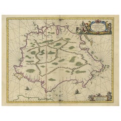
Antique Map of the Island of Borneo by Janssonius, circa 1650
Located in Langweer, NL
Antique map titled 'Insula Borneo et Occidentalis pars Celebis cum adjacentibus Insulis'. Rare sea chart of the island of Borneo. Published by J. Janssonius, circa 1650.
Category
Antique Mid-17th Century Maps
Materials
Paper
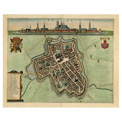
Decorative Bird's-Eye View Plan of Ieper or Ypres in Belgium, 1649
Located in Langweer, NL
Antique print, titled: 'Ypra.'
Bird's-eye view plan of Ieper / Ypres in Belgium. With key to locations and coats of arms. Text in Latin on verso. This plan originates from the famous city Atlas: 'Toneel der Steeden' published by Joan Blaeu...
Category
Antique 1640s Maps
Materials
Paper
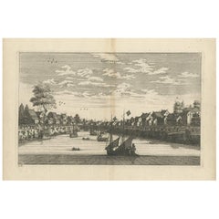
Antique Print of the City of Tiencienwey ‘Tientsin, China’ by J. Nieuhof, 1666
Located in Langweer, NL
Antique print titled 'Tiencienwey'. This plate shows a view on the Chinese city of Tiencienwey or Tientsin. Also depicted are many ships. This print originates from a German edition ...
Category
Antique Mid-17th Century Prints
Materials
Paper
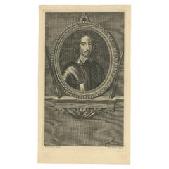
Antique Portrait of Thomas Fairfax, 1697
Located in Langweer, NL
Antique portrait titled 'Thomas Fairfax General du Parlement'. Thomas Fairfax, 3rd Lord Fairfax of Cameron.
Artists and Engravers: Engraved by P. Dre...
Category
Antique 17th Century Prints
Materials
Paper
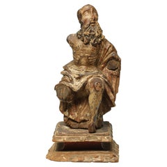
Antique 17th-18th Century Wood Italian Seated Saint Figure Fragment with Beard
Located in Point Richmond, CA
Antique 17th-18th century Italian carved wood seated saint figure fragment with beard. Possibly earlier. Remains of paint or pigments in multiple layers.
Arms and one leg missing, old damage to nose and other areas. Mounted on vintage base...
Category
Antique 17th Century Italian Medieval Tribal Art
Materials
Wood
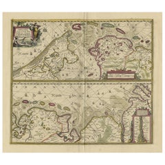
Antique Engraving of Dutch and German North Sea Coast of Friesland, ca.1680
Located in Langweer, NL
Antique map titled 'Tabula Nova In qua accuratè demonstratur tota Navigatio ab Amstelodami Statione per Vada vulgo de Watten Hamburgum usq.' -
Two maps with the Dutch and German North Sea coast of Friesland, with West Frisian Islands and below East Frisian Islands with inset map of the Elbe around Hamburg. With title and a scale cartouche. Map by Henricus Hondius...
Category
Antique 1680s Maps
Materials
Paper
Antique Print of a Lama, a Guinea Pig and Guinea Sheep & Collared Peccary, 1657
Located in Langweer, NL
Antique print of various animals; Ovis Peruana (Lama species) - Aries Guineensis (Guinea Sheep) - Porcus Guineensis (Guinea Pig) - Zainq Tajacu Porcus sylvester (Collared peccary). T...
Category
Antique 17th Century Prints
Materials
Paper
Antique Engraving of Edo 'or Jeddo, Yedo, Now Tokyo', 1669
Located in Langweer, NL
Antique print, titled: 'Iedo'
A bird's eye view of Edo (or Jeddo, Yedo, now Tokyo) as seen from a nearby hill. 62 places are identified in a list (both in French and Dutch). Arno...
Category
Antique 1660s Maps
Materials
Paper
Antique Engravings, One Sheet with 3 Bird's Eye Plans of Rhodes, Greece, 1677
Located in Langweer, NL
Antique map, titled: 'Afbeelding der Oude Stad Rhodus (…).' - Sheet with 3 bird's eye plans of Rhodes, Greece.
Source unknown, to be determined.
Artists and Engravers: Made by ...
Category
Antique 17th Century Prints
Materials
Paper
Antique Map of the Ancient British Isles by Janssonius 'circa 1640'
Located in Langweer, NL
Antique map titled 'Insularum Britannicarum Acurata Delineatio'. Original antique map of the ancient British Isles. England and Wales are labelled as B...
Category
Antique Mid-17th Century Maps
Materials
Paper
Decorative Antique Map of the Dutch Province of Noord-Brabant, ca.1640
Located in Langweer, NL
Antique map titled 'Quarta pars Brabantiae cujus Sylvaducis Willebordus vanderBurgt desrib'.
Highly detailed original antique map of the province of Noord-Brabant, the Netherlands. It shows the cities of 's-Hertogenbosch, Eindhoven and surroundings. Includes a decorative cartouche, 6 coats of arms, topped by winged cherubs and two larger coats of arms...
Category
Antique 1640s Maps
Materials
Paper
Antique Map of Thracia ‘Greece’ by J. Janssonius, circa 1650
Located in Langweer, NL
This antique map of Thracia is engraved and published by J. Janssonius after the cartographical sources by Abraham Ortelius. Ornated in the upper left corner with a title cartouche a...
Category
Antique Mid-17th Century Maps
Materials
Paper
Rare 17th C. Tuscan Baroque Credenza Console Cabinet Italian Sideboard LA CA
Located in West Hollywood, CA
Rare 17th C. Tuscan Baroque Credenza Console Cabinet Italian Sideboard LA CA . A good late 17th century-early 18th century Tuscan baroque polychrome decorated credenza cabinet 2 door...
Category
Antique Late 17th Century Italian Baroque Credenzas
Materials
Iron
Decorative Antique Map of the Quercy Region in France, 1657
Located in Langweer, NL
Antique map of France titled 'Quercy olim Cadurcium'.
Decorative map of the Quercy region. Quercy is a former province of France located in the country's southwest, bounded on th...
Category
Antique 1650s Maps
Materials
Paper
Old Map of the Western Part of Central Europe, c.1680
Located in Langweer, NL
Antique map titled 'Carta nova accurate del Passagio et strada dalli Paesi Bassi'. Old map of the western portion of Central Europe. Oriented to the Northeast.
Artists and Engrav...
Category
Antique 17th Century Maps
Materials
Paper
Detailed Antique Map of Northern Spanish Region of Aragon, c.1650
Located in Langweer, NL
Antique map titled 'Arragonia Regnum'.
Detailed map of northern Spanish region of Aragon. The map is centered on the city of Zaragoza, aka, Saragossa. Shows towns, rivers, castle...
Category
Antique 1650s Maps
Materials
Paper
Old Map of the City of Franeker, Friesland by the Famous Mapmaker Blaeu, 1652
Located in Langweer, NL
Antique map titled 'Franekera'. Old map of the city of Franeker, Friesland. Also shows two cartouches, coats of arms and legend. This map originates from a Latin edition of the town ...
Category
Antique 1650s Maps
Materials
Paper
Antique Map of the French Province Maine, Showing Le Mans, Alencon Etc., Ca1640
Located in Langweer, NL
Antique map titled 'Le Maine'.
Old map of the province of Maine, France. It shows the cities of Le Mans, Alencon and others. This map originates from a composite atlas.
Artis...
Category
Antique 1640s Maps
Materials
Paper
Statue of Roman Empress Agrippina in Rome, Etching on Paper, 1660
Located in Langweer, NL
Antique print, titled: 'Agrippina in Hortis Mediceis.' - Statue of Agrippina in Rome. Agrippina was a Roman Empress. From the 1660 Dutch edition of 'Icones et Segmenta Nobil. Signorum et Statuarum quae Romae extant' by Francois Perrier...
Category
Antique 17th Century Prints
Materials
Paper
Antique Print of Domestic and Wild Cat Species, incl The Civet, 1657
Located in Langweer, NL
Antique print of domestic and wild cat species; Felis domestica, Zahme Katz (Domestic cat) - Felis sylvestris, Wilde Katz (Wild Cat) - Felis Zibetti, Zibet Katz (Civet cat) - Genetta...
Category
Antique 1650s Prints
Materials
Paper
Antique Print of the City of Jiangxi, formerly romanized as Kiangsi, China, 1668
By Johannes Nieuhof
Located in Langweer, NL
Antique print China titled 'Kiangsi'. Old print depicting a view on the Chinese city of Kiangsi with its ramparts. Behind the city wall a pagoda can be seen. This print originates fr...
Category
Antique 17th Century Prints
Materials
Paper
Cartographic Treasures: A Journey Through the Gascogne and Guyenne Regions, 1680
Located in Langweer, NL
The antique map titled "Gouvernement de La Guienne & Gascogne" depicts the region of Gascogne and Guyenne, known for their wine production, in France.
This map is a rare edition, u...
Category
Antique Late 17th Century Maps
Materials
Paper
Beautiful Antique Map of Madagascar, The Comoros Islands & Reunion Island, 1667
Located in Langweer, NL
Antique map titled 'Isle d'Auphine, communement Nommée par les Europeens Madagascar, et St. Laurens, et par les Habitans du pays Madecase'.
Beautiful map of Madagascar...
Category
Antique 1660s Maps
Materials
Paper
Antique Print of Brittenburg 'Near Katwijk', the Netherlands by Blaeu, '1649'
Located in Langweer, NL
Antique print titled 'Arx Britannica'. View of De Brittenburg, a Roman ruin on the Dutch coast near Katwijk, The Netherlands. Originates from 'Toneel der Steeden' published by Joan B...
Category
Antique 17th Century Prints
Materials
Paper
Old Print of Jews Eating on Beds like Assyrians, Persians, Romans, Greeks, 1690
Located in Langweer, NL
Description: Antique print religion titled 'Het aanliggen op de Tafel-Bedden; hoedanigen Eetwyse der Assyriers, Persen, Grieken en Romeinen, ook by de Joden in gebruyk geraakt is'.
...
Category
Antique 1690s Prints
Materials
Paper
Old Decorative & Highly Detailed Sea Chart of the North Dutch-German Coast, 1681
Located in Langweer, NL
Antique map titled 'Paskaart van een gedeelte van Vriesland, Groeninger, en Emderland. Met zyn onderhoorige Eylanden; Strekkende van't Eylant der Schelling'.
Decorative and highl...
Category
Antique 1680s Maps
Materials
Paper
Antique Portrait of Dutch General Gerard Pietersz, Hulft, c.1670
Located in Langweer, NL
Antique portrait titled 'De Ed. Hr. Gerard Hulft, Eerste Raedt en Directeur Generael van Indien, Opper Bevelhebber over de Krygs-Mach soo te Water als te Lande afgesonden na Ceylon en de kusten van Indien'. Old portrait of Gerard Pietersz. Hulft (1621-1656), a Dutch East India general sent with a fleet to Ceylon. Source unknown, to be determined.
Artists and Engravers: Made by 'A. Blooteling' after 'G. Flinck'. Abraham Blooteling (1634-1690) was an eminent Dutch designer and engraver. Govert Flinck...
Category
Antique 17th Century Prints
Materials
Paper
Antique Bird's-eye View Plan of Zierikzee in Zeeland, The Netherlands, 1649
Located in Langweer, NL
Antique print, titled: 'Zirizea.' - A bird's-eye view plan of Zierikzee in The Netherlands, with key to locations and coats of arms. After Matheo Rollando and Stephano Bellemo. Latin tekst on verso. From the city Atlas: 'Toneel der Steeden' published by Joan Blaeu...
Category
Antique 1640s Maps
Materials
Paper
Antique Map Covering Northern Italy, Austria, Slovenia & Croatia, ca.1690
Located in Langweer, NL
Antique map titled 'Exactissima Tabula, qua tam Danubii Fluvii Pars Superior'.
Detailed map covering the region of northern Italy, Austria, Slovenia and Croatia. The course of th...
Category
Antique 1690s Maps
Materials
Paper
Antique Print of Harmonillus Turning into a Lemon Tree, 1646
Located in Langweer, NL
Antique print of Harmonillus turning into a lemon tree. This print originates from 'Hesperides, sive, De malorvm avreorvm cvltura et vsv libri quatuor' by Giovanni Battista Ferrari, published in 1646. This print is an illustration for the introduction by G.B. Ferraris book...
Category
Antique 1640s Prints
Materials
Paper
View of the Chinese City of Nanjing with Its Ramparts, 1665
Located in Langweer, NL
Antique print, titled: 'Namkun of Nankang'
View of the Chinese city of Nanjing with its ramparts. Behind the city wall a pagoda can be seen. On the fore...
Category
Antique 1660s Prints
Materials
Paper
Small Map of Bantam with Dutch Ships and an Engraving of Portugese, 1614
Located in Langweer, NL
Two rare old miniature copper-engravings one one leaf. One showing the first arrival of the first Dutch in Indonesia, the so-called 'Houtman expedition' and on the reverse Portugese welcoming them with gifts.
The First Dutch Expedition to Indonesia was an expedition that took place from 1595 to 1597. It was instrumental in the opening up of the Indonesian spice trade...
Category
Antique Early 17th Century Maps
Materials
Paper
Antique Map of the Dutch Province of Gelderland with Zutphen as Capital, C.1650
Located in Langweer, NL
Antique map titled 'Ducatus Gelriae pars Tertia quae est comitatus Zutphaniensis'. Old map of the province of Gelderland, the Netherlands. The city of Zutphen can be found in the mid...
Category
Antique 17th Century Maps
Materials
Paper
Frisia Occidentalis, A Rare Antique Engraving of Friesland, The Netherlands
Located in Langweer, NL
Antique map titled 'Frisia Occidentalis.' - A very decorative map of the Dutch province Friesland, also showing the Wadden islands Terschelling and Ameland. With coats of arms of the...
Category
Antique 1620s Maps
Materials
Paper
Antique Engraving of Archangel Michael and an Arab Moor Playing Instrument, 1698
Located in Langweer, NL
Untitled print of an Arab Moor man playing a stringed instrument 105: Mural in St. Marc's church: the left a painting of the Archangel Michael, said to be painted by S. Lucas.
Th...
Category
Antique 1690s Religious Items
Materials
Paper
Antique Print Showing the Arms of the Japanese Emperor, 1669
Located in Langweer, NL
Description: Antique print, titled: 'Japansche wapenen van den Kaisar.' - ('The Arms of the Japanese Emperor').
The image shows several official Imp...
Category
Antique 1660s Prints
Materials
Paper
Antique Copper Engraved Map of Gloucestershire in England, 1637
Located in Langweer, NL
Antique map titled 'Glocestriae comitatus olim sedes Dobunorum'. Map of Gloucestershire, England. This map originates from Camden?s 'Britannia' ...
Category
Antique 17th Century Maps
Materials
Paper
Antique Engraving of a Bird's-Eye Plan of Nagapattinam or Negapatam, India, 1672
Located in Langweer, NL
Antique map titled 'Negapatam.'
Bird's-eye plan of Nagapattinam or Negapatam, India. This map originates from 'Naauwkeurige Beschryvinge van Malabar en Choromandel…en het machtige ...
Category
Antique 1670s Maps
Materials
Paper
Attractive Antique Map of Western Africa with Lots of Details on the Coast, 1655
Located in Langweer, NL
Title: "L'Afrique, ou Lybie ulterieure ou sont le Saara, ou Desert, le pays des negres, la Guinee, et les Pays circonv. Tirée en partie de Sanut, et de l'Arabe de Nubie; en partie de diverses Cartes veües jusques a present".
Handsome map of Western Africa filled with information, much of it spurious, in the Sahara Desert, the Niger River and the coast of Guinea. Of particular interest are several incomplete rivers in the desert regions that appear and then disappear. The map is beautifully engraved with a title cartouche fashioned in the form of an oriental carpet.
The map shows a fantastic level of detail near the coastlines, which extends into legend and Ptolemaic myth in the interior of the continent. Detail is particularly extensive in Guinea and the Gold and Ivory Coasts. The Niger River is traced to its Malian lakes. The Mediterranean is barely visible in the northern part of the map. This map incorporates the discoveries made by Samuel Blommaert, who was director of the Dutch West Indies Company, in addition to traveling extensively to Africa and settling the oldest land deed...
Category
Antique 1650s Maps
Materials
Paper
Rare Antique Engraving of a Landscape with Two Horses and Horsemen, ca.1680
Located in Langweer, NL
Antique print of a landscape with two horses and horsemen.
Made after a painting by Philips Wouwerman. Source unknown, to be determined.
Artists and Engravers: Engraved by J....
Category
Antique 1680s Prints
Materials
Paper
Old Print of a Ritual Honorary Suicide, Seppuku or Belly Cutting in Japan, 1669
Located in Langweer, NL
Description: antique print, titled: 'Manier der Buiksnyding.' - ('Method of belly cutting').
A nobleman must commit seppuku because of his crimes. He is kneeling on the ground an...
Category
Antique 1660s Prints
Materials
Paper
Catching Doves in Renaissance Europe: Stradanus & Galle's 1615 Hunting Print
Located in Langweer, NL
The antique print titled 'Retibus aut iaculis capitar sic sepe Palumbe' is a fascinating piece from the early 17th century, part of the renowned 104-print series "Venationes Ferarum, Avium, Piscium" designed by Joannes Stradanus and engraved by Philip Galle around 1615. This series is celebrated for its detailed depiction of various hunting scenes.
**Key Aspects of the Print:**
1. **Scene Depiction**: The print vividly portrays the practice of catching wild doves. It features a hunter selling doves from a basket on the side of his donkey, capturing a moment typical of rural life and hunting practices of the time.
2. **Hunting Technique**: The method of catching doves using large nets in the trees is illustrated, showcasing a historical hunting technique. This detail provides insight into the methods and tools used in bird hunting in the early 17th century.
3. **Artistic Style**: The print reflects the artistic style of Joannes Stradanus, a Flemish artist known for his dynamic and detailed illustrations. Stradanus's work often depicted scenes of hunting, agriculture, and daily life, capturing the spirit of the Renaissance.
4. **Engraving by Philip Galle**: Philip Galle, a renowned engraver, was known for his skillful execution and contribution to the spread of Renaissance art through printed media. His collaboration with Stradanus resulted in high-quality and artistically significant prints.
5. **Cultural and Historical Significance**: This print is valuable for its portrayal of hunting practices and rural life in the early 17th century. It serves as a window into the societal norms, livelihoods, and traditions of the time.
6. **Part of a Larger Series**: Being part of "Venationes Ferarum, Avium, Piscium," this print is a piece of a larger collection that aimed to document various forms of hunting, fishing, and bird catching. The series is significant for its comprehensive portrayal of these activities.
7. **Educational Value**: For historians and art enthusiasts, this print offers educational insights into the techniques of Renaissance printmaking, as well as the socio-cultural aspects of hunting and trade in early modern Europe.
The 'Retibus aut iaculis capitar sic sepe Palumbe' print is not only an antique hunting print...
Category
Antique Early 17th Century Prints
Materials
Paper
Old Color Engraving of Blaeu's first Map of Brazil, North Oriented to the Right
By Willem Blaeu
Located in Langweer, NL
Antique map titled 'Novus Brasiliae Typus'. Fine old color example of Blaeu's first map of Brazil, with north oriented to the right. Includes inset map of Baya de todos Santos, elaborate cartouche, 2 compass roses and richly embellished vignettes of native Brazilian life and animals.
The interior of the map includes vignettes of indigenous animals and native scenes, including cannibalism. Inset within a decorative border is a small map of "Baya de todos Sanctos". In the sea are monsters, a galleon and two compass roses. The large title cartouche features a male and female Brazilian, both of whom are shown naked.
Willem Janszoon Blaeu (1571-1638) was a prominent Dutch geographer and publisher. Born the son of a herring merchant, Blaeu chose not fish but mathematics and astronomy for his focus. He studied with the famous Danish astronomer Tycho Brahe...
Category
Antique Mid-17th Century Maps
Materials
Paper
Original Old Copper Engraved Map of the Region of Albi, Southern France, 1663
Located in Langweer, NL
Antique map titled 'Carte du Diocese d'Alby'.
Original antique map of the region of Albi in Southern France. This map originates from 'Topographia Galliae dat is eene algemeene e...
Category
Antique 1660s Maps
Materials
Paper
Antique Miniature Map of New Guinea by Bertius, '1618'
Located in Langweer, NL
Antique miniature map titled 'Nova Guinea et Ins. Salomonis'. Rare miniature map of New Guinea (Solomon Islands). This map originates from 'Tabularum Geo...
Category
Antique Early 17th Century Maps
Materials
Paper
Antique Uncommon Map of Bohemia, Moravia and Silesia, 1699
Located in Langweer, NL
Antique map titled 'B. V. Boleslaviensis in Bohemia, Moravia et Silesia (..).' Detailed uncommon map of the Bohemia, Moravia and Silesia. Source unknown, to be determined.
Artists...
Category
Antique 17th Century Maps
Materials
Paper
Copper-Line Engraving by Cornelius de Bruyn of Alexandria in Egypt, c.1690
Located in Langweer, NL
Artist: Cornelis de Bruijn (or de Bruyn); 1652 – 1726/7 was a Dutch artist and traveler. He made two large tours and published illustrated books with his observations of people, buil...
Category
Antique Late 17th Century Prints
Materials
Paper
Antique Print of Graves Near the City of Nanjing in China, 1665
Located in Langweer, NL
Antique print titled 'Graf-Steden'. Old print depicting graves near the city of Nanjing, China. This print originates from 'Het gezantschap der Nee^rlandtsche Oost-Indische Compagnie...
Category
Antique 17th Century Prints
Materials
Paper
Antique Map of France by Janssonius, c.1650
Located in Langweer, NL
Antique map titled 'Gallia Vetus'. Beautiful map of France based on Caesar's De Bello Gallico. In the columns to the left and right important tribes and people are described.
Art...
Category
Antique 17th Century Maps
Materials
Paper
Engravings of Harlingen, Stavoren and Sneek in Friesland, the Netherlands, 1680
Located in Langweer, NL
Antique print titled 'Harlingen, Staveren, Sneck'. Views of the cities of Harlingen, Stavoren and Sneek, Friesland, the Netherlands. This print originates from 'Thooneel der Steden e...
Category
Antique 17th Century Prints
Materials
Paper
Antique Map of the Region of the Loire Valley by Janssonius, 1657
By Johannes Janssonius
Located in Langweer, NL
Antique map of France titled 'Aniou'. Decorative map centered on the Loire valley, France. This map originates from 'Atlas Novus, Sive Theatrum Orbis Orbis Terrarum: In quo Galliae, ...
Category
Antique 17th Century Maps
Materials
Paper
Antique Print of the Castle of Batavia in the East-Indies 'Indonesia', 1669
By Johannes Nieuhof
Located in Langweer, NL
Antique print titled 'The Castle of Batavia'. Old print of the Castle of Batavia (Jakarta), Indonesia. This print originates from 'An embassy from the East-India company of the Unite...
Category
Antique 17th Century Prints
Materials
Paper
Antique Print of the City of Kancheu in China, 1668
By Johannes Nieuhof
Located in Langweer, NL
Antique print China titled 'Kancheu'. Old print depicting a view on the Chinese city of Kancheu with its ramparts. This print originates from the L...
Category
Antique 17th Century Prints
Materials
Paper
Antique Print of a Funeral on Ceylon 'Sri Lanka' is Asia, 1672
Located in Langweer, NL
Untitled print of the death of the prince heir, and his burial. Two prints, one with a long burial train including numerous horses, carrying the coffin, covered with cloth. The other...
Category
Antique 17th Century Prints
Materials
Paper
Antique Map of the Region of Poitou by Ortelius, circa 1600
Located in Langweer, NL
Antique map titled 'Poictou'. Original antique map of the region of Poitou, a former province of west-central France whose capital city was Poitiers. Published by A. Ortelius, circa ...
Category
Antique Early 17th Century Maps
Materials
Paper
Antique Map of Austria by Ortelius, c.1612
Located in Langweer, NL
Antique map titled 'Austriae Descrip. per Wolfgangum Lazium' Original antique map of Austria. Published by A. Ortelius, circa 1612.
Artists a...
Category
Antique 17th Century Maps
Materials
Paper
Cartographic Tapestry: Antique Map of Asia Minor, circa 1640
Located in Langweer, NL
Title: "Historical Tapestry: Antique Map of Asia Minor, circa 1640"
Description:
This authentic antique map, created by Willem Blaeu and published in Amsterdam circa 1640, is a capt...
Category
Antique Mid-17th Century Maps
Materials
Paper
Antique Print of Government Houses in Batavia (Jakarta), Indonesia, 1682
By Johannes Nieuhof
Located in Langweer, NL
Antique print titled 'Stats Meesters en Konstenars Woningen'. This print depicts houses of government officials and artists in Batavia, Indonesia.
Originates from 'Gedenkweerdige B...
Category
Antique 17th Century Prints
Materials
Paper
