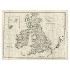
Antique Map Of Great Britain
9
to
27
102
31
52
52
42
21
17
14
13
10
9
7
6
5
5
5
5
5
4
3
3
2
2
2
2
2
1
1
1
1
1
1
1
1
1
1
1
1
1
1
1
19
3
2
2
1
Sort By
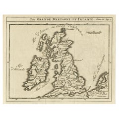
Rare Small Antique Map of Great Britain and Ireland
Located in Langweer, NL
Antique map titled 'La Grande Bretagne et Irlande'. Small antique map of Great Britain and Ireland
Category
Antique Mid-18th Century Maps
Materials
Paper
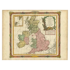
Antique Map of Great Britain and Ireland by Brion de la Tour, 1766
Located in Langweer, NL
Antique map titled 'Les Isles Britanniques (..).'
Attractive map of Great Britain surrounded by
Category
Antique 18th Century Maps
Materials
Paper
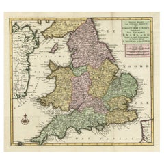
Antique Map of the South Part of Great Britain by Tirion, c.1750
By Isaak Tirion
Located in Langweer, NL
Koningryk Engeland (..).'
Attractive map showing the south part of Great Britain; the Kingdom of England
Category
Antique 18th Century Maps
Materials
Paper
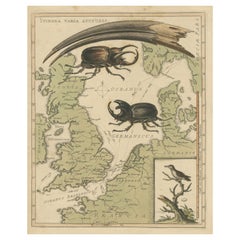
Interesting Map of Great Britain and Northern Europe with various Illustrations
Located in Langweer, NL
Antique map titled 'Itinera Varia Auctoris'. Very interesting map of Great Britain and Northern
Category
Antique Mid-18th Century Maps
Materials
Paper
H 11.23 in W 8.9 in D 0.02 in
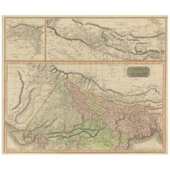
Antique Map of British India with Insets of Kabul and Nepal
Located in Langweer, NL
Antique map titled 'British India, northern part'. Large format map of the northern area of the
Category
Antique Early 19th Century Maps
Materials
Paper
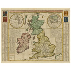
Antique Map of the British Isles by H. Chatelain, 1719
By Henri-Abraham Chatelain
Located in Langweer, NL
Beautiful hand colored large format map of the British Isles, with large insets of the Eastern and
Category
Antique Early 18th Century Maps
Materials
Paper
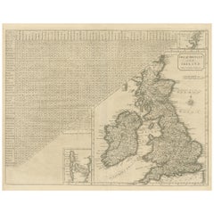
Antique Map of the British Isles, Insets of the Shetland Islands and Hebrides
Located in Langweer, NL
Antique map titled 'Great Britain and Ireland with ye Judges Circuits'. A scarce map of the British
Category
Antique Late 18th Century Maps
Materials
Paper
H 16.82 in W 19.45 in D 0.02 in
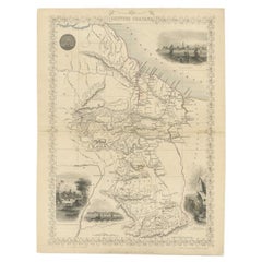
Antique Map of British Guayana with Insets of Georgetown, Devil's Rock Etc, 1851
Located in Langweer, NL
Antique map titled ‘British Guayana’. Includes decorative vignettes titled Georgetown, Christmas
Category
Antique 19th Century Maps
Materials
Paper
Free Shipping
H 14.18 in W 10.83 in D 0 in
Large Antique Map of the British Isles, with inset of the Orkneys and Shetlands
Located in Langweer, NL
Antique map titled 'A Map of Great Britain and Ireland (..)'. Large antique map of the British
Category
Antique Late 18th Century Maps
Materials
Paper
H 18.43 in W 24.93 in D 0.02 in
Antique Map of Scotland With an Inset Map of the Shetland Islands, 1854
Located in Langweer, NL
: Large Antique map titled 'Scotland with its Islands, drawn from the Topographical surveys by James Wyld
Category
Antique 1850s Maps
Materials
Paper
Antique Map of Central Asia, Finely Engraved, 1841
Located in Langweer, NL
Magazine , some maps for Henry Fisher, and engraved a set for Thomas Dugdale's Curiosities of Great Britain
Category
Antique 19th Century Maps
Materials
Paper
Antique Map of Holland with Colorful Vignettes, 1851
Located in Langweer, NL
Antique map titled 'Holland'.
Decorative map of Holland. Includes vignettes of Rotterdam, Dutch
Category
Antique 19th Century Maps
Materials
Paper
Antique Map of South Australia by Tallis, 1851
By Thomas Kitchin
Located in Langweer, NL
Antique map Australia titled 'Part of South Australia'. Decorative map of part of South Australia
Category
Antique 19th Century Maps
Materials
Paper
Antique Map of the Eastern Hemisphere by Wyld, 1842
Located in Langweer, NL
Antique map titled 'Eastern Hemisphere'. Large map depicting the continents Europe, Asia, Afrika
Category
Antique 19th Century Maps
Materials
Paper
Antique Map of the Pacific Ocean by Anson, 1765
Located in Langweer, NL
Antique map titled 'Carte de la Mer du Sud ou Mer Pacifique - Kaart van de Zuyd-Zee of stille
Category
Antique 18th Century Maps
Materials
Paper
Antique Map of Northern Germany by Wyld, c.1840
Located in Langweer, NL
a British geographer and map-seller, best known for Wyld's Great Globe. He was successor to William
Category
Antique 19th Century Maps
Materials
Paper
Original Antique Poly-Olbion Map of Denbighshire and Flintshire, Wales
Located in Langweer, NL
Rare and original antique map of Denbighshire and Flintshire, Wales. From the 'Poly-Olbion,' an
Category
Antique Mid-17th Century Maps
Materials
Paper
H 10.36 in W 13.51 in D 0.02 in
Antique Map of Western Europe by H. Kiepert, circa 1870
By Heinrich Kiepert
Located in Langweer, NL
including countries like Germany, France, Great Britain, The Netherlands and more. This map originates from
Category
Antique Late 19th Century Maps
Materials
Paper
Antique Map of Central America Showing the Communication Lines, 1850
Located in Langweer, NL
Antique map titled 'Map of Central America Shewing the Different Lines of Atlantic & Pacific
Category
Antique 19th Century Maps
Materials
Paper
Antique Map of England and Wales with Decorative Vignettes, 1851
Located in Langweer, NL
Antique map titled ‘England and Wales’. Includes decorative vignettes titled The grand stand on the
Category
Antique 19th Century Maps
Materials
Paper
Antique Map of Russia in Asia by Tallis, c.1851
Located in Langweer, NL
Antique map titled 'Russia in Asia'. Map of Russia in Asia. Showing vignettes of a polar hunting
Category
Antique 19th Century Maps
Materials
Paper
Beautiful Decorative Hand-Colored Antique Map of West Canada, 1851
Located in Langweer, NL
Description: Antique map of Canada titled 'West Canada'.
With decorative vignettes titled
Category
Antique 1850s Maps
Materials
Paper
No Reserve
H 10.63 in W 14.38 in D 0 in
Large Original Antique Map of the Dutchy of Holstein, Germany, ca.1840
Located in Langweer, NL
(1812–1887) was a British geographer and map-seller, best known for Wyld's Great Globe. He was successor
Category
Antique 1840s Maps
Materials
Paper
No Reserve
H 23.04 in W 28.35 in D 0 in
Antique Map of the Provinces of Gelderland and Overijssel by Kaerius, 1617
Located in Langweer, NL
published individual maps, but also atlases of the Netherlands and of Great Britain. In 1627 his Atlas Minor
Category
Antique 17th Century Maps
Materials
Paper
H 15.75 in W 20.67 in D 0 in
Colourful Antique Map of England and Wales Divided in Counties, 1854
Located in Langweer, NL
Antique map titled 'A Map Shewing the Places in England & Wales Sending Members to Parliament with
Category
Antique 19th Century Maps
Materials
Paper
Original Antique Map of the Channel Islands, Incl. Decorative Vignettes, 1851
Located in Langweer, NL
Antique map titled ‘Channel Islands’.
Includes decorative vignettes titled St. Peters Port
Category
Antique 1850s Maps
Materials
Paper
H 14.57 in W 10.24 in D 0 in
Excellent Antique Map of America with Unusual Northwest Coast of America, c.1754
Located in Langweer, NL
Description: Antique map titled 'Nieuwe Kaart Van het Westelykste Deel Der Weereld, dienende tot
Category
Antique 1750s Maps
Materials
Paper
No Reserve
H 13.98 in W 15.75 in D 0 in
Antique Map of France according to the Treaty of Paris '1815', Published in 1854
Located in Langweer, NL
Antique map titled 'The Kingdom of France, describing the new limits according to the treaty of
Category
Antique 19th Century Maps
Materials
Paper
H 23.04 in W 28.35 in D 0 in
Original Antique Map of the Peninsula of India with Part of Ceylon by Wyld, 1844
Located in Langweer, NL
This extensive map of India, spanning two sheets, draws from Reynell’s original map and
Category
Antique Mid-18th Century Maps
Materials
Paper
No Reserve
H 33.47 in W 23.23 in D 0 in
Stunning Decorative Antique Map of East Frisia with an Inset of Emden, c.1610
Located in Langweer, NL
mapmaking. Kaerius published individual maps, but also atlases of the Netherlands and of Great Britain
Category
Antique 1610s Maps
Materials
Paper
H 16.93 in W 20.87 in D 0 in
Large Antique Map of Egypt and the Nile Delta by Wyld, 1854
Located in Langweer, NL
Antique map titled 'Lower Egypt and the adjacent desert, with a part of Palestine to which has been
Category
Antique 19th Century Maps
Materials
Paper
Decorative Antique Map of the Malay Archipelago or East Indies Island, 1851
Located in Langweer, NL
Antique map Indonesia titled 'Malay Archipelago, or East India Islands'. With vignettes of Victoria
Category
Antique 1850s Maps
Materials
Paper
No Reserve
H 10.44 in W 14.18 in D 0 in
Antique Map of Western Africa with Vignettes of Cape Coast Castle etc, ca.1851
Located in Langweer, NL
Antique map titled ‘Western Africa’. Includes decorative vignettes titled Christiansborg, Cape
Category
Antique 1850s Maps
Materials
Paper
H 10.44 in W 13.98 in D 0 in
Antique Map of India as Described It Was before the 5th Century, 1744
Located in Langweer, NL
Antique map titled 'India, as described by all Authors before the fifth Century'. Detailed map of
Category
Antique 18th Century Maps
Materials
Paper
Antique Map of the North Sea From the English Channel to Norway & Sweden, 1746
Located in Langweer, NL
Antique map titled 'A correct Chart of the German Ocean from the North of Scotland to the Start
Category
Antique 1740s Maps
Materials
Paper
H 20.08 in W 15.75 in D 0 in
18th Century Emanuel Bowen Map of County of York, c.1740
By Emanuel Bowen
Located in Royal Tunbridge Wells, Kent
Antique 18th century British rare and original Emanuel Bowen (1694-1767) map of the County of York
Category
Antique Early 18th Century British Maps
Materials
Paper
Free Shipping
H 22.64 in W 29.34 in D 0.79 in
Antique Map of the Journey from Zhe-Hol in Tartary to Beijing and Hang-Tchoo Foo
Located in Langweer, NL
Antique map of China titled 'A Sketch of a Journey from Zhe-Hol in Tartary by land to Pekin and
Category
Antique Late 18th Century Maps
Materials
Paper
No Reserve
H 26.78 in W 20.08 in D 0.02 in
Decorative Map of part of South Australia with Illustrations of Adelaide, 1851
Located in Langweer, NL
Antique map Australia titled 'Part of South Australia'.
Decorative map of part of South
Category
Antique 1850s Maps
Materials
Paper
H 13.71 in W 10.83 in D 0 in
Engraved Large Map of The Kingdom of Portugal Original Handcolored, 1854
Located in Langweer, NL
Antique map titled 'Mappa Corografica do Reino de Portugal - Chorographical map of the Kingdom of
Category
Antique 1850s Maps
Materials
Paper
H 30.91 in W 22.84 in D 0 in
Old Engraved Map of Hungary with Decorative Vignettes, 1851
Located in Langweer, NL
Antique map titled Hungary. Includes decorative vignettes titled Hungarian Peasants, Pesth and the
Category
Antique 19th Century Maps
Materials
Paper
Map of Western Australia & Swan River, insets of Perth, Aboriginals, Sheep, 1851
Located in Langweer, NL
Antique map titled 'Western Australia, Swan River'. Map of Western Australia and Swan River
Category
Antique 1850s Maps
Materials
Paper
H 14.57 in W 10.63 in D 0 in
New Map of North America from the Latest Discoveries, 1763
Located in Philadelphia, PA
A fine antique 18th century map of the North American seaboard.
Entitled "A New Map of North
Category
Antique Mid-18th Century English Georgian Maps
Materials
Paper
Cortesi's Masterpiece: A Comprehensive and Authoritative Map of Uruguay, 1903
Located in Langweer, NL
Antique map titled 'Mapa de la Republica Oriental del Uruguay'. Large and detailed folding map of
Category
Early 20th Century Maps
Materials
Paper
Free Shipping
H 72.84 in W 50.79 in D 0.02 in
Map of Russia with Vignettes of the Neoskoi Prospect, St. Petersburg, ca.1851
Located in Langweer, NL
Antique map titled 'Russia in Europe'.
Map of European Russia. Showing vignettes of the Neoskoi
Category
Antique 1850s Maps
Materials
Paper
H 14.38 in W 10.63 in D 0 in
Old Map of Holstein with the Imperial Towns Hamburg & Lubeck, Germany, 1854
Located in Langweer, NL
Antique map titled 'Map of the Duchy of Holstein with the territories of the Imperial Towns Hamburg
Category
Antique 1850s Maps
Materials
Paper
H 22.13 in W 27.96 in D 0 in
The Roman Empire from the Time of Constantine the Great, Published in 1880
Located in Langweer, NL
Antique map titled: "IMPERIUM ROMANORUM inde a Constantini Magni tempore," which translates to "The
Category
Antique 1880s Maps
Materials
Paper
No Reserve
H 15.56 in W 18.51 in D 0 in
Antique Print of the City of Ten-Tchoo-Foo, China, 1796
Located in Langweer, NL
Great Britain and China by allowing the British to have a permanent embassy in the country. Sir George
Category
Antique 1790s Maps
Materials
Paper
Antique Chart of Dundee, Aberdeen and Montrose in Scotland, C.1774
By Captain Greenvile Collins
Located in Langweer, NL
Antique map titled 'To the Honble the Magistrates of the Citty of Aberdeene'. Sea chart of Tay
Category
Antique 18th Century Maps
Materials
Paper
Coast of Northumberland, England, Incl the Holy & Farne Islands, Etc, 1693
Located in Langweer, NL
Antique map titled 'Holy Island, Staples and Barwick.'
A map of the coast of Northumberland
Category
Antique 1690s Maps
Materials
Paper
H 19.1 in W 23.63 in D 0 in
Navigational Chart of Mexico's Coast, with Acapulco and Port Marquis, 1748
Located in Langweer, NL
Antique map titled 'The Form of cruising off Acapulca on the Coast of Mexico in the South Seas in
Category
Antique 1740s Maps
Materials
Paper
H 9.81 in W 17.52 in D 0.01 in
Rare Engraving of Dutch and Danish Forts on the West African Gold Coast, 1744
Located in Langweer, NL
Seats of the Nobility and Gentry of Great Britain, Curiously Engraven on 80 Copper Plates . This book is
Category
Antique 1740s Maps
Materials
Paper
H 15.36 in W 13.67 in D 0 in
Northern Germany incl Hanover, Oldenburg, Lippe, Bremen, Hamburg & Lubeck, 1854
Located in Langweer, NL
Antique map titled 'Map of the Kingdom of Hanover, with the Grand Duchy of Oldenburg, the
Category
Antique 1850s Maps
Materials
Paper
H 22.96 in W 29.65 in D 0 in
Great Britain Scandinavia Northern France Netherland Germany Mural Map
Located in Berghuelen, DE
The vintage pull-down cottagecore mural map illustrates the North Sea countries with Great Britain
Category
Vintage 1970s German Country Posters
Materials
Canvas, Wood, Paper
H 81.89 in W 88.19 in D 0.79 in
Great Britain, N. France: A Large 17th C. Hand-colored Map by Sanson and Jaillot
By Nicholas Sanson d'Abbeville
Located in Alamo, CA
This large hand-colored 17th century copperplate engraved map entitled "Le Royaume D Angleterre
Category
1690s Landscape Prints
Materials
Engraving
Antique 20th Century Large Scrolled Map Of The World, George Philips c.1918
Located in Royal Tunbridge Wells, Kent
Antique early-20th Century large commercial map of the world by George Philips. This scrolled map
Category
Vintage 1910s British Other Prints
Materials
Wood, Paper
H 47.64 in W 85.04 in D 1.58 in
Antique Map of Italy Drawn & Engraved by R. Scott for Thomsons, Edinburgh 1814
Located in London, GB
This is a magnificent museum quality antique hand-coloured map of Italy, dating from 1814.
This
Category
Antique 1810s Scottish Prints
Materials
Other
H 30.52 in W 23.63 in D 0.79 in
Original Antique World War One Humoros Wap Map Of The World WWI Japan Caricature
Located in London, GB
Original antique World War One satirical map of Europe and Asia portraying the outbreak of WWI
Category
Vintage 1910s Japanese Posters
Materials
Paper
H 18.51 in W 24.81 in D 0.04 in
The Great Carousel
By Varujan Boghosian
Located in Milford, NH
). Boghosian was born in New Britain, CT and after serving in the United States Navy, he attended Central
Category
Early 2000s Abstract Expressionist Mixed Media
Materials
Wood Panel, Laid Paper, Lithograph
New France and Labrador - Graphite Drawing, Landscape, On Antiqued Map
By Don Pollack
Located in Chicago, IL
Coeur d’Alenes trail in Northern Idaho. It is a place of rugged and stark beauty barely on the old maps
Category
21st Century and Contemporary Contemporary Landscape Paintings
Materials
Canvas, Oil
Cambridgeshire map 17th century engraving by John Speed
By John Speed
Located in London, GB
A beautifully coloured map of Cambridgeshire, with an antique description of the county to the
Category
1610s Landscape Prints
Materials
Engraving
- 1
Get Updated with New Arrivals
Save "Antique Map Of Great Britain", and we’ll notify you when there are new listings in this category.
Antique Map Of Great Britain For Sale on 1stDibs
Find many varieties of an authentic antique map of great britain available at 1stDibs. Frequently made of paper, metal and wood, every antique map of great britain was constructed with great care. Your living room may not be complete without an antique map of great britain — find older editions for sale from the 18th Century and newer versions made as recently as the 20th Century. An antique map of great britain made by Victorian designers — as well as those associated with Baroque — is very popular. Many designers have produced at least one well-made antique map of great britain over the years, but those crafted by Isaak Tirion, Heinrich Kiepert and Captain Greenvile Collins are often thought to be among the most beautiful.
How Much is a Antique Map Of Great Britain?
Prices for an antique map of great britain can differ depending upon size, time period and other attributes — at 1stDibs, they begin at $122 and can go as high as $14,750, while the average can fetch as much as $596.
