Illustrated Map
to
72
338
147
249
183
135
77
74
74
55
48
34
33
28
26
26
25
22
18
16
14
14
14
13
12
12
12
10
10
9
8
6
5
5
4
4
4
4
3
3
3
3
2
2
2
2
2
2
2
2
2
2
1
1
1
1
1
1
1
1
1
14
10
8
6
4
Sort By
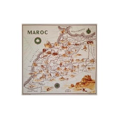
illustrated map of Morocco created in 1950 by Delaye
Located in PARIS, FR
Beautiful illustrated map of Morocco created in 1950 by Delaye. Main roads, car tracks, railroads
Category
1950s Prints and Multiples
Materials
Lithograph, Paper
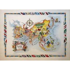
Jacques Liozu's 1951 illustrated map of Asia
By Jacques Liozu
Located in PARIS, FR
Jacques Liozu's 1951 illustrated map of Asia is an exceptional work of cartography that combines
Category
1950s Prints and Multiples
Materials
Lithograph, Paper
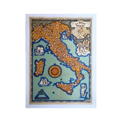
Illustrated map of Italy by Umberto Zimelli dating from 1933
Located in PARIS, FR
Very nice illustrated map of Italy dating from 1933.
Italy - Tourism
Category
1930s Prints and Multiples
Materials
Paper, Lithograph, Linen
$1,185
H 26.38 in W 18.51 in
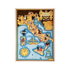
Illustrated map from 1934 of the main Italian popular costumes - Old map
Located in PARIS, FR
Very beautiful illustrated map from 1934 of the main Italian popular costumes.
Italy - Tourism
Category
1930s Prints and Multiples
Materials
Paper, Linen, Lithograph
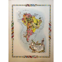
Jacques Liozu's 1951 illustrated map of South America
By Jacques Liozu
Located in PARIS, FR
Jacques Liozu's 1951 illustrated map of South America is an exceptional work of cartography that
Category
1950s Prints and Multiples
Materials
Lithograph, Paper
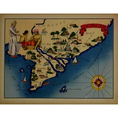
1943 original illustrated map of Cochinchine by Dylbert
Located in PARIS, FR
The 1943 original illustrated map of Cochinchine by Dylbert is a striking example of cartographic
Category
1940s Prints and Multiples
Materials
Lithograph, Paper, Linen
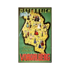
Original poster of Thurnher Weiss representing an illustrated map of Vorarlberg
Located in PARIS, FR
Original poster of Thurnher Weiss representing an illustrated map of Vorarlberg which is a region
Category
Mid-20th Century Prints and Multiples
Materials
Lithograph, Paper
$1,066
H 30.32 in W 20.87 in
Circa 1950 original illustrated map "Carte des Montagnes Suisses"
Located in PARIS, FR
The circa 1950 original illustrated map "Carte des Montagnes Suisses" by L. Koller is a beautifully
Category
1950s Prints and Multiples
Materials
Lithograph, Paper, Linen
$533
H 13.39 in W 16.54 in
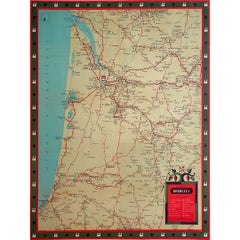
Circa 1950 original illustrated map for "Carte France autour de Bordeaux"
Located in PARIS, FR
The circa 1950 original illustrated map for "Carte France autour de Bordeaux" is an excellent
Category
1950s Prints and Multiples
Materials
Paper, Linen
$474
H 20.48 in W 17.72 in
Jacques Liozu's 1951 illustrated map of Australia and Oceania
By Jacques Liozu
Located in PARIS, FR
Jacques Liozu's 1951 illustrated map of Australia and Oceania is a remarkable cartographic work
Category
1950s Prints and Multiples
Materials
Lithograph, Paper
$889
H 16.15 in W 22.05 in
Jacques Liozu's 1951 illustrated map of North and Central America
By Jacques Liozu
Located in PARIS, FR
Jacques Liozu's 1951 illustrated map of North and Central America is an exceptional work of
Category
1950s Prints and Multiples
Materials
Lithograph, Paper
$889
H 22.05 in W 16.15 in
The Illustrated Map of the Var Department from the Atlas National Illustré, 1856
Located in Langweer, NL
French geographer and cartographer known for his richly illustrated maps.
The map of 'Dépt. du Var' from
Category
Antique 1850s Maps
Materials
Paper
$322 Sale Price
20% Off
H 14.18 in W 20.87 in D 0 in
Jacques Liozu's 1951 illustrated map of Central and Eastern Europe
By Jacques Liozu
Located in PARIS, FR
Jacques Liozu's 1951 illustrated map of Central and Eastern Europe is a cartographic work of great
Category
1950s Prints and Multiples
Materials
Lithograph, Paper
$889
H 22.05 in W 16.15 in
Original Vintage Illustrated Map Poster Afrique Equatoriale Francaise Cameroon
Located in London, GB
Original vintage illustrated map poster for Cameroun AOF Afrique Occidentale Francaise / Cameroon
Category
Vintage 1950s French Posters
Materials
Paper
$1,275
H 47.25 in W 30.71 in D 0.04 in
Jacques Liozu's 1951 illustrated map of the region of Franche-Comté
By Jacques Liozu
Located in PARIS, FR
Jacques Liozu's 1951 illustrated map of Franche-Comté is a cartographic work of great beauty and
Category
1950s Prints and Multiples
Materials
Lithograph, Paper
$829
H 22.05 in W 16.15 in
Original Vintage Illustrated Map Poster Schematic Map Soviet Union USSR Russia
Located in London, GB
Original vintage illustrated map poster - Schematic Map of the Soviet Union's East Siberia and the
Category
Vintage 1960s Russian Posters
Materials
Paper
$1,610
H 25.2 in W 38.19 in D 0.04 in
Jacques Liozu's 1951 illustrated map of Alsace and Lorraine in France
By Jacques Liozu
Located in PARIS, FR
Jacques Liozu's 1951 illustrated map of Alsace and Lorraine is a remarkable work of cartography
Category
1950s Prints and Multiples
Materials
Lithograph, Paper
$829
H 22.05 in W 16.15 in
1937 original poster illustrated map of the Exposition Internationale
Located in PARIS, FR
This 1937 original poster presents a detailed illustrated map of the Exposition Internationale des
Category
1930s Prints and Multiples
Materials
Linen, Paper, Lithograph
$948
H 15.36 in W 29.93 in
Original Vintage Illustrated Map Poster Railway Travel Normandy Brittany Paris
By Lucien Boucher
Located in London, GB
Original vintage travel poster featuring a colourful Illustrated Map of the State Railways Sea and
Category
Vintage 1930s French Posters
Materials
Paper
$2,550
H 39.38 in W 24.61 in D 0.04 in
An original poster featuring an illustrated map of Tenerife - La Lucha
Located in PARIS, FR
A beautiful poster featuring an illustrated map of Tenerife or Tenerife, an island in Spain that
Category
1950s Prints and Multiples
Materials
Lithograph, Paper
$592
H 18.51 in W 26.38 in
Original Vintage Advertising Poster Unilever South America Illustrated Map Art
Located in London, GB
Original vintage advertising poster for Unilever in South America featuring a colourful illustrated
Category
Vintage 1950s British Posters
Materials
Paper
$1,879
H 29.93 in W 20.48 in D 0.04 in
Original Vintage British Railways Poster Illustrated Map of the Channel Islands
Located in London, GB
published by the Southern Region of British Railways. Colourful illustrated map of the Channel Islands
Category
Vintage 1950s British Posters
Materials
Paper
$3,355
H 40.16 in W 50.01 in D 0.04 in
Original Vintage Advertising Poster Unilever Overseas India Illustrated Map
Located in London, GB
Original vintage advertising poster for Unilever Overseas India. Great illustrated map of India
Category
Vintage 1950s British Posters
Materials
Paper
$2,214
H 29.53 in W 20.08 in D 0.04 in
Jacques Liozu's 1951 illustrated map of the region of Pays d'Ouest
By Jacques Liozu
Located in PARIS, FR
Jacques Liozu's 1951 illustrated map of the Pays d'Ouest is a remarkable cartographic work that
Category
1950s Prints and Multiples
Materials
Lithograph, Paper
$829
H 16.15 in W 22.05 in
Original Vintage Illustrated Map Poster Empire Industry Where Our Tea Comes From
Located in London, GB
version depicting colourful illustrated maps of India and Ceylon (now Sri Lanka) featuring the city names
Category
Vintage 1930s British Posters
Materials
Paper
$3,355
H 24.02 in W 24.81 in D 0.04 in
Circa 1950 original illustrated map by André Lesot for "Carte de la Manche"
Located in PARIS, FR
The circa 1950 original illustrated map by André Lesot for "Carte de la Manche" is a significant
Category
1950s Prints and Multiples
Materials
Lithograph, Linen, Paper
$652
H 28.75 in W 21.26 in
1950 illustrated map Italy, Land of Saints and Sanctuaries
Located in PARIS, FR
In 1950, a highly detailed and artistically illustrated map titled Italie Terre de Saints et de
Category
1950s Prints and Multiples
Materials
Lithograph, Linen, Paper
Original WWII Illustrated Map Poster - Time And Tide Map Of The Atlantic Charter
By "Leslie MacDonald ""Max"" Gill"
Located in London, GB
Original vintage illustrated map poster in Spanish by the notable graphic designer, cartographer
Category
Vintage 1940s British Posters
Materials
Paper
$7,382
H 44.89 in W 34.85 in D 0.04 in
Original Vintage Pictorial Illustrated Map Poster Scotland Mackay Midcentury
Located in London, GB
Original vintage pictorial map poster for Scotland featuring various detailed and colourful
Category
Vintage 1950s British Posters
Materials
Paper
$1,275
H 22.05 in W 15.75 in D 0.04 in
Original Vintage Travel Poster Island Of Cyprus Illustrated Map Mediterranean
Located in London, GB
Original vintage travel poster for the Island of Cyprus featuring a map of the ancient historic
Category
Vintage 1930s British Posters
Materials
Paper
$1,275
H 20.08 in W 29.93 in D 0.04 in
Original Vintage Travel Poster Air France Planisphere Illustrated Map Boucher
By Lucien Boucher
Located in London, GB
the top, a detailed map of Europe with the tagline - on the wings of Air France discover the world on
Category
Vintage 1950s French Posters
Materials
Paper
$1,476
H 20.08 in W 28.35 in D 0.04 in
Original Vintage Poster sle Of Skye Illustrated Map Scotland Macleod Macdonald
Located in London, GB
Original vintage pictorial map poster for the Isle of Skye featuring detailed fun and colourful
Category
Vintage 1960s British Posters
Materials
Paper
$1,006
H 18.51 in W 20.87 in D 0.04 in
Original Vintage Travel Poster For La Normandie France Normandy Illustrated Map
Located in London, GB
Original vintage travel poster for Normandy - La Normandie France - featuring a pictorial map
Category
Vintage 1950s French Posters
Materials
Paper
$1,006
H 24.02 in W 35.83 in D 0.04 in
1852 Map of Haut-Rhin: An Illustrated Gateway to Alsace's Viticultural Splendors
Located in Langweer, NL
French geographer and cartographer known for his richly illustrated maps.
The map is a steel engraving
Category
Antique 1850s Maps
Materials
Paper
$322 Sale Price
20% Off
H 14.18 in W 20.75 in D 0 in
Old Map of Vaucluse, France: A Cartographic Celebration of Viticulture, 1852
Located in Langweer, NL
French geographer and cartographer known for his richly illustrated maps.
The map is a steel engraving
Category
Antique 1850s Maps
Materials
Paper
$322 Sale Price
20% Off
H 14.18 in W 20.99 in D 0 in
Ornate 1850s Map of South America: A Masterpiece of Exploration & Art by Rapkin
Located in Langweer, NL
, romantic-era maps, illustrated map, hand-colored map, historical landmarks, ethnographic scenes, J. Rapkin
Category
Antique 1850s Maps
Materials
Paper
$308
H 14.26 in W 10.95 in D 0.01 in
Antique Map Illustrating Solar Eclipses by Scherer, C.1703
Located in Langweer, NL
Antique map of an hemisphere and several figures illustrating the position of the earth, moon and
Category
Antique 18th Century Maps
Materials
Paper
$208 Sale Price
20% Off
H 10.63 in W 8.47 in D 0 in
Antique Map of South Italy, illustrating the Invasion of Naples in, 1806
Located in Langweer, NL
Antique battle map titled 'Map of South Italy, to illustrate the invasion of Naples in 1806 etc
Category
Antique Mid-19th Century Maps
Materials
Paper
$180 Sale Price
20% Off
H 7.09 in W 8.98 in D 0.02 in
Map of Rhône: Culture and Commerce in Lyon's Silk and Wine Legacy, 1852
Located in Langweer, NL
French geographer and cartographer known for his richly illustrated maps.
The map is a steel engraving
Category
Antique 1850s Maps
Materials
Paper
$322 Sale Price
20% Off
H 20.28 in W 13.94 in D 0 in
Old Map of Ancient Rome Illustrating Major Monuments and the Seven Hills, c.1704
Located in Langweer, NL
Illustrating Major Monuments and the Seven Hills. This map originates from 'Beschryving van Oud en Nieuw Rome
Category
Antique 18th Century Maps
Materials
Paper
$450
H 9.65 in W 14.18 in D 0 in
Original Vintage Advertising Poster Tahiti New Caledonia Illustrated Route Map
By Hervé Baille
Located in London, GB
Caledonia and Australia service m.s. Caledonien Tahitien. Fantastic illustrated map design by Herve Baille
Category
Vintage 1950s French Posters
Materials
Paper
$1,677
H 22.84 in W 35.04 in D 0.04 in
Antique Map Made After a Roman Papyrus Travel Map, Known as Peutinger Map, 1773
Located in Langweer, NL
as Peutinger's Tabula or Peutinger Table, is an illustrated itinerarium (ancient Roman road map
Category
Antique 18th Century Maps
Materials
Paper
$426 Sale Price
20% Off
H 15.56 in W 18.51 in D 0 in
Relief Atlas Map of Europe by Hachette – Antique French Map c.1883
Located in Langweer, NL
educational “Atlas en relief.” The map illustrates the physical geography of Europe with hypsometric tinting
Category
Antique Late 19th Century French Maps
Materials
Paper
$462
H 10.12 in W 12.84 in D 0.01 in
Antique Map of the Holy Land and Paradise – Terrae Canaan Map, c.1720
Located in Langweer, NL
habitatarum. The map illustrates the biblical lands of Canaan, Mesopotamia, Arabia, and Syria with remarkable
Category
Antique Early 18th Century Dutch Maps
Materials
Paper
$521
H 9.65 in W 14.41 in D 0.01 in
1847 Amerique Septentrionale Framed Map
Located in Stamford, CT
1847 Amerique Septentrionale Framed Map Illustrated by Raimond Bonheur. As found framed condition.
Category
Antique 1840s American American Classical Maps
Materials
Glass, Wood, Paper
Map of the Persian Empire circa 1750 by Tirion – Hand-Colored Dutch Map
Located in Langweer, NL
the time of publication, the map illustrates the administrative divisions, cities, rivers, and
Category
Antique 1750s Dutch Maps
Materials
Paper
$699
H 16.34 in W 21.54 in D 0.01 in
Original Antique Map of Switzerland, 1882
Located in Langweer, NL
Embark on a historical journey with an original Antique Map of Switzerland from the renowned
Category
Antique 1880s Maps
Materials
Paper
1851 Map of "Independent Tartary", Ric. R018
Located in Norton, MA
1851 Map of
Independent Tartary
"Russia"
Ric.r018
A highly decorative 1851 map of
Category
Antique 19th Century Unknown Maps
Materials
Paper
Nebraska Railroad Map 1888 – Rand McNally Antique Lithograph
Located in Langweer, NL
its development. Produced during the great railroad expansion era, the map illustrates the rapidly
Category
Antique Late 19th Century American Maps
Materials
Paper
Florida 1888 Antique Map – Railroads, Settlements & Gulf Coast Detail
Located in Langweer, NL
Florida Map 1888 – Rand McNally Antique Lithograph
This antique 1888 map of Florida, published by
Category
Antique Late 19th Century American Maps
Materials
Paper
$640
H 20.67 in W 14.18 in D 0.01 in
Antique Map of Eastern Germany, Bohemia, Moravia & Silesia – 1858
Located in Langweer, NL
elevation profile at the bottom of the map illustrates the varying altitudes across the depicted regions
Category
Antique Mid-19th Century German Maps
Materials
Paper
$521
H 14.77 in W 17.88 in D 0.01 in
Antique Map of Novaya Zemlya by Bellin, 1758
Located in Langweer, NL
Maritime (1764), which contained 580 charts, as well as maps to illustrate l' Abbe Prevost's Histoire
Category
Antique 18th Century Maps
Materials
Paper
1874 Map of the United States with Territorial Boundaries
Located in Langweer, NL
development. The map illustrates state and territorial boundaries, with clear outlines in orange to delineate
Category
Antique 1870s Maps
Materials
Paper
$246 Sale Price
20% Off
H 15.75 in W 23.23 in D 0 in
Antique Lithography Map, Western Russia, English, Framed, Cartography, Victorian
Located in Hele, Devon, GB
Tallis to engrave maps for the Illustrated Atlas and Modern History of the World (1845-51).
Quality
Category
Antique Mid-19th Century British Early Victorian Maps
Materials
Wood
$840
H 21.46 in W 17.33 in D 0.6 in
Antique Lithography Map, West Africa, English, Framed, Cartography, Victorian
Located in Hele, Devon, GB
Tallis to engrave maps for the Illustrated Atlas and Modern History of the World (1845-51).
Quality
Category
Antique Mid-19th Century British Early Victorian Maps
Materials
Wood
$840
H 17.52 in W 19.89 in D 0.79 in
Antique Lithography Map, Black Sea, English, Framed, Cartography, Victorian
Located in Hele, Devon, GB
Tallis to engrave maps for the Illustrated Atlas and Modern History of the World (1845-51).
Quality
Category
Antique Mid-19th Century British Early Victorian Maps
Materials
Wood
$840
H 17.72 in W 20.48 in D 0.79 in
Antique Lithography Map, South America, English, Framed, Cartography, Victorian
Located in Hele, Devon, GB
John Tallis to engrave maps for the Illustrated Atlas and Modern History of the World (1845-51
Category
Antique Mid-19th Century British Early Victorian Maps
Materials
Wood
$840
H 21.86 in W 17.13 in D 0.79 in
- 1
Get Updated with New Arrivals
Save "Illustrated Map", and we’ll notify you when there are new listings in this category.
Illustrated Map For Sale on 1stDibs
Choose from an assortment of styles, material and more with respect to the illustrated map you’re looking for at 1stDibs. Each illustrated map for sale was constructed with extraordinary care, often using paper and wood. Your living room may not be complete without a illustrated map — find older editions for sale from the 18th Century and newer versions made as recently as the 20th Century. Each illustrated map bearing Mid-Century Modern or Art Deco hallmarks is very popular. A well-made illustrated map has long been a part of the offerings for many furniture designers and manufacturers, but those produced by Leslie MacDonald Gill, Kerry Lee and Vsevolod Petrovich Nikulin are consistently popular.
How Much is a Illustrated Map?
Prices for a illustrated map start at $437 and top out at $75,000 with the average selling for $1,350.
More Ways To Browse
Antique Curiosities
Antique Atlases
Antique Valuables
17th Century Antiques
In Canada
Rare Antique Maps
1950 Vintage Posters
Antique Cartography
Authentic Antique Maps
Antique Maps 18th Century
Mediterranean Antique
Antique Winder
Chateau De
Antique German Collectibles
Circa 1750
Antique 17th Century Map
The Vintage Map
Lyon Antique
