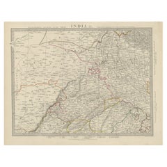
Rare Map Of India
2
to
25
116
25
84
42
36
33
16
16
8
7
6
6
6
3
3
2
2
2
2
1
1
1
1
1
1
1
1
1
1
1
16
4
3
3
2
Sort By
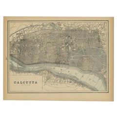
Rare Antique Map of Calcutta 'Kolkata' in India, 1893
Located in Langweer, NL
Antique map titled 'Calcutta (India)'. Old map of Calcutta/Kolkata, India. On verso, a map of Egypt
Category
Antique 19th Century Maps
Materials
Paper
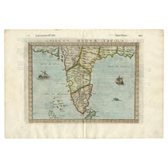
Rare Attractive Antique Map of Asia, India, Sri Lanka, Maldives, 1599
Located in Langweer, NL
Original Antique map of Asia, India, Ceylon (Sri Lanka), Maldives by Rosaccio / Ruscelli in
Category
Antique 16th Century European Maps
Materials
Paper
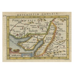
Rare Antique Miniature Map of Pakistan, India and Cambaia, ca.1616
Located in Langweer, NL
Old 17th century miniature antique map of 'Cambaia' , from the 1616 edition of Jadocus Hondius
Category
Antique 17th Century Maps
Materials
Paper
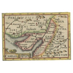
Rare Antique Miniature Map of Pakistan, India and Cambaia, ca.1618
Located in Langweer, NL
Old 17th century miniature antique map of 'Cambaia' , from the 1616 edition of Jadocus Hondius
Category
Antique 17th Century Maps
Materials
Paper
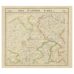
Large and Rare Antique Map of Northern India in Original Coloring, c.1825
Located in Langweer, NL
Antique map titled 'No. 82 Pays d'Ajemeer d'Agra'. Detailed map of Northern India. Originates from
Category
Antique 19th Century Maps
Materials
Paper
H 21.26 in W 29.34 in D 0 in
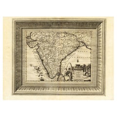
Rare Engraved Antique Map of India with Elephants in the Cartouche, c.1725
Located in Langweer, NL
map of India, with part of Sri Lanka. Compass rose and decorative cartouche lower right with scale and
Category
Antique 18th Century Maps
Materials
Paper
H 19.1 in W 14.57 in D 0 in
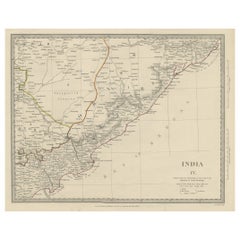
Interesting Detailed Antique Map of Eastern India, 1832
Located in Langweer, NL
Antique map titled 'India IV'. Old steel engraved map of the eastern part of India, including the
Category
Antique 19th Century Maps
Materials
Paper
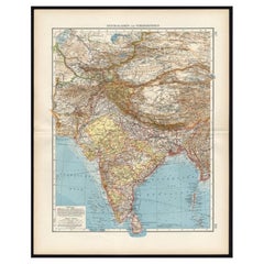
Antique Map of Central Asia and India, 1904
Located in Langweer, NL
Antique map titled 'Zentralasien und Vorderindien'. Map of Central Asia and India. This large
Category
20th Century Maps
Materials
Paper
Antique Map of the Region of Delhi in India, 1833
Located in Langweer, NL
Antique map titled 'India IX'. Old steel engraved map of the region of Delhi, with great detail
Category
Antique 19th Century Maps
Materials
Paper
Antique Map of the Gulf of Cambay, Gujarat, India, 1725
By Pieter Van Der Aa
Located in Langweer, NL
Sea along the west coast of India, in the state of Gujarat.
Extremely rare in this edition. This
Category
Antique 18th Century Maps
Materials
Paper
Detailed Orginal Antique Map of Bengal, India, c.1825
Located in Langweer, NL
flexibility. Depending on the individual map, presentation, and context, a rare or antique map can be modern
Category
Antique 19th Century Maps
Materials
Paper
Antique Map of Eastern India by Kuyper, C.1880
Located in Langweer, NL
rare or antique map can be modern, traditional, abstract, figurative, serious or whimsical. We offer a
Category
Antique 19th Century Maps
Materials
Paper
Antique Map of Part of the Bombay Presidency in India, 1831
Located in Langweer, NL
Antique map titled 'India III Bombay Presidency'. Old steel engraved map of part of the Bombay
Category
Antique 19th Century Maps
Materials
Paper
French Antique Map of India with an Inset of Pondicherry, 1835
Located in Langweer, NL
Antique map India titled 'Presqu'ile de l'Inde en de ca du Gange'. Miniature map depicting India
Category
Antique 19th Century Maps
Materials
Paper
Antique Map of India with Inset of Puducherry by Monin, 1835
Located in Langweer, NL
Antique map India titled 'Presqu'ile de l'Inde en de ca du Gange'. Miniature map depicting India
Category
Antique 19th Century Maps
Materials
Paper
Original Antique Map of Part of the Bahar Region (India), 1834
Located in Langweer, NL
Antique map titled 'India X'. Old steel engraved map of part of the Bahar region, it also shows
Category
Antique 19th Century Maps
Materials
Paper
Detailed Antique Map of the Region of Malwa in India, 1833
Located in Langweer, NL
Antique map titled 'India VI'. Old steel engraved map of the region of Malwa showing great detail
Category
Antique 19th Century Maps
Materials
Paper
Antique Map of Choromandel, Golconda and Orixa, Malabar, India, 1744
By Philip Baldaeus
Located in Langweer, NL
flexibility. Depending on the individual map, presentation, and context, a rare or antique map can be modern
Category
Antique 18th Century Maps
Materials
Paper
Antique Map of the Region of Berar and Rewah in India, 1832
Located in Langweer, NL
Antique map titled 'India VII'. Old steel engraved map of part of India including the Rajah of
Category
Antique 19th Century Maps
Materials
Paper
Antique Map of the Region of Gujarat and Cutch in India, 1833
Located in Langweer, NL
Antique map titled 'India V'. Old steel engraved map of the region of Gujarat and Cutch showing
Category
Antique 19th Century Maps
Materials
Paper
Antique Map of the Region of the Bay of Bengal, India, c.1863
By Edward Weller
Located in Langweer, NL
Antique map titled 'India Bengal'. Old map of India depicting the region near the Bay of Bengal
Category
Antique 19th Century Maps
Materials
Paper
Antique Map of India and the Gulf of Bengal by Mallet, c.1686
Located in Langweer, NL
Antique map titled ?Partie Orientale de la Terre Ferme de l'Inde Moderne. Small map of India and
Category
Antique 17th Century Maps
Materials
Paper
Detailed Antique Map of the Region of Gujarat and Mumbai in India, C.1825
Located in Langweer, NL
their beauty and design flexibility. Depending on the individual map, presentation, and context, a rare
Category
Antique 19th Century Maps
Materials
Paper
H 21.66 in W 29.34 in D 0 in
Antique Map of India as Described It Was before the 5th Century, 1744
Located in Langweer, NL
Antique map titled 'India, as described by all Authors before the fifth Century'. Detailed map of
Category
Antique 18th Century Maps
Materials
Paper
Rare Antique Map of the Moghul Empire, ca.1725
Located in Langweer, NL
Antique map titled 'Oost-Indize Voyagie door William Hawkins van Suratte gedaan na 't Hof van den
Category
Antique 1720s Maps
Materials
Paper
Antique Map of Continental Asia, with Japan, Arabia, India, Russia, etc c.1702
Located in Langweer, NL
individual map, presentation, and context, a rare or antique map can be modern, traditional, abstract
Category
Antique 18th Century Maps
Materials
Paper
H 10.75 in W 15.95 in D 0 in
Rare Original Antique Ptolemy Map of Ceylon, Present Day Sri Lanka
Located in Langweer, NL
Original antique map titled 'Tab XII Asiae Taprobanam (..)'. For this map of Toprobana (Sri Lanka
Category
Antique Late 17th Century Maps
Materials
Paper
Rare 16th Century Original Handcolored Miniature Map of China, Published in 1593
Located in Langweer, NL
.
Very interesting and decorative miniature map of China.
Italian text with 'India' in title on the
Category
Antique 16th Century Maps
Materials
Paper
H 4.53 in W 6.3 in D 0 in
A Rare and Old Trapezoidal Projection of the Ganges and Himalaya Range in India
Located in Langweer, NL
Antique map titled 'Tabula Asiae X'. This Ptolemaic map on a trapezoidal projection is centered on
Category
Antique 16th Century Maps
Materials
Paper
H 9.06 in W 12.41 in D 0.02 in
Rare Antique Map of Persia, Incl the Caspian Sea and the Arabian Peninsula, 1726
Located in Langweer, NL
Rare untitled antique map of Persia. It covers from the Gulf of Suez eastward to Ahmedabad
Category
Antique 1720s Maps
Materials
Paper
H 13 in W 16.93 in D 0 in
Antique Map of the Mongol Empire, 1767
Located in Langweer, NL
Antique map titled 'The Moguls Empire divided into its principal governments'. Old map of India
Category
Antique 18th Century Maps
Materials
Paper
Antique Map Made After a Roman Papyrus Travel Map, Known as Peutinger Map, 1773
Located in Langweer, NL
Old Dutch engraving with title: 'Romeinsche Reis Kaart van K. Peutinger'.
Rare antique map based
Category
Antique 18th Century Maps
Materials
Paper
H 15.56 in W 18.51 in D 0 in
Antique Map of the City of Grave by Blaeu, 1649
Located in Langweer, NL
rare or antique map can be modern, traditional, abstract, figurative, serious or whimsical. We offer a
Category
Antique 17th Century Maps
Materials
Paper
Antique Map of the City of Goch by Blaeu, 1649
Located in Langweer, NL
, presentation, and context, a rare or antique map can be modern, traditional, abstract, figurative, serious or
Category
Antique 17th Century Maps
Materials
Paper
Antique Map of the City of Geldern by Blaeu, 1649
Located in Langweer, NL
cartographer of the Dutch East India Company. Around 1649 Joan Blaeu published a collection of Dutch city maps
Category
Antique 17th Century Maps
Materials
Paper
Antique Map of the City of Tiel by Blaeu, 1649
Located in Langweer, NL
individual map, presentation, and context, a rare or antique map can be modern, traditional, abstract
Category
Antique 17th Century Maps
Materials
Paper
Antique Map of the City of Workum by Blaeu, 1649
Located in Langweer, NL
their beauty and design flexibility. Depending on the individual map, presentation, and context, a rare
Category
Antique 17th Century Maps
Materials
Paper
Antique Map of the City of Sneek by Blaeu, 1649
Located in Langweer, NL
cartographer of the Dutch East India Company. Around 1649 Joan Blaeu published a collection of Dutch city maps
Category
Antique 17th Century Maps
Materials
Paper
Antique Map of the City of Sneek by Blaeu, 1652
Located in Langweer, NL
the individual map, presentation, and context, a rare or antique map can be modern, traditional
Category
Antique 17th Century Maps
Materials
Paper
18th Century Cartographic Depiction of Upper India and Ceylon, 1835
Located in Langweer, NL
cultural and geographical tapestry of Upper India and Ceylon. The maps invite admiration and contemplation
Category
Antique 1830s Maps
Materials
Paper
Free Shipping
H 10.04 in W 14.57 in D 0 in
Very Attractive Handcolored Antique Plan of Cochin in India, 1744
By Philip Baldaeus
Located in Langweer, NL
Antique map titled 'The City of Cochin (..).' Plan of Cochin, Malabar Coast, India, during the
Category
Antique 18th Century Maps
Materials
Paper
Attractive Hand-Colored Antique Plan of Nagapattinam in India, 1744
Located in Langweer, NL
Antique map titled 'Negapatam.' Attractive bird's-eye view of Nagapattinam, India from Churchill's
Category
Antique 18th Century Maps
Materials
Paper
Antique Map of the East Indies by Dower, 1832
Located in Langweer, NL
Antique map titled 'East India Isles'. Old map of the East Indies. This map originates from 'A
Category
Antique 19th Century Maps
Materials
Paper
Old German Antique Map of Iran and Arabia, 1866
Located in Langweer, NL
'. Large map centered on Iran. It shows the area from Turkey to Mumbai in India. Includes Arabia, the
Category
Antique 19th Century Maps
Materials
Paper
Antique Map of the Hesse Region of Germany by Blaeu, 1665
Located in Langweer, NL
, presentation, and context, a rare or antique map can be modern, traditional, abstract, figurative, serious or
Category
Antique 17th Century Maps
Materials
Paper
Antique Map of Asia Showing Its Political Divisions, 1874
Located in Langweer, NL
Travel between London & India, China & Japan & c'. This map covers from the Arabian Peninsula and Turkey
Category
Antique 19th Century Maps
Materials
Paper
Antique Map of the Malabar Coast by Baldaeus, 1744
By Philip Baldaeus
Located in Langweer, NL
individual map, presentation, and context, a rare or antique map can be modern, traditional, abstract
Category
Antique 18th Century Maps
Materials
Paper
Antique Map of the East Indies by Rossi, 1683
Located in Langweer, NL
Antique map titled 'Isole Dell'India cioe le Molucche la Filippine e della Sonda Parte de Paesi di
Category
Antique 17th Century Maps
Materials
Paper
Antique Map of the Coast of Southwest Asia by Kitchin, c.1770
By Thomas Kitchin
Located in Langweer, NL
rare or antique map can be modern, traditional, abstract, figurative, serious or whimsical. We offer a
Category
Antique 18th Century Maps
Materials
Paper
Antique Map of the East Indies by Janssonius, c.1644
By Johannes Janssonius
Located in Langweer, NL
Antique map titled 'India quae Orientalis dicitur, et Insulae adiacentes'. Old map of the East
Category
Antique 17th Century Maps
Materials
Paper
Antique Map of Ambon Island in the Moluccas, Indonesia, c.1760
Located in Langweer, NL
their beauty and design flexibility. Depending on the individual map, presentation, and context, a rare
Category
Antique 18th Century Maps
Materials
Paper
Bird's Eye View of Dabhol as Seen from the Sea, North of Goa, India, 1727
Located in Langweer, NL
. The city is situated on the Vashishti river, north of Goa in India, on the Malabar Coast. The view
Category
Antique 1720s Maps
Materials
Paper
Free Shipping
H 11.82 in W 16.15 in D 0 in
Antique Map of the Islands Near Batavia, Capital of the Dutch East Indies, 1682
Located in Langweer, NL
the individual map, presentation, and context, a rare or antique map can be modern, traditional
Category
Antique 17th Century Maps
Materials
Paper
H 11.82 in W 7.49 in D 0 in
Small Map of Bantam with Dutch Ships and an Engraving of Portugese, 1614
Located in Langweer, NL
Two rare old miniature copper-engravings one one leaf. One showing the first arrival of the first
Category
Antique Early 17th Century Maps
Materials
Paper
Antique Map of the Siege of Breda, City in the Netherlands by Blaeu, 1649
Located in Langweer, NL
cartographer of the Dutch East India Company. Around 1649 Joan Blaeu published a collection of Dutch city maps
Category
Antique 17th Century Maps
Materials
Paper
H 20.87 in W 24.02 in D 0 in
Old Antique Map of the East Indies and Southeast Asia, ca.1644
Located in Langweer, NL
Antique map titled 'India quae Orientalis dicitur, et Insulae adiacentes'.
Old map of the East
Category
Antique 1640s Maps
Materials
Paper
Original Antique Map of the East Indies (Indonesia) by Janssonius, c.1644
By Johannes Janssonius
Located in Langweer, NL
Antique map titled 'India quae Orientalis dicitur, et Insulae adiacentes'. Old map of the East
Category
Antique 17th Century Maps
Materials
Paper
H 18.51 in W 23.43 in D 0 in
Antique Map of the Mughal Empire by Van der Aa, C.1725
By Pieter Van Der Aa
Located in Langweer, NL
individual map, presentation, and context, a rare or antique map can be modern, traditional, abstract
Category
Antique 18th Century Maps
Materials
Paper
Antique Map of Artois in the North of France by Famous Mapmaker Blaeu, c.1640
Located in Langweer, NL
rare or antique map can be modern, traditional, abstract, figurative, serious or whimsical. We offer a
Category
Antique 17th Century Maps
Materials
Paper
No Reserve
H 19.69 in W 23.43 in D 0 in
Antique Map Showing the Religions Around the World by Johnston '1854'
Located in Langweer, NL
According to Religious Belief'. Rare large-size thematic map on the distribution of religions around the
Category
Antique Mid-19th Century Maps
Materials
Paper
H 21.66 in W 26.38 in D 0.02 in
- 1
Get Updated with New Arrivals
Save "Rare Map Of India", and we’ll notify you when there are new listings in this category.
Rare Map Of India For Sale on 1stDibs
With a vast inventory of beautiful furniture at 1stDibs, we’ve got just the rare map of India you’re looking for. Frequently made of paper, wood and bronze, every rare map of India was constructed with great care. Your living room may not be complete without a rare map of India — find older editions for sale from the 18th Century and newer versions made as recently as the 20th Century. A rare map of India is a generally popular piece of furniture, but those created in Baroque and neoclassical styles are sought with frequency. A well-made rare map of India has long been a part of the offerings for many furniture designers and manufacturers, but those produced by Pieter Van Der Aa, Johannes Nieuhof and Philip Baldaeus are consistently popular.
How Much is a Rare Map Of India?
Prices for a rare map of India can differ depending upon size, time period and other attributes — at 1stDibs, they begin at $61 and can go as high as $199,000, while the average can fetch as much as $517.
