School World Map
2
to
28
385
229
289
261
183
115
55
47
47
34
33
29
28
22
19
18
14
14
12
8
8
7
6
4
3
3
3
3
3
2
2
2
2
2
1
1
1
1
1
1
1
1
1
42
42
34
32
32
Sort By
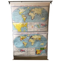
1967 World Exploration School Map
Located in Tarrytown, NY
Pull down world exploration map from 1967.
Category
Vintage 1960s Maps
Materials
Paper
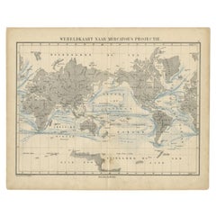
Antique Mercator Projection World Map by Petri, c.1873
Located in Langweer, NL
Antique world map titled 'Wereldkaart naar Mercator's Projectie'. Old map of the world. This map
Category
Antique 19th Century Maps
Materials
Paper
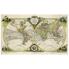
Rare Original Double Hemisphere World Map with Allegorical Figures, 1785
Located in Langweer, NL
hemisphere world map. Four allegorical figures in the corners represent Europe, Asia, Africa and America
Category
Antique 1780s Maps
Materials
Paper
H 17.05 in W 23.23 in D 0 in
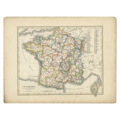
Antique Map of France from an Old Dutch School Atlas, 1852
Located in Langweer, NL
Antique map titled 'Frankrijk'. Map of France. This map originates from 'School-Atlas van alle
Category
Antique 19th Century Maps
Materials
Paper
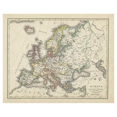
Antique Map of Europe from an Old Dutch School-Atlas, 1852
Located in Langweer, NL
Antique map titled 'Europa'. Map of Europe. This map originates from 'School-Atlas van alle deelen
Category
Antique 19th Century Maps
Materials
Paper
Antique Map of Asia from a German School Atlas, c.1870
Located in Langweer, NL
maps to collectors, historians, educators and interior decorators all over the world. Our collection
Category
Antique 19th Century Maps
Materials
Paper
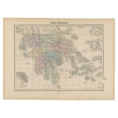
Antique Map of Greece from an Old French School Atlas, 1880
Located in Langweer, NL
world. Our collection includes a wide range of authentic antique maps from the 16th to the 20th
Category
Antique 19th Century Maps
Materials
Paper
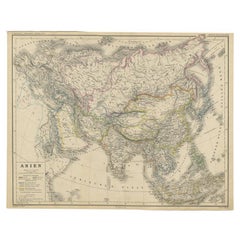
Antique Map of the Asian Continent from a German School Atlas, 1862
Located in Langweer, NL
Antique map titled 'Asien Politische Ubersicht'. Old map of the Asian continent. Originates from
Category
Antique 19th Century Maps
Materials
Paper
Antique Map of Germany and Switzerland from an Old Dutch School Atlas, 1852
Located in Langweer, NL
Antique map titled 'Duitschland en Zwitersland'. Map of Germany and Switzerland. This map
Category
Antique 19th Century Maps
Materials
Paper
H 10.63 in W 13.59 in D 0 in
Antique Map of Germany and Switzerland from an Old Dutch School Atlas, c.1873
Located in Langweer, NL
map originates from 'School-Atlas van alle Deelen der Aarde'. Artists and Engravers: Published by O
Category
Antique 19th Century Maps
Materials
Paper
H 12.88 in W 10.32 in D 0 in
Antique Map of Greece with an Inset Map of the Upper Danube Region, c.1720
Located in Langweer, NL
cities, school atlases and an Atlas of Silesia in 1750 with 20 maps.
Artist: Made by 'Homann Heirs
Category
Antique 18th Century Maps
Materials
Paper
H 21.07 in W 25.2 in D 0 in
Antique Map of Turkey and Greece, 1852
Located in Langweer, NL
decorators all over the world. Our collection includes a wide range of authentic antique maps from the 16th
Category
Antique 19th Century Maps
Materials
Paper
Antique Map of the Netherlands by Petri, 1852
Located in Langweer, NL
map originates from 'School-Atlas van alle deelen der Aarde' by Otto Petri.
Artists and Engravers
Category
Antique 19th Century Maps
Materials
Paper
Charming Scarce Small Antique Map of Asia, 1837
Located in Langweer, NL
leading German world atlas until the middle of the 20th century.
We sell original antique maps to
Category
Antique 19th Century Maps
Materials
Paper
Antique Map of the United Kingdom and Ireland, 1852
Located in Langweer, NL
decorators all over the world. Our collection includes a wide range of authentic antique maps from the 16th
Category
Antique 19th Century Maps
Materials
Paper
Antique Map of Africa with European Language Borders, 1852
Located in Langweer, NL
Antique map titled 'Afrika'. Map of Africa. This map originates from 'School-Atlas van alle deelen
Category
Antique 19th Century Maps
Materials
Paper
Antique Map of Italy with Hand-Colored Borders, 1852
Located in Langweer, NL
Antique map titled 'Italië'. Map of Italy. This map originates from 'School-Atlas van alle deelen
Category
Antique 19th Century Maps
Materials
Paper
Antique Map of the Jewish Land by Lindeman, 1761
Located in Langweer, NL
original antique maps to collectors, historians, educators and interior decorators all over the world. Our
Category
Antique 18th Century Maps
Materials
Paper
Antique Map of Asia Showing Its Political Divisions, 1874
Located in Langweer, NL
company had specialized in the production of school atlases and wall maps of America. They were one of the
Category
Antique 19th Century Maps
Materials
Paper
Antique Map of Turkey and Greece by Petri, c.1873
Located in Langweer, NL
Greece. This map originates from 'School-Atlas van alle Deelen der Aarde'.
Artists and Engravers
Category
Antique 19th Century Maps
Materials
Paper
Antique Decorative Coloured Map Egypt, Nubia, Abyssinia and more, 1882
Located in Langweer, NL
This image contains two maps, with the left one being labeled "Egypt" and the right one "Nubia
Category
Antique 1880s Maps
Materials
Paper
Free Shipping
H 14.97 in W 22.45 in D 0 in
Antique Map of the United Kingdom and Ireland, c.1873
Located in Langweer, NL
, with inset maps of London and factory districts of the UK. This map originates from 'School-Atlas van
Category
Antique 19th Century Maps
Materials
Paper
Antique Map of the Kingdom of Prussia by Petri, 1852
Located in Langweer, NL
all over the world. Our collection includes a wide range of authentic antique maps from the 16th to
Category
Antique 19th Century Maps
Materials
Paper
Antique Map of Vlaams-Brabant by Homann Heirs, c.1720
By Homann Heirs
Located in Langweer, NL
decorators all over the world. Our collection includes a wide range of authentic antique maps from the 16th
Category
Antique 18th Century Maps
Materials
Paper
Antique Map of Ancient Persia, Assyria and surroundings, c.1760
Located in Langweer, NL
over the world. Our collection includes a wide range of authentic antique maps from the 16th to the
Category
Antique 18th Century Maps
Materials
Paper
Antique Map of the Seventeen Provinces by Homann Heirs, 1748
By Homann Heirs
Located in Langweer, NL
cities, school atlases and an Atlas of Silesia in 1750 with 20 maps.
Condition: Good, general age
Category
Antique 18th Century Maps
Materials
Paper
Antique Map of Belgium and Luxembourg by Homann Heirs, 1747
Located in Langweer, NL
Antique map titled 'Belgium Catholicum seu Decem provinciae Germaniae Inferioris cum confiniis
Category
Antique 18th Century Maps
Materials
Paper
Antique Map of Flanders, Belgium by Homann Heirs, c.1735
Located in Langweer, NL
over the world. Our collection includes a wide range of authentic antique maps from the 16th to the
Category
Antique 18th Century Maps
Materials
Paper
Antique Map of Belgium and Luxembourg by Homann Heirs, 1747
Located in Langweer, NL
antique maps to collectors, historians, educators and interior decorators all over the world. Our
Category
Antique 18th Century Maps
Materials
Paper
Antique Map of Europe with Elaborate Title Cartouche, c.1750
Located in Langweer, NL
Antique map of Europe titled 'Europa Secundum legitimas Projectionis Stereographicae regulas et
Category
Antique 18th Century Maps
Materials
Paper
Original Antique Map of the Township of Uithuizermeeden, the Netherlands, 1862
Located in Langweer, NL
Groningen: Gemeente Oldenzijl-Oosternieland-de Roode School-Uithuizermeeden. These scarse detailed
Category
Antique 19th Century Maps
Materials
Paper
H 7.49 in W 9.85 in D 0 in
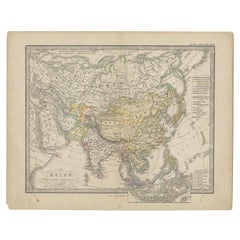
Antique Map of Asia Showing the European Language Areas, c.1873
Located in Langweer, NL
Antique map titled 'Asia'. Old map depicting the Asian continent. This map originates from 'School
Category
Antique 19th Century Maps
Materials
Paper
Antique Map of the Seventeen Provinces of Netherlands, Belgium, Luxembourg, 1748
By Homann Heirs
Located in Langweer, NL
full sized plans of principal cities, school atlases and an Atlas of Silesia in 1750 with 20 maps
Category
Antique 18th Century Maps
Materials
Paper
H 21.07 in W 25.01 in D 0 in
Antique Map of the Islands of Denmark by Homann Heirs, 1720
Located in Langweer, NL
Antique map titled 'Insula Danicae in Mari Balthico sitae (..).' - Map of the Danish islands
Category
Antique 18th Century Maps
Materials
Paper
Antique Map of the Netherlands, Belgium and Luxembourg by Petri, c.1873
Located in Langweer, NL
, Luxembourg and Belgium. With an inset map of Amsterdam. This map originates from 'School-Atlas van alle
Category
Antique 19th Century Maps
Materials
Paper
Antique Map of Friesland, Groningen and German East Friesland by Ortelius, 1603
Located in Langweer, NL
(Theatre of the World). Ortelius is often considered one of the founders of the Netherlandish school of
Category
Antique 17th Century Maps
Materials
Paper
H 17.52 in W 22.45 in D 0 in
Antique Map of Friesland with Elaborate Cartouche by Mapmaker Ortelius, c.1570
Located in Langweer, NL
(Theatre of the World). Ortelius is often considered one of the founders of the Netherlandish school of
Category
Antique 16th Century Maps
Materials
Paper
H 17.45 in W 22.72 in D 0 in
Antique Map of Biblical Palestine with Inset of Israel's 12 Tribes, 1758
Located in Langweer, NL
the world. Our collection includes a wide range of authentic antique maps from the 16th to the 20th
Category
Antique 18th Century Maps
Materials
Paper
H 15.16 in W 18.51 in D 0 in
Antique Map of the Region of Paris by Homann Heirs, c.1720
By Homann Heirs
Located in Langweer, NL
sized plans of principal cities, school atlases and an Atlas of Silesia in 1750 with 20 maps
Category
Antique 18th Century Maps
Materials
Paper
Antique Map of the Region of Orleans by Homann Heirs, c.1760
By Homann Heirs
Located in Langweer, NL
interior decorators all over the world. Our collection includes a wide range of authentic antique maps from
Category
Antique 18th Century Maps
Materials
Paper
Antique Map of the Caspian Sea, Uzbekistan, Northern Persia Etc, C.1735
Located in Langweer, NL
the world. Our collection includes a wide range of authentic antique maps from the 16th to the 20th
Category
Antique 18th Century Maps
Materials
Paper
Antique Map of the Waldeck Region of Germany by Homann Heirs, circa 1733
By Homann Heirs
Located in Langweer, NL
over the world. Our collection includes a wide range of authentic antique maps from the 16th to the
Category
Antique 18th Century Maps
Materials
Paper
H 22.84 in W 19.89 in D 0 in
Antique Map of the Northern Part of Biblical Palestine by Lindeman, c.1763
Located in Langweer, NL
Geography at the 'Illustere School'.
We sell original antique maps to collectors, historians, educators and
Category
Antique 18th Century Maps
Materials
Paper
H 15.16 in W 19.02 in D 0 in
Unusual Benedictine Map of Italy, Showing Various States of the Church, C.1745
Located in Langweer, NL
Antique map titled 'Italia Benedictina Delineata A.P.R.C.P.W.' Unusual Benedictine map of Italy
Category
Antique 18th Century Maps
Materials
Paper
H 25.2 in W 21.07 in D 0 in
Antique Map of the Danube River and Surroundings by Homann Heirs, c.1730
By Homann Heirs
Located in Langweer, NL
Antique map titled 'Danubii Fluminus (a fontibus prope Doneschingam usq Posonium urbem defignati
Category
Antique 18th Century Maps
Materials
Paper
H 21.15 in W 25.01 in D 0 in
Detailed Old Map of the Seven Provinces of the Belgian/Dutch Federation, ca.1748
Located in Langweer, NL
Antique map titled 'Septem Provinciae seu Belgium Foederatum quod generliter Hollandia
Category
Antique 18th Century Maps
Materials
Paper
H 25.2 in W 21.07 in D 0 in
Antique Map of Egypt and the Nile River with Sphinx, Pyramids, Etc, c.1720
Located in Langweer, NL
full sized plans of principal cities, school atlases and an Atlas of Silesia in 1750 with 20 maps
Category
Antique 18th Century Maps
Materials
Paper
H 24.41 in W 21.07 in D 0 in
Dutch Municipality of Uithuizermeeden in Groningen, Kuyper, 1865
Located in Langweer, NL
decorators all over the world. Our collection includes a wide range of authentic antique maps from the 16th
Category
Antique 19th Century Maps
Materials
Paper
A Map of the World
By Max Ferguson
Located in Greenwich, CT
Map Room at the Public Library, Bryant Park, NYC
Born in New York City in 1959, Max Ferguson
Category
2010s Photorealist Figurative Paintings
Materials
Oil, Panel
Late 20th Century Educational Geographic Map - Worlds Resources
Located in Hook, Hampshire
Geographic Map – Worlds Resources. Good quality roll up school educational geographic map from the Czech
Category
Late 20th Century Czech Posters
Materials
Cotton
Late 20th Century Educational Geographic Map - Worlds Oceans
Located in Hook, Hampshire
Geographic Map – Worlds Oceans. Good quality roll up school educational geographic map from the Czech
Category
Late 20th Century Czech Posters
Materials
Cotton
Late 20th Century Educational Geographic Map - World Atlas
Located in Hook, Hampshire
Map – World Atlas . Good quality roll up school educational geographic map from the Czech republic
Category
Late 20th Century Czech Posters
Materials
Cotton
Vintage Mural World Map Earth Poster Pull-Down Wall Chart Poster Print
Located in Berghuelen, DE
A large decorative world map – named our earth, impressive wall chart decoration, published by
Category
Vintage 1970s German Country Prints
Materials
Canvas, Wood, Paper
H 50.01 in W 82.68 in D 0.79 in
Northern Hemisphere of the Earth Rollable Map Vintage Wall Chart World Mural
Located in Berghuelen, DE
A great pull-down map or vintage wall chart illustrating the northern hemisphere of the earth
Category
Mid-20th Century German Country Prints
Materials
Canvas, Wood, Paper
H 70.48 in W 66.93 in D 0.79 in
Post World War II South African Hebrew Inscribed Metal School Supply Box
Located in New York, NY
Metal school supply box sent by the South Africa Jewish Wars Appeal to the Wels displaced persons
Category
Vintage 1940s South African Decorative Boxes
Materials
Metal
Rose of the World
By Varujan Boghosian
Located in Milford, NH
Connecticut Teachers College and the Vesper George School of Art in Boston. In 1953, he had a Fulbright grant
Category
Early 2000s Abstract Expressionist Mixed Media
Materials
Paper, Board, Laid Paper, Color
Great Britain, Money Map Art, Map Art, Finance Artwork, Great British Artwork
By Justine Smith
Located in Deddington, GB
up the map allows for a politically charged worked.
Jusitne Smith is available online and in our
Category
2010s Contemporary Landscape Prints
Materials
Paper, Archival Ink, Inkjet
H 23.43 in W 16.15 in D 0.04 in
Map of the North of Scotland 17th century hand-coloured map by Gerardus Mercator
Located in London, GB
and is most renowned for creating the 1569 world map based on a new projection which represented
Category
1680s Prints and Multiples
Materials
Engraving
Seeking Alignment - Original Surrealist Art Map Figurative
Located in Los Angeles, CA
visualizing edgy, half-buried perceptions troubling us about the world around us. Many of his paintings
Category
21st Century and Contemporary Surrealist Figurative Paintings
Materials
Charcoal, Paper, Ink, Mixed Media
Geobond - Colorful Authentic Urban Map Currency Painting
By Fabio Coruzzi
Located in Los Angeles, CA
, Trinity School – London
Affordable Art Fair Battersea – Bicha Gallery
Cityscapes
Category
21st Century and Contemporary Pop Art Figurative Paintings
Materials
Canvas, Oil Pastel, Mixed Media, Acrylic, Ink, Graphite
- 1
Get Updated with New Arrivals
Save "School World Map", and we’ll notify you when there are new listings in this category.
School World Map For Sale on 1stDibs
With a vast inventory of beautiful furniture at 1stDibs, we’ve got just the school world map you’re looking for. Each school world map for sale was constructed with extraordinary care, often using paper, metal and stainless steel. Find 74 options for an antique or vintage school world map now, or shop our selection of 13 modern versions for a more contemporary example of this long-cherished piece. Whether you’re looking for an older or newer school world map, there are earlier versions available from the 18th Century and newer variations made as recently as the 21st Century. A school world map, designed in the mid-century modern, Art Deco or modern style, is generally a popular piece of furniture. You’ll likely find more than one school world map that is appealing in its simplicity, but Zhang Zhoujie, Homann Heirs and A. D. Copier produced versions that are worth a look.
How Much is a School World Map?
Prices for a school world map start at $55 and top out at $1,150,000 with the average selling for $1,642.
More Ways To Browse
Antique Maps Of Israel
Antique Map Of Israel
Dog Dinner Plates
Pasta Painting
Antique Sicily Map
English Bible Box
Antique Map Sicily
Banc Vintage
Riverside Drive
Nautical Vintage Maps
Los Leones
Gray Chinese Chairs
Nautical Map Vintage
Howard 7 Son
Map Of Jamaica
1920s Movie Poster
17 Th Century Painting
Heinrich And Co Gold
