Maps
to
1,542
1,846
40
1,888
26
2
2
1
1
2,926
2,181
476
3
289
34
10
127
7
35
9
2
5
3
4
2
1,873
23
11
5
3
126
61
34
20
18
1,888
1,888
1,888
24
16
13
12
12
Maps For Sale
Period: 18th Century
Period: 1920s
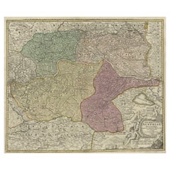
Old Decorative Map of Austria, Centered on the Danube River and Vienna, Ca.1720
Located in Langweer, NL
Antique map titled 'Archiducatus Austriae inferioris (..).' Decorative map of Austria, centered on the course of the Danube River and Vienna. Shows the region from Enss and Steyr to ...
Category
1720s Antique Maps
Materials
Paper
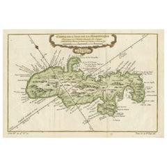
Martinique Island in the Caribbean by Bellin Original Original Antique Map, 1780
Located in Langweer, NL
This mid-18th century map, "Carte de l'Isle de la Martinique pour servir a l'historie generale des voyages," was issued in 1780 by M. Bellin in Paris. It presents a detailed and visually captivating depiction of the Island of Martinique within the context of the Caribbean and the Lesser Antilles.
**Title:** Carte de l'Isle de la Martinique pour servir a l'historie generale des voyages
**Issuer:** M. Bellin
**Date:** 1780
**Location Coverage:** North America, Caribbean, Martinique, Lesser Antilles
This engraved map is notable for its pleasing aesthetics, featuring lovely hand coloring that enhances its visual appeal. The inclusion of a scroll cartouche, an ornamental frame, and measurement lines adds a distinctive and visually appealing quality to the map.
Martinique, situated within the Lesser Antilles in the Caribbean, is presented with meticulous detail, showcasing geographical features, coastlines, settlements, and other notable landmarks. Bellin, known for his accuracy in cartography, crafted this map to serve as a geographical reference within the broader context of historical voyages and exploration.
The combination of detailed cartographic information and artistic embellishments, such as hand coloring and decorative elements, makes this map not only a valuable geographical document but also a visually pleasing piece of cartographic art...
Category
Late 18th Century Antique Maps
Materials
Paper
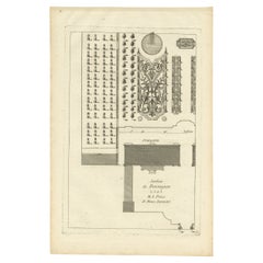
Pl. 12 Antique Print of an Orangery and Garden Plan by Le Rouge, c.1785
Located in Langweer, NL
Antique print titled 'Jardins de Bessingen (..)'. Copper engraving showing a garden plan and orangery (or orangerie). This print originates from 'Jardins A...
Category
18th Century Antique Maps
Materials
Paper
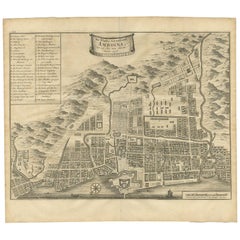
Antique Map of the City of Ambon by Valentijn, 1726
By F. Valentijn
Located in Langweer, NL
Antique map titled 'De Platte Grond van Amboina zoo als het was in den Jaare, 1718'. Antique map depicting the City of Ambon, Indonesia. This print originates from 'Oud en Nieuw Oost...
Category
Early 18th Century Dutch Antique Maps
Materials
Paper
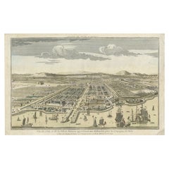
Antique Print of Batavia or nowadays Jakarta, Indonesia, c.1755
Located in Langweer, NL
Antique print titled 'Vue de l'Isle et de la ville de Batavia appartenant aux Hollandois'. Beautiful view of the island and the city of Batavia belonging to the Dutch, for the India ...
Category
18th Century Antique Maps
Materials
Paper
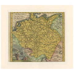
Antique Map of Germany by Hederichs 'circa 1740'
Located in Langweer, NL
Antique map titled 'Germania'. Rare miniature map of Germany and surroundings. This map covers the entirety of those lands traditionally occupied by Germanic peoples, from the Blatic...
Category
Mid-18th Century Antique Maps
Materials
Paper
Antique Map of the Holy Land, Showing the Location of the Various Tribes
Located in Langweer, NL
Antique map titled 'Judaea seu Terra Sancta quae Hebraeorum sive Israelitarum (..)'. Map of The Holy Land, showing the location of the various tribes, in two kingdoms, Judah and Isra...
Category
Early 18th Century Antique Maps
Materials
Paper
Nice Antique Map of Asia Minor, Turkey, circa 1718
Located in Langweer, NL
Antique map titled 'Antiquae Asiae Minoris & C. Tabula' by Philippo Talbor. This rare antique map is published by Edward Wells, circa 1718.
Category
Early 18th Century Antique Maps
Materials
Paper
Antique Print of Hagley Hall in Worcestershire, England, ca.1770
Located in Langweer, NL
Antique print titled 'Principal Front of Hagley'. Main facade of Hagley Hall, Worcestershire.
Hagley Hall is a Grade I listed 18th-century house in Hagley, Worcestershire, the ho...
Category
18th Century Antique Maps
Materials
Paper
Antique Map of Northern Germany by M. Seutter, circa 1730
Located in Langweer, NL
Antique map titled 'Saxoniae Inferioris Circulus'. Old map of the northern part of Germany by M. Seutter. Covering the area of Lower Saxony, Mecklenburg-Vorpommern and Schleswig-Hols...
Category
Mid-18th Century Antique Maps
Materials
Paper
Charting Eastern Tartary: An 18th-Century Jesuit and English Collaboration, 1757
Located in Langweer, NL
The antique map titled 'Carte de la Tartarie Orientale pour Servir a l'Histoire Generale des Voyages Tiree des Cartes Levees par les P.P. Jesuites' is an original old map that covers...
Category
Mid-18th Century Antique Maps
Materials
Paper
Antique Map of Northeastern India, Nepal, Bhutan, Assam and Bangladesh
Located in Langweer, NL
Antique map titled 'De Land-Reyse door Benedictus Goes, van Lahor gedaan, door Tartaryen na China'. Interesting map showing the region of northeastern India, Nepal, Bhutan, Assam and...
Category
Early 18th Century Antique Maps
Materials
Paper
Antique Print of a Chestnut by Knoop, 1758
Located in Langweer, NL
Antique print of a chestnut. Originates from 'Pomologia' by J. H. Knoop.
Artists and Engravers: Published by Johann Hermann Knoop (c.1700-1769).
Condition: Good, general age-re...
Category
18th Century Antique Maps
Materials
Paper
1718 Ides & Witsen Map "Route D'amsterdam a Moscow Et De La Ispahan Et Gamron
Located in Norton, MA
1718 Ides & Witsen map, entitled
"Route D'Amsterdam A Moscow Et De La Ispahan Et Gamron,"
Ric.b005
Subject: Eastern Europe and Central Asia
Period: 1718 (published)
Publicati...
Category
Early 18th Century Dutch Antique Maps
Materials
Paper
Original Antique Engraving of the Creation of the World According to Mozes, 1725
Located in Langweer, NL
Antique map titled 'De Schepping der Wereldt volgens de Beschryving van Mozes' - This plate shows the creation of the world according to Moses. The upper depiction shows the world wi...
Category
18th Century Antique Maps
Materials
Paper
Historical Map of Ancient Germany (1787): Tribes and Territories by Mentele
Located in Langweer, NL
This antique map, titled "Carte Ancienne d'Allemagne," represents ancient Germany and surrounding regions. It was published by the well-known Parisian mapmakers and publishers Jean-Baptiste-Louis Clouet and Alexandre Aimé Vuillemin in the late 18th century, specifically in 1787.
The map covers the extensive geographical area of ancient Germany, highlighting various tribes and regions known at the time. Key features include:
1. **Geographical Boundaries**: The map outlines the territorial extents of ancient Germany, bordered by Gallia (France) to the west, Sarmatia (parts of Eastern Europe) to the east, and the Italian regions to the south. The northern boundary reaches the Oceanus Germanicus (North Sea) and the Sarmatian Sea (Baltic Sea).
2. **Tribal Regions**: It details numerous ancient Germanic...
Category
1780s Antique Maps
Materials
Paper
Authentic Old Map of Persia with Original Border Coloring, 1745
Located in Langweer, NL
Title: "Kaartje van Persien na de stelling van den Heer Guillaume de L'Isle"
Translates to "Map of Persia based on the work of Mr. Guillaume de L'Isle." Guillaume de L'Isle was a p...
Category
1740s Antique Maps
Materials
Paper
Antique Print of Bramham Park by Campbell, 1725
Located in Langweer, NL
Antique print titled 'The Elevation of Braman Park (..)'. Old engraving of Bramham Park in Bramham. This print originates from 'Vitruvius Britannicus' by Colen Campbell. Artists and ...
Category
18th Century Antique Maps
Materials
Paper
Antique French Map of Java, Indonesia by Chatelain, '1719'
Located in Langweer, NL
Antique map titled 'Carte de l'Ile de Java: Partie Occidentale, Partie Orientale, Dressee tout Nouvellement Sur Les Memoires Les Plus Exacts (..)'. This beautiful map of Java (Indone...
Category
Early 18th Century Antique Maps
Materials
Paper
Old Map of Guyana, Suriname and French Guiana with Paramaribo and Cayenne, c1760
Located in Langweer, NL
Description: Antique map titled 'Carte de la Guiane.'
Antique map of the Guianas - present day Guyana, Suriname and French Guiana, including Paramaribo and Cayenne. Source unknown, to be determined.
Artists and Engravers: Made by 'Jacques-Nicholas Bellin...
Category
1760s Antique Maps
Materials
Paper
Old Original Map of Chormandel & Malabar, India & Ceylon, Now Sri Lanka, 1726
Located in Langweer, NL
Antique map titled 'Nieuwe Kaart van Choromandel ende Malabar'.
Antique map depicting the southern part of India and the northern tip of Ceylon, Sri Lanka. This map originates from...
Category
1720s Antique Maps
Materials
Paper
Old Antique Print of Fort Noordwijk, Batavia 'Jakarta, Indonesia', 1739
Located in Langweer, NL
Antique print titled 'Ein Prospect des Forts Nortweijck, wie sich dasselbe wan man von Jacatra komt, mit seiner Gegend präsentiret'.
Old print of Fort Noordwijk, Batavia (Jakarta)....
Category
1730s Antique Maps
Materials
Paper
Antique Map of Portugal by Moll, 1727
Located in Langweer, NL
Antique map Portugal titled 'Portugal Agreeable to Modern History'. Detailed map of Portugal showing major routes, waterways, arch bishoprics, bis...
Category
18th Century Antique Maps
Materials
Paper
Antique Map of the Region of Namur by De Lat, 1737
Located in Langweer, NL
Untitled map of the region of Namur, Charlemont, Rochefort and surroundings, Belgium. This map originates from 'Nieuw en beknopt Kaart-Boekje vertoonende de XVII. Nederlandse Provint...
Category
18th Century Antique Maps
Materials
Paper
A General View of Jerusalem in the Early Part of the 18th Century" (circa 1752)
Located in Langweer, NL
The print is signed by the artist "S. Mynde sc." in the lower right corner. This suggests that the maker of the print is Samuel Mynde, a known engraver from the 18th century. His wor...
Category
1750s Antique Maps
Materials
Paper
Original Engraving of the West Indies, Gulf of Mexico, Antilles, Caribbean, 1780
Located in Langweer, NL
Rigobert Bonne and G. Raynal's 1780 map of the West Indies, Gulf of Mexico, Antilles, and the Caribbean stands as a remarkable cartographic piece, offering a detailed and expansive v...
Category
Late 18th Century Antique Maps
Materials
Paper
Bird's Eye Plan of the Ancient City of Jerusalem Based on Old Records, c.1725
Located in Langweer, NL
Antique map titled 'Beschryving van het oude Jeruzalem volgens Villalpandus.'
Bird's eye plan of the ancient city of Jerusalem based on Villalpando's foundation map. The plan shows...
Category
18th Century Antique Maps
Materials
Paper
Early 18th Century Map of Denmark in Old Coloring, Published in 1706
Located in Langweer, NL
Denmark. Schenk (Petrus), Dania Regnum Ducatus Holsatia. et Slesvicum Insulae Danicae et Provinciae Jutia Scania etc. Amsterdam, 1706, engraved reticulated map on thick paper with co...
Category
Early 1700s Antique Maps
Materials
Paper
Antique Sea Chart of North America by Ottens, circa 1745
Located in Langweer, NL
Antique map titled 'Septemtrionaliora Americae a Groenlandia (..)'. Sea chart of the northern waters of North America, including the coast of Labrador and pa...
Category
Mid-18th Century Antique Maps
Materials
Paper
Antique Print of the Residence of Sir Gregory Page by Miller, c.1770
Located in Langweer, NL
Antique print titled 'Elevation of the Flank of Sir Gregory Page'. Architectural elevation of the residence of Sir Gregory Page.
Sir Gre...
Category
18th Century Antique Maps
Materials
Paper
Antique Print of Batavia 'Jakarta' in the Dutch East Indies in Asia, 1705
Located in Langweer, NL
Antique print Indonesia titled 'Batavia'. Beautiful view of Batavia, Indonesia. This print originates from 'Algemeene weereld-beschryving, nae de rechte verdeeling der landschappen (...
Category
18th Century Antique Maps
Materials
Paper
Antique Map op Siberia and Chinese Tartary with original hand coloring, 1732
Located in Langweer, NL
Antique map titled 'Nieuwe Kaart van Tartarie na de alderlaatste ontdekking int ligt gebragt'. Map op Siberia and Chinese tartary. In the north Novaya Zemlya curls back to attach its...
Category
Mid-18th Century Antique Maps
Materials
Paper
Original Antique Map of Juan Fernandez by Van Schley, 1757
Located in Langweer, NL
Antique map titled 'Carte Particuliere de l'Isle de Juan Fernandez - Byzondere Kaart van 't Eiland Juan Fernandez'.
Map of the Chilean Juan Fernandez Island, topped by a view of it...
Category
18th Century Antique Maps
Materials
Paper
Antique Map of Manipa, Nusa-Laut, Saparua & Haruku 'Indonesia' by F. Valentijn
Located in Langweer, NL
Four maps of islands and two figures in native dress. The islands are: Manipa, Nusa-Laut (Noessa-Laoet), Saparua (Honimoa) and Haruku (Oma). These islands...
Category
Early 18th Century Antique Maps
Materials
Paper
Set of Four Original Antique Maps of Asia by Bolton & Seale, circa 1770
Located in Langweer, NL
Set of four antique maps of Asia:
1) Asia plate 6, Part of China, Tibet and Tartary
2) Asia plate 2, Japan, Corea, the Monguls and part of China
3) As...
Category
Late 18th Century Antique Maps
Materials
Paper
Old Map of Persia, incl the Caspian Sea and Part of the Arabian Peninsula, 1726
Located in Langweer, NL
Antique map of Persia. It covers from the Gulf of Suez eastward to Ahmedabad (Amadabad) in modern day western India.
This map, centered on Persia, includes the Caspian Sea and part of the Arabian...
Category
1720s Antique Maps
Materials
Paper
Antique Map of West Africa by R. Bonne, 1780
Located in Langweer, NL
Antique map titled 'Partie Occidentale De L'Ancien Continent Depuis Lisbonne Jusqua La Riviere De Sierra Leona Avec L'Isle de Madere, les Isles Canaries et celles Du Cap Verd'. Parts...
Category
Late 18th Century Antique Maps
Materials
Paper
Antique Map of France at the Beginning of the 17th Century by Zannoni, 1765
Located in Langweer, NL
Antique map France titled 'Carte pour servir à intelligence de l'Histoire de France (..)'. Beautiful old map of France. This map originates from 'At...
Category
18th Century Antique Maps
Materials
Paper
Antique Map of the Lorraine Region 'France' (c.1735)
Located in Langweer, NL
Antique map titled 'Carte du Duche de Lorraine - Kaart van Lotharingen'. A detailed map of the Duchy of Lorraine. The map is surrounded by thirteen vignette bird-eye view of fortifie...
Category
Mid-18th Century Antique Maps
Materials
Paper
Large Scale Map of Greece with Inset Map of Macedonia, c.1786
Located in Langweer, NL
Antique map titled 'Graeciae Antiquae'. Large scale map of Greece, extends south to the island of Cythera. Inset map shows details of Macedonia. Publis...
Category
18th Century Antique Maps
Materials
Paper
Antique Map of Saxony, Germany
Located in Langweer, NL
Original antique map titled 'Circulus Saxoniae Superioris'. Original antique map of Saxony, Germany. The cities of Leipzig, Freiburg and many others are highlighted in gold. This map originates from 'Atlas Novus Terrarum Orbis...
Category
Early 18th Century Antique Maps
Materials
Paper
Stalls in the Choir of Rochester Cathedral, Basire, 1790
Located in Langweer, NL
Antique print titled 'Stalls in the Choir of Rochester Cathedral'. Antique print depicting the Stalls in the Choir of Rochester Cathedral. Artists and Engravers: Made by J. Basire af...
Category
18th Century Antique Maps
Materials
Paper
Antique Map of the Eastern Part of the World
Located in Langweer, NL
Antique map titled 'Nieuwe Kaart van het Oostelykste Deel der Weereld, diendende tot aanwyzing van de Scheepstogten der Nederlanderen Naar Oostindie'. This finely engraved map of the...
Category
Mid-18th Century Antique Maps
Materials
Paper
Antique Maps of Manipa, Nusa-Laut, Saparua and Haruku in Maluku, Indonesia 1726
Located in Langweer, NL
Antique map titled 'Caart van het Eyland Manipa, Noessa-Laoet, Honimoa, Oma. Der Manipesen dracht, een Orangkaya van Manipa.' Four maps of islands and two figures in native dress. Th...
Category
18th Century Antique Maps
Materials
Paper
Antique Map of the Tunquin River and Bay to Cacho, the Capital City, Siam, 1758
Located in Langweer, NL
Antique map titled ‘Kaart van den Loop der Rivier van Tonkin van Cacho tot aan de Zee / Carte du Cours de la Riviere de Tunquin Depuis Cacho jusqu'à la Mer J. v. Schley direx.’ Detailed map of the Tunquin River and Bay, extending north to Cacho, the capital...
Category
18th Century Antique Maps
Materials
Paper
Antique Map of France Divided into Departments, with Original Hand Coloring
Located in Langweer, NL
Antique map titled 'A New Map of France (..)'. Original old map of France, divided into departments. With original/contemporary hand coloring. Published by John Cary, 1799. John Cary was an important and prolific London map seller...
Category
Late 18th Century Antique Maps
Materials
Paper
Antique Map of Eastern Mediterranean and Asia Minor by a Benedictine, c.1725
Located in Langweer, NL
Antique map titled 'Byzondere Afbeelding der Landschappen, van de Apostelen bevaren en doorwandelt om het Evangelium J. C. te Prediken.' Map of the lands travelled by the Apostles to...
Category
18th Century Antique Maps
Materials
Paper
Sea Chart of Central America and the Northwest Coast of South America, ca.1745
Located in Langweer, NL
Antique map titled 'Novae Hispaniae, Chili, Peruviae et Guatamala Littorae.'
Sea chart of Central America and the northwest coast of South America, oriented to the east, by Reinier & Joshua Ottens (after Frederick de Wit - 1675) in 1745 ('Atlas van de Zeevaart'). The map shows all or parts of the coasts of Peru, Chili, Honduras, Costa Rica and Mexico as well as the western Caribbean and the Galapagos...
Category
1740s Antique Maps
Materials
Paper
Detailed Antique Map of the Black Sea, Balkans and Asia Minor
Located in Langweer, NL
Antique map titled 'Nuova Carta del Europa Turchesca (..)'. This is an Italian version of Tirion's detailed map of the Black Sea, Balkans, and Asia Minor. It is embellished with a si...
Category
Mid-18th Century Antique Maps
Materials
Paper
Antique Map of the Region of Osaka and Hirado Island in Japan, 1725
Located in Langweer, NL
Antique map titled 'Description exacte et fidele des villes, bourgs et villages qui les Ambassadeurs de Hollande ont rencontrez dans leur voyage par terre de la ville Osacca jusqu'a ...
Category
18th Century Antique Maps
Materials
Paper
Early Map of Australasia, Marking The Route of Abel Tasman in 1642 'Publ. 1726'
Located in Langweer, NL
Description: Antique map titled 'Kaart der Reyse van Abel Tasman volgens syn eygen opstel'. Rare and early map of Australasia, marking the route of Abel Tasman's voyage from Mauritius to Batavia in 1642, on which he discovered Tasmania and New Zealand and proved that Australia was not part of the Great Southern...
Category
1720s Antique Maps
Materials
Paper
Antique Hand-Colored Print of the Common Hazel, 1758
Located in Langweer, NL
Antique print of the common hazel. Originates from 'Pomologia' by J. H. Knoop.
Artists and Engravers: Published by Johann Hermann Knoop (c.1700-1769).
Condition: Good, general ...
Category
18th Century Antique Maps
Materials
Paper
Original Old Map East of Stockholm, the Island Ljusterö and Värmdö, Sweden, 1720
Located in Langweer, NL
Antique map titled 'Accurate Carte der Upländischen Scheren mit der Situation und Gegend umb die Konigle Schwedisch Haupt und Residentz Stadt Stockholm.'
Map of the area east of ...
Category
1720s Antique Maps
Materials
Paper
Detailed Original Old Map of the Southern Region of the Kingdom of Algiers 1773
Located in Langweer, NL
Antique map titled 'Kaart van het Zuidelyk Gedeelte van het Ryk Algiers'.
Old map of the southern region of the Kingdom of Algiers, Algeria. Originates from the first Dutch edito...
Category
18th Century Antique Maps
Materials
Paper
Old Map of the East Indonesian Islands Borneo, Celebes, New Guinea, Bali, 1792
Located in Langweer, NL
Antique map titled 'Partie de la Nouvelle Grande Carte des Indes Orientales, contenant les Isles de Borneo, Iava, Celebes, Mindanao (..)'.
Detailed map of the Indonesian islands ...
Category
1790s Antique Maps
Materials
Paper
Antique Engraved Map of Hungary and Transylvania or Romania, c.1710
Located in Langweer, NL
Antique map titled 'Hungary and Transilvania'. Original antique map of Hungary and Transylvania (modern day Romania), centered on Budapest. Artists and ...
Category
18th Century Antique Maps
Materials
Paper
Antique Somerset Map, Thomas Kitchin, English, Cartographic Reference, Georgian
Located in Hele, Devon, GB
This is a fine antique Somerset map. An 18th century English cartographic county reference engraving by Thomas Kitchin (1718–1784), dating to the Georgian period, circa 1780. A beaut...
Category
1780s British Georgian Antique Maps
Materials
Glass, Paper
Antique Map of Europe by Hederichs, circa 1740
Located in Langweer, NL
Antique map titled 'Europa Christiani Orbis Domina'. Rare miniature map of Europe. This map originates from 'Anleitung Zu den fürnehmsten Historischen Wissenschaften, Benanntlich Der...
Category
Mid-18th Century Antique Maps
Materials
Paper
