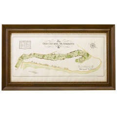
Map of the Old Course in St. Andrews, Surveyed and Depicted by Alister MacKenzie
View Similar Items
Want more images or videos?
Request additional images or videos from the seller
1 of 3
Map of the Old Course in St. Andrews, Surveyed and Depicted by Alister MacKenzie
About the Item
- Dimensions:Height: 17 in (43.18 cm)Width: 29.25 in (74.3 cm)Depth: 2 in (5.08 cm)
- Place of Origin:
- Period:
- Date of Manufacture:1924
- Condition:Wear consistent with age and use.
- Seller Location:Colorado Springs, CO
- Reference Number:1stDibs: LU90971218152
About the Seller
4.9
Platinum Seller
These expertly vetted sellers are 1stDibs' most experienced sellers and are rated highest by our customers.
Established in 2010
1stDibs seller since 2011
400 sales on 1stDibs
More From This SellerView All
- 1856 U.S. Coast Survey Map of Chesapeake Bay and Delaware BayLocated in Colorado Springs, COPresented is U.S. Coast Survey nautical chart or maritime map of Chesapeake Bay and Delaware Bay from 1856. The map depicts the region from Susquehanna, Maryland to the northern Outer Banks in North Carolina. It also shows from Richmond and Petersburg, Virginia to the Atlantic Ocean. The map is highly detailed with many cities and towns labeled throughout. Rivers, inlets, and bays are also labeled. Various charts illustrating more specific parts of the region are marked on the map using dotted lines. The lines form boxes, and the corresponding chart number and publication date are given. Extensive triangulation surveys were conducted the length of Chesapeake Bay and are illustrated here. Hampton Roads, Virginia is labeled, along with the James, York, and Rappahannock Rivers, which were all extensively surveyed. The chart was published under the supervision of A. D. Bache, one of the most influential and prolific figures in the early history of the U.S. Coast Survey, for the 1856 Report of the Superintendent of the U.S. Coast Survey. Alexander Dallas Bache (1806-1867) was an American physicist, scientist, and surveyor. Bache served as the Superintendent of the U.S. Coast Survey from 1843 to 1865. Born in Philadelphia, Bache toured Europe and composed an important treatise on European Education. He also served as president of Philadelphia's Central High School and was a professor of natural history and chemistry at the University of Pennsylvania. Upon the death of Ferdinand Rudolph Hassler, Bache was appointed Superintendent of the United States Coast Survey. The Office of the Coast Survey, founded in 1807 by President Thomas Jefferson and Secretary of Commerce Albert Gallatin...Category
Antique 1850s American Maps
MaterialsPaper
- 1812 United States Map, by Pierre Tardieu, Antique French Map Depicting the U.S.By Pierre François TardieuLocated in Colorado Springs, CO1812 "United States of Nth America -- Carte des Etats-Unis De L'Amerique Septentrionale" Two-Sheet Map by Tardieu This attractive map, published in Paris in 1812, is one of the most rare large format maps from the period. It features a view of the East Coast of the U.S. from Maryland to just below South Carolina. Additionally, Ellicott’s plan for the City of Washington D.C. is included at the top right and an illustration of Niagara Falls is shown at the bottom right with a description in both French and English. This extremely detailed map not only depicts the mountainous regions of the southeastern U.S., but also includes names of regions, rivers, and towns. Based on the first state of Arrowsmith’s 4-sheet map of the United States, this map is completely engraved by Tardieu in Paris and showcases high quality engravings. This detailed map of the recently independent United States includes one of the largest and earliest examples of the Ellicott plan of Washington DC. The artist, Pierre François Tardieu (PF Tardieu) was a very well-known map engraver, geographer, and illustrator. Awarded a bronze medal by King Louis-Phillipe for the accuracy and beauty of his map-making, Tardieu produced many fine works including maps of Louisiana...Category
Antique 1810s French Maps
MaterialsPaper
- 1861 Topographical Map of the District of Columbia, by Boschke, Antique MapLocated in Colorado Springs, COPresented is an original map of Albert Boschke's extremely sought-after "Topographical Map of the District of Columbia Surveyed in the Years 1856 ...Category
Antique 1860s American Historical Memorabilia
MaterialsPaper
- "Clason's Guide Map of Montana" by The Clason Map Company, Circa 1920sLocated in Colorado Springs, COPresented is “Clason's Guide Map of Montana,” published in the early 1920s by the Clason Map Company. Issued as a folding map, this map identifies county boundaries, county seats, Na...Category
Vintage 1920s American Art Deco Maps
MaterialsPaper
- 1908 "Map of Texas" by The Kenyon CompanyLocated in Colorado Springs, COPresented is an antique map of the state of Texas, printed as a pocket map in 1908 by The Kenyon Company. The state map is brightly colored by county, with principal cities and towns listed. The congressional districts are numbered and boldly outlined in red. Rivers, roads, and railroads all appear prominently on this fantastic map...Category
Antique Early 1900s American Maps
MaterialsPaper
- 1873 "Map of the States of California and Nevada" by Chas. Drayton GibbesLocated in Colorado Springs, COPresented is Warren Holt and Charles Drayton Gibbes' 1873 “Map of California and Nevada.” This map is considered to be one of the finest large-scale ...Category
Antique 1870s American Maps
MaterialsPaper


You May Also Like
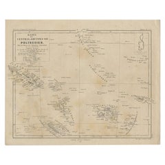
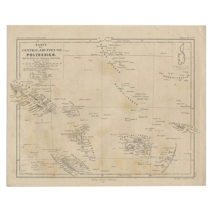
- Old German Map Depicting the Central Islands of Polynesia, 1857Located in Langweer, NLAntique map Polynesia titled 'Karte der Central-Gruppen von Polynesien'. Old map depicting the central islands of Polynesia. This map originates from 'Petermanns Geographische Mittei...Category
Antique 19th Century Maps
MaterialsPaper
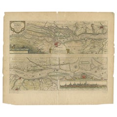
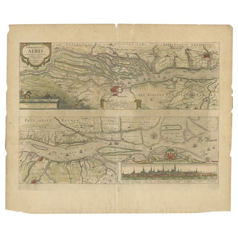
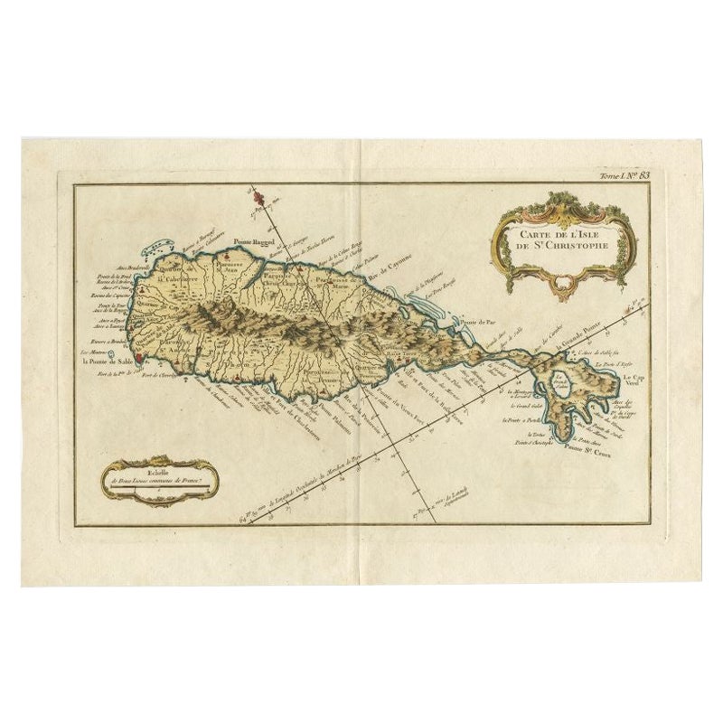
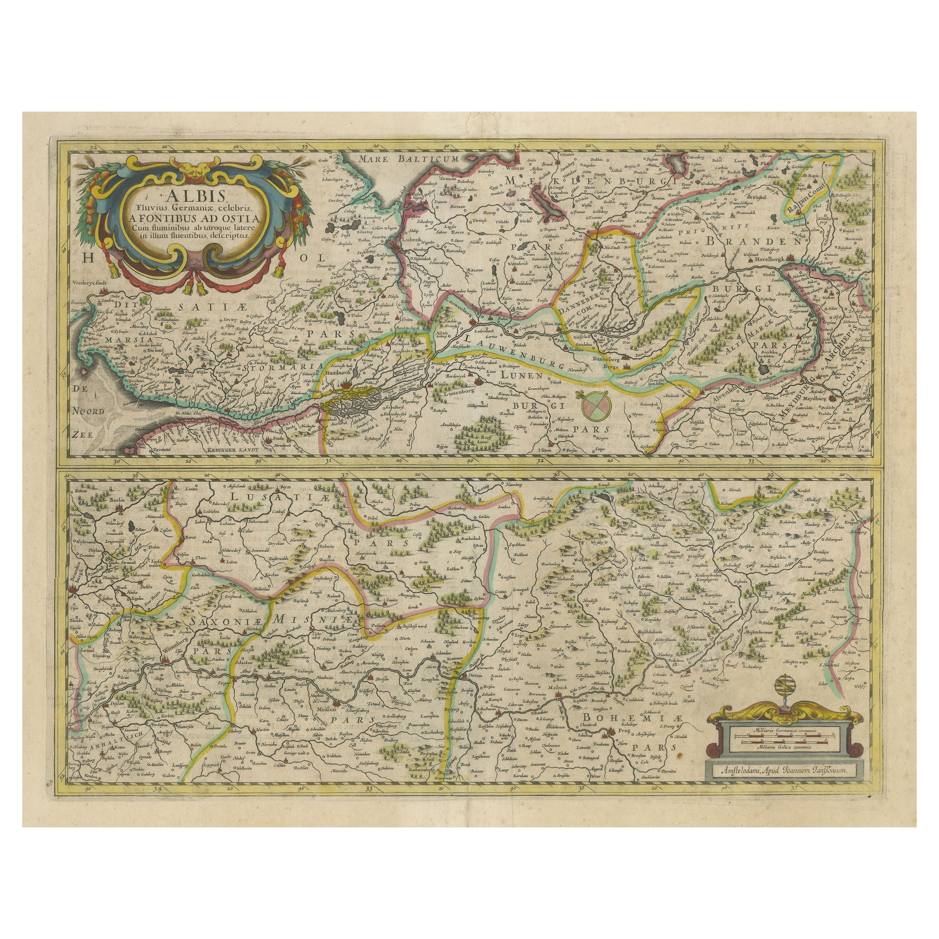
- Antique Map of the Course of the Elbe River by Janssonius, c.1650By Johannes JanssoniusLocated in Langweer, NLAntique map titled 'Nobilis Flubius Albis (..)'. Old map of the course of the Elbe river, large inset view of the city of Hamburg. Source unknown, to be determined. Artists and En...Category
Antique 17th Century Maps
MaterialsPaper
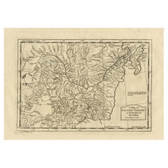
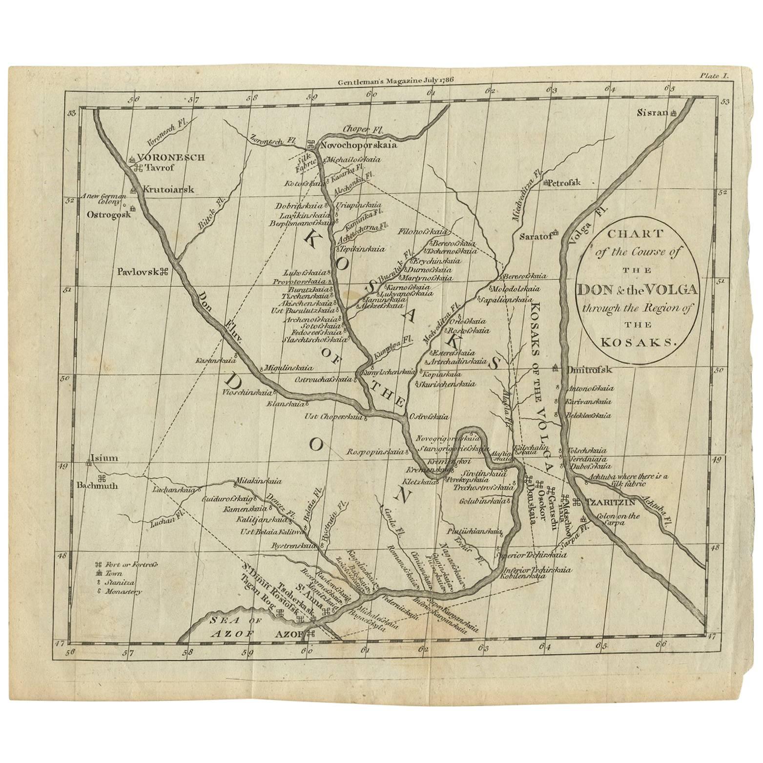
- Antique Map of the course of the Don & Voga riversLocated in Langweer, NLAntique map titled 'Chart of the Course of The Don & the Volga through the Region of The Kosaks'. SW Russia & Ukraine: interesting map showing the course of the Don & Voga rivers thr...Category
Antique Late 18th Century Maps
MaterialsPaper
 $109 Sale Price31% Off
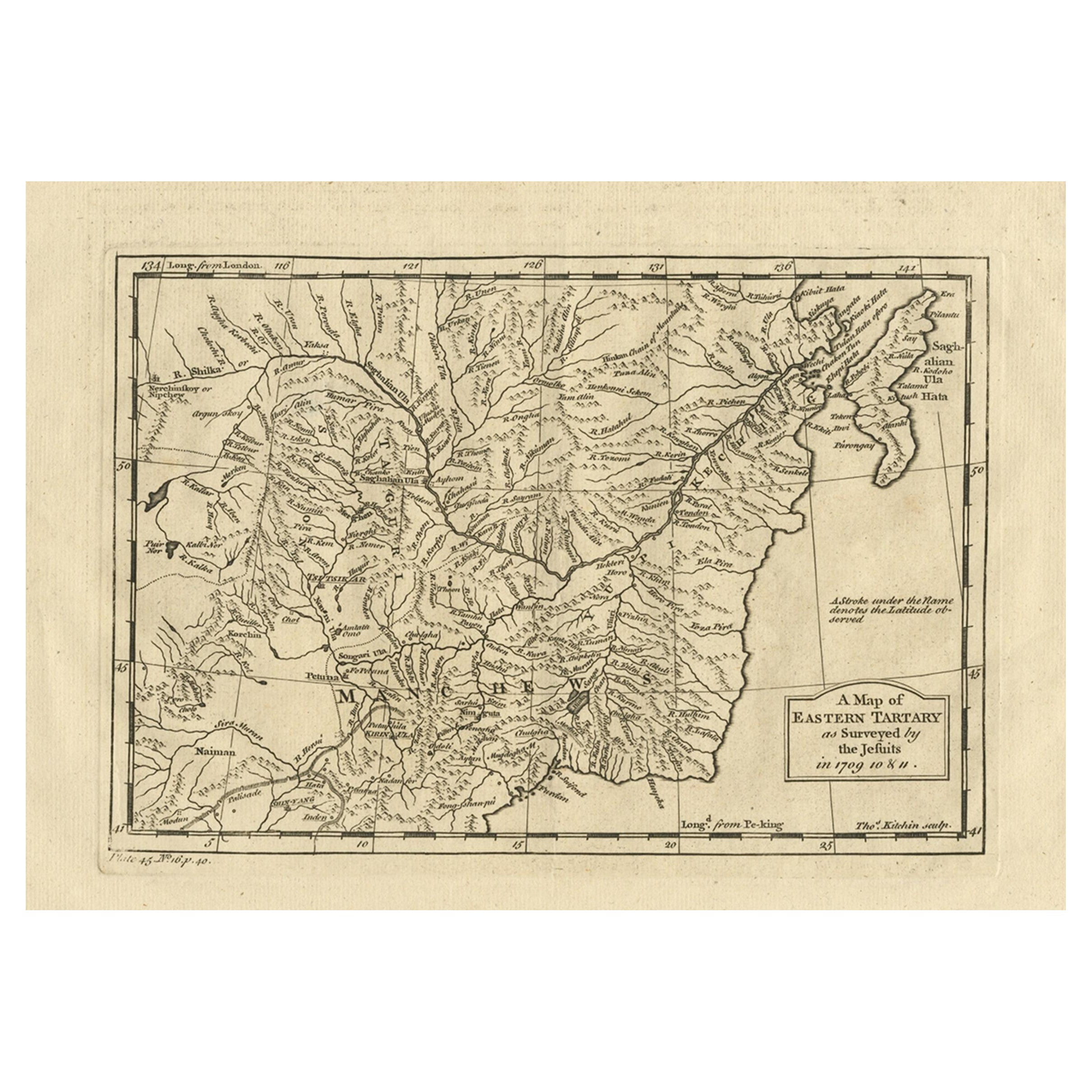
 - Antique Map of Eastern Tartary as Surveyed by the Jesuits, 1746By Thomas KitchinLocated in Langweer, NLAntique map titled 'A Map of Eastern Tartary as Surveyed by the Jesuits in 1709, 10 & 11'. The map covers much of the course of the Amur River or Heilong Jiang, the world's tenth lon...Category
Antique 18th Century Maps
MaterialsPaper
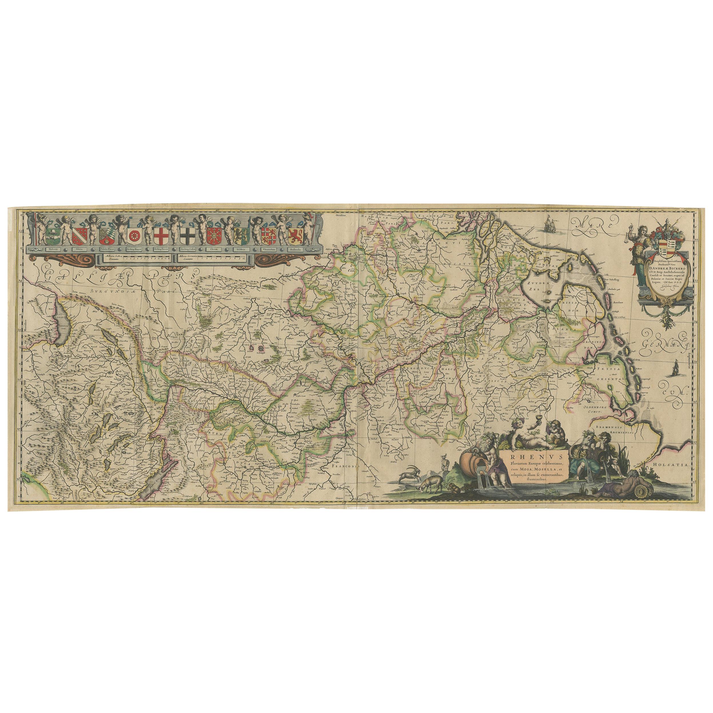
- Antique Map of the Course of the Rhine River by Blaeu, circa 1640Located in Langweer, NLAntique map titled 'Rhenus Fluviorum Europae celeberrimus, cum Mosa, Mosella, et reliquis, in illum se exonerantibus, fluminibus'. Beautiful map of the course of the Rhine River...Category
Antique Mid-17th Century Maps
MaterialsPaper
 $1,314 Sale Price20% Off
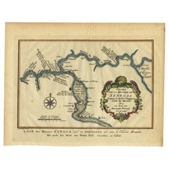
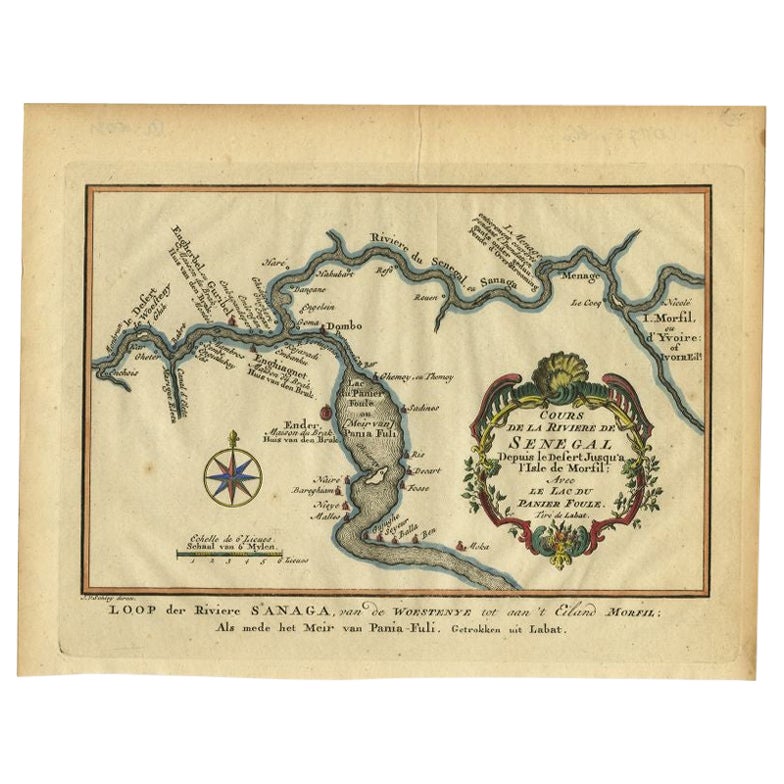
 - Antique Map of the Course of the Sanaga River by Van Schley, 1747Located in Langweer, NLAntique map titled 'Cours de la Riviere de Senegal (..) - Loop der Riviere Sanaga (..)'. Original antique map of the course of the Sanaga River that forms the border between Senegal ...Category
Antique 18th Century Maps
MaterialsPaper