17th Century Maps
to
763
907
62
970
10
1
2,936
2,181
476
3
289
34
10
127
7
35
9
2
5
4
4
2
969
10
9
2
2
91
43
30
18
14
970
970
970
63
12
11
10
6
Period: 17th Century
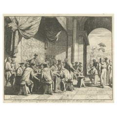
The Iron Duke of Alva of Spain Planning the Atrocities Against the Dutch, c.1680
Located in Langweer, NL
Antique print titled ‘Afbeeldinge van de Spaansche Bloedraad in den Jaare 1567 door den Hartog van Alva aangestelt’.
The Duke of Alva and his entourage seated at a table planning...
Category
Antique 17th Century Maps
Materials
Paper
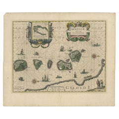
Antique Map of the Maluku Islands by Blaeu, c.1640
Located in Langweer, NL
Antique map titled 'Moluccae Insulae Celeberrimae'. Decorative map of the Maluku Islands, also known as the Moluccas or the Spice Islands. Inset of the island of Bachian (Batjan) in ...
Category
Antique 17th Century Maps
Materials
Paper
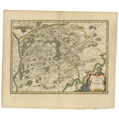
Antique Map of the Region of Valois by Hondius, circa 1630
Located in Langweer, NL
Antique map titled 'Le Pais de Valois'. Old map of the historic region of Valois, France. It corresponds to the southeastern quarter of the modern département of Oise, with an adjace...
Category
Antique 17th Century Maps
Materials
Paper
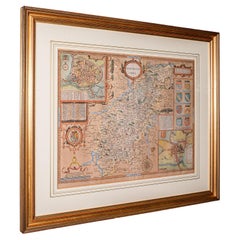
Large Antique Lithography Map, Northamptonshire, Framed Cartography, John Speed
Located in Hele, Devon, GB
This is a large antique lithography map of Northamptonshire. An English, framed atlas engraving of cartographic interest by John Speed, dating to the early 17th century and later.
Superb lithography reproduction of Northamtonshire - place names are written in 17th century English
Displays a desirable aged patina and in very good order
Fascinating Jacobean period cartography, set within a quality, later frame
Reproduced here from its appearance in the 'Theatre of Great Britain' of 1627 published by George Humble
Marked for John Speed as cartographer and George Humbell (sic) as seller
Exceptional detail, as expected from a John Speed map...
Category
British Other Antique 17th Century Maps
Materials
Glass, Wood, Paper
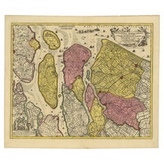
Detailed Map of Southern Holland, Incl the Hague, Rotterdam, Delft, Gouda, c1680
Located in Langweer, NL
Antique map titled 'Delflandia, Schielandia et circumjacentes Insulae ut Voorna, Overflackea, Goerea, Yselmonda et aliae.'
Detailed map of Southern Holland, which includes the ci...
Category
Antique 17th Century Maps
Materials
Paper
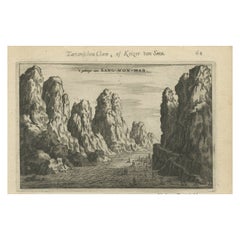
Antique Print of the Sang-Won-Hab Mountains in China, 1665
Located in Langweer, NL
Antique print titled 'Gebergte van Sang-Won-Hab'. Old print depicting the Sang-Won-Hab mountains (China) with many ships on the river between the mountains. This print originates fro...
Category
Antique 17th Century Maps
Materials
Paper
Antique Map of the City of Coevorden by Blaeu, 1649
Located in Langweer, NL
Antique map titled 'Coeverden'. Original map of the city of Coevorden, the Netherlands. This map originates from 'Novum Ac Magnum Theatrum Urbium Belgicae Liberae Ac Foederatae' publ...
Category
Antique 17th Century Maps
Materials
Paper
Antique Map of the City of Muiden by Merian, 1659
Located in Langweer, NL
Antique map titled 'Muyden'. Original antique map of the city of Muiden, the Netherlands. This map originates from 'Topographia Germania Inferioris' by C. Merian. Published 1659.
...
Category
Antique 17th Century Maps
Materials
Paper
Antique County Map, Hampshire, English, Framed Cartography, Robert Morden, 1700
Located in Hele, Devon, GB
This is an antique county map of Hampshire. An English, framed atlas engraving of cartographic interest By Robert Morden, dating to the late 17th century and later.
Superb lithogra...
Category
British Other Antique 17th Century Maps
Materials
Glass, Wood, Paper
Antique Map of Stavoren by Blaeu, 1649
Located in Langweer, NL
Antique map titled 'Staveren'. Original antique map of the city of Stavoren, Friesland, The Netherlands. This map originates from 'Novum Ac Magnum Theatrum Urbium Belgicae Liberae Ac...
Category
Antique 17th Century Maps
Materials
Paper
Antique Map of Upper Bavaria, Germany
Located in Langweer, NL
Antique map titled 'Bavariae pars superior cum insertis et adjacentibus regionibus non solum in ejusdem ditiones generales (..). Original antique map of upper Bavaria from Regensburg...
Category
Antique 17th Century Maps
Materials
Paper
Antique Map of the Province of Gelderland, the Netherlands, c.1690
Located in Langweer, NL
Antique map titled 'Ducatus Geldriae novissima descriptio'. Map of Gelderland, The Netherlands. Shows many cities (like Arnhem, Nijmegen, Eindhoven, Zutphen, Zwolle, etc), roads, riv...
Category
Antique 17th Century Maps
Materials
Paper
Antique Map of the Province of Kilan by Olearius '1662'
Located in Langweer, NL
Antique map titled 'A Map of ye Province of Kilan as it lies on ye Caspian Sea'. Rare map of the province of Kilan, near the Caspian Sea. Originates from 'The voyages and travells of the Ambassadors sent by Frederick Duke of Holstein, to the Great Duke of Muscovy, and the King of Persia...
Category
Antique 17th Century Maps
Materials
Paper
Antique Map of Sloten, IJlst, Workum & Hindeloopen by Blaeu, 1652
Located in Langweer, NL
Antique map titled: 'Sloten - Ylst - Worcum - Hinloopen.' - Three plans and a bird's eye view on one sheet. The plans show the Frisian cities Sloten, IJlst, Workum and the view shows...
Category
Antique 17th Century Maps
Materials
Paper
Antique Map of Mar del Sur, Chile, Peru, New Guinea and Tierra del Fuego, 1621
Located in Langweer, NL
Uncommon and rare map of Mar del Sur and the coast of Peru. With inset maps of part of New Guinea and Tierra del Fuego. This map originates from 'Miroir Oost &...
Category
Antique 17th Century Maps
Materials
Paper
Antique Map of the Region of Île-de-France by Hondius, circa 1630
Located in Langweer, NL
Antique map titled Gouvernement de l'Isle de France'. Old map of the region of Île-de-France, France. It is located in the north-central part of the country and often called the régi...
Category
Antique 17th Century Maps
Materials
Paper
Antique Map of the Region of Guyenne by Janssonius, 1657
Located in Langweer, NL
Antique map of France titled 'Description du Guienne'. Decorative map of Guyenne region. Guyenne or Guienne was an old French province which corresponded roughly to the Roman provinc...
Category
Antique 17th Century Maps
Materials
Paper
Antique Map of the City of Leeuwarden by Guicciardini, 1613
Located in Langweer, NL
Antique map tited 'Lewardum'. Plan of the city of Leeuwarden, Friesland, the Netherlands. This map originates from the 1613 edition of 'Discrittione di tutti i Paesi Bassi', by L. Gu...
Category
Antique 17th Century Maps
Materials
Paper
Antique Map of Nova Zembla by Janssonius, c.1650
Located in Langweer, NL
Antique map titled 'Nova Zemla, waygats fretum Nassovi cum et terra Samoiedum singula omnium emendatissime descripta'. This map depicts Nova Zembla and the northern continental coast...
Category
Antique 17th Century Maps
Materials
Paper
Antique Map of the Region of Saintonge by Janssonius, 1657
Located in Langweer, NL
Antique map 'La Saintonge vers le Midy avecq le Brovageais'. Decorative map of the Saintonge region, a former province of France located on the west central Atlantic coast. This map ...
Category
Antique 17th Century Maps
Materials
Paper
Antique Map of Drenthe, a Province of The Netherlands, 1635
Located in Langweer, NL
Antique map titled 'Drentiae'. Original antique map of the province of Drenthe, the Netherlands. This map originates from 'Vyerige Colom verthonende de 17 Nederlandsche Provintien.',...
Category
Antique 17th Century Maps
Materials
Paper
Antique Map of the Adriatic Sea and the Balkan by J. Janssonius, circa 1650
Located in Langweer, NL
Striking large-scale map of the Greater Balkans. Decorated with two large-scale cartouches, one showing two swordsman at odds with one another and the other ...
Category
Antique 17th Century Maps
Materials
Paper
Antique Map of the Namur Region in France by Coronelli, c.1695
Located in Langweer, NL
Antique map titled 'Contado di Namur (..)'. Old map of the Namur region in central Belgium. Includes several coats of arms.
Artists and Engravers: The remarkable Vincenzo Coronell...
Category
Antique 17th Century Maps
Materials
Paper
Antique Map of the City of Alkmaar by Priorato, 1673
Located in Langweer, NL
Antique map titled 'Alcmaer'. Original map of the city of Alkmaar, the Netherlands. This map originates from 'Teatro del Belgio', by G. Gualdo Priorato. Artists and Engravers: Author: Galeazzo Gualdo Priorato (1606-1678) entered military service at a very young age and served in Flanders under the Prince of Orange. After his retirement, he authored several historical accounts including the Teatro del Belgio, which described the Catholic/Protestant wars in Belgium and Netherlands during the seventeenth century. His superb plans do not show the internal layout of the cities, except for showing the locations of the major churches. Instead the emphasis is on the fortification, as well as on the surrounding site, rivers and canals...
Category
Antique 17th Century Maps
Materials
Paper
Antique Map of the Rhine-Palatinate by Janssonius, circa 1630
Located in Langweer, NL
Antique map titled 'Nova Descriptio Palatinatus Rheni'. Detailed map of the Rhine-Palatinate, a state of Germany located in the west of the country. The map tracks the course of the ...
Category
Antique 17th Century Maps
Materials
Paper
Antique Map of the City of Gorinchem by Merian, 1659
Located in Langweer, NL
Antique map titled 'Gorckum'. This print depicts the city of Gorinchem (or Gorcum/Gorkum, The Netherlands). This print originates from 'Topographia Germaniae Inferioris (..)' by C. M...
Category
Antique 17th Century Maps
Materials
Paper
Original Antique Map of the City of Stavoren, Friesland, The Netherlands, 1649
Located in Langweer, NL
Antique map titled 'Staveren'. Original antique map of the city of Stavoren, Friesland, The Netherlands. This map originates from 'Toonneel der Steden van de Vereenighde Nederlanden'...
Category
Antique 17th Century Maps
Materials
Paper
Antique 17th Century Map of the Islands Near Ceylon or Sri Lanka, 1672
Located in Langweer, NL
Antique map titled 'Eyland Ceylon.' Map of the islands near Ceylon or Sri Lanka. Dutch text on verso. Source unknown, to be determined.
Artists and Engravers: Philip Baldaeus (1632-...
Category
Antique 17th Century Maps
Materials
Paper
Antique Map of the City of Franeker by Blaeu, 1652
Located in Langweer, NL
Antique map titled 'Franekera'. Old map of the city of Franeker, Friesland. Also shows two cartouches, coats of arms and legend. This map originates from a Latin edition of the town ...
Category
Antique 17th Century Maps
Materials
Paper
Antique Map of the Namur Region 'France' by F. de Wit, circa 1680
Located in Langweer, NL
Antique map titled 'Comitatus Namurci Tabula in Lucem Edita'. Large map of the Namur region, France. Published by F. de Wit, circa 1680.
Category
Antique 17th Century Maps
Materials
Paper
Antique Map of the Region of Ferwerderadeel in The Netherlands, 1664
Located in Langweer, NL
Antique map titled 'De Grietenye van Ferwerdera-Deel (..)'. Map of the Grietenij of Ferwerderadeel, Friesland, The Netherlands. Originates from "Beschrijvinge ende nieuwe caerten van...
Category
Antique 17th Century Maps
Materials
Paper
Antique Map of the Region of Zevenwouden in Friesland, The Netherlands, 1635
Located in Langweer, NL
Antique map titled 'De Zeeven Wolden'. Map of the region of Zevenwouden (or Zevenwolden) in Friesland, the Netherlands. This region include the villages of Langweer, Echtenerbrug, Le...
Category
Antique 17th Century Maps
Materials
Paper
Antique Map of the Region of Kollumerland by Schotanus, 1664
By B. Schotanus
Located in Langweer, NL
Antique map titled 'De Grietenije van Kollumer landt (..).' Map of the Grietenij of Kollumerland, Friesland, The Netherlands. Multiple cartouches, key and coat of arms. "Beschrijving...
Category
Antique 17th Century Maps
Materials
Paper
Antique Map of Southern Germany and Switzerland by Cluver, 1685
Located in Langweer, NL
"Antique map titled 'Vindeliciae et Norici conterminarunque terrarum antiqua descriptio.' Miniature map of south Germany and Switzerland in Celtic times, From the pocket atlas 'Intro...
Category
Antique 17th Century Maps
Materials
Paper
Antique Map of the Region of Beauce in France by Janssonius, c.1650
Located in Langweer, NL
Antique map of France titled 'La Beauce'. Decorative map of the region of Beauce, a natural region in northern France, located between the Seine and Loire ri...
Category
Antique 17th Century Maps
Materials
Paper
Antique Map of the Alsace Region of France by Janssonius, c.1650
Located in Langweer, NL
Antique map titled 'Utriusquae Alsatiae Superioris Ac Inferioris Nova Tabula'. Map of the Alsace region (France) including the Rhine from Phillipsburg to south of Basle. Two decorati...
Category
Antique 17th Century Maps
Materials
Paper
Antique Map of Overijssel by Visscher, c.1652
Located in Langweer, NL
Antique map titled 'Transisalania provincia vulgo Over-yssel'. Original antique map of the province of Overijssel, the Netherlands. Published by N. Visscher after N. ten Have, circa ...
Category
Antique 17th Century Maps
Materials
Paper
Antique Map of the Region of Dauphiné by Janssonius, 1657
Located in Langweer, NL
Antique map of France titled 'Nova et Accurata descriptio Delphinatus vulgo Dauphiné'. Decorative map of Dauphiné region in France. Originally a seperate province in southeastern Fra...
Category
Antique 17th Century Maps
Materials
Paper
Antique Map of Northern India and the Bengal Gulf by Mallet, 1686
Located in Langweer, NL
This is a fine example of 17th or early 18th-century cartography, showcasing Southeast Asia, including parts of India, China, and the Gulf of Bengal. The French-labeled map highlights early European understanding of the Orient during the Age of Exploration.
Mounted in a soft cream matting board, the presentation enhances the map’s historical appeal while protecting its delicate condition.
The map features detailed geographical elements such as rivers, coastal lines, and mountain ranges. Regions like Tartarie, the Presqu'Isle de l'Inde, and the Golfe de Bengala are illustrated with early cartographic precision. Subtle hand-coloring highlights borders and coastal areas, adding to its visual charm.
In terms of condition, the map is well-preserved with clean paper with some waterdamage in the top, light toning, intact margins, and no visible tears or damage. The hand-coloring remains vibrant, reflecting careful handling over centuries.
This map provides insight into the evolving European knowledge of Asia and would make a distinguished addition to any collection of antique maps or historical artifacts.
Antique map titled "Partie Orientale de la Terre Ferme de l'Inde Moderne". Original antique map of the northern part of India and the Bengal Gulf. This map originates from Alain Manesson Mallet's 'Description de l 'Univers'. Artists and Engravers: Alain Manesson Mallet (1630?1706) was a French cartographer and engineer. He started his career as a soldier in the army of Louis XIV, became a Sergeant-Major in the artillery and an Inspector of Fortifications. He also served under the King of Portugal, before returning to France, and his appointment to the court of Louis XIV. His military engineering and mathematical background led to his position teaching mathematics at court. His major publications were Description de L'Univers (1683) in 5 volumes, and Les Travaux de Mars ou l'Art de la Guerre (1684) in 3 volumes. His Description de L'Universe contains a wide variety of information, including star maps...
Category
Antique 17th Century Maps
Materials
Paper
Rare Antique Map of the Region of Franekeradeel, The Netherlands 1664
Located in Langweer, NL
Antique map titled 'De Grietenije van Franeker deel (..)'. Map of the Grietenij of Franekeradeel, Friesland, The Netherlands. Multiple cartouches, key and coat of arms. Originates fr...
Category
Antique 17th Century Maps
Materials
Paper
Antique Map of the Region of Sedan and Doncheri in France by Janssonius, c.1650
Located in Langweer, NL
Antique map of France titled 'La Souveraineté de Sedan et de Raucourt, et la prevosté de Doncheri'. Lovely map centered on Sedan and Doncheri and the Meuze River from Charleville and...
Category
Antique 17th Century Maps
Materials
Paper
Antique Map of the Lower Alsace Region of France by Mapmaker Hondius, c.1630
Located in Langweer, NL
Antique map titled 'Alsatia Inferior'. Original antique map of the northern Alsace (Elzas) region of France. The map is centered on the course of the Rhine River, with Strasbourg at ...
Category
Antique 17th Century Maps
Materials
Paper
Antique Map of the Region of Cologne and Liege by Scherer, 1699
Located in Langweer, NL
Antique map titled 'Archpiescopatus Coloniensis (..) Episcopatus Leodiensis (..).' Detailed uncommon map of the Archbishopric of Cologne and the Bishopric of Liege/Luik. Source unkno...
Category
Antique 17th Century Maps
Materials
Paper
Antique Map of the Region of 'Île de France' by Janssonius, 1657
Located in Langweer, NL
Antique map of France titled 'Ager Parisiensis vulgo l'Isle de France'. Old map of Paris and adjacent regions. This map originates from 'Atlas Novus, ...
Category
Antique 17th Century Maps
Materials
Paper
Antique Map of the Region of Achtkarspelen by Schotanus, 1664
Located in Langweer, NL
Antique map titled 'De Grietenije van Achtkerspelen (..)'. Map of the Grietenij of Achtkarspelen, Friesland, The Netherlands. Multiple cartouches, key and coat of arms. Originates fr...
Category
Antique 17th Century Maps
Materials
Paper
Antique Map of the Region of Blois by Janssonius, c.1650
Located in Langweer, NL
Antique map titled 'Description du Blaisois'. Old map of the region of Blois, France. It shows the city of Blois, Amboise, the Loire River and more.
Artists and Engravers: Johann...
Category
Antique 17th Century Maps
Materials
Paper
Antique Map of the Region of Perce and Blois by Janssonius, 1657
Located in Langweer, NL
Antique map of France titled 'Perchensis Comitatus - Comitatus Blesensis'. Decorative map of Perce region and the region of Blois. This map originates from 'Atlas Novus, Sive Theatru...
Category
Antique 17th Century Maps
Materials
Paper
Antique Map of Stavoren by Blaeu, 1649
Located in Langweer, NL
Antique map titled 'Staveren'. Original antique map of the city of Stavoren, Friesland, The Netherlands. This map originates from 'Toonneel der Steden van de Vereenighde Nederlanden'...
Category
Antique 17th Century Maps
Materials
Paper
Antique Map of the Region of Franekeradeel, Friesland, The Netherlands, 1664
Located in Langweer, NL
Antique map titled 'De Grietenije van Franeker deel (..)'. Map of the Grietenij of Franekeradeel, Friesland, The Netherlands. Multiple cartouches, key and coat of arms. Originates fr...
Category
Antique 17th Century Maps
Materials
Paper
Antique Map of the Province of Groningen by Blaeu, 1635
Located in Langweer, NL
Antique map titled 'Groninga Dominium.' A map of the Dutch province Groningen. This includes the Wadden islands Schiermonnikoog, Rottumeroog (Rottumerplaat) and Borkum. With compass ...
Category
Antique 17th Century Maps
Materials
Paper
Antique Map of Normandy by Janssonius, 1657
Located in Langweer, NL
Antique map of France titled 'Normandia Ducatus'. Decorative map of the Normandy region, including decorative cartouche, sailing ships and compass rose. This map originates from 'Atl...
Category
Antique 17th Century Maps
Materials
Paper
Antique Map of the Moluccas in Indonesia by Janssonius, C.1650
Located in Langweer, NL
Antique map titled 'Insularum Moluccarum Nova Descriptio.' Old map of the Moluccas. The famous Spice Islands, the cornerstone of the Dutch trading ...
Category
Antique 17th Century Maps
Materials
Paper
Antique Map of Surrey by Speed, 1676
Located in Langweer, NL
Antique map titled 'Surrey described and divided into hundreds'. Map of Surrey, England. Includes inset elevations of Richmond and Nonsuch Palaces. This map originates from 'Theatre ...
Category
Antique 17th Century Maps
Materials
Paper
Antique Map of the City of Enkhuizen by Merian, 1659
Located in Langweer, NL
Antique map titled 'Enckhuysen'. This print depicts the city of Enkhuizen, the Netherlands. This print originates from 'Topographia Germaniae Inferioris (..)' by C. Merian. Artists a...
Category
Antique 17th Century Maps
Materials
Paper
Antique Map of the City of Roermond by Guicciardini, 1613
Located in Langweer, NL
Antique map titled ‚Ruremunda Gelriae Opp‘. Plan of Roermond in the province of Limburg, The Netherlands, Holland. This map originates from the 1613 edition of 'Discrittione di tutti...
Category
Antique 17th Century Maps
Materials
Paper
Antique Map of the City of Zutphen by Guicciardini, 1612
Located in Langweer, NL
Antique map Zutphen titled 'Zutphen'. This map depicts the city of Zutphen, Gelderland, The Netherlands. Originates from 'Beschryvinghe van alle de Neder-landen anderssins ghenoemt N...
Category
Antique 17th Century Maps
Materials
Paper
Antique Map of the Region of Gaasterland, Friesland, The Netherlands, 1664
Located in Langweer, NL
Antique map titled 'De Grietenie van Gaesterlandt (..)'. Map of the region of Gaasterland in Friesland, the Netherlands. This region includes the villages of Balk, Sloten, Wyckel and...
Category
Antique 17th Century Maps
Materials
Paper
Antique Map of the Region of Dantumadeel, Friesland, The Netherlands, 1664
Located in Langweer, NL
Antique map titled 'De Grietenije van Dantuma deel (..)'. Map of the Grietenij of Dantumadeel, Friesland, The Netherlands. Multiple cartouches, key and coat of arms. Originates from ...
Category
Antique 17th Century Maps
Materials
Paper
