Paper Collectibles and Curiosities

198
2,904
to
532
2,573
316
2,904
2,904
2,904
100
30
18
7
6
4
3
3
3
2
1
1
1
1
3,295
3,966
1,602
787
874
1,384
151
69
207
164
103
193
239
274
337
439
2,904
1,858
1,719
574
483
527
316
192
170
166
106
20
9
7
7
Period: 19th Century
Material: Paper
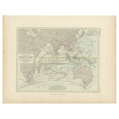
Antique Physical Chart of the Indian Ocean by Johnston, 1850
Located in Langweer, NL
Antique map titled 'Physical Chart of the Indian Ocean'. This map shows the temperature of the water, currents of the air and ocean, direction of the wind, districts of hurricanes, t...
Category

19th Century Antique Paper Collectibles and Curiosities

Materials

Paper

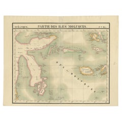
Old Map of the Moluccas and Part of Sulawesi Indonesia by Vandermaelen, c 1825
Located in Langweer, NL
Antique map titled 'Partie des Iles Moluques'. Map of a portion of the Moluccas and part of Sulawesi. Includes the Maluku islands Buru, Sula, Bacan and more. Originates from 'Atlas U...
Category

19th Century Antique Paper Collectibles and Curiosities

Materials

Paper

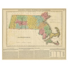
Antique Geographical, Historical and Statistical Map of Massachusetts, 1822
Located in Langweer, NL
This attractive map of Massachusetts presents a finely detailed overview of the state in the first quarter of the 19th century. Transportation ...
Category

1820s Antique Paper Collectibles and Curiosities

Materials

Paper

Antique Map of the United Kingdom and Ireland, c.1873
Located in Langweer, NL
Antique map titled 'Groot Brittanje en Ierland'. Old map depicting the United Kingdom and Ireland, with inset maps of London and factory districts of the UK. This map originates from...
Category

19th Century Antique Paper Collectibles and Curiosities

Materials

Paper

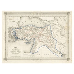
Antique Map of Turkey in Asia, with Frame Style Border
Located in Langweer, NL
Antique map titled 'Asie Ottomane ou Turquie d'Asie'. Attractive map of Turkey in Asia. The map covers the Asian territories claimed by the Turkish Ottoman Empire c.1850 from the Bla...
Category

Mid-19th Century Antique Paper Collectibles and Curiosities

Materials

Paper

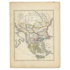
Antique Map of Turkey and Greece, 1852
Located in Langweer, NL
Antique map titled 'Europisch Turkije en Griekenland'. Map of Turkey in Europe and Greece. This map originates from 'School-Atlas van alle deelen der Aar...
Category

19th Century Antique Paper Collectibles and Curiosities

Materials

Paper

Antique Political Map of France, 1880
Located in Langweer, NL
Antique map titled 'France Féodale'. Old map of France with a decorative vignette of Castle de Pierrefonds. This map originates from 'Géographie Universelle Atlas-Migeon' by J. Migeo...
Category

19th Century Antique Paper Collectibles and Curiosities

Materials

Paper

Antique Map of Tunis and Tripoli in Northern Africa, circa 1880
Located in Langweer, NL
Antique map titled 'Tunis et Tripoli & Empire de Maroc'. Old map of Tunis and Tripoli and the Empire of Morocco. This map originates from 'Géographie Universelle Atlas-Migeon' by J. ...
Category

19th Century Antique Paper Collectibles and Curiosities

Materials

Paper

Antique Map of the British Isles with Outline Coloring
Located in Langweer, NL
Antique map titled 'Iles Britanniques'. Attractive map of the British Isles. Details England, Scotland and Ireland as well as parts of neighboring France. Upper right corner features...
Category

Mid-19th Century Antique Paper Collectibles and Curiosities

Materials

Paper

Works of Shakespere Imperial Edition by Charles Knight Vol i with Golden Edges
Located in Doha, QA
This unique book is very rare and terrific edition which goes back to late 19th century, approximately 1870-1875. This is one of two volumes of Complete Works of W. Shakespeare. This...
Category

Late 19th Century English High Victorian Antique Paper Collectibles and Curiosities

Materials

Gold

Original Antique English County Map, Northumberland, J & C Walker, 1851
Located in St Annes, Lancashire
Great map of Northumberland Original colour By J & C Walker Published by Longman, Rees, Orme, Brown & Co. 1851 Unframed.
Category

1850s English Other Antique Paper Collectibles and Curiosities

Materials

Paper

Antique Map of Part of Borneo 'Kalimantan' Indonesia by Vandermaelen, C.1825
Located in Langweer, NL
Antique map titled 'Partie de l'Ile de Bornéo'. Map of a portion of Borneo, showing Magidara Unsung, Isles Soulous, Mandren and Candepan, along with many other places in the area. Or...
Category

19th Century Antique Paper Collectibles and Curiosities

Materials

Paper

Antique Map of the Strait of Le Maire by Cook, 1803
Located in Langweer, NL
Antique map titled 'Kaart van de Good Success Baai in de Straat van Le Maire (..)'. Antique map of the Strait of Le Maire between Terra Fuego and Staten Island. On top, various coast...
Category

19th Century Antique Paper Collectibles and Curiosities

Materials

Paper

Antique Map of Part of Borneo 'Kalimantan' Indonesia, by Vandermaelen, C.1825
Located in Langweer, NL
Antique map titled 'Partie de l'Ile de Bornéo'. Map of a portion of Borneo, primarily the Southern part of the Island, the Strait of Macassar and the Staffinaff Islands. Originates f...
Category

19th Century Antique Paper Collectibles and Curiosities

Materials

Paper

4 Antique 1808 Goldsmiths History of Earth Animated Nature Leather Book Vol I-IV
Located in Dayton, OH
Early 19th century four volume hard cover book set – marbled board covers with leather spine. A History of the Earth and Animated Nature – In Four Volumes – by Oliver Goldsmith – A N...
Category

Early 1800s Antique Paper Collectibles and Curiosities

Materials

Leather, Paper

Large Original Antique Map of Kentucky, USA, C.1900
Located in St Annes, Lancashire
Fabulous map of Kentucky Original color Engraved and printed by the George F. Cram Company, Indianapolis. Published, C.1900 Unframed.
Category

1890s American Antique Paper Collectibles and Curiosities

Materials

Paper

Antique Map of Scandinavia: Norway, Sweden and Denmark
Located in Langweer, NL
Antique map titled 'Suède, Norwège & Danemark'. Attractive map of Scandinavia, with Sweden, Norway and Denmark. With an inset map of Iceland and th...
Category

Mid-19th Century Antique Paper Collectibles and Curiosities

Materials

Paper

Antique Map of Spain and Portugal, with Frame Style Border
Located in Langweer, NL
Antique map titled 'Espagne et Portugal'. Attractive map of Spain and Portugal. The map covers all of Spain and Portugal from France to the Mediterranean Sea and includes the Baleari...
Category

Mid-19th Century Antique Paper Collectibles and Curiosities

Materials

Paper

Antique Map of the United Kingdom and Ireland, circa 1825
Located in Langweer, NL
Antique map titled 'Insula Britannicae'. Old map of the United Kingdom and Ireland originating from 'Atlas der Oude Wereld'. Artists and Engravers: Published by C. Ph. Funke and W. v...
Category

19th Century Antique Paper Collectibles and Curiosities

Materials

Paper

Antique Japanese Woodblock Print Book Edo Period, circa 1833
Located in Barcelona, Barcelona
Antique Japanese Oraimono book Edo period, circa 1833 Woodblock print book Book dimensions: 260 mm x 180 mm There are damages because it is...
Category

1830s Japanese Edo Antique Paper Collectibles and Curiosities

Materials

Paper

Antique Map of Turkey in Asia by Johnston, 1882
Located in Langweer, NL
Antique map titled 'Turkey in Asia (Asia Minor) and Transcaucasia'. Old map of Turkey in Asia (Asia Minor). This map originates from 'The Royal Atlas of Modern Geography, Exhibiting,...
Category

19th Century Antique Paper Collectibles and Curiosities

Materials

Paper

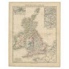
Antique Map of the United Kingdom and Ireland, 1852
Located in Langweer, NL
Antique map titled 'Groot-Brittanje en Ierland'. Map of the United Kingdom and Ireland. This map originates from 'School-Atlas van alle deelen der Aarde' by Otto Petri. Artists a...
Category

19th Century Antique Paper Collectibles and Curiosities

Materials

Paper

Steel Engraved Antique Map of England
Located in Langweer, NL
Antique map titled 'Angleterre'. Original antique map of England. Engraved by Th. Duvotenay. Originates from 'Complement de L'Encyclopedie Mode...
Category

Late 19th Century Antique Paper Collectibles and Curiosities

Materials

Paper

Large Original Antique Map of Oklahoma, USA, circa 1900
Located in St Annes, Lancashire
Fabulous map of Oklahoma Original color Engraved and printed by the George F. Cram Company, Indianapolis. Published, circa 1900 Unframed Repair to...
Category

1890s American Antique Paper Collectibles and Curiosities

Materials

Paper

Lithographed Antique Map of England and Wales
Located in Langweer, NL
Original antique map titled 'Map XXIII England & Wales'. Lithographed map of England and Wales. Published by Fisk & See, circa 1890.
Category

Late 19th Century Antique Paper Collectibles and Curiosities

Materials

Paper

Antique Map of Greece and Its Colonies, with Frame Style Border
Located in Langweer, NL
Antique map titled 'La Grèce'. Attractive map of Greece and its Colonies. The map covers from the southern part of Italy, including Sicily, to the western parts of Asia Minor and fro...
Category

Mid-19th Century Antique Paper Collectibles and Curiosities

Materials

Paper

Antique Art Nouveau Photo Album or Book with Brass Stand Up Frame
Located in Hamilton, Ontario
This antique standing photo album is unsigned, but presumed to have originated from France and date to approximately 1900 and done in the period Art Nouveau style. The album is compo...
Category

Late 19th Century French Art Nouveau Antique Paper Collectibles and Curiosities

Materials

Brass

Antique Map of Mauritania, Massaesylia, Numidia, Tunisia, Cyrenaica & Marmarica
Located in Langweer, NL
Three maps on one sheet showing Mauritania, Massaesylia, Numidia, Tunisia, Cyrenaica and Marmarica (ancient Libya). This map originates from 'Schul-Atlas für die alte Erdbeschreibung...
Category

Early 19th Century Antique Paper Collectibles and Curiosities

Materials

Paper

Antique Fold-Out Illustrated Book, Japanese, Woodblock Print, Linen, Meiji, 1900
Located in Hele, Devon, GB
This is an antique fold-out illustrated book. A Japanese, woodblock print on linen concertina collection of full-colour scenes, dating to the Meiji period, circa 1900. Striking when fully extended, with an abundance of fine detail to both sides Displays a desirable aged patina and in good original order Sheets of linen bound on a fine canvas with multiple concertina folds Decorative bound cover to front and rear, the front accentuated with a red inset Twelve pages per side host wonderful figural scenes in the woodblock print tradition Each page in full colour, with vibrant hues and fine detail Japanese characters adorn the left-hand edge of each scene, with a small boxout to top right Can be read individually, or carefully extended to a length of 254cm (100'') This is a delightful antique fold-out illustrated book, astonishing when fully extended to take in the quality and colour of each scene. Perfect for the collector of fine Japanese decorative arts...
Category

Late 19th Century Japanese Meiji Antique Paper Collectibles and Curiosities

Materials

Paper

Original Antique Map of Asia
Located in Langweer, NL
Antique map titled 'Asien'. Original old map of Asia. Published in Berlin by Simon Schropp et Comp, 1819.
Category

Early 19th Century Antique Paper Collectibles and Curiosities

Materials

Paper

Antique Map of Saxon England according to the Anglo-Saxon Chronicle
Located in Langweer, NL
Antique map titled 'Saxon England According to the Saxon Chronicle'. Map of Saxon England based upon descriptions in the Anglo-Saxon Chronicle, a collection of annals in Old English ...
Category

Early 19th Century Antique Paper Collectibles and Curiosities

Materials

Paper

1889 "The Pacific States and Territories"
Located in Colorado Springs, CO
Presented is an uncommon 1889 map of the western United States, titled “The Pacific States and Territories.” The vertical map depicts the Western states at the time: Washington, Oregon, California, Montana, Idaho, Wyoming, Utah, Colorado, Arizona, and New Mexico. They are bordered by British America to the north, Lower California, Mexico and Texas to the south, and North Dakota, South Dakota, Nebraska and Texas to the east. The map provides a fascinating look at the western states of the United States, just before the turn of the century. In addition to excellent topographical detail of mountain ranges, the map identifies towns and cities, rivers, lakes, deserts and valleys. Crisscrossing across the states, railroad routes are identified with hatched blacklines. Death Valley, Yosemite, Yellowstone National Park, as well as the key mining towns, like Virginia City...
Category

1880s American Antique Paper Collectibles and Curiosities

Materials

Paper

Antique Map of the Netherlands, Belgium and Luxembourg
Located in Langweer, NL
Antique map titled 'Carte des Royaumes Hollande et Belgique'. Attractive map of the Netherlands, Belgium and Luxembourg. This map originates fro...
Category

Mid-19th Century Antique Paper Collectibles and Curiosities

Materials

Paper

Antique Print of a Knight in England or Scotland '1842'
Located in Langweer, NL
Antique print titled 'A Knight'. Old print of a knight. This print originates from 'A critical inquiry into antient armour as it existed in Europe (..)' by Sir Samuel Rush Meyrick. ...
Category

19th Century Antique Paper Collectibles and Curiosities

Materials

Paper

Rolfe's Angling Sketches, Fishing Picture, Not Long Caught.
Located in Oxfordshire, GB
Rolfe's Angling Sketches. An extremely rare colourful fishing lithograph after Henry Leonidas Rolfe (1823 - 1881) 'Rolfe's Angling Sketches, Not ...
Category

1850s British Sporting Art Antique Paper Collectibles and Curiosities

Materials

Paper

Antique Rolland Books in French Language
Located in Alessandria, Piemonte
nr. 9 books - owner Rolland - various titles and authors : Les maitres d'autrefois (Eugène Fromentin) - Petit Bob (GyP) - Voyage autour de mon jardin (Alphonse Karr) - Sans famille (...
Category

Late 19th Century French Other Antique Paper Collectibles and Curiosities

Materials

Paper

Antique Print of a Japanese Soldier Carrying Swords, 1843
Located in Langweer, NL
Antique costume print titled 'Soldat Japonais'. Original antique print of a Japanese soldier carrying swords. This print originates from 'Moeurs, usag...
Category

19th Century Antique Paper Collectibles and Curiosities

Materials

Paper

Original Antique English County Map, Lincolnshire, J & C Walker, 1851
Located in St Annes, Lancashire
Great map of Lincolnshire Original colour By J & C Walker Published by Longman, Rees, Orme, Brown & Co. 1851 Unframed.
Category

1850s English Other Antique Paper Collectibles and Curiosities

Materials

Paper

Large Antique Map of England and Wales
Located in Langweer, NL
Antique map titled 'An Accurate Map of England and Wales'. Original old map of England and Wales. Engraved by John Cary. Originates from 'New British Atlas' by John Stockdale, publis...
Category

Early 19th Century Antique Paper Collectibles and Curiosities

Materials

Paper

Antique Map of Russia in Europe, with Frame Style Border
Located in Langweer, NL
Antique map titled 'Russie d'Europe'. Attractive map of Russia in Europe, covers the European portions of Russia from the Arctic Sea south to the Black Sea and Caspian Sea. This map ...
Category

Mid-19th Century Antique Paper Collectibles and Curiosities

Materials

Paper

General William Tecumseh Sherman Autograph
Located in Dallas, TX
PRESENTING A RARE and FULLY AUTHENTIC General William Tecumseh Sherman Autograph. Last page of a hand written letter, circa 1885-1890. P...
Category

Late 19th Century American American Classical Antique Paper Collectibles and Curiosities

Materials

Paper

Original Antique English County Map, Somerset. J & C Walker, 1851
Located in St Annes, Lancashire
Great map of Somerset Original colour By J & C Walker Published by Longman, Rees, Orme, Brown & Co. 1851 Unframed.
Category

1850s English Other Antique Paper Collectibles and Curiosities

Materials

Paper

Original Antique Map of England with Hand Coloring
Located in Langweer, NL
Antique map titled 'Engand'. Original old map of England. Engraved by W. Milton. Published by John Mc. Gowan, circa 1829.
Category

Mid-19th Century Antique Paper Collectibles and Curiosities

Materials

Paper

Antique Map of Russia in Asia and Siberia, with Frame Style Border
Located in Langweer, NL
Antique map titled 'Sibérie ou Russie d'Asie'. Attractive map of Russia in Asia and Siberia. This map originates from Maison Basset's 1852 edition of 'Atlas Illustre Destine a l'ense...
Category

Mid-19th Century Antique Paper Collectibles and Curiosities

Materials

Paper

Antique Map of France in Provinces, with Inset of Paris
Located in Langweer, NL
Antique map titled 'France par Provinces'. Original antique map of France in Provinces. It covers from the Flanders in the north to Roussillon in the south and from Brittany in the w...
Category

Mid-19th Century Antique Paper Collectibles and Curiosities

Materials

Paper

Large Antique County Map of Northamptonshire, England
Located in Langweer, NL
Antique map titled 'A Map of Northamptonshire from the best Authorities'. Original old county map of Northamptonshire, England. Engraved by John Cary. Originates from 'New British At...
Category

Early 19th Century Antique Paper Collectibles and Curiosities

Materials

Paper

Dickens, Life and Adventures of Nicholas Nickleby, First Edition in 19 Parts
Located in Hillsborough, NJ
AUTHOR: DICKENS, Charles. TITLE: The Life and Adventures Of Nicholas Nickleby. (20 Parts in 19). PUBLISHER: London: Chapman and Hall, 1838. DESCRIPTION: FIRST EDITION IN TH...
Category

1830s British Antique Paper Collectibles and Curiosities

Materials

Paper

Original Antique Map of England with Outline Coloring
Located in Langweer, NL
Antique map titled 'Angleterre'. Original old map of England with outline coloring. Source unknown, to be determined. Published circa 1830.
Category

Mid-19th Century Antique Paper Collectibles and Curiosities

Materials

Paper

Large Antique County Map of Surrey, England
Located in Langweer, NL
Antique map titled 'A Map of Surry from the best Authorities'. Original old county map of Surrey, England. Engraved by John Cary. Originates from 'New British Atlas' by John Stockdal...
Category

Early 19th Century Antique Paper Collectibles and Curiosities

Materials

Paper

Miniature Antique Map of England and Wales
Located in Langweer, NL
Miniature map titled 'England & Wales'. Original antique map of England & Wales. This map originates from 'Darton's New Miniature Atlas' publis...
Category

Early 19th Century Antique Paper Collectibles and Curiosities

Materials

Paper

Large Antique Map of England Hand Colored by Counties
Located in Langweer, NL
Antique map titled 'A New Map of England from the latest Authorities'. Large map of England, hand colored by counties. Published by John Cary, 1821. John Cary (1755-1835) was a B...
Category

Early 19th Century Antique Paper Collectibles and Curiosities

Materials

Paper

Terrestrial Table Globe by Félix Delamarche, Paris, 1821
By Félix Delamarche
Located in Milano, IT
Terrestrial table globe Félix Delamarche Paris, 1821 It measures 20.47 in height, Ø max 14.17 in; the sphere Ø 9.44 in (h 52 cm x Ø max 36.5 cm; the sphere Ø 24 cm) Wood, printed...
Category

1820s French Restauration Antique Paper Collectibles and Curiosities

Materials

Metal

Antique Map of China and Japan, with Frame Style Border
Located in Langweer, NL
Antique map titled 'Empires Chinois et Japonnais'. Attractive map of China and Japan. This map originates from Maison Basset's 1852 edition of 'Atlas Illustre Destine a l'enseignemen...
Category

Mid-19th Century Antique Paper Collectibles and Curiosities

Materials

Paper

Large Antique County Map of Lincolnshire, England
Located in Langweer, NL
Antique map titled 'A Map of Lincolnshire from the best Authorities'. Original old county map of Lincolnshire, England. Engraved by John Cary. Originates from 'New British Atlas' by ...
Category

Early 19th Century Antique Paper Collectibles and Curiosities

Materials

Paper

Ulysses S. Grant Signed Presidential Appointment, Dated February 28, 1871
By Ulysses S. Grant
Located in Colorado Springs, CO
Presented is an original Ulysses S. Grant signed Presidential Appointment, dating to February 28, 1871. Signed during the first term of Grant's presidency, the document appoints "Robert W. Healy" to the role of "Marshal of the United States in and for the Southern District of Alabama." The appointment is countersigned by "Hamilton Fish" as Secretary of State. The document is partially printed in formal script, and completed by hand in black ink. The document reads in full: “Ulysses S. Grant, President of the United States of America. To all who shall see these presents greeting: Know ye, That reposing special trust and confidence in the Integrity, Ability, and Diligence of Robert W. Healy, I have Nominated, and, by and with the advice and consent of the Senate, DO APPOINT HIM Marshal of the United States in & for the Southern District of Alabama; and do authorize & empower him to execute and fulfill the duties of that Office according to Law. And to hold and hold the said Office, with all the powers, privileges, and emoluments to the same of right appertaining, unto him, the said Robert W. Healy, for the term of four years from the day of the date hereof, subject to the conditions prescribed by law. In Testimony Whereof, I have caused these Letters to be made Patent, and the Seat of the United States to be hereunto affixed. Given under my hand, at the city of Washington, the Twenty eighth...
Category

1870s American Antique Paper Collectibles and Curiosities

Materials

Paper

1876 "Gettysburg, The Repulse of Longstreet's Assault." Engraving
Located in Colorado Springs, CO
Presented here is an 1876 engraving of John B. Bachelder and James Walker’s Gettysburg. The Repulse of Longstreet’s Assault. The engraved scene depicts the decisive battle on the final day of the Battle of Gettysburg. Researched by the photographer and topographer John B. Bachelder and painted by James Walker, the original painting was created in 1870. This detailed engraving was done by H. B. Hall Jr. and published by James Drummond Ball. Otherwise called Pickett’s Charge, the battle occurred on July 3, 1863. Pickett’s corp commander, Lieutenant General James Longstreet was placed in charge of the attack despite his hesitations. Longstreet’s central role led to the title of the work, Repulse of Longstreet’s Assault. In an attempt to gain control of an important supply route, nine Confederate brigades charged across three-quarters of a mile of open ground against cannon fire to take Cemetery Ridge from the defending Union Army. Despite their overwhelming numbers, the Confederate forces were repelled with considerable casualties marking not only a decisive victory for the Union, but also the beginning of the slow defeat of Lee’s Army. The furthest the charging forces advanced before being repulsed would forever be known as the “High Water Mark of the Confederacy.” The Confederate army never recovered from the losses at Gettysburg and it effectively ended Lee’s campaign into Pennsylvania. The engraving gives the perspective from the Union rear, one that encompasses most of the battlefield, from Big Round Top on the left to the northern reaches of Cemetery Ridge on the right. The Confederate lines at Seminary Ridge are in the far distance, partially obscured by bursting shells. The image centers on the main Confederate assault, in the vicinity of what today are known as "The Copse" and "The Bloody Angle." The composition has elemen...
Category

1870s American Antique Paper Collectibles and Curiosities

Materials

Paper

Beautifully Bound Book by Lord Alfred Tennyson: the Lover's Tale
Located in Middletown, NY
Tennyson, Alfred. The Lover's tale. London: C. Kegan Paul & Co., 1879. First Edition. 16mo, 6 1/2 x 4 1/4 in. (165 x 109 mm), 95 pp + 4pp ads; fine FULL TAN CRUSHED MOROCCO BY ZA...
Category

Late 19th Century English Antique Paper Collectibles and Curiosities

Materials

Gold Leaf

Large Original Antique Map of Ireland by Sidney Hall, 1847
Located in St Annes, Lancashire
Great map of Ireland Drawn and engraved by Sidney Hall Steel engraving Original colour outline Published by A & C Black. 1847 Unframed Free shipping.
Category

1840s Scottish Antique Paper Collectibles and Curiosities

Materials

Paper

Read More

Pamela Shamshiri Shares the Secrets behind Her First-Ever Book and Its Effortlessly Cool Interiors

The sought-after designer worked with the team at Hoffman Creative to produce a monograph that beautifully showcases some of Studio Shamshiri's most inspiring projects.

Moroccan Artworks and Objects Take Center Stage in an Extraordinary Villa in Tangier

Italian writer and collector Umberto Pasti opens the doors to his remarkable cave of wonders in North Africa.

Montecito Has Drawn Royalty and Celebrities, and These Homes Are Proof of Its Allure

Hollywood A-listers, ex-pat aristocrats and art collectors and style setters of all stripes appreciate the allure of the coastal California hamlet — much on our minds after recent winter floods.

Whaam! Blam! Pow! — a New Book on Pop Art Packs a Punch

Publishing house Assouline and writer Julie Belcove have teamed up to trace the history of the genre, from Roy Lichtenstein, Andy Warhol and Yayoi Kusama to Mickalene Thomas and Jeff Koons.

The Sparkling Legacy of Tiffany & Co. Explained, One Jewel at a Time

A gorgeous new book celebrates — and memorializes — the iconic jeweler’s rich heritage.

What Makes a Gem-Encrusted Chess Set Worth $4 Million?

The world’s most opulent chess set, weighing in at 513 carats, is literally fit for a king and queen.

Tauba Auerbach’s Geometric Pop-Up Book Is Mighty Rare, Thanks to a Hurricane

This sculptural art book has an epic backstory of its own.

Step inside the Storied Mansions of Palm Beach’s Most Effervescent Architect

From Spanish-style courtyards to fanciful fountains, these acclaimed structures abound in surprising and elegant details.
Recently Viewed

View All