18th Century Collectibles and Curiosities

to
1,731
2,054
2,424
343
2,054
15
1
3,091
2,413
734
42
337
113
35
79
5
6
10
6
16
30
13
6
4
2,002
19
19
14
14
82
52
9
6
6
2,054
2,054
2,054
20
14
13
12
11
Item Ships From: Netherlands
Period: 18th Century
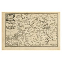
Original Antique Map of Canaan, Armenia, Syria, Mesopotamia and Arabia, 1709
Located in Langweer, NL
Antique map titled 'Descriptio Paradisi et Terrae Canaan'. Original antique map of Canaan, Armenia, Syria, Mesopotamia and Arabia. It displays the Middle East from the eastern Mediterranean Sea to the Persian Gulf...
Category

Antique 18th Century Collectibles and Curiosities

Materials

Paper

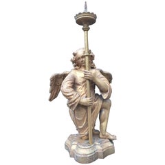
Antique 18th Century Gilt Gothic Art Carved Wood Angel Sculpture Candlestick
Located in Lisse, NL
Beautiful and sizeable Church altar candelabra in the form of a winged Angel. This hand-carved Church altar piece is carved out of wood and the gilt finishing gives this piece it's ...
Category

Dutch Gothic Antique 18th Century Collectibles and Curiosities

Materials

Wood

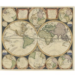
Antique World Map by P. Schenk '1706'
By Peter Schenk
Located in Langweer, NL
Antique map titled 'Diversa Orbis Terrae. Visu Incedente per Coluros Tropicorum, Ambos Ejus Polos, et Parciularis Sphaerae Zenith, in Planum Orthographica Projectio (..) Plat Ontwerp van verscheyde Aert-klooten (..)'. One of the earliest Dutch World Maps to focus on a more modern cartographic style, based on Carel Allard's map of 1696. This map represented a noteworthy shift from the traditional decorative Dutch 17th century maps where the margins would be full of classical mythological...
Category

Antique 18th Century Collectibles and Curiosities

Materials

Paper

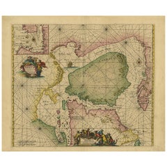
Antique Sea Chart of North America by Ottens, circa 1745
Located in Langweer, NL
Antique map titled 'Septemtrionaliora Americae a Groenlandia (..)'. Sea chart of the northern waters of North America, including the coast of Labrador and pa...
Category

Antique 18th Century Collectibles and Curiosities

Materials

Paper

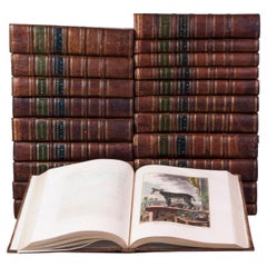
Hand-coloured set of Buffon’s Histoire naturelle in its most luxurious form
Located in ZWIJNDRECHT, NL
Publisher: Buffon, Georges-Louis Leclerc de Place / Date: Dordrecht, Abraham Blussé, 1766-1799 Size: 38 parts in 21 volumes. Large 4to. With more than 1100 hand-coloured engraved ...
Category

Dutch Dutch Colonial Antique 18th Century Collectibles and Curiosities

Materials

Paint, Paper

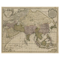
Large Antique Map of Asia including All of Southeast Asia, c.1792
Located in Langweer, NL
Antique map titled 'L' Asie Divisee en ses Empires, Royaumes, et Etats'. Attractive, large map of Asia including all of Southeast Asia. The cartography is archaic for the period with...
Category

Antique 18th Century Collectibles and Curiosities

Materials

Paper

1742 Antique Map of the Persian Empire with Detailed Borders and Cartouche
Located in Langweer, NL
Title: 1742 Covens & Mortier Map of the Persian Empire by Guillaume De L'Isle This remarkable 1742 map, "Carte de Perse," was originally designed by Guillaume De L'Isle, a preemin...
Category

Antique 18th Century Collectibles and Curiosities

Materials

Paper

Unusual Benedictine Map of Italy, Showing Various States of the Church, C.1745
Located in Langweer, NL
Antique map titled 'Italia Benedictina Delineata A.P.R.C.P.W.' Unusual Benedictine map of Italy, showing the various states of the church, with an elaborate cartouche. Part of a seri...
Category

Antique 18th Century Collectibles and Curiosities

Materials

Paper

Old Map of the Spice Islands, Moluccas by Bellin, Published in 1771
Located in Langweer, NL
Title: 1771 Jacques-Nicolas Bellin Map of the Moluccas, the Spice Islands of Indonesia Description: This finely engraved eighteenth-century map, titled Carte Particulière des Is...
Category

Antique 18th Century Collectibles and Curiosities

Materials

Paper

Rare Unusual Antique Map of Asia with a Landbridge from Korea to America, 1717
Located in Langweer, NL
Antique map titled 'L'Asie Suivant les Nouvelles Decouvertes (..).' Interesting and very unusual map of the Asian continent. The map is based primarily on Dutch sources, particular...
Category

Antique 18th Century Collectibles and Curiosities

Materials

Paper

Original Antique Map of Arabia and the Red Sea
Located in Langweer, NL
Antique map titled 'Carte de la Coste d'Arabie (..) - Kaart van de Kust van Arabië (..)'. This is a Dutch version, engraved by J. van Schley, of Bellin's map of Arabia and the Red Sea...
Category

Antique 18th Century Collectibles and Curiosities

Materials

Paper

Antique Map of the Middle East with a Large Arabia, 1799
Located in Langweer, NL
Antique map titled 'Perse, Turquie Asiatique et Arabie (..)'. Map of the Middle East with a large Arabia, extending from the Black Sea to the In...
Category

Antique 18th Century Collectibles and Curiosities

Materials

Paper

18th-Century Map of the Eastern Roman Empire by Henri Chatelain, c. 1719
Located in Langweer, NL
Title: 18th-Century Map of the Eastern Roman Empire by Henri Chatelain, c. 1719 Description: This intricately detailed map, titled *Nouvelle Carte pour Servir à l'Histoire de l'Empi...
Category

Antique 18th Century Collectibles and Curiosities

Materials

Paper

Authentic Old Map of Sumatra, Malaysia and Singapore, 1745
Located in Langweer, NL
Title: "Kaartje van't Eiland Sumatra en de Maleidse Kust gelegen na de stelling van de G. de L'Isle" Published by Jacob Keizer and by Jan de Lat Creator: Keizer, Jacob, active 1706...
Category

Antique 18th Century Collectibles and Curiosities

Materials

Paper

Rare 1757 Jesuit Map of California and Baja, Dedicated to the King of Spain
Located in Langweer, NL
Title: Rare 1757 Jesuit Map of California and Baja, Dedicated to the King of Spain This rare and detailed map, titled *Carte de la Californie Levee par la Société des Jésuites*, wa...
Category

Antique 18th Century Collectibles and Curiosities

Materials

Paper

Original Old Map of Present-Day Mongolia, Northeast China and Korea
Located in Langweer, NL
Antique map titled 'Carte de la Tartarie Chinoise. Projettee et assujettie aux observations astronomiques par M. Bonne, Hydrographe du Roi. A Paris, Chez Lattre Graveur, ordinaire de...
Category

Antique 18th Century Collectibles and Curiosities

Materials

Paper

Scarce Latin Edition of Guillaume Delisle's 1700 Map of North America
Located in Langweer, NL
Scarce German Edition of Guillaume Delisle's 1700 Map of North America This beautifully colored and highly detailed map is a rare Latin edition of Guillaume Delisle's influential 17...
Category

Antique 18th Century Collectibles and Curiosities

Materials

Paper

Antique Map of the Empire of Morocco by Kitchin, c.1760
Located in Langweer, NL
Antique map titled 'A Map of the Empire of Morocco Comprehending the Kingdoms of Fez, Morocco'. Original antique map of the kingdoms of Fez, Algiers, Segelmese, Tafilet and Morocco. ...
Category

Antique 18th Century Collectibles and Curiosities

Materials

Paper

Antique Hand-Colored Map of France by J.B. Elwe, 1792
Located in Langweer, NL
Antique map titled 'Carte Nouvelle du Royaume de France'. Beautiful antique map of France, including the Southern part of England. Decorated with cartouche and 12 coats of arms.  
Category

Antique 18th Century Collectibles and Curiosities

Materials

Paper

Antique Print of a Moorish Song by Shaw, 1773
Located in Langweer, NL
Antique print titled 'De Mizmoune'. Old print depicting a music sheet with the 'Mizmoune' (Moorish song), a Dance and a Turkish song. Originates from the first Dutch editon of an int...
Category

Antique 18th Century Collectibles and Curiosities

Materials

Paper

Antique plan of Ayutthaya, the capital of Siam, Thailand
Located in Langweer, NL
Antique map titled 'Judia, De Hoofd-Stad van Siam'. Antique plan of Ayutthaya, the capital of Siam (Thailand). This print originates from 'Oud en Nieuw Oost-...
Category

Antique 18th Century Collectibles and Curiosities

Materials

Paper

Original Antique View of the City of Damietta, Egypt, 1774
Located in Langweer, NL
Antique print, titled: 'Prospect der Stadt Damiat.' - Tab VIII. View of the city of Damietta, Egypt. From 'Reisebeschreibung von Arabien und anderen umliegenden Landern (1774-1778)...
Category

Antique 18th Century Collectibles and Curiosities

Materials

Paper

Map of Tartary by Isaak Tirion: Detailed Cartography of Northern Asia, ca.1740
Located in Langweer, NL
This is an antique map titled "Nieuwe Kaart van Tartarie," which translates to "New Map of Tartary." The map was created by Isaak Tirion, a prominent Dutch cartographer and publisher...
Category

Antique 18th Century Collectibles and Curiosities

Materials

Paper

Antique Map of the Coast of Southern France, 1793
Located in Langweer, NL
Antique map titled '14th Chart of the Coast of France, from Port Vendres to the Petit Rhône'. Original map with later hand coroling of the coast of Southern France. The "14th Chart of the Coast of France, from Port Vendres to the Petit Rhône" is an antique map that offers a detailed depiction of the southern coast of France, specifically highlighting the Mediterranean coastline. This map, which dates back to 1793, was originally part of "Le Petit Neptune Français; Or, French Coasting Pilot," a publication designed for maritime navigation along the French coastlines. Key Features of the Map: 1. **Geographic Coverage**: - The map covers the southern French coastline from Port Vendres in the west to the Petit Rhône in the east. - It includes notable regions such as Languedoc, the Gulf of Lyon, and parts of Catalonia (Spain). 2. **Notable Places**: - **Montpellier**: A major city in the Diocese of Montpellier, an important cultural and economic center. - **Narbonne**: Located in the Diocese of Narbonne, a historical city with Roman heritage. - **Agde**: Situated in the Diocese of Agde, known for its ancient Greek colony origins. - **Béziers**: Part of the Diocese of Béziers, another city with deep historical roots dating back to Roman times. - **Port Vendres**: A critical port near the Spanish border. - **Catalonia**: Including parts of northeastern Spain, emphasizing the coastal connection between France and Spain. 3. **Dioceses and Regions**: - The map is marked with various dioceses such as Montpellier, Agde, Narbonne, and Béziers, indicating ecclesiastical boundaries. - It highlights the broader region of Languedoc, a historical province known for its wine production and medieval history. 4. **Navigational Aids**: - The map features a compass rose with radiating lines, a common navigational aid in maritime maps...
Category

Antique 18th Century Collectibles and Curiosities

Materials

Paper

Original Antique Map of Greece and part of Turkey
Located in Langweer, NL
Original antique map titled 'La Grece ou partie meridionale de la Turquie d'Europe'. Small map of Greece and part of Turkey. This map originates from 'Le nouveau et curieux Atlas Geo...
Category

Antique 18th Century Collectibles and Curiosities

Materials

Paper

Imperial map of Northern Russia with Archangel, Lapland and Permia, c.1730
Located in Langweer, NL
Imperial map of Northern Russia with Archangel, Lapland, and Permia, c.1730 Description: This intricately engraved and hand-colored map presents the northern reaches of the Russian ...
Category

German Antique 18th Century Collectibles and Curiosities

Materials

Paper

Old Map Depicting Turkey, Persia, Arab and Black Sea Etc, 1778
Located in Langweer, NL
Antique map titled 'Turquie d'Asie, Arabie, Perse, Tartarie Independante'. Old map of Turkey in Asia. The map shows all of Turkey and the Black Sea, and extends east to include t...
Category

Antique 18th Century Collectibles and Curiosities

Materials

Paper

1792 Map of Eastern Africa and the Arabian Peninsula by Delisle/Elwe
Located in Langweer, NL
1792 Map of Eastern Africa and the Arabian Peninsula by Delisle/Elwe This detailed 1792 map, created by Delisle and published by Elwe, depicts northeastern Africa, including Egypt, ...
Category

Antique 18th Century Collectibles and Curiosities

Materials

Paper

Antique Map Dedicated to British Merchants Trading to North America, ca.1746
Located in Langweer, NL
Description: Antique map titled 'A New Chart of the Coast of New England, Nova Scotia, New France or Canada, with the islands of Newfoundland, Capte Breton, St John's (..)'. Map stre...
Category

Antique 18th Century Collectibles and Curiosities

Materials

Paper

Orginal Antique Handcolored Map of the Turkish Empire, 1748
Located in Langweer, NL
Antique map titled 'L'Empire des Turcs'. Old map of the Turkish Empire with an inset of the North African regions. Originates from 'Atlas Nouveau Portatif' by G.L. le Rouge. Artis...
Category

Antique 18th Century Collectibles and Curiosities

Materials

Paper

Biblical Map and Family Trees of the Holy Land by Chatelain, ca. 1720
Located in Langweer, NL
Title: 1720 Chatelain Map of the Holy Land with Biblical Family Trees and Chronology Description: This fascinating 18th-century folio map by Henry Abraham Chatelain combines geo...
Category

Antique 18th Century Collectibles and Curiosities

Materials

Paper

Navigating the Spice Trade: A Maritime Chart of the Banda Sea, 1799
Located in Langweer, NL
This original antique map is an 18th-century nautical chart by Laurie & Whittle, a well-known British firm that was involved in the publication of maps, charts, and maritime books. ...
Category

Antique 18th Century Collectibles and Curiosities

Materials

Paper

Original Antique Map of Normandy, France
Located in Langweer, NL
Antique map titled 'Carte de Normandie (..)'. Attractive map of Normandy, France. it depicts the former French Duchy of Normandy, covers the region fro...
Category

Antique 18th Century Collectibles and Curiosities

Materials

Paper

A General View of Jerusalem in the Early Part of the 18th Century" (circa 1752)
Located in Langweer, NL
The print is signed by the artist "S. Mynde sc." in the lower right corner. This suggests that the maker of the print is Samuel Mynde, a known engraver from the 18th century. His wor...
Category

Antique 18th Century Collectibles and Curiosities

Materials

Paper

Detailed Antique Map of the Windward Islands in the Caribbean
Located in Langweer, NL
Antique map titled 'Carte des Antilles Francoises et des Isles Voisines'. Original antique map of the French Antilles, covering an area stretching from Guadeloupe in the north to Gre...
Category

Antique 18th Century Collectibles and Curiosities

Materials

Paper

Map of the Vietnamese Coast, Centered on Turon Harbor 'Da Nang Area', 1796
Located in Langweer, NL
Antique map titled 'A chart of part of the coast of Cochin-China including Turon Harbour and the Island Callao'. Detailed map of the Vietnamese Coast, centered on Turon Harbor (D...
Category

Antique 18th Century Collectibles and Curiosities

Materials

Paper

Map of India and Ceylon with Inset of Calcutta and the Ganges, by Bonne, 1780
Located in Langweer, NL
The map on offer is an antique copperplate engraving of India and Ceylon (Sri Lanka), created by Rigobert Bonne (1727-1794), a prominent French cartographer. Here is a breakdown of t...
Category

Antique 18th Century Collectibles and Curiosities

Materials

Paper

Original Antique Map of Abyssinia, Sudan and the Red Sea, 1749
Located in Langweer, NL
Antique map titled 'Nubie, Abissinie et Cote d'Ajan'. Map of Abyssinia, Sudan and the Red Sea by Robert Vaugondy. Covers from Arabia and Egypt south to M...
Category

Antique 18th Century Collectibles and Curiosities

Materials

Paper

Map of Baja California and Mexico - Jesuit Observations and Native Tribes, 1777
Located in Langweer, NL
1777 A. Krevelt Map of Baja California and Northwestern Mexico - Jesuit Observations and Native Tribes A. Krevelt - Carte de la Californie d'Après les observations les plus exactes ...
Category

Antique 18th Century Collectibles and Curiosities

Materials

Paper

Spectacular 1770 Bird's-Eye View of Dunkirk Harbor by Basset, with 66 Landmarks
Located in Langweer, NL
This engraving, titled *Vue de Dunkerque du coté de la Mer*, is a spectacular bird's-eye view of Dunkirk from the sea, published by Basset around 1770. It provides a detailed panor...
Category

Antique 18th Century Collectibles and Curiosities

Materials

Paper

Antique Hand-Coloured Map of North and South America, ca.1765
Located in Langweer, NL
Description: Antique map titled 'Nieuwe Kaart van Amerika.' Attractive map of North and South America, the western part of Africa and south west Europe. Source unknown, to be determi...
Category

Antique 18th Century Collectibles and Curiosities

Materials

Paper

Old Map of the Moluccas, Known as the Famous Spice Islands, Indonesia, ca.1730
Located in Langweer, NL
Antique map titled 'Insularum Moluccarum Nova Descriptio.' Old map of the Moluccas. The famous Spice Islands, the cornerstone of the Dutch trading empire in the East Indies throughout the 17th Century, is the focus of this exquisite map. Similar to Blaeu's map, except that it extends further south...
Category

Antique 18th Century Collectibles and Curiosities

Materials

Paper

Antique Engraving of Persepolis, a City Sacked by Alexander the Great, 1726
Located in Langweer, NL
Antique print titled 'Ruinen van 't Paleis van Darius, gelegen in 't oude Persepolis, door last van Alexander de Groote verbrandt (..)'. Persepolis was sacked by the troops of Al...
Category

Antique 18th Century Collectibles and Curiosities

Materials

Paper

Saint-Domingue (French Section): 18th Century Map from France Militaire Series
Located in Langweer, NL
This map is titled "St. Domingue (Partie Française)" and is part of the France Militaire series. It focuses on the French portion of Saint-Domingue, which corresponds to modern-day H...
Category

Antique 18th Century Collectibles and Curiosities

Materials

Paper

Rare Antique Engraving with Three Unique Views of Iran, 1711
Located in Langweer, NL
Antique print titled 'Karavane by het dorp Coraming - Brug over de rivier Kiesilosan - Het Dorp 't Sargabrand'. Old print with three views, two of which unidentified villages in Iran, and a bridge over the Kiesilosan river. This print originates from 'Cornelis de Bruins...
Category

Antique 18th Century Collectibles and Curiosities

Materials

Paper

Original Engraving of the West Indies, Gulf of Mexico, Antilles, Caribbean, 1780
Located in Langweer, NL
Rigobert Bonne and G. Raynal's 1780 map of the West Indies, Gulf of Mexico, Antilles, and the Caribbean stands as a remarkable cartographic piece, offering a detailed and expansive v...
Category

Antique 18th Century Collectibles and Curiosities

Materials

Paper

Antique Print of Seals of Nobility and Important Men of Scotland, 1792
Located in Langweer, NL
Antique print titled 'Plate XXX. Seals of Nobility and great Men of Scotland'. Original antique print showing Seals of Nobility and important men of Scotland. This print originates f...
Category

Antique 18th Century Collectibles and Curiosities

Materials

Paper

18th Century Brass Bedpan with Original Dark Oak Wooden Turned Steel
Located in Delft, NL
18th century brass bedpan with original dark oak wooden turned steel. A brass bedpan, made in The Netherlands in the 18th Century This bedpan would be f...
Category

Dutch Antique 18th Century Collectibles and Curiosities

Materials

Brass

Navigational Chart of Jamaica, Cape Gracias a Dios, and the Mosquito Coast, 1775
Located in Langweer, NL
The map titled "The Island of Jamaica and Cape Gracias a Dios with the Banks (Shows Moskito Kings Party)" illustrates a significant historical period marked by shifting colonial infl...
Category

Antique 18th Century Collectibles and Curiosities

Materials

Paper

Original Antique Engraving of a Chinese Temple, 1736
Located in Langweer, NL
Antique print titled 'Temple Chinois'. Old print depicting a temple in China. Source unknown, to be determined. Artists and Engravers: Made after J.C. Philips. Condition: Very ...
Category

Antique 18th Century Collectibles and Curiosities

Materials

Paper

Detailed Antique Map of Hungary and Transylvania by Tirion, 1753
Located in Langweer, NL
Title: Nieuwe Kaart van’t Koninkryk Hongaryen en Zevenbergen by Isaak Tirion, 1753 – Antique Map of Hungary and Transylvania Description: This is an antique 1753 map titled *Nieuwe Kaart van’t Koninkryk Hongaryen en Zevenbergen*, created by the notable Dutch cartographer and publisher Isaak Tirion. The map showcases the Kingdom of Hungary and the region of Transylvania (referred to as "Zevenbergen") as they appeared in the mid-18th century. Tirion’s maps are well-known for their clarity, precision, and attention to geographic detail, making them highly sought after by collectors of antique maps. This map provides a detailed view of Hungary and Transylvania, including borders, towns, cities, rivers, and mountain ranges. It was created using the latest discoveries and updates of the time and reflects the political landscape of the region, which was part of the Habsburg Empire during a period of territorial changes and consolidations. The map’s borders are highlighted with color to distinguish different regions, and significant cities such as Buda, Pest, and Debrecen are clearly labeled. Isaak Tirion was one of the most prominent Dutch publishers of the 18th century, particularly known for his *Nieuwe en Beknopte Hand-Atlas* (New and Concise Hand Atlas) series, which included a wide range of maps of Europe and beyond. His works were appreciated for their cartographic accuracy and artistic quality. This map is a valuable piece for collectors interested in 18th-century European maps, particularly those that highlight Central Europe, Hungary, Transylvania, and the Habsburg Empire. It is a fine example of the craftsmanship of Isaak Tirion and offers insight into the historical geography of the region. Condition: Excellent for its age, with finely preserved hand-coloring and wide margins. Slight edge wear typical of maps from this period. Effective keywords that may help attract collectors or enthusiasts interested in historical maps of Hungary, Transylvania, and Central Europe: - Antique map of Hungary - Historical map of Transylvania - 18th-century map of Central Europe - Habsburg Empire map - Isaak Tirion map - Nieuwe Kaart van’t Koninkryk Hongaryen en Zevenbergen - Kingdom of Hungary map...
Category

Antique 18th Century Collectibles and Curiosities

Materials

Paper

Rare Engraving with a View of the City of Kom in Egypt
Located in Langweer, NL
This is an original antique print of the city of Kom in Egypt.
Category

Antique 18th Century Collectibles and Curiosities

Materials

Paper

Antique Map of Israel Filled with Biblical Scenes, Published in 1748
Located in Langweer, NL
Antique map Holy Land titled 'Het beloofde landt Canaan doorwandelt van onsen Saligmaker Jesu Christo neffens zyne Apostelen'. Antique map of Israel ...
Category

Antique 18th Century Collectibles and Curiosities

Materials

Paper

Bible, Biblia Sacra, Utrecht, Cornelius Guillielmus Le Febvre, 1732
Located in Delft, NL
Bible,, Biblia Sacra, dat is, de H. Schriftuer van het Oude, en het Nieuwe Testament, Naar de laetste Roomsche Keure der gemeine Latijnsche Overzettinge, in nederduitsch Vertaeld, me...
Category

Dutch Antique 18th Century Collectibles and Curiosities

Materials

Leather, Paper

Antique Hand-Colored Print of the Labyrinth of Versailles, c.1720
Located in Langweer, NL
Antique print titled 'Le Serpent à plusieurs Testes: dans le Labyrinte de Versailles'. This print illustrates the fable 'The Snake with several heads' of the labyrinth of Versailles ...
Category

Antique 18th Century Collectibles and Curiosities

Materials

Paper

Antique Print of the Malabar Coast of India showing the VOC establishments, 1726
Located in Langweer, NL
Dutch print with the title: Platte Grond van t'Fort Tricoen male met de daar aangelegen Pagoods-Berg (Trincomalee, Sri Lanka) The map is taken from: 'Oud en Nieuw Oost-Indiën' van François Valentyn. 1) Ottens, Frederik (engraver / etcher) 2) Braam, J. van (publisher) 3) Linden, Gerard onder de (publisher) MALABAR COAST...
Category

Antique 18th Century Collectibles and Curiosities

Materials

Paper

Antique Map of Portugal by Nolin '1704'
Located in Langweer, NL
Antique map titled 'Le Royaume de Porutgal divisé en cinq grandes Provinces (..)'. Rare and very decorative map of Portugal. It shows the territory of ...
Category

Antique 18th Century Collectibles and Curiosities

Materials

Paper

Set of Four Original Antique Maps of Asia by Bolton & Seale, circa 1770
Located in Langweer, NL
Set of four antique maps of Asia: 1) Asia plate 6, Part of China, Tibet and Tartary 2) Asia plate 2, Japan, Corea, the Monguls and part of China 3) As...
Category

Antique 18th Century Collectibles and Curiosities

Materials

Paper

Read More

Medal-Worthy Memorabilia from Epic Past Olympic Games

Get into the games! These items celebrate the events, athletes, host countries and sporting spirit.

Ahoy! You’ve Never Seen a Collection of Sailor Art and Kitsch Quite Like This

French trendsetter and serial collector Daniel Rozensztroch tells us about his obsession with objects related to seafaring men.

Pamela Shamshiri Shares the Secrets behind Her First-Ever Book and Its Effortlessly Cool Interiors

The sought-after designer worked with the team at Hoffman Creative to produce a monograph that beautifully showcases some of Studio Shamshiri's most inspiring projects.

Moroccan Artworks and Objects Take Center Stage in an Extraordinary Villa in Tangier

Italian writer and collector Umberto Pasti opens the doors to his remarkable cave of wonders in North Africa.

Montecito Has Drawn Royalty and Celebrities, and These Homes Are Proof of Its Allure

Hollywood A-listers, ex-pat aristocrats and art collectors and style setters of all stripes appreciate the allure of the coastal California hamlet — much on our minds after recent winter floods.

Whaam! Blam! Pow! — a New Book on Pop Art Packs a Punch

Publishing house Assouline and writer Julie Belcove have teamed up to trace the history of the genre, from Roy Lichtenstein, Andy Warhol and Yayoi Kusama to Mickalene Thomas and Jeff Koons.

The Sparkling Legacy of Tiffany & Co. Explained, One Jewel at a Time

A gorgeous new book celebrates — and memorializes — the iconic jeweler’s rich heritage.

What Makes a Gem-Encrusted Chess Set Worth $4 Million?

The world’s most opulent chess set, weighing in at 513 carats, is literally fit for a king and queen.
Recently Viewed

View All