17th Century More Furniture and Collectibles

to
894
1,184
313
1,506
109
84
23
2
2
1
1
1
1
5,224
10,407
31,449
15,361
6,659
13,584
6,645
937
571
1,127
1,392
1,026
2,833
2,899
2,598
1,215
794
1,046
184
167
166
118
482
101
89
80
67
1,506
1,506
1,506
63
12
11
11
7
Period: 17th Century
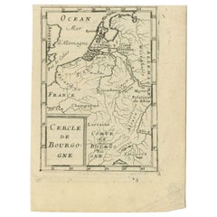
Antique Map of the Burgundy Region by Mallet, c.1683
Located in Langweer, NL
Antique map titled 'Cercle de Bourgogne'. Detailed miniature map of the Burgundy region, France. Also shows the Netherlands and Belgium. Originates from Mallet's 'Description de l'Un...
Category

Antique 17th Century More Furniture and Collectibles

Materials

Paper

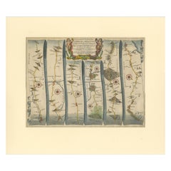
Original Antique Map of the Road from Marlborough to Huntspil
Located in Langweer, NL
Antique map titled 'The Continuation of the Road from London to Bristol (..)'. A strip map of the continuation of the road from London to Bristol, this particular sheet showing the r...
Category

Antique 17th Century More Furniture and Collectibles

Materials

Paper

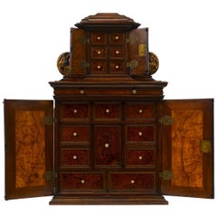
Rare 17th Century Baroque Cabinet, South Germany Probably Augsburg, Wunderkammer
Located in Worpswede / Bremen, DE
A small architectural table cabinet, veneered in walnut and mulberry, the centre doors enclosing an arrangement of nine various sized drawers with bone knobs, behind a central door a...
Category

German Baroque Antique 17th Century More Furniture and Collectibles

Materials

Brass

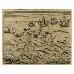
Old Print of Ascension Island with Ships, a Whale and Flying Fish, 1601
Located in Langweer, NL
Antique print, titled: 'Vera effigies et delineato Insulae Ascenstio …' - Bird's eye view of Ascension Island. Five large sailing ships in the background and flying fish and waterfowl in the foreground. On the rear an image of four ships sailing towards a whale, accompanied by fowl, flying fish and dolphins. From 'Indiae Orientalis', 1598-1604. Artists and Engravers: Made by an anonymous engraver after 'Jean Theodore de Bry...
Category

Antique 17th Century More Furniture and Collectibles

Materials

Paper

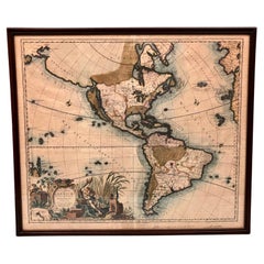
America Septentrionalis by Carroli Allard (1648-1709) Copper Plate Engraving
Located in San Francisco, CA
"Recentissuma Novi Orbis Sive Americae Septentrionale et Meriodionalis" A hand-colored copper plate engraving of North and South America by Carel Allard depicting recent discoveries...
Category

Dutch Antique 17th Century More Furniture and Collectibles

Materials

Paper

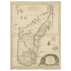
Antique Map of Madagascar by Mariette 'c.1670'
Located in Langweer, NL
Antique map titled 'Isle Dauphine communement nommée par les Europeens Madagascar, et St. Laurens (..)'. Original large-scale antique map of Madagascar...
Category

Antique 17th Century More Furniture and Collectibles

Materials

Paper

SHAHKAR Antique 17th Century Flemish Verdure Tapestry Pillow with Foliage
Located in New York, NY
Stunning 17th Century Verdure Tapestry pillow with foliage that will brighten up any sofa, canapé or settee! Tan velvet backing in excellent condition. It measures 10 x 11 inches. C...
Category

Belgian Baroque Antique 17th Century More Furniture and Collectibles

Materials

Tapestry

Antique Map of the Islands Near Ceylon by Baldaeus, 1672
Located in Langweer, NL
Antique print, untitled. This original antique print shows the islands Leyden, Middelburg, Hammenhiel, Bramines, Dona Clara and Deserta near Ceylon / Sri Lanka, with their Dutch name...
Category

Antique 17th Century More Furniture and Collectibles

Materials

Paper

Antique Print of the City of Hukoen in China, 1668
Located in Langweer, NL
Antique print China titled 'Hukoen of ou Hukeu'. Old print depicting a view on the Chinese city of Hukoen with its ramparts. This print originates ...
Category

Antique 17th Century More Furniture and Collectibles

Materials

Paper

Antique Map of Piedmonte and Savoie 'Italy' by N. Visscher, circa 1683
Located in Langweer, NL
Antique map titled 'Regiae Celsitudinis Sabaudicae Status consistens in Sabaudiae ac Montisferrati Ducatus, Pedemontii Principatum (..). This map originates from 'Atlas Minor Sive Ge...
Category

Antique 17th Century More Furniture and Collectibles

Materials

Paper

Antique Detailed World Map Drawn on Mercator's Projection, 1700
Located in Langweer, NL
Antique world map titled 'Carte generale du monde, ou description du monde terrestre & Aquatique - Generale Waereld kaart, of beschryving van de land en water waereld'. This is Pierr...
Category

Antique 17th Century More Furniture and Collectibles

Materials

Paper

Antique Map of the Region of Touraine by Janssonius 'circa 1650'
Located in Langweer, NL
Antique map of France titled 'Touraine - Turonensis Ducatus'. Decorative map of the Touraine region, France. It shows the cities of Tours, Amboise and others. Published by J. Jansson...
Category

Antique 17th Century More Furniture and Collectibles

Materials

Paper

Antique Hand-Colored Map of Western Russia and Ukraine, c.1680
Located in Langweer, NL
Description: Antique map titled 'Novissima et Accuratissima Totius Russiae vulgo Muscoviae Tabula'. Antique map of Western Russia and Ukraine, published by Justus Danckerts. The ma...
Category

Antique 17th Century More Furniture and Collectibles

Materials

Paper

1638 Plancius Detailed Map of Sri Lanka or Ceylon with Decorative Cartouches
Located in Langweer, NL
"1638 Plancius Detailed Map of Sri Lanka with Decorative Cartouches" This beautifully detailed map of Sri Lanka, titled "Ins. Ceilan," was engraved by P. Plancius from a design by C...
Category

Antique 17th Century More Furniture and Collectibles

Materials

Paper

Antique Map of Germany from a 17th Century Pocket Atlas, 1685
Located in Langweer, NL
Antique map titled 'Nova Totius Germaniae descriptio.' Miniature map of Germany, from the pocket atlas 'Introductionis in Universam Geographiam tam Veterem...
Category

Antique 17th Century More Furniture and Collectibles

Materials

Paper

Antique 17th century carved wooden statue from Saint Joseph With The Child Jesus
Located in Bilzen, BE
Wooden statue representing Joseph and the child Jesus from the 17th century, carved in walnut. Aged patina Height 30 cm.
Category

Baroque Antique 17th Century More Furniture and Collectibles

Materials

Wood

1608 Hispaniae Novae Sive Magnae Vera Descriptio Framed Mexico Map
Located in Stamford, CT
1608 Hispaniae Novae Sive Magnae Vera Descriptio Framed Mexico Map. As found custom black wooden frame/ matting. This map is based on the work of Abraham Ortelius as is an example o...
Category

Mexican Spanish Colonial Antique 17th Century More Furniture and Collectibles

Materials

Glass, Wood, Paper

Very Rare Antique Print of the Kings Celebrations in Pegu, Myanmar, 1682
Located in Langweer, NL
Plate: 'Konings feesten tot Pegu.' (Kings celebrations in Pegu.) On this plate: 1. The King. 2. And the Queen, sprinkling water on each other. 3. Their children. 4. Officers. 5. ...
Category

Antique 17th Century More Furniture and Collectibles

Materials

Paper

Antique Map of the West African Coast and the Cape Verde Islands, c.1680
Located in Langweer, NL
Antique map Africa titled 'Isles du Cap Verd Coste et Pays des Negres'. Antique map of the coast of Africa and the Cape Verde islands. Artists and...
Category

Antique 17th Century More Furniture and Collectibles

Materials

Paper

Les Fables d'Esope Phrigien avec celles de Philelphe [Aesop's Fables, 1708]
Located in Middletown, NY
A RARE EARLY EDITION OF AESOPIC LITERATURE, BEAUTIFULLY ILLLUSTRATED. Les Fables d'Esope Phrigien avec celles de Philelphe; traduction nouvelle, Enrichie de Discours Moraux et Histor...
Category

Dutch Antique 17th Century More Furniture and Collectibles

Materials

Gold Leaf

Old Map of the Bourbonnais Region of France, ca.1630
Located in Langweer, NL
Antique map titled 'Bourbonois - Borbonium Ducatus'. Old map of the Bourbonnais region of France. Bourbonnais was a historic province in the centre of France that corresponds to ...
Category

Antique 17th Century More Furniture and Collectibles

Materials

Paper

Antique Map of the Island of Tinos by Dapper, 1687
Located in Langweer, NL
Antique map titled 'Tino.' This original antique map shows the island of Tinos, Greece. Source unknown, to be determined. Artists and Engravers: Made by 'Olfert Dapper' after an a...
Category

Antique 17th Century More Furniture and Collectibles

Materials

Paper

Cartographic Depiction of Flensburg and Surrounding Territories, Anno 1648
Located in Langweer, NL
Title: Landtcarte Vonn dem Ambte Flensborg, ohne Nordgoeßherde. Anno 1648. Description: This exquisitely detailed and old coloured map of Flensburg was crafted by the noted cartogr...
Category

Antique 17th Century More Furniture and Collectibles

Materials

Paper

Rhine Splendor: Antique Map of the Lower Rhine Region, circa 1680
Located in Langweer, NL
The antique map titled 'Novissima et Accuratissima Archiepiscopatus et Electoratus Coloniensis Ducatuum Iuliancensis et Montensis et Meursiae Comitatus' is a handsome and detailed ma...
Category

Antique 17th Century More Furniture and Collectibles

Materials

Paper

Circa 1659 Blaeu Family Map: Glogau and the Odra River Valley, Silesia
Located in Langweer, NL
Circa 1659 Blaeu Family Map: Glogau and the Odra River Valley, Silesia This hand-colored map from circa 1659 by the Blaeu Family, titled "Ducatus Silesiae Glogani Vera Delineatio," provides a detailed view of the Odra River valley in western Poland, centered around the city of Glogau. The map, based on the work of Silesian cartographer Jonas Scultetus, is oriented with north to the left. It intricately details forests, rivers, lakes, and numerous small villages. A large decorative title cartouche features an ornate coat of arms and a key to the map's symbols. The bottom right includes a finely crafted scale of miles cartouche, adorned with calipers and a pair of falcons. Published between 1659 and 1672, the map has Spanish text on the verso. Measuring 19.9 inches wide by 16.4 inches high, it is in good condition with full contemporary color on a bright sheet, a watermark of the god Atlas, some marginal soiling, and a few short tears along the edges. Keywords: - Blaeu Family map - Silesia historical map - Glogau map - Odra River valley - 17th-century Poland map - Jonas Scultetus - Decorative cartouches - Historical cartography - Antique maps of Poland...
Category

Antique 17th Century More Furniture and Collectibles

Materials

Paper

1634 Mercator/Jansson Map: Eastern Austria with Vienna, Hand-Colored
Located in Langweer, NL
1634 Mercator/Jansson Map: Eastern Austria with Vienna, Hand-Colored This hand-colored map from 1634, titled "Austria Archiducatus," by Mercator and Jansson, depicts the eastern reg...
Category

Antique 17th Century More Furniture and Collectibles

Materials

Paper

Charming Miniature Map of Thrace or Thrake in Southeast Europe, 1685
Located in Langweer, NL
Antique map titled 'Thraciae Descriptio.' Charming miniature map of Thrace, from the pocket atlas 'Introductionis in Universam Geographiam tam Veterem quam novam .. Acessit P. Be...
Category

Antique 17th Century More Furniture and Collectibles

Materials

Paper

Original Antique Map the Imperial States of the Habsburg Netherlands, 1609
Located in Langweer, NL
Antique map titled 'Belgii inferioris descriptio (..)'. Old map of the Seventeen Provinces, the Imperial states of the Habsburg Netherlands in the 16th century. They roughly cove...
Category

Antique 17th Century More Furniture and Collectibles

Materials

Paper

Antique Map of the Strait of Malacca, Malay Peninsula & Dutch Indies, c.1670
Located in Langweer, NL
Antique map titled 'Indiae Orientalis, nec non Insularum Adiacentium Nova Descriptio.' Map of Southeast Asia. The map centers on the Strait of Malacca and Malay Peninsula. It ext...
Category

Antique 17th Century More Furniture and Collectibles

Materials

Paper

French Censer / incense burner / Church clock / perfume burner - Bronze - 17th
Located in Beuzevillette, FR
Very beautiful baluster censer decorated with gadroons from the Louis XIV period. This censer / incense burner / church clock / perfume burner in openwo...
Category

French Louis XIV Antique 17th Century More Furniture and Collectibles

Materials

Bronze

1698 Mercator Ptolemaic Map of Asia East of the Ganges
Located in Langweer, NL
**Catalogue Description:** **Title:** Tab. XI. Asiae, comprehendens Indiam extra Gangem. **Description:** This is an exquisite Ptolemaic map depicting Asia east of the Ganges, ti...
Category

Antique 17th Century More Furniture and Collectibles

Materials

Paper

Bird’s-Eye View Map of Gallipoli: Fortified Ionian Gem by Mattheus Merian, 1688
Located in Langweer, NL
Bird’s-Eye View Map of Gallipoli: Fortified Ionian Gem by Mattheus Merian Description: This exquisitely detailed map of Gallipoli, crafted by the renowned engraver Mattheus Merian,...
Category

Antique 17th Century More Furniture and Collectibles

Materials

Paper

La femme demasquée ou l'amour peint selon l'usage nouveau – Quesnot de La Chênée
Located in Middletown, NY
Quesnot de La Chênée, Jean-Jacques La femme démasquée ou l'amour peint selon l'usage nouveau la Haye (The Hague): Jacob van Ellinckhuysen, 1698. First Edition. 12mo, 5 x 2 3/4 inc...
Category

French Antique 17th Century More Furniture and Collectibles

Materials

Gold Leaf

Gallipoli Fortifications: A 1688 Engraved Bird’s-Eye Map by Mattheus Merian
Located in Langweer, NL
Gallipoli Fortifications: A 1688 Bird’s-Eye Map by Mattheus Merian Description: This exquisitely detailed map of Gallipoli, crafted by the renowned engraver Mattheus Merian, offers ...
Category

Antique 17th Century More Furniture and Collectibles

Materials

Paper

Old Handcolored Antique Map of Pays De Caux in Normandy, France, ca.1640
Located in Langweer, NL
Antique map titled 'Le Pais de Caux'. Old map of Pays de Caux, France. Pays de Caux is an area in Normandy occupying the greater part of the French département of Seine Maritime ...
Category

Antique 17th Century More Furniture and Collectibles

Materials

Paper

Map of Northwestern Switzerland (Basel and Zurich Region) by Willem & Jan Blaeu
Located in Langweer, NL
Map of Northwestern Switzerland by Willem & Jan Blaeu (Circa 1650) This is a detailed map of Northwestern Switzerland, specifically depicting the region between Basel and Zurich, cr...
Category

Antique 17th Century More Furniture and Collectibles

Materials

Paper

Elaborately Decorated 17th Century Studded Leather Traveling Trunk
Located in Greenwich, CT
A fantastic 17th century Dutch traveling trunk in russia leather with elaborate brass stud decoration to front and top in the form of swirling flowers in geometric patterns with central winged cherub pull plate...
Category

Dutch Antique 17th Century More Furniture and Collectibles

Materials

Brass

Antique Map of the City of Leeuwarden by Priorato, 1673
Located in Langweer, NL
Antique map titled 'Leverden'. This map depicts the city of Leeuwarden (Friesland, The Netherlands). This original antique print originates from 'Teatro del Belgio (…)', published in...
Category

Antique 17th Century More Furniture and Collectibles

Materials

Paper

Antique Map of the Iberian Peninsula with two decorative Cartouches
Located in Langweer, NL
Antique map titled 'Hispaniae et Portugalliae Regna'. Original old map of the Iberian peninsula showing Spain, Portugal and the Balearic Islands. Two beautiful cartouches with severa...
Category

Antique 17th Century More Furniture and Collectibles

Materials

Paper

1627 Hondius Map "La Principaute d'Orange et Comtat de Ve", Ric.0003
Located in Norton, MA
1627 Hondius map entitled "La Principaute d'Orange et Comtat de Venaissin," Original Hand-Colored Description: From Johannes Janssonius's Atlantis Maioris Appendix of 1630. ...
Category

Unknown Antique 17th Century More Furniture and Collectibles

Materials

Paper

Cartographic Elegance: The Art and Science of 17th-Century Asian Maps, ca.1681
Located in Langweer, NL
This original antique map is an artifact from a pivotal era in cartography, reflecting not only the geographical knowledge of its time but also the intertwining of art and science in...
Category

Antique 17th Century More Furniture and Collectibles

Materials

Paper

1692 Engraved Map: Detailed Mogul Empire, India to Afghanistan, Hand-Colored
Located in Langweer, NL
1692 Map of the Mogul Empire by Jacques Peeters This finely engraved map, published in 1692 by Jacques Peeters, showcases the Mogul Empire region, covering areas from northern India...
Category

Antique 17th Century More Furniture and Collectibles

Materials

Paper

Antique Map of the Hainaut Region 'France' by F. de Wit, circa 1680
Located in Langweer, NL
Antique map titled 'Comitatus Hannoniae et Episcopatus Cambresis Descriptio'. Large map of the Hainaut region, France. Published by F. de Wit, circa 1680.
Category

Antique 17th Century More Furniture and Collectibles

Materials

Paper

Antique Print of Chinese Vessels Near Lantam, China, 1665
Located in Langweer, NL
Antique print titled 'Lantam'. Old print depicting Chinese ships on the coast of Lantam. Also depicted are Chinese village houses. This print originates f...
Category

Antique 17th Century More Furniture and Collectibles

Materials

Paper

Les Moeurs des Israelites by Claude Fleury
Located in Middletown, NY
A third edition in an attractive 19th-century binding of the influential work by the eminent French priest, historian and jurist Claude Fleury (1640 – 1723). It is an account of the ...
Category

Antique 17th Century More Furniture and Collectibles

Materials

Gold Leaf

Antique Map of the City of Zwolle by Guicciardini, 1613
Located in Langweer, NL
Antique map titled 'Swolla'. Map of the city of Zwolle, the Netherlands. This map originates from the 1613 edition of 'Discrittione di tutti i Paesi Bassi', by L. Guicciardini, publi...
Category

Antique 17th Century More Furniture and Collectibles

Materials

Paper

Rare Antique Map of Southwestern Europe and West Africa by V.M. Coronelli, 1692
Located in Langweer, NL
Antique Globe Gore: Southwestern Europe and West Africa by Vincenzo Coronelli This exquisite, hand-colored globe gore by Vincenzo Coronelli, one of the most renowned 17th-century cartographers, represents Southwestern Europe and West Africa. A segment of Coronelli's monumental 42-inch terrestrial globe, this gore is a remarkable example of the artistry and geographical knowledge of the late 1600s. Covering France, the Iberian Peninsula, and all of Africa west of a line extending from Algeria to the Bight of Benin, it also includes the Canary Islands and Madeira. Coronelli’s globe gores are celebrated for their exceptional engraving and accuracy, and this piece is no exception. The coastline of Africa is depicted with remarkable precision for its time, reflecting the latest geographical knowledge of European explorers. In contrast, the interior of Africa—still a mystery to European mapmakers—features mythical elements such as fantastical mountain ranges and exotic fauna. Giraffes, elephants, lions, and mysterious giant birds populate the landscape, offering a glimpse into the imagination and curiosity of the era. One notable detail is the Gambia...
Category

Antique 17th Century More Furniture and Collectibles

Materials

Paper

Old Original Handcoloured Map of the Former Province of Perche, France, ca.1640
Located in Langweer, NL
Antique map titled 'Perchensis Comitatus - La Perche compte'. Old map of the former province of Perche, France. Until the French Revolution, Perche was bounded by four ancient te...
Category

Antique 17th Century More Furniture and Collectibles

Materials

Paper

Antique Map of the Burgundy Region by Merian '1646'
Located in Langweer, NL
Antique map titled 'Utriusque Burgundiae tum Ducatus tum Comitatus descriptio'. Old map of the Burgundy (Bourgogne) region of France. This map originates from 'Neuwe Archontologia co...
Category

Antique 17th Century More Furniture and Collectibles

Materials

Paper

Antique Map of the City of Kampen by Guicciardini, 1613
Located in Langweer, NL
Antique map titled 'Urbis Campensis (..)'. Plan of the city of Kampen, the Netherlands. This map originates from the 1613 edition of 'Discrittione di tutti i Paesi Bassi', by L. Guic...
Category

Antique 17th Century More Furniture and Collectibles

Materials

Paper

Antique Map of the City of Leeuwarden by Bast, 1603
Located in Langweer, NL
Antique map titled 'Leeuwerden de hooft stadt van Frislant. Leoverdia Metropolis Frisiae (…) 1603.' Very rare plan of Leeuwarden, Friesland, The Netherlands. With several carouches a...
Category

Antique 17th Century More Furniture and Collectibles

Materials

Paper

Antique Map of Zeeland, The Netherlands, by Jaillot, 1693
Located in Langweer, NL
Antique map titled 'Le Comte de Zeelande (..).' Detailed map of the province of Zeeland, The Netherlands. Details shown include fortified towns, roads, sandbanks and marshlands. Base...
Category

Antique 17th Century More Furniture and Collectibles

Materials

Paper

Old Map of Morocco, The Canary Islands, Madeira, Inset of Penon de Velez, 1605
Located in Langweer, NL
Antique map titled 'Fessae et Marocchi Regna'. Original antique map of Morocco, extending south to Cape Bojador and , north to the Spanish Coast. Inset of Penon de Velez. Artists and...
Category

Antique 17th Century More Furniture and Collectibles

Materials

Paper

Old Copper Engraving of the City of Kajutsiu in China, 1668
Located in Langweer, NL
Antique print China titled ‘Kajutsiu'. This plate shows a view on the Chinese city of Kajutsiu. This print originates from the Latin edition of Nie...
Category

Antique 17th Century More Furniture and Collectibles

Materials

Paper

Antique Engraving of the Statue of the Mythologic Hero Meleager, Rome. 1660
Located in Langweer, NL
Description: Antique print, titled: 'Meleager in Aedibus Pichinys.' Statue of Meleager in Rome. In Greek mythology, Meleager was a hero venerated in his temenos at Calydon in Aetolia. He was already famed as the host of the Calydonian boar hunt in the epic tradition that was reworked by Homer. From the 1660 Dutch edition of 'Icones et Segmenta Nobil. Signorum et Statuarum quae Romae extant' by Francois Perrier...
Category

Antique 17th Century More Furniture and Collectibles

Materials

Paper

Antique Map of Batavia, Dutch East Indies, Nowadays Jakarta, Indonesia, ca.1669
Located in Langweer, NL
Antique map titled 'Ware afbeeldinge wegens het Casteel ende Stadt Batavia gelegen opt groot Eylant Java Anno 1679. Plan de la Ville et du Chateau de Batavia en l'Isle de Iava. 1679....
Category

Antique 17th Century More Furniture and Collectibles

Materials

Paper

Original Old & Rare View of the City of Workum, Friesland, The Netherlands, 1616
Located in Langweer, NL
Antique map titled 'Worcum'. This print depicts the city of Workum (Friesland, The Netherlands). With German captions. This print originates from 'Rerum Frisicarum Historia' publishe...
Category

Antique 17th Century More Furniture and Collectibles

Materials

Paper

Antique Miniature Map of Java by Bertius '1618'
Located in Langweer, NL
Antique miniature map titled 'Iava Maior'. Rare miniature map of Java, Indonesia. This map originates from 'Tabularum Geographicarum Contractarum Libri s...
Category

Antique 17th Century More Furniture and Collectibles

Materials

Paper

Read More

Medal-Worthy Memorabilia from Epic Past Olympic Games

Get into the games! These items celebrate the events, athletes, host countries and sporting spirit.

Ahoy! You’ve Never Seen a Collection of Sailor Art and Kitsch Quite Like This

French trendsetter and serial collector Daniel Rozensztroch tells us about his obsession with objects related to seafaring men.

39 Incredible Swimming Pools

It's hard to resist the allure of a beautiful pool. So, go ahead and daydream about whiling away your summer in paradise.

Pamela Shamshiri Shares the Secrets behind Her First-Ever Book and Its Effortlessly Cool Interiors

The sought-after designer worked with the team at Hoffman Creative to produce a monograph that beautifully showcases some of Studio Shamshiri's most inspiring projects.

Moroccan Artworks and Objects Take Center Stage in an Extraordinary Villa in Tangier

Italian writer and collector Umberto Pasti opens the doors to his remarkable cave of wonders in North Africa.

Montecito Has Drawn Royalty and Celebrities, and These Homes Are Proof of Its Allure

Hollywood A-listers, ex-pat aristocrats and art collectors and style setters of all stripes appreciate the allure of the coastal California hamlet — much on our minds after recent winter floods.

Whaam! Blam! Pow! — a New Book on Pop Art Packs a Punch

Publishing house Assouline and writer Julie Belcove have teamed up to trace the history of the genre, from Roy Lichtenstein, Andy Warhol and Yayoi Kusama to Mickalene Thomas and Jeff Koons.

The Sparkling Legacy of Tiffany & Co. Explained, One Jewel at a Time

A gorgeous new book celebrates — and memorializes — the iconic jeweler’s rich heritage.
Recently Viewed

View All