Collectibles and Curiosities on Sale

  • The Design Lover's Sale

    Enjoy up to 60% off through May 27.

    Plus, get free delivery on art, fashion & decor over $500 with code FREESHIP

    Terms & Conditions
853
to
796
52
853
853
853
39
6
4
4
3
2
2
1
1
1
1
1
845
1,377
149
333
578
248
40
31
57
97
62
118
105
81
47
44
741
82
29
12
10
125
37
22
14
11
16
8
6
5
4
Sale Items
Period: 18th Century and Earlier
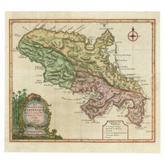
Antique Map of Martinique with Title Cartouche Garnished with Sugar Cane, c.1760
Located in Langweer, NL
Antique map titled 'Het Westindisch Eiland Martenique'. Decorative map of Martinique filled with good detail of roads, topography, soundings, villages, windmills, and plantations. Th...
Category

Antique 18th Century Maps

Materials

Paper

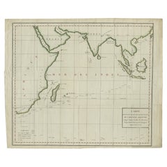
Old Map of Indian Ocean & Sumatra, Java, Borneo, India, Arabia, Africa, c.1783
Located in Langweer, NL
Antique map titled 'Carte des Declinaisons et Inclinaisons de L'Aiguille Aimantée redigée d'après la table des observations Magnetiques faites par les Voyageurs depuis l'Année 1775'....
Category

Antique 1780s Maps

Materials

Paper

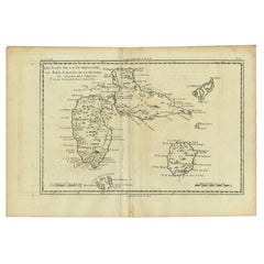
Antique Map of Guadeloupe with Les Saintes, Grand Bourg and La Désirade, c.1780
Located in Langweer, NL
Antique map titled 'Les Isles de la Guadeloupe (..).' Map of the Caribbean Island of Guadeloupe with the surrounding islands Les Saintes, Grand Bourg and La Désirade. Source unknow...
Category

Antique 18th Century Maps

Materials

Paper

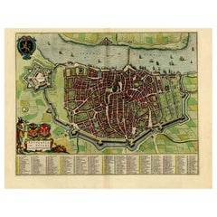
Beautiful Original Antique Map of Antwerp, Belgium by Mapmaker Blaeu, ca.1652
Located in Langweer, NL
Description: Antique map titled 'Antverpia; Gallis Anvers. Vernacule Antwerpen.' A very nicely coloured plan of Antwerp in Flanders, Belgium. West-oriented, with the river Scheld...
Category

Antique 1650s Maps

Materials

Paper

French Antique Map of France and Western Europe, 1765
By G. A. Rizzi-zannoni
Located in Langweer, NL
Antique map titled 'Carte de tous les Lieux, célébres dans l'Histoire (..)'. Beautiful old map of France and western Europe. This map originates from 'Atlas Historique de la France A...
Category

Antique 18th Century Maps

Materials

Paper

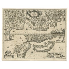
Map of Japanese Coast from Osaka to Tokyo & the Kyushu and Shikoku Islands, 1669
Located in Langweer, NL
Antique map titled 'De Land Reyse van Osacca to Iedo. De Water eyse van Nangasacqui tot Osacca.' Two maps on one sheet. The top map shows the Japanese coast from Osaka to Tokyo (Jedo). The lower map shows the strait between mainland Japan and the two large islands...
Category

Antique 1660s Maps

Materials

Paper

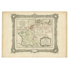
Antique Map of France in the 5th Century by Zannoni, 1765
Located in Langweer, NL
Antique map France titled 'Etat de la Gaule (..)'. Beautiful old map of France. This map originates from 'Atlas Historique de la France Ancienne et Moderne' by M. Rizzi Zannoni. ...
Category

Antique 18th Century Maps

Materials

Paper

Antique Sea Chart of the Shetland Islands, Scotland, ca.1745
Located in Langweer, NL
Antique map of Scotland titled 'Nieuwe Paskaard van Hitland met de daar omleggende eylanden na de nieuwe aftekening gemaakt by den Lofwaarden en onvermoeyden Hit en Zeeman Ian Bruyst...
Category

Antique 1740s Maps

Materials

Paper

Antique Frontispiece of Book about The Turkish Empire in Asia and Africa, 1733
Located in Langweer, NL
Antique frontispiece of the 5th volume of 'Hedendaagsche historie of tegenwoordige staat van allen volkeren (..)' by Thomas Salmon. This volume describes the...
Category

Antique 18th Century Prints

Materials

Paper

Early Chart Identifying British Spice Trading Colony of Bencoolen, Sumatra, 1797
Located in Langweer, NL
Antique map titled 'A Chart of the West Coast of Sumatra'. Early nautical chart identifying the British spice trading colony of Bencoolen and F...
Category

Antique 1790s Maps

Materials

Paper

Map of East Frisian Islands & Northwestern Tip of Germany, Ostfriesland, c.1595
Located in Langweer, NL
Antique map titled 'Frisia Orientalis'. Beautiful map of east Frisian islands and the northwestern tip of Germany, Ostfriesland. With people in local costumes. Ornamented inset of the Eems estuary. Based on a manuscript map...
Category

Antique 16th Century Maps

Materials

Paper

Antique Map of New Ireland Island in the Bismarck Archipelago, New Guinea, 1772
Located in Langweer, NL
Antique map titled 'Nova Hibernia'. Antique map of New Ireland, an island in the Bismarck Archipelago, New Guinea. Lying just north of New Britain, from which it is separated by St. ...
Category

Antique 18th Century Maps

Materials

Paper

Rare Engraved Antique Map of India with Elephants in the Cartouche, c.1725
Located in Langweer, NL
Antique map titled 'L'Inde de ca le Gange suivant les nouvelles observations (..)'. Detailed map of India, with part of Sri Lanka. Compass rose and decorative cartouche lower rig...
Category

Antique 18th Century Maps

Materials

Paper

Antique Colourful Map of the Island of Java and Madura, Indonesia, C.1760
Located in Langweer, NL
Antique map titled 'Nouvelle Carte de l'Isle de Java'. Chart of the island of Java, depicting soundings around the coast, all principal harbors, rivers and elevations, bays and p...
Category

Antique 18th Century Maps

Materials

Paper

Nice Antique Map of the Empire of Japan. Centered on the Bay of Osaka, ca.1752
Located in Langweer, NL
Antique map titled 'Carte de L'Empire de Japon (..).' Map of the Empire of Japan. Centered on the Bay of Osaka, this map covers from Hirado (here identified as I. Firando) and Naga...
Category

Antique 1750s Maps

Materials

Paper

Two Antique Sea Charts of the Thousand Islands between Batavia and Bantam, c1734
Located in Langweer, NL
Antique maps titled 'A large draught of the Coast of Iava from Bantam Point to Batavia'. Two seperate sheets, joined together they depict the island of Java, Indonesia. Condition...
Category

Antique 1730s Maps

Materials

Paper

Rare Old English Sea Chart of Part of Indonesia with Java, Madura and Bali, 1711
Located in Langweer, NL
Antique map titled 'A Large Draught of the East End of Java and Madura shewing the Streights of Bally.' Rare early example of this working English Sea Chart of part of Indonesia ...
Category

Antique 1710s Maps

Materials

Paper

Antique Map of France under the Reign of Francois I, 1765
Located in Langweer, NL
Antique map France titled 'Etat des Possessions de la Couronne (..)'. Beautiful old map of France. This map originates from 'Atlas Historique de la France Ancienne et Moderne' by...
Category

Antique 18th Century Maps

Materials

Paper

Scarce Plate Showing the Four Evangelists; John, Matthew, Marc and Luke, 1762
Located in Langweer, NL
Description: Antique print titled 'S. Johannes - S. Matthaeus - S. Marcus - S. Lucas'. Scarce plate showing the four evangelists; John, Matthew, M...
Category

Antique 1760s Prints

Materials

Paper

Antique Map of France under the Reign of Louis XIII by Zannoni, 1765
Located in Langweer, NL
Antique map France titled 'Tableau de la France sous Louis XIII (..)'. Beautiful old map of France. This map originates from 'Atlas Historique de la France Ancienne et Moderne' b...
Category

Antique 18th Century Maps

Materials

Paper

Old Print of Baltiysk or Pillau, a Seaport Town Near Kaliningrad, Russia, 1652
Located in Langweer, NL
Description: Antique print titled 'Pillau'. View of Baltiysk, known by its German name Pillau. A seaport town and the administrative center of Baltiysky District in Kaliningrad O...
Category

Antique 1650s Maps

Materials

Paper

Rare Antique Map of the Rio De La Plata, Buenos Ayres, Brazil, ca.1760
Located in Langweer, NL
Description: Antique map titled 'De Ingang van Rio de la Plata, Waar aan de Stad Buenos Ayres ligt, in Zuid-Amerika'. A map showing the Rio de la Plata es...
Category

Antique 1760s Maps

Materials

Paper

Antique Map of Java in The Dutch East Indies, Now Indonesia, c.1690
Located in Langweer, NL
Antique map titled 'Insulae Iavae cum parte insularum Boreno Sumatrae (..)'. Beautiful map of the Island of Java and part of Borneo, Bali, Madura and Sumatra. Artists and Engrave...
Category

Antique 17th Century Maps

Materials

Paper

Original Old Map of St Kitts, Antigua, Bermuda, Barbados, and Jamaica, ca.1745
Located in Langweer, NL
Antique map titled 'Dominia Anglorum in praecipuis Insulis Americae ut sunt Insula S. Christophori, Antegoa, Iamaica, Barbados nec non Insulae Bermudes vel Sommers dictae. Die Englis...
Category

Antique 1740s Maps

Materials

Paper

Antique Map of France by Zannoni, 1765
Located in Langweer, NL
Antique map titled 'La France divisée en ses LVIII Provinces (..)'. Beautiful old map of France. This map originates from 'Atlas Historique de la France Ancienne et Moderne' by M. Ri...
Category

Antique 18th Century Maps

Materials

Paper

Antique Map of France under the Reign of Charles VII by Zannoni, 1765
Located in Langweer, NL
Antique map France titled 'La France sous le Règne de Charles VII (..)'. Beautiful old map of France. This map originates from 'Atlas Historique de la ...
Category

Antique 18th Century Maps

Materials

Paper

Antique Map of France under the Reign of Philip II by Zannoni, 1765
Located in Langweer, NL
Antique map France titled 'La France sous les Regne de Philippe Auguste (..)'. Beautiful old map of France. This map originates from 'Atlas Historique de la France Ancienne et Mo...
Category

Antique 18th Century Maps

Materials

Paper

Copper Engraving of Kamchadal Men from Kamchatka, Russia, 1770
Located in Langweer, NL
Description: Antique print titled 'Habillemens des Kamtchadals'. Copper engraving of Kamchadal men. This print originates from volume 19 of 'Histoire generale des voyages (..)' by Antoine Francois Prevost d'Exile. Artists and Engravers: Published by Panckoucke. The Kamchadals inhabit Kamchatka, Russia. The name "Kamchadal" was applied to the descendants of the local Siberians and aboriginal peoples (the Itelmens, Ainu, Koryaks and Chuvans) who assimilated with the Russians. The descendants of the mixed-blood Russian settlers in 18th-19th century are called Kamchadals these days. The Kamchadals speak Russian with a touch of local dialects of the aboriginal languages of Kamchatka. The Kamchadals engage in fur trading...
Category

Antique 1770s Prints

Materials

Paper

Antique Map with Details of Berings' Expedition into Russians' Far East, 1737
Located in Langweer, NL
Antique map titled 'Carte Des Pays traverses par le Capne. Beerings depuis la Ville de Tobolsk jusqua'a Kamtschatka'. This is the first printed map to illustrate Vitus Bering's fir...
Category

Antique 1730s Maps

Materials

Paper

Beautiful Large Scale Map of Spain and Portugal Published by Herman Moll in 1711
Located in Langweer, NL
Title: A New and Exact Map of Spain & Portugal Author: Herman Moll Date: 1711 Medium: ?Hand-colored copperplate engraving Condition: Very good - light age toning, light wear and discoloration along issued quatrefolds, surface dirt, minor creasing throughout,. Large engraved map on two conjoined sheets, contemporary outline colouring with some later enhancement inches. Herman Moll (c. 1654-1732) was one of the most important London mapmakers in the first half of the eighteenth century. Moll was probably born in Bremen, Germany, around 1654. He moved to London to escape the Scanian Wars. His earliest work was as an engraver for Moses Pitt on the production of the English Atlas, a failed work which landed Pitt in debtor's prison. Moll also engraved for Sir Jonas Moore, Grenville Collins, John Adair, and the Seller & Price firm. He published his first original maps in the early 1680s and had set up his own shop by the 1690s. Moll's work quickly helped him become a member of a group which congregated at Jonathan's Coffee House at Number 20 Exchange Alley, Cornhill, where speculators met to trade stock. Moll's circle included the scientist Robert Hooke...
Category

Antique 1710s Maps

Materials

Paper

Rare Antique Map of Japan with Place Names Given in Dutch Nomenclature, 1726
Located in Langweer, NL
Antique map titled 'Nieuwe Kaart van het Eyland Japan'. Rare map of Japan, it shows each of the Japanese provinces, with place names along the route from Nagasaki to Edo. The place...
Category

Antique 18th Century Maps

Materials

Paper

Antique 17th Century Map of the Islands Near Ceylon or Sri Lanka, 1672
Located in Langweer, NL
Antique map titled 'Eyland Ceylon.' Map of the islands near Ceylon or Sri Lanka. Dutch text on verso. Source unknown, to be determined. Artists and Engravers: Philip Baldaeus (1632-...
Category

Antique 17th Century Maps

Materials

Paper

Antique Map of Eastern Tartary, now the Primorsky Krai Area, Russia, 1758
By Jakob van der Schley
Located in Langweer, NL
Antique map titled 'Carte de la Tartarie orientale.' A map of Eastern Tartary. East Tartary is an old names for the Manchu-inhabited territory extending from the River Amur to Sakhal...
Category

Antique 18th Century Maps

Materials

Paper

Antique Map of the Dutch Province of Gelderland with Zutphen as Capital, C.1650
Located in Langweer, NL
Antique map titled 'Ducatus Gelriae pars Tertia quae est comitatus Zutphaniensis'. Old map of the province of Gelderland, the Netherlands. The city of Zutphen can be found in the mid...
Category

Antique 17th Century Maps

Materials

Paper

Unique Antique Projection of the World with Twice California as an Island, c1703
Located in Langweer, NL
Description: Antique map of the world. Printed for Scherer's 'Atlas Novus' (1702-1710). On this old engraving you can find California as an Island twice! Rare! Artists and Eng...
Category

Antique Early 1700s Maps

Materials

Paper

Antique Map of France in the 7th Century by Zannoni, 1765
Located in Langweer, NL
Antique map France titled 'La France sous le VIIe Siècle (..)'. Beautiful old map of France. This map originates from 'Atlas Historique de la France Ancienne et Moderne' by M. Rizzi ...
Category

Antique 18th Century Maps

Materials

Paper

Antique Map of Friesland with Four Coats of Arms, 1664
Located in Langweer, NL
Antique map titled 'Typus Frisiae inter Fevum et Lavicam'. Original antique map of the province of Friesland, the Netherlands. Also shows the Wadden islands Vlieland, Terschelling and Ameland and part of Schiermonnikoog. With a decorative cartouche with two putti, livestock and cheese and milk barrels. Four coats...
Category

Antique 17th Century Maps

Materials

Paper

Large Antique Map of New Guinea and New Britain Showing Capt. Cooks Tract, 1773
Located in Langweer, NL
Antique map titled 'A Chart of Captain Carteret's Discoveries at New Britain, with part of Captain Cooke's Passage thro Endeavour Streights, & of Captain Dampier's tract & discoverie...
Category

Antique 18th Century Maps

Materials

Paper

Antique Map of Choromandel, Golconda and Orixa, Malabar, India, 1744
By Philip Baldaeus
Located in Langweer, NL
Antique map titled 'Regionum Choromandel, Golconda (..).' Handsome map of Choromandel, Golconda and Orixa, published in 'The True and Exact Description of the Most Celebrated East - ...
Category

Antique 18th Century Maps

Materials

Paper

Antique City View and Map of IJlst, City in Friesland, Holland, Framed, 1664
Located in Langweer, NL
Antique map titled 'Ylst'. Old map and city view of the city of IJlst, Friesland. This map originates from 'Beschrijvinge van de Heerlyckheydt van Frieslandt' by B. Schotanus à Sterr...
Category

Antique 17th Century Maps

Materials

Paper

Antique Map of France under the Reign of Charles IX by Zannoni, 1765
Located in Langweer, NL
Antique map France titled 'Tableau du Domaine sous Charles IX (..)'. Beautiful old map of France. This map originates from 'Atlas Historique de la France An...
Category

Antique 18th Century Maps

Materials

Paper

Antique Map of France under the Reign of Francois II, 1765
Located in Langweer, NL
Antique map France titled 'La Bretagne et le Cté de Penthièvre (..)'. Beautiful old map of France. This map originates from 'Atlas Historique de la France Ancienne et Moderne' by M. ...
Category

Antique 18th Century Maps

Materials

Paper

Antique Map of the Island Java, Indonesia, c.1650
Located in Langweer, NL
Antique map titled 'Insulae Iavae cum parte insularum Boreno Sumatrae (..)'. Beautiful map of the island of Java and part of Borneo, Bali, Madura and Sumatra. With decorative carto...
Category

Antique 17th Century Maps

Materials

Paper

Antique Hand-Coloured Map of North and South America, ca.1765
Located in Langweer, NL
Description: Antique map titled 'Nieuwe Kaart van Amerika.' Attractive map of North and South America, the western part of Africa and south west Europe. Source unknown, to be determi...
Category

Antique 1760s Maps

Materials

Paper

Important and Scarce Antique Map of Asia from Jesuit Sources, C.1713
Located in Langweer, NL
Antique map titled 'L'Asie selon les nouvelles observations de Messrs de l'Academie des Sciences etc'. The main focus of this important and scarce map of Asia is the delineation of the northeast part of the continent from Jesuit sources. The northeast coast is severely truncated with the discoveries of Nicolas Witsen shown, and the partial coastlines of Jesso and Compagnies Land are depicted to the north of Japan. Inset in the North Pacific is a map of that same region based on the information from Father Martino Martini. It shows Jesso connected to the mainland with a narrow strait between it and a huge Compagnies Land. An inset below, taken from Father Ferdinand Verbiest, illustrates the road between Peking and Kirin and Nincrita. Father Verbiest's world map of 1674, which he compiled for the Chinese, subsequently led to the Jesuits obtaining a commission to make a comprehensive topographical...
Category

Antique 18th Century Maps

Materials

Paper

Antique Map of France under the Reign of St. Louis by Zannoni, 1765
Located in Langweer, NL
Antique map France titled 'Le Domaine de la Couronne (..)'. Beautiful old map of France. This map originates from 'Atlas Historique de la France Ancienne et Moderne' by M. Rizzi Zann...
Category

Antique 18th Century Maps

Materials

Paper

Antique Map of Gloucestershire in Britain by Camden, 1637
Located in Langweer, NL
Antique map titled 'Glocestriae comitatus olim sedes Dobunorum'. Map of Gloucestershire, England. This map originates from Camden?s 'Britannia' ...
Category

Antique 17th Century Maps

Materials

Paper

Antique Map of Asia with Northern Portion of Australia “Hollandia Nova", 1727
Located in Langweer, NL
Antique map titled 'Exactissima Asiae Delineatio in praecipuas regiones Caeterasq Partes.' Original antique map of the continent of Asia with a northern portion of Australia “Holland...
Category

Antique 18th Century Maps

Materials

Paper

Stunning Decorative Antique Map of East Frisia with an Inset of Emden, c.1610
Located in Langweer, NL
Description: Antique map titled 'Typus Frisie Orientalis a Dullarto (..)'. One of the most decorative maps of East Frisia and its important shipping center of Emden and the Watten Is...
Category

Antique 1610s Maps

Materials

Paper

Striking Antique Map of Cayenne in French Guyana, South America, ca.1760
Located in Langweer, NL
Description: Antique map titled 'Land-kaart van het Eiland en de Volkplanting van Cayenne aan de Kust van Zuid-Amerika'. Striking map of the island and settlement of Cayenne in F...
Category

Antique 1760s Maps

Materials

Paper

Attractive Antique Hand-Coloured Map of South America, ca.1765
Located in Langweer, NL
Antique map titled 'Kaart van het Onderkoningschap van Peru zig uitstrekkende: over Chile, Paraguay en andere Spaansche Landen als ook van Brazil en verdere Bezittingen van Portugal ...
Category

Antique 1760s Maps

Materials

Paper

Scarce Plate of Saints Nilus and Bartholomew Kneeling for the Holy Virgin, 1762
Located in Langweer, NL
Description: Antique print titled 'Bma Virgo S. S. Nilum, et Bartholomæum pomo aureo donat'. Scarce plate of Saint Nilus and Saint Bartholomew kn...
Category

Antique 1760s Prints

Materials

Paper

Old Original Antique Map of the Islands of East Indonesia, 1756
Located in Langweer, NL
Title: Isles Moluques. Old and rare, this decorative map of the Maluku Islands in the period it was still controlled by the Dutch colonial power. It also shows the island of Bali, Lombok, part of Borneo (Kalimantan), Celebes (Sulawesi), Timor, The Lesser Sunda Islands, West Papua...
Category

Antique 1750s Maps

Materials

Paper

Arrival of the English King Charles II from Delft in The Hague, Holland, 1660
Located in Langweer, NL
Antique engraving with the title Arrival of the English King Charles II from Delft in The Hague, 25 May 1660. Episode during his tour through and departure from the Netherlands. Arrival at the Vijverberg and Het Groene Zoodje, salute shots are fired at the Hofvijver. In the air the fame and putti with the arms of the English king, Holland and The Hague. On the left part of the signs of the zodiac. Marked at the top: Page. 34. In the top the Arms of the King with the text: Honi soit qui mal y pense. This a maxim in the Anglo-Norman language, a dialect of Old Norman French spoken by the medieval ruling class in England, meaning "shamed be whoever thinks ill of it", usually translated as "shame on anyone who thinks evil of it" It has been used as the motto of the British chivalric Order of the Garter. In current French usage, the phrase may be used ironically to insinuate the presence of a hidden agenda or a conflict of interest. Makers (mentioned on the engraving): Pieter Philippe after a design of: Jacob...
Category

Antique 1660s Prints

Materials

Paper

Beautiful First State Map of Friesland, the Netherlands, c.1665
Located in Langweer, NL
Antique map titled 'Dominii Frisiae Tabula, inter Flevum et Lavicam'. Beautiful first state map of Friesland, the Netherlands. With small inset map of the Frisian Wadden islands Vlie...
Category

Antique 17th Century Maps

Materials

Paper

Beautiful Antique Map of China and Korea by Famous Mapmaker Janssonius, c.1660
Located in Langweer, NL
Antique map titled 'Imperii Sinarum Nova Descriptio'. Beautiful map of China and Korea. This map was published in Jansson's 'Atlas Maior'. Much detail troughout the map, including the Islands of Formosa and Hainan. Artists and Engravers: Cartographer: Johan van Loon...
Category

Antique 17th Century Maps

Materials

Paper

Antique Map of France under the Reign of Philip VI by Zannoni, 1765
Located in Langweer, NL
Antique map France titled 'Le Dauphine et la Champagne (..)'. Beautiful old map of France. This map originates from 'Atlas Historique de la France Ancienne...
Category

Antique 18th Century Maps

Materials

Paper

Antique Map of France under the Second Race by Zannoni, 1765
Located in Langweer, NL
Antique map France titled 'Tableau du Domaine Royal (..)'. Beautiful old map of France. This map originates from 'Atlas Historique de la France Ancienne et Moderne' by M. Rizzi Zanno...
Category

Antique 18th Century Maps

Materials

Paper

Read More

Pamela Shamshiri Shares the Secrets behind Her First-Ever Book and Its Effortlessly Cool Interiors

The sought-after designer worked with the team at Hoffman Creative to produce a monograph that beautifully showcases some of Studio Shamshiri's most inspiring projects.

Moroccan Artworks and Objects Take Center Stage in an Extraordinary Villa in Tangier

Italian writer and collector Umberto Pasti opens the doors to his remarkable cave of wonders in North Africa.

Montecito Has Drawn Royalty and Celebrities, and These Homes Are Proof of Its Allure

Hollywood A-listers, ex-pat aristocrats and art collectors and style setters of all stripes appreciate the allure of the coastal California hamlet — much on our minds after recent winter floods.

Whaam! Blam! Pow! — a New Book on Pop Art Packs a Punch

Publishing house Assouline and writer Julie Belcove have teamed up to trace the history of the genre, from Roy Lichtenstein, Andy Warhol and Yayoi Kusama to Mickalene Thomas and Jeff Koons.

The Sparkling Legacy of Tiffany & Co. Explained, One Jewel at a Time

A gorgeous new book celebrates — and memorializes — the iconic jeweler’s rich heritage.

What Makes a Gem-Encrusted Chess Set Worth $4 Million?

The world’s most opulent chess set, weighing in at 513 carats, is literally fit for a king and queen.

Tauba Auerbach’s Geometric Pop-Up Book Is Mighty Rare, Thanks to a Hurricane

This sculptural art book has an epic backstory of its own.

Step inside the Storied Mansions of Palm Beach’s Most Effervescent Architect

From Spanish-style courtyards to fanciful fountains, these acclaimed structures abound in surprising and elegant details.

Recently Viewed

View All