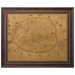
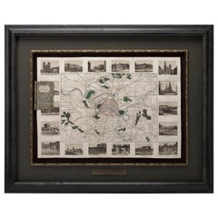
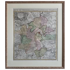
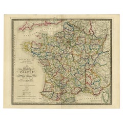
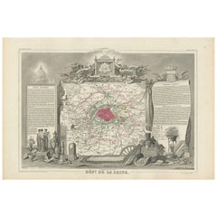
Antique Map Of Paris France

3
to
88
470
147
303
290
204
157
73
65
48
37
28
28
28
25
24
20
16
13
10
10
10
9
8
8
7
7
7
6
6
6
5
5
4
4
4
4
3
3
3
2
2
2
1
1
67
16
16
14
13
Sort By
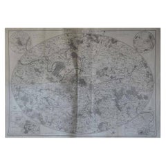
Original Large Antique Map of Paris, France by John Dower, 1861
Located in St Annes, Lancashire
Fabulous monochrome map of Paris. Vignettes of St Germain En Laye, Saint Cloud, Versailles and
Category

1860s English Victorian Antique Map Of Paris France

Materials

Paper

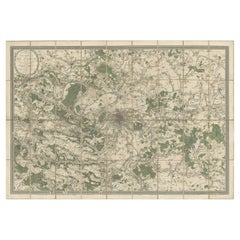
Large Folding Map of Paris, France, on Linen, 36 Segments, Published in 1836
Located in Langweer, NL
d'apres les travaux de la Nouvelle Carte De France'. Folding map of Paris on linen, 36 segments
Category

1830s Antique Map Of Paris France

Materials

Paper

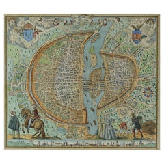
French Map of Paris, Musuem Carnavalet Rossingol University Map, 1576
Located in Gardena, CA
French Map of Paris, Musuem Carnavalet Rossingol University Map, 1576. Map of Paris, France
Category

16th Century French Antique Map Of Paris France

Materials

Paper

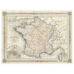
Antique Map of France in Provinces, with Inset of Paris
Located in Langweer, NL
Antique map titled 'France par Provinces'. Original antique map of France in Provinces. It covers
Category

Mid-19th Century Antique Map Of Paris France

Materials

Paper

Plan of Paris, France, by A. Vuillemin, Antique Map, 1845
Located in Colorado Springs, CO
This large and detailed plan of Paris was published by Alexandre Vuillemin in 1845. The map conveys
Category

1840s American Antique Map Of Paris France

Materials

Paper

Antique Map of Paris, "Carte Routiere des Environs de Paris" 1841
Located in Colorado Springs, CO
This beautiful hand-colored road map of Paris was published in 1841. The map shows Paris and the
Category

1840s French Antique Map Of Paris France

Materials

Paper

Antique Map of the Region of Paris ‘France’ by H. Heirs, circa 1720
Located in Langweer, NL
. Centered on Paris, the map extends to show these cities at the extremities - Ablis, Messe, Herissy, Senlies
Category

Early 18th Century Antique Map Of Paris France

Materials

Paper

Antique Map of France according to the Treaty of Paris '1815', Published in 1854
Located in Langweer, NL
Paris. (1815)'. Large map of France. From James Wyld's 'A New General Atlas of Modern Geography
Category

19th Century Antique Map Of Paris France

Materials

Paper

Decorative Antique Map of the Seine River and Paris in France, ca.1854
By Victor Levasseur
Located in Langweer, NL
Antique map titled 'Dépt. de la Seine'. Map of the French department of Seine. Focusing on Paris
Category

Mid-19th Century Antique Map Of Paris France

Materials

Paper

Antique Map of the City of Paris by Tirion '1763'
Located in Langweer, NL
Paris, France. This map originates from 'Nieuwe en Beknopte Hand-Atlas, bestaande in eene Verzameling
Category

Mid-18th Century Antique Map Of Paris France

Materials

Paper

Antique Political Map of France, 1880
By J. Migeon
Located in Langweer, NL
Antique map titled 'France Féodale'. Old map of France with a decorative vignette of Castle de
Category

19th Century Antique Map Of Paris France

Materials

Paper

Antique Political Map of France, 1880
H 13.59 in W 18.71 in D 0 in
Antique Map of the Bay of Brusc, France
Located in Langweer, NL
Antique map titled 'Carte de la rade du Brusc'. Original map of the bay of Brusc, France. This map
Category

Mid-18th Century Antique Map Of Paris France

Materials

Paper

Antique Map of the Bay of Brusc, France
H 12.49 in W 8.98 in D 0.02 in
Antique Map of the Coast of Roussillon, France
Located in Langweer, NL
map of the coast of Roussillon, France. This map originates from 'Le Petit Atlas Maritime (..)' by J.N
Category

Mid-18th Century Antique Map Of Paris France

Materials

Paper

Antique Map of the Region of Martigues, France
Located in Langweer, NL
Title: "Etang de Martigues et Environs: Antique Map of the Martigues Region, France" Description
Category

Mid-18th Century Antique Map Of Paris France

Materials

Paper

Antique Map of the Region of Fréjus, France
Located in Langweer, NL
of charts for the French Depot de la Marine. He was born in Paris in 1703 and educated as an engineer
Category

Mid-18th Century Antique Map Of Paris France

Materials

Paper

Antique Map of the Region of Fréjus, France
H 12.49 in W 8.98 in D 0.02 in
Antique Map of France by Zannoni, 1765
Located in Langweer, NL
Antique map titled 'La France divisée en ses LVIII Provinces (..)'. Beautiful old map of France
Category

18th Century Antique Map Of Paris France

Materials

Paper

Antique Map of France by Zannoni, 1765
H 19.89 in W 19.69 in D 0 in
Antique Map of France by Migeon, 1880
Located in Langweer, NL
Antique map titled 'France Physique'. Old map of France. This map originates from 'Géographie
Category

19th Century Antique Map Of Paris France

Materials

Paper

Antique Map of France by Migeon, 1880
H 13.59 in W 18.71 in D 0 in
Antique Map of Cher in France, 1854
By Victor Levasseur
Located in Langweer, NL
map originates from ‘Atlas National de la France Illustré’. Published by A. Combette, Paris, 1854.
Category

Mid-19th Century Antique Map Of Paris France

Materials

Paper

Antique Map of Cher  in France, 1854
H 13.98 in W 20.67 in D 0.02 in
French Antique Map of France and Western Europe, 1765
By G. A. Rizzi-zannoni
Located in Langweer, NL
France and western Europe. This map originates from 'Atlas Historique de la France Ancienne et Moderne
Category

18th Century Antique Map Of Paris France

Materials

Paper

Antique Map of ancient France by Zannoni, 1765
Located in Langweer, NL
Antique map France titled 'Galliae Veteris (..)'. Beautiful old map of France. This map originates
Category

18th Century Antique Map Of Paris France

Materials

Paper

Antique Map of the Region of Berre-l'Étang, France
Located in Langweer, NL
of Berre-l'Étang, France. This map originates from 'Le Petit Atlas Maritime (..)' by J.N. Bellin
Category

Mid-18th Century Antique Map Of Paris France

Materials

Paper

Antique Map of the Departments of France by Migeon, 1880
By J. Migeon
Located in Langweer, NL
Antique map titled 'France par Départements'. Old map of France with a decorative vignette of
Category

19th Century Antique Map Of Paris France

Materials

Paper

Antique Map of Morbihan ‘France’ by V. Levasseur, 1854
Located in Langweer, NL
Antique map titled 'Dépt. du Morbihan'. Map of the French department of Morbihan, France. This map
Category

Mid-19th Century Antique Map Of Paris France

Materials

Paper

Antique Map of Meurthe ‘France’ by V. Levasseur, 1854
Located in Langweer, NL
Antique map titled 'Dépt. de la Meurthe'. Map of the French department of Meurthe, France. Part of
Category

Mid-19th Century Antique Map Of Paris France

Materials

Paper

Antique Map of the Adour River, Near Bayonne, France
Located in Langweer, NL
of the Adour river, near Bayonne, France. This map originates from 'Le Petit Atlas Maritime (..)' by
Category

Mid-18th Century Antique Map Of Paris France

Materials

Paper

Antique Map of Vosges ‘France’ by V. Levasseur, 1854
By Victor Levasseur
Located in Langweer, NL
map originates from ‘Atlas National de la France Illustré’. Published by A. Combette, Paris: 1854.
Category

Mid-19th Century Antique Map Of Paris France

Materials

Paper

Antique Map of Loire ‘France’ by V. Levasseur, 1854
Located in Langweer, NL
Antique map titled 'Dépt. de la Loire'. Map of the French department of Loire, France. This area of
Category

Mid-19th Century Antique Map Of Paris France

Materials

Paper

Antique Map of Loire ‘France’ by V. Levasseur, 1854
Located in Langweer, NL
Antique map titled 'Dépt. de la Loire'. Map of the French department of Loire, France. This area of
Category

Mid-19th Century Antique Map Of Paris France

Materials

Paper

Antique Map of Oise ‘France’ by V. Levasseur, 1854
By Victor Levasseur
Located in Langweer, NL
Antique map titled 'Dépt. de l'Oise'. Map of the French department of Oise, France. The map is
Category

Mid-19th Century Antique Map Of Paris France

Materials

Paper

Antique Map of France in Ancient Roman Times, 1880
Located in Langweer, NL
Antique map titled 'Gaule indépendante et Romaine'. Old map of Gaul or France in ancient Roman
Category

19th Century Antique Map Of Paris France

Materials

Paper

French Geographical, Statistical and Historical Map of Pensylvania, 1825
Located in Langweer, NL
and bottom. Prime meridians: Washington and Paris. A very interesting 1825 French hand-colored map
Category

1820s Antique Map Of Paris France

Materials

Paper

Antique Map of Moselle ‘France’ by V. Levasseur, 1854
Located in Langweer, NL
Antique map titled 'Dépt. de la Moselle'. Map of the French department of Moselle, France. This
Category

Mid-19th Century Antique Map Of Paris France

Materials

Paper

Antique Map of Doubs ‘France’ by V. Levasseur, 1854
By Victor Levasseur
Located in Langweer, NL
Antique map titled 'Dépt. du Doubs'. Map of the French department of Doubs, France. The whole is
Category

Mid-19th Century Antique Map Of Paris France

Materials

Paper

Antique Map of Mayenne ‘France’ by V. Levasseur, 1854
Located in Langweer, NL
Antique map titled 'Dépt. de la Mayenne'. Map of the French department of Mayenne, France. This
Category

Mid-19th Century Antique Map Of Paris France

Materials

Paper

Antique Map of Somme ‘France’ by V. Levasseur, 1854
By Victor Levasseur
Located in Langweer, NL
Antique map titled 'Dépt. de la Somme'. Map of the French department of Somme, France. This area is
Category

Mid-19th Century Antique Map Of Paris France

Materials

Paper

Antique Map of Landes ‘France’ by V. Levasseur, 1854
By Victor Levasseur
Located in Langweer, NL
Antique map titled 'Dépt. des Landes'. Map of the French department Landes, France. This area is
Category

Mid-19th Century Antique Map Of Paris France

Materials

Paper

Antique Map of Aube ‘France’ by V. Levasseur, 1854
Located in Langweer, NL
Antique map titled 'Dépt. de l'Aube'. Map of the French department of Aube, France. This area of
Category

Mid-19th Century Antique Map Of Paris France

Materials

Paper

Antique Map of Calvados ‘France’ by V. Levasseur, 1854
By Victor Levasseur
Located in Langweer, NL
Antique map titled 'Dépt. du Calvados'. Map of the French department of Calvados, France. This area
Category

Mid-19th Century Antique Map Of Paris France

Materials

Paper

Antique Map of Marne ‘France’ by V. Levasseur, 1854
Located in Langweer, NL
Antique map titled 'Dépt. de la Marne'. Map of the French department of Marne, France. This
Category

Mid-19th Century Antique Map Of Paris France

Materials

Paper

Antique Map of Calais ‘France’ by V. Levasseur, 1854
By Victor Levasseur
Located in Langweer, NL
Antique map titled 'Dépt. du Pas de Calais'. Map of the French department of Calais, France. This
Category

Mid-19th Century Antique Map Of Paris France

Materials

Paper

Antique Map of Vienne 'France' by V. Levasseur, 1854
By Victor Levasseur
Located in Langweer, NL
Antique map titled 'Dépt. de la Vienne'. Decorative antique map of the French Department of Vienne
Category

Mid-19th Century Antique Map Of Paris France

Materials

Paper

Antique Map of Nièvre ‘France’ by V. Levasseur, 1854
Located in Langweer, NL
Antique map titled 'Dépt. de la Nièvre'. Map of the French department of Nievre, France. Part of
Category

Mid-19th Century Antique Map Of Paris France

Materials

Paper

Antique Map of Lot ‘France’ by V. Levasseur, 1854
Located in Langweer, NL
Antique map titled 'Dépt. du Lot'. Map of the French department of Lot, France. This area of France
Category

Mid-19th Century Antique Map Of Paris France

Materials

Paper

Antique Map of Ariège ‘France’ by V. Levasseur, 1854
Located in Langweer, NL
Antique map titled 'Dépt. de l'Ariège'. Map of the French department of Ariege, France. This area
Category

Mid-19th Century Antique Map Of Paris France

Materials

Paper

Antique Map of Gard ‘France’ by V. Levasseur, 1854
By Victor Levasseur
Located in Langweer, NL
Antique map titled 'Dépt. du Gard'. Map of the French department of Gard, France. This area of
Category

Mid-19th Century Antique Map Of Paris France

Materials

Paper

Antique Map of Corrèze ‘France’ by V. Levasseur, 1854
By Victor Levasseur
Located in Langweer, NL
Antique map titled 'Dépt. da la Corrèze'. Map of the French department of Correze, France. This
Category

Mid-19th Century Antique Map Of Paris France

Materials

Paper

Antique Map of Cantal ‘France’ by V. Levasseur, 1854
By Victor Levasseur
Located in Langweer, NL
Antique map titled 'Dépt. du Cantal'. Map of the French department of Cantal, France. This area of
Category

Mid-19th Century Antique Map Of Paris France

Materials

Paper

Antique Map of Meuse ‘France’ by V. Levasseur, 1854
Located in Langweer, NL
Antique map titled 'Dépt. de la Meuse'. Map of the French department of Meuse, France. This area
Category

Mid-19th Century Antique Map Of Paris France

Materials

Paper

Antique Map of Eure ‘France’ by V. Levasseur, 1854
By Victor Levasseur
Located in Langweer, NL
Antique map titled 'Dépt. de l'Eure'. Map of the French department of Eure, France. This region of
Category

Mid-19th Century Antique Map Of Paris France

Materials

Paper

Antique Map of Drôme ‘France’ by V. Levasseur, 1854
Located in Langweer, NL
map originates from ‘Atlas National de la France Illustré’. Published by A. Combette, Paris, 1854.
Category

Mid-19th Century Antique Map Of Paris France

Materials

Paper

Antique Map of Orne ‘France’ by V. Levasseur, 1854
By Victor Levasseur
Located in Langweer, NL
map. This map originates from ‘Atlas National de la France Illustré’. Published by A. Combette, Paris
Category

Mid-19th Century Antique Map Of Paris France

Materials

Paper

Antique Map of Loiret ‘France’ by V. Levasseur, 1854
Located in Langweer, NL
Antique map titled 'Dépt. du Loiret'. Map of the French department of Loiret, France. Surrounding
Category

Mid-19th Century Antique Map Of Paris France

Materials

Paper

Antique Map of Tarn 'France' by V. Levasseur, 1854
By Victor Levasseur
Located in Langweer, NL
Antique map titled 'Dépt. du Tarn'. Map of the French department of Tarn, France. This area
Category

Mid-19th Century Antique Map Of Paris France

Materials

Paper

Antique Map of Finistère ‘France’ by V. Levasseur, 1854
By Victor Levasseur
Located in Langweer, NL
map. This map originates from ‘Atlas National de la France Illustré’. Published by A. Combette, Paris
Category

Mid-19th Century Antique Map Of Paris France

Materials

Paper

Antique Map of Jura ‘France’ by V. Levasseur, 1854
By Victor Levasseur
Located in Langweer, NL
Antique map titled 'Dépt. du Jura'. Map of the French department Jura, France. The Jura wines are
Category

Mid-19th Century Antique Map Of Paris France

Materials

Paper

Antique Map of Creuse ‘France’ by V. Levasseur, 1854
By Victor Levasseur
Located in Langweer, NL
Antique map titled 'Dépt. de la Creuse'. Map of the French department of Creuse, France. This
Category

Mid-19th Century Antique Map Of Paris France

Materials

Paper

Antique Map of Ain ‘France’ by V. Levasseur, 1854
By Victor Levasseur
Located in Langweer, NL
Antique map titled 'Dépt. de l'Ain'. Map of the French department of l'Ain, France. This area of
Category

Mid-19th Century Antique Map Of Paris France

Materials

Paper

Antique Map of Lozère ‘France’ by V. Levasseur, 1854
Located in Langweer, NL
Antique map titled 'Dépt. de la Lozère'. Map of the French department of Lozere, France. This
Category

Mid-19th Century Antique Map Of Paris France

Materials

Paper

Antique Map of Isère ‘France’ by V. Levasseur, 1854
By Victor Levasseur
Located in Langweer, NL
Antique map titled 'Dépt. de l'Isère'. Map of the French department Isere. It is presented with a
Category

Mid-19th Century Antique Map Of Paris France

Materials

Paper

Antique Map of Gironde ‘France’ by V. Levasseur, 1854
By Victor Levasseur
Located in Langweer, NL
Antique map titled 'Dépt. de la Gironde'. Map of the French department of Gironde. This coastal
Category

Mid-19th Century Antique Map Of Paris France

Materials

Paper

  • 1
Get Updated with New Arrivals
Save "Antique Map Of Paris France", and we’ll notify you when there are new listings in this category.

Antique Map Of Paris France For Sale on 1stDibs

Choose from an assortment of styles, material and more with respect to the antique map of paris France you’re looking for at 1stDibs. An antique map of paris France — often made from paper, wood and fabric — can elevate any home. Your living room may not be complete without an antique map of paris France — find older editions for sale from the 18th Century and newer versions made as recently as the 20th Century. An antique map of paris France made by Neoclassical designers — as well as those associated with Victorian — is very popular. A well-made antique map of paris France has long been a part of the offerings for many furniture designers and manufacturers, but those produced by Andriveau-Goujon, Angelique Marie Martin and J. Forest are consistently popular.

How Much is a Antique Map Of Paris France?

The average selling price for an antique map of paris France at 1stDibs is $2,046, while they’re typically $278 on the low end and $9,000 for the highest priced.

Read More

Pamela Shamshiri Shares the Secrets behind Her First-Ever Book and Its Effortlessly Cool Interiors

The sought-after designer worked with the team at Hoffman Creative to produce a monograph that beautifully showcases some of Studio Shamshiri's most inspiring projects.

Moroccan Artworks and Objects Take Center Stage in an Extraordinary Villa in Tangier

Italian writer and collector Umberto Pasti opens the doors to his remarkable cave of wonders in North Africa.

Montecito Has Drawn Royalty and Celebrities, and These Homes Are Proof of Its Allure

Hollywood A-listers, ex-pat aristocrats and art collectors and style setters of all stripes appreciate the allure of the coastal California hamlet — much on our minds after recent winter floods.

Whaam! Blam! Pow! — a New Book on Pop Art Packs a Punch

Publishing house Assouline and writer Julie Belcove have teamed up to trace the history of the genre, from Roy Lichtenstein, Andy Warhol and Yayoi Kusama to Mickalene Thomas and Jeff Koons.

The Sparkling Legacy of Tiffany & Co. Explained, One Jewel at a Time

A gorgeous new book celebrates — and memorializes — the iconic jeweler’s rich heritage.

What Makes a Gem-Encrusted Chess Set Worth $4 Million?

The world’s most opulent chess set, weighing in at 513 carats, is literally fit for a king and queen.

Tauba Auerbach’s Geometric Pop-Up Book Is Mighty Rare, Thanks to a Hurricane

This sculptural art book has an epic backstory of its own.

Step inside the Storied Mansions of Palm Beach’s Most Effervescent Architect

From Spanish-style courtyards to fanciful fountains, these acclaimed structures abound in surprising and elegant details.