Antique Maps Of Germany

to
209
328
43
223
142
124
82
63
33
32
31
23
19
17
16
16
11
9
9
7
7
7
7
6
5
5
4
4
4
4
3
3
3
3
3
2
2
2
2
2
1
1
1
1
1
1
1
12
12
6
5
3
Sort By
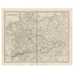
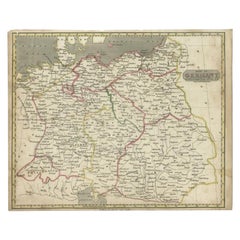
Antique Map of Germany by Balbi '1847'
Located in Langweer, NL
Antique map titled 'Allemagne'. Original antique map of Germany. This map originates from 'Abrégé
Category

Mid-19th Century Antique Maps Of Germany

Materials

Paper

Antique Map of Germany by Balbi '1847'
$142 Sale Price
20% Off
H 9.06 in W 11.23 in D 0.02 in
Antique Map of Germany by Clouet, 1787
Located in Langweer, NL
Antique map titled 'L'Allemagne'. Antique map of Germany. Originates from 'Geographie moderne avec
Category

Late 18th Century Antique Maps Of Germany

Materials

Paper

Antique Map of Germany by Clouet, 1787
$380 Sale Price
20% Off
H 17.33 in W 23.43 in D 0.02 in
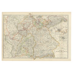
Antique Map of Germany by Johnston '1909'
Located in Langweer, NL
Antique map titled 'Empire of Germany'. Original antique map of Germany. With inset maps of
Category

Early 20th Century Antique Maps Of Germany

Materials

Paper

Antique Map of Germany by Johnston '1909'
$237 Sale Price
20% Off
H 19.49 in W 28.15 in D 0.02 in
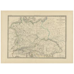
Antique Map of Germany by Lapie, 1842
Located in Langweer, NL
Antique map titled 'Carte de la Germanie Ancienne'. Map of Germany. This map originates from 'Atlas
Category

Mid-19th Century Antique Maps Of Germany

Materials

Paper

Antique Map of Germany by Lapie, 1842
$475 Sale Price
20% Off
H 19.89 in W 26.78 in D 0.02 in
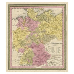
Decorative Antique Map of Germany, 1846
Located in Langweer, NL
Antique map titled 'Germany'. Old map of Germany. This map originates from 'A New Universal
Category

1840s Antique Maps Of Germany

Materials

Paper

Decorative Antique Map of Germany, 1846
$218 Sale Price
20% Off
H 13.59 in W 13.78 in D 0 in
Antique Map of Germany by Walker, 1820
By R. Walker
Located in Langweer, NL
Antique map Germany titled 'Map of Germany as defined by the Peace of Paris'. Detailed antique map
Category

19th Century Antique Maps Of Germany

Materials

Paper

Antique Map of Germany by Walker, 1820
$61 Sale Price
20% Off
H 8.27 in W 10.24 in D 0 in
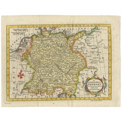
Antique Map of Germany by T. Kitchin, circa 1770
Located in Langweer, NL
Antique map titled 'An Accurate Map of Germany (..) '. Drawn from the best Authorities by T.Kitchin
Category

Mid-18th Century Antique Maps Of Germany

Materials

Paper

Antique Map of Germany by T. Kitchin, circa 1770
$228 Sale Price
20% Off
H 6.82 in W 8.86 in D 0.02 in
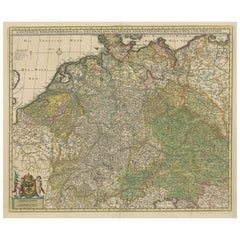
Antique Map of Germany and Central Europe
Located in Langweer, NL
Königreichen und Provincien'. Original antique map of Germany covering the central part of Europe with Germany
Category

Late 17th Century Antique Maps Of Germany

Materials

Paper

Antique Map of Germany and Central Europe
$1,046 Sale Price
20% Off
H 20.67 in W 24.22 in D 0.02 in
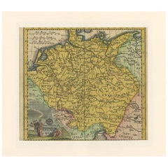
Antique Map of Germany by Hederichs 'circa 1740'
Located in Langweer, NL
Antique map titled 'Germania'. Rare miniature map of Germany and surroundings. This map covers the
Category

Mid-18th Century Antique Maps Of Germany

Materials

Paper

Antique Map of Germany by Hederichs 'circa 1740'
$237 Sale Price
20% Off
H 9.85 in W 13.78 in D 0.02 in
Antique Map of Germany with the Empire of Austria by Wyld '1845'
Located in Langweer, NL
Antique map titled 'The Confederated States of Germany with the Empire of Austria, and The Kingdoms
Category

Mid-19th Century Antique Maps Of Germany

Materials

Paper

Antique Map of Germany with the Empire of Austria by Wyld '1845'
$285 Sale Price
20% Off
H 15.36 in W 19.69 in D 0.02 in
Map of Germany - Original Etching - 1820
Located in Roma, IT
Map of Germany is an Original Etching realized by an unknown artist of 19th century in 1820. Very
Category

1820s Modern Antique Maps Of Germany

Materials

Etching

Map of Germany - Original Etching - 1820
$416
H 18.31 in W 23.04 in D 0.04 in
Antique Map of Germany by French Cartographer Lapie, 1842
Located in Langweer, NL
Antique map titled 'Carte d'Allemagne (..)'. Map of Germany. This map originates from 'Atlas
Category

19th Century Antique Maps Of Germany

Materials

Paper

Antique Map of Germany by French Cartographer Lapie, 1842
$247 Sale Price
20% Off
H 19.89 in W 26.78 in D 0 in
Antique Map of Germany & Railways – Transport Network Overview, 1857
Located in Langweer, NL
Antique Map of Germany & Railways – Transport Network Overview, 1857 Striking 19th-century map
Category

Mid-19th Century German Antique Maps Of Germany

Materials

Paper

Antique Map of Germany, Netherlands, Belgium & Switzerland – Stülpnagel, 1857
Located in Langweer, NL
Antique Map of Germany, Netherlands, Belgium & Switzerland – Stülpnagel, 1857 Fine mid-19th
Category

Mid-19th Century German Antique Maps Of Germany

Materials

Paper

Antique Map of Germany c.1830 by Thomas Kelly – Hand-Coloured Copper Engraving
Located in Langweer, NL
Antique Map of Germany by Thomas Kelly, London, circa 1830, with hand colouring Finely engraved
Category

1830s Antique Maps Of Germany

Materials

Paper

French Antique Miniature Map of Germany and Surrounding Countries, 1721
Located in Langweer, NL
Antique map Germany titled 'Allemagne Par N. Sanson le Fils Geographe du Roy'. Minitaure map of
Category

18th Century Antique Maps Of Germany

Materials

Paper

Decorative Hand-Colored Map of Germany by Nicolas Sanson, 1648
Located in Langweer, NL
Title: Hand-Colored Map of Germany by Nicolas Sanson, 1648 This hand-colored map, titled
Category

1640s Antique Maps Of Germany

Materials

Paper

Rare Antique Map of Germany with English Text, c.1690
Located in Langweer, NL
Antique map Germany titled 'Germani by Robt. Morden'. Rare antique map of Germany. Originates from
Category

17th Century Antique Maps Of Germany

Materials

Paper

Rare Antique Map of Germany with English Text, c.1690
$133 Sale Price
20% Off
H 7.88 in W 6.11 in D 0 in
Ornate Hand-Colored Map of Germany by John Tallis with Vignettes, ca. 1850
Located in Langweer, NL
Title: Hand-Colored Map of Germany by J. Tallis, ca. 1850 This beautifully hand-colored map of
Category

1850s Antique Maps Of Germany

Materials

Paper

Antique Map of Germany from an Old English Atlas, c.1802
Located in Langweer, NL
Antique map titled 'Germany'. Antique map of Germany engraved for 'Atlas to Walker's Geography
Category

19th Century Antique Maps Of Germany

Materials

Paper

Antique Map of Germany from an Old English Atlas, c.1802
$123 Sale Price
20% Off
H 8.27 in W 10.04 in D 0 in
Antique Map of Germany in Roman Times, Showing Roman Provinces, 1825
Located in Langweer, NL
'. Old map of Germany and surroundings originating from 'Atlas der Oude Wereld'. Artists and Engravers
Category

19th Century Antique Maps Of Germany

Materials

Paper

Antique Map of Germany in Roman Times, Showing Roman Provinces, 1825
$117 Sale Price
20% Off
H 8.59 in W 9.57 in D 0 in
Antique Map of Germany from a 17th Century Pocket Atlas, 1685
Located in Langweer, NL
Antique map titled 'Nova Totius Germaniae descriptio.' Miniature map of Germany, from the pocket
Category

17th Century Antique Maps Of Germany

Materials

Paper

Antique Map of Germany from a 17th Century Pocket Atlas, 1685
$118 Sale Price
20% Off
H 5.12 in W 5.52 in D 0 in
Antique Copper Engraved Map of Germany in the Early 18th Century, c.1740
Located in Langweer, NL
Antique map Germany titled 'Allemagne'. Rare miniature map of Germany and surroundings. Also
Category

18th Century Antique Maps Of Germany

Materials

Paper

Antique Map of Germany During the Mid-18th Century, Published in 1747
Located in Langweer, NL
Antique map Germany titled 'A New & Accurate Map of Germany'. It covers Germany during the mid-18th
Category

18th Century Antique Maps Of Germany

Materials

Paper

Antique Map of Germany During the Mid-18th Century, Published in 1747
$199 Sale Price
20% Off
H 14.57 in W 10.04 in D 0 in
Antique Map of Germany from an American 19th Century Atlas, 1846
Located in Langweer, NL
Antique map titled 'Germany'. Old map of Germany. This map originates from 'A New Universal Atlas
Category

19th Century Antique Maps Of Germany

Materials

Paper

Antique Map of Germany from an American 19th Century Atlas, 1846
$117 Sale Price
20% Off
H 17.13 in W 13.78 in D 0 in
Antique Map of Germany and Switzerland from an Old Dutch School Atlas, 1852
Located in Langweer, NL
Antique map titled 'Duitschland en Zwitersland'. Map of Germany and Switzerland. This map
Category

19th Century Antique Maps Of Germany

Materials

Paper

Antique Map of Germany and Switzerland from an Old Dutch School Atlas, 1852
$114 Sale Price
20% Off
H 10.63 in W 13.59 in D 0 in
Antique Map of German Colonies by Meyer, 1895
Located in Langweer, NL
Antique map titled 'Deutsche Kolonien.' Lithographed map of the German Colonies. German East-Africa
Category

19th Century Antique Maps Of Germany

Materials

Paper

Antique Map of German Colonies by Meyer, 1895
$104 Sale Price
20% Off
H 12.13 in W 9.45 in D 0 in
Antique Map of Germany and Switzerland by Lowry, '1852'
Located in Langweer, NL
Antique map titled 'Germany and Switzerland'. Four individual sheets of Germany and Switzerland
Category

Mid-19th Century Antique Maps Of Germany

Materials

Paper

Antique Map of Germany and Switzerland by Lowry, '1852'
$237 Sale Price / set
20% Off
H 12.21 in W 9.65 in D 0.02 in
Antique Map of Germany of German in Roman Times, c.1660
Located in Langweer, NL
Antique map Germany titled 'Germaniae Veteris Typus'. Antique map probably by Blaeu or based on an
Category

17th Century Antique Maps Of Germany

Materials

Paper

Antique Map of Germany of German in Roman Times, c.1660
$808 Sale Price
20% Off
H 20.87 in W 25.2 in D 0 in
Antique Map of Germany, the Netherlands, Bohemia, Bavaria and Switzerland, 1785
Located in Langweer, NL
Antique map titled 'Germany and the Netherlands from the latest authorities'. Depicts Germany, the
Category

18th Century Antique Maps Of Germany

Materials

Paper

1855 Relief Map of Germany and the Alps Showing Rivers and Terrain
Located in Langweer, NL
map of Switzerland, titled "Die Schweiz," was published in 1855 by the renowned German cartographer
Category

Mid-19th Century German Antique Maps Of Germany

Materials

Paper

Regional Map of Germany, inc Hamburg, Luneberg, Hannover, Braunsweig etc, c.1720
Located in Langweer, NL
the most important map publishers in Germany in the eighteenth century, the business being founded by
Category

1720s Antique Maps Of Germany

Materials

Paper

Antique Map of Germany, Bohemia, Hungary and Part of Poland by R. Bonne ‘1780’
Located in Langweer, NL
Francois Raynal (1713-1796). This map shows current Holland, Germany, Belgium, Switzerland, Austria
Category

Late 18th Century French Antique Maps Of Germany

Materials

Paper

Antique Map of Germany and Switzerland from an Old Dutch School Atlas, c.1873
Located in Langweer, NL
Antique map titled 'Deutschland en Zwitserland'. Old map depicting Germany and Switzerland. This
Category

19th Century Antique Maps Of Germany

Materials

Paper

Large Antique Map of the German Empire
Located in Langweer, NL
Antique map titled 'A Map of Germany (..)'. Large antique map of the German Empire, highly detailed
Category

Late 18th Century Antique Maps Of Germany

Materials

Paper

Large Antique Map of the German Empire
$647 Sale Price
20% Off
H 18.43 in W 24.3 in D 0.02 in
Antique Map of the German Empire with decorative Title Cartouche
Located in Langweer, NL
antique map of Germany. The map first appeared in 1606, with views in margins and a portrait of the
Category

Early 17th Century Antique Maps Of Germany

Materials

Paper

Antique Map of the German Empire with decorative Title Cartouche
$2,093 Sale Price
20% Off
H 15.08 in W 19.38 in D 0.02 in
Antique Map of present-day North-Rhine Westphalia, Germany
Located in Langweer, NL
map of Germany showing the region bounded by the Maas River in the west and to part of Westphalia in
Category

Mid-18th Century Antique Maps Of Germany

Materials

Paper

Antique Map of present-day North-Rhine Westphalia, Germany
$504 Sale Price
20% Off
H 21.66 in W 25.52 in D 0.02 in
Antique Map of the German Empire by Migeon, 1880
Located in Langweer, NL
Antique map titled 'Empire d'Allemagne'. Old map of Germany. With decorative vignette of Mainz
Category

19th Century Antique Maps Of Germany

Materials

Paper

Antique Map of the German Empire by Migeon, 1880
$104 Sale Price
20% Off
H 18.71 in W 13.59 in D 0 in
Antique Map of Westfalia, Germany by Mercator/Hondius, circa '1620'
Located in Langweer, NL
Antique map titled 'Westfalia cum dioecelsi Bremensi'. Original antique map of Germany. Published
Category

16th Century Antique Maps Of Germany

Materials

Paper

Antique Map of Westfalia, Germany by Mercator/Hondius, circa '1620'
$904 Sale Price
20% Off
H 17.72 in W 21.66 in D 0.02 in
Germany & Central Europe – Antique 1865 Map by Andriveau-Goujon, Paris
Located in Langweer, NL
Antique Map of Germany and Central Europe – “Allemagne et Europe Centrale” by Andriveau-Goujon
Category

Mid-19th Century French Antique Maps Of Germany

Materials

Paper

Antique Map of Holstein, Germany
Located in Langweer, NL
Antique map titled 'Holsatia Ducatus'. Original old map of Holstein, Germany. By Petrus Kaerius
Category

Mid-17th Century Antique Maps Of Germany

Materials

Paper

Antique Map of Holstein, Germany
$361 Sale Price
20% Off
H 9.85 in W 14.97 in D 0.02 in
Antique Map of Saxony, Germany
Located in Langweer, NL
Original antique map titled 'Circulus Saxoniae Superioris'. Original antique map of Saxony, Germany
Category

Early 18th Century Antique Maps Of Germany

Materials

Paper

Antique Map of Saxony, Germany
$571 Sale Price
20% Off
H 19.49 in W 23.04 in D 0.02 in
German Antique Map of Oceania, 1895
Located in Langweer, NL
/ map originates from 1885-1907 editions of a famous German encyclopedia: 'Meyers grosses Konversations
Category

19th Century Antique Maps Of Germany

Materials

Paper

German Antique Map of Oceania, 1895
$76 Sale Price
20% Off
H 9.85 in W 12.21 in D 0 in
1858 Map of Southwestern Germany & Switzerland – Bavaria, Württemberg, Baden
Located in Langweer, NL
Antique Map of Southwestern Germany & Switzerland – Bavaria, Württemberg, Baden, 1858 Detailed
Category

Mid-19th Century German Antique Maps Of Germany

Materials

Paper

Antique Map of Northeastern Germany – Saxon & Prussian States, 1858
Located in Langweer, NL
Antique Map of Northeastern Germany – Saxon & Prussian States, 1858 Detailed and finely engraved
Category

Mid-19th Century German Antique Maps Of Germany

Materials

Paper

Antique Map of Eastern Germany, Bohemia, Moravia & Silesia – 1858
Located in Langweer, NL
Antique Map of Eastern Germany, Bohemia, Moravia & Silesia – 1858 Detailed 19th-century engraved
Category

Mid-19th Century German Antique Maps Of Germany

Materials

Paper

Antique Map of The German Empire (West Sheet), 1882
Located in Langweer, NL
Transport yourself to the heart of history with an original Antique Map of The German Empire (west
Category

1880s German Antique Maps Of Germany

Materials

Paper

Antique Map of the Westphalia region of Germany
Located in Langweer, NL
Antique map titled 'Circulus Westphaliae (..)'. Original old map of the Westphalia region, Germany
Category

Late 17th Century Antique Maps Of Germany

Materials

Paper

Antique Map of the Westphalia region of Germany
$656 Sale Price
20% Off
H 21.03 in W 23.63 in D 0.02 in
Antique Map of the Duchy of Westphalia, Germany
Located in Langweer, NL
Original antique map titled 'Westphalia Ducatus'. Fine map of the Duchy of Westphalia, Germany. The
Category

Mid-17th Century Antique Maps Of Germany

Materials

Paper

Antique Map of the Duchy of Westphalia, Germany
$704 Sale Price
20% Off
H 19.3 in W 22.84 in D 0.02 in
Old German Map of the Austrian Empire, ca.1870
Located in Langweer, NL
Antique map titled 'Kaiserthum Österreich'. Old map of the Austrian Empire. This map originates
Category

1870s German Antique Maps Of Germany

Materials

Paper

Old German Map of the Austrian Empire, ca.1870
$275 Sale Price
20% Off
H 13.78 in W 17.64 in D 0 in
Antique Map of the Region of Oldenburg, Germany
By Willem Blaeu
Located in Langweer, NL
Antique map titled 'Oldenburg Comitatus'. Detailed old map of Oldenburg, Germany. The map also
Category

Mid-17th Century Antique Maps Of Germany

Materials

Paper

Antique Map of the Region of Oldenburg, Germany
$418 Sale Price
20% Off
H 20.2 in W 23.86 in D 0.02 in
Antique Hand-colored Map of Brandenburg, Germany
Located in Langweer, NL
Antique map titled 'Marchionatus Brandenburgicus'. Original antique map of Brandenburg, with
Category

Mid-17th Century Antique Maps Of Germany

Materials

Paper

Antique Hand-colored Map of Brandenburg, Germany
$399 Sale Price
20% Off
H 19.97 in W 23.51 in D 0.02 in
German Antique Map of Australia, Meyers, 1885
Located in Langweer, NL
original old antique print / plate / map originates from 1885-1907 editions of a famous German encyclopedia
Category

19th Century Antique Maps Of Germany

Materials

Paper

German Antique Map of Australia, Meyers, 1885
$76 Sale Price
20% Off
H 9.6 in W 12.1 in D 0.001 in
Antique Map of the Niederrhein region, Germany
Located in Langweer, NL
Antique map titled 'Circulus Electorum Rheni sive Rhenanus Inferior (..)'. Original antique map of
Category

Late 17th Century Antique Maps Of Germany

Materials

Paper

Antique Map of the Niederrhein region, Germany
$428 Sale Price
20% Off
H 25.2 in W 21.15 in D 0.02 in
Antique Map of the Archdiocese of Cologne, Germany
Located in Langweer, NL
Antique map titled 'Archevesche et Eslectorat de Cologne avec ses Enclaves'. Original old map of
Category

Late 17th Century Antique Maps Of Germany

Materials

Paper

Antique Map of the Archdiocese of Cologne, Germany
$409 Sale Price
20% Off
H 24.61 in W 18.23 in D 0.02 in
Map of Samoa or Schiffer-Inseln (Navigator Islands) - 19th Century German Map
Located in Langweer, NL
Map of Samoa or Schiffer-Inseln (Navigator Islands) - 19th Century German Map This detailed 19th
Category

1890s Antique Maps Of Germany

Materials

Paper

Old Original Antique German Map of North America, ca.1870
Located in Langweer, NL
Antique map titled 'Nord-America'. Old map of North America. This map originates from 'H
Category

1870s German Antique Maps Of Germany

Materials

Paper

Old Original Antique German Map of North America, ca.1870
$378 Sale Price
35% Off
H 13.82 in W 17.72 in D 0 in
Antique German Map of South America by Kiepert, c.1870
Located in Langweer, NL
Antique map titled 'Süd-America'. Old map of South America. This map originates from 'H. Kiepert's
Category

19th Century German Antique Maps Of Germany

Materials

Paper

  • 1
Get Updated with New Arrivals
Save "Antique Maps Of Germany", and we’ll notify you when there are new listings in this category.

Antique Maps Of Germany For Sale on 1stDibs

Choose from an assortment of styles, material and more with respect to the antique maps of Germany you’re looking for at 1stDibs. Each antique maps of Germany for sale was constructed with extraordinary care, often using paper, paint and parchment paper. You’ve searched high and low for the perfect antique maps of Germany — we have versions that date back to the 18th Century alongside those produced as recently as the 20th Century are available. Each antique maps of Germany bearing Baroque, Georgian or Rococo hallmarks is very popular. Johann Baptist Homann, Matthew Seutter and Georg Braun and Frans Hogenberg each produced at least one beautiful antique maps of Germany that is worth considering.

How Much is a Antique Maps Of Germany?

Prices for an antique maps of Germany start at $72 and top out at $10,000 with the average selling for $551.

Read More

Patchwork Quilts Are the Latest Nostalgic Design Trend

New or old, the coverlets add old-time charm to any space.

Medal-Worthy Memorabilia from Epic Past Olympic Games

Get into the games! These items celebrate the events, athletes, host countries and sporting spirit.

Ahoy! You’ve Never Seen a Collection of Sailor Art and Kitsch Quite Like This

French trendsetter and serial collector Daniel Rozensztroch tells us about his obsession with objects related to seafaring men.

39 Incredible Swimming Pools

It's hard to resist the allure of a beautiful pool. So, go ahead and daydream about whiling away your summer in paradise.

Pamela Shamshiri Shares the Secrets behind Her First-Ever Book and Its Effortlessly Cool Interiors

The sought-after designer worked with the team at Hoffman Creative to produce a monograph that beautifully showcases some of Studio Shamshiri's most inspiring projects.

Moroccan Artworks and Objects Take Center Stage in an Extraordinary Villa in Tangier

Italian writer and collector Umberto Pasti opens the doors to his remarkable cave of wonders in North Africa.

Montecito Has Drawn Royalty and Celebrities, and These Homes Are Proof of Its Allure

Hollywood A-listers, ex-pat aristocrats and art collectors and style setters of all stripes appreciate the allure of the coastal California hamlet — much on our minds after recent winter floods.

Whaam! Blam! Pow! — a New Book on Pop Art Packs a Punch

Publishing house Assouline and writer Julie Belcove have teamed up to trace the history of the genre, from Roy Lichtenstein, Andy Warhol and Yayoi Kusama to Mickalene Thomas and Jeff Koons.