Antique Marine Maps

1
to
24
177
36
173
164
63
36
26
25
19
14
14
12
7
7
6
5
5
5
5
4
3
2
2
2
2
2
1
1
1
1
1
1
1
1
27
4
2
1
1
Sort By
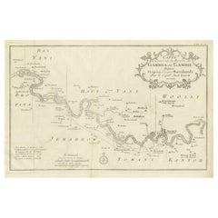
Antique Map of Gambia, West Africa
Located in Langweer, NL
Antique map titled 'Carte du Cours de la Riviere de Gambra ou Gambie (..)'. Detailed map of Gambia
Category

Mid-18th Century Antique Marine Maps

Materials

Paper

Antique Map of Gambia, West Africa
H 9.97 in W 14.97 in D 0.02 in
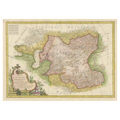
Decorative Antique Map of Central Asia
Located in Langweer, NL
Antique map titled 'Carte de la Tartarie Indépendante (..)'. Decorative map of Central Asia
Category

Late 18th Century Antique Marine Maps

Materials

Paper

Decorative Antique Map of Central Asia
H 14.57 in W 19.69 in D 0.02 in
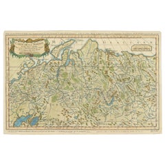
Antique Map of Siberia by Bellin, 1754
Located in Langweer, NL
Antique map titled 'Carte de la Siberie'. Detailed map of Siberia, extending from the White Sea and
Category

18th Century Antique Marine Maps

Materials

Paper

Antique Map of Siberia by Bellin, 1754
H 12.21 in W 18.51 in D 0 in
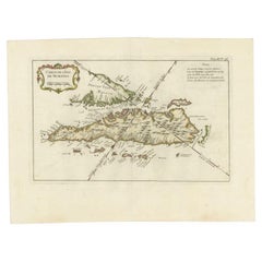
Antique Map of Sumatra by Bellin, 1764
Located in Langweer, NL
Antique map Sumatra titled 'Carte de l'Isle de Sumatra'. Old map of Sumatra, Malaysia and the
Category

18th Century Antique Marine Maps

Materials

Paper

Antique Map of Sumatra by Bellin, 1764
H 12.8 in W 17.13 in D 0 in
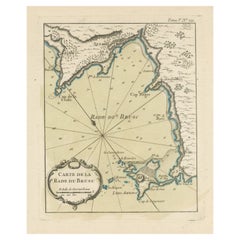
Antique Map of the Bay of Brusc, France
Located in Langweer, NL
Antique map titled 'Carte de la rade du Brusc'. Original map of the bay of Brusc, France. This map
Category

Mid-18th Century Antique Marine Maps

Materials

Paper

Antique Map of the Bay of Brusc, France
H 12.49 in W 8.98 in D 0.02 in
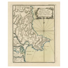
Antique Map of the Coast of Roussillon, France
Located in Langweer, NL
Antique map titled 'Coste de Roussillon depuis Port Vendres, jusqu'au golphe de Rozes'. Original
Category

Mid-18th Century Antique Marine Maps

Materials

Paper

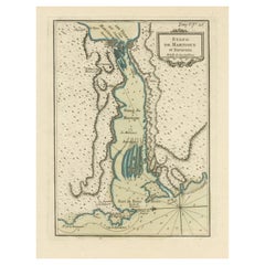
Antique Map of the Region of Martigues, France
Located in Langweer, NL
Title: "Etang de Martigues et Environs: Antique Map of the Martigues Region, France" Description
Category

Mid-18th Century Antique Marine Maps

Materials

Paper

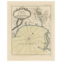
Antique Map of the Region of Fréjus, France
Located in Langweer, NL
Title: "Golf de Fréjus" Description: This antique map, titled "Golf de Fréjus," is an original
Category

Mid-18th Century Antique Marine Maps

Materials

Paper

Antique Map of the Region of Fréjus, France
H 12.49 in W 8.98 in D 0.02 in
Antique Map of Novaya Zemlya by Bellin, 1758
Located in Langweer, NL
maps, particular of maritime interest. He was appointed the first Ingenieur Hydrographe de la Marine
Category

18th Century Antique Marine Maps

Materials

Paper

Antique Map of Northern India by Bonne, 1780
Located in Langweer, NL
Marine. Condition: Fair, age-related toning. Defect and stain lower part of map. Please study image
Category

18th Century Antique Marine Maps

Materials

Paper

Antique Map of the Adour River, Near Bayonne, France
Located in Langweer, NL
Antique map titled 'Cours de la riviere de l'Adour depuis la mer jusqua Bayonne'. Original old map
Category

Mid-18th Century Antique Marine Maps

Materials

Paper

Antique Map of part of Central and Southern Asia
Located in Langweer, NL
Antique map titled 'Carte de la Partie Superieure de l'Inde en deca du Gange. Comprise entre la
Category

Late 18th Century Antique Marine Maps

Materials

Paper

Original Antique Map of the Cape Verde Islands, 1746
Located in Langweer, NL
large number of maps of particular interest to the Ministere de la Marine. Artist: Jacques Nicolas
Category

18th Century Antique Marine Maps

Materials

Paper

Antique Map of Persia, Georgia and Kazakhstan, ca.1780
Located in Langweer, NL
Antique map titled 'Carte de la Perse, de la Georgie, et de la Tartarie Independante'. Map of
Category

1780s Antique Marine Maps

Materials

Paper

Antique Map of the Maluku Islands or Moluccas, Indonesia
Located in Langweer, NL
Antique map titled 'Carte Particuliere des Isles Moluques'. This map depicts the islands of Herij
Category

Mid-18th Century Antique Marine Maps

Materials

Paper

Antique Map of Tartary and Northeast Asia, c.1750
Located in Langweer, NL
Antique map titled 'Carte de la tartarie occidentale'. An interesting map of Tartary and northeast
Category

18th Century Antique Marine Maps

Materials

Paper

Antique Map of the Eastern Mediterranean and the Balkans
Located in Langweer, NL
Antique map titled 'La Turquie d'Europe et celle d'Asie'. Attractive double page map of the Eastern
Category

Late 18th Century Antique Marine Maps

Materials

Paper

Antique Map of Northern Brazil by Bonne, c.1780
Located in Langweer, NL
Antique map titled 'Carte de la Partie Septentrionale du Bresil.' Detailed map of the northern
Category

18th Century Antique Marine Maps

Materials

Paper

Antique Map of Celebes 'Sulawesi', Island in Indonesia, 1754
By Jacques-Nicolas Bellin
Located in Langweer, NL
Antique map titled 'Carte De L'Isle Celebes ou Macassar'. Detailed copper engraved map of Celebes
Category

18th Century Antique Marine Maps

Materials

Paper

Antique Map of Northern Europe by Bonne, c.1780
Located in Langweer, NL
Antique map titled 'Le Nord de L'Europe, Contenant Le Danemark, La Norwege; La Suede et La Laponie
Category

18th Century Antique Marine Maps

Materials

Paper

Antique Map of Turkmenistan, Uzbekistan, Tajikistan and Kyrgyzstan, 1749
Located in Langweer, NL
Antique map titled ‘Carte de la Petite Bukharie et Pays Voisins – Tirée des Auteurs Anglois pour
Category

18th Century Antique Marine Maps

Materials

Paper

Old Map of Turkmenistan, Uzbekistan, Afghanistan, Tajikistan, Kyrgyzstan, 1757
Located in Langweer, NL
Antique map titled 'Kort over det Lille Bukarie og de naest graensende Lande. af Engelske
Category

1750s Antique Marine Maps

Materials

Paper

Antique Map of Manchuria and the Northeast Portion of Tartary
Located in Langweer, NL
Antique map titled 'Carte de la Tartarie Orientale (..)'. Detailed map of Manchuria and the
Category

Mid-18th Century Antique Marine Maps

Materials

Paper

Antique Map of Southern Brazil by Bonne, c.1780
Located in Langweer, NL
"Antique map titled 'Carte de la Partie Méridionale du Bresil (..)'. This antique map of Brazil
Category

18th Century Antique Marine Maps

Materials

Paper

Stunning Large Scale Antique Map of Martinique, Rare, Published 1758
Located in Langweer, NL
Antique map titled 'Carte Reduite de l'Isle de la Martinique Dressee au Depost des Cartes Plans et
Category

18th Century Antique Marine Maps

Materials

Paper

Antique Map of Tartary and Northeast Asia with Hand Coloring
Located in Langweer, NL
Antique map titled 'Carte de la Tartarie Occidentale'. An interesting map of Tartary and northeast
Category

Mid-18th Century Antique Marine Maps

Materials

Paper

Antique Map of the Region of Berre-l'Étang, France
Located in Langweer, NL
Antique map titled 'Carte des etangs de Berre de Martigue et environs'. Original map of the region
Category

Mid-18th Century Antique Marine Maps

Materials

Paper

Antique Map of Guadeloupe, Island in the Caribbean, c.1757
Located in Langweer, NL
maps of particular interest to the Ministere de la Marine. Artist: Jacques Nicolas Bellin (1703 - 1772
Category

18th Century Antique Marine Maps

Materials

Paper

Antique Map of Hondarribia Near the Bidasoa River, France & Spain
Located in Langweer, NL
Antique map titled 'Plan de Fontarabie et de la redoute d'Andaye'. Original old map of Hondarribia
Category

Mid-18th Century Antique Marine Maps

Materials

Paper

Antique Map of Java and Madura Island, Indonesia, c.1760
Located in Langweer, NL
large number of maps of particular interest to the Ministere de la Marine. Condition: Good, given age
Category

18th Century Antique Marine Maps

Materials

Paper

Antique Map of Eastern Siberia Extending to Kamtchatka, Russia, 1764
By Jacques-Nicolas Bellin
Located in Langweer, NL
Antique map titled 'Suite De La Carte De La Siberie Et le Pays de Kamtchatka'. Detailed map the
Category

18th Century Antique Marine Maps

Materials

Paper

Original Antique Map of the Maluku Islands or Moluccas, Indonesia
Located in Langweer, NL
Antique map titled 'Carte Particuliere des Isles Moluques'. This map depicts the islands of Herij
Category

Mid-18th Century Antique Marine Maps

Materials

Paper

Antique Map of the Tunquin River and Bay, Siam, 1757
Located in Langweer, NL
Antique map titled ‘Carte du Cours de la Riviere de Tunquin Depuis Cacho jusqu'à la Mer’. Detailed
Category

18th Century Antique Marine Maps

Materials

Paper

Antique Map of the Coast of China by Bellin, 1752
By Jacques-Nicolas Bellin
Located in Langweer, NL
Antique map titled 'Carte des Costes de Cochinchine, Tunquin et Partie de celles de Chine
Category

18th Century Antique Marine Maps

Materials

Paper

Antique Map of the City of Hangzhou by Bellin, 1748
By Jacques-Nicolas Bellin
Located in Langweer, NL
Antique map titled 'Plan de la ville de Hang-Tcheou-Fou ou Hang-Chew-Fu Capitale de la Province de
Category

18th Century Antique Marine Maps

Materials

Paper

Antique Map of Italy, Corsica, Sardinia and Sicily, ca.1780
Located in Langweer, NL
Description: Antique map titled 'L'Italie.' Map of Italy, Corsica, Sardinia and Sicily. Highly
Category

1780s Antique Marine Maps

Materials

Paper

Antique Map of the Maluku Islands by Bellin, c.1750
By Jacques-Nicolas Bellin
Located in Langweer, NL
Antique map titled 'Carte Particuliere des Isles Moluques'. This map depicts the islands of Herij
Category

18th Century Antique Marine Maps

Materials

Paper

Antique Map of Northern Europe and European Russia, ca.1780
Located in Langweer, NL
Antique map titled 'Le Nord de L'Europe, Contenant Le Danemark, La Norwege; La Suede et La Laponie
Category

1780s Antique Marine Maps

Materials

Paper

Antique Map of Celebes 'Sulawesi', Island in Indonesia, c.1750
By Jacques-Nicolas Bellin
Located in Langweer, NL
Antique map titled 'Carte De L'Isle Celebes ou Macassar'. Detailed copper engraved map of Celebes
Category

18th Century Antique Marine Maps

Materials

Paper

Antique Map of the Bukhari and Surroundings by Bellin, 1749
Located in Langweer, NL
Antique map titled 'Carte de la Petite Bukharie et Pays Voisins'. Old map of the Bukhari (Sinkiang
Category

18th Century Antique Marine Maps

Materials

Paper

Antique Map of the Region of Aigues-Mortes and Camargue, France
Located in Langweer, NL
Antique map titled 'Environs d'Aiguemortes de Peccais &a et la petite Camargue'. Original map of
Category

Mid-18th Century Antique Marine Maps

Materials

Paper

Antique Map of the Languedoc Canal, Between Touloouse and Marseillette, France
Located in Langweer, NL
Antique map titled 'Carte du canal de Languedoc depuis Toulouse jusqu'a I'etang de Marceillette
Category

Mid-18th Century Antique Marine Maps

Materials

Paper

Superb, Large Map of British India, Chinese Empire, Indochina, Malaysia, 1860
Located in Langweer, NL
'Graveur du Depot de la Marine' and in this position engraved numerous French naval and military maps
Category

1860s Antique Marine Maps

Materials

Paper

Attractive Antique Map of Asia with Borders Hand-Coloured, c.1780
Located in Langweer, NL
Antique map titled 'L'Asie.' This map shows the Asia continent. Originates from 'Atlas de
Category

18th Century Antique Marine Maps

Materials

Paper

Antique Map of Ambon Island in the Moluccas, Indonesia, c.1760
Located in Langweer, NL
Antique map Ambon titled 'Carte Particuliere de l 'Isle Amboine'. Old map showing Ambon, in the
Category

18th Century Antique Marine Maps

Materials

Paper

Antique Map of Persia, Georgia and Kazakhstan by Bonne, c.1780
Located in Langweer, NL
Antique map titled 'Carte de la Perse, de la Georgie, et de la Tartarie Independante'. Map of
Category

18th Century Antique Marine Maps

Materials

Paper

Antique Map of the Island Anjouan by Van Schley, c.1750
Located in Langweer, NL
Antique map titled 'Carte de l'Isle d'Anjouan une des Isles de Comore'. Striking map of the Island
Category

18th Century Antique Marine Maps

Materials

Paper

Antique Map of the Empire of China by Bonne, c.1780
By Rigobert Bonne
Located in Langweer, NL
Antique map titled 'Carte de L'Empire de la Chine.' Decorative map of the Empire of China
Category

18th Century Antique Marine Maps

Materials

Paper

Antique Map of Part of Southern Asia by Bonne, c.1780
Located in Langweer, NL
Antique map titled 'Carte de la Partie Superieure de l'Inde en deca du Gange. Comprise entre la
Category

18th Century Antique Marine Maps

Materials

Paper

Antique Map of Anjouan or Ndzuani, Island of The Comoros, 1748
Located in Langweer, NL
Antique map titled ‘Carte de L’Isle D’Anjouan’. Original antique map of Anjouan, also known as
Category

18th Century Antique Marine Maps

Materials

Paper

Antique Map of Southern Brazil and Uruguay by Bonne, c.1780
Located in Langweer, NL
"Antique map titled 'Carte de la Partie Meridional du Bresil avec les Possessions Espagnoles
Category

18th Century Antique Marine Maps

Materials

Paper

Original Antique Map of Tartary 'Northern China & Far Eastern Russia', 1757
Located in Langweer, NL
Antique map titled 'Carte de la Tartarie Orientale (..)'. Original antique map of what is
Category

1750s Antique Marine Maps

Materials

Paper

Antique Map of Northern China and Eastern Russia by Bellin, 1757
Located in Langweer, NL
Antique map titled 'Carte de la Tartarie Orientale (..)'. Original antique map of what is present
Category

18th Century Antique Marine Maps

Materials

Paper

Antique Map of Northern China and Eastern Russia by Bellin, 1754
Located in Langweer, NL
Antique map titled 'Carte De La Tartarie Orientale (..)'. A map for this far eastern portion of
Category

18th Century Antique Marine Maps

Materials

Paper

Authentic Antique Map of the Caribbean, Gulf Coast and Central America, 1787
Located in Langweer, NL
Antique map titled 'Les Isles Antilles et le Golfe du Méxique'. Original old map of the Caribbean
Category

Late 18th Century Antique Marine Maps

Materials

Paper

An Ornate and Historical Tallis Map of Jamaica with Decorative Vignettes, 1851
Located in Langweer, NL
This original antique map of Jamaica is part of the renowned series created by the Tallis Company
Category

1850s Antique Marine Maps

Materials

Paper

Antique Map of the Languedoc Coast between Agde and Sète 'Cette', France
Located in Langweer, NL
Antique map titled 'Coste de Languedoc depuis Agde jusqu'a Cette'. Original map of the Languedoc
Category

Mid-18th Century Antique Marine Maps

Materials

Paper

Antique Map of Southern India, the Maldives and Sri Lanka with Currents
Located in Langweer, NL
Antique map titled 'Carte de la Partie Inferieure De L'Inde En Deca Du Gange (..)'. Interesting map
Category

Late 18th Century Antique Marine Maps

Materials

Paper

Fabulous Original Antique two-sheet Map of the Caspian Sea, ca.1723
Located in Langweer, NL
Carte Marine de la Mer Caspiene... [and] Coste de Perse sur la Mer Caspiene et Partie de Celles de
Category

1720s Antique Marine Maps

Materials

Paper

Map of the Russian Islands of Novaya Zemlya and Pechorskaya Guba, 1758
Located in Langweer, NL
maps, particular of maritime interest. He was appointed the first Ingenieur Hydrographe de la Marine
Category

1750s Antique Marine Maps

Materials

Paper

  • 1
Get Updated with New Arrivals
Save "Antique Marine Maps", and we’ll notify you when there are new listings in this category.

Antique Marine Maps For Sale on 1stDibs

Find a variety of antique marine maps available on 1stDibs. Frequently made of paper, fabric and wool, all antique marine maps available were constructed with great care. Antique marine maps have been produced for many years, with earlier versions available from the 18th Century and newer variations made as recently as the 20th Century. Antique marine maps bearing Victorian hallmark is very popular at 1stDibs. There have been many well-made antique marine maps over the years, but those made by Jacques-Nicolas Bellin are often thought to be among the most beautiful.

How Much are Antique Marine Maps?

Antique marine maps can differ in price owing to various characteristics — the average selling price at 1stDibs is $493, while the lowest priced sells for $107 and the highest can go for as much as $275,000.

Read More

Pamela Shamshiri Shares the Secrets behind Her First-Ever Book and Its Effortlessly Cool Interiors

The sought-after designer worked with the team at Hoffman Creative to produce a monograph that beautifully showcases some of Studio Shamshiri's most inspiring projects.

Moroccan Artworks and Objects Take Center Stage in an Extraordinary Villa in Tangier

Italian writer and collector Umberto Pasti opens the doors to his remarkable cave of wonders in North Africa.

Montecito Has Drawn Royalty and Celebrities, and These Homes Are Proof of Its Allure

Hollywood A-listers, ex-pat aristocrats and art collectors and style setters of all stripes appreciate the allure of the coastal California hamlet — much on our minds after recent winter floods.

Whaam! Blam! Pow! — a New Book on Pop Art Packs a Punch

Publishing house Assouline and writer Julie Belcove have teamed up to trace the history of the genre, from Roy Lichtenstein, Andy Warhol and Yayoi Kusama to Mickalene Thomas and Jeff Koons.

The Sparkling Legacy of Tiffany & Co. Explained, One Jewel at a Time

A gorgeous new book celebrates — and memorializes — the iconic jeweler’s rich heritage.

What Makes a Gem-Encrusted Chess Set Worth $4 Million?

The world’s most opulent chess set, weighing in at 513 carats, is literally fit for a king and queen.

Tauba Auerbach’s Geometric Pop-Up Book Is Mighty Rare, Thanks to a Hurricane

This sculptural art book has an epic backstory of its own.

Step inside the Storied Mansions of Palm Beach’s Most Effervescent Architect

From Spanish-style courtyards to fanciful fountains, these acclaimed structures abound in surprising and elegant details.