Map Monde

1
127
to
19
120
7
127
127
127
1
1
76
47
4
1
3
1
2
1
122
3
1
1
1
15
10
4
16
2
1
1
1
Sort By
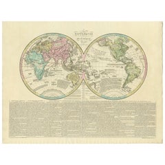
Antique World Map by Lesage, 1823
Located in Langweer, NL
Antique world map titled 'Mappe Monde Historique'. The map depicts both the Eastern and Western
Category

Antique Early 19th Century Maps

Materials

Paper

Antique World Map by Lesage, 1823
H 21.07 in W 27.56 in D 0.02 in
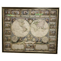
Colored wall map of the WORLD
By Chambon
Located in ZWIJNDRECHT, NL
“Mappe Monde, contenant les Parties Connues du Globe Terrestre” CHAMBON, Gobert-Denis (France, 17
Category

Antique Mid-18th Century French French Provincial Maps

Materials

Wood, Paper

Colored wall map of the WORLD
Free Shipping
H 45 in W 57 in D 0.8 in
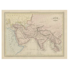
Original Antique Map of Ancient Asia, 1847
Located in Langweer, NL
Description: Antique map Asia titled 'Asie Ancienne'. This is an original antique map of
Category

Antique 1840s Maps

Materials

Paper

Original Antique Map of Ancient Asia, 1847
H 10.63 in W 14.77 in D 0 in
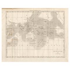
Antique Map of Oceania by Didot, 1836
Located in Langweer, NL
Antique map titled 'Oceanie par G.L.Dy. De Rienzi'. Map of the Oceania region, around Australia
Category

Antique 19th Century Maps

Materials

Paper

Antique Map of Oceania by Didot, 1836
H 8.27 in W 10.44 in D 0 in
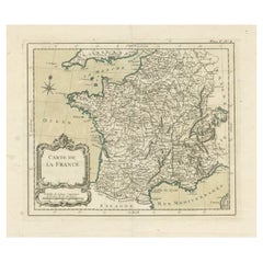
Antique Map of France with Decorative Title Cartouche
Located in Langweer, NL
Antique map titled 'Carte de la France'. Original old map of France. This map originates from 'Le
Category

Antique Mid-18th Century Maps

Materials

Paper

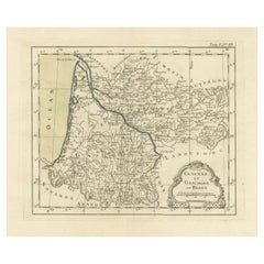
Antique Map of Guyenne, Gascony and Béarn, France
Located in Langweer, NL
Antique map titled 'Guyenne et Gascogne et Bearn'. Original old map of Guyenne (or Guienne
Category

Antique Mid-18th Century Maps

Materials

Paper

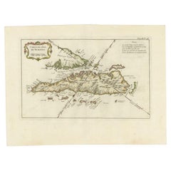
Antique Map of Sumatra by Bellin, 1764
Located in Langweer, NL
Antique map Sumatra titled 'Carte de l'Isle de Sumatra'. Old map of Sumatra, Malaysia and the
Category

Antique 18th Century Maps

Materials

Paper

Antique Map of Sumatra by Bellin, 1764
H 12.8 in W 17.13 in D 0 in
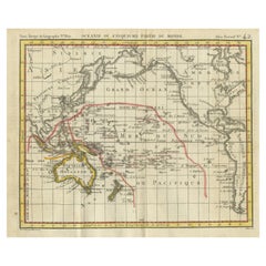
Antique Map of Oceania by Hérisson, 1816
Located in Langweer, NL
Antique map titled "Océanie ou cinquième partie du monde". This is an original antique map of
Category

Antique 19th Century Maps

Materials

Paper

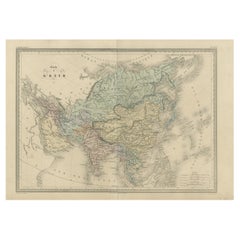
Antique Map of Asia by Malte-Brun, 1880
Located in Langweer, NL
Map Pl. 63 - 64: 'Carte de l'Asie.' This map shows Asia. This original antique map originates from
Category

Antique 19th Century Maps

Materials

Paper

Antique Map of Asia by Malte-Brun, 1880
H 15.36 in W 21.66 in D 0 in
Antique Map of the World by D'Urville '1853'
Located in Langweer, NL
Antique map titled 'Voyage Autour du Monde'. Original map of the world. This map originates from
Category

Antique Mid-19th Century Maps

Materials

Paper

Antique Map of the World by D'Urville '1853'
H 15.56 in W 20.67 in D 0.02 in
Antique Map of Novaya Zemlya by Bellin, 1758
Located in Langweer, NL
Antique map titled 'Partie de la Mer Glaciale Contenant la Nouvelle Zemle et le Pais des Samoiedes
Category

Antique 18th Century Maps

Materials

Paper

Antique Map of European Russia with Picture Frame Border
Located in Langweer, NL
Antique map titled 'La Moscovie Septentrionale (..)'. Decorative example of van der Aa's map of the
Category

Antique Early 18th Century Maps

Materials

Paper

Antique Map of Boulogne-sur-Mer by Bellin '1764'
Located in Langweer, NL
Antique map titled 'Plan de la Ville de Boulogne'. Original antique map of Boulogne-sur-Mer, France
Category

Antique Mid-18th Century Maps

Materials

Paper

Antique Map of the Cocos or Keeling Islands, 1778
Located in Langweer, NL
Antique map titled 'Die Cocos Insel vom Capt. Wallis Bosawren. Die Verrather Islel von Capt. Wallis
Category

Antique 18th Century Maps

Materials

Paper

Antique Detailed World Map Drawn on Mercator's Projection, 1700
Located in Langweer, NL
Antique world map titled 'Carte generale du monde, ou description du monde terrestre & Aquatique
Category

Antique 17th Century Maps

Materials

Paper

Rare Small Antique Map of the Persian Empire, 1692
Located in Langweer, NL
cartouche and armorial shield. This map originates from 'L'Atlas en Abrege, ou Nouvelle Description du Monde
Category

Antique 17th Century Maps

Materials

Paper

Antique Map of the Pacific Ocean by Rienzi, 1836
Located in Langweer, NL
Antique map titled 'Mélanésie'. Map of the Pacific ocean around Australia, including Java, Timor
Category

Antique 19th Century Maps

Materials

Paper

Antique Map of Japan by A.M. Mallet, 1683
Located in Langweer, NL
A charming late 17th century French map with a very decorative title cartouche showing trumpet
Category

Antique Late 17th Century Maps

Materials

Paper

Antique Map of Japan by A.M. Mallet, 1683
H 8.19 in W 5.28 in D 0.02 in
Original Antique Map of Oceania, the 5th Continent, 1816
Located in Langweer, NL
Antique map titled ‘Océanie ou cinquième partie du monde‘. This is an original antique map of
Category

Antique 1810s Maps

Materials

Paper

Rare Antique Map of the Moghul Empire, ca.1725
Located in Langweer, NL
Antique map titled 'Oost-Indize Voyagie door William Hawkins van Suratte gedaan na 't Hof van den
Category

Antique 1720s Maps

Materials

Paper

Antique Map of the Holy Land with Picture Frame Border
Located in Langweer, NL
Antique map titled 'Terre Sainte Suivant les Nouvelles Observations (..)'. Original old map of the
Category

Antique Early 18th Century Maps

Materials

Paper

Antique Map of the Holy Land with Picture Frame Border
Free Shipping
H 11.66 in W 17.01 in D 0.02 in
Antique World Map before the Voyages of Christopher Columbus, 1880
Located in Langweer, NL
Antique world map titled 'Monde Connu des Anciens'. Antique map of the World and continents before
Category

Antique 19th Century Maps

Materials

Paper

Antique Map of India and Southeast Asia by Sanson '1654'
Located in Langweer, NL
Antique map titled 'Partie Meridionale de l'Inde'. Early map of India and Southeast Asia. The map
Category

Antique Mid-17th Century Maps

Materials

Paper

Antique Map of the Coast of France Between Brest and Bayonne
Located in Langweer, NL
Antique map titled 'Carte des Costes de France depuis Brest jusquá Bayone'. Original old map of the
Category

Antique Mid-18th Century Maps

Materials

Paper

Antique Map of the Gulf of Cambay, Gujarat, India, 1725
By Pieter Van Der Aa
Located in Langweer, NL
Antique map titled 'Le Golfe de Cambaye at la Rade de Suratt.' (The gulf of Cambay and the coast of
Category

Antique 18th Century Maps

Materials

Paper

Original Antique Hand-colored World Map with or without Frame, '1696'
Located in Langweer, NL
Antique world map titled 'Mappe-Monde dressee sur les Observations de Mrs. de l'Academie Royale des
Category

Antique Late 17th Century Maps

Materials

Paper

Antique Map of Asia Minor Showing Turkey in Ancient Times, 1880
Located in Langweer, NL
Map Pl. 9: 'Asie Mineure.' This map shows Asia Minor / Turkey in ancient times. This original
Category

Antique 19th Century Maps

Materials

Paper

Antique Map of of Bengal and the mouth of the Ganges River
Located in Langweer, NL
Antique map titled 'Carte du Bengale, avec la partie Septentrionale (..)'. Original antique map of
Category

Antique Late 18th Century Maps

Materials

Paper

Antique Map of the Maluku Islands by Van der Aa, 1725
By Pieter Van Der Aa
Located in Langweer, NL
Antique map titled 'Les Iles Moluques (..).' (The Moluccan Islands, Maluku, Moluccas, Spice Islands
Category

Antique 18th Century Maps

Materials

Paper

Antique Map of Banten Bay on Java Island, Indonesia, c.1720
Located in Langweer, NL
Antique map titled 'La Rade de Bantam'. A small early 18th century black and white map of Banten
Category

Antique 18th Century Maps

Materials

Paper

Antique Map of the Region of Boulogne-sur-Mer by Bellin '1764'
Located in Langweer, NL
Antique map titled 'Plan de Boulogne et des Environs'. Original antique map of the region of
Category

Antique Mid-18th Century Maps

Materials

Paper

Antique Map of the Rhineland and Alsace Region with Original Hand Coloring
Located in Langweer, NL
Antique map titled 'Palitinat du Rhein, Alsace, et partie de Souabe de Franconie (..)'. Double-page
Category

Antique Mid-17th Century Maps

Materials

Paper

Antique Map of the Island of Java by Van Der Aa, 1725
By Pieter Van Der Aa
Located in Langweer, NL
Antique map titled 'Map: 'L'Ile de Java'. (The island of Java.) This map shows the Indonesian
Category

Antique 18th Century Maps

Materials

Paper

Antique Map of the Roadstead of Batavia by Van der Aa, 1725
By Pieter Van Der Aa
Located in Langweer, NL
Antique map titled 'La rade de Batavia'. (The roadstead of Batavia.) This map shows the roadstead
Category

Antique 18th Century Maps

Materials

Paper

Antique Map of the Roadstead of Bantam by Van der Aa, 1725
By Pieter Van Der Aa
Located in Langweer, NL
Antique map titled 'La rade de Bantam'. (The roadstead of Bantam.) This map shows the Indonesian
Category

Antique 18th Century Maps

Materials

Paper

Antique Map of the Mughal Empire by Van der Aa, C.1725
By Pieter Van Der Aa
Located in Langweer, NL
Antique map titled 'Royaume de Grand Mogol (..).' This map shows the extend of the Mughal Empire
Category

Antique 18th Century Maps

Materials

Paper

Extremely Scarce Antique Map of The Island of Borneo, Indonesia, c. 1725
Located in Langweer, NL
Antique map titled 'L'Ile de Borneo Suivant les memoires des plus Celebres Navigateurs.' A
Category

Antique 18th Century Maps

Materials

Paper

Antique Miniature Map of the Old World and France by Mallet, circa 1683
Located in Langweer, NL
Antique map titled 'Planisphere du Monde - France'. Two miniature maps on one sheet. The upper map
Category

Antique Late 17th Century Maps

Materials

Paper

Old Map of the British Isles with the Faroes and Shetlands, Showing Cock Fights
Located in Langweer, NL
Antique map titled 'Les Isles Britaniques ou sont les Royaumes d'Angleterre (..)'. Original old map
Category

Antique Early 18th Century Maps

Materials

Paper

Extremely Rare Map of the East-Indies towards the South-East 'Indonesia', 1725
Located in Langweer, NL
Antique map titled 'La partie des Indes Orientales vers le Zud-Est, depuis Timor jusqu'a Midanao
Category

Antique 1720s Maps

Materials

Paper

Rare Engraved Antique Map of India with Elephants in the Cartouche, c.1725
Located in Langweer, NL
elephants. This map originates from 'La galerie agreable du monde. Tome premier des Indes Orientales
Category

Antique 18th Century Maps

Materials

Paper

Antique Map of the Region of Osaka and Hirado Island in Japan, 1725
By Pieter Van Der Aa
Located in Langweer, NL
, Nagasaki. This map originates from the very scarse: 'La Galerie Agreable du Monde (..). Tome premier des
Category

Antique 18th Century Maps

Materials

Paper

Antique Map of the Bay of Batavia by Van der Aa, c.1720
Located in Langweer, NL
Antique map titled 'La Rade de Batavia'. A small early 18th century black and white map of the Bay
Category

Antique 18th Century Maps

Materials

Paper

Extremely Rare Map of The land of Eso or Hokkaido in Japan, 1725
Located in Langweer, NL
. This plate originates from the very scarse: 'La Galerie Agreable du Monde (..). Tome premier des Indes
Category

Antique 18th Century Maps

Materials

Paper

Antique Map of the Islands of Banda, Indonesia from a Very Rare Edition, 1725
Located in Langweer, NL
Antique map titled 'Les Iles de Banda (..).' (The islands of Banda, Indonesia.) Extremely rare
Category

Antique 1720s Maps

Materials

Paper

Interesting Map of the Thousand Islands in the Bay of Batavia 'Jakarta', ca.1740
Located in Langweer, NL
de cartes et plans des quatre parties du Monde. Paris: Bellin, 1764, but again they are smaller. Map
Category

Antique 1740s Maps

Materials

Paper

Very Decorative Original Antique Map of the World, Published in France in c.1780
By Rigobert Bonne
Located in Langweer, NL
Antique map titled 'L'Ancien Monde Et Le Nouveau en Deux Hemispheres' - Double hemisphere map of
Category

Antique 18th Century Maps

Materials

Paper

Rare Antique Map with Timor and Nearby Islands Plus an Inset of Hawaii, 1825
Located in Langweer, NL
Antique map titled 'Essai sur la Geographie de l'Ile Timor.' A map showing Timor and the
Category

Antique 1820s Maps

Materials

Paper

Map Holy Land La Terre Sainte Engraved van Loon Published N de Fer 1703 French
Located in BUNGAY, SUFFOLK
Majeste Catoliq et de Monseigneur le Dauphin. Avec Privil du Roi 1703 Detailed map of the Holy Land
Category

Antique Early 1700s French Louis XIV Maps

Materials

Paper

Old Map of the island of Saint Christopher or St. Kitts in the Caribbean, c.1765
Located in Langweer, NL
Antique map titled 'Carte de l'Isle de Saint-Christophe'. A detailed map of the island of Saint
Category

Antique 18th Century Maps

Materials

Paper

Antique Chart of the Voyage of Captain Cook by Benard, 1780
Located in Langweer, NL
Antique map titled 'Carte des Découvertes faites dans la Mer Pacifique sur la Vaisse au de Roi, La
Category

Antique 18th Century Maps

Materials

Paper

Old Engraving of the Track of the Resolution Captain Cook in the Pacific, 1780
Located in Langweer, NL
Antique map titled 'Carte des Découvertes faites dans la Mer Pacifique sur la Vaisse au de Roi, La
Category

Antique 18th Century Maps

Materials

Paper

Antique Plan of Batavia, Capital of the Dutch East Indies, by Van Der Aa, 1725
By Pieter Van Der Aa
Located in Langweer, NL
Antique map titled 'Plan de Batavia'. (Plan of Batavia.) This plate shows a plan of the city of
Category

Antique 18th Century Maps

Materials

Paper

View of the City Banten or Bantam Near the Western End of Java, Indonesia, c1725
Located in Langweer, NL
nautical vessels in the harbour. This print originates from the very scarse: La Galerie Agréable du Monde
Category

Antique 1720s Maps

Materials

Paper

Bird's Eye View of Dabhol as Seen from the Sea, North of Goa, India, 1727
Located in Langweer, NL
on the coast.This plate originates from the very scarse: 'La Galerie Agreable du Monde (...). Tome
Category

Antique 1720s Maps

Materials

Paper

Rare Chine-collé Aquatint of Banyuwangi, East Java, Indonesia, 1835
Located in Langweer, NL
from the series 'Voyage autour du monde par les mers de l'Inde et de la Chine de la corvette de sa
Category

Antique 1830s Maps

Materials

Paper

Print of Commander Laplace Received by a Cochinchinese Mandarin, c.1830
Located in Langweer, NL
and Malaysia, into the China Sea. Originates from the series 'Voyage autour du monde par les mers de
Category

Antique 1830s Maps

Materials

Paper

Antique Map of Batavia, Jakarta, Indonesia by P. Van Der Aa, 1719
Located in Langweer, NL
A small early 18th century black and white map of Batavia by the Dutch cartographer Pieter Van Der
Category

Antique Early 18th Century Prints

Materials

Paper

1800s French Map of the World in Two Hemispheres - Le Dictionnaire Géographique
Located in Montréal, CA
Mappe-Monde. En deux Hemispheres Pour le Dictionnaire Géographique. Author: Vosgien and Caillot
Category

Antique Early 19th Century French Prints

Materials

Paper

Antique Print of a Druze Woman in Libanon, 1843
Located in Langweer, NL
print originates from 'Moeurs, usages et costumes de tous les peuples du monde' by Auguste Wahlen
Category

Antique 19th Century Prints

Materials

Paper

  • 1
Get Updated with New Arrivals
Save "Map Monde", and we’ll notify you when there are new listings in this category.

Map Monde For Sale on 1stDibs

Choose from an assortment of styles, material and more with respect to the map monde you’re looking for at 1stDibs. A map monde — often made from paper, copper and metal — can elevate any home. There are many kinds of the map monde you’re looking for, from those produced as long ago as the 18th Century to those made as recently as the 20th Century. When you’re browsing for the right map monde, those designed in mid-century modern styles are of considerable interest. You’ll likely find more than one map monde that is appealing in its simplicity, but Pieter Van Der Aa, J.B. Elwe and Lucien Boucher produced versions that are worth a look.

How Much is a Map Monde?

Prices for a map monde start at $82 and top out at $42,568 with the average selling for $504.

Read More

In Francks Deceus’s ‘Mumbo Jumbo #5,’ the Black Experience Is . . . Complicated

Despite the obstacles, the piece’s protagonist navigates the chaos without losing his humanity.

12 Floral-Accented Rooms with a Handmade, Folkloric Feel

Who needs a flower garden? Just use your imagination — and some beautifully patterned wallpaper or fabric — to bring the outdoors in.

This Wolf Kahn Pastel Is the Epitome of Beauty at Its Most Essential

A longtime admirer of Kahn’s work, 1stDibs editorial director Anthony Barzilay Freund explores why it’s relevant now more than ever.

Why Jules Chéret Was the King of the Modern Poster

The streets of fin-de-siècle Paris were set aglow with colorful poster ads, thanks to the printing techniques invented by Jules Chéret. Now, the Milwaukee Art Museum is celebrating this undersung talent in America's first solo show dedicated his exuberant works.

Anna Condo’s Multifaceted Career Spans Film, Photography and NFTs

From her historic Manhattan townhouse, the talented creator and curator of 1stDibs' latest NFT exhibition tells us about the art in her home and how she got involved with cryptoart.

How Keith Rivers Went from NFL Linebacker to Blue-Chip Art Aficionado

The former football player is as serious about becoming a great contemporary-art patron as he once was about making tackles. Here, Rivers tells us how he got the collecting bug and how his tastes have evolved over the years.

More Than Ever, the Female Design Council Is Embracing Funked-Up Creativity

The organization's "Womxn’s History Month" collection celebrates female-identified creators pushing the boundaries of technique and material.

This New Orleans Antiques Dealer’s Stylish Home Doubles as Her Art Studio

A former lawyer, Karina Gentinetta has achieved second-act success as a furniture gallerist and painter.