Maps

to
4,332
5,257
243
5,505
3
82
35
19
12
9
6
4
4
4
3
1
1
2,919
2,163
423
3
236
34
10
124
7
35
9
2
5
3
4
2
5,415
127
60
33
33
496
294
179
131
119
5,508
5,508
5,508
104
63
29
23
16
Maps For Sale
Stunning Decorative Antique Map of Venice in Italy, ca.1787
Located in Langweer, NL
Title: Piano elevato dell'inclita città di Venezia
Bird's-eye view (etching) of Venice.
Print made by: Marco Sebastiano Giampiccoli
After: Matthäus Merian I
Two copper engraved sh...
Category
Late 18th Century Antique Maps
Materials
Paper


1683 Alain Manesson Mallet Map of Ancient India, the Ganges, and Taprobane
Located in Langweer, NL
Title: 1683 Alain Manesson Mallet Map of Ancient India, the Ganges, and Taprobane
Description: This finely engraved seventeenth-century map, titled Inde Ancienne à l’Occident du ...
Category
1680s Antique Maps
Materials
Paper

Original Hand-Colored Antique Map of America by Danckerts, circa 1680
Located in Langweer, NL
Antique map titled 'Novissima et Accuratissima Totius Americae Descriptio per I. Danckerts'. Striking map of America. California is shown as an island, Based Upon Sanson's model. The Great Lakes are shown with an open western coastline. No Northwestern Coast beyond 40 degrees. The seven cities of Cibola appear in the Southwestern US. The conception of the Mississippi River is still very vague and pushed far west of its true mouth. The large lake in the Southeastern US first seen on Le Moyne's map is still present. South America retains its excessively wide format. A hopeful extension from Button's Bay is shown portending a possible Northwest Passage. The map is richly embellished with two cartouches, 9 sailing vessels and elaborate vignettes of native villages, native warriors...
Category
Late 17th Century Antique Maps
Materials
Paper

Original Antique Map of the American State of Maryland & Delaware, 1903
Located in St Annes, Lancashire
Antique map of Maryland And Delaware
Published By A & C Black. 1903
Original colour
Good condition
Unframed.
Free shipping
Category
Early 1900s English Antique Maps
Materials
Paper

Large 1778 Lotter World Map - Ovoid Projection with Captain Cook's Voyage Routes
Located in Langweer, NL
Title: 1778 Lotter World Map - Ovoid Projection with Captain Cook's First Voyage Routes
Description: This rare 1778 map, "Mappe Monde ou Carte Generale de L'Univers," was published ...
Category
1770s Antique Maps
Materials
Paper

1709 Map of the Holy Land - Twelve Tribes of Israel, Hand-Colored, Antique Map
Located in Langweer, NL
This is a beautiful 1709 map of the Holy Land, titled "Iudaea seu Terra Sancta quae Hebraeorum sive Israelitarum in suas duodecim Tribus divisa," by Guillaume Sanson and Alexis Huber...
Category
Early 1700s Antique Maps
Materials
Paper

1720 Weigel Engraving of Jerusalem: A Biblical View from Josephus' Perspective
Located in Langweer, NL
1720 Weigel Map of Jerusalem Based on Josephus' Writings
This intricate 1720 bird's-eye view map of ancient Jerusalem by I.H. Coccejo, engraved by Christoph Weigel, offers a fasc...
Category
1720s Antique Maps
Materials
Paper

1683 Alain Manesson Mallet Map of Ancient India, the Ganges, and Taprobane
Located in Langweer, NL
Title: 1683 Alain Manesson Mallet Map of Ancient India, the Ganges, and Taprobane
Description: This finely engraved seventeenth-century map, titled Inde Ancienne à l’Occident du ...
Category
1680s Antique Maps
Materials
Paper
Antique Map of the Early United States by Pierre Antoine Tardieu (1784-1869)
Located in Langweer, NL
This is an original antique map titled "Carte Générale des Etats Unis de l'Amérique Septentrionale," depicting the early United States and adjacent regions. This map, created by Pier...
Category
Early 1800s Antique Maps
Materials
Paper
")
Mythical Atlantis Restored - A 1694 Map of the Americas and Ancient Geography
Located in Langweer, NL
This rare and fascinating map, titled "Atlantis Insula a Nicolao Sanson Antiquitati Restituta" by Guillaume Sanson, presents an unusual interpretation of the Western Hemisphere, comb...
Category
1690s Antique Maps
Materials
Paper

1675 Map of the Kingdom of the Black People (Nigritarum Regnum) by Janssonius
Located in Langweer, NL
This original antique map, titled 'Nigritarum Regnum' (The Kingdom of the Black People), was produced by the renowned Dutch cartographer Johannes Janssonius and published in 'Joannis...
Category
1670s Antique Maps
Materials
Paper
 by Janssonius")
Antique Map of the Northeastern United States and Canada by Tardieu, 1802
Located in Langweer, NL
This antique map titled "Carte de la Partie Septentrionale des Etats Unis," created by Pierre Antoine Tardieu, depicts the northeastern part of the United States and parts of Canada....
Category
Early 1800s Antique Maps
Materials
Paper

1584 Abraham Ortelius Map of Lower Burgundy, France
Located in Langweer, NL
1584 Abraham Ortelius Map of Lower Burgundy, France
Description of the Map:
This antique map by Abraham Ortelius, titled "Bvrgvndiae Inferioris Qvae Dvcatvs Nomine Censetur Des," w...
Category
16th Century Antique Maps
Materials
Paper

Antique Map of South Carolina, North Carolina, and Virginia by Tardieu, 1802
Located in Langweer, NL
This is an original antique map titled "Carte de la Caroline Méridionale et Septentrionale et de la Virginie," depicting the regions of South Carolina, North Carolina, and Virginia in the early 19th century. Created by Pierre Antoine Tardieu, this map provides a detailed view of the geographical and political landscape of these southeastern United States areas.
Map Details:
- **Title**: Carte de la Caroline Méridionale et Septentrionale et de la Virginie
- **Creator**: Pierre Antoine Tardieu (1784-1869)
- **Publication Date**: Early 19th century
- **Dimensions**: Approximately 34.5 x 43.5 cm (13.5 x 17.25 inches)
- **Features**: The map includes detailed representations of South Carolina, North Carolina, and Virginia, highlighting political boundaries, major cities, rivers, and other geographical features. The title cartouche is located in the lower right corner, and the outlines are hand-colored to distinguish different regions.
Key Geographic Features and Areas:
1. **South Carolina**:
- Major cities such as Charleston and Columbia are marked.
- The map details the rivers and topography, including the Savannah River and various inland features.
2. **North Carolina**:
- Key locations such as Raleigh and New Bern...
Category
Early 1800s Antique Maps
Materials
Paper

French Colonies in the Caribbean: Maps of Martinique and Guadeloupe (1852)
Located in Langweer, NL
This pair of maps, published in 1852, provides a detailed representation of the French Caribbean colonies, specifically Martinique and Guadeloupe. They were part of the *Atlas Univer...
Category
1850s Antique Maps
Materials
Paper
")
Old Map of the Province of Groningen, the Netherlands & inset of Islands, C.1680
Located in Langweer, NL
Antique map titled 'Tabulae dominii Groeningae quae et complecitur maximam partem Drentiae Emendata'.
Old map of the province of Groningen, the Netherlands. With an inset map of ...
Category
1680s Antique Maps
Materials
Paper

Mythical Atlantis Restored - A 1694 Map of the Americas and Ancient Geography
Located in Langweer, NL
This rare and fascinating map, titled "Atlantis Insula a Nicolao Sanson Antiquitati Restituta" by Guillaume Sanson, presents an unusual interpretation of the Western Hemisphere, comb...
Category
1690s Antique Maps
Materials
Paper
Antique Map of the City of Visby 'Sweden' by F. Hogenberg, 1598
Located in Langweer, NL
This is a wonderful bird's-eye plan/view of the oldest city in Sweden.
Visby, the largest city on the island of Gotland was an important Viking city and the main centre of the Hanseatic League...
Category
16th Century Antique Maps
Materials
Paper

Finely Engraved Historical Map of Middle East and Asia, c.1745
Located in Langweer, NL
Description: Antique map titled'Theatrum Historicum pars Orientalis.'
Finely engraved historical map with a profusion of details. It shows the Middle East and Asia. Decorative ti...
Category
1740s Antique Maps
Materials
Paper

Stunning Decorative Antique Map of Venice in Italy, ca.1787
Located in Langweer, NL
Title: Piano elevato dell'inclita città di Venezia
Bird's-eye view (etching) of Venice.
Print made by: Marco Sebastiano Giampiccoli
After: Matthäus Merian I
Two copper engraved sh...
Category
Late 18th Century Antique Maps
Materials
Paper
Spectacular Antique Original Engraving of a Town Plan of Jerusalem, 1708
Located in Langweer, NL
Description: Antique map titled 'Erster Abriss der Stadt Jerusalem wie sie Furnemblich zur Zeit des Hernn Christi beschaffen (..).'
Spectacular town plan...
Category
Early 1700s Antique Maps
Materials
Paper

Detailed 1795 Map of the Americas with Exploration Tracks and Nice Cartouche
Located in Langweer, NL
This is a very handsome and rare 1795 map of the Americas titled "Amerique ou Nouveau Continent Dressee sur les Nouvelles Relations Decouvertes et Observations" by Jean Baptiste Noli...
Category
1790s Antique Maps
Materials
Paper

Vintage Map of the Greater Antilles and Lesser Antilles
Located in Langweer, NL
Vintage map titled 'Antilles'. Original map of the Antilles. Shows the Cayman Islands, Cuba, Hispaniola (subdivided into the nations of the Dominican Republic and Haiti), Jamaica, and Puerto Rico. Also shows the Lesser Antilles...
Category
20th Century Maps
Materials
Paper

Antique Map of Japan with Scale and Compass Rose, c.1730
Located in Langweer, NL
Antique map titled 'Naauwkeurige Kaart van 'T Keizerryk Japan (..).'
Attractive detailed map of Japan. With scale and compass rose. This map originates from 'Hedendaegsche historie...
Category
18th Century Antique Maps
Materials
Paper

Antique Map of North and South America by Pierre Antoine Tardieu (1784-1869)
Located in Langweer, NL
This is an original antique map titled "Carte Générale et Politique de l'Amérique," depicting the political and geographical features of North and South America. This map, created by Pierre Antoine Tardieu, illustrates the continent's boundaries, major regions, and significant features as understood in the early 19th century.
Map Details:
- **Title**: Carte Générale et Politique de l'Amérique
- **Creator**: Pierre Antoine Tardieu (1784-1869)
- **Publication Date**: Early 19th century
- **Dimensions**: Approximately 34.5 x 43.5 cm (13.5 x 17.25 inches)
- **Features**: The map includes detailed representations of North and South America, highlighting political boundaries, major cities, rivers, and mountain ranges. The title cartouche is located in the lower right corner, and the outlines are hand-colored to distinguish different regions and countries.
Condition Overview:
1. Paper Quality: The paper shows typical signs of aging, such as slight yellowing, but remains in good condition without major tears or damage.
2. Edges and Corners: The edges are slightly worn, with minor fraying and small tears, particularly near the center fold. These imperfections do not significantly impact the overall readability or aesthetic value.
3. Center Fold: A center fold is present, which is common for maps of this period that were often folded for storage or publication. The fold appears intact without significant separation or damage, except for a small split at the lower end.
4. Color and Print Quality: The hand-colored outlines remain vibrant and clear, highlighting the borders of different regions. The print quality is excellent, with sharp, legible text and detailed illustrations.
5. Staining and Spots: There are a few spots and stains, particularly near the edges and along the fold. These do not obscure any critical details of the map.
Historical Context
Around the year 1800, the Americas were a region of significant political change and exploration. Here’s an overview of the region during that period:
Political Landscape
1. North America:
- United States: The United States was a young nation, having gained independence from Great Britain in 1776. The early 19th century was a period of westward expansion and the establishment of new states.
- Canada: Canada was divided into British colonies, including Upper Canada (Ontario) and Lower Canada (Quebec). The British maintained control over these territories following the American Revolution.
- Mexico: Mexico was part of the Spanish Empire, known as New Spain. It would gain independence from Spain in 1821.
2. Central and South America:
- Spanish Colonies: Much of Central and South America was under Spanish colonial rule. Significant regions included New Granada (Colombia), Peru, and the Viceroyalty of the Rio de la Plata (Argentina).
- Portuguese Brazil: Brazil was a Portuguese colony and the largest territory in South America. It would gain independence from Portugal in 1822.
- Independence Movements: The early 19th century was marked by independence movements across Latin America, led by figures such as Simón Bolívar and José de San Martín, which resulted in the creation of new nations.
3. Caribbean:
- The Caribbean islands were controlled by various European powers, including Spain, France, Great Britain, and the Netherlands. These islands were significant for their sugar plantations and as hubs of the Atlantic slave trade.
Socio-Economic Conditions
1. Trade and Commerce:
- The Americas were integral to global trade, exporting commodities such as sugar, tobacco, cotton, and coffee. The port cities of Havana, Veracruz, and Buenos Aires were crucial trade...
Category
Early 1800s Antique Maps
Materials
Paper
")
Antique Map of Tartary, Also Showing the Great Wall of China
Located in Langweer, NL
Antique map titled 'Carte de Tartarie'. Detailed map of Tartary, consisting of the Eastern part of Russia, Central Asia, China and Korea, first published by Guillaume De L'Isle in 1706. The map extends from the Peninsula of Korea in the east to the Caspian and Black Seas. The Great Wall of China...
Category
Early 18th Century Antique Maps
Materials
Paper

Antique Map of India during the height of the Mughal Imperial Expansion, 1713
Located in Langweer, NL
Antique map titled 'L'Inde de ca le Gange (..)'. Beautiful original antique map embracing most of India, made during the height of the Mughal imperial expansion. The map encompasses ...
Category
Early 18th Century Antique Maps
Materials
Paper

Antique Map of the Gulf of Mexico and all the islands of the West Indies
Located in Langweer, NL
Antique map titled 'Carte du Golfe du Mexique'. This uncommon map depicts the Gulf of Mexico and all the islands of the West Indies. It also includes ni...
Category
Early 19th Century Antique Maps
Materials
Paper

Antique Map of Bourbon, or Reunion, Colony of France
Located in Langweer, NL
Original antique map titled 'Ile de la Réunion'. This is a fascinating map of the French department of Ile. Bourbon or Reunion. Bourbon, or Reunion, is a volcanic island off the coas...
Category
Mid-19th Century Antique Maps
Materials
Paper

Gascogne and Guyenne Map - Hand-Colored 17th-Century Engraving by De Wit, c.1688
Located in Langweer, NL
Title: Gascogne and Guyenne Map - Hand-Colored 17th-Century Engraving by Frederik De Wit c. 1688
Description: This remarkable map, "Gouvernement de la Guyenne & Gascogne," captures ...
Category
1680s Antique Maps
Materials
Paper

Antique Map of Italy by Andriveau-Goujon, 1843
By Andriveau-Goujon
Located in New York, NY
Antique Map of Italy by Andriveau-Goujon, 1843. Map of Italy in two parts by Andriveau-Goujon for the Library of Prince Carini at Palazzo Carini i...
Category
1840s French Antique Maps
Materials
Linen, Paper

1750 Map of the Holy Land: The Land of Canaan and the Twelve Tribes
Located in Langweer, NL
Carte de la Terre de Canaan ou Terre Promise
Cartographer: Le St. Robert
Date of Publication: 1750
This exquisite 18th-century map, 'Carte de la Terre de Canaan ou Terre Promise', w...
Category
1750s Antique Maps
Materials
Paper

Old Original Print Depicting the Ruins of the City of Palmyra, Syria, 1782
Located in Langweer, NL
The print is a detailed 18th-century engraving depicting the ruins of the ancient city of Palmyra in Syria. It is titled "Ruins of Palmyra" and was published by Harrison & Co in the ...
Category
1780s Antique Maps
Materials
Paper

Antique Map of Champagne and surrounding Regions, France
Located in Langweer, NL
Antique map titled 'Carte de la Champagne et des Pays Voisins (..)'. Detailed map of Champagne and surrounding regions of Chalons and Soissons, Reims,...
Category
Mid-18th Century Antique Maps
Materials
Paper

Exquisite 1850s Vintage Map of North America: A Victorian Cartographic Treasure
Located in Langweer, NL
Ornate 19th-Century Map of North America by J. Rapkin, Published by J & F Tallis
This stunning 19th-century map of North America, created by renowned cartographer J. Rapkin and ...
Category
1850s Antique Maps
Materials
Paper

16th Century Map of Saudi Arabia, the Persian Gulf and Red Sea, ca. 1574
Located in Langweer, NL
Ptolemaic map of the Arabian Peninsula based on the 1548 map of Giacomo Gastaldi. It covers nearly all of the peninsula, but does not include the head of the Red Sea. The coastlines ...
Category
16th Century Antique Maps
Materials
Paper

Antique Map of the United States by Titus '1871'
Located in Langweer, NL
Antique map titled 'The United States of America'. Original antique map of the United States. This map originates from 'Atlas of Prebl...
Category
Late 19th Century Antique Maps
Materials
Paper

Original Antique Map of Jerusalem Based on Josephus' Writings by Weigel, ca.1720
Located in Langweer, NL
1720 Weigel Map of Jerusalem Based on Josephus' Writings
This intricate 1720 bird's-eye view map of ancient Jerusalem by I.H. Coccejo, engraved by Christoph Weigel, offers a fasc...
Category
1720s Antique Maps
Materials
Paper

Very Decorative Rare Antique Map of the Northern Part of Africa, 1702
Located in Langweer, NL
Antique map titled 'Africae Pars Borealis.'
Very decorative antique map of the northern part of Africa by Heinrich Scherer. The map is full of the spurious geography of the perio...
Category
Early 1700s Antique Maps
Materials
Paper

Original Antique Map of the American State of Indiana, 1903
Located in St Annes, Lancashire
Antique map of Indiana
Published By A & C Black. 1903
Original colour
Good condition
Unframed.
Free shipping
Category
Early 1900s English Antique Maps
Materials
Paper

Antique Map of North America with Vignette of the Statue of Liberty, New York
Located in Langweer, NL
Antique map titled 'Amérique du Nord'. Original antique map of North America. Meticulous information from the new Alaska Territory and through the Caribbean Windward Islands. Very go...
Category
Late 19th Century Antique Maps
Materials
Paper

Antique Map of California, Utah, Nevada, Colorado, New Mexico & Arizona '1872'
Located in Langweer, NL
Antique map titled 'Johnson's California (..)'. Original map of California, Utah, Nevada, Colorado, New Mexico and Arizona. This map originates from ...
Category
Late 19th Century Antique Maps
Materials
Paper

Antique County Map, Shropshire, English, Atlas Engraving, Richard Blome, C.1673
Located in Hele, Devon, GB
This is an antique county map of Shropshire. An English, framed atlas engraving by Richard Blome, dating to the 17th century and later.
A treat for the collector or county native, ...
Category
17th Century British Restauration Antique Maps
Materials
Glass, Wood, Paper

Antique Map of Algeria, 1880
Located in Langweer, NL
Antique map titled 'Algérie. Old map of Algeria. This map originates from 'Géographie Universelle Atlas-Migeon' by J. Migeon.
Artists and Engravers: Published by J. Migeon. Review...
Category
19th Century Antique Maps
Materials
Paper

1792 Hand-Colored Plan of St. Petersburg and Moscow in Russia
Located in Langweer, NL
Title: 1792 Hand-Colored Plan of St. Petersburg and Moscow
Description: This rare 1792 map features detailed plans of two iconic Russian cities, St. Petersburg and Moscow. The upp...
Category
1790s Antique Maps
Materials
Paper

1750 Map of the Holy Land: The Land of Canaan and the Twelve Tribes
Located in Langweer, NL
Carte de la Terre de Canaan ou Terre Promise
Cartographer: Le St. Robert
Date of Publication: 1750
This exquisite 18th-century map, 'Carte de la Terre de Canaan ou Terre Promise', w...
Category
1750s Antique Maps
Materials
Paper
Renaissance Mapping of Sumatra: Featuring Singapore in Münster’s Woodcut, c.1590
Located in Langweer, NL
Description: Antique map titled 'Sumatra ein grosse Insel / so von den alten Geographen Taprobana genennt worden'. Beautiful map of Sumatra and the southern part of Malaysia, with Si...
Category
16th Century Antique Maps
Materials
Paper

Finely Detailed Map Covering Northern Italy, Austria, Slovenia & Croatia, c.1690
Located in Langweer, NL
Antique map titled 'Exactissima Tabula, qua tam Danubii Fluvii Pars Superior'.
Very finely detailed map covering the region of northern Italy, Austria, Slovenia and Croatia. The co...
Category
1690s Antique Maps
Materials
Paper

Antique Map of the Early United States by Pierre Antoine Tardieu (1784-1869)
Located in Langweer, NL
This is an original antique map titled "Carte Générale des Etats Unis de l'Amérique Septentrionale," depicting the early United States and adjacent regions. This map, created by Pier...
Category
Early 1800s Antique Maps
Materials
Paper
Antique Map of Virginia, with Inset Map of the South Western Continuation
Located in Langweer, NL
Antique map titled 'Virginia'. Original antique map of Virginia, United States. With inset map of the south western continuation of Virginia. T...
Category
Late 19th Century Antique Maps
Materials
Paper

1846 "North America" Map, Engraved by I. Dower
Located in Colorado Springs, CO
Presented is an original 1846 map of “North America.” The map was drawn and engraved by I. Dower and published in London by Orr & Company. The map depicts North America, to include G...
Category
1840s English Victorian Antique Maps
Materials
Paper

Beautiful Original Antique Print of Indian Decorative Art, 1869
Located in Langweer, NL
Old print of Indian decorative art. This print originates from 'L'Ornement polychrome'. A beautiful work containing about 2000 patterns of all the st...
Category
1860s Antique Maps
Materials
Paper

Antique Map of the South Pole by Keizer & de Lat, 1788
Located in Langweer, NL
Antique map titled 'De Zuid Pool, waar in aangetoont werd alle de Nieuwe Landen (..)'. Original antique map of the South Pole including two small inset maps...
Category
Late 18th Century Antique Maps
Materials
Paper

Original Antique Map of Hawaii And Adjacent Islands. C.1900
Located in St Annes, Lancashire
Fabulous map of Hawaii. With a vignette of Honolulu
Original color.
Engraved and printed by the George F. Cram Company, Indianapolis.
Published, C.1900.
Unframed.
Free shipping.
Category
1890s American Antique Maps
Materials
Paper

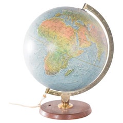
Antique Hammond's 6-Inch Terrestrial Globe on Stand
Located in Philadelphia, PA
Offered here for your consideration is, A fine antique 6-inch terrestrial globe.
Additional Details:
By C.S. Hammond & Co.
The globe likely dates from 1927 to 1930 due to the ...
Category
20th Century Unknown Art Deco Maps
Materials
Wood, Paper

Large Original Antique Map of Ireland. C.1900
Located in St Annes, Lancashire
Fabulous map of Ireland
Original color.
Engraved and printed by the George F. Cram Company, Indianapolis.
Published, C.1900.
Unframed.
Free shipping.
Category
1890s American Antique Maps
Materials
Paper

Original Antique Map of the American State of Colorado, 1903
Located in St Annes, Lancashire
Antique map of Colorado
Published By A & C Black. 1903
Original colour
Good condition
Unframed.
Free shipping
Category
Early 1900s English Antique Maps
Materials
Paper

North & South America: A 17th Century Hand-colored Map by Jansson & Goos
Located in Alamo, CA
A 17th century hand-colored map of North & South America entitled "Americae Descriptio" by the cartographer Johannes Jansson, published in Jansson's Atlas Minor in Amsterdam in 1628....
Category
1620s Dutch Antique Maps
Materials
Paper

Antique Map of Morocco Showing Towns of Marakesh, Taradant and Fez, 1636
Located in Langweer, NL
Antique map titled 'Fezzae et Marocchi regna Africae Celeberrima'. Map of Morocco, showing large fortified towns of Marakesh, Taradante and Fez, towns, mountains, rivers, lakes, etc....
Category
17th Century Antique Maps
Materials
Paper

The 'Brazen Sea' in Solomon's Temple and a Cross Section of the Brazen Sea, 1725
Located in Langweer, NL
Two religious images on one sheet titled 'Kopere Zee in den Tempel van Salomon' and 'Doorsnede van de Kopere Zee des Tempels van Salomon'.
The 'Brazen Sea' in Solomon's Temple an...
Category
1720s Antique Maps
Materials
Paper

Antique Lithography Map, Huntingdonshire, English, Framed Cartography, Victorian
Located in Hele, Devon, GB
This is an antique lithography map of Huntingdonshire. An English, framed atlas engraving of cartographic interest, dating to the mid 19th century and later.
Superb lithography of ...
Category
Mid-19th Century British Victorian Antique Maps
Materials
Glass, Wood, Paper

Antique Map of China and Japan by Tardieu, 1821
Located in Langweer, NL
Antique map titled 'Carte de la Chine et du Japon'. Detailed map of China, showing Korea, Japan and Taiwan. This map originates from 'L'histoire général des voyages' by J.F. de la Harpe.
Category
Early 19th Century Antique Maps
Materials
Paper

Antique Map of Greece from Ortelius's Theatrum Orbis Terrarum, 1595
Located in Langweer, NL
Original antique map titled "Graecia Sophiani." This is a very detailed and decorative engraved map, with two decorative cartouches and a hand-colored initial on the verso, from Abra...
Category
16th Century Antique Maps
Materials
Paper

Exquisite 1850s Vintage Map of North America: A Victorian Cartographic Treasure
Located in Langweer, NL
Ornate 19th-Century Map of North America by J. Rapkin, Published by J & F Tallis
This stunning 19th-century map of North America, created by renowned cartographer J. Rapkin and ...
Category
1850s Antique Maps
Materials
Paper
18th-Century Dutch Garden Design by Gijsbert van Laar, Published in 1802
Located in Langweer, NL
18th-Century Dutch Garden Design by Gijsbert van Laar – Magazijn van tuin-sieraaden, 1802
This exquisite hand-colored engraving is from the renowned work 'Magazijn van tuin-sieraa...
Category
Early 1800s Antique Maps
Materials
Paper

Original Hand-Colored Antique Map of America by Danckerts, circa 1680
Located in Langweer, NL
Antique map titled 'Novissima et Accuratissima Totius Americae Descriptio per I. Danckerts'. Striking map of America. California is shown as an island, Based Upon Sanson's model. The Great Lakes are shown with an open western coastline. No Northwestern Coast beyond 40 degrees. The seven cities of Cibola appear in the Southwestern US. The conception of the Mississippi River is still very vague and pushed far west of its true mouth. The large lake in the Southeastern US first seen on Le Moyne's map is still present. South America retains its excessively wide format. A hopeful extension from Button's Bay is shown portending a possible Northwest Passage. The map is richly embellished with two cartouches, 9 sailing vessels and elaborate vignettes of native villages, native warriors...
Category
Late 17th Century Antique Maps
Materials
Paper
c1920's French Art Deco World Globe on Pedestal
Located in Opa Locka, FL
c1920's French Art Deco Worl Globe On Pedestal. Rare form, this globe stands beautifully on this original base.
Category
1920s French Art Deco Vintage Maps
Materials
Wood

Antique Map of Part of the United States Including Lower California & Arizona
Located in Langweer, NL
Antique map of part of the United States of America including Lower California, Arizona and part of Mexico. This map was part of a set of six individual sheets with maps of the Unite...
Category
Late 19th Century Antique Maps
Materials
Paper

Antique Engraving with a Plan of Rhodes, Greece, 1688
Located in Langweer, NL
Description: Antique map, titled: 'Rhodos.' - Plan of Rhodes, Greece. This map originates from 'Nauwkeurige Beschrijving der eilanden in de in de Archipel der Middellantsche Zee', by...
Category
1680s Antique Maps
Materials
Paper

Antique Map of Yemen by Schraembl, 1789
Located in Langweer, NL
Antique map titled 'Karte von dem groessten Theil des Landes Jemen'. Original map of Yemen, this map is the first printed map specifically of Yemen, and t...
Category
Late 18th Century Antique Maps
Materials
Paper

Original Antique Map of the American State of Connecticut & Rhode Island, 1903
Located in St Annes, Lancashire
Antique map of Connecticut and Rhode Island
Published By A & C Black. 1903
Original colour
Good condition
Unframed.
Free shipping
Category
Early 1900s English Antique Maps
Materials
Paper

Small Antique Map of the European Turkey, Greece & Ionian Islands – c.1860
Located in Langweer, NL
Antique Map of the European Turkey, Greece & Ionian Islands – Stieler, c.1860
Original antique map titled *Die Europaeische Türkei, Griechenland und die ...
Category
1860s Antique Maps
Materials
Paper

Very Large Double Page Detailed Map of Italy and Surrounding Regions, 1794
Located in Langweer, NL
This is a large (two seperate sheets) and detailed map of Italy, including the southern parts of Germany, Dalmatia, the adjacent countries, and the Illyric Islands. The map is titled...
Category
1790s Antique Maps
Materials
Paper
