Items Similar to Antique Map of Friesland with Elaborate Cartouche by Mapmaker Ortelius, c.1570


Want more images or videos?
Request additional images or videos from the seller
1 of 10
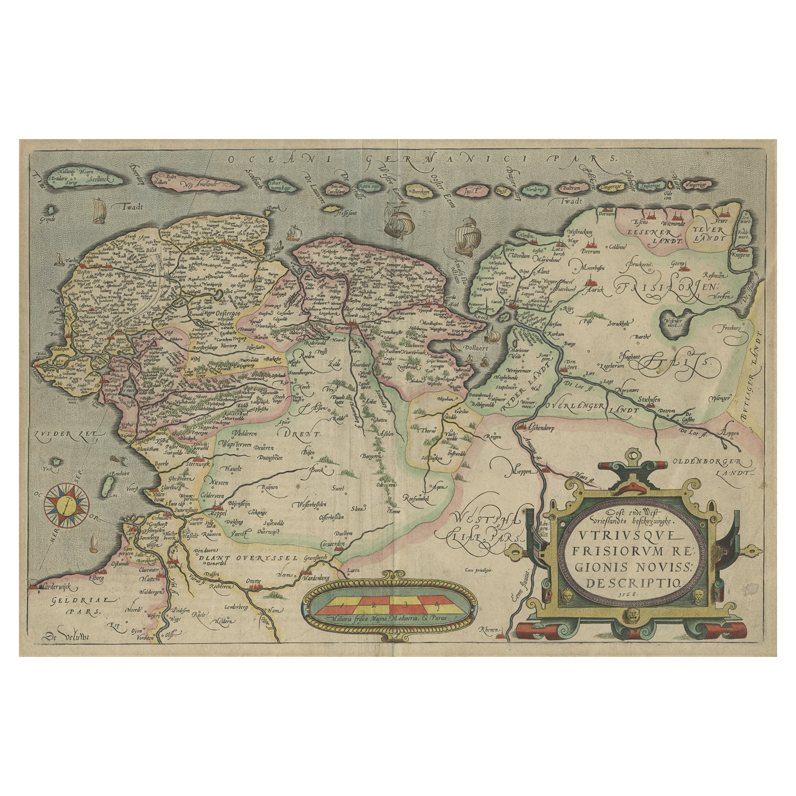
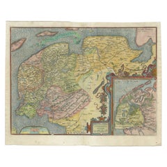
Antique Map of Friesland with Elaborate Cartouche by Mapmaker Ortelius, c.1570
$908.67
$1,135.8320% Off
£672.69
£840.8620% Off
€760
€95020% Off
CA$1,257.37
CA$1,571.7120% Off
A$1,386.22
A$1,732.7820% Off
CHF 725.23
CHF 906.5320% Off
MX$17,006.36
MX$21,257.9420% Off
NOK 9,129.16
NOK 11,411.4520% Off
SEK 8,537.21
SEK 10,671.5120% Off
DKK 5,789.21
DKK 7,236.5220% Off
About the Item
Antique map titled 'Oost end West Vrieslandts beschrijvinghe. Utriusque Frisiorum Regionis Noviss: Descriptio. 1568.' Detailed map of Friesland, the Netherlands. Includes a larger compass rose, sailing ships and an elaborate cartouche. First state. This map originates from 'Theatrum Orbis Terrarum, published circa 1570. Artists and Engravers: Abraham Ortelius was a Brabantian cartographer, geographer, and cosmographer, conventionally recognized as the creator of the first modern atlas, the Theatrum Orbis Terrarum (Theatre of the World). Ortelius is often considered one of the founders of the Netherlandish school of cartography and one of the most notable figures of the school in its golden age (approximately 1570s?1670s). The publication of his atlas in 1570 is often considered as the official beginning of the Golden Age of Netherlandish cartography. He is also believed to be the first person to imagine that the continents were joined before drifting to their present positions.
Artist: Abraham Ortelius was a Brabantian cartographer, geographer, and cosmographer, conventionally recognized as the creator of the first modern atlas, the Theatrum Orbis Terrarum (Theatre of the World). Ortelius is often considered one of the founders of the Netherlandish school of cartography and one of the most notable figures of the school in its golden age (approximately 1570s?1670s). The publication of his atlas in 1570 is often considered as the official beginning of the Golden Age of Netherlandish cartography. He is also believed to be the first person to imagine that the continents were joined before drifting to their present positions.
Condition: Good, given age. A few small spots in the margins. A couple of soft diagonal creases upper right. Four wormholes top margin. A few tiny unobtrusive holes in image near middle fold, hardly visible. Paper separation in the middle fold, backed with acid-free archival tape. Slightly browned near middle fold. Middle fold as issued. General age-related toning and/or occasional minor defects from handling. Please study image carefully.
Date: c.1570
We sell original antique maps to collectors, historians, educators and interior decorators all over the world. Our collection includes a wide range of authentic antique maps from the 16th to the 20th centuries. Buying and collecting antique maps is a tradition that goes back hundreds of years. Antique maps have proved a richly rewarding investment over the past decade, thanks to a growing appreciation of their unique historical appeal. Today the decorative qualities of antique maps are widely recognized by interior designers who appreciate their beauty and design flexibility. Depending on the individual map, presentation, and context, a rare or antique map can be modern, traditional, abstract, figurative, serious or whimsical. We offer a wide range of authentic antique maps for any budget.
- Dimensions:Height: 17.45 in (44.3 cm)Width: 22.72 in (57.7 cm)Depth: 0 in (0.01 mm)
- Materials and Techniques:
- Period:
- Date of Manufacture:circa 1570
- Condition:Condition: Good, given age. A few small spots in the margins. A couple of soft diagonal creases upper right. Four wormholes top margin. A few tiny unobtrusive holes in image near middle fold, hardly visible. Paper separation in the middle fold.
- Seller Location:Langweer, NL
- Reference Number:Seller: PC-580611stDibs: LU3054326282192
About the Seller
5.0
Recognized Seller
These prestigious sellers are industry leaders and represent the highest echelon for item quality and design.
Platinum Seller
Premium sellers with a 4.7+ rating and 24-hour response times
Established in 2009
1stDibs seller since 2017
2,613 sales on 1stDibs
Typical response time: <1 hour
- ShippingRetrieving quote...Shipping from: Langweer, Netherlands
- Return Policy
Authenticity Guarantee
In the unlikely event there’s an issue with an item’s authenticity, contact us within 1 year for a full refund. DetailsMoney-Back Guarantee
If your item is not as described, is damaged in transit, or does not arrive, contact us within 7 days for a full refund. Details24-Hour Cancellation
You have a 24-hour grace period in which to reconsider your purchase, with no questions asked.Vetted Professional Sellers
Our world-class sellers must adhere to strict standards for service and quality, maintaining the integrity of our listings.Price-Match Guarantee
If you find that a seller listed the same item for a lower price elsewhere, we’ll match it.Trusted Global Delivery
Our best-in-class carrier network provides specialized shipping options worldwide, including custom delivery.More From This Seller
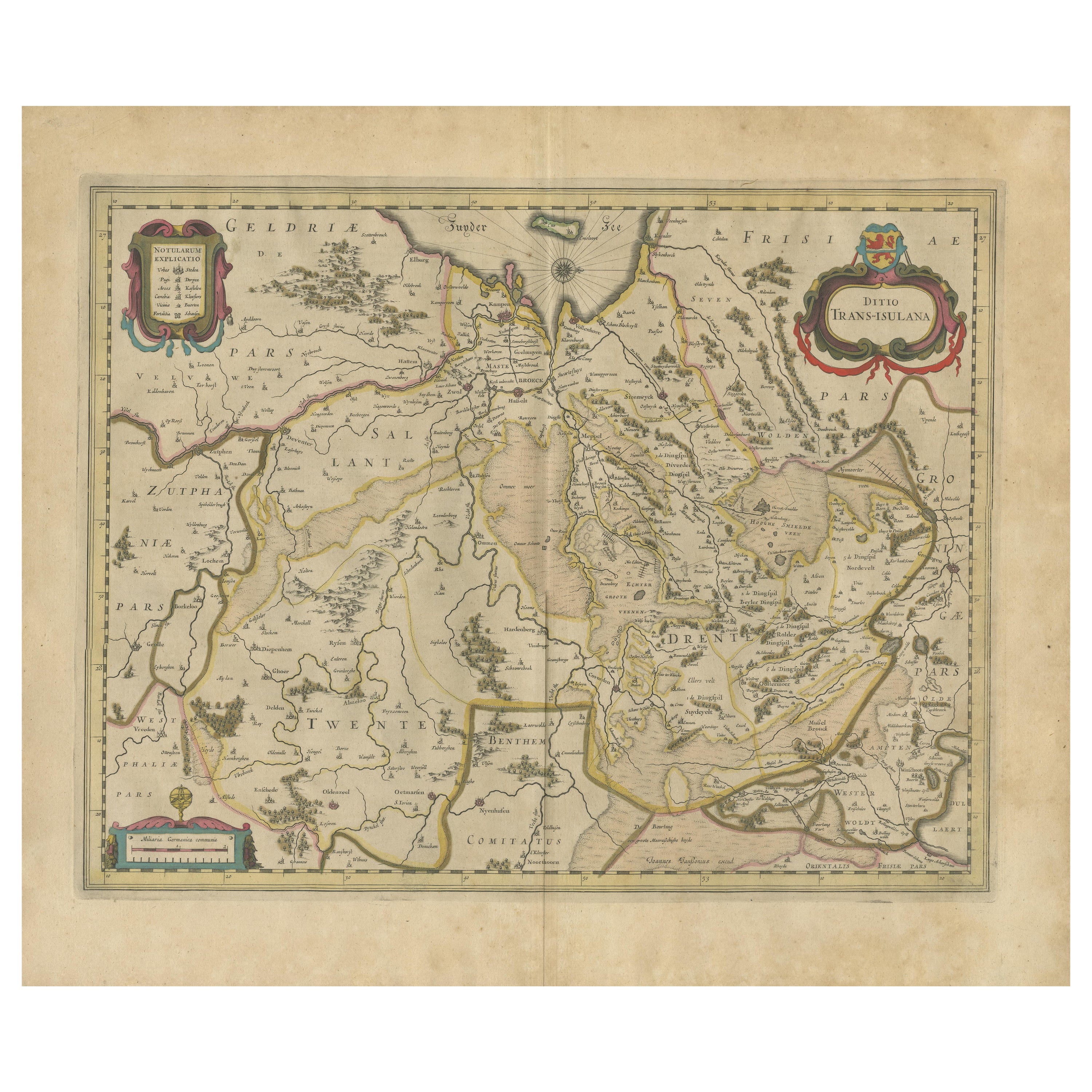
View AllAntique Map of Friesland, Groningen and German East Friesland by Ortelius, 1603
Located in Langweer, NL
Antique map titled 'Oost end West Vrieslandts beschrijvinghe. Utriusque Frisiorum Regionis Noviss: Descriptio. 1568.' Detailed map of Friesland, the Netherlands. Includes a larger co...
Category
Antique 17th Century Maps
Materials
Paper

$306 Sale Price
60% Off
Original Antique Map of Friesland in Decorative Hand-Colouring, 1600
Located in Langweer, NL
Antique map titled 'Frisiae antiquissima trans rhenu provinc et adiacentium regionum nova et exacta descriptio'. Original antique map of the province of Friesland, the Netherlands. T...
Category
Antique 17th Century Maps
Materials
Paper
$593 Sale Price
20% Off
Antique Map of East Frisia by Ortelius, c.1595
Located in Langweer, NL
Antique print, titled: 'Frisia Orientalis.' Map of East Frisia originating from 'Theatrum Orbis Terrarum'. It is based on the manuscript map by Jon Bloe...
Category
Antique 16th Century Maps
Materials
Paper

$813 Sale Price
20% Off
Old Antique Map of the Province of Friesland, the Netherlands, c.1580
Located in Langweer, NL
Antique map titled 'Frisia Occidentalis'. Old map of the province of Friesland, the Netherlands. This map is also known as the 'Pauwenkaart' ('peacock map'), referring to the peacock next to the inset map. Based on a manuscript map...
Category
Antique 16th Century Maps
Materials
Paper
$908 Sale Price
20% Off
Antique Map by Janssonius of the Dutch Province of Overijsel, ca.1650
Located in Langweer, NL
Very good, given the age. Center fold as issued with wide margins. Sharp print with beautiful old-fashioned colouring, carbon copy on verso. Paper in the margins somewhat browned.
Category
Antique 1650s Maps
Materials
Paper

$420 Sale Price
20% Off
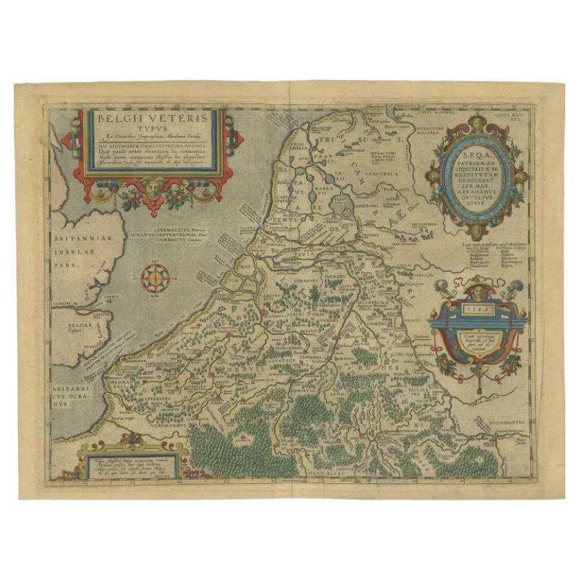
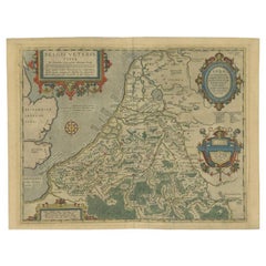
Antique Map of the Low Countries by Ortelius, 1584
By Abraham Ortelius
Located in Langweer, NL
Antique map titled 'Belgii Veteris Typus'. Beautiful map of the Low Countries, extending to the English Channel and part of Britain. This map originates from Ortelius' 'Theatrum Orbi...
Category
Antique 16th Century Maps
Materials
Paper
$564 Sale Price
20% Off
You May Also Like
1592 Abraham Ortelius Map "Lorraine: Lotharingiae Nova Descripti, Ric.A005
Located in Norton, MA
1592 Abraham Ortelius map entitled
"Lorraine: Lotharingiae Nova Descripti
Ric.a005
Description: Ortelius is best known for producing the atlas from which this map comes from, "...
Category
Antique 16th Century Dutch Maps
Materials
Paper

1590 Ortelius Map of Calais and Vermandois, France and Vicinity Ric.a014
Located in Norton, MA
1590 Ortelius map of
Calais and Vermandois, France and Vicinity
Ric.a014
Two rare regional Abraham Ortelius maps on a single folio sheet. Left map, entitled Caletensium, depic...
Category
Antique 16th Century Dutch Maps
Materials
Paper

1643 Willem&Joan Blaeu Map NW Flanders "Flandriae Teutonicae Pars Prientalior
Located in Norton, MA
1643 Willem and Joan Blaeu map of northwest Flanders, entitled
"Flandriae Teutonicae Pars Prientalior,"
Ric0012
" Authentic" - Map of the northwest Fl...
Category
Antique 17th Century Dutch Maps
Materials
Paper

1620 Map of Artois Entitled "Artesia Comitatvs Artois, " by Bleau, Ric.a012
Located in Norton, MA
1640 map of Artois entitled
"Artesia Comitatvs Artois,"
by Bleau
Colored
A-012.
Detailed map of the northern province of Artois, France on the border with Belgium. Feature...
Category
Antique 17th Century Dutch Maps
Materials
Paper

1635 Willem Blaeu Map of Northern France"Comitatvs Bellovacvm" Ric.a08
Located in Norton, MA
1635 Willem Blaeu map of northern France, entitled.
"Comitatvs Bellovacvm Vernacule Beavvais,"
Colored
Ric.a008
“COMITATVS BELLOVACVM…” Amsterdam: W...
Category
Antique 17th Century Unknown Maps
Materials
Paper

1640 Willem Blaeu Map Entitled "Contado di molise et principato vltra, " Ric.a003
By Willem Blaeu
Located in Norton, MA
1640 Willem Blaeu map entitled
"Contado di molise et principato vltra,"
Colored
Ric. a003
Measures: 38 x 49.6 cm and wide margins
DBLAEU.
Cou...
Category
Antique 17th Century Dutch Maps
Materials
Paper

More Ways To Browse
Antique Cartouche
Ships Compass
Ship Compass Antique
John Speed Antique Maps
19th Century World Map
Antique Maps New Zealand
Antique Ohio Maps
Antique Texas Furniture
Biblical Maps
Birds Eye View Map
West Africa Map
Antique Compass Map
Antique Maps California
Hungary Map
Nantucket Map
Map Of Syria
Treasure Map
Antique Navigational Tools