18th Century Collectibles and Curiosities

to
1,731
2,054
2,424
343
2,054
15
1
3,091
2,413
734
42
337
113
35
79
5
6
10
6
16
30
13
6
4
2,002
19
19
14
14
82
52
9
6
6
2,054
2,054
2,054
20
14
13
12
11
Item Ships From: Netherlands
Period: 18th Century
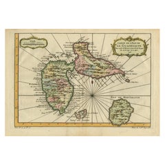
Antique Map of Guadeloupe, Island in the Caribbean, c.1757
Located in Langweer, NL
Antique map titled 'Carte de L'Isle de la Guadeloupe'. A very decorative map of Guadeloupe in the Caribbean, adorned with rhumb lines, fleur-de-lys, and two decorative rococo-style...
Category

Antique 18th Century Collectibles and Curiosities

Materials

Paper

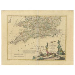
Antique Map of Southern England and Wales by Zatta, 1784
Located in Langweer, NL
"Antique map titled 'Parte Meridionale dell' Inghilterra e del Pricipato di Galles'. Engraved map of the southern part of England and Wales, with title cartouche. Shows political and...
Category

Antique 18th Century Collectibles and Curiosities

Materials

Paper

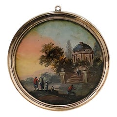
18th / Early 19th Century Miniature Painting
Located in Delft, NL
An 18th / early 19th century miniature painting An 18th / early 19th century miniature painting painted on glass and framed. The copper framed miniature painting in another copp...
Category

European Antique 18th Century Collectibles and Curiosities

Materials

Copper

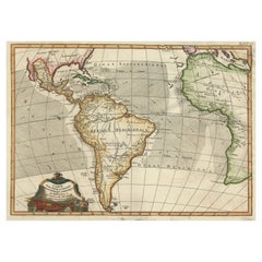
Antique Map of South American, The West Indies & Most of Africa, Ca.1775
Located in Langweer, NL
Antique map titled 'Carte pour Servir a l' Histoire Philosophique et Politique des Etablissemens et du Commerce des Europeens dans les deux Indes'. This map is roughly centered o...
Category

Antique 18th Century Collectibles and Curiosities

Materials

Paper

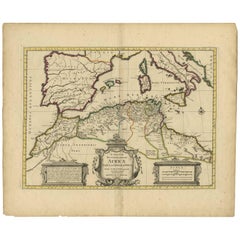
Antique Map of the Northern Coast of Africa and Southern Europe, circa 1745
Located in Langweer, NL
Antique map titled 'In Notitiam Ecclesiasticam Africae Tabula Geographica'. Very decorative hand-colored map of the northern coast of Africa, Spain, Italy and the Mediterranean with the islands of Sardinia, Corsica, Majorca, Minorca etc. Sicily features a smoking Mount Aetna. Embellished with three architectural cartouches...
Category

Antique 18th Century Collectibles and Curiosities

Materials

Paper

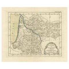
Antique Map of Guyenne, Gascony and Béarn, France
Located in Langweer, NL
Antique map titled 'Guyenne et Gascogne et Bearn'. Original old map of Guyenne (or Guienne), Gascony and Béarn, France. This map originates from 'Le Petit Atlas Maritime Recueil De C...
Category

Antique 18th Century Collectibles and Curiosities

Materials

Paper

Antique Engraving of Majorinus, Bishop of Carthage of the Donatist Sect, 1701
Located in Langweer, NL
Antique print, titled: 'Majorinus Numida' Majorinus was a bishop of Carthage in dispute with Ceacilianus. He favored the so-called Donatist sect. Het died ca. 329 AD. The background to the controversy was the wave of persecutions of Christians by the Roman Emperor Diocletian. At that time some Church leaders - unwilling to endure torture or death and become martyrs - had been ready to take such acts as worshipping the gods of the old pantheon, considered idols by Christians, or surrendering church books and property to the imperial authorities. Such people became known as 'traditors' ("surrenderers"). One of these "traditors", named Caecilian, had returned to the fold of the Church once the persecutions ended, and was consecrated Bishop of Carthage and Primate of North Africa. Those of the faithful who refused to accept the authority of such a spiritual leader raised Majorinus as a rival bishop; however, Majorinus died shortly after being consecrated, and it fell to Donatus to take his place and continue the struggle. This rare print originates from: 'Historie der Kerken en Ketteren van den beginne des Nieuwen Testaments tot aan het Jaar onses Heeren 1688. Onzydig in 't Hoogduytsch beschreeven, door den Hoog-geleerden Heer Godfried Arnold, Voor deezen Hoog-Leeraar in de Historien tot Giesen. In het Neederduyts vertaald. Vercierd met verscheyde Koopere Plaaten door den Heer Romeyn de Hooghe.' (transl.: History of Churches and Heretics from the start of the New Testament until the year of our lord 1688 ...), by Godfried Arnold, Dutch edition published by Sebastiaan Petzold, Amsterdam 1701. This edition contains portraits of heretic figures, etched by the reknown Romeyn de Hooghe. Artists and Engravers: Made by 'Romeyn de Hooghe' after an anonymous artist. Gottfried Arnold (pseud. Christophorus Irenaeus) was an important representative of the so-called radical Pietism, publicist, church historian and chants writer (so he was believed to have written the well-known Church song 'O Durchbrecher aller Bande'). Arnold studied theology in Wittenberg. From the Lutheran Orthodoxy he converted, through writings of Spener, to Pietism, associating later into a circle around the court preacher Sprögel, who was influenced by Jakok Böhm. Many medieval mystics were later re-issued by him. In addition he was clearly influenced by Grotius and the early enlightenment. His quest for the 'true' Christianity rightly brought him in the early Church. So he arranged an edition containing the sermons of the desert father Macarius. Arnold was a skilled patristicus, although he did not escape from the creation of an ideal image of the Christian life in the early Church, in his view a flowering time which ended with the reign of Constantine. His first study of the early Church ('Die erste Liebe der Gemeinen Jesu Christi') provided him a professor position in Gießen, a post which he soon left, disappointed by what he called the 'Ruhmsachtige Vernunftwesen des akademischen Lebens'. He continued as an individual scientist and he published books and poems. His main work is 'Unparteiischen Kirchen- und Ketzerhistorie' (1699-1700), of which this is the Dutch translation. He adapts in this study the reformatory decay theory, where the censure lies no longer with Constantine, but the post-Apostolic time. The decay is temporarily lifted with the Reformation, but occurres again soon, so that even the contemporary institutional Protestantism lies under the fire of his criticism. On the other hand he favours the 'Church of the spirit' that existed in all times (invisible) and is characterised by avoiding the world and asceticism. Not the orthodoxy, but the subjectivity of religious man...
Category

Antique 18th Century Collectibles and Curiosities

Materials

Paper

Original Antique Map of the Cape Verde Islands, 1746
Located in Langweer, NL
Antique map titled 'Carte Des Isles Du Cap Verd.' Original antique map of the Cape Verde Islands. Decorative cartouche and compass rose. Extends from Isle d...
Category

Antique 18th Century Collectibles and Curiosities

Materials

Paper

Old Antique Print of Fort Noordwijk, Batavia in the Dutch East Indies, 1739
Located in Langweer, NL
Antique print titled 'Ein Prospect des Forts Nortweijck, wie sich dasselbe wan man von Jacatra komt, mit seiner Gegend präsentiret'. Old print of Fort Noordwijk, Batavia (Jakarta). This print originates from from 'Allerneuester Geographische- und Topographischer Schau-platz, von Africa und Ost-Indien'. Artists and Engravers: Johann Wolfgang Heydt, a German artist who worked for the Dutch East India...
Category

Antique 18th Century Collectibles and Curiosities

Materials

Paper

Antique Map of the Caspian Sea, Uzbekistan, Northern Persia Etc, C.1735
Located in Langweer, NL
Antique map titled 'Nova Maris Caspii et Regions Usbeck (..).' Detailed map of Central Asia centered on the Caspian Sea, showing Uzbekistan to the east of ...
Category

Antique 18th Century Collectibles and Curiosities

Materials

Paper

Genuine Antique Engraved Map of Helvetia or Switzerland, 1729
Located in Langweer, NL
Decorative early 18th century engraved map of Switzerland. Title: Helvetia Conterminarumq terra rum antiqua. Translated from Latin: Switzerland is an ancient land Description: Switzerland, antique copperplate engraved map with hand coloring and a decorative title cartouche. Two figures greatly enhances visual appeal. Author: Phillip Cluver, or Philip Cluverius, Philipp Clüver, Latinized as Philippus Cluverius studied law in Leiden and settled over there in 1615. We only sell Guaranteed Absolutely Original authentic Maps and Prints. A Certificate of Authenticity ( COA ) will be supplied on request. We ship our antique maps and prints...
Category

Antique 18th Century Collectibles and Curiosities

Materials

Paper

Antique Map of the Northern Portion of the Philippines by J.N. Bellin, 1764
Located in Langweer, NL
Detailed map of the Northern portion of the Philippines, extending from Batanes and Babuyanes to Mindonoro and Masbate, and centered on Luzon. One of the most detailed maps of the pe...
Category

Antique 18th Century Collectibles and Curiosities

Materials

Paper

18th Century Antique Engraving of the Southern Hemisphere by G. de L'Isle
Located in Langweer, NL
Antique map titled 'Hemisphere Meridional pour voir plus distinctement Les Terres Australes'. Hemispherical map of the southern hemisphere centered on ...
Category

Antique 18th Century Collectibles and Curiosities

Materials

Paper

Antique Map of the Banda Islands in Indonesia by Valentijn, 1726
Located in Langweer, NL
Antique map Indonesia titled 'Kaart der Zuyd-Wester Eylanden van Banda'. Map of the islands in the southwestern part of the Banda Sea including ...
Category

Antique 18th Century Collectibles and Curiosities

Materials

Paper

Map of the West African coast from the North of Mauretania to Guinee, 1788
Located in Langweer, NL
Antique map titled 'Particular Map of the Western Coast of Africa, from Cape Blanco to Cape de Verga, and of the Course of the Rivers Senega and Gambia.' Map of the African coast...
Category

Antique 18th Century Collectibles and Curiosities

Materials

Paper

Detailed Plan of the City of Zutphen, The Netherlands – Hendrik de Leth, c.1740
Located in Langweer, NL
Title: Detailed Plan of the City of Zutphen – Hendrik de Leth, ca. 1740 This hand-colored engraving, created by Hendrik de Leth and published around 1740, presents a detailed and ...
Category

Antique 18th Century Collectibles and Curiosities

Materials

Paper

Chinese Porcelain Dollhouse Miniature Blue and White Kangxi Vase '1662-1722'
Located in Delft, NL
Chinese Porcelain Dollhouse miniature blue and white Kangxi vase Kangxi (1662-1722), ca 1720 With a scene of floral decor and long Eliza The porcelain vase...
Category

Chinese Antique 18th Century Collectibles and Curiosities

Materials

Porcelain

Fabulous Original Antique two-sheet Map of the Caspian Sea, ca.1723
Located in Langweer, NL
Carte Marine de la Mer Caspiene... [and] Coste de Perse sur la Mer Caspiene et Partie de Celles de Tartarie", Delisle, Guillaume (2 maps) Subject: Caspian Sea ...
Category

Antique 18th Century Collectibles and Curiosities

Materials

Paper

Engraved Commemorative Surinam Plantation Glass, History of 18th Century Slavery
Located in Amsterdam, NL
A splendid commemorating glass with a fine engraving of a plantation house and coffee shrubs with a text reading: Het.Welvaaren.Van.De.Plantagie.Saxen (the prosperity of the Plantati...
Category

Surinamer Antique 18th Century Collectibles and Curiosities

Materials

Glass

Antique Map of the Coast of Guinea and the Cape Verde Islands
Located in Langweer, NL
Antique map titled 'Carte de la Guinée (..)'. This map was originally part of a 2 sheet larger map of Eastern Africa, showing the Cape Verde Islands and Senegal. This map originates ...
Category

Antique 18th Century Collectibles and Curiosities

Materials

Paper

Antique Map of the Region of Brie and Champagne by Zatta, 1779
Located in Langweer, NL
Antique map titled 'Li Governi di Sciampagna e Brie'. Old map of France showing the provinces of Brie and Champagne. This map originates from 'Atlante Novissimo, illustrato ed accres...
Category

Antique 18th Century Collectibles and Curiosities

Materials

Paper

Antique Map of Menorca / Minorca by Homann Heirs '1757'
Located in Langweer, NL
Antique map titled 'Carte Topographique de l'Isle Minorque'. Scarce decorative map of Menorca (or Minorca), with two gorgeous views of Mahon and Fort St. Phillipe at the bottom. Publ...
Category

Antique 18th Century Collectibles and Curiosities

Materials

Paper

Rare Old English Sea Chart of Part of Indonesia with Java, Madura and Bali, 1711
Located in Langweer, NL
Antique map titled 'A Large Draught of the East End of Java and Madura shewing the Streights of Bally.' Rare early example of this working English Sea Chart of part of Indonesia ...
Category

Antique 18th Century Collectibles and Curiosities

Materials

Paper

Antique Map of the Mongol Empire, 1767
Located in Langweer, NL
Antique map titled 'The Moguls Empire divided into its principal governments'. Old map of India, Bangladesh, and parts of eastern China. Artists and Engravers: Published in the G...
Category

Antique 18th Century Collectibles and Curiosities

Materials

Paper

Antique Map of the Electorate of Brandenburg by Georges-Louis Le Rouge, 1768
Located in Langweer, NL
Antique Map of the Electorate of Brandenburg by Georges-Louis Le Rouge, 1748 This 1748 map by Georges-Louis Le Rouge, titled "Le Marquisat et Electorat de Brandenbourg," depicts the...
Category

Antique 18th Century Collectibles and Curiosities

Materials

Paper

Antique Map of South East Asia, Australia and the Indian Ocean, 1726
Located in Langweer, NL
Antique map titled 'Tabula Indiae Orientalis'. Beautiful detailed map of Australia, Southeast Asia and the Indian Ocean. The map features a fine depiction of the outlines of the western two-thirds of Australia, based on the discoveries of explorers working for the Dutch East India Company (the VOC). These include Willem Jansz's discoveries in the Gulf of Carpentaria in 1606; the encounters of Dirk...
Category

Dutch Antique 18th Century Collectibles and Curiosities

Materials

Paper

Antique Map of Turkey in Europe by Russell, circa 1795
Located in Langweer, NL
Antique map titled 'Turkey in Europe and Hungary'. Original map of Turkey in Europe. Covers present day Northern Turkey, Greece, Albania, Romania, Hungary, Croatia, Bosnia Herzogovin...
Category

Antique 18th Century Collectibles and Curiosities

Materials

Paper

Antique Map of the City of Groningen Made After Harrewijn, C.1750
Located in Langweer, NL
Antique map titled 'Groeningue'. Old map of the city of Groningen, the Netherlands. Source unknown, to be determined. Artists and Engravers: Most likely made after J. Harrewijn. ...
Category

Antique 18th Century Collectibles and Curiosities

Materials

Paper

Antique Engravings of Mauritius and Indonesia, incl de Banda Islands, c.1730
Located in Langweer, NL
Title on page: "Ins. de Cerno a. Nostatibus Mauritius Nominata [on sheet with] Gunnanappi Labetacq [and] Civitas Gammelamme [and] Rex Tubatus", Le Clerc, Jean This sheet includes fo...
Category

Antique 18th Century Collectibles and Curiosities

Materials

Paper

Antique Decorative French Map of Java, Indonesia, 1718
Located in Langweer, NL
Antique map of Java titled 'Carte de l'Ile de Java: Partie Occidentale, Partie Orientale, Dressee tout Nouvellement (..)'. Decorative large format map...
Category

Antique 18th Century Collectibles and Curiosities

Materials

Paper

Original Antique Map of Northern India
Located in Langweer, NL
Antique map titled 'Carte de l'Indoustan (..) - Kaart van Hindoestan (..)'. Original antique map of northern India. This map originates from 'His...
Category

Antique 18th Century Collectibles and Curiosities

Materials

Paper

Hibernia Regnum Map by Carel Allard, 1700: Hand-Colored Provinces of Ireland
Located in Langweer, NL
This is a historical map of Ireland created by Carel Allard around 1700, titled "Hibernia Regnum in Quatuor Provincias Ultoniam, Connaciam, Lageniam, et Momoniam". The map is hand-colored and engraved. It includes two large decorative cartouches. The map is part of an atlas by Carel Allard, an Amsterdam-based cartographer. Here are the detailed points about the map: Maker: Carel Allard - a prominent Dutch cartographer and publisher from Amsterdam. Atlas: Source Atlas - Likely part of an atlas published by Carel Allard, but specific title of the atlas isn't mentioned. Interesting Features 1. Decorative Cartouches: The map features two large, ornate cartouches. One in the upper left depicts a classical figure and British Royal arms...
Category

Antique 18th Century Collectibles and Curiosities

Materials

Paper

Detailed 18th-Century Map of Paris and Its Surrounding Regions by Johann Homann
Located in Langweer, NL
This map, titled “Agri Parisiensis Tabula particularis,” was created and published by the German cartographer Johann Baptist Homann (1664–1724), or his workshop, in Nuremberg. Homann...
Category

Antique 18th Century Collectibles and Curiosities

Materials

Paper

Large Map of Russian Discoveries in Siberia, Alaska & the Bering Strait, 1784
Located in Langweer, NL
1784 Russian Discoveries in Siberia, Alaska & the Bering Strait - Gerhard Friedrich Muller "Nouvelle Carte des Decouvertes Faites par des Vaisseaux Russiens Aux Cotes Inconnues de L'Amerique Septentrionale avec Les Pais Adiacents" is a seminal map by Gerhard Friedrich Muller, showcasing Russian discoveries in Siberia, Alaska, and the Bering Strait region. Originally published in 1754, this map served as a direct counter to Guillaume de L'Isle's speculative "fantasy" map of the same area, which prominently featured the fictitious Mer de l'Ouest (Sea of the West). This edition, published in 1784 by the Imperial Academy of Sciences in St. Petersburg, reflects the substantial geographic knowledge gained through Russian explorations, particularly the voyages of Vitus Bering. It accurately depicts the northern Pacific coasts, focusing on Siberia, the Aleutian Islands, and the Alaskan coast. The hand-coloring remains vibrant, emphasizing key geographic details, and a richly decorated rococo cartouche adorns the upper right, indicating the map's origins. This map is a significant artifact, illustrating the progression of cartographic accuracy and the influence of Russian expeditions in shaping the early knowledge of the North Pacific and Arctic regions. The 1784 edition of Gerhard Friedrich Muller's map features the routes of key Russian voyages that explored the North Pacific, specifically those related to the exploration of Siberia, Alaska, and the Bering Strait. These include: 1. Vitus Bering's Voyages (1728 and 1741) - The map shows routes of Vitus Bering, a Danish explorer in the Russian Navy, who led two important expeditions: - During his first Kamchatka Expedition (1728), Bering navigated through what is now known as the Bering Strait, proving that Siberia and Alaska were separated by a sea. - His second Kamchatka Expedition (1741) extended further eastward to Alaska. This journey greatly expanded European knowledge of the northern Pacific and confirmed Alaska as part of the North American continent. 2. Aleksei Chirikov's Route (1741) - As part of the second Kamchatka Expedition, Aleksei Chirikov, who was Bering's second-in-command, led a separate ship and reached the Alaskan coast, discovering the southeastern parts of Alaska and providing further detailed knowledge of the area. 3. Russian Navigators in the Aleutian Islands - The map also shows the exploration routes in and around the Aleutian Islands, which were instrumental for Russian fur...
Category

Antique 18th Century Collectibles and Curiosities

Materials

Paper

Old Print of William Cavendish, First Duke of Newcastle, on Horseback, ca.1740
Located in Langweer, NL
Antique print titled 'Apres l'homme le Cheval (..)'. Antique print depicting William Cavendish, first Duke of Newcastle, on horseback on an inscr...
Category

Antique 18th Century Collectibles and Curiosities

Materials

Paper

Old Antique Map of Borneo 'Kalimantan Indonesia, Sabah Malaysia & Brunei'
Located in Langweer, NL
Antique map titled 'Kaart van het Eyland Borneo'. Original antique map of the island of Borneo. Published 1724-1726 by Joannes van Braam and Gerard Onder de ...
Category

Antique 18th Century Collectibles and Curiosities

Materials

Paper

Antique Map of South America by Gordon, c.1745
Located in Langweer, NL
Antique map titled 'South America according to the latest observations'. Antique map of South America originating from 'Geography Anatomiz'd: or, The Geographical Grammar'. Artists a...
Category

Antique 18th Century Collectibles and Curiosities

Materials

Paper

Antique Map of France at the End of the Reign of Jean II by Zannoni, 1765
Located in Langweer, NL
Antique map France titled 'La France sous la fin du Regne de Jean II (..)'. Beautiful old map of France. This map originates from 'Atlas Historique de la France Ancienne et Moderne' ...
Category

Antique 18th Century Collectibles and Curiosities

Materials

Paper

Antique Print of Two Jewish Synagogues in Amsterdam, The Netherlands, c.1760
Located in Langweer, NL
Antique print titled 'De Twee groote Synagogen der Hoogduitsche Jooden en het Oude-Zyds-Huiszitten-Aalmoesseniers-Huis van agteren, in 't verschiet'. Old print depicting two large large synagogues of German jews...
Category

Antique 18th Century Collectibles and Curiosities

Materials

Paper

Rare Antique English SeaChart of Bali, Lombok, Floris, Borneo, Celebes etc, 1711
Located in Langweer, NL
Antique map titled 'A Large Draught from Benjar on the Island of Borneo To Macasser on the Island of Celebes Shewing the Streight of Bally with the Islands to the Eastward thereof.' ...
Category

Antique 18th Century Collectibles and Curiosities

Materials

Paper

Antique Map of Westergo, Friesland in the the Netherlands, by Tirion, 1744
Located in Langweer, NL
Antique map titled 'Westergo'. Original antique map of Westergo, part of the province of Friesland, the Netherlands. Published 1744. Artists and Engravers: Isaak Tirion (1705 in U...
Category

Antique 18th Century Collectibles and Curiosities

Materials

Paper

Highly Decorative Map of The Eastern Mediterranean and The Middle East, ca.1700
Located in Langweer, NL
Antique map titled 'Byzondere Kaart van de Landen Daar de Apostelen Het Evangelium Gepredikt Hebben (..).' Highly decorative map of the eastern Mediterranean...
Category

Antique 18th Century Collectibles and Curiosities

Materials

Paper

Antique Map of Asia Minor including part of the Greek Archipelago and Cyprus
Located in Langweer, NL
Antique map titled 'Chersonesi quae hodie Natolia Descriptio'. Decorative, smaller map of Asia Minor including part of the Greek Archipelago and Cyprus. The drape-style title cartouc...
Category

Antique 18th Century Collectibles and Curiosities

Materials

Paper

Original Antique Engraving of Algiers in Algeria, 1773
Located in Langweer, NL
Antique print titled 'Algiers'. Old print with a view of Algiers, Algeria. With Dutch legend. Originates from the first Dutch editon of an interesting travel account of Northern Afri...
Category

Antique 18th Century Collectibles and Curiosities

Materials

Paper

Antique Map of the Congo, Gabon and Angola by N. Sanson, circa 1700
Located in Langweer, NL
Attractive map of Gabon, the Congo and Angola from Cape Lopez and Sao Tomé to approximately the border with present-day Namibia. The map is fully engraved with mountains, rivers, for...
Category

Antique 18th Century Collectibles and Curiosities

Materials

Paper

Decorative Map of Hanover, Lower Saxony by Lodge, ca. 1785
Located in Langweer, NL
Title: Decorative Map of Hanover, Lower Saxony by Lodge, ca. 1785 This decorative map, titled "A New & Correct Plan of Hanover, a City in the circle of Lower Saxony," was engraved b...
Category

Antique 18th Century Collectibles and Curiosities

Materials

Paper

Original Antique Map of Southern India and Ceylon 'Present-Day Sri Lanka'
Located in Langweer, NL
Antique map titled 'Suite de la Carte de l'Indoustan (..) - Vervolg van de Kaart van Hindoestan (..)'. Original antique map of Southern India and Ceylon (present-day Sri Lanka). This...
Category

Antique 18th Century Collectibles and Curiosities

Materials

Paper

Antique Map of the Region of Aigues-Mortes and Camargue, France
Located in Langweer, NL
Antique map titled 'Environs d'Aiguemortes de Peccais &a et la petite Camargue'. Original map of the region of Aigues-Mortes and Camargue, France. This map originates from 'Le Petit ...
Category

Antique 18th Century Collectibles and Curiosities

Materials

Paper

Antique Roman Battle Print of the Greater and Lesser Camp by Duncan, c.1753
Located in Langweer, NL
Antique battle map showing the greater and lesser camp. With detailed legend explaining the various elements of the print. This print most likely originates from an edition of 'The C...
Category

Antique 18th Century Collectibles and Curiosities

Materials

Paper

Antique Bible World Map by R. & J. Wetstein, 1743
Located in Langweer, NL
Antique world map titled 'De Werelt Caart'. A scarce and richly detailed double hemisphere world map that was probably based on an earlier work by Cornelis Dankerts. This map has t...
Category

Antique 18th Century Collectibles and Curiosities

Materials

Paper

Old Map of the Sinai Peninsula Showing the Mediterranean and the Red Sea, 1773
Located in Langweer, NL
Antique map of the Sinai Peninsula showing the Mediterranean Sea to the north and the Red Sea to the south. The map is decorated with images of a Persian wheel and a view of a vi...
Category

Antique 18th Century Collectibles and Curiosities

Materials

Paper

Rare Map of Rama or Ramma 'Ramallah?' in Palestine or the Holy Land, ca.1730
Located in Langweer, NL
Antique map titled 'Rama'. This maps shows a view of Ramma (Ramallah?) in Palestine or the Holy Land. With Dutch legend. Source unknown, to be determined. Artists and Engraver...
Category

Antique 18th Century Collectibles and Curiosities

Materials

Paper

Antique Map of the Maluku Islands by Bellin, c.1750
Located in Langweer, NL
Antique map titled 'Carte Particuliere des Isles Moluques'. This map depicts the islands of Herij, Ternate, Tidor, Pottebackers, Timor, Machian and Bachian. The Moluccan islands were...
Category

Antique 18th Century Collectibles and Curiosities

Materials

Paper

Imperii Persici Delineatio: A 1722 Cartographic Masterpiece of Persia by Schenk
Located in Langweer, NL
Title: IMPERII PERCICI delineatio ex scriptis potissimum geographicis Arabum et Persarum Cartographer: Petrus Schenk (Pieter Schenk), 1722 An original antique hand-colored engraved...
Category

Antique 18th Century Collectibles and Curiosities

Materials

Paper

Rare Engraved City Plan of Nuremberg, Bavaria by Christoph Weigel, 1718
Located in Langweer, NL
Title: Rare Engraved City Plan of Nuremberg, Bavaria by Christoph Weigel, 1718 Description: This detailed city plan of Nuremberg, Bavaria was crafted by Christoph Weigel in 1718 an...
Category

Antique 18th Century Collectibles and Curiosities

Materials

Paper

Hand-Colored City Plan of Cologne by Nicolas de Fer, 1705
Located in Langweer, NL
Title: Hand-Colored City Plan of Cologne by Nicolas de Fer, 1705 This hand-colored map, titled "Cologne Ville Considerable Situee sur le Bord Occidentale du Rhein Capit. de l'Electo...
Category

Antique 18th Century Collectibles and Curiosities

Materials

Paper

Antique Print of the Road Between Semarang and Kartosuro, Java, 1726
Located in Langweer, NL
Antique print titled 'Caarte Gemaakt ter Ordre van den Edelen Heer Herman de Wilde ..... Van de weg tusschen Samarang en Cartasoera.' This print shows a map of the road between Semar...
Category

Antique 18th Century Collectibles and Curiosities

Materials

Paper

Antique Plan of Batavia, Nowadays Jakarta, Indonesia, 1780
Located in Langweer, NL
Antique map titled 'Plan der Stad en 't Kasteel Batavia'. A very rare late 18th century detailed plan of Batavia with an alpha-numeric key showing the main areas and buildings (only ...
Category

Antique 18th Century Collectibles and Curiosities

Materials

Paper

Read More

Medal-Worthy Memorabilia from Epic Past Olympic Games

Get into the games! These items celebrate the events, athletes, host countries and sporting spirit.

Ahoy! You’ve Never Seen a Collection of Sailor Art and Kitsch Quite Like This

French trendsetter and serial collector Daniel Rozensztroch tells us about his obsession with objects related to seafaring men.

Pamela Shamshiri Shares the Secrets behind Her First-Ever Book and Its Effortlessly Cool Interiors

The sought-after designer worked with the team at Hoffman Creative to produce a monograph that beautifully showcases some of Studio Shamshiri's most inspiring projects.

Moroccan Artworks and Objects Take Center Stage in an Extraordinary Villa in Tangier

Italian writer and collector Umberto Pasti opens the doors to his remarkable cave of wonders in North Africa.

Montecito Has Drawn Royalty and Celebrities, and These Homes Are Proof of Its Allure

Hollywood A-listers, ex-pat aristocrats and art collectors and style setters of all stripes appreciate the allure of the coastal California hamlet — much on our minds after recent winter floods.

Whaam! Blam! Pow! — a New Book on Pop Art Packs a Punch

Publishing house Assouline and writer Julie Belcove have teamed up to trace the history of the genre, from Roy Lichtenstein, Andy Warhol and Yayoi Kusama to Mickalene Thomas and Jeff Koons.

The Sparkling Legacy of Tiffany & Co. Explained, One Jewel at a Time

A gorgeous new book celebrates — and memorializes — the iconic jeweler’s rich heritage.

What Makes a Gem-Encrusted Chess Set Worth $4 Million?

The world’s most opulent chess set, weighing in at 513 carats, is literally fit for a king and queen.
Recently Viewed

View All