18th Century Collectibles and Curiosities

to
1,731
2,054
2,424
343
2,054
15
1
3,091
2,413
734
42
337
113
35
79
5
6
10
6
16
30
13
6
4
2,002
19
19
14
14
82
52
9
6
6
2,054
2,054
2,054
20
14
13
12
11
Item Ships From: Netherlands
Period: 18th Century
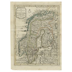
Antique Map of the Kingdom of Sweden and Norway by Keizer & de Lat, 1788
Located in Langweer, NL
Antique map titled 't Koninkryk van Zweden en Noorwegen'. Uncommon original antique map of the Kingdom of Sweden and Norway. This map originates from 'Nieuwe Natuur- Geschied- en Han...
Category

Antique 18th Century Collectibles and Curiosities

Materials

Paper

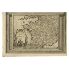
Antique Map of France with Beautiful Title Cartouche and Border, c.1740
Located in Langweer, NL
Antique map titled 'La France suivant les nouvelles Observations de Messrs de l'Academie Royale des Sciences etc.'. Rare map of France with beautiful title cartouche and decorative b...
Category

Antique 18th Century Collectibles and Curiosities

Materials

Paper

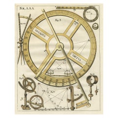
Occasus Ortus: An Astronomical Measuring Device for Angular Precision, c.1780
Located in Langweer, NL
This print, titled "Occasus Ortus", showcases a highly detailed engraving of an 18th-century measuring device, likely related to astronomy or navigation. The design features various components of the instrument arranged systematically, with each part labeled by figure numbers. The centerpiece is a large circular protractor...
Category

Antique 18th Century Collectibles and Curiosities

Materials

Paper

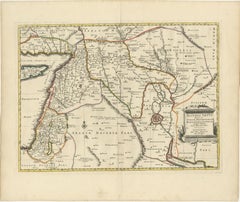
Old Map of Ancient Assyria Divided into Syria, Mesopotamia, Babylonia & Assyria
Located in Langweer, NL
This map, "Assyria vetus diuisa in Syriam, Messopotamiam, Babyloniam, et Assyriam", by Pierre Mortier, is a late 17th-century depiction of the historical Middle East. Title: Ancie...
Category

Antique 18th Century Collectibles and Curiosities

Materials

Paper

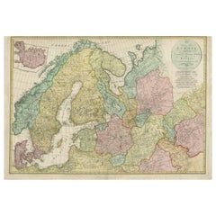
Historical Map of Northern Europe and Russia - Engraved for I. Harrison, 1788
Located in Langweer, NL
Historical Map of Northern Europe and Russia - Engraved for I. Harrison, 1788 This impressive historical map titled A New Map of Europe Containing Denmark, Norway, Sweden and Russ...
Category

Antique 18th Century Collectibles and Curiosities

Materials

Paper

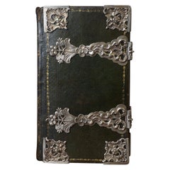
Complete bible bound in green leather morocco with silver clasps, 18th century
Located in Gorssel, GE
La Sainte Bible qui contient le Vieux et le Nouveau Testament edited by: Z.CHatelain & Fils, Arkstee & Merkus, Marc Michel Rey. A.D. 1770. Subtitle: 'Le nouveau Testament, cést à di...
Category

European Rococo Antique 18th Century Collectibles and Curiosities

Materials

Silver

Finest Detailed and Patina Antique Bronze Corpus of Christ for Wall Mounting
Located in Lisse, NL
Beautiful and meaningful religious art. If only the best quality and condition is good enough for you then this stunning and practical size corpus of Christ could be gracing your wall soon. Both the perfect anatomy and the amazing details in this antique corpus...
Category

Italian Renaissance Revival Antique 18th Century Collectibles and Curiosities

Materials

Bronze

Barados and St Christopher or St Kitts and Nevis Islands in the Caribbean, 1748
Located in Langweer, NL
This original map, a copperplate engraving by Le Rouge, presents two significant areas in the Caribbean. Titled "Isle St. Christophle une des Antilles aux anglois" and "La Barbade. d...
Category

Antique 18th Century Collectibles and Curiosities

Materials

Paper

Rare Chinese Export Porcelain Voc Dish
Located in Amsterdam, NL
A Chinese export porcelain VOC (Dutch East India Company) dish Canton, Yongzheng period, circa 1730 Diam. 23 cm Executed in rose-pink, ...
Category

Chinese Chinese Export Antique 18th Century Collectibles and Curiosities

Materials

Porcelain

Historical Map of the Duchy of Lauenburg by Johann Baptist Homann - Circa 1720
Located in Langweer, NL
Historical Map of the Duchy of Lauenburg by Johann Baptist Homann - Circa 1720 This splendid historical map titled Ducatus Lauemburgicus is a highly detailed and beautifully engra...
Category

Antique 18th Century Collectibles and Curiosities

Materials

Paper

Pl. 8 Antique Plan of the House of Mr. Morel by Le Rouge, c.1785
Located in Langweer, NL
Antique print titled 'Plan de la Maison de Ville et de Campagne de Mr. Morel'. Copper engraving showing a plan of the house of Mr. Morel. This print originates from 'Jardins Anglo-Ch...
Category

Antique 18th Century Collectibles and Curiosities

Materials

Paper

Antique Map of the Mediterranean Sea and Surroundings by Keizer & de Lat, 1788
Located in Langweer, NL
Antique map titled 't Wester Deel van de Middelandse Zee (..)'. Uncommon original antique map of the Mediterranean Sea and surroundings. This map originates from 'Nieuwe Natuur- Gesc...
Category

Antique 18th Century Collectibles and Curiosities

Materials

Paper

18th Century Polynesian Ironwood Gata Waka or War Club from Fiji
Located in Amsterdam, NL
A Polynesian ironwood Gata waka or war club Fiji, probably 18th century or earlier Measures: Height. 97 cm Including museum-quality powder-coated stand. Provenance: Private collection, France Polynesian culture is traditionally a culture of power and prestige, and there was a fine line between battle and ceremony. Warrior people par excellence, the Fijians had at their disposal a large panoply of weapons, each for a specific use. The elegant Gata are called gun-sticks by Europeans due to the recognizable form. However, they are designed after a snake, gata in Fijian language. The Ula throwing clubs...
Category

Fijian Antique 18th Century Collectibles and Curiosities

Materials

Hardwood

Hand-Colored Map of Delfland by Hendrik de Leth, 1740 – Delft & The Hague
Located in Langweer, NL
Hand-Colored Map of Delfland by Hendrik de Leth, 1740 – Delft & The Hague This beautifully preserved antique map titled "Nieuwe Gemeete Kaert van Delfland" was engraved by Hendrik d...
Category

Antique 18th Century Collectibles and Curiosities

Materials

Paper

Reference Book -The Colour Treasury of 18th Century Porcelain Siegfried Ducret
Located in Amsterdam, Noord Holland
Reference Book Chinese Japanese and European Porcelain and Antique -The Colour Treasury of 18th Century PorcelaiN Siegfried Ducret The Colour Treasury of 18th Century PorcelaiN Sieg...
Category

Antique 18th Century Collectibles and Curiosities

Materials

Paper

1732 Henri Chatelain Map of the Holy Land Divided Among the Tribes of Israel
Located in Langweer, NL
Title: 1732 Henri Chatelain Map of the Holy Land Divided Among the Tribes of Israel This exquisite 18th-century map by Henri Chatelain, published in 1732, offers a detailed depict...
Category

Antique 18th Century Collectibles and Curiosities

Materials

Paper

Antique Map of the County of Burgundy by Johann Baptist Homann circa 1710
Located in Langweer, NL
Antique Map of the County of Burgundy by Johann Baptist Homann circa 1710 Hand-Colored This finely detailed antique map titled Comitatus Burgundia depicts the historic region of t...
Category

Antique 18th Century Collectibles and Curiosities

Materials

Paper

Large Antique Map of Ceylon, Sri Lanka
Located in Langweer, NL
Antique map titled 'Nieuwe Kaart van het Eyland Ceylon opgestelt door Francois Valentyn'. Beautiful map of Sri Lanka. Originates from 'Oud en Nieuw Oost ...
Category

Antique 18th Century Collectibles and Curiosities

Materials

Paper

Antique Map of the Sunda Islands Including Sumatra, Java, and Borneo, 1705
Located in Langweer, NL
Title: “Antique Map of the Sunda Islands Including Sumatra, Java, and Borneo” This print is a beautifully detailed and relatively rare map of Western Indonesia, encompassing the reg...
Category

Antique 18th Century Collectibles and Curiosities

Materials

Paper

Original Map of the East Indies Including Sumatra, Java, Borneo & Malaysia, 1747
Located in Langweer, NL
Antique map titled 'Carte des Isles Java, Sumatra, Borneo (..) - Kaart van de Eilanden van Iava, Sumatra, Borneo (..)'. Map of the East Indies including Sumatra, Java, Borneo and...
Category

Antique 18th Century Collectibles and Curiosities

Materials

Paper

Rare Anthropological Diorama of Carib Indigenous by Hendrik Schouten
Located in Amsterdam, NL
Hendrik Samuel Schouten (1785-1840) A unique diorama depicting Carib Indigenous at the river side Wood, paint on paper, twigs and dried moss Measures: H. 51 x W. 69.5 x D. 20 cm Note: This is the only known diorama by Hendrik Schouten. He became a planter and inherited the Jagtlust plantation from his grandfather Samuel Loske. His older brother Gerrit Schouten...
Category

Antique 18th Century Collectibles and Curiosities

Materials

Twig, Wood, Giltwood, Paint, Paper

Detailed Antique Map of the Southern Part of European Russia and Ukraine, 1752
Located in Langweer, NL
Antique map titled 'Partie meridionale de la Russie Européenne'. Detailed map of the southern part of European Russia by Robert de Vaugondy. It covers from Moscow south to Georgia and from Poland east to the Volga River, including Crimea and Ukraine. Artists and engravers: Gilles Robert de Vaugondy (1688-1766) was the head of a leading family of geographers in eighteenth century France. Gilles got his start when he jointly inherited the shop of Pierre-Moullart Sanson, grandson of the famous geographer Nicholas Sanson. The inheritance included the business, its stock of plates, and a roller press...
Category

Antique 18th Century Collectibles and Curiosities

Materials

Paper

Rare Antique Map of the Dutch East Indies 'Indonesia', 1774
Located in Langweer, NL
Rare decorative engraved map of the Dutch East Indies, or nowadays Indonesia. Title (in old Dutch): NIEUWE EN NAUKEURIGE KAART DER OOST-INDISCHE ...
Category

Antique 18th Century Collectibles and Curiosities

Materials

Paper

1788 Map of Europe - France, Italy, Spain, Germany, Great Britain & Ireland
Located in Langweer, NL
Title: "1788 Map of Europe - France, Italy, Spain, Germany, Great Britain & Ireland by D'Anville" Description: This detailed map of Europe, titled "First Part of the Map of Europe...
Category

Antique 18th Century Collectibles and Curiosities

Materials

Paper

Antique Map of Tibet, The Gobi Desert and China by Bellin, circa 1764
Located in Langweer, NL
Antique map titled 'Carte de l'Empire de Hya et Partie de Tangut'. Old map of Tibet, Gobi desert and China depicting the Great Wall of China and caravan routes. Originates from Prevo...
Category

Antique 18th Century Collectibles and Curiosities

Materials

Paper

Venetian Trade Routes in the Levant – Antique Map by Pieter van der Aa, ca.1720
Located in Langweer, NL
Venetian Trade Routes in the Levant – Antique Map by Pieter van der Aa, Early 18th Century This finely engraved map, published by Pieter van der Aa in Leiden, provides a detailed d...
Category

Antique 18th Century Collectibles and Curiosities

Materials

Paper

1773 Map of Persia, Gujarat & Malabar Coasts – Arabia to India, Hand-Colored
Located in Langweer, NL
1773 Bellin map of Persia, Gujarat and Malabar coasts with Arabia and Maldives Description: This finely engraved and delicately hand-colored 18th-century map titled Kaart van de Kusten van Persië, Guzaratte en Malabar was produced by the eminent French cartographer Jacques-Nicolas Bellin and engraved by Jakob van der Schley. It was published in 1773 in Amsterdam by E. van Harrevelt and D. Changuion, as part of a Dutch edition of Bellin’s maritime atlas focused on the East Indies and the Indian Ocean. The map presents the coastline bordering the Arabian Sea, extending from the Persian Gulf and parts of the Arabian Peninsula to the shores of Gujarat and the Malabar Coast in southwestern India. It provides a detailed representation of the coastlines of Persia (modern-day Iran), the western coast of India, and a portion of southern Arabia including the Oman Peninsula. Coastal towns, rivers, ports, and geographical landmarks are clearly labeled, including prominent trading centers like Surat, Goa, Calicut, Cochin, and Cape Comorin (now Kanyakumari). Additionally, the map shows the Laccadive Islands (Laka Dives) and the Maldives (Maldivische Eilanden), with attention to navigational details such as shoals, sandbanks, and anchor points. A large compass rose and clear latitude and longitude markings enhance its utility as a navigational aid. A highly decorative title cartouche at lower left features maritime iconography such as sea creatures, a fountain, and shells. An inset legend beneath the map provides explanations in Dutch for the symbols used to indicate bays, capes, ports, forts, islands, and towns. This is a copperplate engraving printed on laid paper with full original hand coloring. It retains its original fold lines as issued. The condition is generally good, with minor age toning and a few light spots in the margins. No repairs or restoration are visible. The paper is strong, and the impression remains crisp and clear. This historical map is a significant and attractive example of 18th-century European cartography, especially valued for its depiction of maritime trade regions and coastal geography during the age of exploration and colonial expansion. To frame this 1773 Bellin map attractively and safely: - Use acid-free matting in a neutral tone like cream or antique white - Consider double matting with a subtle inner color that complements the map - Choose a simple wooden frame in walnut, cherry, or aged oak for a classic look - Use UV-protective glass or acrylic to prevent fading - For a full display, consider float mounting to show the edges and fold lines - Allow 2 to 3 inch mat margins to balance the composition and enhance presentation Keywords: Bellin map 1773, van der Schley, Persia coast map, Gujarat map, Malabar map...
Category

Antique 18th Century Collectibles and Curiosities

Materials

Paper

Antique Map of the Ancient Greek Colonization
Located in Langweer, NL
Antique map titled 'Map I containing the Western Division of the Grecian Colonies & Conquests'. Original antique map of the ancient Greek colonization. Frontispiece map of 'The Histo...
Category

Antique 18th Century Collectibles and Curiosities

Materials

Paper

Important and Scarce Antique Map of Asia from Jesuit Sources, C.1713
Located in Langweer, NL
Antique map titled 'L'Asie selon les nouvelles observations de Messrs de l'Academie des Sciences etc'. The main focus of this important and scarce map of Asia is the delineation of the northeast part of the continent from Jesuit sources. The northeast coast is severely truncated with the discoveries of Nicolas Witsen shown, and the partial coastlines of Jesso and Compagnies Land are depicted to the north of Japan. Inset in the North Pacific is a map of that same region based on the information from Father Martino Martini. It shows Jesso connected to the mainland with a narrow strait between it and a huge Compagnies Land. An inset below, taken from Father Ferdinand Verbiest, illustrates the road between Peking and Kirin and Nincrita. Father Verbiest's world map of 1674, which he compiled for the Chinese, subsequently led to the Jesuits obtaining a commission to make a comprehensive topographical...
Category

Antique 18th Century Collectibles and Curiosities

Materials

Paper

Original Antique Bird's Eye View of Banten or Bantam in Java, Indonesia, 1725
Located in Langweer, NL
Antique print titled 'La Ville de Bantam capitale du Roiaume de meme nom'. A bird's eye view of the city Banten or Bantam near the western end of Java in Indonesia. Several tall ...
Category

Antique 18th Century Collectibles and Curiosities

Materials

Paper

Pl. 8 Antique Print of Garden Pavilions by Le Rouge, c.1785
Located in Langweer, NL
Antique print titled 'Pavillon pour les jardins (..)'. Copper engraving showing the pavilions of knight Worsley of Hovingham and knight Willoughby. This print originates from 'Jardin...
Category

Antique 18th Century Collectibles and Curiosities

Materials

Paper

1718 Holy Land Map - Twelve Tribes, Six Provinces, Hand-Colored, Antique Map
Located in Langweer, NL
Title: Terra Sancta in XII olim Tribus nunc VI Provincias Dispertita Cartographer: Christoph Weigel the Elder (1654–1725) Publisher: Johann Ernst Adelbulner Publication Locatio...
Category

Antique 18th Century Collectibles and Curiosities

Materials

Paper

Europe Divided into Principal States by Jean Denis Janvier, Paris, 1782
Located in Langweer, NL
This is a historical map of Europe titled "L'Europe divisee en ses Principaux Etats," created by Jean Denis Janvier in 1782. This beautiful map depicts the political boundaries and...
Category

Antique 18th Century Collectibles and Curiosities

Materials

Paper

Antique Print of the Melville House in Fife, Scotland, 1725
Located in Langweer, NL
Antique print titled 'The Elevation of Melvin House in the Shire of Fyfe (..)'. Old engraving of Melville House in Fife, Scotland. This print originates from 'Vitruvius Britannic...
Category

Antique 18th Century Collectibles and Curiosities

Materials

Paper

Very Attractive Map of North and South America and Western Part of Africa, 1744
Located in Langweer, NL
Antique map titled 'Nieuwe Kaart van America.' Very attractive map of North and South America, the western part of Africa and south west Europe. With full contemporary hand colouring...
Category

Antique 18th Century Collectibles and Curiosities

Materials

Paper

Map of Friesland (La Frise), from a French Atlas - circa 1756
Located in Langweer, NL
Title: Map of Friesland (La Frise), from "Atlas Nouveau Portatif" (1756) This is an 18th-century map of Friesland (Frise), a northern province of the Netherlands, engraved by *Georg...
Category

Antique 18th Century Collectibles and Curiosities

Materials

Paper

Original Antique Engraving of Kannur 'or Cannanore', Kerala, India, 1726
Located in Langweer, NL
Antique print, titled: 'Cananor' - This is a print of a view of Kannur (or Cannanore), Kerala, India. From the monumental: "Oud en Nieuw Oost-Indiën ..." ...
Category

Antique 18th Century Collectibles and Curiosities

Materials

Paper

Original Antique Map of Tartary 'Northern China & Far Eastern Russia', 1757
Located in Langweer, NL
Antique map titled 'Carte de la Tartarie Orientale (..)'. Original antique map of what is present day northern China and far eastern Russia. Centere...
Category

Antique 18th Century Collectibles and Curiosities

Materials

Paper

A Dutch West India Company GWC almanack for the year 1760
Located in Amsterdam, NL
"D'Erven Stichter’s Comptoir Almanach, Op ’t Schrikkel-Jaar onzes Heeren Jesu Christi, 1760, voorzien met alle de Jaar-, Paarden-, Beesten-, en Leermarkten Alsmede de Vacantien, het ...
Category

Dutch Antique 18th Century Collectibles and Curiosities

Materials

Leather, Paper

1782 Map of the East Indies – India, Siam, Philippines, Java, Borneo, Ganges
Located in Langweer, NL
1782 Bayly Map of the East Indies – India, Siam, Philippines, Java, Borneo, Ganges This finely engraved and vibrantly hand-colored map titled 'A New Map of the East Indies' was dr...
Category

Antique 18th Century Collectibles and Curiosities

Materials

Paper

Antique Map of Southern Palestine by Bachiene, 1763
Located in Langweer, NL
"Antique map of the south part of Palestine. This simplified map shows the most important cities of the Jewish Land. Source unknown, to be determined. Artists and Engravers: Made by ...
Category

Antique 18th Century Collectibles and Curiosities

Materials

Paper

Crete Map 1749 – Homann Heirs Engraving of Candia with Aegean Islands
Located in Langweer, NL
Crete Map 1749 – Homann Heirs Engraving of Candia with Aegean Islands This fine 1749 map titled 'Insula Creta hodie Candia' presents an 18th-century cartographic portrait of the isl...
Category

German Antique 18th Century Collectibles and Curiosities

Materials

Paper

Switzerland Map 1778 – Striking Hand-Colored Copperplate of the Thirteen Cantons
Located in Langweer, NL
Switzerland Map 1778 – Faden’s Hand-Colored Copperplate of the Thirteen Cantons This striking copperplate engraving, published by William Faden in London in 1778, offers a detailed ...
Category

European Antique 18th Century Collectibles and Curiosities

Materials

Paper

Greece and Ottoman Balkans Map – Homann Engraving ca. 1720
Located in Langweer, NL
Greece and the Danube Basin Map c.1720 – Antique Engraving of the Balkans This remarkable early 18th-century map presents a sweeping view of southeastern Europe, centering on the co...
Category

European Antique 18th Century Collectibles and Curiosities

Materials

Paper

Antique Map of the Port of Zihuatanejo in Mexico, c.1740
Located in Langweer, NL
Antique map titled 'Plan du Port de Chequetan ou Seguataneo'. Map of the Mexican port of Zihuatanejo. This area was originally named Cihuatlán in Aztec, which means 'Place of Women,'...
Category

Antique 18th Century Collectibles and Curiosities

Materials

Paper

Highly Detailed Antique Map of the Holy Land Showing 12 Tribes of Israel, c.1720
Located in Langweer, NL
Antique map titled 'Heylige Land verdeeld in de Twaalf Stammen Israels (..).' Highly detailed map of the Holy Land divided into 12 tribes of Israel...
Category

Antique 18th Century Collectibles and Curiosities

Materials

Paper

Large Antique Map of the German Empire
Located in Langweer, NL
Antique map titled 'A Map of Germany (..)'. Large antique map of the German Empire, highly detailed. Engraved by T. Kitchin. Published J. Blair, cir...
Category

Antique 18th Century Collectibles and Curiosities

Materials

Paper

Antique Map of Flanders, France Incl the Cities Lille, Tournai, Douai, c.1730
Located in Langweer, NL
Antique map titled 'Flandriae comitatus pars Australis'. Decorative antique map of the southern portion of Flanders, France. It shows the cities of Lille (Rijsel), Douai, Tournai (Do...
Category

Antique 18th Century Collectibles and Curiosities

Materials

Paper

French Antique Map of France and Western Europe, 1765
Located in Langweer, NL
Antique map titled 'Carte de tous les Lieux, célébres dans l'Histoire (..)'. Beautiful old map of France and western Europe. This map originates from 'Atlas Historique de la France A...
Category

Antique 18th Century Collectibles and Curiosities

Materials

Paper

Antique Print of Duncombe Park by Campbell, 1725
Located in Langweer, NL
Antique print titled 'Elevation of Duncomb Park in Yorkshire (..)'. Old engraving of Duncombe Park, Yorkshire. Duncombe Park is the seat of the Duncombe family whose senior members a...
Category

Antique 18th Century Collectibles and Curiosities

Materials

Paper

Antique Map of the Cities of the Qing Dynasty Provinces in China, 1738
Located in Langweer, NL
Antique print titled 'Cities of the Province of Kyang-si, Fo-kyen, Shan-Si & Yun-nan'. Old map depicting four walled cities of the Chinese Qing dynasty provinces Yunnan, Shanxi, Fuji...
Category

Antique 18th Century Collectibles and Curiosities

Materials

Paper

Antique Map of Java, Madura, Bali and the Sunda Strait, Indonesia, c.1770
Located in Langweer, NL
Antique map Indonesia titled 'Nouvelle Carte de l'Isle de Java - Nieuwe kaart, van het Eiland Java'. Chart of the island of Java, depicting soun...
Category

Antique 18th Century Collectibles and Curiosities

Materials

Paper

Historical Map of the Black Sea and Surrounding Regions, 1705
Located in Langweer, NL
Title: "Map of Turcomania, Georgia, and Comania" This print presents an intricately detailed map of the Caucasus region, titled “Turcomania, Georgien Commanie,” by the esteemed cart...
Category

Antique 18th Century Collectibles and Curiosities

Materials

Paper

Map of the Margraviate and Electorate of Brandenburg by de Beaurain - ca.1750
Located in Langweer, NL
Historical Map of the Margraviate and Electorate of Brandenburg by Chevalier de Beaurain - Circa 1750 This impressive historical map, titled "Carte du Marquisat et Electorat de Br...
Category

Antique 18th Century Collectibles and Curiosities

Materials

Paper

Original Copper Engraving Depicting Dutch Merchants visting China, ca.1700
Located in Langweer, NL
Title: 'The departure of the Empirour Hockflieuw to the Emprial Court at Peking' with further description in Dutch. The Dutch man Pieter van Hoorn, his son...
Category

Antique 18th Century Collectibles and Curiosities

Materials

Paper

Antique Map of Martinique, Showing Roads, Houses, Sugar Plantations, etc. c.1750
Located in Langweer, NL
Antique map titled 'Carte de l'Isle de la Martinique'. Detailed map of Martinique. Shows hilly terrain, forests, roads, houses, and even the sugar plantations. The island was to ...
Category

Antique 18th Century Collectibles and Curiosities

Materials

Paper

Antique Map of of Bengal and the mouth of the Ganges River
Located in Langweer, NL
Antique map titled 'Carte du Bengale, avec la partie Septentrionale (..)'. Original antique map of Bengal and the mouth of the Ganges river. This map ori...
Category

Antique 18th Century Collectibles and Curiosities

Materials

Paper

Bay of Saint Helena: French Naval Chart by N.B. Ingénieur de la Marine, ca.1770
Located in Langweer, NL
Bay of Saint Helena: French Naval Chart by N.B. Ingénieur de la Marine, 18th Century This meticulously detailed copper engraving, titled 'Carte de la Baye de Sainte Helene' (Map of the Bay of Saint Helena), was drawn by N.B., an engineer of the French Navy (*Ingénieur de la Marine*). The map was created based on the navigational observations of mariners and published in the 18th century, most likely in France. It offers a precise and practical representation of Saint Helena Bay, a crucial anchorage point in the South Atlantic Ocean. Saint Helena Bay, located on the island of Saint Helena, was an important stopover for ships sailing between Europe and Asia, particularly for Dutch and British vessels during the Age of Exploration and the later colonial period. Its significance was further heightened when the island became the final exile location of Napoleon Bonaparte from 1815 to 1821. The map shows the bay with impressive attention to detail, depicting the coastline with numerous soundings marked in French and English leagues (*Lieues Marines de France et d'Angleterre*), allowing navigators to gauge the water depth and avoid hazards. The bay’s natural topography, including hills and coastal elevations, is rendered in delicate engraving lines. A large central peak dominates the landscape, surrounded by rugged terrain, while a smaller inlet and river (*Riviere*) are also shown, highlighting the complex geography of the bay. A decorative fleur-de-lis compass rose marks the left side of the chart, indicating orientation and providing a clear sense of direction for mariners. The map's clean and elegant design reflects the French cartographic tradition of combining functional navigation aids with aesthetic appeal. The chart includes practical features such as scale indicators and coastal profiles that help sailors recognize the bay from a distance. The detailed soundings marked throughout the bay make this map an invaluable tool for understanding the navigational challenges of the area, particularly for large, heavily laden ships. This rare chart belongs to a series of marine maps...
Category

Antique 18th Century Collectibles and Curiosities

Materials

Paper

Read More

Medal-Worthy Memorabilia from Epic Past Olympic Games

Get into the games! These items celebrate the events, athletes, host countries and sporting spirit.

Ahoy! You’ve Never Seen a Collection of Sailor Art and Kitsch Quite Like This

French trendsetter and serial collector Daniel Rozensztroch tells us about his obsession with objects related to seafaring men.

Pamela Shamshiri Shares the Secrets behind Her First-Ever Book and Its Effortlessly Cool Interiors

The sought-after designer worked with the team at Hoffman Creative to produce a monograph that beautifully showcases some of Studio Shamshiri's most inspiring projects.

Moroccan Artworks and Objects Take Center Stage in an Extraordinary Villa in Tangier

Italian writer and collector Umberto Pasti opens the doors to his remarkable cave of wonders in North Africa.

Montecito Has Drawn Royalty and Celebrities, and These Homes Are Proof of Its Allure

Hollywood A-listers, ex-pat aristocrats and art collectors and style setters of all stripes appreciate the allure of the coastal California hamlet — much on our minds after recent winter floods.

Whaam! Blam! Pow! — a New Book on Pop Art Packs a Punch

Publishing house Assouline and writer Julie Belcove have teamed up to trace the history of the genre, from Roy Lichtenstein, Andy Warhol and Yayoi Kusama to Mickalene Thomas and Jeff Koons.

The Sparkling Legacy of Tiffany & Co. Explained, One Jewel at a Time

A gorgeous new book celebrates — and memorializes — the iconic jeweler’s rich heritage.

What Makes a Gem-Encrusted Chess Set Worth $4 Million?

The world’s most opulent chess set, weighing in at 513 carats, is literally fit for a king and queen.
Recently Viewed

View All