Engraved Collectibles and Curiosities

to
329
508
242
762
5
5
17
12
11
10
9
8
7
5
4
2
1
1
1
1
456
191
115
10
63
24
16
7
4
2
5
3
1
3
6
3
4
582
167
89
53
35
250
67
54
54
53
772
772
772
10
9
9
8
5
Technique: Engraved
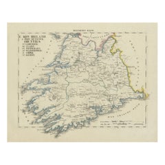
Antique 1830 Map of Munster, Ireland with Limerick, Cork, Kerry and Tipperary
Located in Langweer, NL
Title: Antique 1830 Map of Munster, Ireland with Limerick, Cork, Kerry, and Tipperary Description: This 1830 German-language map, titled Britisches Reich – C. Kon: Ireland, focu...
Category

1830s Antique Engraved Collectibles and Curiosities

Materials

Paper

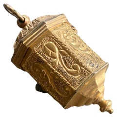
18th Century Antique Octagonal Pendant Locket in Gold with Exquisite Engravings
Located in Sofia, BG
18th century Small golden box in octagonal shape, which is engraved in fine details and all the sides have different images! It is a lovely locket where you may keep your tiny treasu...
Category

Mid-18th Century French Antique Engraved Collectibles and Curiosities

Materials

Gold

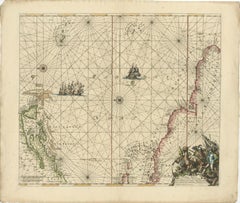
Rare North Atlantic and Caribbean Sea Chart: Newfoundland to Venezuela, 1745
Located in Langweer, NL
This impressive map titled "Terra Neuf, en de Custen van Nieu Vranckryck, Nieuw Engeland... Venezuela," published by Louis Renard in 1745, captures the North Atlantic coastline, enco...
Category

1740s Antique Engraved Collectibles and Curiosities

Materials

Paper

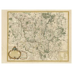
Map of the Margraviate and Electorate of Brandenburg by de Beaurain - ca.1750
Located in Langweer, NL
Historical Map of the Margraviate and Electorate of Brandenburg by Chevalier de Beaurain - Circa 1750 This impressive historical map, titled "Carte du Marquisat et Electorat de Br...
Category

1750s Antique Engraved Collectibles and Curiosities

Materials

Paper

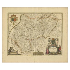
Île-de-France Map, including Paris - Hand-Colored Engraving by F. De Wit c. 1688
Located in Langweer, NL
Title: Hand-Colored 17th-Century Map of Île-de-France by Frederik De Wit c. 1688 Description: This striking map, "Le Gouvernement de l’Isle de France," showcases the Île-de-France r...
Category

1680s Antique Engraved Collectibles and Curiosities

Materials

Paper

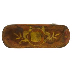
Engraved Brass and Copper Snuff Box, English, Circa 1850
Located in Nantucket, MA
19th Century English brass snuff box with copper top and bottom, remnants of old decoration throughout, circa 1850.
Category

Mid-19th Century English Antique Engraved Collectibles and Curiosities

Materials

Brass, Copper

17th-Century Original Antique Map of Guangxi Province, China – Qvangsii by Blaeu
Located in Langweer, NL
Title: Antique 17th-Century Map of Guangxi Province, China – "Qvangsii" by Blaeu, Richly Illustrated and Colored Description: This fascinating 17th-century map of Guangxi Province, historically referred to as "Qvangsii," was crafted by Johannes Blaeu and published in 1655 as part of the *Novus Atlas Sinensis*. Blaeu’s atlas, created in collaboration with Jesuit missionary Martino Martini, introduced European audiences to the geography of China in an unprecedented way. Guangxi Province, known for its striking karst landscapes and important historical trade routes, is depicted here in remarkable detail. The map highlights the province’s topography, including mountain ranges, rivers, and towns, all meticulously engraved and labeled in Latin. It also captures key trade connections and cultural significance, as Guangxi historically served as a bridge between China and Southeast Asia. The decorative cartouche at the top left is adorned with figures in traditional Chinese costumes, symbolizing the cultural richness of the region and adding artistic elegance to the map. This map was engraved using the copperplate technique, known for its ability to produce fine, detailed lines. The hand-coloring further enhances the visual impact, clearly distinguishing territorial divisions and natural features. Blaeu’s reputation for both accuracy and artistry is evident in this piece, making it a collector’s item of historical and aesthetic significance. Guangxi Province, historically referred to as "Qvangsii," is renowned for its breathtaking natural beauty, unique karst landscapes, and cultural diversity. It is famous for its dramatic limestone formations, verdant hills, and picturesque rivers, making it one of the most visually striking regions in China. Guangxi has historically been a significant trade corridor between China and Southeast Asia, contributing to its cultural and economic importance. It is also home to various ethnic minority groups, including the Zhuang, Miao, and Dong, whose traditions and festivals enrich the region's cultural tapestry. Important places in Guangxi include Guilin, known for its iconic karst mountains and the Li River, which has inspired poets and artists for centuries. Yangshuo, a town near Guilin, is celebrated for its stunning natural scenery and outdoor activities. Nanning, the provincial capital, is an important economic and cultural hub. The Longji Rice Terraces, also known as the Dragon’s Backbone, are an engineering marvel and a popular tourist destination. Beihai, a coastal city, is known for its silver beaches and maritime trade history. Keywords for this map include 17th-century China map, Guangxi Province, Qvangsii map, antique Chinese maps...
Category

1650s Antique Engraved Collectibles and Curiosities

Materials

Paper

1654 Nicolas Sanson Map of Southern India and Southeast Asia
Located in Langweer, NL
1654 Nicolas Sanson Map of Southern India and Southeast Asia - Partie Meridionale de L'Inde This 1654 map by Nicolas Sanson, titled "Partie Meridionale de L'Inde en deux Presqu'Is...
Category

1650s Antique Engraved Collectibles and Curiosities

Materials

Paper

Early Woodcut Map of Franconia and Surrounding Regions, 1628
Located in Langweer, NL
Title: Early Woodcut Map of Franconia and Surrounding Regions, 1628 Franconia (Franckenlande) is a region in Germany. Historically, Franconia was a significant part of the Holy Roma...
Category

1620s Antique Engraved Collectibles and Curiosities

Materials

Paper

Bay of Saint Helena: French Naval Chart by N.B. Ingénieur de la Marine, ca.1770
Located in Langweer, NL
Bay of Saint Helena: French Naval Chart by N.B. Ingénieur de la Marine, 18th Century This meticulously detailed copper engraving, titled 'Carte de la Baye de Sainte Helene' (Map of the Bay of Saint Helena), was drawn by N.B., an engineer of the French Navy (*Ingénieur de la Marine*). The map was created based on the navigational observations of mariners and published in the 18th century, most likely in France. It offers a precise and practical representation of Saint Helena Bay, a crucial anchorage point in the South Atlantic Ocean. Saint Helena Bay, located on the island of Saint Helena, was an important stopover for ships sailing between Europe and Asia, particularly for Dutch and British vessels during the Age of Exploration and the later colonial period. Its significance was further heightened when the island became the final exile location of Napoleon Bonaparte from 1815 to 1821. The map shows the bay with impressive attention to detail, depicting the coastline with numerous soundings marked in French and English leagues (*Lieues Marines de France et d'Angleterre*), allowing navigators to gauge the water depth and avoid hazards. The bay’s natural topography, including hills and coastal elevations, is rendered in delicate engraving lines. A large central peak dominates the landscape, surrounded by rugged terrain, while a smaller inlet and river (*Riviere*) are also shown, highlighting the complex geography of the bay. A decorative fleur-de-lis compass rose marks the left side of the chart, indicating orientation and providing a clear sense of direction for mariners. The map's clean and elegant design reflects the French cartographic tradition of combining functional navigation aids with aesthetic appeal. The chart includes practical features such as scale indicators and coastal profiles that help sailors recognize the bay from a distance. The detailed soundings marked throughout the bay make this map an invaluable tool for understanding the navigational challenges of the area, particularly for large, heavily laden ships. This rare chart belongs to a series of marine maps...
Category

1770s Antique Engraved Collectibles and Curiosities

Materials

Paper

Pair of English Silver and Silver Gilt Rimonim
Located in London, GB
Pair of English silver and silver gilt rimonim English, c. 1920 Height 37cm, diameter 10cm Forged from luminous silver and enhanced with elegant silver gilt accents, this refined p...
Category

Early 20th Century English Other Engraved Collectibles and Curiosities

Materials

Silver

1574 Sebastian Münster Woodcut Map of Europe: Early View of the Continent
Located in Langweer, NL
Title: Early Woodcut Map of Europe from Münster's Cosmographia, 1574 This is an original early woodcut map of Europe by the famed cartographer Sebastian Münster, printed in 1574 by ...
Category

16th Century Antique Engraved Collectibles and Curiosities

Materials

Paper

Old Map of the Margraviate of Brandenburg by Giacomo Cantelli da Vignola, 1687
Located in Langweer, NL
Historical Map of the Margraviate of Brandenburg by Giacomo Cantelli da Vignola - 1687 This magnificent map, titled Marchesato, et Elettorato di Brandeburgo con una gran Porzione ...
Category

1680s Antique Engraved Collectibles and Curiosities

Materials

Paper

Hibernia Regnum Map by Carel Allard, 1700: Hand-Colored Provinces of Ireland
Located in Langweer, NL
This is a historical map of Ireland created by Carel Allard around 1700, titled "Hibernia Regnum in Quatuor Provincias Ultoniam, Connaciam, Lageniam, et Momoniam". The map is hand-colored and engraved. It includes two large decorative cartouches. The map is part of an atlas by Carel Allard, an Amsterdam-based cartographer. Here are the detailed points about the map: Maker: Carel Allard - a prominent Dutch cartographer and publisher from Amsterdam. Atlas: Source Atlas - Likely part of an atlas published by Carel Allard, but specific title of the atlas isn't mentioned. Interesting Features 1. Decorative Cartouches: The map features two large, ornate cartouches. One in the upper left depicts a classical figure and British Royal arms...
Category

Early 1700s Antique Engraved Collectibles and Curiosities

Materials

Paper

Old Map of Ancient Assyria Divided into Syria, Mesopotamia, Babylonia & Assyria
Located in Langweer, NL
This map, "Assyria vetus diuisa in Syriam, Messopotamiam, Babyloniam, et Assyriam", by Pierre Mortier, is a late 17th-century depiction of the historical Middle East. Title: Ancie...
Category

Early 1700s Antique Engraved Collectibles and Curiosities

Materials

Paper

1792 Map of Eastern Africa and the Arabian Peninsula by Delisle/Elwe
Located in Langweer, NL
1792 Map of Eastern Africa and the Arabian Peninsula by Delisle/Elwe This detailed 1792 map, created by Delisle and published by Elwe, depicts northeastern Africa, including Egypt, ...
Category

1790s Antique Engraved Collectibles and Curiosities

Materials

Paper

Harvard Fraternal Medallion - Delta Kappa Epsilon DKE 1877 Robert P. Hastings
Located in Soquel, CA
Harvard Fraternal Medallion - Delta Kappa Epsilon DKE 1877 Robert P. Hastings Silver Medallion by the Delta Kappa Epsilon Fraternity to Robert P. Hastings Harvard College 1873-1877 The Hastings College of Law was founded by Serranus Clinton Hastings, a man of diverse and magnificent accomplishments. Schoolmaster, lawyer, legislator, member of Congress, Chief Justice...
Category

1870s American American Classical Antique Engraved Collectibles and Curiosities

Materials

Silver

1788 Map of Europe - France, Italy, Spain, Germany, Great Britain & Ireland
Located in Langweer, NL
Title: "1788 Map of Europe - France, Italy, Spain, Germany, Great Britain & Ireland by D'Anville" Description: This detailed map of Europe, titled "First Part of the Map of Europe...
Category

1780s Antique Engraved Collectibles and Curiosities

Materials

Paper

Coronation of Queen Elizabeth II Commemorative Glass
Located in New Orleans, LA
This engraved glass was crafted to commemorate the coronation of Queen Elizabeth II. Sixteen years following the coronation of her father, King George VI, the official coronation of Queen Elizabeth II represented a fascinating mix of tradition and modernity. Held at Westminster Abbey, it was the first official celebration of its kind ever to be televised — approximately 27 million people in the United Kingdom alone tuned in to watch their new Queen don her crown for the first time. Considering the widespread popularity of the event, commemorative objects such as this became highly desirable, as people around the world sought remembrances of the joyous occasion. This glass is an exceptional example of its type that remains in excellent condition. One side reads "The Coronation of Queen Elizabeth 1953," while the other displays the initials "ER II...
Category

20th Century English Engraved Collectibles and Curiosities

Materials

Glass

1720 Maps of the Holy Land: Ancient and Modern by De Fer and Danet
Located in Langweer, NL
1720 Maps of the Holy Land: Ancient and Modern by De Fer and Danet This set of two 1720 maps, published by Nicolas de Fer and Danet in Paris, presents a unique juxtaposition of t...
Category

1720s Antique Engraved Collectibles and Curiosities

Materials

Paper

1717 Johannes Van Keulen Sea Chart of the Eastern Atlantic - Amsterdam to Gambia
Located in Langweer, NL
1717 Johannes Van Keulen Sea Chart of the Eastern Atlantic - Amsterdam to Gambia This 1717 sea chart by Johannes Van Keulen, titled "Nieuwe Paskaert vande ...
Category

1710s Antique Engraved Collectibles and Curiosities

Materials

Paper

Sterling Silver Medallion reliquary – 18th Century
Located in Madrid, ES
Elegant 18th-century reliquary in solid silver, finely hand-engraved, with ornamental decoration typical of Baroque religious art. Its oval shape features floral and symbolic details...
Category

18th Century European Baroque Antique Engraved Collectibles and Curiosities

Materials

Sterling Silver

Sterling Silver Medallion reliquary – 18th Century
Located in Madrid, ES
Elegant 18th-century reliquary in solid silver, finely hand-engraved, with ornamental decoration typical of Baroque religious art. Its oval shape features floral and symbolic detail...
Category

18th Century European Baroque Antique Engraved Collectibles and Curiosities

Materials

Sterling Silver

Sterling Silver Medallion reliquary – 18th Century
Located in Madrid, ES
Elegant 18th-century reliquary in solid silver, finely hand-engraved, with an ornamental decoration typical of Baroque religious art. Its oval shape features floral and symbolic deta...
Category

18th Century European Baroque Antique Engraved Collectibles and Curiosities

Materials

Sterling Silver

18th-century reliquary in solid silver, finely hand-engraved
Located in Madrid, ES
Elegant 18th-century reliquary in solid silver, finely hand-engraved, with an ornamental decoration typical of Baroque religious art. Its oval shape features floral and symbolic deta...
Category

18th Century European Baroque Antique Engraved Collectibles and Curiosities

Materials

Silver

18th-century reliquary in solid silver, finely hand-engraved
Located in Madrid, ES
Elegant 18th-century reliquary in solid silver, finely hand-engraved, with ornamental decoration typical of Baroque religious art. Its oval shape features floral and symbolic details...
Category

18th Century European Baroque Antique Engraved Collectibles and Curiosities

Materials

Silver

Engraved Copper Plate – 18th Century
Located in Madrid, ES
Interesting and rare original 18th-century copper plate used for printing religious engravings. The plate is finely engraved with a burin, depicting sacred scenes typical of the devo...
Category

18th Century European Baroque Antique Engraved Collectibles and Curiosities

Materials

Copper

18th C Baroque Style German G. von Gundlach Armorial Beer /Goblet/Kelchglas
Located in West Palm Beach, FL
18th C Baroque Style German G. von Gundlach Armorial Beer /Goblet/Kelchglas Engraved later with ancestors name 'G. von Gundlach' with corresponding Armorial Crest, Germany, Hesse or Saxony region, Circa 1790 An exceptional 18th century example of early German or Dutch craftsmanship in this traditional Kelchglas form. A finely engraved later armorial to the body reveals the Gundlach family heraldry which date back to as early as 1304. The crest and shield of arms...
Category

18th Century German Baroque Antique Engraved Collectibles and Curiosities

Materials

Blown Glass

Engraved Silver Reliquary – 18th Century
Located in Madrid, ES
Antique religious reliquary in engraved silver, dating from the 18th century. This devotional piece features engraved letters or inscriptions on one side and, on the other, a very de...
Category

18th Century European Baroque Antique Engraved Collectibles and Curiosities

Materials

Silver

18th Century French Religious Fer a Hosties Eucharist Host Iron Waffle Press
Located in Forney, TX
A scarce antique, circa 1765, French fer a hosties (cast iron host press / host mold). Exquisitely hand forged in France in the 18th century, showcasing the blacksmith's high qual...
Category

Late 18th Century French Medieval Antique Engraved Collectibles and Curiosities

Materials

Iron

Original 18th-Century Map of Southern Austria, Carinthia, Carniola, and Styria
Located in Langweer, NL
title: 18th-Century Map of Southern Austria, Carinthia, Carniola, and Styria by Robert de Vaugondy Description: This finely engraved 18th-century map by Gilles Robert de Vaugondy ...
Category

1750s Antique Engraved Collectibles and Curiosities

Materials

Paper

1616 Petrus Bertius Map of Arakan and Pegu in Southeast Asia
Located in Langweer, NL
Title: 1616 Petrus Bertius Map of Arakan and Pegu in Southeast Asia Description: This early seventeenth-century map, titled Descriptio Arachan et Pegu, was published in 1616 by P...
Category

1610s Antique Engraved Collectibles and Curiosities

Materials

Paper

Engraved Commemorative Surinam Plantation Glass, History of 18th Century Slavery
Located in Amsterdam, NL
A splendid commemorating glass with a fine engraving of a plantation house and coffee shrubs with a text reading: Het.Welvaaren.Van.De.Plantagie.Saxen (the prosperity of the Plantati...
Category

Mid-18th Century Surinamer Antique Engraved Collectibles and Curiosities

Materials

Glass

1700 Guillaume Delisle Map: Western Mediterranean & Moorish North Africa
Located in Langweer, NL
1700 Guillaume Delisle Map: Western Mediterranean & Moorish North Africa This hand-colored map from 1700 by Guillaume Delisle, titled "In Notitiam Ecclesiasticam Africae Tabula Geographica," offers a detailed look at the regions under Moorish control during the later medieval period. It encompasses the northern African coast from Morocco to Libya, the Iberian Peninsula, and the western Mediterranean, including notable islands such as Sardinia, Corsica, Malta, the Balearics, and Sicily, where a smoking Mount Etna is depicted. The map is embellished with three decorative cartouches, adding artistic flair to the detailed geographical renderings. Engraved by Jean Baptiste Liebaux, the map measures 25.2 inches wide by 19.1 inches high. It features a sharp impression with contemporary outline color, later enhanced cartouches, and is printed on a bright sheet with a Society of Jesus watermark. The condition is very good, with an archivally repaired centerfold separation at the bottom and light toning along the edges. Keywords: - Guillaume Delisle map - Western Mediterranean historical map - Northern Africa map...
Category

Early 1700s Antique Engraved Collectibles and Curiosities

Materials

Paper

Original Antique 17th-Century Map of Shaangxi (Xensi) Province, China – by Blaeu
Located in Langweer, NL
Antique 17th-Century Map of Shaangxi Province, China – "Xensi" by Blaeu, Featuring Decorative Cartouches Description: This exquisite 17th-century map of Shaangxi Province, historically known as Xensi Province, is an exceptional work by Johannes Blaeu, one of the most celebrated mapmakers of the Dutch Golden Age. Originally published in Blaeu's groundbreaking 'Novus Atlas Sinensis', this map is a masterful blend of geography and artistry. Blaeu's atlas was created in collaboration with Martino Martini, a Jesuit missionary whose insights into China provided European audiences with unprecedented geographical accuracy. The map meticulously charts Shaangxi's mountains, rivers, mines, cities, and towns, with names rendered in Latin. It also features a detailed section of the Great Wall of China, a symbol of the region's historical significance. The artistry of this map is further enhanced by its elaborate cartouches. At the top, a Chinese warrior is beautifully illustrated, while the lower-left corner displays a deer, possibly a reference to the elusive Pere David deer...
Category

1650s Antique Engraved Collectibles and Curiosities

Materials

Paper

Asian Cigarette Box Center Serpentine Stone Hand Engraved
Located in New York, NY
An Asian brass cigarette box with serpentine stone and hand engraving, circa mid-20th century, China. This brass box has a teak wood lining, a round centre serpentine stone that rese...
Category

Mid-20th Century Chinese Engraved Collectibles and Curiosities

Materials

Stone, Brass

Rare 1730 Roman Empire Map by Moll - Detailed and Engraved Masterpiece
Located in Langweer, NL
An Historical Map of the Roman Empire and the Neighbouring Barbarous Nations by Herman Moll - Circa 1730 This grand and historically significant map of the Roman Empire was create...
Category

1730s Antique Engraved Collectibles and Curiosities

Materials

Paper

Italia Antiqua Philippo Cluvero – 1603 Hondius Map of Ancient Italy, Handcolored
Located in Langweer, NL
Italia Antiqua Philippo Cluvero – 1603 Hondius Map of Ancient Italy with Hand Color This stunning early 17th-century map, *Italia Antiqua Philippo Cluvero Borusso Designatore*, wa...
Category

Early 1600s Antique Engraved Collectibles and Curiosities

Materials

Paper

Imperii Persici Delineatio: A 1722 Cartographic Masterpiece of Persia by Schenk
Located in Langweer, NL
Title: IMPERII PERCICI delineatio ex scriptis potissimum geographicis Arabum et Persarum Cartographer: Petrus Schenk (Pieter Schenk), 1722 An original antique hand-colored engraved...
Category

1720s Antique Engraved Collectibles and Curiosities

Materials

Paper

Hand-Colored 17th-Century Map of Orléanais in France by Frederik De Wit c. 1688
Located in Langweer, NL
Title: Hand-Colored 17th-Century Map of Orléanais by Frederik De Wit c. 1688 Description: This beautifully crafted map, "Gouvernement General du Pays Orléanois," illustrates the Orl...
Category

1680s Antique Engraved Collectibles and Curiosities

Materials

Paper

Map of Saint Helena Island: Early 18th-Century Copper Engraving by F. Bernard
Located in Langweer, NL
Map of Saint Helena Island: Early 18th-Century Copper Engraving by F. Bernard This rare and beautifully detailed copper engraving of Saint Helena Island dates from around 1722 and...
Category

1720s Antique Engraved Collectibles and Curiosities

Materials

Paper

Austria by Wolfgang Lazius – A Magnificent 16th-Century Map from Ortelius
Located in Langweer, NL
Title: Avstriae Descrip – Wolfgang Lazius’ Map of Austria, 16th Century Description: This extraordinary map of Austria pays homage to the Austrian humanist and cartographer Wo...
Category

16th Century Antique Engraved Collectibles and Curiosities

Materials

Paper

Rare 1770 Bellin Map of Sumatra with Stunning Decorative Cartouches
Located in Langweer, NL
Title: 1750 Bellin Map of Sumatra with Decorative Cartouches This exquisite 18th-century map of Sumatra, drawn by Jacques-Nicolas Bellin around 1750, is a testament to the artistr...
Category

1770s Antique Engraved Collectibles and Curiosities

Materials

Paper

18th-Century Map of Holstein and Surrounding Duchies by Homann Heirs
Located in Langweer, NL
18th-Century Map of Holstein and Surrounding Duchies by Homann Heirs Description: This finely detailed 18th-century map by the Homann Heirs (Homannische Erben) illustrates the Duc...
Category

1750s Antique Engraved Collectibles and Curiosities

Materials

Paper

Meerschaum Pipe Bowl with Silver Mountings by Klinkosch
By J. C. Klinkosch
Located in London, GB
Meerschaum pipe bowl with silver mountings by Klinkosch Austro-Hungarian, Late 19th Century Height 19cm, width 21cm, depth 9cm Emerging from the annals of late 19th-century Austro-H...
Category

Late 19th Century Austrian Folk Art Antique Engraved Collectibles and Curiosities

Materials

Silver

Rare 18th-Century Hand-Colored Map of Southeast Asia and the East Indies, 1748
Located in Langweer, NL
1748 Homann Map of Southeast Asia and East Indies by Homann Heirs This original 1748 map, published by the renowned Homann Heirs, depicts Southeast Asia, the East Indies, and adjace...
Category

1740s Antique Engraved Collectibles and Curiosities

Materials

Paper

1802 German Map of Kashmir and Surrounding Regions by Weimar, Based on Gentil
Located in Langweer, NL
Title: 1802 German Map of Kashmir and Surrounding Regions by Weimar, Based on Gentil Description: This rare and finely detailed antique map, titled Charte von Kaschemir, was pub...
Category

Early 1800s Antique Engraved Collectibles and Curiosities

Materials

Paper

1816 Large Southern Hindostan Map by J. Thomson – New General Atlas
Located in Langweer, NL
Title: 1816 Southern Hindostan Map by J. Thomson – New General Atlas This map, titled "Southern Hindostan," was published in 1816 as part of J. Thomson’s *New General Atlas*. The ma...
Category

1810s Antique Engraved Collectibles and Curiosities

Materials

Paper

18th-Century Map of Tyrol and Surrounding Regions by Johann Baptist Homann
Located in Langweer, NL
18th-Century Map of Tyrol and Surrounding Regions by Johann Baptist Homann Description: This striking 18th-century map by Johann Baptist Homann depicts the County of Tyrol (Tirol)...
Category

1720s Antique Engraved Collectibles and Curiosities

Materials

Paper

1621 Ptolemy & Magini Map of Taprobana (Sumatra) with Elephant Inset
Located in Langweer, NL
Title: 1620 Ptolemy and Magini Map of Taprobana (Sumatra) with Elephant Inset, Italian Edition Description: This rare and beautifully hand-colored 1620 map engraving, Tavola Duode...
Category

1620s Antique Engraved Collectibles and Curiosities

Materials

Paper

18th Century Silver Butterfield Dial By Langlois Paris
By Pierre Langlois
Located in Lincolnshire, GB
A fine example of a silver Butterfield type sundial in the original green shagreen case. The finely engraved dial has Premier cadran (first dial) engraved with the city names and lat...
Category

Mid-18th Century French Antique Engraved Collectibles and Curiosities

Materials

Silver

Excellent Antique Map of America with Unusual Northwest Coast of America, c.1754
Located in Langweer, NL
Description: Antique map titled 'Nieuwe Kaart Van het Westelykste Deel Der Weereld, dienende tot aanwyzing an de Scheepstogten der Nederlanderne Naar West Indie.' Excellent map of America, featuring an unusual northwest coast of America, which includes Martin d'Aguilar's strait which provides for a Northwest Passage via the Great Lakes. The rest of the NW coast...
Category

1750s Antique Engraved Collectibles and Curiosities

Materials

Paper

Thraciae Veteris Typus – 1618 Ortelius Map of Ancient Thrace with Hand Color
Located in Langweer, NL
Thraciae Veteris Typus – 1618 Ortelius Map of Ancient Thrace with Hand Color This striking early 17th-century map, Thraciae Veteris Typus, was published in 1618 by Abraham Orteliu...
Category

Early 1600s Antique Engraved Collectibles and Curiosities

Materials

Paper

Map of England and Surrounding Regions: Early 19th Century - 1802 Tardieu Atlas
Located in Langweer, NL
Title: Isles Britanniques. Troisieme Carte, Angleterre Publication Details: - **Atlas Title:** Nouvel Atlas Universel de Géographie Ancienne et Moderne - **Purpose:** For the Nouve...
Category

Early 1800s Antique Engraved Collectibles and Curiosities

Materials

Paper

Antique Map of the Location of the Garden of Eden and Travels of the Patriarchs
Located in Langweer, NL
Title: Map of the Location of the Garden of Eden and Travels of the Patriarchs Cartographer/Publisher: Pieter Mortier (1661–1711), published by Covens & Mortier (Amsterdam, 1725)...
Category

1720s Antique Engraved Collectibles and Curiosities

Materials

Paper

Antique Map of Lotharingia (Lorraine) by Danckerts, c. 1700 – Hand-Colored
Located in Langweer, NL
Antique Map of Lotharingia (Lorraine) by Theodorus Danckerts circa 1700 Hand-Colored This beautifully detailed antique map of Lotharingia, now the Lorraine region in northeastern ...
Category

Early 1700s Antique Engraved Collectibles and Curiosities

Materials

Paper

Original Antique Map of Munich, Germany by J. Stockdale, 1800
Located in Langweer, NL
Title: Vintage Map of Munich, Germany by J. Stockdale, 1800 This vintage map, titled "A Plan of the City of Munich," was published by J. Stockdale in Piccadilly, London, in 1800. Th...
Category

Early 1800s Antique Engraved Collectibles and Curiosities

Materials

Paper

Ancient World Map: Europe, Africa & Asia - 1802 Tardieu Atlas
Located in Langweer, NL
Antique Map Description with title: "Monde Connu Des Anciens" Publication Details: - Atlas Title: Nouvel Atlas Universel de Géographie Ancienne et Moderne - Purpose: For the Nouvel...
Category

Early 1800s Antique Engraved Collectibles and Curiosities

Materials

Paper

Read More

Medal-Worthy Memorabilia from Epic Past Olympic Games

Get into the games! These items celebrate the events, athletes, host countries and sporting spirit.

Ahoy! You’ve Never Seen a Collection of Sailor Art and Kitsch Quite Like This

French trendsetter and serial collector Daniel Rozensztroch tells us about his obsession with objects related to seafaring men.

Pamela Shamshiri Shares the Secrets behind Her First-Ever Book and Its Effortlessly Cool Interiors

The sought-after designer worked with the team at Hoffman Creative to produce a monograph that beautifully showcases some of Studio Shamshiri's most inspiring projects.

Moroccan Artworks and Objects Take Center Stage in an Extraordinary Villa in Tangier

Italian writer and collector Umberto Pasti opens the doors to his remarkable cave of wonders in North Africa.

Montecito Has Drawn Royalty and Celebrities, and These Homes Are Proof of Its Allure

Hollywood A-listers, ex-pat aristocrats and art collectors and style setters of all stripes appreciate the allure of the coastal California hamlet — much on our minds after recent winter floods.

Whaam! Blam! Pow! — a New Book on Pop Art Packs a Punch

Publishing house Assouline and writer Julie Belcove have teamed up to trace the history of the genre, from Roy Lichtenstein, Andy Warhol and Yayoi Kusama to Mickalene Thomas and Jeff Koons.

The Sparkling Legacy of Tiffany & Co. Explained, One Jewel at a Time

A gorgeous new book celebrates — and memorializes — the iconic jeweler’s rich heritage.

What Makes a Gem-Encrusted Chess Set Worth $4 Million?

The world’s most opulent chess set, weighing in at 513 carats, is literally fit for a king and queen.
Recently Viewed

View All