Engraved Collectibles and Curiosities

to
329
508
242
762
5
5
17
12
11
10
9
8
7
5
4
2
1
1
1
1
456
191
115
10
63
24
16
7
4
2
5
3
1
3
6
3
4
582
167
89
53
35
250
67
54
54
53
772
772
772
10
9
9
8
5
Technique: Engraved
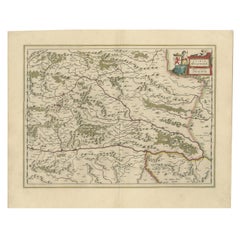
Map of Styria by William Blaeu, 1645: A Masterpiece of 17th-Century Cartography
Located in Langweer, NL
This 1645 map, created by Willem Janszoon Blaeu, represents Styria (Steyrmark), a historical region in present-day Austria, located in the Alpine regions. Blaeu, one of the most sign...
Category

1640s Antique Engraved Collectibles and Curiosities

Materials

Paper

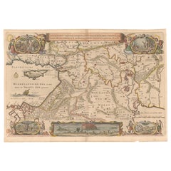
Circa 1686 Daniel Stoopendaal Map: Biblical Sites from Paradise to Canaan
Located in Langweer, NL
Circa 1686 Daniel Stoopendaal Map: Biblical Sites from Paradise to Canaan This circa 1686 hand-colored map by Daniel Stoopendaal, titled "De Gelegentheyt van 't Paradys en 't Landt Canaan," beautifully illustrates the Middle East, extending from the Mediterranean to the Persian Gulf. The map features numerous Biblical locations, such as the Garden of Eden, the wanderings of the Children of Israel, and the story of Jonas and the whale. It is adorned with elaborate decorations, including a banner-style title cartouche and four corner vignettes depicting scenes from Genesis: Paradise, the creation of Adam and Eve, Eve offering the apple, and their expulsion from Eden. The bottom center showcases a dramatic portrayal of Noah's Ark. Measuring 18.3 inches wide by 11.9 inches high, this first state map includes Dutch text on the reverse and is in good condition, with a crisp impression, light toning along the centerfold, and a small chip in the bottom margin. Keywords: - Daniel Stoopendaal map - Biblical map - Garden of Eden - Land of Canaan - Middle East historical map - Noah's Ark map - Adam and Eve - 17th-century Bible...
Category

1680s Antique Engraved Collectibles and Curiosities

Materials

Paper

Early Woodcut Map of the Rhine River Region in Germany and Holland, circa 1628
Located in Langweer, NL
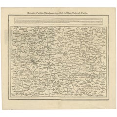
Early Woodcut Map of the Rhine River Region, "Die Dritte Tafel des Rheinstroms," ca. 16th Century This early woodcut map, titled "Die Dritte Tafel des Rheinstroms Innhaltend das Nid...
Category

1620s Antique Engraved Collectibles and Curiosities

Materials

Paper

Early Woodcut Map of Swabia and Bavaria in Germany, 1628
Located in Langweer, NL
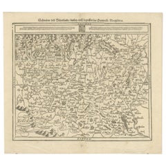
Title: Early Woodcut Map of Swabia and Bavaria, 16th Century This early woodcut map titled "Schwaben und Bayernlande / Darbey auch begreiffen der Oenwaldt / Nordgaw / etc." provides...
Category

1620s Antique Engraved Collectibles and Curiosities

Materials

Paper

Detailed 18th-Century Map of Paris and Its Surrounding Regions by Johann Homann
Located in Langweer, NL
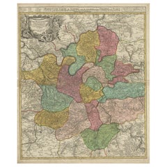
This map, titled “Agri Parisiensis Tabula particularis,” was created and published by the German cartographer Johann Baptist Homann (1664–1724), or his workshop, in Nuremberg. Homann...
Category

1720s Antique Engraved Collectibles and Curiosities

Materials

Paper

Woodcut Map of the Rhine River Region Covering the Palatinate, Austria and Elsa
Located in Langweer, NL
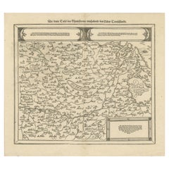
Early Woodcut Map of the Rhine River Region Covering the Palatinate, Austria, and Elsass, ca. 1628 This early woodcut map, titled "Die ander Tafel des Rheinstromes/begriffen die Pfa...
Category

1620s Antique Engraved Collectibles and Curiosities

Materials

Paper

Large Map of Russian Discoveries in Siberia, Alaska & the Bering Strait, 1784
Located in Langweer, NL
1784 Russian Discoveries in Siberia, Alaska & the Bering Strait - Gerhard Friedrich Muller "Nouvelle Carte des Decouvertes Faites par des Vaisseaux Russiens Aux Cotes Inconnues de L'Amerique Septentrionale avec Les Pais Adiacents" is a seminal map by Gerhard Friedrich Muller, showcasing Russian discoveries in Siberia, Alaska, and the Bering Strait region. Originally published in 1754, this map served as a direct counter to Guillaume de L'Isle's speculative "fantasy" map of the same area, which prominently featured the fictitious Mer de l'Ouest (Sea of the West). This edition, published in 1784 by the Imperial Academy of Sciences in St. Petersburg, reflects the substantial geographic knowledge gained through Russian explorations, particularly the voyages of Vitus Bering. It accurately depicts the northern Pacific coasts, focusing on Siberia, the Aleutian Islands, and the Alaskan coast. The hand-coloring remains vibrant, emphasizing key geographic details, and a richly decorated rococo cartouche adorns the upper right, indicating the map's origins. This map is a significant artifact, illustrating the progression of cartographic accuracy and the influence of Russian expeditions in shaping the early knowledge of the North Pacific and Arctic regions. The 1784 edition of Gerhard Friedrich Muller's map features the routes of key Russian voyages that explored the North Pacific, specifically those related to the exploration of Siberia, Alaska, and the Bering Strait. These include: 1. Vitus Bering's Voyages (1728 and 1741) - The map shows routes of Vitus Bering, a Danish explorer in the Russian Navy, who led two important expeditions: - During his first Kamchatka Expedition (1728), Bering navigated through what is now known as the Bering Strait, proving that Siberia and Alaska were separated by a sea. - His second Kamchatka Expedition (1741) extended further eastward to Alaska. This journey greatly expanded European knowledge of the northern Pacific and confirmed Alaska as part of the North American continent. 2. Aleksei Chirikov's Route (1741) - As part of the second Kamchatka Expedition, Aleksei Chirikov, who was Bering's second-in-command, led a separate ship and reached the Alaskan coast, discovering the southeastern parts of Alaska and providing further detailed knowledge of the area. 3. Russian Navigators in the Aleutian Islands - The map also shows the exploration routes in and around the Aleutian Islands, which were instrumental for Russian fur...
Category

1780s Antique Engraved Collectibles and Curiosities

Materials

Paper

1782 Map of the East Indies – India, Siam, Philippines, Java, Borneo, Ganges
Located in Langweer, NL
1782 Bayly Map of the East Indies – India, Siam, Philippines, Java, Borneo, Ganges This finely engraved and vibrantly hand-colored map titled 'A New Map of the East Indies' was dr...
Category

1780s Antique Engraved Collectibles and Curiosities

Materials

Paper

Bonne Map of Philippines, Formosa, Siam, Indochina & South China, 1780
Located in Langweer, NL
Bonne Map of Philippines, Formosa, Siam, Indochina & South China, 1780 Les Isles Philippines, celle de Formose, le Sud de la Chine, les Royaumes de Tunkin, de Cochinchine, de Cambog...
Category

1780s Antique Engraved Collectibles and Curiosities

Materials

Paper

Coronation of King George vi and Queen Elizabeth Glass Tankard
Located in New Orleans, LA
Intricate engravings symbolic of the English monarchy decorate this limited edition glass tankard commemorating the 1937 coronation of King George VI and Queen Elizabeth...
Category

20th Century English Engraved Collectibles and Curiosities

Materials

Glass

Antique Print of the Malabar Coast of India showing the VOC establishments, 1726
Located in Langweer, NL
Dutch print with the title: Platte Grond van t'Fort Tricoen male met de daar aangelegen Pagoods-Berg (Trincomalee, Sri Lanka) The map is taken from: 'Oud en Nieuw Oost-Indiën' van François Valentyn. 1) Ottens, Frederik (engraver / etcher) 2) Braam, J. van (publisher) 3) Linden, Gerard onder de (publisher) MALABAR COAST...
Category

1720s Antique Engraved Collectibles and Curiosities

Materials

Paper

Bishopric of Hildesheim Map in Northern Germany by Willem & Joan Blaeu, 1645
Located in Langweer, NL
This beautifully hand-colored map, titled "Episcopatus Hildesiensis Descriptio Novissima," depicts the Bishopric of Hildesheim, a historical ecclesiastical territory in present-day L...
Category

1640s Antique Engraved Collectibles and Curiosities

Materials

Paper

Antique English Choir Trophy Award Plaque Copper Repousse c1938 Lyre Harp
Located in Shreveport, LA
Antique English Choir Trophy Award Plaque Copper Repousse c1938 Lyre Harp. Direct from England, just arrived in our most recent container, we have several of these one-of-a-kind Eng...
Category

1930s British Other Vintage Engraved Collectibles and Curiosities

Materials

Copper

The Astronomer Unique Historical Folk Art Painting Signed 1918
Located in South Burlington, VT
Unique Historical Work of Art Dated 1918 "L' Astronome (The Astronomer) by Fedinant Roybet. This is an original and one-of-a-kind artistic presentation- a superb pyrography incis...
Category

Early 20th Century French Engraved Collectibles and Curiosities

Materials

Wood

Antique Sea Chart of Hudson Bay and Arctic Canada by Van Keulen, circa 1681
Located in Langweer, NL
Antique map titled 'Pascaarte vande Noorderzee Custen van America (..)'. Sea chart of Hudson Bay and Arctic Canada. Compass roses, loxodromic lines, and ships decorate the oceans and...
Category

Late 17th Century Antique Engraved Collectibles and Curiosities

Materials

Paper

Rare Engraved City Plan of Nuremberg, Bavaria by Christoph Weigel, 1718
Located in Langweer, NL
Title: Rare Engraved City Plan of Nuremberg, Bavaria by Christoph Weigel, 1718 Description: This detailed city plan of Nuremberg, Bavaria was crafted by Christoph Weigel in 1718 an...
Category

1710s Antique Engraved Collectibles and Curiosities

Materials

Paper

Decorative Hand-Colored Map of Germany by Nicolas Sanson, 1648
Located in Langweer, NL
Title: Hand-Colored Map of Germany by Nicolas Sanson, 1648 This hand-colored map, titled "Allemagne," was created by Nicolas Sanson, a prominent 17th-century French cartographer and...
Category

1640s Antique Engraved Collectibles and Curiosities

Materials

Paper

Prussian Dominions Map by John Pinkerton, 1818 - Detailed Copperplate Engraving
Located in Langweer, NL
Prussian Dominions Map by John Pinkerton, 1818 - Detailed Copperplate Engraving Description: This detailed map by John Pinkerton depicts the Prussian Dominions as of 1818, including...
Category

1810s Antique Engraved Collectibles and Curiosities

Materials

Paper

Joe DiMaggio Silver Presentation Tray by Cartier
Located in New Orleans, LA
Made for one of the most celebrated sports figures of the 20th century, this incredible Cartier presentation tray was gifted to the baseball star Joe DiMaggio...
Category

20th Century French Other Engraved Collectibles and Curiosities

Materials

Silver

Battle of Wimpfen, 1622: Engraving by Matthäus Merian (ca. 1645)
Located in Langweer, NL
Title: Battle of Wimpfen, 1622: Engraving by Matthäus Merian (ca. 1645) Description: This antique copper engraving, created by the renowned Swiss-German engraver Matthäus Merian aro...
Category

1640s Antique Engraved Collectibles and Curiosities

Materials

Paper

Ancient Course of the Ganges: A First Ptolemaic Map of India by Mercator, c.1584
Located in Langweer, NL
This remarkable map, titled "Asiae X Tab:", is a significant historical artifact that represents the convergence of knowledge and craftsmanship from two of the most esteemed figures in the history of geography and cartography. Created by Gerard Mercator and based on the geographical insights of Claudius Ptolemy, this map is part of the rare first issue published in Brussels in 1578. The map itself meticulously delineates the region between the Indus and Ganges rivers, an area of immense historical and geographical importance. It is an excellent representation of Ptolemy's second-century geographical data, which was fundamental in shaping the modern principles of mapmaking. Mercator, renowned for his precision and dedication to adhering closely to Ptolemy's original intentions, showcases this commitment through the detailed depiction of this significant Asian landscape. This edition stands out not only for its historical accuracy but also for its artistic execution. Gerard Mercator, who was also an innovator in the use of the italic hand for map lettering, first introduced this style in his "Literarum latinarum" in 1540. The use of italics in this map enhances its legibility and aesthetic appeal, which became a hallmark of the finest sixteenth and seventeenth-century Dutch maps, largely attributed to Mercator’s influence. The map measures 13 ½ x 18 inches and features fine hand coloring, which has been preserved in almost excellent condition alttough there some browning due to age. As a splendid example of the first issue from Mercator’s definitive edition of Ptolemy’s "Geographia", it not only serves as a testament to the rich history of geographical exploration but also stands as a beacon of the enduring legacy of its makers, shaping the future of cartographic design and precision. The map "Asiae X Tab:", focusing on the region between the Indus and Ganges rivers, highlights several areas and cities of historical and geographical importance that are likely of interest to scholars, historians, and collectors. Here are key locations depicted on the map: 1. **Indus River**: As one of the major rivers of Asia and a cradle of ancient civilizations like the Indus Valley Civilization, the Indus River holds significant historical importance. 2. **Ganges River**: Another crucial river not just for its cultural and religious significance in India, but also as a vital geographic feature in ancient and medieval maps...
Category

16th Century Antique Engraved Collectibles and Curiosities

Materials

Paper

Detailed Map of Arabian Peninsula and Canaan, Highlighting Biblical Territories
Located in Langweer, NL
This antique map, titled "Terre de Chanaan ou Terre Promise a Abraham," is a finely detailed copper-engraved map created around 1750 by Delamarche in Paris, based on earlier works by...
Category

1750s Antique Engraved Collectibles and Curiosities

Materials

Paper

Cartographic Elegance: The Art and Science of 17th-Century Asian Maps, ca.1681
Located in Langweer, NL
This original antique map is an artifact from a pivotal era in cartography, reflecting not only the geographical knowledge of its time but also the intertwining of art and science in...
Category

1680s Antique Engraved Collectibles and Curiosities

Materials

Paper

1698 Mercator Ptolemaic Map of Asia East of the Ganges
Located in Langweer, NL
**Catalogue Description:** **Title:** Tab. XI. Asiae, comprehendens Indiam extra Gangem. **Description:** This is an exquisite Ptolemaic map depicting Asia east of the Ganges, ti...
Category

1680s Antique Engraved Collectibles and Curiosities

Materials

Paper

Historic Map of the Bishopric of Paderborn by Blaeu, a Masterpiece of 1645
Located in Langweer, NL
This hand-colored map, titled "Paderbornensis Episcopatus Descriptio Nova," depicts the Bishopric of Paderborn, a historical ecclesiastical territory within the Holy Roman Empire, lo...
Category

1640s Antique Engraved Collectibles and Curiosities

Materials

Paper

Antique Map of the Cape Verde Islands and Part of Senegal, West Africa, 1690
Located in Langweer, NL
Antique map titled 'Bocche del Fivme Negro et Isole di Capo Verde'. Beautiful double-page map of the Cape Verde Islands and part of the coast of Senegal, with large decorative cartou...
Category

17th Century Antique Engraved Collectibles and Curiosities

Materials

Paper

Martinique Island in the Caribbean by Bellin Original Original Antique Map, 1780
Located in Langweer, NL
This mid-18th century map, "Carte de l'Isle de la Martinique pour servir a l'historie generale des voyages," was issued in 1780 by M. Bellin in Paris. It presents a detailed and visually captivating depiction of the Island of Martinique within the context of the Caribbean and the Lesser Antilles. **Title:** Carte de l'Isle de la Martinique pour servir a l'historie generale des voyages **Issuer:** M. Bellin **Date:** 1780 **Location Coverage:** North America, Caribbean, Martinique, Lesser Antilles This engraved map is notable for its pleasing aesthetics, featuring lovely hand coloring that enhances its visual appeal. The inclusion of a scroll cartouche, an ornamental frame, and measurement lines adds a distinctive and visually appealing quality to the map. Martinique, situated within the Lesser Antilles in the Caribbean, is presented with meticulous detail, showcasing geographical features, coastlines, settlements, and other notable landmarks. Bellin, known for his accuracy in cartography, crafted this map to serve as a geographical reference within the broader context of historical voyages and exploration. The combination of detailed cartographic information and artistic embellishments, such as hand coloring and decorative elements, makes this map not only a valuable geographical document but also a visually pleasing piece of cartographic art...
Category

Late 18th Century Antique Engraved Collectibles and Curiosities

Materials

Paper

Antique Bird's Eye-view Atjien or Atjeh in Aceh in Northern Sumatra, Indonesia
Located in Langweer, NL
Description: Antique print Indonesia titled 'Atsjien'. Bird's eye-view of the Town of Atjien on the northernmost point of Sumatra. This print originates from 'Oud en Nieuw Oost-Indië...
Category

1720s Antique Engraved Collectibles and Curiosities

Materials

Paper

Antique Map of Celebes 'Sulawesi, Indonesia' by Bellin, ciarca 1755
Located in Langweer, NL
Antique map titled 'Carte de l'Isle Celebes ou Macassar'. Map of Celebes (Sulawesi, Indonesia), showing Makassar, which was the most important trading city of eastern Indonesia in th...
Category

Mid-18th Century European Antique Engraved Collectibles and Curiosities

Materials

Paper

The 1649 Haderschleben Map of Western Jutland and North Sea Islands
Located in Langweer, NL
This is a beautiful example of an antique map, titled "Westertheil des Amptes Haderschleben Zusambt Rieben und dem Loehmcloster Anno 1649." It's a hand-colored copper etching by Matt...
Category

1640s Antique Engraved Collectibles and Curiosities

Materials

Paper

1638 Plancius Detailed Map of Sri Lanka or Ceylon with Decorative Cartouches
Located in Langweer, NL
"1638 Plancius Detailed Map of Sri Lanka with Decorative Cartouches" This beautifully detailed map of Sri Lanka, titled "Ins. Ceilan," was engraved by P. Plancius from a design by C...
Category

1630s Antique Engraved Collectibles and Curiosities

Materials

Paper

Original Engraved Map of Saint Lucia in the West Indies by Bellin, 1758
Located in Langweer, NL
The "Carte de L’Isle de Sainte Lucie" by Jacques Nicolas Bellin, a prominent figure as the Royal Hydrographer and engineer of the French Navy, is a remarkable antique map showcasing ...
Category

1750s Antique Engraved Collectibles and Curiosities

Materials

Paper

Antique Map of Northern India, Bengal, and Surrounding Regions by Tardieu, 1802
Located in Langweer, NL
This is an original antique map titled "Inde, Indostan Bengale &c. et Partie Septentrionale de la Presqu'isle en deça du Gange," depicting the northern part of the Indian subcontinen...
Category

Early 1800s Antique Engraved Collectibles and Curiosities

Materials

Paper

Map of Ireland: Early 19th Century - from the 1802 Tardieu Atlas
Located in Langweer, NL
Antique Map Description **Title:** Carte d'Irlande **Publication Details:** - **Atlas Title:** Nouvel Atlas Universel de Géographie Ancienne et Moderne - **Purpose:** For the Nouve...
Category

Early 1800s Antique Engraved Collectibles and Curiosities

Materials

Paper

Authentic Old Map of Persia with Original Border Coloring, 1745
Located in Langweer, NL
Title: "Kaartje van Persien na de stelling van den Heer Guillaume de L'Isle" Translates to "Map of Persia based on the work of Mr. Guillaume de L'Isle." Guillaume de L'Isle was a p...
Category

1740s Antique Engraved Collectibles and Curiosities

Materials

Paper

1585 Mercator Map of Ireland, Entitled "Irlandiae Regnvm, " Hand Colored Ric0006
Located in Norton, MA
1585 Mercator map of Ireland, entitled "Irlandiae Regnvm." Hand Colored Description: Published in Amsterdam by Mercator/Hondius ca. 1585. Artists and Engravers: 1585 Mercator map of Ireland, entitled "Irlandiae Regnvm." Copperplate engraving on verge type hand laid paper with watermark. Description: Published in Amsterdam by Mercator/Hondius ca. 1585.Artists and Engravers: Mercator was born in Rupelmonde in Flanders and studied in Louvain under Gemma Frisius, Dutch writer, astronomer and mathematician. The excellence of his work brought him the patronage of Charles V, but in spite of his favor with the Emperor he was caught up in the persecution of Lutheran protestants and charged with heresy, fortunately without serious consequences. No doubt the fear of further persecution influenced his move in 1552 to Duisburg, where he continued the production of maps, globes and instruments. Mercator's sons and grandsons, were all cartographers and made their contributions in various ways to his atlas. Rumold, in particular, was responsible for the complete edition in 1595. The map plates...
Category

16th Century Dutch Antique Engraved Collectibles and Curiosities

Materials

Paper

Impressive Decorative Engraved Map of the Red Sea and Arabian Peninsula, 1787
Located in Langweer, NL
This map, titled "Karte des arabischen Meerbusens oder des Rothen Meeres," is an original engraving from 1787 created by F. A. Schraembl, based on the cartographic work of d'Anville. It is a partially colored copper engraving. Key features and notable details of the map include: 1. The title is prominently displayed within a large, ornate cartouche, enhancing the aesthetic appeal and indicating the map's subject as the Red Sea (Rothen Meeres). 2. The map covers the Red Sea and its surrounding regions, including significant portions of the Arabian Peninsula and northeastern Africa. 3. There are two detailed inset maps: - The first inset map shows the roadstead of the port of Suez (Rheede des Hafen von Sues). - The second inset map depicts Bahr el Kolsum, the northwestern arm of the Red Sea, based on a map by De la Rochette from 1785. 4. Geographical Features: The map meticulously details the coastline, islands, and notable port cities along the Red Sea. The cartography highlights both natural and man-made features, with elevations and mountains represented through hachures. 5. Condition and Preservation: The map has a horizontal centerfold and is partially backed to prevent tears. The edges of the map sheet show minor holes, tears, and faint brown spots, yet it remains in overall good condition considering its age. 6. Historical Importance: This map is a valuable historical document, reflecting the cartographic knowledge of the late 18th century. It serves as a significant piece for collectors interested in antique maps, particularly those focusing on the Arabian Peninsula and maritime navigation in the Red Sea region. The map shows the coastline of the Red Sea and the Arabian Peninsula, detailing regions and places along the western coast of Saudi Arabia and Yemen, as well as the eastern coast of Egypt and Sudan. Here are some of the most important places identified on the map: 1. Jeddah (Gedda): A major city and port on the western coast of Saudi Arabia, significant for its role as a gateway for pilgrims traveling to Mecca. 2. Mecca (Mekka): A holy city in Islam, located inland from the Red Sea, important for being the site of pilgrimage (Hajj) for Muslims. 3. Medina (Medina): Another important Islamic city, known for the Prophet's Mosque and being a key pilgrimage site. 4. Suez (Suess): Located at the northern end of the Red Sea, near the Suez Canal, it's a crucial link between the Mediterranean Sea and the Red Sea. 5. Aden: A port city in Yemen, located at the southern tip of the Arabian Peninsula, historically significant as a trading hub. 6. Mocha (Mokka): A port city in Yemen, historically known for being a major marketplace for coffee. 7. Sana'a: The capital city of Yemen, noted for its historical and cultural significance. 8. Bab el Mandeb: The strait connecting the Red Sea to the Gulf of Aden, crucial for maritime navigation. These locations are critical due to their historical, religious, and economic significance, especially in terms of trade routes and pilgrimage sites. The map also illustrates the mountainous terrain and coastal features of the region. The condition and preservation status, which, despite minor imperfections, is considered well-preserved for its age. Overall, this map is a rare and valuable artifact, offering both historical insights and aesthetic appeal for collectors and enthusiasts of antique cartography.
Category

1780s Antique Engraved Collectibles and Curiosities

Materials

Paper

1692 Jacq. Peeters Map: East Indies, Indonesia, Japan, Philippines and Singapore
Located in Langweer, NL
1692 Jacques Peeters Map: East Indies, Indonesia & Japan with Unique Inset This hand-colored map from 1692, created by Jacques Peeters, captures the islands of Indonesia, the Philippines, and features a unique inset of Japan. It closely resembles Nicolas de Fer's map and is primarily based on Sanson's influential maps. The map meticulously details cities, smaller settlements, rivers, mountain chains, and forests, offering a comprehensive view of the region's geography. The inset map of Japan stands out due to its distinctive shape and influences, reflecting different cartographic sources. Notable features include the marked equator and detailed latitude and longitude indications on the borders. The map measures 6.5 inches in width by 5.5 inches in height and is in excellent condition, with a dark impression, slight toning, and a minor centerfold crease. Keywords: - East Indies map - Indonesia historical map - Philippines map...
Category

1690s Antique Engraved Collectibles and Curiosities

Materials

Paper

Johannes Janssonius' 17th-Century Map of the Duchy of Bremen in Germany
Located in Langweer, NL
The map titled "Ducatus olim Episcopatus Bremensis et ostiorum Albis et Visurgis Fluviorum novissima Descriptio" by Johannes Janssonius provides a rich historical and geographical il...
Category

1650s Antique Engraved Collectibles and Curiosities

Materials

Paper

1592 Abraham Ortelius Map "Lorraine: Lotharingiae Nova Descripti, Ric.A005
Located in Norton, MA
1592 Abraham Ortelius map entitled "Lorraine: Lotharingiae Nova Descripti Ric.a005 Description: Ortelius is best known for producing the atlas from which this map comes from, "...
Category

16th Century Dutch Antique Engraved Collectibles and Curiosities

Materials

Paper

1710 Edward Wells Detailed Ancient Greece Map with Ornate Cartouche
Located in Langweer, NL
"1710 Edward Wells Map of Ancient Greece: A New Map of Antient Greece, Tirana, Morea, Ilyricum, Sicily, and Macedonia" Description of the Map: This map, produced around 1710 and en...
Category

1710s Antique Engraved Collectibles and Curiosities

Materials

Paper

1832 Large Map "Russian & Poland" Ric. R0012
Located in Norton, MA
Large map 1832 "Russian & Poland" Ric.r0012 Russia & Poland, by J. Arrowsmith. London, pubd. 15 Feby. 1832 by J. Arrowsmith, 35 Essex Street, Strand., ...
Category

19th Century Unknown Antique Engraved Collectibles and Curiosities

Materials

Paper

Antique Map of Asian Turkey, Levant, and Mesopotamia by Tardieu, circa 1802
Located in Langweer, NL
This is an original antique map titled "Carte de la Turquie Asiatique," depicting the Asian territories of the Ottoman Empire. Created by Pierre Antoine Tardieu, this map illustrates...
Category

Early 1800s Antique Engraved Collectibles and Curiosities

Materials

Paper

Gallipoli Fortifications: A 1688 Engraved Bird’s-Eye Map by Mattheus Merian
Located in Langweer, NL
Gallipoli Fortifications: A 1688 Bird’s-Eye Map by Mattheus Merian Description: This exquisitely detailed map of Gallipoli, crafted by the renowned engraver Mattheus Merian, offers ...
Category

1680s Antique Engraved Collectibles and Curiosities

Materials

Paper

Circa 1659 Blaeu Family Map: Glogau and the Odra River Valley, Silesia
Located in Langweer, NL
Circa 1659 Blaeu Family Map: Glogau and the Odra River Valley, Silesia This hand-colored map from circa 1659 by the Blaeu Family, titled "Ducatus Silesiae Glogani Vera Delineatio," provides a detailed view of the Odra River valley in western Poland, centered around the city of Glogau. The map, based on the work of Silesian cartographer Jonas Scultetus, is oriented with north to the left. It intricately details forests, rivers, lakes, and numerous small villages. A large decorative title cartouche features an ornate coat of arms and a key to the map's symbols. The bottom right includes a finely crafted scale of miles cartouche, adorned with calipers and a pair of falcons. Published between 1659 and 1672, the map has Spanish text on the verso. Measuring 19.9 inches wide by 16.4 inches high, it is in good condition with full contemporary color on a bright sheet, a watermark of the god Atlas, some marginal soiling, and a few short tears along the edges. Keywords: - Blaeu Family map - Silesia historical map - Glogau map - Odra River valley - 17th-century Poland map - Jonas Scultetus - Decorative cartouches - Historical cartography - Antique maps of Poland...
Category

1650s Antique Engraved Collectibles and Curiosities

Materials

Paper

Old Ptolemaic Map of the Region Between the Persian Gulf and Caspian Sea, 1598
Located in Langweer, NL
"Tabula Asiae V", Ptolemy/Ruscelli Subject: Persia - Iran Period: 1598 (published) Publication: Geografia di Claudio Tolomeo Allessadrino… Claudius Ptolemy was a mathematician, ast...
Category

16th Century Antique Engraved Collectibles and Curiosities

Materials

Paper

1864 Johnson's Map of the World on Mercator's Projection, Ric.B009
Located in Norton, MA
An 1864 Johnson's map of the World on Mercator's Projection Ric.b009 About this Item "This antique map came from Johnson's New Illustrated (Steel Plate) Family Atlas, publ...
Category

19th Century Dutch Antique Engraved Collectibles and Curiosities

Materials

Paper

1817 Large Northern Hindostan Map by J. Thomson – New General Atlas
Located in Langweer, NL
1817 Thomson Map of Northern Hindoostan – Detailed British Cartography of India This map, titled "A New Map of Hindoostan from the Latest Authorities," was drawn and engraved for Jo...
Category

1810s Antique Engraved Collectibles and Curiosities

Materials

Paper

Cartographic Depiction of Flensburg and Surrounding Territories, Anno 1648
Located in Langweer, NL
Title: Landtcarte Vonn dem Ambte Flensborg, ohne Nordgoeßherde. Anno 1648. Description: This exquisitely detailed and old coloured map of Flensburg was crafted by the noted cartogr...
Category

1640s Antique Engraved Collectibles and Curiosities

Materials

Paper

Iberian Peninsula & Mediterranean Map: Western Roman Empire, by Tardieu, 1802
Located in Langweer, NL
Antique Map with Title: "Partie Occidentale de l'Empire Romain ou du Monde connu des Anciens" Publication Details: - Atlas Title: Nouvel Atlas Universel de Géographie Ancienne et M...
Category

Early 1800s Antique Engraved Collectibles and Curiosities

Materials

Paper

1634 Mercator/Jansson Map: Eastern Austria with Vienna, Hand-Colored
Located in Langweer, NL
1634 Mercator/Jansson Map: Eastern Austria with Vienna, Hand-Colored This hand-colored map from 1634, titled "Austria Archiducatus," by Mercator and Jansson, depicts the eastern reg...
Category

1630s Antique Engraved Collectibles and Curiosities

Materials

Paper

Antique Map of the Sunda Islands Including Sumatra, Java, and Borneo, 1705
Located in Langweer, NL
Title: “Antique Map of the Sunda Islands Including Sumatra, Java, and Borneo” This print is a beautifully detailed and relatively rare map of Western Indonesia, encompassing the reg...
Category

Early 1700s Antique Engraved Collectibles and Curiosities

Materials

Paper

1720 Johann Baptist Homann Map of the Austrian Circle and Surrounding Regions
Located in Langweer, NL
"1720 Johann Baptist Homann Map of the Austrian Circle and Surrounding Regions" Description of the Map: This map, crafted by the renowned cartographer Johann Baptist Homann around...
Category

1720s Antique Engraved Collectibles and Curiosities

Materials

Paper

Old Engraving of Batavia 'Jakarta, Indonesia' with Map and Harbour View, 1750
Located in Langweer, NL
Antique map titled 'Carte des environs de Batavia '. French map of the Batavia area (Jakarta) in Indonesia. With cartouche, scale and compass rose. Published circa 1750. The map i...
Category

1750s Antique Engraved Collectibles and Curiosities

Materials

Paper

Copper Engraved Grenada Map by John Thompson Published in 1810
Located in Langweer, NL
John Thomson's original antique map of Grenada, dating back to 1810 and hailing from Edinburgh, stands as a testament to meticulous cartography. This historical piece, adorned with o...
Category

Early 19th Century Antique Engraved Collectibles and Curiosities

Materials

Paper

18th Century Dutch Copper Tobacco Box
Located in Delft, NL
18th century Dutch copper tobacco box 18th century copper tobacco box in oval shape with rims. Engraved with Biblical scenes and Dutch text. Text is: "...
Category

Mid-18th Century Dutch Antique Engraved Collectibles and Curiosities

Materials

Copper

Circa 1802 Map of the Troad Region by Tardieu – From the Voyage de la Troade
Located in Langweer, NL
This is a large fold-out map titled *Carte de la Troade*, measuring approximately 53.5 x 68 cm, engraved by Tardieu, and extracted from the atlas of *Voyage de la Troade, fait dans l...
Category

Early 1800s Antique Engraved Collectibles and Curiosities

Materials

Paper

Bird’s-Eye View Map of Gallipoli: Fortified Ionian Gem by Mattheus Merian, 1688
Located in Langweer, NL
Bird’s-Eye View Map of Gallipoli: Fortified Ionian Gem by Mattheus Merian Description: This exquisitely detailed map of Gallipoli, crafted by the renowned engraver Mattheus Merian,...
Category

1680s Antique Engraved Collectibles and Curiosities

Materials

Paper

Read More

Medal-Worthy Memorabilia from Epic Past Olympic Games

Get into the games! These items celebrate the events, athletes, host countries and sporting spirit.

Ahoy! You’ve Never Seen a Collection of Sailor Art and Kitsch Quite Like This

French trendsetter and serial collector Daniel Rozensztroch tells us about his obsession with objects related to seafaring men.

Pamela Shamshiri Shares the Secrets behind Her First-Ever Book and Its Effortlessly Cool Interiors

The sought-after designer worked with the team at Hoffman Creative to produce a monograph that beautifully showcases some of Studio Shamshiri's most inspiring projects.

Moroccan Artworks and Objects Take Center Stage in an Extraordinary Villa in Tangier

Italian writer and collector Umberto Pasti opens the doors to his remarkable cave of wonders in North Africa.

Montecito Has Drawn Royalty and Celebrities, and These Homes Are Proof of Its Allure

Hollywood A-listers, ex-pat aristocrats and art collectors and style setters of all stripes appreciate the allure of the coastal California hamlet — much on our minds after recent winter floods.

Whaam! Blam! Pow! — a New Book on Pop Art Packs a Punch

Publishing house Assouline and writer Julie Belcove have teamed up to trace the history of the genre, from Roy Lichtenstein, Andy Warhol and Yayoi Kusama to Mickalene Thomas and Jeff Koons.

The Sparkling Legacy of Tiffany & Co. Explained, One Jewel at a Time

A gorgeous new book celebrates — and memorializes — the iconic jeweler’s rich heritage.

What Makes a Gem-Encrusted Chess Set Worth $4 Million?

The world’s most opulent chess set, weighing in at 513 carats, is literally fit for a king and queen.
Recently Viewed

View All