Engraved Collectibles and Curiosities

to
329
508
242
762
5
5
17
12
11
10
9
8
7
5
4
2
1
1
1
1
456
191
115
10
63
24
16
7
4
2
5
3
1
3
6
3
4
582
167
89
53
35
250
67
54
54
53
772
772
772
10
9
9
8
5
Technique: Engraved
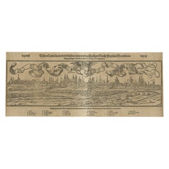
16th-Century Panoramic View of Worms: A Woodcut from Sebastian Münster's
Located in Langweer, NL
This is a woodcut city view of Worms, published in Sebastian Münster's *Cosmographia* around 1578. The image depicts a bird's-eye view of the city of Worms, located in Rheinland-Pfal...
Category

16th Century Antique Engraved Collectibles and Curiosities

Materials

Paper

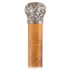
Late 19th Century Arts & Crafts Style Silver Mounted Walking Stick
Located in London, GB
Late 19th century Arts & Crafts style silver mounted walking stick English, 1893 Height 90cm, diameter 3.5cm Expertly crafted in 1893, this antique walking stick embodies the es...
Category

Late 19th Century English Arts and Crafts Antique Engraved Collectibles and Curiosities

Materials

Metal, Silver

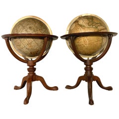
Pair of 19th Century English J & W Cary Celestial/Terrestrial Table Model Globes
Located in Milford, NH
A fine assembled pair of 12-inch English table model globes on stands manufactured by J & W. Cary, the left globe with cartouche labeled “The New Celestial Globe, on which are correc...
Category

Early 19th Century English Antique Engraved Collectibles and Curiosities

Materials

Brass

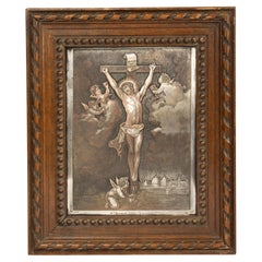
Antique Engraving - Crucifixion Christ - Silver Plated Copper - After Van Dyck
By Anthony van Dyck
Located in Casteren, Noord-Brabant
A late 19th century engraving, depicting the crucifixion of Jesus Christ and cherubs "Christ aux Anges". Engraved on a copper panel, silver plated. After Anthony Van Dyck (1599-1641)...
Category

1880s French Baroque Antique Engraved Collectibles and Curiosities

Materials

Silver Plate, Copper

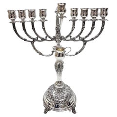
20th Century Italian Solid Silver 800 Nine Lights Chanukkiyah
Located in VALENZA, IT
Jewish candelabra completely handmade in solid 800 silver. The round base is raised from the support surface with 4 feet made with the casting techni...
Category

1980s Italian Other Vintage Engraved Collectibles and Curiosities

Materials

Silver

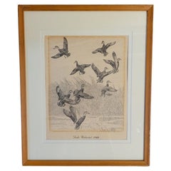
Rare Lynn Bogue Hunt Engraving of Ducks Unlimited, 1940
By Lynn Bogue Hunt
Located in Dallas, TX
Presenting a Rare Lynn Bogue Hunt engraving of ducks unlimited 1940. This piece cam from a wealthy estate in Dallas, TX with the mansion being built...
Category

Mid-20th Century American Sporting Art Engraved Collectibles and Curiosities

Materials

Paper

Large Antique Map of Guadeloupe and Antigua with Adjacent Isles, 19th Century
Located in Langweer, NL
Title: "Antique Map of Guadeloupe and Antigua with Adjacent Isles, 19th Century" Source: New General Atlas (circa 1817), published in Edinburgh Description: This detailed antique m...
Category

Early 19th Century Antique Engraved Collectibles and Curiosities

Materials

Paper

Mapping the Heart of France: Willem Blaeu's 17th Century Île-de-France, ca.1650
Located in Langweer, NL
This original antique map titled "Le Gouvernement de l'Isle de France" represents the Île-de-France region, which historically was one of the provinces of France and contained the ci...
Category

1650s Antique Engraved Collectibles and Curiosities

Materials

Paper

Original Antique Map of the Western Part of NEW MEXICO & CALIFORNIA
Located in Langweer, NL
Title: "Map of the Western Part of NEW MEXICO and CALIFORNIA According to the Latest Discoveries by the Jesuits and Others" Description: This exquisite original Dutch map, titled "...
Category

1760s Antique Engraved Collectibles and Curiosities

Materials

Paper

A Wonderful Ormolu Ritual Dagger
Located in Lincolnshire, GB
A mid 19th century French ritual dagger with a superb figure of skeletal father death, the blade engraved and the scabbard also mounted in ormolu and made to look as if it's much old...
Category

Mid-19th Century French Antique Engraved Collectibles and Curiosities

Materials

Ormolu

Rare Hand-Colored Map of Lorraine and Barrois, France by Frederik De Wit c. 1688
Located in Langweer, NL
Title: Rare Hand-Colored Map of Lorraine and Barrois by Frederik De Wit c. 1688 Description: This remarkable 17th-century map, titled "Generalis Lotharingiae Ducatus," offers a deta...
Category

1680s Antique Engraved Collectibles and Curiosities

Materials

Paper

Rare and Hand Coloured Engraving of A Temple in South East Asia
Located in Langweer, NL
Description: Plate 41: (Temple in South East Asia). This plate shows a temple in South East Asia. Also palm trees are depicted. This very rare attractive original old antique print / plate originates from: 'Il Costume Antico e Moderno ...' , by Giulio Ferrario, published in Milan in 21 volumes by Antonio Fortunato Stella in 1827 (first edition, second issue). The 17 volumes of the first issue were published sequentially between c. 1815/1816 until 1826 after first being issued in 143 weekly installments. The work appeared in Italian and French. Smaller size editions with smaller much less elaborate plates were published in Florence (1823-38), Naples (1831-42) and even a 16mo. editon in Livorno (1830). Artists and Engravers: Giulio Ferrario was founder of the 'Societa Tipografica de Classici Italiani' and served as the director of the Braidense National Library in Milan, Italy. Artists that worked on this monumental work are: Gallo Gallina...
Category

1820s Antique Engraved Collectibles and Curiosities

Materials

Paper

Collection of 18 Prints of Musical Instruments from Gabinetto Armonico, 1722
Located in valatie, NY
A collection of 18 framed prints from engravings of musical instruments from the book by Gabinetto Armonico, which was published in 1722. The book had a total of 150 instruments. The...
Category

18th Century Italian Baroque Antique Engraved Collectibles and Curiosities

Materials

Paper

1767 D’Anville Map of the Holy Land: Ancient Divisions and Biblical Geography
Located in Langweer, NL
Ancient Map of Palestine or the Holy Land by D'Anville (1767) This detailed map, created by the renowned French cartographer Jean Baptiste Bourguignon d'Anville in 1767, depicts the...
Category

1670s Antique Engraved Collectibles and Curiosities

Materials

Paper

1667 Melchior Tavernier Map of the Patriarchate of Constantinople – Black Sea, G
Located in Langweer, NL
This 1667 map titled "Patriarchatus Constantinopolitani Geographica Descriptio" was crafted by renowned French cartographer Melchior Tavernier, who was a prominent map engraver during the 17th century. This rare and historically significant map focuses on the territories under the ecclesiastical jurisdiction of the Patriarchate of Constantinople, one of the most important centers of the Eastern Orthodox Church. It covers regions around the Black Sea (Pontus Euxinus), parts of Greece, and adjacent areas in Asia Minor and the Balkans, which were historically vital during the Byzantine and Ottoman Empires. The map is filled with ancient place names, making it a valuable resource for both historical and cartographic enthusiasts. Key Features: - Antique ecclesiastical map illustrating the influence of the Orthodox Patriarchate of Constantinople in the 17th century. - Features beautifully detailed ancient coastlines, rivers, and terrains, providing a comprehensive geographical view of the region. - Rich with historic place names - like Byzantium, Nicomedia, Nicaea, Cyzicus, Bithynia, Pontus, Macedonia, and Thrace - that date back to the classical era, offering insights into the ancient geography of the eastern Mediterranean. - A finely engraved strapwork cartouche in the lower right corner with Baroque-style decoration, featuring two putti (cherubic figures) – a hallmark of 17th-century map art. - The map extends to include the Mediterranean Sea (Mare Mediterraneum) to the south and the Black Sea to the north, highlighting its ecclesiastical and geopolitical significance. - Original hand coloring may still be present, enhancing the decorative appeal for collectors of antique maps. This rare map offers a unique perspective on the religious influence and historical geography of the Eastern Mediterranean during the late 17th century. It would appeal to collectors interested in: - **Byzantine history** - **Ottoman Empire** - **Eastern Orthodox Church** - **Antique cartography...
Category

1660s Antique Engraved Collectibles and Curiosities

Materials

Paper

Russian 19th Century Silver Icon of Christ Pantocrator
Located in London, GB
Russian 19th century silver icon of Christ Pantocrator Moscow, 1883 Height 50cm, width 41.5cm, depth 3cm The piece, steeped in Russian Orthodox tradition, portrays Christ Pantocrator, a term synonymous with the 'Ruler of All'. Christ Pantocrator icons...
Category

1880s Russian Antique Engraved Collectibles and Curiosities

Materials

Silver

Canadian WW1 21st Regiment Soldier's Uniform Buttons, Badges & Medals Grouping
Located in Hamilton, Ontario
This grouping of some three dozen WW1 items come from the estate of CPL. D.C Stewart who served in the Infantry of the 21st Regiment of the Canadian Armed Fo...
Category

Early 20th Century Canadian Art Deco Engraved Collectibles and Curiosities

Materials

Brass

17th Century Nautical Chart of Skagerrak and Øresund by Johannes van Keulen
Located in Langweer, NL
This map titled *Pascaret van Schager-Rack de Bælt en de Sondt* was created by the prominent Dutch cartographer Johannes van Keulen and published in Amsterd...
Category

Late 17th Century Antique Engraved Collectibles and Curiosities

Materials

Paper

1601 Miniature Map of Southeast Asia & Nova Guinea by Ortelius, Vrients Edition
Located in Langweer, NL
This miniature map of the East Indies and Nova Guinea was created by Abraham Ortelius and published in 1601 as part of the "Epitome" by Giovanni Battista Vrients. It is a finely hand...
Category

Early 1600s Antique Engraved Collectibles and Curiosities

Materials

Paper

1808 C. Smith Map of Hindoostan – British India with Intricate Details
Located in Langweer, NL
Title: 1808 C. Smith Map of Hindoostan – British India with Intricate Details This map, titled "Hindoostan," was published by C. Smith, a prominent London map seller, on January 6, ...
Category

Early 1800s Antique Engraved Collectibles and Curiosities

Materials

Paper

An 18th Century European Purim Pewter Plate for Collecting Alms
Located in New York, NY
This 18th-century pewter Purim plate is a rare and historically significant item associated with Jewish traditions. It features decorative engravings likely used for collecting alms,...
Category

18th Century European Antique Engraved Collectibles and Curiosities

Materials

Pewter

Hand-Colored City Plan of Cologne by Nicolas de Fer, 1705
Located in Langweer, NL
Title: Hand-Colored City Plan of Cologne by Nicolas de Fer, 1705 This hand-colored map, titled "Cologne Ville Considerable Situee sur le Bord Occidentale du Rhein Capit. de l'Electo...
Category

Early 1700s Antique Engraved Collectibles and Curiosities

Materials

Paper

Biblical Journeys: Apostle Paul's Voyages and the Israelites' Exodus, 1856
Located in Langweer, NL
Two maps in matting board. From the Pictorial Bible Atlas, published in 1856. Title for Map 1: Voyages and Travels of Apostle Paul – Illustrated Antique...
Category

1850s Antique Engraved Collectibles and Curiosities

Materials

Paper

Old Map of The Mughal Empire and the Indian Peninsula South of the Ganges, 1787
Located in Langweer, NL
This is a historical map titled "L'Empire Du Mogol, Et La Presqu Isle De L'Inde En Deca Du Gange." An original authentic map, created by Rigobert Bonne (1727-1794), an influential ...
Category

1780s Antique Engraved Collectibles and Curiosities

Materials

Paper

Engraving of St. Gallen and its Monastery, from Civitates Orbis Terrarum (1575)
Located in Langweer, NL
Description of the Engraving: Braun & Hogenberg’s "S. Galli Opp. et Monasterium Heluetiorum" from Civitates Orbis Terrarum (1575) This is an original, hand-colored copper engraving ...
Category

16th Century Antique Engraved Collectibles and Curiosities

Materials

Paper

Antique MODEL CARS, Collectible Black Car including Tonka/Burgao, Italy.
Located in Wembley, GB
Arising from the collaboration of the automobile brands, this exclusive antique model car are 1:10 scale model that took over 4,000 hours to develop...
Category

Early 1900s Italian Hollywood Regency Antique Engraved Collectibles and Curiosities

Materials

Metal, Aluminum, Berlin Iron, Brass, Bronze, Cut Steel, Foil, Iron, Nick...

Original Antique Map of Dresden, Germany by J. Stockdale, 1800
Located in Langweer, NL
Vintage Map of Dresden, Germany by J. Stockdale, 1800 This vintage map titled "A Plan of the City of Dresden" was published by J. Stockdale in Piccadilly, London, in 1800. It provid...
Category

Early 1800s Antique Engraved Collectibles and Curiosities

Materials

Paper

The Antient City of Jerusalem and Places Adjacent, Hand-Colored Map, 1699
Located in Langweer, NL
Title: "1699 Hand-Colored Bird's-Eye Plan of Jerusalem with Ancient and Biblical Landmarks" This beautifully hand-colored, imaginary bird's-eye plan of Jerusalem, published in 1699,...
Category

1690s Antique Engraved Collectibles and Curiosities

Materials

Paper

Scrap Book and Photograph pertaining to Ogden College, Bowling Green, KY
Located in Dallas, TX
PRESENTING A UNIQUE AND IMPORTANT Original Scrap Book and Photograph of Major WA Obenchain, pertaining to Ogden College, Bowling Green, KY. The photograph is ‘new’ to the market and has never left family ownership until NOW! It is a previously, unseen image, of a significant historical figure, Major William Alexander Obenchain, who served on General Robert E. Lee’s Staff during the Civil War and was President of Ogden College in Bowling Green, Kentucky between 1883 – 1906. We are of the opinion that the photo was taken, whilst, Major Obenchain was President of Ogden College, and circa 1890-1900. It bears the stamp on the bottom right for “McClure of Lexington, KY”. Framed and under glass. The Scrap Book is his personal Collection of numerous and various newspaper article cuttings, letters, speeches and other historical items of memorabilia, MAINLY, relating to Ogden College (now part of Western Kentucky University), from the 1870’s up to 1918. Signed in ink, by the Major, on the inside of the front cover and hand-written annotations by him, throughout. It also includes newspaper article cuttings and other historical items of memorabilia personally relating to Major Obenchain and his family, including: Articles relating to the ‘Stone’ Criminal Trial in Dallas, TX in 1876 for the almost fatal shooting of his brother, James T Obenchain , Merit Certificate for distinguished academic achievement by Major Obenchain, from the Buchanan Collegiate Institute dated July 6th 1849, et al. Over 53 Pages of content! An EXCEPTIONAL and UNIQUE Collection that is ‘new’ to the market, has never been seen by the public before and has never left family ownership until NOW! A UNIQUE HISTORICAL RECORD OF OGDEN COLLEGE/WESTERN KENTUCKY UNIVERSITY and BOWLING GREEN! William Alexander Obenchain. Born April 27, 1841 at Buchanan, Botetourt Co., Virginia. Parents: Thomas Jefferson Obenchain and Elizabeth Ann Sweetland. Entered VMI on July 18, 1859 as a member of the VMI (Virginia Military Institute...
Category

Late 19th Century American American Classical Antique Engraved Collectibles and Curiosities

Materials

Paper

1625 Petrus Plancius / Cloppenburg Map of the Holy Land with Biblical Vignettes
Located in Langweer, NL
1625 Petrus Plancius / Johannes Cloppenburg Map of the Holy Land with Biblical Vignettes This exquisite 1625 map by Petrus Plancius and Johannes Cloppenburg represents the Holy Lan...
Category

1620s Antique Engraved Collectibles and Curiosities

Materials

Paper

The Son of Tarzan First Edition
Located in Dallas, TX
Presenting a gloriously rare book …. The Return of Tarzan First Edition by Edgar Rice Burroughs Grosset & Dunlap 1st Edition. Very good +, squa...
Category

Early 20th Century American Romantic Engraved Collectibles and Curiosities

Materials

Paper

Dutch City Plan of Sloten in Friesland by N. Van Geelkercken, hand-colored 1616
Located in Langweer, NL
Bird’s-Eye View of Sloten in Friesland by Nicolaes van Geelkercken, ca. 1616 This captivating hand-colored engraving presents an early 17th-century bird’s-eye view of the fortified ...
Category

1610s Dutch Antique Engraved Collectibles and Curiosities

Materials

Paper

1825 Buchon Map of Puerto Rico & Virgin Islands with Detailed Colonial History
Located in Langweer, NL
This map of Puerto Rico and the Virgin Islands, published by Jean Alexandre Buchon in 1825, offers a unique look at the Caribbean during a time of E...
Category

1820s Antique Engraved Collectibles and Curiosities

Materials

Paper

Senex Map of Castile, Leon & La Mancha in The Spanish Heartland, 1714
Located in Langweer, NL
This antique map, titled "A Map of Old & New Castile from the Observations of Rodrigo Mendes Silva and others," depicts the regions of Old Castile and New Castile in Spain, along with the Kingdom of Leon, Estremadura, La Mancha, among others. The map dates back to the early 18th century, a period marked by significant political shifts and territorial changes in Europe, particularly illustrated by the War of the Spanish Succession (1701–1714) that reshaped Spain’s governance and regional boundaries. The map itself was published in 1714 by John Senex, a prominent English mapmaker, surveyor, globemaker, and geographer of the early eighteenth century. He was apprenticed as a young man to bookseller Robert Clavell and collaborated with notable mapmakers such as Jeremiah Seller and Charles Price. In 1728, Senex's contributions to geography and mapping were recognized when he was elected a Fellow of the Royal Society, an exceptional honor for a mapmaker, underlining his significant role as the Society's engraver and a publisher of maps by Edmund Halley and other notable figures. John Senex is renowned for his English Atlas, first published in the same year as this map, 1714, and continued to be printed until the 1760s. Following his death in 1740, his widow Mary Senex managed the business until 1755. Afterward, the stock passed to William Herbert and Robert Sayer for maps, and to James Ferguson for globes. The map serves not just as a geographical record but also as a historical document, reflecting the territorial divisions significant to Spain's political and economic structure at the time. The focus on Old and New Castile underscores their importance during a transformative era in Spanish history. Here are some potentially significant places and features of this map: 1. **Old Castile (Castilla la Vieja)**: Historically significant as part of the former Kingdom of Castile, this region includes major cities such as Burgos and Valladolid. These cities could be popular search...
Category

Early 18th Century Antique Engraved Collectibles and Curiosities

Materials

Paper

Giant Art Deco Brass Fountain Pen and Mechanical Pencil Display Models
By Wahl Eversharp Co
Located in Hanover, MA
SATURDAY SALE Oversized retail advertising presentation brass fountain pen and mechanical pencil display signs from the early 1920s when they would have been featured within a wood and glass display cabinet at the pen counter of a stationary store. Originally the fountain pen would have been marked on its side "Wahl Pen...
Category

1920s American Art Deco Vintage Engraved Collectibles and Curiosities

Materials

Brass

A 19th-Century Map of West Canada with Niagara Falls and Indigenous Scenes
Located in Langweer, NL
Decorative 19th-Century Map of West Canada with Niagara Falls and Indigenous Scenes This detailed 19th-century map of West Canada, drawn and engraved by J. Rapkin and published by...
Category

1850s Antique Engraved Collectibles and Curiosities

Materials

Paper

1802 Map of Australasia and the South Pacific - European Exploration Routes
Located in Langweer, NL
1802 Johann Walch Map of Australasia and the South Pacific - European Exploration Routes This 1802 map by Johann Walch provides a highly detailed view of Australasia and the South P...
Category

Early 1800s Antique Engraved Collectibles and Curiosities

Materials

Paper

Map of Ancient Gaul & Roman Provinces: Early 19th Century - 1802 Tardieu Atlas
Located in Langweer, NL
### Antique Map Description **Title:** La Gaule et Ses Grandes Dignités Romaines au Temps des Empereurs **Publication Details:** - **Atlas Title:** Nouvel Atlas Universel de Géogra...
Category

Early 1800s Antique Engraved Collectibles and Curiosities

Materials

Paper

Ornate 1850s Map of South America: A Masterpiece of Exploration & Art by Rapkin
Located in Langweer, NL
Decorative 19th-Century Map of South America by J. Rapkin, Published by J & F Tallis Description: This beautifully detailed map of South America, drawn and engraved by J. Rapkin a...
Category

1850s Antique Engraved Collectibles and Curiosities

Materials

Paper

Decorative 1850s Map of Eastern Canada and New Brunswick with Historic Vignettes
Located in Langweer, NL
Decorative 1850s Map of Eastern Canada and New Brunswick with Historic Vignettes This beautifully crafted 19th-century map of Eastern Canada and New Brunswick, drawn and engrave...
Category

1850s Antique Engraved Collectibles and Curiosities

Materials

Paper

Brampton Salt Glazed Jesus College Cambridge Presentation Pottery Tyg
Located in Bishop's Stortford, Hertfordshire
A large and impressive Jesus College, Cambridge University Rowing Presentation salt glazed pottery tyg by Brampton dated 1869. The large stoneware tyg is of cylindrical shape standin...
Category

1860s English High Victorian Antique Engraved Collectibles and Curiosities

Materials

Silver Plate

19th-Century Decorative Map of British America with Arctic and Pacific Vignettes
Located in Langweer, NL
19th-Century Decorative Map of British America with Arctic and Pacific Vignettes This 19th-century map of British America, drawn and engraved by J. Rapkin and published by J & F T...
Category

1850s Antique Engraved Collectibles and Curiosities

Materials

Paper

An Original Antique Mid-17th Century Blaeu Map of Styria in Southeastern Austria
Located in Langweer, NL
This is an antique map of Styria (referred to as “Stiria” or “Steyrmarck”), published by the renowned Dutch cartographer Willem Janszoon Blaeu (often simply “Blaeu”). The first editi...
Category

1640s Antique Engraved Collectibles and Curiosities

Materials

Paper

ALFRED DUNHILL Paris 1936 Art Deco Savory Petrol Pocket Lighter In .925 Sterling
Located in Miami, FL
The Savory lighter designed by Alfred Dunhill. This is a rare petrol pocket lighter, created in Switzerland by La Nationale for the Alfred Dunhill Company in Paris, back in the 1936. This semi-automatic full-size lighter is the iconic and popular Savory model, crafted with art deco patterns in solid .925/.999 sterling silver and decorated with engine turned barley patterns. This very early Dunhill lighter is highly collectible. This model was originally marketed with two names, The Savory in France and The Handy in the rest of the world Brand: Dunhill-Paris. Model: Savory Semi-automatic, full size. First Produced: 1936. Material: Solid .925 Sterling silver. Weight: 56.2 Grams, (36.03 Dwt). Measurements: 50 mm by 34 mm by 12 mm (1.97 x 1.34 x 0.47 Inches). Hallmarks: Stamped with the maker's mark, the mark for the assay of the silver and signed in full as follow, "ALFRED DUNHILL PARIS FAB. SUISSE STERLING MECAN AD SAVORY BREVETTE No-806949". Alfred Dunhill He inherited his father’s London saddlery in 1893. Following the increase in motor car ownership, Alfred developed the business to include motoring accessories, which he called ‘Dunhill’s Motorities’. This included goggles, timepieces, picnic sets, and leather coats, and it wasn’t long before the brand became associated with men’s general motoring attire. They opened two shops in Mayfair and had a catalogue of over 1300 items. Between the 1904 and 1905, Dunhill introduced their ‘Windshield Pipe’, to help drivers combat the effect of wind and travel on their ability to smoke. This marked both the end of the ‘motorities’ focus and their entry into the world of smoking ephemera, and they shortly opened their first tobacconist in 1907 on Duke Street. The proximity to several esteemed Private Members Clubs around the Mayfair, St James’ area ensured that the venture was a success. (From Nicholas Wells With Thanks). Literature: Blei-Bottoni, The Dunhill Petrol Lighter "A Unique Story", Unique SRL 2004 first edition. Figure-500 Pp-256-259 for this model illustrated in several materials and finishes. Note: This pocket lighter is empty of any flammable, gas or butane substances and is ready to be ship by any carrier. This lighter just need a new flint and proper lighter fluid. Was tested and is in working condition. Collateral: This lighter is accompanied by a presentation pouch. Condition: The overall condition of this Alfred Dunhill lighter...
Category

1930s French Art Deco Vintage Engraved Collectibles and Curiosities

Materials

Silver, Sterling Silver

Aphrodite; Ancient Manners by Pierre Louÿs, illustrated by Clara Tice
Located in Middletown, NY
Aphrodite; (Ancient Manners) Translated into ENGLISH - LIMITED EDITION - ILLUSTRATED by CLARA TICE Privately Printed, 1925 8vo; 7 5/8 x 5 3/8 inches (193 x 132 mm); xiii, 252, (1) p...
Category

Early 20th Century American Engraved Collectibles and Curiosities

Materials

Leather, Wood, Paper

Large 1695 Hand-Colored Engraved Map of Gascony (Gascogna), France
Located in Langweer, NL
This map, created by Giacomo Cantelli da Vignola in 1695, represents the "General Government of Guyenne and Gascony" in southwest France. Cantelli da Vignola was a renowned Italian c...
Category

1690s Antique Engraved Collectibles and Curiosities

Materials

Paper

Barbados Island at the Height of the Plantation Economy, Circa 1759
Located in Langweer, NL
Carte de l'Isle de la Barbade by Jacques-Nicolas Bellin (1703–1772), Circa 1759 This rare antique map of Barbados, titled Carte de l'Isle de la Barbad...
Category

1750s Antique Engraved Collectibles and Curiosities

Materials

Paper

18th-Century Biblical Map of the Colonies of Ham: Africa, Middle East and Beyond
Located in Langweer, NL
This map, titled "A Map of the Colonies of the Descendants of Ham," dates to around 1790. It illustrates regions in Africa, the Middle East, and parts of Europe that were traditional...
Category

1790s Antique Engraved Collectibles and Curiosities

Materials

Paper

Early Woodcut Bird's Eye View of Rouffach, France, by Sebastian Münster, 1554
Located in Langweer, NL
Early Woodcut Bird's Eye View of Rouffach, France, by Sebastian Münster, 1554 Description: This rare 1554 woodcut is a bird's eye view of Rouffach, a town in the Haut-Rhin departmen...
Category

16th Century Antique Engraved Collectibles and Curiosities

Materials

Paper

Map of French Colonies in the Americas: St. Martin, French Guiana and St. Pierre
Located in Langweer, NL
This is an intricately detailed map from 1852 titled *Colonies Françaises en Amérique*, depicting several key French colonies in the Americas. The map focuses on regions such as Fr...
Category

1850s Antique Engraved Collectibles and Curiosities

Materials

Paper

Map of Le Maine by H. Hondius, 1633, Hand-Colored, Decorative and Historic
Located in Langweer, NL
Map of Le Maine by H. Hondius, 1633, Hand-Colored, Decorative and Historic This rare and beautifully executed antique map titled 'Le Maine' was published in 1633 by Henricus Hondius...
Category

1630s Antique Engraved Collectibles and Curiosities

Materials

Paper

A Porter's Direction Sundial Germany Early 19th Century
Located in Firenze, IT
The printed and pivoted compass card and chapter ring centred by brass gnomon, in turned rosewood case with domed lid, (glass cover), 5cm (2in) diam.
Category

Early 19th Century German Neoclassical Antique Engraved Collectibles and Curiosities

Materials

Wood

French Pair of World War I Brass Engraved Shell Casings Trench Artillery, French
Located in Labrit, Landes
Antique French pair of shell casings from the World War I vases. Trench Artillery Brass engraved representing on each casing. This pair can also also be used as vases. Good condi...
Category

Early 20th Century French French Provincial Engraved Collectibles and Curiosities

Materials

Brass

1866 Ensign & Bridgman's Rail Road Map of the United States
Located in Colorado Springs, CO
Presented is an 1866 issue of “Ensign & Bridgeman’s Rail Road Map of the United States, showing Depots & Stations.” First published in 1856, this is the third edition, following anot...
Category

1860s American Late Victorian Antique Engraved Collectibles and Curiosities

Materials

Paper

Hand-Colored Map of West India Islands: St. Christopher's, St. Lucia and Nevis
Located in Langweer, NL
This map, titled "West India Islands," was published by John Thomson & Co. in 1821 as part of *Thomson's New General Atlas.* The map offers detailed depictions of three key islands i...
Category

1820s Antique Engraved Collectibles and Curiosities

Materials

Paper

Moullart-Sanson Map of the Holy Land and Sacred Geography of the Old Testament
Located in Langweer, NL
"1716 Moullart-Sanson Map of the Holy Land and Sacred Geography of the Old Testament" This engraved map, created by Pierre Moullart-Sanson and reissued by Robert de Vaugondy in 1740...
Category

1710s Antique Engraved Collectibles and Curiosities

Materials

Paper

John Bull Original Annuals from 1820-1829
Located in Dallas, TX
Presenting a set of 9 volumes, leather bound John Bull yearly annuals. All the weekly newspaper publications of John Bull for the years 1820-1829 (Inclusi...
Category

Early 19th Century English George III Antique Engraved Collectibles and Curiosities

Materials

Paper

Old Map of Part of France: Poitou, Berry, Bourbonnais, and Nivernais in 1768
Located in Langweer, NL
The map with text neatly mounted on both sides of the map on the plate, is a section of an old map with accompanying French text. The map mentions several historical French provinces...
Category

1760s Antique Engraved Collectibles and Curiosities

Materials

Paper

Read More

Medal-Worthy Memorabilia from Epic Past Olympic Games

Get into the games! These items celebrate the events, athletes, host countries and sporting spirit.

Ahoy! You’ve Never Seen a Collection of Sailor Art and Kitsch Quite Like This

French trendsetter and serial collector Daniel Rozensztroch tells us about his obsession with objects related to seafaring men.

Pamela Shamshiri Shares the Secrets behind Her First-Ever Book and Its Effortlessly Cool Interiors

The sought-after designer worked with the team at Hoffman Creative to produce a monograph that beautifully showcases some of Studio Shamshiri's most inspiring projects.

Moroccan Artworks and Objects Take Center Stage in an Extraordinary Villa in Tangier

Italian writer and collector Umberto Pasti opens the doors to his remarkable cave of wonders in North Africa.

Montecito Has Drawn Royalty and Celebrities, and These Homes Are Proof of Its Allure

Hollywood A-listers, ex-pat aristocrats and art collectors and style setters of all stripes appreciate the allure of the coastal California hamlet — much on our minds after recent winter floods.

Whaam! Blam! Pow! — a New Book on Pop Art Packs a Punch

Publishing house Assouline and writer Julie Belcove have teamed up to trace the history of the genre, from Roy Lichtenstein, Andy Warhol and Yayoi Kusama to Mickalene Thomas and Jeff Koons.

The Sparkling Legacy of Tiffany & Co. Explained, One Jewel at a Time

A gorgeous new book celebrates — and memorializes — the iconic jeweler’s rich heritage.

What Makes a Gem-Encrusted Chess Set Worth $4 Million?

The world’s most opulent chess set, weighing in at 513 carats, is literally fit for a king and queen.
Recently Viewed

View All