Engraved Collectibles and Curiosities

to
329
508
242
762
5
5
17
12
11
10
9
8
7
5
4
2
1
1
1
1
456
191
115
10
63
24
16
7
4
2
5
3
1
3
6
3
4
582
167
89
53
35
250
67
54
54
53
772
772
772
10
9
9
8
5
Technique: Engraved
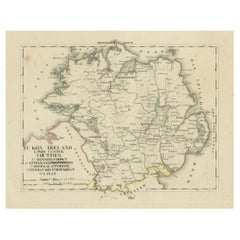
Antique 1830 Map of Ulster, Ireland with Armagh, Down, Antrim, Donegal, Tyrone
Located in Langweer, NL
Title: Antique 1830 Map of Ulster, Ireland with Armagh, Down, Antrim, Donegal, and Tyrone Description: This 1830 German-language map, titled Britisches Reich – C. Kon: Ireland, ...
Category

1830s Antique Engraved Collectibles and Curiosities

Materials

Paper

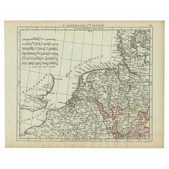
Antique Map of Northern Germany and the Netherlands – circa 1806
Located in Langweer, NL
Title: Antique Map of Northern Germany and the Netherlands – circa 1806 Description: This finely engraved antique map, titled L'Allemagne 1re Feuille, depicts the northern regions...
Category

Early 1800s Antique Engraved Collectibles and Curiosities

Materials

Paper

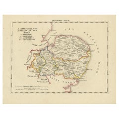
Antique 1830 Map of Eastern England with Suffolk, Norfolk Cambridge, Huntingdon
Located in Langweer, NL
Title: Antique 1830 Map of Eastern England with Suffolk, Norfolk, Cambridge, and Huntingdon Description: This 1830 German-language map, titled Britisches Reich – A. Kon: England,...
Category

1830s Antique Engraved Collectibles and Curiosities

Materials

Paper

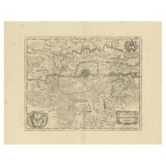
Territorium Francofurtens – Moses Pitt’s 17th-Century Map of Frankfurt
Located in Langweer, NL
Title: Territorium Francofurtens – Moses Pitt’s 17th-Century Map of Frankfurt Description: This rare 17th-century map, titled Territorium Francofurtens, was published by Moses ...
Category

1690s Antique Engraved Collectibles and Curiosities

Materials

Paper

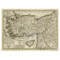
Old Map of Anatolia, part of modern-day Turkey, Armenia and Syria, 1745
Located in Langweer, NL
Title: "Kaartje van Natolie en Syrie opgesteld door de Hr. Lucas en de Hr. Guil de L'Isle en andere auteuren" The title "Kaartje van Natolie en Syrie opgesteld door de Hr. Lucas en...
Category

1740s Antique Engraved Collectibles and Curiosities

Materials

Paper

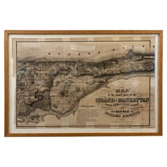
1868 Map of the Upper Part of the Island of Manhattan Above 86th Street
Located in San Francisco, CA
This wonderful piece of New York City history is over 150 years old. It depicts 86th street and above. It was lithographed by WC Rogers and company. It was made to show what was the Battle of Harlem during the Revolutionary war...
Category

1860s American American Colonial Antique Engraved Collectibles and Curiosities

Materials

Paper

Rare Hand-Colored Map of of the Wine Region Burgundy in France by De Wit, c.1688
Located in Langweer, NL
Title: New Description of the Duchy of Burgundy - Frederik De Wit c. 1688 Description: This exquisite map of the Duchy of Burgundy, published after 1688, is a fascinating example of...
Category

1680s Antique Engraved Collectibles and Curiosities

Materials

Paper

Late 19th Century Chinese Silver Kiddush Goblet
Located in New York, NY
Chinese export silver covered Kiddush goblet, 19th century. Round cup on a stem mounted to a flat circular foot. Stepped domed cover with bird finial. ...
Category

Late 19th Century Chinese Chinese Export Antique Engraved Collectibles and Curiosities

Materials

Silver

1690 Frederick de Wit Sea Chart of Hudson Bay, Baffin Bay and Greenland
Located in Langweer, NL
Title: c. 1690 Frederick de Wit Sea Chart of Hudson Bay, Baffin Bay, and Greenland - Engraved by Romeyn de Hooghe This striking sea chart by Frederick de Wit, titled "Septemtrionali...
Category

1690s Antique Engraved Collectibles and Curiosities

Materials

Paper

German Globe by C. Abel-Klinger, Nuremberg, circa 1860
Located in Milano, IT
Terrestrial globe Artistic company C. Abel - Klinger Nuremberg, circa 1860 H cm 31 x 22 cm (12.20 x 8.66 in); sphere 14 cm (5.51 in) in diameter lb 2.30 (kg 1.04) State of conservation: good. On the sphere there are slight visible signs of accidental bumping at the poles, as well as on New Guinea and England (vertical and more visible); some ink stains, especially at the South Pole and on the meridian that crosses North America. The globe is composed of twelve whole gores of printed paper, juxtaposed and glued on a sphere made with a chalky base mixture. The circle of the meridian, made of brass...
Category

1860s German Other Antique Engraved Collectibles and Curiosities

Materials

Wood, Paper

Circa 1659 Willem Blaeu Map: Southwestern Switzerland with Geneva & Lakes
Located in Langweer, NL
Circa 1659 Willem Blaeu Map: Southwestern Switzerland with Geneva & Lakes This detailed map from circa 1659 by Willem Blaeu, titled "Das Wiflispurgergow," highlights the southwestern region of Switzerland. It features significant landmarks such as Geneva, Lake Geneva (Lacus Lemannus), Lake Neuchatel, Lake Biel, Bern, Freiburg, and Lake Thuner. Based on the work of Gerard Mercator, this map is published with Spanish text on the verso, dating from the period between 1659 and 1672. Measuring 19.9 inches wide by 15.1 inches high, the map is rendered in full contemporary color on a bright sheet that bears a large watermark of the god Atlas. The condition is excellent, with a sharp impression, short centerfold separations at the top and bottom margins, and an archivally repaired tear in the right margin. Keywords: - Willem Blaeu map - Gerard Mercator - 17th-century Switzerland map...
Category

1650s Antique Engraved Collectibles and Curiosities

Materials

Paper

1606 Hand-Colored Woodcut Map of Sumatra from Ramusio’s Delle Navigationi
Located in Langweer, NL
This is a fascinating woodcut map titled *Taprobana*, depicting the island of Sumatra, hand-colored, and published in Venice in 1606. The map originates from Giovanni Battista Ramusi...
Category

Early 1600s Antique Engraved Collectibles and Curiosities

Materials

Paper

Map of the Provence in Southern France, Original Old Engraving by De Wit c. 1688
Located in Langweer, NL
Title: Provence Map - Hand-Colored 17th-Century Engraving by Frederik De Wit c. 1688 Description: This captivating map, "Gouvernement de Provence," depicts the Provence region of so...
Category

1680s Antique Engraved Collectibles and Curiosities

Materials

Paper

17th-Century Map of the Latin Patriarchate of Jerusalem by Melchior Tavernier
Located in Langweer, NL
Title: 17th-Century Map of the Latin Patriarchate of Jerusalem by Melchior Tavernier Description: This rare 17th-century map by Melchior Tavernier illustrates the geographical ext...
Category

1640s Antique Engraved Collectibles and Curiosities

Materials

Paper

Original 17th-Century Antique Map of Fujian (Fokien) Province, China – by Blaeu
Located in Langweer, NL
17th-Century Antique Map of Fujian Province, China – "Fokien" by Blaeu, with Decorative Cartouches Description: This stunning 17th-century map of Fujian Province, historically ref...
Category

1650s Antique Engraved Collectibles and Curiosities

Materials

Paper

Original Antique 17th-Century Map of Shanxi (Xansi) Province, China – by Blaeu
Located in Langweer, NL
Antique 17th-Century Map of Shanxi Province, China – "Xansi" by Blaeu, with Artistic Cartouches Description: This beautifully engraved map of Shanxi Province, historically referred to as "Xansi," was created by Johannes Blaeu in 1655 as part of his renowned *Novus Atlas Sinensis*. This atlas was the first comprehensive Western collection focused on Chinese geography, produced with the guidance of Jesuit missionary Martino Martini. Blaeu’s attention to detail and artistic flair are evident in this representation of Shanxi, highlighting mountains, rivers, cities, towns, and key geographic features. The Great Wall of China, an iconic landmark, is also depicted. The map includes decorative cartouches that enhance its aesthetic appeal. The upper-left corner features the map's title framed in an ornate design, while the lower-right corner showcases a seated figure in traditional Chinese attire alongside a small globe, symbolizing the merging of European cartographic expertise and Chinese knowledge. Each city and geographic feature is labeled in Latin, making it a fascinating historical artifact of cross-cultural exploration. This map was crafted using the copperplate engraving technique, prized for its ability to produce fine, precise details. It is further embellished with hand-coloring, which brings the landscape and decorative elements to life. Blaeu’s maps are highly regarded for their accuracy, artistry, and historical significance, making this piece a valuable collectible. Shanxi Province, historically referred to as "Xansi," is renowned for its historical significance, natural landscapes, and rich cultural heritage. The region has been a crucial center of Chinese history and culture for centuries. Its name, meaning "West of the Mountains," refers to its location west of the Taihang Mountains. Shanxi has long been known for its coal resources, which have made it an important economic hub in modern times. Important places in Shanxi include Pingyao, a UNESCO World Heritage Site known for its well-preserved ancient city walls and traditional Chinese architecture. The Yungang Grottoes, near Datong, are another UNESCO site, famous for their intricate Buddhist carvings and statues. Mount Wutai, one of China’s Four Sacred Buddhist Mountains, is a significant religious site that attracts pilgrims and tourists alike. Taiyuan, the provincial capital, is known for its historical sites, including the Jinci Temple. Shanxi is also known for its role in the early development of Chinese banking, particularly during the Ming and Qing Dynasties. Keywords include antique map of Shanxi, Xansi map, Pingyao, Yungang Grottoes, Mount Wutai, 17th-century China map...
Category

1650s Antique Engraved Collectibles and Curiosities

Materials

Paper

1st US Edition of ‘Enquiry Concerning Political Justice’ by W Godwin 1796
Located in Dallas, TX
PRESENTING AN EXTREMELY RARE FIRST US EDITION hardback copy of “Enquiry Concerning Political Justice and Its Influence on Morals and Happiness by William Godwin, First American from ...
Category

Late 18th Century American George III Antique Engraved Collectibles and Curiosities

Materials

Leather, Paper

Exploring Ancient Persia: Ptolemaic Map of Iran and Iraq by Ptolemy and Mercator
Located in Langweer, NL
Claudius Ptolemy was a mathematician, astronomer and geographer who worked in Alexandria, then a part of the Roman Empire, in the 2nd century AD. One of the most learned and influent...
Category

1610s Antique Engraved Collectibles and Curiosities

Materials

Paper

Antique Map of the Duchy of Westphalia, Germany
Located in Langweer, NL
Original antique map titled 'Westphalia Ducatus'. Fine map of the Duchy of Westphalia, Germany. The map is centered on Meschede and includes Arensberg, Beelick, and Brilon. Published...
Category

Mid-17th Century Antique Engraved Collectibles and Curiosities

Materials

Paper

Black Sea & Eastern Mediterranean Map: Eastern Roman Empire, Tardieu Atlas, 1802
Located in Langweer, NL
Antique Map with Title: "Partie Orientale de l'Empire Romain ou du Monde connu des Anciens" Publication Details: - **Atlas Title:** Nouvel Atlas Universel de Géographie Ancienne e...
Category

Early 1800s Antique Engraved Collectibles and Curiosities

Materials

Paper

Historical Map of the Black Sea and Surrounding Regions, 1705
Located in Langweer, NL
Title: "Map of Turcomania, Georgia, and Comania" This print presents an intricately detailed map of the Caucasus region, titled “Turcomania, Georgien Commanie,” by the esteemed cart...
Category

Early 1700s Antique Engraved Collectibles and Curiosities

Materials

Paper

Rare 17th-Century Map of Dauphiné in Southeastern France by F. De Wit, ca.1688
Located in Langweer, NL
Title: Rare Hand-Colored 17th-Century Map of Dauphiné by Frederik De Wit c. 1688 Description: This captivating 17th-century map of Dauphiné, titled "Nova et Accurata Delphinatus Vul...
Category

1680s Antique Engraved Collectibles and Curiosities

Materials

Paper

Antique Map of the Black Sea and Crimea by Pierre Antoine Tardieu (1784-1869)
Located in Langweer, NL
This is an original antique map titled "Carte de la Mer Noire ou Kara Degniz," depicting the Black Sea region. This map, created by Pierre Antoine Tardieu, highlights the geographica...
Category

Early 1800s Antique Engraved Collectibles and Curiosities

Materials

Paper

Late 19th Century North-African Silver Torah Pointer
Located in New York, NY
Handmade gilt silver Torah pointer (Yad), probably Morocco, circa 1880. Engraved in Hebrew: "For the soul of the virgin Tova daughter of Erza Asher. Every item in Menorah Galleries...
Category

Late 19th Century African Antique Engraved Collectibles and Curiosities

Materials

Silver

Original 17th-Century Antique Map of Henan (Honan) Province, China – by Blaeu
Located in Langweer, NL
17th-Century Antique Map of Henan Province, China – "Honan" by Blaeu, with Detailed Cartography and Artistic Cartouches Description: This exceptional 17th-century map of Henan Province, historically referred to as "Honan," was created by Johannes Blaeu and published in 1655 as part of the *Novus Atlas Sinensis*. Henan, located in central China, is known as the cradle of Chinese...
Category

1650s Antique Engraved Collectibles and Curiosities

Materials

Paper

King Edward VIII Abdication Cup
Located in New Orleans, LA
This limited edition glass cup memorializes the accession and imminent abdication of King Edward VIII. Titled the Prince of Wales on his 16th birthday, Edward was crowned King of England in January 1936, but famously and scandalously abdicated his throne after less than a year in order to marry the American divorcee and socialite Wallis Simpson...
Category

20th Century English Other Engraved Collectibles and Curiosities

Materials

Glass

17th-Century Map of Sri Lanka (Ceylon) by Mercator & van den Keere, 1630
Located in Langweer, NL
This captivating 17th-century map titled "Zeilan ou Ceilon Isle" (Ceylon/Sri Lanka) was engraved by Petrus Kaerius (van den Keere) and published in Mercator's "Atlas Minor," edited b...
Category

1630s Antique Engraved Collectibles and Curiosities

Materials

Paper

Pair of Silver Amulets of Two Fantastic Animals, Naples, 18th-19th Century
Located in Bruxelles, BE
Pair of silver amulets of two fantastic animals Naples, late 18th- early 19th century Silver, punches and the seal of the Kingdom of Naples Measures: ...
Category

Early 19th Century Italian Other Antique Engraved Collectibles and Curiosities

Materials

Silver

1773 John Blair Map of the Ancient Holy Land: Tribes, Journeys, and Empires
Located in Langweer, NL
Title: 1773 John Blair Map of the Ancient Holy Land: Tribes, Journeys, and Empires This exceptional map by John Blair, published in London in 1773, offers a richly detailed view o...
Category

1770s Antique Engraved Collectibles and Curiosities

Materials

Paper

Rare Hand-Colored Map of Champagne and Brie, France, by Frederik De Wit c. 1688
Located in Langweer, NL
Title: Rare Hand-Colored Map of Champagne and Brie by Frederik De Wit c. 1688 Description: This exquisite 17th-century map, "Champagne et Brie," beau...
Category

1680s Antique Engraved Collectibles and Curiosities

Materials

Paper

1748 Homann Heirs Double Map of the East Indies and Southeast Asia
Located in Langweer, NL
Title: 1774 Homann Heirs Double Map of the East Indies and Southeast Asia Description: This stunning 1774 double map by the Homann Heirs showcases the East Indies and Southeast ...
Category

1740s Antique Engraved Collectibles and Curiosities

Materials

Paper

Late 19th Century Continental Silver Kiddush Cup
Located in New York, NY
Hand engraved silver Kiddush cup, 1894. Engraved with Hebrew text: "This cup of Blessing donated by Max Freined for "Aid for sick" society, Rosh Ha'Shana, ...
Category

1890s European Antique Engraved Collectibles and Curiosities

Materials

Silver

Early 20th Century Algerian Palace-Shaped Brass Hanukkah Lamp
Located in New York, NY
Hanukkah lamp shaped like a palace, surmounted by Islamic crescent. Made in Laghouat, Algeria. The Hanukkah lamp is made of two parts: a pierced and engraved brass in the shape of ...
Category

1930s Algerian Islamic Vintage Engraved Collectibles and Curiosities

Materials

Brass, Copper

1738 Map of the Philippines & Eastern Indonesia: Spice Islands by Tirion
Located in Langweer, NL
1738 Map of the Philippines & Eastern Indonesia: Spice Islands by Tirion/Albrizzi This beautifully hand-colored map from circa 1738, created by Tirion and Albrizzi, showcases the Philippines and the eastern part of Indonesia, reflecting the Dutch colonial interests in the region. The map features a detailed representation of the numerous islands, including the renowned Spice or Banda Islands, pivotal to the Dutch spice trade. Key regions include the Philippines (Isole Filippine), the Mariana Islands (Ladrones), with Guam, the Caroline and Palau Islands (Nieuwe Fillippynsche Eilenden), the Moluccas (Moluccos) known as the Spice Islands, the eastern tip of Java and Borneo, and a portion of Papua New Guinea. Measuring 12.8 inches wide by 11.1 inches high, the map is in excellent condition with a crisp impression, slight foxing, and minor printer's creases, printed on a bright sheet with a lion watermark. Keywords: - Philippines historical map - Eastern Indonesia map...
Category

1730s Antique Engraved Collectibles and Curiosities

Materials

Paper

Antique Equestrian Print, Heywood Hardy Engraving "Too Late"
Located in Oxfordshire, GB
Equestrian Print, Heywood Hardy. A fine photogravure after the original painting by Heywood Hardy titled 'Too Late'. The 'romantic' print depicts a young couple leaving the church w...
Category

1880s French Sporting Art Antique Engraved Collectibles and Curiosities

Materials

Paper

WWI German Trench Artillery Brass Shell Casing with Engraved Foliage Motifs
Located in Dallas, TX
Decorate a man's office or a study display shelf with this antique trench art shell casing. Created in Germany, and dated 1918, this World War I artillery shell casing...
Category

Early 20th Century German Engraved Collectibles and Curiosities

Materials

Brass

Original 1806 Engraved Map of Asia and Surrounding Regions by John Cary
Located in Langweer, NL
The map titled "A New Map of Asia, From the Latest Authorities" was published in 1806. It is a detailed and comprehensive depiction of the continent of Asia, extending from Europe and the Arabian Peninsula in the west to Japan and the Pacific Islands in the east, and from the Arctic regions in the north to parts of New Holland (Australia) and the Indian Ocean in the south. The map is finely engraved, with political boundaries delineated using color to distinguish different empires, kingdoms, and colonial possessions of the time. Key geographical features such as mountain ranges, rivers, and major cities are clearly marked. It also includes significant maritime routes and islands across the Indian and Pacific Oceans, reflecting the global trade and exploration activities of the early 19th century. Notable Features: - Asia is represented with its vast and diverse regions, including the extensive Russian Empire in the north, the Ottoman Empire in the west, the Qing Dynasty's control over China, and the Mughal Empire's influence in India, which is under increasing British control. - India is shown with its numerous princely states, many of which are under British influence or control. - Southeast Asia includes the colonial possessions of European powers, particularly the Dutch East Indies, Spanish Philippines...
Category

Early 1800s Antique Engraved Collectibles and Curiosities

Materials

Paper

18th Century Antique Engraving of the Southern Hemisphere by G. de L'Isle
Located in Langweer, NL
Antique map titled 'Hemisphere Meridional pour voir plus distinctement Les Terres Australes'. Hemispherical map of the southern hemisphere centered on ...
Category

Late 18th Century Antique Engraved Collectibles and Curiosities

Materials

Paper

Antique Map op Siberia and Chinese Tartary with original hand coloring, 1732
Located in Langweer, NL
Antique map titled 'Nieuwe Kaart van Tartarie na de alderlaatste ontdekking int ligt gebragt'. Map op Siberia and Chinese tartary. In the north Novaya Zemlya curls back to attach its...
Category

Mid-18th Century Antique Engraved Collectibles and Curiosities

Materials

Paper

Old Map of the Arabian Peninsula with Parts of Egypt, Sudan, Eritrea & Ethiopia
Located in Langweer, NL
"Carte de l'Arabie, du Golfe Persique, et de la Mer Rouge, avec l'Egypte, la Nubie et l'Abissinie", Bonne, Rigobert Subject: Arabia Period: 1780 (circa) Publication: Atlas de Toutes...
Category

1780s Antique Engraved Collectibles and Curiosities

Materials

Paper

Antique Map of the City of Kampen by Guicciardini, 1613
Located in Langweer, NL
Antique map titled 'Urbis Campensis (..)'. Plan of the city of Kampen, the Netherlands. This map originates from the 1613 edition of 'Discrittione di tutti i Paesi Bassi', by L. Guic...
Category

17th Century Antique Engraved Collectibles and Curiosities

Materials

Paper

Old Map of the Lower Bishopric of Münster (1726-1750) by Sanson & Ottens, c.1750
Located in Langweer, NL
Historical Map of the Lower Bishopric of Münster (1726-1750) by Sanson & Ottens – Hand-Colored Copperplate Engraving The map titled "BASSE PARTIE DE L'EVESCHE DE MUNSTER" is a detai...
Category

1750s Antique Engraved Collectibles and Curiosities

Materials

Paper

Pair of 19th Century Scottish Monogramed Hardwood Lawn Balls
Located in West Palm Beach, FL
Pair of 19th Century Scottish Monogrammed Hardwood Lawn Balls  A pair of 19th-century Scottish monogrammed hardwood lawn balls. Each ball, measuring 5 inches in diameter, is crafted...
Category

Late 19th Century Scottish High Victorian Antique Engraved Collectibles and Curiosities

Materials

Hardwood

Antique Indo Persian Dhal Separ Shield
Located in Palm Beach, FL
Intriguing historical 19th Century Indo Persian shield handcrafted in steel and decorated with four floral protuberances and engraved figures, reta...
Category

Late 19th Century Indian Moorish Antique Engraved Collectibles and Curiosities

Materials

Steel

18th Century Antique Conrad Lotter Septentrionalis Meridionalis American Maps
Located in Dayton, OH
Pair of rare hand colored maps from the 1770's, depicting "America Septentrionalis" (North America), engraved by Georg Friedrich Lotter and America Meridionalis (South America), engr...
Category

18th Century Antique Engraved Collectibles and Curiosities

Materials

Paper

Commemorative King George VI and Queen Elizabeth Coronation Goblet
Located in New Orleans, LA
This elegantly formed glass goblet was crafted specifically to celebrate the coronation of Britain's King George VI and Queen Elizabeth. The cup's bowl ...
Category

20th Century English Other Engraved Collectibles and Curiosities

Materials

Glass

1584 Ortelius Map of Switzerland: A Cartographic Reversal
Located in Langweer, NL
This is a fine example of Ortelius' map of Switzerland from his *Theatrum Orbis Terrarum*, recognized as the first modern atlas of the world. The map is oriented with south at the top, which reverses the typical north-up orientation seen in most modern maps. It highlights significant geographical features such as Lake Geneva (Lemanus Lacus) to the right of the map and the Rhine river entering Switzerland near the center. The *Theatrum Orbis Terrarum*, first published in 1570 by Abraham Ortelius in Antwerp, was groundbreaking as it compiled uniform maps with supporting text in a single volume, marking a departure from earlier collections of maps that were custom-assembled on demand. This atlas included a wealth of sixteenth-century cartographic knowledge, reflecting the extensive global explorations occurring after the discovery of America...
Category

16th Century Antique Engraved Collectibles and Curiosities

Materials

Paper

18th Century Map of Upper Guinea: Kingdoms and Coastal Regions of West Africa
Located in Langweer, NL
This is an antique map depicting the coastal regions of West Africa, specifically the Gulf of Guinea and surrounding areas, including parts of what is now Senegal, Guinea, Sierra Leo...
Category

1780s Antique Engraved Collectibles and Curiosities

Materials

Paper

Antique Map of the Electorate of Brandenburg by Georges-Louis Le Rouge, 1768
Located in Langweer, NL
Antique Map of the Electorate of Brandenburg by Georges-Louis Le Rouge, 1748 This 1748 map by Georges-Louis Le Rouge, titled "Le Marquisat et Electorat de Brandenbourg," depicts the...
Category

1760s Antique Engraved Collectibles and Curiosities

Materials

Paper

A Stunning 1744 Bowen Map: South East Germany & Queen of Hungary’s Dominions
Located in Langweer, NL
Title: A New and Correct Map of the South East part of Germany, 1744 This map by Emanuel Bowen, dating to around 1744, beautifully captures the southeastern part of Germany. The det...
Category

1740s Antique Engraved Collectibles and Curiosities

Materials

Paper

Antique Bird's-Eye Plan of Tutecoryn (Tuticorin or Thoothukudi), India, 1672
Located in Langweer, NL
Antique map, titled: 'Tutecoryn.' Bird's-eye plan of map of Tutecoryn (Tuticorin or Thoothukudi), India. This map originates from 'Naauwkeurige Beschryvinge van Malabar en Choroman...
Category

1670s Antique Engraved Collectibles and Curiosities

Materials

Paper

Map of Europe Highlighting Ancient and Modern Geographical Divisions (1794)
Located in Langweer, NL
Map of Europe Highlighting Ancient and Modern Geographical Divisions (1794). Germany, France, Italy, Spain, and the British Isles – Map by D’Anville (1794). This detailed 18th-cent...
Category

1790s Antique Engraved Collectibles and Curiosities

Materials

Paper

Antique Engraving of Kirby Hall Near Gretton, Northamptonshire, England c.1770
Located in Langweer, NL
Antique print titled 'Principal Front of Kirby Hall'. Kirby Hall is an Elizabethan country house, located near Gretton, Northamptonshire, England. The nearest main town is Corby. One of the great Elizabethan houses of England, Kirby Hall was built for Sir Humphrey Stafford of Blatherwick, beginning in 1570. In 1575 the property was purchased by Sir Christopher Hatton of Holdenby,[1] Lord Chancellor to Queen Elizabeth I. It is a leading and early example of the Elizabethan prodigy house. Construction on the building began in 1570, based on the designs in French architectural pattern books and expanded in the Classical style over the course of the following decades. The house is now in a semi-ruined state with many parts roof-less although the Great Hall and state rooms remain intact. The gardens, with their elaborate "cutwork" design, complete with statues and urns, have been recently restored. Anne of Denmark stayed at Kirby on 9 August 1605 while King James stayed at Rockingham Castle. King James stayed for three days in August 1616. During a royal progress Esmé Stewart, 3rd Duke of Lennox died at Kirby of the "spotted ague" on 30 July 1624. The building and gardens are owned by the Earl of Winchilsea and are managed by English Heritage. Kirby Hall has been used as a filming location in many productions. These include the following; an episode (6. Protest and Communication) of Kenneth Clark...
Category

18th Century Antique Engraved Collectibles and Curiosities

Materials

Paper

Detailed Plan of the City of Zutphen, The Netherlands – Hendrik de Leth, c.1740
Located in Langweer, NL
Title: Detailed Plan of the City of Zutphen – Hendrik de Leth, ca. 1740 This hand-colored engraving, created by Hendrik de Leth and published around 1740, presents a detailed and ...
Category

1740s Antique Engraved Collectibles and Curiosities

Materials

Paper

"Nova Barbariae Descriptio", a 17th Century Hand-Colored Map of North Africa
Located in Alamo, CA
This original attractive 17th century hand-colored map of North Africa entitled "Nova Barbariae Descriptio" by Johannes Janssonius was published in Paris in 1635. It includes the Med...
Category

Mid-17th Century Dutch Antique Engraved Collectibles and Curiosities

Materials

Paper

The 17th Century Map of Northern Dithmarschen and Its Towns in Germany
Located in Langweer, NL
This is a detailed colored copperplate engraving depicting northern Dithmarschen, accompanied by town plans of Weßlingburen (now Wesselburen), Lunden, and Heyde (now Heide) at the to...
Category

1640s Antique Engraved Collectibles and Curiosities

Materials

Paper

Territorium Norimbergense - Antique Map of Nürnberg by Janssonius (1645-58)
Located in Langweer, NL
This is an antique map of Nürnberg, titled "Territorium Norimbergense," created by Johannes Janssonius and published between 1645 and 1658. It is a copperplate engraving printed on p...
Category

1650s Antique Engraved Collectibles and Curiosities

Materials

Paper

Map of Amersfoort and Surroundings by Covens & Mortier, published in 1747
Located in Langweer, NL
Map of Amersfoort and Surroundings by Covens & Mortier, published in 1747 Hand-coloured copper engraving titled *Carte Particulière des Environs de Amersfoort*, created by Jean Cove...
Category

1740s Antique Engraved Collectibles and Curiosities

Materials

Paper

Read More

Medal-Worthy Memorabilia from Epic Past Olympic Games

Get into the games! These items celebrate the events, athletes, host countries and sporting spirit.

Ahoy! You’ve Never Seen a Collection of Sailor Art and Kitsch Quite Like This

French trendsetter and serial collector Daniel Rozensztroch tells us about his obsession with objects related to seafaring men.

Pamela Shamshiri Shares the Secrets behind Her First-Ever Book and Its Effortlessly Cool Interiors

The sought-after designer worked with the team at Hoffman Creative to produce a monograph that beautifully showcases some of Studio Shamshiri's most inspiring projects.

Moroccan Artworks and Objects Take Center Stage in an Extraordinary Villa in Tangier

Italian writer and collector Umberto Pasti opens the doors to his remarkable cave of wonders in North Africa.

Montecito Has Drawn Royalty and Celebrities, and These Homes Are Proof of Its Allure

Hollywood A-listers, ex-pat aristocrats and art collectors and style setters of all stripes appreciate the allure of the coastal California hamlet — much on our minds after recent winter floods.

Whaam! Blam! Pow! — a New Book on Pop Art Packs a Punch

Publishing house Assouline and writer Julie Belcove have teamed up to trace the history of the genre, from Roy Lichtenstein, Andy Warhol and Yayoi Kusama to Mickalene Thomas and Jeff Koons.

The Sparkling Legacy of Tiffany & Co. Explained, One Jewel at a Time

A gorgeous new book celebrates — and memorializes — the iconic jeweler’s rich heritage.

What Makes a Gem-Encrusted Chess Set Worth $4 Million?

The world’s most opulent chess set, weighing in at 513 carats, is literally fit for a king and queen.
Recently Viewed

View All