Engraved Collectibles and Curiosities

to
329
508
242
762
5
5
17
12
11
10
9
8
7
5
4
2
1
1
1
1
456
191
115
10
63
24
16
7
4
2
5
3
1
3
6
3
4
582
167
89
53
35
250
67
54
54
53
772
772
772
10
9
9
8
5
Technique: Engraved
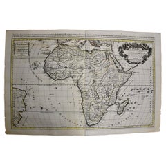
Africa: A Large 17th Century Hand-Colored Map by Sanson and Jaillot
Located in Alamo, CA
This large original hand-colored copperplate engraved map of Africa entitled "L'Afrique divisee suivant l'estendue de ses principales parties ou sont distingues les uns des autres, L...
Category

1690s French Antique Engraved Collectibles and Curiosities

Materials

Paper

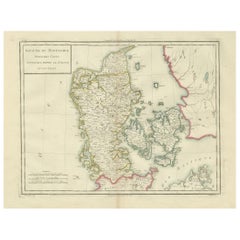
Map of Denmark Proper & Jutland: Early 19th Century from the 1802 Tardieu Atlas
Located in Langweer, NL
Antique Map with Title: "Royaume de Danemarck: Deuxieme Carte. Danemarck Propre, le Jutland et les Isles" Publication Details: - **Atlas Title:** Nouvel Atlas Universel de Géograp...
Category

Early 1800s Antique Engraved Collectibles and Curiosities

Materials

Paper

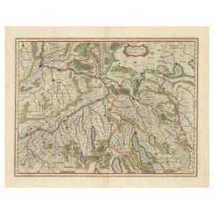
Map of Northwestern Switzerland (Basel and Zurich Region) by Willem & Jan Blaeu
Located in Langweer, NL
Map of Northwestern Switzerland by Willem & Jan Blaeu (Circa 1650) This is a detailed map of Northwestern Switzerland, specifically depicting the region between Basel and Zurich, cr...
Category

1650s Antique Engraved Collectibles and Curiosities

Materials

Paper

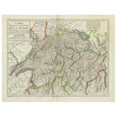
Physical & Political Map of Switzerland: Late 18th Century - Mentelle Atlas
Located in Langweer, NL
Antique Map with Title: 'Carte Physique et Politique de la Suisse' **Publication Details:** - **Atlas Title:** Nouvel Atlas Universel de Géographie Ancienne et Moderne - **Purpose:...
Category

1790s Antique Engraved Collectibles and Curiosities

Materials

Paper

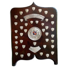
Antique English Order of the Odd Fellows Society Trophy Award c1939 Silver plate
Located in Shreveport, LA
Antique English Order of the Odd Fellows Society Trophy Award c1939 Silver plate. Direct from England, just arrived in our most recent container, we have several of these one-of-a-kind English trophies that are brimming with provenance, and oh “the stories they could tell”! This large oak plaque/trophy is highly engraved, with large, dimensional descriptive plaque at the top, as follows: “INDEPENDENT ORDER OF ODD FELLOWS...
Category

1930s British Other Vintage Engraved Collectibles and Curiosities

Materials

Silver Plate

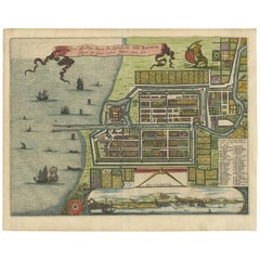
Antique Map of Batavia 'Jakarta, Indonesia' by Montanus, 1679
Located in Langweer, NL
Fine early plan of Batavia (Jakarta), published by Arnoldus Montanus. This map has a vignette at the bottom showing Jakarta from the sea with the volcanoes Mount Gede, Mount Pangrnago and Mount Salak in the background. The plan is based on the earlier, much larger map of Batavia published by Clement de Jonghe...
Category

Late 17th Century Unknown Antique Engraved Collectibles and Curiosities

Materials

Paper

Original Antique Map of Brasil, Published in the 16th Century, 1561
Located in Langweer, NL
This important Ruscelli map of Brazil, from his work La Geografia di Claudio Tolomeo Alessandrino, is one of the earliest obtainable modern maps of the re...
Category

1660s Antique Engraved Collectibles and Curiosities

Materials

Paper

20th Century Italian Miniature Wooden Rack, 4 Hunting Rifles in Sterling Silver
Located in VALENZA, IT
Miniature wooden rack with 4 hunting rifles in 925 sterling silver. The rifles for hunting, in four different models, are in solid sterling silver casting ...
Category

1990s Italian Other Engraved Collectibles and Curiosities

Materials

Sterling Silver

Detailed Antique Map of Jamaica - Published in Weimar, 1825
Located in Langweer, NL
This map of Jamaica is an interesting historical document. This map is part of an atlas that was issued in six editions in English, French, and German ...
Category

1820s Antique Engraved Collectibles and Curiosities

Materials

Paper

Limburg Cityscape 1580: Historical Copper Engraving by Braun and Hogenberg
Located in Langweer, NL
Title: Limburgum Oppidum Galliae Belgicae, vulgo Lympurch, gallicè, Lembor Dr. Type: Print (Copper Engraving) Circa 1580 Technique: Colored Copper Engraving Medium: Handmade Paper S...
Category

16th Century Antique Engraved Collectibles and Curiosities

Materials

Paper

18th Century German Pewter Passover Plate
Located in New York, NY
Pewter passover tray, Germany, 18th century. The outer rim has wriggle- work engraving of the order of the Seder service, along with a pair of birds fl...
Category

Late 18th Century German Antique Engraved Collectibles and Curiosities

Materials

Pewter

Map of Denmark, Norway & Iceland: Early 19th Century from the 1802 Tardieu Atlas
Located in Langweer, NL
Antique Map Description Title: Royaume de Danemarck: Première Carte. Danemarck, Norwege et Islande Publication Details: - **Atlas Title:** Nouvel Atlas Universel de Géographie Anc...
Category

Early 1800s Antique Engraved Collectibles and Curiosities

Materials

Paper

Early 18th Century Map of Denmark in Old Coloring, Published in 1706
Located in Langweer, NL
Denmark. Schenk (Petrus), Dania Regnum Ducatus Holsatia. et Slesvicum Insulae Danicae et Provinciae Jutia Scania etc. Amsterdam, 1706, engraved reticulated map on thick paper with co...
Category

Early 1700s Antique Engraved Collectibles and Curiosities

Materials

Paper

Historical Map of Ancient Germany (1787): Tribes and Territories by Mentele
Located in Langweer, NL
This antique map, titled "Carte Ancienne d'Allemagne," represents ancient Germany and surrounding regions. It was published by the well-known Parisian mapmakers and publishers Jean-Baptiste-Louis Clouet and Alexandre Aimé Vuillemin in the late 18th century, specifically in 1787. The map covers the extensive geographical area of ancient Germany, highlighting various tribes and regions known at the time. Key features include: 1. **Geographical Boundaries**: The map outlines the territorial extents of ancient Germany, bordered by Gallia (France) to the west, Sarmatia (parts of Eastern Europe) to the east, and the Italian regions to the south. The northern boundary reaches the Oceanus Germanicus (North Sea) and the Sarmatian Sea (Baltic Sea). 2. **Tribal Regions**: It details numerous ancient Germanic...
Category

1780s Antique Engraved Collectibles and Curiosities

Materials

Paper

Print of a Dutch VOC Fort on the Peninsula Trincomalee, Ceylon (Sri Lanka), 1726
Located in Langweer, NL
Dutch print with the title: Platte Grond van t'Fort Tricoen male met de daar aangelegen Pagoods-Berg (Trincomalee, Sri Lanka) The map is taken from: 'Oud en Nieuw Oost-Indiën' van...
Category

1720s Antique Engraved Collectibles and Curiosities

Materials

Paper

Three Antique Maps on One Folio: Turkey, Northern Egypt, and Ancient Carthage
Located in Langweer, NL
The map consists of three distinct sections on a single folio sheet: 1. **Map of Turkey**: - Orientation: The map is oriented with the east at the top, which is a common practic...
Category

16th Century Antique Engraved Collectibles and Curiosities

Materials

Paper

LES PASTORALES. Binding by René Kieffer with Original Wood Block.
Located in Middletown, NY
Les Pastorales by Theocritus / Théocrite, illustrated and with unique binding by Kieffer, René Les Pastorales; Traduites intégralement par Gabriel Soulages. Bois originaux de J.-B. ...
Category

Early 20th Century French Engraved Collectibles and Curiosities

Materials

Leather, Wood, Paper

Old Map of Indonesian Islands Borneo, Celebes, New Guinea & New Britain, 1792
Located in Langweer, NL
Antique map titled 'Partie de la Nouvelle Grande Carte des Indes Orientales, contenant les Isles de Borneo, Iava, Celebes, Mindanao (..)'. Detailed map of the Indonesian islands Bo...
Category

1790s Antique Engraved Collectibles and Curiosities

Materials

Paper

Historical Map of Holstein - Copperplate Engraving by Matthias Seutter, ca. 1730
Located in Langweer, NL
Historical Map of Holstein - Copperplate Engraving by Matthias Seutter, ca. 1730 This impressive historical map, titled Holsatiae. Mappa universalis in suos ducatus nimirum Holsat...
Category

1730s Antique Engraved Collectibles and Curiosities

Materials

Paper

Historic 1690 Map of Lorraine in France by Allard - Cities of Toul, Nancy, Metz
Located in Langweer, NL
Exactissima Lotharingia - A Rare 17th Century Map of Lorraine by Carel Allard This fascinating map of Lorraine, created by Carel Allard around 1690, is a stunning example of coppe...
Category

1690s Antique Engraved Collectibles and Curiosities

Materials

Paper

Antique English Rifle Gun Shoot Trophy Award Plaque Silver plate Shield c1910
Located in Shreveport, LA
Antique English Rifle Gun Shoot Trophy Award Plaque Silver plate Shield c1910. Direct from England, just arrived in our most recent container, we have...
Category

1910s British Vintage Engraved Collectibles and Curiosities

Materials

Silver Plate

Highly Detailed Antique Map of the Holy Land Showing 12 Tribes of Israel, c.1720
Located in Langweer, NL
Antique map titled 'Heylige Land verdeeld in de Twaalf Stammen Israels (..).' Highly detailed map of the Holy Land divided into 12 tribes of Israel...
Category

1720s Antique Engraved Collectibles and Curiosities

Materials

Paper

Isle de Ladrones: Early 18th-Century Map of the Mariana Islands by F. Bernard
Located in Langweer, NL
Isle de Ladrones: Early 18th-Century Map of the Mariana Islands by F. Bernard This intriguing copper engraving depicts the *Isle de Ladrones*, now known as the Mariana Islands, situated in the western Pacific Ocean. The map was published around 1722 in Amsterdam by F. Bernard as part of the influential travel compilation *Recueil des voyages qui ont servi a ...*. The map offers a simplistic yet stylized portrayal of the island, emphasizing its rugged and mountainous terrain, dotted with sparse vegetation and hills. The term *Isle de Ladrones* (Islands of Thieves) was given by the Spanish explorer Ferdinand Magellan in 1521 during his circumnavigation of the globe, as his crew encountered thefts from the native Chamorro people. The name later changed to *Mariana Islands* when they were named after Queen...
Category

1720s Antique Engraved Collectibles and Curiosities

Materials

Paper

Map of Northern European Russia: Early 19th Century - 1802 Tardieu Atlas
Located in Langweer, NL
Title: Russie Européenne: Partie Septentrionale. Deuxieme Carte. **Publication Details:** - **Atlas Title:** Nouvel Atlas Universel de Géographie Ancienne et Moderne - **Purpose:**...
Category

Early 1800s Antique Engraved Collectibles and Curiosities

Materials

Paper

Old Map Showing Info Related to the Ottoman Wars including Conflict Dates, c1690
Located in Langweer, NL
"Corso del Danubio da Vienna Sui a Vicopoli, e Paesi Adiacenti - Northwestern Sheet", Coronelli, Vincenzo Maria Subject: Central Europe, Danube River Period: 1690 (circa) Publicatio...
Category

1690s Antique Engraved Collectibles and Curiosities

Materials

Paper

Cartographic Elegance of Touraine: A 17th-Century Map Showing French Heritage
Located in Langweer, NL
"Ducatus Turonensis - Touraine," is a original antique historical map of the Touraine region, which is located in the heart of France, centered...
Category

1630s Antique Engraved Collectibles and Curiosities

Materials

Paper

Loudun and Mirebeau: A Cartographic Masterpiece of 17th Century France by Blaeu
Located in Langweer, NL
Cartography, 17th century. Willem (1571-1638) and Joan Blaeu (1596-1673), Theatrum Orbis Terrarum sive Atlas Novus..., 1635. Figure: Loudonois. Laudunum (Loudun); Mirebalais (Mirebea...
Category

1650s Antique Engraved Collectibles and Curiosities

Materials

Paper

Old Engraving of French Visiting Tomari, a Village in Far East Russia, 1797
Located in Langweer, NL
Plate: 'Costumes des Habitants de la Baie de Langle.' (Costumes of the inhabitants of Langle Bay, Russia). Tomari (Russian: ??????) is a coastal town and the administrative cente...
Category

1790s Antique Engraved Collectibles and Curiosities

Materials

Paper

1726 Valentyn's Map of Bali and Lombok, Original Engraving
Located in Langweer, NL
This antique map is a detailed 18th-century chart of the island of Bali, one of the many islands of Indonesia, with an inset of the neighboring island Lombok, attributed to François ...
Category

Early 18th Century Antique Engraved Collectibles and Curiosities

Materials

Paper

Detailed Original Antique Map of the Turkish Empire with Arabia, 1778
Located in Langweer, NL
Title: Etats Due Grand-Seigneur En Asie, Empire De Perse, Pays Des Usbecs, Arabie et Egypte . . . 1753 Detailed map of the Turkish Empire, extending to the Black Sea, Georgia, the...
Category

1770s Antique Engraved Collectibles and Curiosities

Materials

Paper

Vintage Hand-Engraved Perpetual Calendar in Brass, 1960s
Located in Esbjerg, DK
Hand-engraved perpetual calendar in brass. Shaped as a lion featuring the option of setting the day, month and year. Originally made as a 28 years calendar from 1967-1994. The Gregor...
Category

1960s Mid-Century Modern Vintage Engraved Collectibles and Curiosities

Materials

Brass

Roseaux, St. Lucia Island Map by BELLIN, Handcolored Engraving, 1763
Located in Langweer, NL
Dating back to around 1763, this antique hand-colored print, a creation by Jacques Nicolas Bellin, unveils a meticulously detailed "Plan du Cul de Sac des Roseaux dans l'Isle de Ste....
Category

1760s Antique Engraved Collectibles and Curiosities

Materials

Paper

West Coast of Africa, Guinea & Sierra Leone: An 18th Century Map by Bellin
Located in Alamo, CA
Jacques Bellin's copper-plate map entitled "Partie de la Coste de Guinee Dupuis la Riviere de Sierra Leona Jusquau Cap das Palmas", depicting the coast of Guinea and Sierra Leone in ...
Category

Mid-18th Century French Antique Engraved Collectibles and Curiosities

Materials

Paper

Highly Decorative Map of The Eastern Mediterranean and The Middle East, ca.1700
Located in Langweer, NL
Antique map titled 'Byzondere Kaart van de Landen Daar de Apostelen Het Evangelium Gepredikt Hebben (..).' Highly decorative map of the eastern Mediterranean...
Category

Early 1700s Antique Engraved Collectibles and Curiosities

Materials

Paper

Russian Engraved Crystal Beaker, Commemorative of Alexander I, "The Blessed"
Located in West Palm Beach, FL
Russian Engraved Crystal Beaker, Commemorative of Alexander I, "The Blessed" Russian, 19th Century Presenting an exquisite 19th-century Russian crystal beaker that pays homage to the revered Emperor Alexander I, known as "The Blessed." This intricately engraved piece showcases the fine craftsmanship and historical significance of Russian artistry. The beaker features three vignettes, each meticulously engraved with remarkable detail. The first vignette proudly displays the Russian Eagle...
Category

19th Century Russian Baltic Antique Engraved Collectibles and Curiosities

Materials

Crystal

Charting the Course of Empire: Bonne's 1770 Masterpiece Maps of the Indian Ocean
Located in Langweer, NL
A voyage through history with an exquisite collection of Rigobert Bonne's 1770 maps, as featured in the coveted Atlas Moderne circa 1770. Each map, a cartographic treasure, captures ...
Category

1770s Antique Engraved Collectibles and Curiosities

Materials

Paper

The Valley of Inspruck: An 18th-Century Engraved Perspective, 1792
Located in Langweer, NL
Title: "The Valley of Inspruck: An 18th-Century Engraved Perspective" This elegant original antique engraving, titled "The Valley of Inspruck," showcases a serene view of the Innsbruck Valley. The artwork is delicately rendered, capturing the grandeur of the mountains and the pastoral tranquility of the valley. The print depicts a detailed landscape scene, replete with towering craggy peaks that loom over a peaceful settlement nestled in the valley. A striking feature is the contrast between the ruggedness of the natural environment and the cultivated lands and architecture, indicating a harmonious coexistence of humanity with nature. It was published as directed on January 1, 1792, by T & G Egerton of Whitehall for the author. Albanis Beaumont is credited with the original design ('Del.' for delineavit, indicating he drew the initial illustration), and Cornelis Apostool is noted for the engraving work ('Sculp.' for sculpsit, indicating he engraved the image). The publication of this print during the late 18th century aligns with a time when there was a heightened interest in natural beauty and the picturesque, reflected in the art and literature of the Romantic period. This print would have appealed to those with an appreciation for both the aesthetic and the sublime qualities of the European landscape. The publication by T & G Egerton, a reputable firm known for their work in the arts, and the involvement of a skilled artist and engraver like Beaumont and Apostool, respectively, underline the quality and desirability of the print. It is a piece that would attract collectors of fine engravings and admirers of European landscapes, offering a window into the aesthetic values and artistic endeavors of the late 18th century. As a historical piece, this print offers a view into the past, inviting contemplation of the rich cultural and natural heritage of the Innsbruck area. It is a valuable collectible for enthusiasts of antique maps and prints...
Category

Late 18th Century Antique Engraved Collectibles and Curiosities

Materials

Paper

Lyonnais, Beaujolais, Forez, Mâconnais: A 1644 Depiction of France's Provinces
Located in Langweer, NL
An original antique map from 1644, depicting the French provinces of Lyonnais, Beaujolais, Forez, and Mâconnais. In this map, north is oriented to the right, which is a cartographic ...
Category

1640s Antique Engraved Collectibles and Curiosities

Materials

Paper

Commesso di Fiori Fiorentino con Cornice Argentata Ovale Montelatici 1920
By Giovani Montelatici
Located in Milano, MI
Cornice da Tavolo argentata con Commesso di Fiori inizi 1900 di forma ovale con un profilo perlinato ed incernierato nella parte destra in modo tale da poter aprire la cornice che presenta due piedi ed una cimasa riccamente decorati da volute finemente incise nei bordi. La cornice di questa placca ovale è realizzata in lamina di ottone di buon spessore ed argentata con una marchio sul retro con le iniziali  MV in campo ovale con figura di un martello al centro. Il commesso è realizzato su lastra di ardesia o lavagna con l’intarsio di una rosa al centro e dei fiorellini di campo. Degne di nota le foglie verdi per le quali sono state scelte pietre dure con sfumature chiaroscurali naturali che danno una bella profondità alla composizione floreale. All’interno dell’antina ovale troviamo una fodera verde stampata in oro con la dicitura G. Montelatici 7 Lung’Arno Corsini Firenze con giglio fiorentino al centro.  Giovanni Montelatici...
Category

Early 20th Century Italian Art Nouveau Engraved Collectibles and Curiosities

Materials

Marble, Slate, Brass

L'isle De La Martinique Caribbean Copper Engraving Original Handcoloring, 1704
Located in Langweer, NL
The original hand-colored map titled "Isle de la Martinique," published in 1704 and part of De Fer's Atlas Curieux, is a cartographic masterpiece offering an intricate portrayal of t...
Category

Late 19th Century Antique Engraved Collectibles and Curiosities

Materials

Paper

1616 Bertius Map of Sumatra, Singapore and the Straits of Malacca
Located in Langweer, NL
Title: "1616 Bertius Map of Sumatra and the Straits of Malacca" Description: This is an exquisite 1616 original antique map by Petrus Bertius, titled "Sumatra Insula," showcasing Su...
Category

Early 17th Century Antique Engraved Collectibles and Curiosities

Materials

Paper

1849 Map of "Europaische Russland", 'Meyer Map of European Russia', Ric. R017
Located in Norton, MA
1849 Map of "Europaische Russland" ( Meyer Map of European Russia) Ric.r017 A lovely map of European Russia dating to 1849 by Joseph Meyer. It covers the European portions of...
Category

19th Century Unknown Antique Engraved Collectibles and Curiosities

Materials

Paper

Serene Vista of Messina and its Strait: An Engraved Jewel, circa 1800
Located in Langweer, NL
Title: "Vue de Messine & de Son Détroit" This evocative print titled "Vue de Messine & de Son Détroit" presents a picturesque view of Messina and its strait, a vital waterway separa...
Category

Early 19th Century Antique Engraved Collectibles and Curiosities

Materials

Paper

Grande Bilancia Italiana Inizio 1800 in Legno Scolpito e Ferro a Due Piatti
Located in Milano, MI
Alta quasi 51 inches, questa grande bilancia italiana da terra del XIX secolo è realizzata con un capitello corinzio intagliato a motivi folgiati, scolpito con foglie di acanto e la...
Category

Early 19th Century Italian Louis XV Antique Engraved Collectibles and Curiosities

Materials

Iron, Metal

Original Antique Map of Martinique Island In The West Indies by Bonne, circa1780
Located in Langweer, NL
Antique map titled 'Carte de l'Isle de la Martinique Colonie Francoise dans les Isles Antilles'. Detailed map of the French Island of Martinique. Many towns and harbours, anchor pl...
Category

18th Century Antique Engraved Collectibles and Curiosities

Materials

Paper

Antique Map Eastern Mediterranean by D. Stoopendaal 'circa 1710'
Located in Langweer, NL
Antique map Middle East titled 'De Beschryving van de Reysen Pauli en van de Andere Apostelen'. Antique map of the Eastern Mediterranean with details of the travels by Apostle Paul...
Category

Early 18th Century Dutch Antique Engraved Collectibles and Curiosities

Materials

Paper

Cartographic Elegance of the Mughal Dominion in a Hand-Colored Antique Map, 1705
Located in Langweer, NL
This original antique map titled “'T Ryk van den Grooten Mogol” by Nicolas Sanson from 1705 is an interesting historical artifact. It depicts the extent of the Mughal Empire in North...
Category

Early 1700s Antique Engraved Collectibles and Curiosities

Materials

Paper

1750 Bellin Map of the Red River (Tonkin River) and Hanoi, Vietnam
Located in Langweer, NL
Title: 1750 Bellin Map of the Red River and Hanoi, Vietnam Description: This finely engraved eighteenth-century French map, titled Carte du Cours de la Riviere de Tunquin, was created by the renowned cartographer Jacques-Nicolas Bellin and published in 1750. It depicts the course of the Red River, historically referred to as the Tonkin River, from Hanoi, labeled as Cacho, Ville Capitale du Tunquin, to the Gulf of Tonkin, labeled as Baye de Tunquin. Bellin’s work was based on navigational surveys by an English explorer, as stated in the title, reflecting the growing European interest in Southeast Asia during the early colonial period. The Red River Delta was a crucial region for trade and agriculture, forming the backbone of Vietnam’s economic and cultural history. The river originates in China and flows through northern Vietnam, passing through Hanoi before emptying into the Gulf of Tonkin. This map captures the strategic importance of the river, as it served as a major trade route for goods and a point of interest for European navigators, merchants, and missionaries seeking access to Indochina. The map includes numerous geographical details. Hanoi is prominently labeled as the capital of Tonkin, a historical term used by Europeans to describe northern Vietnam. The surrounding settlements, islands, and tributaries are carefully marked, illustrating the intricate network of waterways that characterized the region. Notable features include Île de la Potterie, referring to a location known for ceramic production, and various sandbanks and fortified locations along the river. A decorative compass rose is placed in the upper left corner, reinforcing the map’s navigational purpose. The scale of measurement is provided in French leagues, labeled as Grandes Lieues...
Category

1750s Antique Engraved Collectibles and Curiosities

Materials

Paper

Antique Map of Peru in South America by Blaeu, circa 1645
Located in Langweer, NL
Antique map titled 'Peru'. Original antique map of Peru. With cartouche, compass rose, ships and two sea-monsters. Published by W. Blaeu, circa 1645.
Category

Mid-17th Century Antique Engraved Collectibles and Curiosities

Materials

Paper

Antique Engraved Map with Original Hand Colour of French Guiana, 1876
Located in Langweer, NL
The 1876 map of French Guiana from the "Grand Atlas Départemental de la France de L'Algérie et des colonies" by H. Fisquet, published by A. Le Vasseur in Paris, is a significant piec...
Category

Late 19th Century Antique Engraved Collectibles and Curiosities

Materials

Paper

1590 Mercator Map Entitled "France Picardie Champaigne, Ric.0001
Located in Norton, MA
Description: Published in Amsterdam by Mercator/Hondius ca. 1590. Ric.0001 Artists and Engravers: Map : 'France Picardie Champaigne cum regionibus adiacentibus'. (Map of the french provinces of Picardie and Champagne.) Copper engraved map of the french provinces of Picardie and Champagne, showing the cities of Caen, Paris, Melun, Auxerre, Verdun, etc. Copperplate engraving on verge type hand laid paper with watermark. Description: Published in Amsterdam by Mercator/Hondius ca. 1600.Artists and Engravers: Mercator was born in Rupelmonde in Flanders and studied in Louvain under Gemma Frisius, Dutch writer, astronomer and mathematician. The excellence of his work brought him the patronage of Charles V, but in spite of his favor with the Emperor he was caught up in the persecution of Lutheran protestants and charged with heresy, fortunately without serious consequences. No doubt the fear of further persecution influenced his move in 1552 to Duisburg, where he continued the production of maps, globes and instruments. Mercator's sons and grandsons, were all cartographers and made their contributions in various ways to his atlas. Rumold, in particular, was responsible for the complete edition in 1595. The map plates...
Category

16th Century Dutch Antique Engraved Collectibles and Curiosities

Materials

Paper

1797 Tardieu Map of Southeast Asia: The Malay Archipelago and Beyond
Located in Langweer, NL
An original historical map titled 'Presqu' Île Au Dela Du Gange et Archipel De L'Inde', created by Pierre Francois Tardieu and published in the "Atlas Universel" by Pierre Grégoire C...
Category

1790s Antique Engraved Collectibles and Curiosities

Materials

Paper

Joseph Crossard French Silver Gold Plated and Engraved Traveling Liqueur Bottle
By Joseph Crossard 1
Located in Delft, NL
Joseph crossard French silver gold plated and Engraved traveling liqueur Bottle, 1900. A French Art Nouveau crystal bottle, richly decorated with gol...
Category

Early 20th Century French Engraved Collectibles and Curiosities

Materials

Crystal, Silver

18th-Century Map of the Swiss Confederation by Robert de Vaugondy
Located in Langweer, NL
Title: 18th-Century Map of the Swiss Confederation by Robert de Vaugondy Description: This detailed 18th-century map by Gilles Robert de Vaugondy presents the Swiss Confederation,...
Category

1750s Antique Engraved Collectibles and Curiosities

Materials

Paper

Antique Map of the Netherlands by N. Visscher, 1684
Located in Langweer, NL
Antique map titled 'Comitatus Hollandiae Tabula Pluribus Locis Recens Emendata a Nicolao I. Visschero'. West to the top. Lower left inset of the Wadden Islands, Texel, Vlieland, Ters...
Category

Late 17th Century Antique Engraved Collectibles and Curiosities

Materials

Paper

Antique Map of the Region of Le Mans 'France' by Blaeu, circa 1640
Located in Langweer, NL
Antique Map: Cenomanorum Galliae regionis typus vulgo le Mans – Blaeu, circa 1640 This beautifully engraved and hand-colored map depicts the historical province of Maine in northw...
Category

Mid-17th Century Antique Engraved Collectibles and Curiosities

Materials

Paper

Antique Map of Champagne France by Johann Baptist Homann circa 1710 Hand-Colored
Located in Langweer, NL
Antique Map of Champagne France by Johann Baptist Homann circa 1710 Hand-Colored This richly detailed antique map titled Tabula Geographica Campani...
Category

1720s Antique Engraved Collectibles and Curiosities

Materials

Paper

Fabulous Original Antique two-sheet Map of the Caspian Sea, ca.1723
Located in Langweer, NL
Carte Marine de la Mer Caspiene... [and] Coste de Perse sur la Mer Caspiene et Partie de Celles de Tartarie", Delisle, Guillaume (2 maps) Subject: Caspian Sea ...
Category

1720s Antique Engraved Collectibles and Curiosities

Materials

Paper

Read More

Medal-Worthy Memorabilia from Epic Past Olympic Games

Get into the games! These items celebrate the events, athletes, host countries and sporting spirit.

Ahoy! You’ve Never Seen a Collection of Sailor Art and Kitsch Quite Like This

French trendsetter and serial collector Daniel Rozensztroch tells us about his obsession with objects related to seafaring men.

Pamela Shamshiri Shares the Secrets behind Her First-Ever Book and Its Effortlessly Cool Interiors

The sought-after designer worked with the team at Hoffman Creative to produce a monograph that beautifully showcases some of Studio Shamshiri's most inspiring projects.

Moroccan Artworks and Objects Take Center Stage in an Extraordinary Villa in Tangier

Italian writer and collector Umberto Pasti opens the doors to his remarkable cave of wonders in North Africa.

Montecito Has Drawn Royalty and Celebrities, and These Homes Are Proof of Its Allure

Hollywood A-listers, ex-pat aristocrats and art collectors and style setters of all stripes appreciate the allure of the coastal California hamlet — much on our minds after recent winter floods.

Whaam! Blam! Pow! — a New Book on Pop Art Packs a Punch

Publishing house Assouline and writer Julie Belcove have teamed up to trace the history of the genre, from Roy Lichtenstein, Andy Warhol and Yayoi Kusama to Mickalene Thomas and Jeff Koons.

The Sparkling Legacy of Tiffany & Co. Explained, One Jewel at a Time

A gorgeous new book celebrates — and memorializes — the iconic jeweler’s rich heritage.

What Makes a Gem-Encrusted Chess Set Worth $4 Million?

The world’s most opulent chess set, weighing in at 513 carats, is literally fit for a king and queen.
Recently Viewed

View All