Engraved Collectibles and Curiosities

to
329
508
242
762
5
5
17
12
11
10
9
8
7
5
4
2
1
1
1
1
456
191
115
10
63
24
16
7
4
2
5
3
1
3
6
3
4
582
167
89
53
35
250
67
54
54
53
772
772
772
10
9
9
8
5
Technique: Engraved
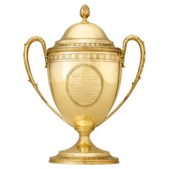
Yates Gold Cup
By Hannah Northcote
Located in New Orleans, LA
Remarkable in scale and artistry, this George III-style cup and cover was created by the famed London silversmith Hannah Northcote. Set on a circular foot and taking the form of a vase, the cup features two leaf-capped handles and a detachable domed cover crowned with a bud finial. Astounding in craftsmanship given the scarcity of gold at the time of its creation, the sentimental message engraved within the frontal cartouche indicates the prestigious provenance that further distinguishes this cup. Originally commissioned by Robert Peel, the father of 19th century British Prime Minister Robert Peel, the gold cup...
Category

19th Century English Georgian Antique Engraved Collectibles and Curiosities

Materials

Gold

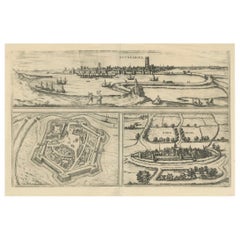
Bird's-Eye Views of Dunkerque, Gravelines, and Bourbourg by Braun and Hogenberg
Located in Langweer, NL
Bird's-Eye Views of Dunkerque, Gravelines, and Bourbourg by Braun and Hogenberg, 1597 This antique print, published in 1597 by Braun and Hogenberg, showcases three detailed bird's...
Category

16th Century Antique Engraved Collectibles and Curiosities

Materials

Paper

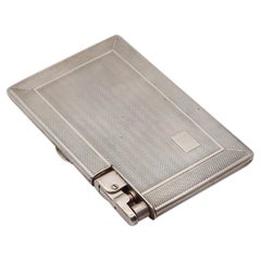
MYLFLAM ENGLAND Dublin 1949 Compendium Lighter Case In .925 Sterling Silver
Located in Miami, FL
A compendium lighter cigarette case made in England. This is a very rare compendium cigarettes and lighter case, created in Dublin England during the post-war back in 1947. The enti...
Category

1940s German Mid-Century Modern Vintage Engraved Collectibles and Curiosities

Materials

Sterling Silver

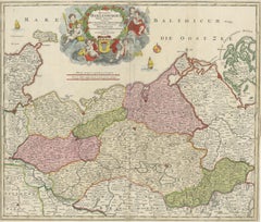
Antique Map of Mecklenburg-Vorpommern in Germany by J.B. Homann, c.1720
Located in Langweer, NL
Antique Map of Mecklenburg-Vorpommern by J.B. Homann, c.1720 Old colored antique map of Mecklenburg-Vorpommern by Johann Baptist Homann. This stunning map, titled "Ducatus Meklenbur...
Category

1720s Antique Engraved Collectibles and Curiosities

Materials

Paper

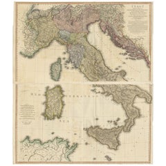
Very Large Double Page Detailed Map of Italy and Surrounding Regions, 1794
Located in Langweer, NL
This is a large (two seperate sheets) and detailed map of Italy, including the southern parts of Germany, Dalmatia, the adjacent countries, and the Illyric Islands. The map is titled...
Category

1790s Antique Engraved Collectibles and Curiosities

Materials

Paper

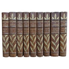
History of India, edited by A.V.Williams Jackson (9volumes-leather bound)
Located in San Francisco, CA
This limited luxury edition has a issue of 200 copies, this set is number 98. Each book has a handcolored frontispiece, with tissue guards, each volumen averages 300 or more pages, ...
Category

Early 1900s Antique Engraved Collectibles and Curiosities

Materials

Leather

1579 Ornate Map of Burgundy County by Ferdinand de Lannoy
Located in Langweer, NL
1579 Ornate Map of Burgundy County by Ferdinand de Lannoy Description of the Map: This is a beautifully detailed map of the Burgundy region, titled "Bvrgvndiae Comitatus Recentiss....
Category

16th Century Antique Engraved Collectibles and Curiosities

Materials

Paper

Midcentury Era Sterling Silver Miniature Golf Trophy with Figural Club Handles
Located in Hamilton, Ontario
This vintage miniature trophy has no maker's mark, but is presumed to have originated from the United States and date to approximately 1959 and done in the period Mid-Century Modern style. The trophy is composed of sterling silver and features three cast figural golf...
Category

Mid-20th Century American Mid-Century Modern Engraved Collectibles and Curiosities

Materials

Sterling Silver

Original Normandy Map by Frederick de Wit, 1705, with Inset of Channel Islands
Located in Langweer, NL
Normandy Map by Frederick de Wit, 1705, with Inset of Channel Islands Description: This beautifully engraved and hand-colored map, titled Duché et Gouvernement General de Normandie,...
Category

Early 1700s Antique Engraved Collectibles and Curiosities

Materials

Paper

Genuine Antique Map of European Turkey by Pierre Antoine Tardieu (1784-1869)
Located in Langweer, NL
This is an original antique map titled "Carte de la Turquie d'Europe," which depicts the European territories of the Ottoman Empire. The map features detailed geographical and political boundaries, showcasing various regions, cities, rivers, and mountains within the Ottoman European territories. The map was created by Pierre Antoine Tardieu, a renowned French engraver, steel engraver, and cartographer known for his high-quality work. Map Details: - **Title**: Carte de la Turquie d'Europe - **Creator**: Pierre Antoine Tardieu (1784-1869) - **Publication Date**: Early 19th century - **Dimensions**: Approximately 34.5 x 43.5 cm (13.5 x 17.25 inches) - **Features**: The map includes a detailed representation of the European territories of the Ottoman Empire, with place names, rivers, mountains, and regions clearly marked. The title cartouche is located in the upper left corner, and the mile scale is presented in the lower left. Around the year 1800, the region referred to as "European Turkey" or "Ottoman Europe" was a significant part of the Ottoman Empire, which was one of the most powerful empires in the world at the time. Here are some key aspects of European Turkey during this period: ### Geographic Scope European Turkey included a large part of Southeastern Europe, encompassing modern-day: - Greece - Bulgaria - Romania (specifically the regions of Dobruja and parts of Wallachia) - Serbia - Albania - Montenegro - Bosnia and Herzegovina - Parts of Croatia, Macedonia, and Hungary Political Structure - **Ottoman Administration**: The region was governed by the Ottoman administrative system, which divided territories into provinces (vilayets) and smaller administrative units (sanjaks). Each province was overseen by a governor (pasha) appointed by the Sultan. - **Autonomy and Vassal States**: Some areas within European Turkey had varying degrees of autonomy or were vassal states. For example, Wallachia and Moldavia (in modern-day Romania) were vassal principalities that retained local rulers under Ottoman suzerainty. Society and Demographics - **Ethnic Diversity**: The region was extremely diverse, home to numerous ethnic groups, including Turks, Greeks, Bulgarians, Serbs, Albanians, Vlachs (Romanians), and Jews, among others. - **Religious Diversity**: There was significant religious diversity, with Islam being the dominant religion due to Ottoman rule, but large Christian (Eastern Orthodox, Roman Catholic) and Jewish populations coexisted. Economy - **Agriculture**: The economy was largely agrarian, with agriculture being the primary occupation. Key crops included grains, tobacco, and cotton. - **Trade and Commerce**: European Turkey was strategically important for trade, connecting the Mediterranean with Central Europe and the Black Sea. Major cities like Constantinople (modern-day Istanbul), Thessaloniki, and Belgrade were key commercial hubs. Culture - **Cultural Influence**: The region was a melting pot of various cultures, influenced by Byzantine, Slavic, and Ottoman traditions. This mix was reflected in architecture, cuisine, music, and customs. - **Education and Language**: The official language of administration was Ottoman Turkish, but many local languages were spoken. Education was often conducted in religious institutions, with different communities maintaining their own schools. Challenges and Conflicts - **Internal Strife**: The Ottoman Empire faced numerous internal challenges, including administrative inefficiency, corruption, and local uprisings. - **External Threats**: The empire was also under pressure from external forces, particularly from the Habsburg Empire, Russia, and later from nationalist movements within the Balkans, which sought independence or autonomy from Ottoman rule. Decline of Ottoman Power By 1800, the Ottoman Empire was experiencing a gradual decline, which would intensify throughout the 19th century. This period saw increasing nationalist sentiments among various ethnic groups within European Turkey, leading to uprisings and eventual wars of independence, such as the Serbian Revolution (1804-1835) and the Greek War of Independence (1821-1829). Overall, European Turkey around 1800 was a complex and diverse region under the Ottoman Empire's waning control, characterized by a rich tapestry of cultures, economic activities, and political structures. Condition Overview: 1. **Paper Quality**: The map exhibits signs of aging, such as yellowing along the edges, which is typical for documents of this age. The paper remains in good condition without major tears or damage. 2. **Edges and Corners**: The edges are slightly worn, with minor fraying and a few small tears that do not significantly impact the map's readability or aesthetic value. 3. **Center Fold**: There is a visible center fold, common for maps that were folded for storage or publication. The fold is in good condition without significant wear but with splits on both sidess. 4. **Color and Print Quality**: The colors used to outline the boundaries remain vibrant and clear. The print quality is excellent, with sharp, legible text and detailed illustrations. 5. **Staining and Spots**: There are a few spots and stains, particularly near the edges and along the fold. These do not obscure any critical details of the map. Historical and Artistic Value: Pierre Antoine Tardieu was known for his meticulous craftsmanship and contributions to cartography. His work drew the attention of prominent figures such as Alexander von Humboldt...
Category

Early 1800s Antique Engraved Collectibles and Curiosities

Materials

Paper

An Early 20th Century Sterling Silver Vesta Case in the Form of a Devil’s Head
Located in Ottawa, Ontario
An amusing sterling silver novelty vesta case / match safe in the form of a devil's head. The face having an expressive sardonic grin and eyes inset with red stones. The crown of the head...
Category

Early 20th Century Unknown Other Engraved Collectibles and Curiosities

Materials

Sterling Silver

Friesland, Groningen and Overijssel – Rare Woodcut Map by Münster, c. 1550
Located in Langweer, NL
Frisia, Groningen and Overijssel – Rare Woodcut Map by Münster, c. 1550, Germany This highly decorative 16th-century woodcut map titled “Von dem Teutschen Land: Seelentfrie” was pub...
Category

16th Century Antique Engraved Collectibles and Curiosities

Materials

Paper

1756 Map of Brazil from Bahia to São Paulo by Bellin – French Colonial Engraving
Located in Langweer, NL
Antique Map of Brazil from Bahia to São Paulo – Bellin for L'Histoire des Voyages This elegant 18th-century French map titled "Suite du Bresil, Depuis la Baie de Tous les Saints jus...
Category

1750s Antique Engraved Collectibles and Curiosities

Materials

Paper

Hand-Colored Map of Delfland by Hendrik de Leth, 1740 – Delft & The Hague
Located in Langweer, NL
Hand-Colored Map of Delfland by Hendrik de Leth, 1740 – Delft & The Hague This beautifully preserved antique map titled "Nieuwe Gemeete Kaert van Delfland" was engraved by Hendrik d...
Category

1740s Antique Engraved Collectibles and Curiosities

Materials

Paper

1687 Engraved View of Rhodes by O. Dapper – Hand-Colored Island of Rhodus
Located in Langweer, NL
1687 Engraved View of Rhodes by O. Dapper – Hand-Colored Island of Rhodus This original antique print is a beautifully detailed copper engraving titled "Het Eylant Rhodus" (The Isla...
Category

1680s Antique Engraved Collectibles and Curiosities

Materials

Paper

English Monumental Polished Steel & Bone Carving Set, Hallmarks S.H, Circa 1835
By Samuel Harwood
Located in Charleston, SC
English monumental polished steel carving set with inlaid eagle bone handles depicting E. pluribus unum motto. Stamped with Hallmarks in Silver S.H. Samue...
Category

1830s English William IV Antique Engraved Collectibles and Curiosities

Materials

Sterling Silver, Steel

1817 Map of Puerto Rico and the Virgin Islands with Original Hand Coloring
Located in Langweer, NL
The title provided for this map is "Porto Rico and Virgin Isles," and it is an antique map from an early 19th century atlas, dated 1817, featuring original hand coloring. This histor...
Category

Early 19th Century Antique Engraved Collectibles and Curiosities

Materials

Paper

1645 Blaeu Map of Westmorland, Northern England – Hand Colored, Decorative
Located in Langweer, NL
This map, "Westmoria Comitatus; Anglice Westmorland", was created by the esteemed Dutch cartographer Willem Blaeu and was published around 1645 in 'Le Theatre du Monde ou Nouvel Atlas'. It provides a detailed look at Westmorland, a historic county in northern England, based on John Speed’s earlier map. The map features numerous place names, parks, and estates, including Brigster Park, Colnhead Park, Crosbye, and Midleton, along with a detailed depiction of Windermere (spelled Wynandermere) and the surrounding regions. Additional Features: - Hand-colored map, with vibrant and detailed colors that bring out the topographical and decorative features. - Includes intricate cartouches, such as the royal coat of arms, a decorative title cartouche topped with putti (cherubic figures), and six coats of arms (two left blank). - Depicts the region’s rich landscape, including the rolling hills and mountainous terrain of northern England. - French text on the verso, indicative of the publication period from 1645-1648, part of Blaeu’s highly sought-after atlases. - Map shows precise details of small towns, estates, and parks, such as Brigster Park, Colnhead Park, Crosbye, and Wynandermere (now Windermere Lake). This map would be of particular interest to collectors of English county maps, antique maps of northern England, 17th-century cartography, and the decorative works of Willem Blaeu. Blaeu's maps are renowned for their accuracy, artistic beauty, and historical significance. Keywords: Willem Blaeu, Westmorland map, northern England, 17th-century map, antique map, English county map, John Speed, Windermere, decorative cartography, hand-colored map, rare map, antique cartography...
Category

1640s Antique Engraved Collectibles and Curiosities

Materials

Paper

Tarzan and The Ant Men First Edition
Located in Dallas, TX
Presenting a gloriously rare book …. Tarzan and The Ant Men First Edition by Edgar Rice Burroughs Grosset & Dunlap 1st Edition. Mixed edition...
Category

Early 20th Century American Romantic Engraved Collectibles and Curiosities

Materials

Paper

Jewelry Box Apprentice Chest Brass Engraved Thistle Miniature
Located in Cheltenham, GB
Chest of Drawers Jewelry Box Apprentice Chest Brass Engraved Solid brass apprentice chest of drawers, chest with 5 working drawers all with stylized...
Category

Early 20th Century British Engraved Collectibles and Curiosities

Materials

Brass

Antique Map of Peloponnesus, Greece by Pierre Antoine Tardieu, 1797
Located in Langweer, NL
This antique map, titled "Carte Ancienne d'Allemagne," represents ancient Germany and surrounding regions. It was published by the well-known Parisian mapmakers and publishers Jean-Baptiste-Louis Clouet and Alexandre Aimé Vuillemin in the late 18th century, specifically in 1787. The map covers the extensive geographical area of ancient Germany, highlighting various tribes and regions known at the time. Key features include: 1. **Geographical Boundaries**: The map outlines the territorial extents of ancient Germany, bordered by Gallia (France) to the west, Sarmatia (parts of Eastern Europe) to the east, and the Italian regions to the south. The northern boundary reaches the Oceanus Germanicus (North Sea) and the Sarmatian Sea (Baltic Sea). 2. **Tribal Regions**: It details numerous ancient Germanic...
Category

1790s Antique Engraved Collectibles and Curiosities

Materials

Paper

Mercator's Ptolemaic Map of Ancient Assyria, Media, and Persia
Located in Langweer, NL
This map, "Asiae I Tab:", features the region corresponding to modern-day Iran and Iraq, intricately depicted in Gerard Mercator's edition of Claudius Ptolemy's "Tabulae Geographicae...
Category

16th Century Antique Engraved Collectibles and Curiosities

Materials

Paper

Navigational Chart of Jamaica, Cape Gracias a Dios, and the Mosquito Coast, 1775
Located in Langweer, NL
The map titled "The Island of Jamaica and Cape Gracias a Dios with the Banks (Shows Moskito Kings Party)" illustrates a significant historical period marked by shifting colonial infl...
Category

1770s Antique Engraved Collectibles and Curiosities

Materials

Paper

Exquisite 1600 Ortelius Map of Artois, France: A Collector’s Piece
Located in Langweer, NL
Exquisite 1600 Ortelius Map of Artois, France: A Collector’s Piece with Rich Historical Detail Description of the Map: This map, titled "Atrebatum Regionis Vera Descriptio," create...
Category

Early 1600s Antique Engraved Collectibles and Curiosities

Materials

Paper

Map of India and Ceylon with Inset of Calcutta and the Ganges, by Bonne, 1780
Located in Langweer, NL
The map on offer is an antique copperplate engraving of India and Ceylon (Sri Lanka), created by Rigobert Bonne (1727-1794), a prominent French cartographer. Here is a breakdown of t...
Category

1780s Antique Engraved Collectibles and Curiosities

Materials

Paper

Detailed Antique Map of Hungary and Transylvania by Tirion, 1753
Located in Langweer, NL
Title: Nieuwe Kaart van’t Koninkryk Hongaryen en Zevenbergen by Isaak Tirion, 1753 – Antique Map of Hungary and Transylvania Description: This is an antique 1753 map titled *Nieuwe Kaart van’t Koninkryk Hongaryen en Zevenbergen*, created by the notable Dutch cartographer and publisher Isaak Tirion. The map showcases the Kingdom of Hungary and the region of Transylvania (referred to as "Zevenbergen") as they appeared in the mid-18th century. Tirion’s maps are well-known for their clarity, precision, and attention to geographic detail, making them highly sought after by collectors of antique maps. This map provides a detailed view of Hungary and Transylvania, including borders, towns, cities, rivers, and mountain ranges. It was created using the latest discoveries and updates of the time and reflects the political landscape of the region, which was part of the Habsburg Empire during a period of territorial changes and consolidations. The map’s borders are highlighted with color to distinguish different regions, and significant cities such as Buda, Pest, and Debrecen are clearly labeled. Isaak Tirion was one of the most prominent Dutch publishers of the 18th century, particularly known for his *Nieuwe en Beknopte Hand-Atlas* (New and Concise Hand Atlas) series, which included a wide range of maps of Europe and beyond. His works were appreciated for their cartographic accuracy and artistic quality. This map is a valuable piece for collectors interested in 18th-century European maps, particularly those that highlight Central Europe, Hungary, Transylvania, and the Habsburg Empire. It is a fine example of the craftsmanship of Isaak Tirion and offers insight into the historical geography of the region. Condition: Excellent for its age, with finely preserved hand-coloring and wide margins. Slight edge wear typical of maps from this period. Effective keywords that may help attract collectors or enthusiasts interested in historical maps of Hungary, Transylvania, and Central Europe: - Antique map of Hungary - Historical map of Transylvania - 18th-century map of Central Europe - Habsburg Empire map - Isaak Tirion map - Nieuwe Kaart van’t Koninkryk Hongaryen en Zevenbergen - Kingdom of Hungary map...
Category

1750s Antique Engraved Collectibles and Curiosities

Materials

Paper

Rare 1681 Map of Batavia: Detailed Dutch Colonial Era Cartography, 1681
Located in Langweer, NL
The map of Batavia (modern-day Jakarta) from 1681, attributed to Frederick de Wit holds significant historical importance for several reasons: Historical Context 1. Colonial Era: This map dates back to the Dutch colonial era when Batavia served as the administrative and commercial hub of the Dutch East India Company (VOC). The VOC was a powerful trading entity that played a crucial role in the global spice trade and colonization in Southeast Asia. 2. Strategic Importance: Batavia was strategically located on the northwestern coast of Java, providing the Dutch with a critical base for their maritime operations. The city became the center of Dutch political and military control in the region. Cartographic Significance 1. Detailed Urban Layout: The map meticulously details the layout of Batavia, including its fortifications, canals, streets, and significant buildings. This level of detail provides insights into the urban planning and architectural styles of the period. 2. Military Engineering: The fortifications shown on the map illustrate the advanced military engineering techniques used by the Dutch to protect their valuable colony. The walls, bastions, and moats indicate the strategic considerations taken to defend against potential invasions. 3. Maritime Activity: The depiction of ships in the harbor highlights Batavia's role as a major maritime center. The VOC's fleets were essential for trade routes connecting Europe, Africa, and Asia, making Batavia a crucial node in global commerce. Artistic and Cultural Value 1. Artistic Elements: The decorative elements, such as the lion holding a shield and the intricate cartouches, reflect the artistic trends of Dutch Golden Age cartography. These embellishments were not only informative but also served to display the cartographer's skill and the map's prestige. 2. Cultural Exchange: Maps like this one provide evidence of cultural exchange between the Dutch and the indigenous populations of Java. The blending of Dutch and local influences can be seen in various aspects of the map and the architecture of the city. Rarity and Preservation 1. Rarity: Maps from the 17th century, especially those in good condition, are relatively rare and highly valued by collectors and historians. Each map provides a unique snapshot of historical geography and urban development. 2. Preservation of History: This map serves as a historical document, preserving knowledge about Batavia's cityscape, infrastructure, and colonial governance. It helps historians and scholars understand the socio-economic and political dynamics of the period. Conclusion The map of Batavia from 1681 is special due to its detailed depiction of one of the most important colonial cities in Southeast Asia during the Dutch Golden Age. It reflects the strategic, economic, and cultural significance of Batavia, serving as a valuable resource for understanding the history of Dutch colonialism and its global impact. The map's artistry and precision make it an important artifact in the history of cartography. --------------- The map is an original and historical map of Batavia (present-day Jakarta) on the island of Java, dated 1681. There are several details to consider when evaluating its origins and possible authorship: 1. **Style and Detail**: The intricate details and style are reminiscent of maps created by Frederick de Wit, a prominent Dutch cartographer and engraver of the 17th century. He was known for his detailed city maps and sea charts. 2. **Lack of Signature**: The absence of "F. de Wit, Excudit" could indicate either an omission or a different engraver. However, it is essential to note that some maps from that period were reproduced or copied by other engravers and cartographers. This was not uncommon, as map-making was a collaborative effort, and copies of popular maps were frequently made. 3. **Map Characteristics**: - The depiction of ships and the detailed fortifications are typical of Dutch cartography in the late 17th century. - The decorative elements, such as the lion holding a shield, are also characteristic of Dutch map engravers. 4. **Other Possible Engravers**: While Frederick de Wit is a strong candidate, other notable Dutch engravers from that period include Joan Blaeu and Willem Janszoon Blaeu. They also produced highly detailed maps and could potentially be the creators or inspirers of this map. To determine the precise authorship, you might consider: - **Comparing** this map with other confirmed works of Frederick de Wit and his contemporaries to identify stylistic similarities and differences. - **Historical Records**: Consulting historical records or publications related to Dutch cartography in the 17th century might provide more context or even direct references to this particular map. If you have access to additional details or higher-resolution images of specific sections, it might help further pinpoint the map's origin and authorship. ------------- Frederick de Wit (1629–1706) was a prominent Dutch cartographer, engraver, and publisher known for his detailed and decorative maps, atlases, and globes. He played a significant role in the Dutch Golden Age of cartography, contributing to the wealth of geographic knowledge and artistic achievement during this period. Here are key aspects of his life and work: ### Biography - **Early Life**: Frederick de Wit was born in Gouda, Netherlands, in 1629. Little is known about his early years, but he moved to Amsterdam, the epicenter of Dutch cartography, in the mid-17th century. - **Career Beginnings**: De Wit began his career as an engraver and publisher, initially producing maps that were reissues of earlier works by other cartographers, such as Joan Blaeu and Willem Janszoon Blaeu. ### Contributions to Cartography - **Mapmaking**: De Wit was known for his meticulous attention to detail and artistic flair. He produced a wide range of maps, including world maps, regional maps, city plans, and maritime charts...
Category

1680s Antique Engraved Collectibles and Curiosities

Materials

Paper

Bird’s-Eye View of Basel from Braun & Hogenberg’s Civitates Orbis Terrarum, 1575
Located in Langweer, NL
Bird’s-Eye View of Basel from Braun & Hogenberg’s "Civitates Orbis Terrarum" (Circa 1572-1617) This highly detailed map of Basel is a bird's-eye view, originally based on Sebastian Münster’s map...
Category

16th Century Antique Engraved Collectibles and Curiosities

Materials

Paper

Map of Groningen from The Genealogy of the Illustrious Counts of Nassau (1615)
Located in Langweer, NL
Title: Map of Groningen from "The Genealogy of the Illustrious Counts of Nassau" (1615) Description: This antique map, titled "Gronenga," offers a detailed depiction of the forti...
Category

1610s Antique Engraved Collectibles and Curiosities

Materials

Paper

Old Map of Ancient Spain and Portugal – Hispania Antiqua Featuring Roman Cities
Located in Langweer, NL
Title: "Hispania Antiqua in Tres Praecipuas Partes Divisa: Tarraconensem, Lusitaniam, et Bæticam" by Robert de Vaugondy, 18th Century Description: This beautifully detailed map titl...
Category

Late 18th Century Antique Engraved Collectibles and Curiosities

Materials

Paper

Political Map of Europe: Early 19th Century, from the 1802 Tardieu Atlas
Located in Langweer, NL
Antique Map Description Title: Carte Générale et Politique de l'Europe Publication Details: - **Atlas Title:** Nouvel Atlas Universel de Géographie Ancienne et Moderne - **Purpose...
Category

Early 1800s Antique Engraved Collectibles and Curiosities

Materials

Paper

Decorative Antique Map of Cyprus and Asia Minor by Christoph Weigel, Circa 1720
Located in Langweer, NL
Title: Asiae Peninsula sive Asia Intra Taurum by Christoph Weigel, Circa 1720 – Decorative Antique Map of Cyprus and Asia Minor Description: Thi...
Category

1720s Antique Engraved Collectibles and Curiosities

Materials

Paper

Antique Cylinder Sundial Late 19th Century
Located in Firenze, IT
Shipping policy No additional costs will be added to this order. Shipping costs will be totally covered by the seller (customs duties included). A boxwood cylinder sundial...
Category

Late 19th Century British Late Victorian Antique Engraved Collectibles and Curiosities

Materials

Wood, Paper

18th Century Original Dutch Map of Martinique in The West Indies by Isaak Tirion
Located in Langweer, NL
This is an 18th-century Dutch map of Martinique, titled *Het Westindisch Eiland Martinique*. The map was produced by Isaak Tirion, a renowned Dutch cartographer and publisher known for his precise and beautifully crafted maps. The cartouche in the lower left corner, adorned with decorative elements, adds to the aesthetic appeal of the map. ### Key Features: - Martinique: The map offers detailed topographical information of the island, including mountains, rivers, and settlements. - Geographical Details: Locations such as Fort Royal, Bay de St. Pierre, and Point de Cloche are marked, showcasing significant features of the island. - Cartouche: The ornate cartouche, featuring tropical plants, reflects the importance of the island's agricultural production during the colonial period, particularly its sugar plantations. This map captures Martinique during its time as a French colony and provides valuable insight into the island’s layout and strategic significance in the Caribbean. The attention to coastal detail highlights the importance of Martinique as a hub of maritime activity. The map’s combination of aesthetic elegance and cartographic precision makes it a remarkable piece for collectors and those interested in Caribbean colonial...
Category

1760s Antique Engraved Collectibles and Curiosities

Materials

Paper

World Map in Two Hemispheres: Eastern & Western - 1802 Tardieu Atlas
Located in Langweer, NL
Antique Map with Title: "Mappemonde en Deux Hémisphères" Publication Details: - **Atlas Title:** Nouvel Atlas Universel de Géographie Ancienne et Moderne - **Purpose:** For the Nouvelle Edition de la Géographie de Guthrie - **Mapmakers:** P. F. Tardieu, with contributions from various geographical works - **Publisher:** Chez Hyacinthe Langlois, Libraire, quai des Augustins, n° 45 - **Year:** An X - 1802 (French Revolutionary Calendar) **Geographical Scope:** This antique map illustrates a double-hemisphere world map, showing both the Eastern (Old World) and Western (New World) hemispheres. It provides a global perspective, capturing the entire known world as understood in the early 19th century. **Map Features:** - **Hemispheres Displayed:** - **Western Hemisphere:** The Americas, labeled as "Hémisphère Occidental ou Nouveau Monde...
Category

Early 1800s Antique Engraved Collectibles and Curiosities

Materials

Paper

John Bennett Georgian Barometer
Located in New Orleans, LA
This exceptional Georgian barometer by the leading London instrument-maker John Bennett strongly reflects the prevalent furniture style and archite...
Category

18th Century English Georgian Antique Engraved Collectibles and Curiosities

Materials

Brass

Map of Tartary by Isaak Tirion: Detailed Cartography of Northern Asia, ca.1740
Located in Langweer, NL
This is an antique map titled "Nieuwe Kaart van Tartarie," which translates to "New Map of Tartary." The map was created by Isaak Tirion, a prominent Dutch cartographer and publisher...
Category

1740s Antique Engraved Collectibles and Curiosities

Materials

Paper

Antique English Gold Mounted Walking Stick
Located in London, GB
Antique English gold mounted walking stick English, 1809 Height 91cm, diameter 2.5cm This charming walking stick, created in 1809, is adorned with symbolic motifs. At the top ...
Category

Early 19th Century English Antique Engraved Collectibles and Curiosities

Materials

Metal, Gold

Antique Map of the Frankfurt Region by Johannes Janssonius, Hand-Colored, C.1650
Located in Langweer, NL
Antique Map of the Frankfurt Region by Johannes Janssonius circa 1650 Hand-Colored This rare and beautifully detailed antique map titled Territorium Francofurtense depicts the reg...
Category

1650s Antique Engraved Collectibles and Curiosities

Materials

Paper

Frisia Occidentalis, A Rare Antique Engraving of Friesland, The Netherlands
Located in Langweer, NL
Antique map titled 'Frisia Occidentalis.' - A very decorative map of the Dutch province Friesland, also showing the Wadden islands Terschelling and Ameland. With coats of arms of the...
Category

1620s Antique Engraved Collectibles and Curiosities

Materials

Paper

Huy (Huum) Cityscape 1574: Historical Copper Engraving by Braun & Hogenberg
Located in Langweer, NL
Title: Huum opp. condrusorum caput (...) Anno partae salutis 1574. **Type:** Print (Colored Copper Engraving) **Year:** Circa 1580 **Technique:** Colored Copper Engraving **Medium:...
Category

16th Century Antique Engraved Collectibles and Curiosities

Materials

Paper

Authentique Map by Pilon of The French Colonies in The West Indies, 1876
Located in Langweer, NL
The 1876 map titled "Carte des Colonies Françaises aux Antilles" represents a significant contribution to cartography within the "Grand Atlas Départemental de la France de L'Algérie ...
Category

Late 19th Century Antique Engraved Collectibles and Curiosities

Materials

Paper

Antique Map of Greece from Ortelius's Theatrum Orbis Terrarum, 1595
Located in Langweer, NL
Original antique map titled "Graecia Sophiani." This is a very detailed and decorative engraved map, with two decorative cartouches and a hand-colored initial on the verso, from Abra...
Category

16th Century Antique Engraved Collectibles and Curiosities

Materials

Paper

Antique Map of Jamaica and Hispaniola (Saint-Domingue and Santo Domingo), 1802
Located in Langweer, NL
This is an original antique map titled "Carte des Isles de la Jamaïque et de St. Domingue," depicting the islands of Jamaica and Saint-Domingue (modern-day Haiti and the Dominican Re...
Category

Early 1800s Antique Engraved Collectibles and Curiosities

Materials

Paper

Luigi Del Monte Modern Aluminum Hanukkah Lamp
Located in New York, NY
The Hanukkah Lamp by Luigi Del Monte, created in 1999, is a striking reinterpretation of the traditional Hanukkah menorah. Constructed from brushed aluminum, the lamp embraces minima...
Category

Late 20th Century Italian Modern Engraved Collectibles and Curiosities

Materials

Aluminum

21st Century Italian Sterling Silver Chalice
Located in VALENZA, IT
Solid sterling silver liturgical chalice, completely handmade. The base is hammered and embossed with arched motifs that facilitate its grip. The mi...
Category

Early 2000s Italian Modern Engraved Collectibles and Curiosities

Materials

Sterling Silver

A General View of Jerusalem in the Early Part of the 18th Century" (circa 1752)
Located in Langweer, NL
The print is signed by the artist "S. Mynde sc." in the lower right corner. This suggests that the maker of the print is Samuel Mynde, a known engraver from the 18th century. His wor...
Category

1750s Antique Engraved Collectibles and Curiosities

Materials

Paper

17th Century Cartographic Marvel: A Detailed Engraving of Guangzhou (Kanton)
Located in Langweer, NL
This engraving of Guangzhou ("Kanton") is from a French edition of Olfert Dapper's work. The French edition titled "Description de l’Empire de la Chine" was published in 1674. It is ...
Category

1670s Antique Engraved Collectibles and Curiosities

Materials

Paper

Colomba by Prosper Mérimée, Prosper - ILLUSTRATED
Located in Middletown, NY
Paris: Librairie L. Conquet, L.Carteret et Cie. 1904. Maurice Tourneux, preface, Daniel Vierge, illustrations LIMITED EDITION Large 8vo, 10 1/2 x 7 inches (270 x 177 mm); viii, 298 ...
Category

Early 20th Century French Engraved Collectibles and Curiosities

Materials

Leather, Wood, Paper

Western Roman Empire Map: British Isles & Gaul - 1802 Tardieu Atlas
Located in Langweer, NL
Antique Map Description and title: "Partie Occidentale de l'Empire Romain ou du Monde connu des Anciens d'Après d'Anville" Publication Details: - **Atlas Title:** Nouvel Atlas Univ...
Category

Early 1800s Antique Engraved Collectibles and Curiosities

Materials

Paper

Vieille France by Roger Martin DuGard - Art Deco Binding - Henri Matisse cover
Located in Middletown, NY
Neuchatel & Paris: Ides et Calendes, 1946 Henri Matisse illustration Limited Edition. 8vo; 7 1/4 x 5 3/8 inches (182 x 136 mm); frontispiece reproducing a map of part of Paris, origi...
Category

Mid-20th Century French Engraved Collectibles and Curiosities

Materials

Gold Leaf

Original Antique Map of the Island of Dominica in the West Indies, 1794
Located in Langweer, NL
MAP OF THE ISLAND OF DOMINICA for the History of the West Indies, by Bryan Edwards. Esq. Dominica, an island renowned for its lucrative exports of sugar, cocoa, and coffee, operated...
Category

1790s Antique Engraved Collectibles and Curiosities

Materials

Paper

Important Confederate Field Map of Richmond VA 1864 with Provenance
Located in Dallas, TX
PRESENTING AN HISTORIC AND EXCEPTIONALLY RARE AND IMPORTANT American Civil War Collection consisting of: (1) ORIGINAL and FULLY AUTHENTIC Confederate Field Map of Richmond, VA 1864 belonging to Capt W.A. Obenchain C.S. Engineers, (2) ORIGINAL and FULLY AUTHENTIC Surrender/Parole Paper for Capt. W.A. Obenchain dated 1st May 1865 at Greensboro, NC (3) ORIGINAL and FULLY AUTHENTIC Pamphlet for Hillsborough Military Academy, NC with Major W.M. A. Obenchain listed as 'Military Staff'. These ALL belonged to Captain (later promoted to rank of Major) William Alexander Obenchain and the battlefield map was his 'personal' field map for the Battle of the Richmond Peninsula in 1864, at the end of the US Civil War...
Category

Mid-19th Century American American Classical Antique Engraved Collectibles and Curiosities

Materials

Canvas, Paper

Hand-colored Nautical Chart: St. George's Channel and the Irish Sea, 1744
Located in Langweer, NL
The map was engraved by Richard William Seale, a notable British engraver. This map is a fine example of 18th-century cartography, particularly focused on maritime navigation. The m...
Category

1740s Antique Engraved Collectibles and Curiosities

Materials

Paper

Beautiful and Rare Original Antique Engraving of a Village in Tonga, 1817
Located in Langweer, NL
Fete donnee au General Dentrecasteaux par Toubau, Roi des Iles des Amis Original antique engraving showing the party given to General Dentrecasteaux by Toubau, King of the Friendl...
Category

1810s Antique Engraved Collectibles and Curiosities

Materials

Paper

Authentic 1644 Janssonius Map of the Champagne Region (Campania) in France
Located in Langweer, NL
"1644 Janssonius Map of Champagne, France" This meticulously detailed original antique map, engraved in 1644, is a work by the esteemed cartographer Johannes Janssonius. It depicts the historic province of Champagne, situated in the northeastern part of France. The map is notable for its high level of detail, with meticulously drawn boundaries, city markers, and river courses. It features a beautifully rendered cartouche adorned with the provincial coat of arms, flanked by classical figures, indicative of the region's cultural significance. In the lower left corner, a pair of cherubs are engaged in surveying, symbolizing the scientific endeavor of cartography. The elaborate compass rose and the scale bar further complement the map's utility and artistic merit. Champagne is renowned globally for its viticultural heritage, being the birthplace of the eponymous Champagne sparkling wine. The region's unique terroir, with its chalky soil and cool climate, is ideal for the production of the grapes used in champagne-making. The historical significance of Champagne extends beyond winemaking; it has been the site of pivotal battles and royal coronations, which shaped the course of French and European history. This map is not only a navigational tool but also a snapshot of a region rich in history and tradition, an artifact that embodies the geographical and cultural prestige of Champagne. This description provides a detailed visual and contextual presentation of the map, suitable for a catalog entry, emphasizing both its artistic features and the historical and cultural importance of the Champagne region. THE WINE AREAS: The Champagne region, known primarily for its production of the sparkling wine that bears its name, encompasses several important cities and sites of historical and cultural significance: 1. **Reims**: Often considered the unofficial capital of the Champagne region, Reims is renowned for its grand cathedral, Notre-Dame de Reims, where French kings were historically crowned...
Category

1640s Antique Engraved Collectibles and Curiosities

Materials

Paper

The Principality of Dombes: A 17th-Century Cartographic Jewel by Jan Jansson
Located in Langweer, NL
The text on the map "La principaute de Dombes; J. van den Eynde sculpit.; La Principavte de Dombes" indicates that it is a map of the principality of Dombes, engraved by J. van den E...
Category

1630s Antique Engraved Collectibles and Curiosities

Materials

Paper

18th Century Cartographic Depiction of Upper India and Ceylon, 1835
Located in Langweer, NL
An exquisite set of two maps, 'Carte de la Partie Superieure De L'Inde en de Cadu Gange,' masterfully crafted by the renowned 18th-century French cartographer, Charles Marie Rigobert...
Category

1830s Antique Engraved Collectibles and Curiosities

Materials

Paper

Read More

Medal-Worthy Memorabilia from Epic Past Olympic Games

Get into the games! These items celebrate the events, athletes, host countries and sporting spirit.

Ahoy! You’ve Never Seen a Collection of Sailor Art and Kitsch Quite Like This

French trendsetter and serial collector Daniel Rozensztroch tells us about his obsession with objects related to seafaring men.

Pamela Shamshiri Shares the Secrets behind Her First-Ever Book and Its Effortlessly Cool Interiors

The sought-after designer worked with the team at Hoffman Creative to produce a monograph that beautifully showcases some of Studio Shamshiri's most inspiring projects.

Moroccan Artworks and Objects Take Center Stage in an Extraordinary Villa in Tangier

Italian writer and collector Umberto Pasti opens the doors to his remarkable cave of wonders in North Africa.

Montecito Has Drawn Royalty and Celebrities, and These Homes Are Proof of Its Allure

Hollywood A-listers, ex-pat aristocrats and art collectors and style setters of all stripes appreciate the allure of the coastal California hamlet — much on our minds after recent winter floods.

Whaam! Blam! Pow! — a New Book on Pop Art Packs a Punch

Publishing house Assouline and writer Julie Belcove have teamed up to trace the history of the genre, from Roy Lichtenstein, Andy Warhol and Yayoi Kusama to Mickalene Thomas and Jeff Koons.

The Sparkling Legacy of Tiffany & Co. Explained, One Jewel at a Time

A gorgeous new book celebrates — and memorializes — the iconic jeweler’s rich heritage.

What Makes a Gem-Encrusted Chess Set Worth $4 Million?

The world’s most opulent chess set, weighing in at 513 carats, is literally fit for a king and queen.
Recently Viewed

View All