Engraved Collectibles and Curiosities

to
329
508
242
762
5
5
17
12
11
10
9
8
7
5
4
2
1
1
1
1
456
191
115
10
63
24
16
7
4
2
5
3
1
3
6
3
4
582
167
89
53
35
250
67
54
54
53
772
772
772
10
9
9
8
5
Technique: Engraved
The Rhinegold and The Valkyrie Illustrated by A Rackham First Edition
Located in Dallas, TX
Presenting a fabulous first edition book, namely, The Rhinegold and The Valkyrie Illustrated by A Rackham First Edition. The Rhinegol...
Category

Early 20th Century American Bohemian Engraved Collectibles and Curiosities

Materials

Paper

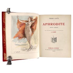
Aphrodite; Moeurs Antiques by Pierre Louÿs, illustr. by Antoine Calbet -
Located in Middletown, NY
Paris: Rombaldi Éditeur, 1937. Limited Edition. 8vo, 7 5/8 x 5 3/4 (194 x 156 mm). pp: 4, vii, 242. Five color lithographs including the frontispiece. Copies printed on Voiron laid...
Category

Early 20th Century French Engraved Collectibles and Curiosities

Materials

Leather, Wood, Paper

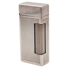
ALFRED DUNHILL Paris 1960 Short Automatique Rollalite Petrol Pocket Lighter
Located in Miami, FL
An automatic rollalite lighter designed by Alfred Dunhill. This is a very scarce petrol pocket lighter, created in Switzerland by La Nationale company for the Alfred Dunhill Company...
Category

1960s English Mid-Century Modern Vintage Engraved Collectibles and Curiosities

Materials

Silver, Sterling Silver

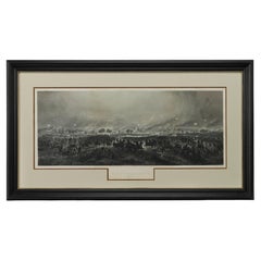
1876 "Gettysburg, The Repulse of Longstreet's Assault." Engraving
Located in Colorado Springs, CO
Presented here is an 1876 engraving of John B. Bachelder and James Walker’s Gettysburg. The Repulse of Longstreet’s Assault. The engraved scene depicts the decisive battle on the final day of the Battle of Gettysburg. Researched by the photographer and topographer John B. Bachelder and painted by James Walker, the original painting was created in 1870. This detailed engraving was done by H. B. Hall Jr. and published by James Drummond Ball. Otherwise called Pickett’s Charge, the battle occurred on July 3, 1863. Pickett’s corp commander, Lieutenant General James Longstreet was placed in charge of the attack despite his hesitations. Longstreet’s central role led to the title of the work, Repulse of Longstreet’s Assault. In an attempt to gain control of an important supply route, nine Confederate brigades charged across three-quarters of a mile of open ground against cannon fire to take Cemetery Ridge from the defending Union Army. Despite their overwhelming numbers, the Confederate forces were repelled with considerable casualties marking not only a decisive victory for the Union, but also the beginning of the slow defeat of Lee’s Army. The furthest the charging forces advanced before being repulsed would forever be known as the “High Water Mark of the Confederacy.” The Confederate army never recovered from the losses at Gettysburg and it effectively ended Lee’s campaign into Pennsylvania. The engraving gives the perspective from the Union rear, one that encompasses most of the battlefield, from Big Round Top on the left to the northern reaches of Cemetery Ridge on the right. The Confederate lines at Seminary Ridge are in the far distance, partially obscured by bursting shells. The image centers on the main Confederate assault, in the vicinity of what today are known as "The Copse" and "The Bloody Angle." The composition has elemen...
Category

1870s American Antique Engraved Collectibles and Curiosities

Materials

Paper

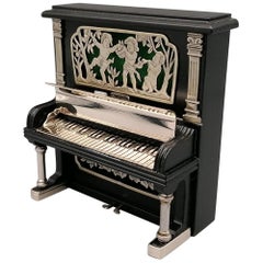
20th Century Italian Miniature Mahogany Piano Sterling Silver Details
Located in VALENZA, IT
Mahogany vertical piano miniature with 925 sterling silver inserts and details. In the upper part, the silver is pierced with drawings of children picki...
Category

1980s Italian Other Vintage Engraved Collectibles and Curiosities

Materials

Sterling Silver

Antique Bird's-Eye View of Hangzhou (China) by Matthäus Merian, 1638
Located in Langweer, NL
This is an exquisite antique bird's-eye view map of Hangzhou, historically referred to as "Xuntien or Quinzay," from the first edition of Matthäus Merian's publication in 1638. This ...
Category

1630s Antique Engraved Collectibles and Curiosities

Materials

Paper

Early 19th Century English Inclining Sundial by William Hawks Grice London
Located in Firenze, IT
Shipping policy No additional costs will be added to this order. Shipping costs will be totally covered by the seller (customs duties included). Early 19th Century English Inclin...
Category

Early 19th Century British Georgian Antique Engraved Collectibles and Curiosities

Materials

Brass

1573 Ortelius Map: First to Name California, Spanning Tartary to North America
Located in Langweer, NL
"1573 Abraham Ortelius Map of Tartary, Japan, and Western North America" Description of the Map: This is an outstanding example of Abraham Ortelius' map titled "Tartariae Sive Magn...
Category

16th Century Antique Engraved Collectibles and Curiosities

Materials

Paper

8 Theological Leather Bound Books, by Franz Volkmar Reinhard, Published 1808
Located in West Palm Beach, FL
8 Theological Leather Bound Books, by Franz Volkmar Reinhard,  Germany, published in 1808 We are pleased to offer a rare and historical find with this exquisite collection of eight ...
Category

Early 19th Century Neoclassical Antique Engraved Collectibles and Curiosities

Materials

Leather, Paper, Parchment Paper

English Mahogany Steel Engraved Stick Barometer Signed F. Tarone, Circa 1780
Located in Charleston, SC
English mahogany stick Barometer with a broken arch pediment, brass urn finial, Satin wood string inlay, hinged glass door revealing a numeral steel engraved dial with original mounted thermometer and barometric pressure gauge. Signed F. Tarone. Late 18th Century Barometer...
Category

1780s English Sheraton Antique Engraved Collectibles and Curiosities

Materials

Steel

Antique 1683 Map of Hispaniola and Puerto Rico in the Caribbean by Mallet
Located in Langweer, NL
Title: 17th Century Map of Hispaniola and Puerto Rico by Mallet (1683) This exquisite 17th-century map by Mallet, titled "I. d'Hispaniola et P.to Rico," showcases the islands of Hispaniola and Puerto Rico with remarkable detail. Published in Paris in 1683 as part of Mallet's monumental "Description de l'Univers," this map is a prime example of historical cartography from the era. Map Features: - Detailed depiction of Hispaniola and Puerto Rico - Nearby islands: Inagua islands, Mayaguana, Île-à-Vache, Saona, and Mona - Three illustrated naval battles surrounding the islands - Hand-colored illustrations typical of the period - Published in Paris, 1683, as part of the "Description de l'Univers" - Engraved with artistic and geographic precision Collectors and enthusiasts of antique maps will appreciate the historical significance and artistic detail of this rare print. Although small, the map is perfect for framing and this map serves as a captivating piece of history, reflecting the maritime exploration and territorial knowledge of the late 17th century. The maker of the map is Allain Manesson Mallet, a notable 17th-century cartographer, military engineer, and author. Born in Paris in 1630, Mallet served in the French army and worked as a military engineer under Louis XIV. He later became a professor of mathematics and military architecture. Mallet is best known for his monumental work, "Description de l'Univers," published in Paris in 1683. This extensive publication is considered one of the greatest works of its kind in the 17th century, providing detailed descriptions and maps of various parts of the world. Mallet's maps are renowned for their artistic quality, intricate details, and the inclusion of illustrative elements such as ships, sea creatures, and topographical features. Mallet's contributions to cartography and his work in "Description de l'Univers" have left a lasting impact on the field, making his maps highly valued by collectors and historians. Keywords: - 17th-century map - Mallet map 1683 - Hispaniola map - Puerto Rico map - Antique Caribbean map...
Category

1830s Antique Engraved Collectibles and Curiosities

Materials

Paper

Gold Rush Era Masterpiece: The Tallis & Rapkin Rare Map of Pre-Queensland, 1851
Located in Langweer, NL
The image is an original historical map of Australia from the year 1851, created by John Rapkin with illustrations by J. Marchant and engravings by J. B. Allen. The map was published...
Category

1850s Antique Engraved Collectibles and Curiosities

Materials

Paper

Antique Map of the Middle East with a Large Arabia, 1799
Located in Langweer, NL
Antique map titled 'Perse, Turquie Asiatique et Arabie (..)'. Map of the Middle East with a large Arabia, extending from the Black Sea to the In...
Category

Late 18th Century Antique Engraved Collectibles and Curiosities

Materials

Paper

Old Map of the Spice Islands, Moluccas by Bellin, Published in 1771
Located in Langweer, NL
Title: 1771 Jacques-Nicolas Bellin Map of the Moluccas, the Spice Islands of Indonesia Description: This finely engraved eighteenth-century map, titled Carte Particulière des Is...
Category

1770s Antique Engraved Collectibles and Curiosities

Materials

Paper

Antique Sterling Silver Miniature Engraved Vesta Match Case Birmingham 1886
Located in Portland, OR
A good antique late Victorian engraved sterling silver vesta match case, George Goodman, Birmingham, 1886. This miniature vesta case is profusely engraved on all sides with a floral ...
Category

1880s English Victorian Antique Engraved Collectibles and Curiosities

Materials

Sterling Silver

Rare 1572 Map of Ancient Rome with Monuments by Ligorio, Braun & Hogenberg
Located in Langweer, NL
Rare 1572 Map of Ancient Rome with Monuments by Ligorio, Braun & Hogenberg This remarkable 16th-century map, *Urbis Romae Situs cum ils quae adhuc Conspiciuntur Veter. Monumet Rel...
Category

16th Century Antique Engraved Collectibles and Curiosities

Materials

Paper

1705 Sanson Map of Southern India and Malabar with an Inset Map
Located in Langweer, NL
Title: 1705 Sanson Map of Southern India and Malabar with an Inset Map Description: This finely engraved and beautifully hand-colored antique map, published in 1705, depicts south...
Category

Early 1700s Antique Engraved Collectibles and Curiosities

Materials

Paper

Jungle Tales of Tarzan First Edition
Located in Dallas, TX
Presenting a gloriously rare book …. Jungle Tales of Tarzan First Edition by Edgar Rice Burroughs Grosset & Dunlap 1st Edition. Good +, square ...
Category

Early 20th Century American Romantic Engraved Collectibles and Curiosities

Materials

Paper

1711 Star Chart of Southern Sky with Mythical Constellations and Exotic Animals
Located in Langweer, NL
1711 Star Chart of the Southern Sky - "Mappa Stellarum Australium quae in Altitudine Poli Borei Graduum" This beautiful star chart, engraved by Arnold van Westerhout in 1711, shows ...
Category

1710s Antique Engraved Collectibles and Curiosities

Materials

Paper

Scarce Latin Edition of Guillaume Delisle's 1700 Map of North America
Located in Langweer, NL
Scarce German Edition of Guillaume Delisle's 1700 Map of North America This beautifully colored and highly detailed map is a rare Latin edition of Guillaume Delisle's influential 17...
Category

Early 1700s Antique Engraved Collectibles and Curiosities

Materials

Paper

Large 1693 Maritime Map of Irish Sea, West Coasts of Ireland, England, Scotland
Located in Langweer, NL
This is a historical sea chart titled "Carte Generale des Costes d'Irlande, et des Costes Occidentales d'Angleterre avec une Partie de celles d'Ecosse," which translates to "General Map of the Coasts of Ireland and the Western Coasts of England with a Part of Scotland." The map was first published in 1693 in the atlas "La Neptune Francois," created by Jaillot and published by Pieter Mortier in Amsterdam. This initiative was started by the French minister Colbert to improve maritime navigation. Details of the Map: 1. **Geographical Coverage:** - The map primarily focuses on the Irish coast. - It also includes the west coast of England and Wales. - Parts of the west coast of Scotland are also depicted. 2. **Inset Map:** - There is a detailed inset map showing the area around Chester and the course of the River Dee. 3. **Features:** - **Depth Soundings:** The Irish Sea is detailed with depth soundings to assist in navigation. - **Coastal Towns and Islands:** Numerous coastal towns, islands, and geographical features are indicated. - **Rhumb Lines:** The map includes extensive rhumb lines, which are lines used by navigators to plot a straight-line course. - **Key:** There is a key describing the quality of the terrain along the coast, important for navigators to understand the nature of the coastal landscape. 4. **Labels and Annotations:** - **Coastal Settlements:** Ports, forts, and villages along the coast are labeled. - **Geographical Features:** Islands and other significant features are marked. 5. **Artistic and Practical Elements:** - The map is printed on thick paper and is hand-colored, reflecting contemporary coloring techniques. - Detailed lines and soundings are included to help ships navigate around the numerous small islands and narrow inlets safely. 6. **Historical Context:** - The map was part of a significant French maritime project aimed at improving navigation and charting European waters more accurately. - It reflects the high level of cartographic skill and knowledge of the late 17th century. This map would have been a valuable tool for mariners of the time, providing them with crucial information about the coastal features, depth soundings, and safe passage routes around the complex coastlines of Ireland, England, and Scotland. About the Makers and the Atlas **1. Alexis-Hubert Jaillot (1632-1712):** - **Background:** Jaillot was a prominent French cartographer and publisher in the 17th century. He was known for his detailed and accurate maps and atlases. - **Work:** He collaborated with other notable cartographers of his time and played a key role in improving and publishing detailed maps. Jaillot's work was characterized by its precision and artistic quality. - **Contribution:** He was instrumental in the creation of "La Neptune Francois," a maritime atlas aimed at improving French naval navigation. **2. Pieter Mortier (1661-1711):** - **Background:** Mortier was a Dutch engraver, publisher, and mapmaker based in Amsterdam. He was well-known for his high-quality prints and maps. - **Work:** Mortier published several important atlases and maps, often collaborating with other cartographers and engravers. His work was recognized for its detailed craftsmanship and accuracy. - **Contribution:** Mortier published "La Neptune Francois" in Amsterdam, making significant contributions to maritime navigation by providing highly detailed sea charts. About the Atlas "La Neptune Francois": **1. Purpose:** - The atlas was created as part of an initiative led by Jean-Baptiste Colbert, the French minister of finance under King Louis XIV. The goal was to enhance the accuracy and availability of maritime charts for French naval and commercial vessels. - "La Neptune Francois" was designed to be a comprehensive and detailed reference for navigators, covering various European waters with a focus on the French coast and adjacent regions. **2. Content:** - The atlas includes a series of sea charts, each providing detailed information on coastal regions, depth soundings, rhumb lines, and other navigational aids. - The maps were printed on high-quality paper and hand-colored, reflecting the artistic standards of the time. **3. Historical Significance:** - "La Neptune Francois" was a landmark in the history of cartography, representing a significant advancement in the accuracy and detail of maritime maps...
Category

1690s Antique Engraved Collectibles and Curiosities

Materials

Paper

Pflueger Summit 1993-L Engraved and Jeweled Fishing Reel with Box, Bag & Papers
By Pflueger
Located in Hamilton, Ontario
This bait fishing reel was made by Pflueger of the United States in the period and style of the Art Deco era. The reel is plated with nickel silver and intricately engraved with jewe...
Category

Early 20th Century American Art Deco Engraved Collectibles and Curiosities

Materials

Silver Plate, Brass

11 Piece Antique Sterling Silver & Blue Guilloche Enamel Ladies Dresser Set
Located in Hamilton, Ontario
This large antique ladies dresser or vanity set is hallmarked by an unknown maker, and presumed to have originated from the United States and da...
Category

Early 20th Century American Art Deco Engraved Collectibles and Curiosities

Materials

Sterling Silver

Antique English Georgian Sterling Silver Pocket Cigar Case
Located in Hamilton, Ontario
This sterling silver and intricately engraved cigar case was made in London England in circa 1831, during the reign of King George IV. The top and bottom are both ornately engraved w...
Category

Early 19th Century English George III Antique Engraved Collectibles and Curiosities

Materials

Sterling Silver

Pocket Globe, Nicholas Lane, London, post 1779
By Nicholas Lane
Located in Milano, IT
Pocket Globe Nicholas Lane London, post 1779 The globe is contained in its original case, which is covered in leather. The sphere measures 2.75 in (6.9 cm) whereas the case measure...
Category

1780s English Other Antique Engraved Collectibles and Curiosities

Materials

Leather, Wood, Paper

The Seven Seas by Rudyard Kipling First Edition
Located in Dallas, TX
Presenting an extremely rare first edition hardback copy of The Seven Seas by Rudyard Kipling from 1897. This rare book is in fair to good condition for ...
Category

Late 19th Century American Art Nouveau Antique Engraved Collectibles and Curiosities

Materials

Paper

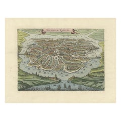
Palermo – 1620 Braun & Hogenberg Bird’s-Eye Map of Palermo, Sicily
Located in Langweer, NL
Palermo – 1620 Braun & Hogenberg Bird’s-Eye Map of Palermo, Sicily This beautifully detailed bird’s-eye view of Palermo, Sicily, was created by Georg Braun and Frans Hogenberg aro...
Category

1620s Antique Engraved Collectibles and Curiosities

Materials

Paper

Empire of the Parthians: Historical Cartographic Masterpiece by d'Anville, 1819
Located in Langweer, NL
Description: Ancient map of the Parthian Empire (19th century), original engraving extracted from the atlas of the history of the emperors from 1819, based on the history of the Rom...
Category

1810s Antique Engraved Collectibles and Curiosities

Materials

Paper

Table Cigar Lighter Four-Leaf Clover Malachite Stone Sterling Silver Salimbeni
Located in Firenze, FI
Table cigar lighter in the shape of a four-leaf clover with frames in 925/1000 sterling silvergold plated and real malachite stone. Piezoelectric m...
Category

1970s Italian Other Vintage Engraved Collectibles and Curiosities

Materials

Malachite, Gold Plate, Enamel, Sterling Silver

Map of the Holy Land "Carte de la Syrie et de l'Egypte" by Pierre M. Lapie
Located in Alamo, CA
An early 19th century map of ancient Syria and Egypt entitled "Carte de la Syrie et de l'Egypte anciennes/dressée par M. Lapie, Colonel d'Etat Major, et...
Category

Early 19th Century French Antique Engraved Collectibles and Curiosities

Materials

Paper

1806 John Cary Map of Hindoostan – Detailed British Cartography of India
Located in Langweer, NL
Title: 1806 John Cary Map of Hindoostan – Detailed British Cartography of India This highly detailed map, titled "A New Map of Hindoostan from the Latest Authorities," was engraved ...
Category

Early 1800s Antique Engraved Collectibles and Curiosities

Materials

Paper

1821 Thomson Map of Guadeloupe, Marie-Galante and Antigua in the West Indies
Located in Langweer, NL
This map, published in 1821 by John Thomson, showcases Guadeloupe, Marie-Galante, and Antigua from the *West India Islands* collection. Part of Thomson's *New General Atlas*, it prov...
Category

1820s Antique Engraved Collectibles and Curiosities

Materials

Paper

Antique Map of the Gulf of Mexico and Caribbean Islands by Tardieu, 1802
Located in Langweer, NL
This is an original antique map titled "Carte du Golfe du Mexique et des Isles Antilles," depicting the Gulf of Mexico and the Caribbean islands. Created by Pierre Antoine Tardieu, t...
Category

Early 1800s Antique Engraved Collectibles and Curiosities

Materials

Paper

Ornate 1850s Map of the United States: Featuring Iconic Landmarks and Portrets
Located in Langweer, NL
Ornate 1850s Map of the United States: Featuring Iconic Landmarks and Historical Portraits This decorative 19th-century map of the United States, created by J. Rapkin and publishe...
Category

1850s Antique Engraved Collectibles and Curiosities

Materials

Paper

1640 Map of North Africa Nova Barbariae Descriptio or The Barbarian Coast
Located in Langweer, NL
1640 Antique Map of North Africa 'Nova Barbariae Descriptio' by Johannes Janssonius This antique map titled Nova Barbariae Descriptio*, published by Johannes Janssonius around 1640,...
Category

1640s Antique Engraved Collectibles and Curiosities

Materials

Paper

Large Abalone and Mother of Pearl Icon Depicting the Last Supper
Located in London, GB
Large abalone and mother of pearl icon depicting the Last Supper Jerusalem, Late 19th Century Icon: Height 78cm, width 75cm, depth 13cm Case: Heig...
Category

Late 19th Century Israeli Antique Engraved Collectibles and Curiosities

Materials

Abalone, Mother-of-Pearl, Wood

1616 Petrus Bertius Miniature Map of Cambay (Gujarat, India)
Located in Langweer, NL
Title: 1616 Petrus Bertius Map of Cambay and Gujarat, India Description: This early seventeenth-century map, titled Descriptio Cambaiæ, was published in 1616 by Petrus Bertius, a ...
Category

1610s Antique Engraved Collectibles and Curiosities

Materials

Paper

Georg Jensen Sterling Silver Table Lighter #203A
Located in New York, NY
Exquisite Georg Jensen sterling silver table lighter in pattern 203A with small engraving on the body. A great gift and addition to one's...
Category

20th Century Danish Engraved Collectibles and Curiosities

Materials

Sterling Silver, Silver

Original Engraving of the West Indies, Gulf of Mexico, Antilles, Caribbean, 1780
Located in Langweer, NL
Rigobert Bonne and G. Raynal's 1780 map of the West Indies, Gulf of Mexico, Antilles, and the Caribbean stands as a remarkable cartographic piece, offering a detailed and expansive v...
Category

Late 18th Century Antique Engraved Collectibles and Curiosities

Materials

Paper

Triple Tiered Silver Smokers Compendium by Goldsmiths and Silversmiths Company
Located in Northampton, GB
Goldsmiths and Silversmiths Company From our Silver collection, we are delighted to introduce to the market this Solid Silver Triple Tiered Smokers Compendium. The Silver Smokers Co...
Category

Early 1900s English Art Nouveau Antique Engraved Collectibles and Curiosities

Materials

Silver, Sterling Silver

Antique 1830 Map of Scotland with Counties Renfrew, Stirling, Dumbarton and Bute
Located in Langweer, NL
Title: Antique 1830 Map of Scotland with Counties Renfrew, Stirling, Dumbarton, and Bute Description: This 1830 German-language map, titled Britisches Reich – B. Kon Scotland, ...
Category

1830s Antique Engraved Collectibles and Curiosities

Materials

Paper

Bird's-Eye View of Blâmont in Lorraine by Braun and Hogenberg, 1597
Located in Langweer, NL
Title: Bird's-Eye View of Blâmont in Lorraine by Braun and Hogenberg, 1597 This copperplate engraving, published in 1597 by Braun and Hogenberg, depicts a bird's-eye view of the t...
Category

16th Century Antique Engraved Collectibles and Curiosities

Materials

Paper

A Brass Equinoctial Dial French 1780ca
Located in Firenze, IT
Shipping policy No additional costs will be added to this order. Shipping costs will be totally covered by the seller (customs duties included). With hinged gnomon, hour ring and l...
Category

Late 18th Century French Louis XVI Antique Engraved Collectibles and Curiosities

Materials

Brass

'Bibliomania or Book Madness' by Thomas Frognall Dibdin, 1842
Located in Dallas, TX
PRESENTING AN EXTREMELY RARE EDITION hardback copy of ‘Bibliomania or Book Madness; A Bibliographical Romance. Illustrated with Cuts’, by Thomas Frognall Dibdin, D.D. New and Improve...
Category

Mid-19th Century English Early Victorian Antique Engraved Collectibles and Curiosities

Materials

Paper

Biblical Map and Family Trees of the Holy Land by Chatelain, ca. 1720
Located in Langweer, NL
Title: 1720 Chatelain Map of the Holy Land with Biblical Family Trees and Chronology Description: This fascinating 18th-century folio map by Henry Abraham Chatelain combines geo...
Category

1710s Antique Engraved Collectibles and Curiosities

Materials

Paper

Antique Map of Arabia including Nubia and Abyssinia, also shows the Red Sea
Located in Langweer, NL
Antique map titled 'Nubie et Abissinie'. Original antique map of Nubia, a region along the Nile river, and Abyssinia or the Ethiopian Empire. This map o...
Category

Late 18th Century Antique Engraved Collectibles and Curiosities

Materials

Paper

Ancient Byzantine Bronze Double-Sided Engraved Reliquary Cross, 9th-12th Century
Located in New York, NY
Fine engraved double-sided Byzantine bronze reliquary cross, 9th-12th Century AD Excellent original patina Composed of two parts hinged at the top an...
Category

15th Century and Earlier European Medieval Antique Engraved Collectibles and Curiosities

Materials

Bronze

Spectacular 1770 Bird's-Eye View of Dunkirk Harbor by Basset, with 66 Landmarks
Located in Langweer, NL
This engraving, titled *Vue de Dunkerque du coté de la Mer*, is a spectacular bird's-eye view of Dunkirk from the sea, published by Basset around 1770. It provides a detailed panor...
Category

1770s Antique Engraved Collectibles and Curiosities

Materials

Paper

Birks Sterling Silver Ladies Compact with Enamel Portrait & Guilloche Decoration
Located in Hamilton, Ontario
This sterling silver ladies compact was made for the Birks retailer in presumably France in circa 1950. This compact features an enamel portrait done in...
Category

Mid-20th Century French Renaissance Revival Engraved Collectibles and Curiosities

Materials

Sterling Silver

1742 Antique Map of the Persian Empire with Detailed Borders and Cartouche
Located in Langweer, NL
Title: 1742 Covens & Mortier Map of the Persian Empire by Guillaume De L'Isle This remarkable 1742 map, "Carte de Perse," was originally designed by Guillaume De L'Isle, a preemin...
Category

1740s Antique Engraved Collectibles and Curiosities

Materials

Paper

Old World Map Featuring Captain Cook's Exploration Routes and Polar Views, 1787
Located in Langweer, NL
1786 World Map with Polar Projections - "Globo Terrestre" by Giovanni Maria Cassini This 1786 map titled "Globo Terrestre" by Giovanni Maria Cassini offers a fascinating and detai...
Category

1860s Antique Engraved Collectibles and Curiosities

Materials

Paper

1684 Mallet Map of Amazon River & Kingdom of Amazons – Hand Colored, Miniature
Located in Langweer, NL
This map, titled 'Royaume des Amazones', was created by Alain Manesson Mallet and published in 1684 in a German edition of *Beschreibung des Gantzen Welt-Kreisses*, a renowned work d...
Category

1680s Antique Engraved Collectibles and Curiosities

Materials

Paper

Circa 1691 Frederick de Wit Map: Middle East with Arabia, Persia & More
Located in Langweer, NL
Circa 1691 Frederick de Wit Map: Middle East with Arabia, Persia & More This exquisite hand-colored map, circa 1691, by Frederick de Wit, illustrates the Middle East, spanning from Turkey and Egypt to Afghanistan, with a detailed representation of the Arabian Peninsula. The map's detailing in Arabia is based on Nicolas Sanson's influential 1654 map, which was one of the most accurate and detailed depictions of the region up to the mid-seventeenth century. The decorative title cartouche is richly adorned with images of exotic figures, animals, and a merchant ship, symbolizing the region's historical trade importance. Additionally, a mapmaker is shown working with traditional tools, adding a touch of authenticity to the cartographic art. This is the fourth state of the map, published between 1691 and 1696. The map measures 21.8 inches in width by 18.5 inches in height, featuring a sharp impression, with minimal staining and a carefully repaired centerfold separation at the bottom. Keywords: - Middle East historical map - Frederick de Wit map - 17th century maps - Arabian Peninsula map - Persia (Iran) map - Turkey and Egypt map...
Category

1690s Antique Engraved Collectibles and Curiosities

Materials

Paper

Chinese Silver & Leather Theatre Opera / Wedding Tiered Phoenix Headdress, 1920s
Located in West Palm Beach, FL
Chinese Silver & Leather Theatre Opera / Wedding Tiered Phoenix Headdress, 1920s Silvered Metal & leather and embroidered Mandarin hat This Chinese silv...
Category

Early 20th Century Chinese Chinese Export Engraved Collectibles and Curiosities

Materials

Metal

18th-Century Map of the Eastern Roman Empire by Henri Chatelain, c. 1719
Located in Langweer, NL
Title: 18th-Century Map of the Eastern Roman Empire by Henri Chatelain, c. 1719 Description: This intricately detailed map, titled *Nouvelle Carte pour Servir à l'Histoire de l'Empi...
Category

1710s Antique Engraved Collectibles and Curiosities

Materials

Paper

Map of Baja California and Mexico - Jesuit Observations and Native Tribes, 1777
Located in Langweer, NL
1777 A. Krevelt Map of Baja California and Northwestern Mexico - Jesuit Observations and Native Tribes A. Krevelt - Carte de la Californie d'Après les observations les plus exactes ...
Category

1770s Antique Engraved Collectibles and Curiosities

Materials

Paper

Dutch Conquest of Rio Grande, Brazil (1633) Under Prince Frederick Hendrick
Located in Langweer, NL
The image is an engraving titled “VEROVERINGE VAN RIO GRANDE IN BRASIL ANNO 1633.” This historical print depicts the Dutch conquest of Rio Grande in Brazil, known today as Natal, dur...
Category

1690s Antique Engraved Collectibles and Curiosities

Materials

Paper

Original 17th-Century Antique Map of Nanjing Province, China – by Blaeu
Located in Langweer, NL
Title: 17th-Century Antique Map of Nanjing Province, China – "Nanking sive Kiangnan" by Blaeu, with Decorative Details Description: This captivating 17th-century map of Nanjing Pr...
Category

1650s Antique Engraved Collectibles and Curiosities

Materials

Paper

Read More

Medal-Worthy Memorabilia from Epic Past Olympic Games

Get into the games! These items celebrate the events, athletes, host countries and sporting spirit.

Ahoy! You’ve Never Seen a Collection of Sailor Art and Kitsch Quite Like This

French trendsetter and serial collector Daniel Rozensztroch tells us about his obsession with objects related to seafaring men.

Pamela Shamshiri Shares the Secrets behind Her First-Ever Book and Its Effortlessly Cool Interiors

The sought-after designer worked with the team at Hoffman Creative to produce a monograph that beautifully showcases some of Studio Shamshiri's most inspiring projects.

Moroccan Artworks and Objects Take Center Stage in an Extraordinary Villa in Tangier

Italian writer and collector Umberto Pasti opens the doors to his remarkable cave of wonders in North Africa.

Montecito Has Drawn Royalty and Celebrities, and These Homes Are Proof of Its Allure

Hollywood A-listers, ex-pat aristocrats and art collectors and style setters of all stripes appreciate the allure of the coastal California hamlet — much on our minds after recent winter floods.

Whaam! Blam! Pow! — a New Book on Pop Art Packs a Punch

Publishing house Assouline and writer Julie Belcove have teamed up to trace the history of the genre, from Roy Lichtenstein, Andy Warhol and Yayoi Kusama to Mickalene Thomas and Jeff Koons.

The Sparkling Legacy of Tiffany & Co. Explained, One Jewel at a Time

A gorgeous new book celebrates — and memorializes — the iconic jeweler’s rich heritage.

What Makes a Gem-Encrusted Chess Set Worth $4 Million?

The world’s most opulent chess set, weighing in at 513 carats, is literally fit for a king and queen.

Recently Viewed

View All