1780s More Furniture and Collectibles

to
66
98
18
116
11
5
4
3
3
1
5,228
10,412
31,461
15,360
6,662
13,590
6,648
937
571
1,129
1,393
1,026
2,833
2,900
2,601
1,216
794
76
33
12
7
7
42
13
10
10
10
116
116
116
1
1
1
1
Period: 1780s
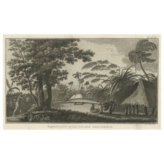
Cemetery on Amsterdam Island, French Territory in the Indian Ocean, ca.1785
Located in Langweer, NL
Antique print titled 'Begraafplaats op het eiland Amsterdam'. Engraved view of a local cemetery on Amsterdam Island, a small French territory in the southern Indian Ocean. Origin...
Category

Antique 1780s More Furniture and Collectibles

Materials

Paper

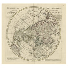
Antique Map of the Northern Hemisphere, 1782
Located in Langweer, NL
Antique map titled 'Hémisphère Septentrional pour voir plus distinctement les Terres Arctiques (..)'. Map of the Northern Hemisphere, originall...
Category

Antique 1780s More Furniture and Collectibles

Materials

Paper

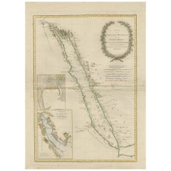
Impressive Decorative Engraved Map of the Red Sea and Arabian Peninsula, 1787
Located in Langweer, NL
This map, titled "Karte des arabischen Meerbusens oder des Rothen Meeres," is an original engraving from 1787 created by F. A. Schraembl, based on the cartographic work of d'Anville. It is a partially colored copper engraving. Key features and notable details of the map include: 1. The title is prominently displayed within a large, ornate cartouche, enhancing the aesthetic appeal and indicating the map's subject as the Red Sea (Rothen Meeres). 2. The map covers the Red Sea and its surrounding regions, including significant portions of the Arabian Peninsula and northeastern Africa. 3. There are two detailed inset maps: - The first inset map shows the roadstead of the port of Suez (Rheede des Hafen von Sues). - The second inset map depicts Bahr el Kolsum, the northwestern arm of the Red Sea, based on a map by De la Rochette from 1785. 4. Geographical Features: The map meticulously details the coastline, islands, and notable port cities along the Red Sea. The cartography highlights both natural and man-made features, with elevations and mountains represented through hachures. 5. Condition and Preservation: The map has a horizontal centerfold and is partially backed to prevent tears. The edges of the map sheet show minor holes, tears, and faint brown spots, yet it remains in overall good condition considering its age. 6. Historical Importance: This map is a valuable historical document, reflecting the cartographic knowledge of the late 18th century. It serves as a significant piece for collectors interested in antique maps, particularly those focusing on the Arabian Peninsula and maritime navigation in the Red Sea region. The map shows the coastline of the Red Sea and the Arabian Peninsula, detailing regions and places along the western coast of Saudi Arabia and Yemen, as well as the eastern coast of Egypt and Sudan. Here are some of the most important places identified on the map: 1. Jeddah (Gedda): A major city and port on the western coast of Saudi Arabia, significant for its role as a gateway for pilgrims traveling to Mecca. 2. Mecca (Mekka): A holy city in Islam, located inland from the Red Sea, important for being the site of pilgrimage (Hajj) for Muslims. 3. Medina (Medina): Another important Islamic city, known for the Prophet's Mosque and being a key pilgrimage site. 4. Suez (Suess): Located at the northern end of the Red Sea, near the Suez Canal, it's a crucial link between the Mediterranean Sea and the Red Sea. 5. Aden: A port city in Yemen, located at the southern tip of the Arabian Peninsula, historically significant as a trading hub. 6. Mocha (Mokka): A port city in Yemen, historically known for being a major marketplace for coffee. 7. Sana'a: The capital city of Yemen, noted for its historical and cultural significance. 8. Bab el Mandeb: The strait connecting the Red Sea to the Gulf of Aden, crucial for maritime navigation. These locations are critical due to their historical, religious, and economic significance, especially in terms of trade routes and pilgrimage sites. The map also illustrates the mountainous terrain and coastal features of the region. The condition and preservation status, which, despite minor imperfections, is considered well-preserved for its age. Overall, this map is a rare and valuable artifact, offering both historical insights and aesthetic appeal for collectors and enthusiasts of antique cartography.
Category

Antique 1780s More Furniture and Collectibles

Materials

Paper

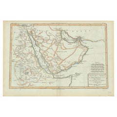
Old Map of the Arabian Peninsula with Parts of Egypt, Sudan, Eritrea & Ethiopia
Located in Langweer, NL
"Carte de l'Arabie, du Golfe Persique, et de la Mer Rouge, avec l'Egypte, la Nubie et l'Abissinie", Bonne, Rigobert Subject: Arabia Period: 1780 (circa) Publication: Atlas de Toutes...
Category

Antique 1780s More Furniture and Collectibles

Materials

Paper

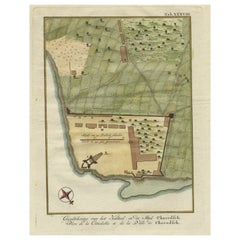
Original Antique Plan of the Fortress of Charedsch in Persia or Iran, ca.1780
Located in Langweer, NL
Antique map, titled: 'Plan de la Citadelle de la Ville de Charedsch.' Plan of the fortress of Charedsch, Iran / Persia. This original antique print originates from 'Reize naar Ar...
Category

Antique 1780s More Furniture and Collectibles

Materials

Paper

Historical Map of Ancient Germany (1787): Tribes and Territories by Mentele
Located in Langweer, NL
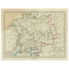
This antique map, titled "Carte Ancienne d'Allemagne," represents ancient Germany and surrounding regions. It was published by the well-known Parisian mapmakers and publishers Jean-Baptiste-Louis Clouet and Alexandre Aimé Vuillemin in the late 18th century, specifically in 1787. The map covers the extensive geographical area of ancient Germany, highlighting various tribes and regions known at the time. Key features include: 1. **Geographical Boundaries**: The map outlines the territorial extents of ancient Germany, bordered by Gallia (France) to the west, Sarmatia (parts of Eastern Europe) to the east, and the Italian regions to the south. The northern boundary reaches the Oceanus Germanicus (North Sea) and the Sarmatian Sea (Baltic Sea). 2. **Tribal Regions**: It details numerous ancient Germanic...
Category

Antique 1780s More Furniture and Collectibles

Materials

Paper

Marseille Ancienne et Moderne - FIRST ED WITH THE GILT ARMS OF NAPOLEON - 1786
Located in Hillsborough, NJ
AUTHOR: M. Guys [Pierre-Augustin]. TITLE: Marseille Ancienne et Moderne. PUBLISHER: Paris: Veuve Duchesne, 1786. DESCRIPTION: FIRST EDITION WITH THE GILT ARMS OF NAPOLEON. 1 vol....
Category

French Antique 1780s More Furniture and Collectibles

Materials

Leather

Antique Somerset Map, Thomas Kitchin, English, Cartographic Reference, Georgian
Located in Hele, Devon, GB
This is a fine antique Somerset map. An 18th century English cartographic county reference engraving by Thomas Kitchin (1718–1784), dating to the Georgian period, circa 1780. A beaut...
Category

British Georgian Antique 1780s More Furniture and Collectibles

Materials

Glass, Paper

Old Map of the UK & Ireland, Insets of Orkney, Shetland and Faroe Islands, 1786
Located in Langweer, NL
Title: "Les Isles Britanniques qui contiennent les Royaumes d'Angleterre, Escosse, et Irlande". Hand-colored engraved map with 2 (large) decorative cartouches, inset map of the Ork...
Category

Antique 1780s More Furniture and Collectibles

Materials

Paper

Large, Original Antique Print of the Roman Tropaeum Alpium, Near Monaco, ca.1780
Located in Langweer, NL
Antique print titled 'Ruines du Monument de la Turbie, près de Monaco'. Large, original antique print of the Tropaeum Alpium, a Roman trophy (tropaeum) ce...
Category

Antique 1780s More Furniture and Collectibles

Materials

Paper

Antique George III Quality Mahogany Banjo Barometer
Located in Suffolk, GB
Antique George III quality mahogany banjo barometer having a swan neck pediment, original thermometer and an engraved circular silvered dial with original hands and brass bezel, qual...
Category

English George III Antique 1780s More Furniture and Collectibles

Materials

Mahogany

Rare Original Double Hemisphere World Map with Allegorical Figures, 1785
Located in Langweer, NL
Antique map titled 'Nieuwe en Naukeurige Kaart der Gantsche bekende Werreld.' A double hemisphere world map. Four allegorical figures in the c...
Category

Antique 1780s More Furniture and Collectibles

Materials

Paper

Old Map of Indian Ocean & Sumatra, Java, Borneo, India, Arabia, Africa, c.1783
Located in Langweer, NL
Antique map titled 'Carte des Declinaisons et Inclinaisons de L'Aiguille Aimantée redigée d'après la table des observations Magnetiques faites par les Voyageurs depuis l'Année 1775'....
Category

Antique 1780s More Furniture and Collectibles

Materials

Paper

The Pennsylvania Journal and The Weekly Advertiser, Issued June 16, 1787
Located in Colorado Springs, CO
Presented is an June 16, 1787 issue of Philadelphia's "The Pennsylvania Journal, and The Weekly Advertiser," containing coverage of the Constitutional Convention. The magazine period...
Category

American Federal Antique 1780s More Furniture and Collectibles

Materials

Leather, Fabric, Paper

Old Map of the Great Lakes and Upper Mississippi Valley, Northern America, c1780
Located in Langweer, NL
Antique map titled 'Partie Occidentale du Canada'. A fine example of Rigobert Bonne and Guilleme Raynal's 1780 map of the Great Lakes and upper Mississippi Valley. A map of c...
Category

Antique 1780s More Furniture and Collectibles

Materials

Paper

Italian-transalpine time dial paper on wood board. Giusti, Nerici, Italy 1781.
Located in Milan, IT
An Italian and transalpine hour dial in paper printed on a fruitwood board. The base, in turned boxwood, has a wavy profile and distinct edge, at the top of which is mounted the rect...
Category

Italian Antique 1780s More Furniture and Collectibles

Materials

Brass

Antique Map of the World with California as an Island, 1788
Located in Langweer, NL
Description: Antique map titled 'De wareld in een ronde gedaante van de Noord Pool te zien - De Wareld verbeeld in de gedaante van een hard'. This interesting composition contains three world maps on the sheet. At left is a northern projection showing all the landmasses. At right is a cordiform projection (heart-shaped). At top is a map of the world as known to the ancients. Both the polar and cordiform projections show California as an island...
Category

Antique 1780s More Furniture and Collectibles

Materials

Paper

Old Sea Charts of Tourane Bay & the Con Dao Islands 'Pulo Condor', Vietnam, 1780
Located in Langweer, NL
Description: Two maps on one sheet titled 'Carte d'une partie de la Cote de Cochinchine [and] Plan de l'Isle Condor'. Sea charts of the coast of Vietnam around the Tourane Bay an...
Category

Antique 1780s More Furniture and Collectibles

Materials

Paper

Antique Map of the Russian Empire in Europe, ca.1780
Located in Langweer, NL
Description: Antique map titled 'Bowles's New Pocket Map of the Russian Empire in Europe, Comprehending the West Part of the Empire in Asia' Large and detai...
Category

Antique 1780s More Furniture and Collectibles

Materials

Paper

Original and Colourful Map of Northern India with Surrounding Regions, 1783
Located in Langweer, NL
Antique map titled 'Indes'. A map of Northern India with surrounding regions. From Lattre's 'Atlas moderne ou collection de cartes sur toutes les parties du globe terrestre...
Category

Antique 1780s More Furniture and Collectibles

Materials

Paper

Original Antique Print of the 'Korenbeurs' in Amsterdam, the Netherlands, 1787
Located in Langweer, NL
Antique print titled 'De Nieuwe Koornbeurs, in 1786'. Original antique print of the 'Korenbeurs' in Amsterdam, the Netherlands. The Korenbeurs ("grain bourse") was a 17th-century commodity market in Amsterdam where grain was traded. The building stood on the banks of the Amstel, on the western side (Nieuwezijde) of the Damrak. It was directly south of the Oude Brug bridge, on a spot now occupied by the former stock and commodity exchange Beurs van Berlage...
Category

Antique 1780s More Furniture and Collectibles

Materials

Paper

Uncommon Old Map of Lapland to Russia and Denmark to Kazan in the South, 1785
Located in Langweer, NL
Description: Antique map titled 'Kaart van het Noorderdeel van Europa, Bevattende Deenmarken, Noorwegen, Zweden, Lapland en het Grootste Gedeelte van Europeesch Rusland.' This un...
Category

Antique 1780s More Furniture and Collectibles

Materials

Paper

Large and Detailed Map of the Russian Empire in Asia, ca.1780
Located in Langweer, NL
Description: Antique map titled 'Bowles's New Pocket Map of the East Part of the Russian Empire in Asia'. Large and detailed map of the Russian Empire in Asia. Source unknown, to be determined. Artists and Engravers: Made by 'Thomas & Carington Bowles' after 'D'Anville'. Thomas Bowles, born around 1712, was map publisher and seller in London...
Category

Antique 1780s More Furniture and Collectibles

Materials

Paper

Map of the Western Coast of South America from Ecuador into Chili, ca.1780
Located in Langweer, NL
Antique map titled 'Carte du Perou avec une partie des pays qui en sont a l'est.' Map of the western coast of South America extending from Ecuador, through Peru and present-day B...
Category

Antique 1780s More Furniture and Collectibles

Materials

Paper

Map of Spain & Portugal Incl. the islands of Ibiza, Minorque & Majorque, 1780
Located in Langweer, NL
Antique map titled 'Les Royaumes d'Espagne et de Portugal.' Map of Spain and Portugal. Includes the islands of Ibiza, Minorque, and Majorque. Shows towns, rivers, some topographi...
Category

Antique 1780s More Furniture and Collectibles

Materials

Paper

Antique Map of Northern Europe and European Russia, ca.1780
Located in Langweer, NL
Antique map titled 'Le Nord de L'Europe, Contenant Le Danemark, La Norwege; La Suede et La Laponie avec la Majeure Partie de al Russie Europeenne.' Map of Northern Europe and Eur...
Category

Antique 1780s More Furniture and Collectibles

Materials

Paper

Map of the African Coast, Gulf of Guinea, from Sierra Leone to Gabon, 1788
Located in Langweer, NL
Antique map titled 'Drawn from d'Anvilles Map of the Coast of Guinea, Between Sierra Leone and the crossing of the Line.' Map of the African coast, Gulf of Guinea, from Sierra Le...
Category

Antique 1780s More Furniture and Collectibles

Materials

Paper

Old Map of the East Coast of Honshu with an Inset, Japan, c.1785
Located in Langweer, NL
Antique map titled ‘Part of Japan or Nippon'. View of the Coast of Japan when we first saw it: The Hill a bearing West 3 miles distant. London Published by Allexer Hogg at the Kings Arms...
Category

Antique 1780s More Furniture and Collectibles

Materials

Paper

Religious Antique Engravings of Confucius and Buddha Amida in Japan, ca.1782
Located in Langweer, NL
Original (proof) engraving of two religions. Adoration of the statue of Confucius and Boeddha Amida in Japan. Title on the leaf: 1) Het beeld van Confucius, zo als het in de ope...
Category

Antique 1780s More Furniture and Collectibles

Materials

Paper

Old Map of the Kingdom of Tonga, Also Known as the Friendly Islands, ca.1780
Located in Langweer, NL
Antique print, titled: 'Carte des Isles des Amis.' Map of the Kingdom of Tonga, also known as the Friendly Islands, and one of the last hereditary monarchies. Cook named this gro...
Category

Antique 1780s More Furniture and Collectibles

Materials

Paper

Nice Sheet of the Sangihe Archipelago in Indonesia & California Island, 1788
Located in Langweer, NL
Antique map titled 'De Noord Pool waar in aangetoont werd alle de Nieuwe Landen (..) De Eilanden van Sangir Sjauw en Pangasare (..)'. Interesting map that includes a map of the N...
Category

Antique 1780s More Furniture and Collectibles

Materials

Paper

Print of Maps of Islands of the South Pacific, Incl. Pitcairn & Dusky Bay, 1788
Located in Langweer, NL
Antique map titled 'Esquisse de la Bay Dusky, Dans La Nouvelle Zeelande / I. Pitcairn / Isles de Wallis / I Turtle / I des Cocos and Traitres / Palmerston I. / I. Suavage / I. D'Hervey/ Havre Pickersgill / I de Pasques.' Detailed set of maps of the islands of the South Pacific...
Category

Antique 1780s More Furniture and Collectibles

Materials

Paper

Antique Engraved Map of the Friendly Islands or Tonga, ca.1785
Located in Langweer, NL
Antique map titled 'Carte des Isles des Amis'. Map of the Friendly Islands / Tonga. The Tongan people first encountered Europeans in 1616 when the Dutch vessel Eendracht, captain...
Category

Antique 1780s More Furniture and Collectibles

Materials

Paper

Copper Engraving Showing the Neptune Fountain of Versailles, Paris, France, 1785
Located in Langweer, NL
Antique print titled 'Plan de la décoration du Bassin de Neptune à Versailles'. Copper engraving showing parts of the Neptune fountain of Versaill...
Category

Antique 1780s More Furniture and Collectibles

Materials

Paper

Antique Detailed Map of Papua New Guinea and the Regions to the West, ca.1780
Located in Langweer, NL
Antique map titled 'Carte des Decouvertes du Capite. Carteret dans La Nlle. Bretagne avec une parte du passage du Capite. Cook Par Le Detroit De L'Endeavor ...
Category

Antique 1780s More Furniture and Collectibles

Materials

Paper

Old Vatican Frescoes; Separation of Land from Sea & The Creation of Eve, ca.1780
Located in Langweer, NL
Antique print religion titled 'Producant Aquae Reptile Animae Viventis (..)'. This print depicts the seperation of Land from Sea and the Creation of Eve. Originates from 'Frescoes in the Sistine Chapel'. The Sistine Chapel is a chapel in the Apostolic Palace, in Vatican City and the official residence of the pope. Originally known as the Cappella Magna ('Great Chapel'), the chapel takes its name from Pope Sixtus IV, who had it built between 1473 and 1481. Since that time, the chapel has served as a place of both religious and functionary papal activity. Today, it is the site of the papal conclave, the process by which a new pope is selected. The fame of the Sistine Chapel lies mainly in the frescoes that decorate the interior, most particularly the Sistine Chapel ceiling and The Last Judgment...
Category

Antique 1780s More Furniture and Collectibles

Materials

Paper

Old Print of an Indian Nobleman and Noblewoman in a Sedan Chair, 1782
Located in Langweer, NL
Untitled print of an Indian nobleman and noblewoman in a sedan chair. This print originates from: 'Voyage aux Indes Orientales et a la Chine (..)', by Pierre Sonnerat, published in Paris in 1782. Artists and Engravers: Pierre M. Sonnerat (1745-1814) was a French naturalist...
Category

Antique 1780s More Furniture and Collectibles

Materials

Paper

Old Print of an Oriental Man in a Small Carriage Pulled by Oxen, 1782
Located in Langweer, NL
Untitled print of an oriental man, possible an Indian, in a small carriage pulled by oxen. This print originates from: 'Voyage aux Indes Orientales et a...
Category

Antique 1780s More Furniture and Collectibles

Materials

Paper

Antique Map of the West Coast of America with Island Views, ca.1784
Located in Langweer, NL
Antique print titled 'Views on the West Coast of America (..)'. Coastal views of various islands of the American coast. Originates from an edition of Cook's Voyages. Artists ...
Category

Antique 1780s More Furniture and Collectibles

Materials

Paper

Print of the Vegetation & Sun & Moon, from Frescoes in the Sistine Chapel, c1780
Located in Langweer, NL
Antique print religion titled 'Germinet Terra Herbam Virentem (..)'. This print depicts the Vegetation and Sun and Moon. Originates from 'Frescoes in the Sistine Chapel...
Category

Antique 1780s More Furniture and Collectibles

Materials

Paper

Decorative Map of the French Regions of Picardy, Artois & French Flanders, c1780
Located in Langweer, NL
Antique map titled 'Carte des Gouvernements de Flandre Francoise, d'Artois, de Picardie et du Boulenois.' An attractive example of Rigobert Bonne's 1771 decorative map of the Fre...
Category

Antique 1780s More Furniture and Collectibles

Materials

Paper

Decorative Map of the Empire of China, Korea, Japan, Taiwan, Lucon, Macau, 1780
Located in Langweer, NL
Antique map titled 'Carte de L'Empire de la Chine.' Decorative map of the Empire of China, depicting China, Corea ( Korea ), Japan, Tonquin and the Philippine island Lucon. Source unknown, to be determined. Artists and Engravers: Rigobert Bonne (1727-1795 ) was one of the most important cartographers of the late 18th century. In 1773 he succeeded Jacques Bellin as Royal Cartographer to France in the office of the Hydrographer at the Depôt de la Marine. Working in his official capacity Bonne compiled some of the most detailed and accurate maps of the period. Bonne's work represents an important step in the evolution of the cartographic ideology away from the decorative work of the 17th and early 18th century towards a more detail oriented and practical aesthetic. With regard to the rendering of terrain Bonne maps...
Category

Antique 1780s More Furniture and Collectibles

Materials

Paper

Antique Map of Italy, Corsica, Sardinia and Sicily, ca.1780
Located in Langweer, NL
Description: Antique map titled 'L'Italie.' Map of Italy, Corsica, Sardinia and Sicily. Highly detailed, showing towns, rivers, some topographical features and political boundari...
Category

Antique 1780s More Furniture and Collectibles

Materials

Paper

Antique Copper Engraving of an Italian Vineyard and a Farm, ca.1785
Located in Langweer, NL
Antique print titled 'Vue de la Vigne a l'Italienne (..)'. Copper engraving of an Italian vineyard and a farm. This print originates from 'Jardins ...
Category

Antique 1780s More Furniture and Collectibles

Materials

Paper

Neoclassical Inlaid Bedside Table Italy Last Quarter 18th Century
By Non-Standard Furniture and Lighting
Located in Milano, IT
Neoclassical bedside table late 18th century Lombardy. The cabinet is veneered in rosewood, maple, boxwood, and other light-colored woods for inlays; both the front in which the door is housed and the sides are made with a lowered central panel in rosewood, with an octagonal reserve in the center enclosed by an inlaid molded frame; the reserves on a maple background feature architectural inlay with whimsy, temples, statues, and figures. The panels are set in double frames with brass-plated cornices and rosewood veneer arranged head-on and herringbone. An inlaid frame in the base borders the four truncated pyramid feet, and another supports the top in which an alps green marble top is embedded. Lacks and restorations, walnut interior. The cabinet is close to the production of Giovanni Maffezzoli...
Category

Italian Neoclassical Revival Antique 1780s More Furniture and Collectibles

Materials

Marble

Vibrant 1782 Map of Northern Upper Saxony and Baltic Coast by Antonio Zatta
Located in Langweer, NL
This map is titled "Parte Settentrionale del Circolo dell'Alta Sassonia" and was created by Pietro Antonio Zatta in 1782. It is a beautifully colored copperplate engraving, depicting...
Category

Antique 1780s More Furniture and Collectibles

Materials

Paper

RARE ANTiQUE 1405-1603 ENGLISH ROYAL COAT OF ARMS ARMORIAL CREST CARVED WALNUT
Located in West Sussex, Pulborough
Royal House Antiques Royal House Antiques is delighted to offer for sale this stunning and very rare English Armorial Crest coat of arms that covers a period of 1405-1603 hand carve...
Category

English Georgian Antique 1780s More Furniture and Collectibles

Materials

Walnut

Rosewood and Oak French Convertible Music Stand by N. Grevenich, circa 1780
Located in Milano, IT
Nicolas Grevenich Convertible music stand France, last quarter 18th century. Bois de rose and oak Measures: H 26.77 in; when open H max 44.09 in Top: 16.14 in x 12.79 in; when open...
Category

French Neoclassical Antique 1780s More Furniture and Collectibles

Materials

Oak, Rosewood

Personification of Fortitude as a Modestly Dressed Seated Female Figure, ca.1780
Located in Langweer, NL
Antique print, titled: 'Fortitude.' - Personification of Fortitude as a modestly dressed seated female figure. A lion in the background. From 'The Univers...
Category

Antique 1780s More Furniture and Collectibles

Materials

Paper

Copper Engraved Map of Tierra del Fuego and the Strait of Magellan, c1780
Located in Langweer, NL
Antique map titled 'Extremite Meridionale de l'Amerique.' Copper engraved map of Tierra del Fuego and the Strait of Magellan with five detailed insets of the region showing soundings, anchorages, etc. Engraved by Andre. This map originates from 'Atlas de Toutes les Parties Connues du Globe Terrestre'. Artists and Engravers: Rigobert Bonne (1727-1795 ) was one of the most important cartographers of the late 18th century. In 1773 he succeeded Jacques Bellin as Royal Cartographer to France in the office of the Hydrographer at the Depôt de la Marine. Working in his official capacity Bonne compiled some of the most detailed and accurate maps of the period. Bonne's work represents an important step in the evolution of the cartographic ideology away from the decorative work of the 17th and early 18th century towards a more detail oriented and practical aesthetic. With regard to the rendering of terrain Bonne maps...
Category

Antique 1780s More Furniture and Collectibles

Materials

Paper

Decorative Rare Map of the French Regions of Isle De France and Orleans, ca.1780
Located in Langweer, NL
Antique map titled 'Carte du Gouvernment de L'Isle de France et de edlui de L'Orleanois (..).' A fine example of Rigobert Bonne's c. 1780 decorative map of the French regions of ...
Category

Antique 1780s More Furniture and Collectibles

Materials

Paper

Antique Copper Engraving Showing Two Mosques, ca.1785
Located in Langweer, NL
Antique print titled 'Mosquée - Autre Mosquée'. Copper engraving showing two mosques. This print originates from 'Jardins Anglo-Chinois à la Mode' by Georg Louis le Rouge. Ar...
Category

Antique 1780s More Furniture and Collectibles

Materials

Paper

Pair of Late 18th Century Gold Wood and Gesso Baroque Altar Vases
Located in Hastings, GB
A pair of late 18th Century German baroque altar vases, in carved and gilded wood, small areas of gilt loss and patina as to be expected given their age. These would have been displa...
Category

German Baroque Antique 1780s More Furniture and Collectibles

Materials

Wood

Rare 18th Century Neapolitan Nativity Figure – Woman in Traditional Dress
Located in Hamburg, DE
This rare, antique Neapolitan nativity figure from the 18th century represents a woman in traditional dress with a distinctive head covering, a vivid example of the skill and cultura...
Category

Baroque Antique 1780s More Furniture and Collectibles

Materials

Textile, Glass, Wood

French Louis XVI Carved Giltwood Mercury Barometer
Located in Norwich, GB
Louis XVI carved giltwood and painted mercury wheel barometer. Eight inch circular painted wood register dial with central rosette within the scale calibrated from 27-28-29 and ...
Category

French Louis XVI Antique 1780s More Furniture and Collectibles

Materials

Giltwood

18TH CENTURY POLYCHROME PAiNTED LEATHER ARMORAIL CREST TRUNK CARVED WALNUT FEET
Located in West Sussex, Pulborough
Royal House Antiques Royal House Antiques is delighted to offer for sale this absolutely exquisite, fully restored, circa 1780-1800 Polychrome painted leather domed top trunk with A...
Category

Italian George III Antique 1780s More Furniture and Collectibles

Materials

Leather, Walnut

18th Century Italian Minature Table Top Exotic Woods Chest
Located in Dallas, TX
An Italian miniature table top commode chest with exotic inlaid woods. Circa 1780-1800. Very fine French polish.
Category

Italian Antique 1780s More Furniture and Collectibles

Materials

Wood

Italian Neoclassical Handcarved Gilded Tester State Bed (6ft/180cm) & Cupboard
Located in BUNGAY, SUFFOLK
- Rare Opportunity To Acquire A Museum Quality, Late-18th Century, Neoclassical Period, Italian, Handcarved, Painted & Gilded, Tester State Bed & Accompanying Cupboard of State With ...
Category

Italian Neoclassical Antique 1780s More Furniture and Collectibles

Materials

Beech

Read More

Medal-Worthy Memorabilia from Epic Past Olympic Games

Get into the games! These items celebrate the events, athletes, host countries and sporting spirit.

Ahoy! You’ve Never Seen a Collection of Sailor Art and Kitsch Quite Like This

French trendsetter and serial collector Daniel Rozensztroch tells us about his obsession with objects related to seafaring men.

39 Incredible Swimming Pools

It's hard to resist the allure of a beautiful pool. So, go ahead and daydream about whiling away your summer in paradise.

Pamela Shamshiri Shares the Secrets behind Her First-Ever Book and Its Effortlessly Cool Interiors

The sought-after designer worked with the team at Hoffman Creative to produce a monograph that beautifully showcases some of Studio Shamshiri's most inspiring projects.

Moroccan Artworks and Objects Take Center Stage in an Extraordinary Villa in Tangier

Italian writer and collector Umberto Pasti opens the doors to his remarkable cave of wonders in North Africa.

Montecito Has Drawn Royalty and Celebrities, and These Homes Are Proof of Its Allure

Hollywood A-listers, ex-pat aristocrats and art collectors and style setters of all stripes appreciate the allure of the coastal California hamlet — much on our minds after recent winter floods.

Whaam! Blam! Pow! — a New Book on Pop Art Packs a Punch

Publishing house Assouline and writer Julie Belcove have teamed up to trace the history of the genre, from Roy Lichtenstein, Andy Warhol and Yayoi Kusama to Mickalene Thomas and Jeff Koons.

The Sparkling Legacy of Tiffany & Co. Explained, One Jewel at a Time

A gorgeous new book celebrates — and memorializes — the iconic jeweler’s rich heritage.
Recently Viewed

View All