Old Masters Landscape Prints

OLD MASTERS

Encompassing centuries of change in Europe between 1300 and 1800, from booms of prosperity to bloody revolutions, Old Masters describes a wide range of artists. The informal term was derived from the title of an artist who trained in a guild long enough to become a master, such as Leonardo da Vinci, who studied in a Florence painters’ guild. However, Old Masters paintings, prints and other art is now used to refer to work made by any artist with a high level of skill in painting, drawing, sculpture or printmaking who worked during this era.

The 15th century’s expansive trade and commerce spread culture across borders. A vibrant period of art emerged, bolstered by studies of anatomy and nature that influenced a new visual realism. From Raphael and Michelangelo in the Renaissance to Rembrandt van Rijn and Johannes Vermeer in the Dutch Golden Age, artists expressed emotion, naturalism, color and light in new ways. El Greco and Paolo Veronese were leaders in the dramatic style of Mannerism, while Caravaggio and Peter Paul Rubens demonstrated the movement and meticulous detail of Baroque art.

Historically, most attention was concentrated on male artists, but recent research and exhibitions have elevated the impactful work of women such as Rachel Ruysch and Artemisia Gentileschi. In late-18th-century France, female artists like Adélaïde Labille-Guiard and Élisabeth Vigée Le Brun were prominent names. Nevertheless, access to the academies and guilds was highly restricted for women, and even those able to establish practices were expected to adhere to portraits and still lifes rather than the grand history paintings being created by men.

Find a collection of Old Masters prints, paintings, drawings and watercolors and other art on 1stDibs.

to
15
275
118
33
7
2
Overall Width
to
Overall Height
to
4,615
3,198
797
754
678
663
627
360
84
83
77
26
15
97
27
15
14
11
365
67
5
1
1
284
330
67
38
269
161
121
59
53
49
42
38
36
35
26
25
21
20
15
15
14
13
13
12
336
93
57
47
23
45
212
167
165
Style: Old Masters
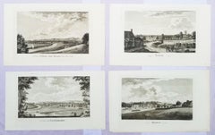
Set of Four Engravings from Nash's "History of Worcestershire" /// Landscape Art
Located in Saint Augustine, FL
Artist: Treadway Russell Nash (English, 1724-1811) Title: "A View of Stourbridge", "A View of Upton upon Severn, from Ryal Hill", "Bewdley", and "Tenbury" Portfolio: Collections for the History of Worcestershire Year: 1781-1782 (First edition) Medium: Set of Four Original Engravings on watermarked laid paper Limited edition: Unknown Printer: John Nichols, London, UK Publisher: T. Payne and Son, J. Robson, B. White, Leigh and Sotheby, London, UK; Fletcher, Oxford, UK; and Lewis, Worcester, UK Reference: Upcott III, page 1330 Sheet size (each): approx. 10" x 16.5" Image size (each): approx. 6.88" x 11.75" Condition: A few light handling creases. Have been professionally stored away for decades. They are all strong impressions in excellent condition Notes: Provenance: private collection - Aspen, CO. All four works were engraved by English artist Thomas Sanders (Active: Mid-Late 18th Century) after drawings by himself. Comes from Nash's two volume "Collections for the History of Worcestershire", (1781-1782) (First edition), which consists of 75 engravings. Each work is printed from one copper plate in one color: black. There was a (Second edition) "with Additions" bound in with Volume II of this portfolio published by John White in 1799. And, both the First and Second editions of "Collections for the History of Worcestershire" are based off Thomas Sanders' 1779-1781 "Perspective Views of the Market Towns within the County of Worcester". Both "A View of Stourbridge" and "A View of Upton upon Severn, from Ryal Hill" have unidentified fleur-de-lis watermarks in the center of their sheets. "Bewdley" has an unidentified watermark in the center of its sheet resembling "XV" and "Tenbury" has no watermark. Biography: Treadway Russell Nash (24 June 1724 – 26 January 1811) was an English clergyman, now known as an early historian of Worcestershire and the author of Collections for the History of Worcestershire, an important source document for Worcestershire county histories. He was a fellow of the Society of Antiquaries of London. Treadway Russell Nash was born on 24 June 1724 born at Clerkenleap, in Kempsey, Worcestershire. His family were from Ombersley. They had lands there and at Claines, and had later bought lands in the Reformation around St Peter's, Droitwich. He was related to James Nash and John Nash, both MPs for Worcester. His father Richard, a grandson of Sir Rowland Berkeley, died in 1740, and Richard's eldest son in 1757. As a result, Treadway Russell Nash inherited the Russells' Strensham estates from his brother, as well as the Nash estates, and took both names. He was educated from the age of twelve at King's School, Worcester, and became a scholar at Worcester College, Oxford aged fifteen. In March 1749, he accompanied his brother on a trip to the continent, to aid Richard's health. They visited Paris for about six weeks, before spending the summer "on the banks of the Loire". They then visited "Bourdeaux, Thoulouse, Montpelier, Marseilles, Leghorn, Florence, Rome, Naples, Bologna, Venice, Padua, Verona, Milan, Lyons, and again Paris"; such expeditions are often known as the Grand Tour. On his return in late summer 1751, Nash took up a post as Vicar of Eynsham through his friend and future brother-in-law, John Martin. He also had an income as a tutor at Oxford. He took his Doctor of Divinity degree and left Oxford, having "gone out grand compounder", following the death of his brother. He also left his benefice at Eynsham in 1757. While at Oxford he had proposed a road from there to Witney (now the A40 and B4022), and also stood for Parliament. Nash married Margaret Martin...
Category

1780s Old Masters Landscape Prints

Materials

Laid Paper, Engraving

Hadrian's Mausoleum, Castel S. Angelo: A Framed 18th Century Etching by Piranesi
Located in Alamo, CA
This large framed 18th century etching by Giovanni Battista Piranesi entitled "Veduta del Mausoleo d'Elio Adriana ora chiamato Castello S. Angelo nella parte opposta alla Facciata de...
Category

1750s Old Masters Landscape Prints

Materials

Etching

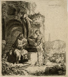
Christ and the Woman of Samaria Among Ruins by James Bretherton after Rembrandt
Located in Middletown, NY
Bretherton, James (After Rembrandt van Rijn). Christ and the Woman of Samaria Among Ruins. London: c 1775. Etching on light cream laid paper, 4 3/4...
Category

18th Century Old Masters Landscape Prints

Materials

Handmade Paper, Etching, Laid Paper

Four Framed Hogarth Engravings "Four Times of the Day"
Located in Alamo, CA
The four plates in this "Four Times of the Day" set were created utilizing both engraving and etching techniques by William Hogarth in 1738. Hogarth's original copper plates were refurbished where needed by James Heath and these engravings were republished in London in 1822 by Braddock, Cradock & Joy. This was the last time Hogarth's original copper plates were used for printing. Most were melted down during World War I for the construction of bombs. Printed upon early nineteenth century wove paper and with large, full margins as published by William Heath in 1822. The inscription below each print reads "Invented Painted & Engraved by Wm. Hogarth & Publish'd March 25. 1738 according to Act of Parliament". These large folio sized "Four Times of the Day" engravings/etchings are presented in complex gold-colored wood frames with black bands and scalloped gold inner trim. A majority of each thick impressive frame is covered with glass applied near the outer edge. Each frame measures 25.75" high, 22.25" wide and 1.88" deep. There are a few small dents in the edge of these frames, which are otherwise in very good condition. "Morning" has two focal areas of discoloration in the upper margin and some discoloration in the right margin, a short tear in the left margin and a short tear or crease in the right margin. "Noon" has a spot in the upper margin that extends into the upper image, but it is otherwise in very good condition. "Evening" has a faint spot in the upper margin, but it is otherwise in very good condition. "Night" is in excellent condition. The "Four Times of the Day" series is in the collection of many major museums, including: The British Museum, The Metropolitan Museum of Art, The Tate Museum, The Chicago Art Institute and The Victoria and Albert Museum. Through this series Hogarth is portraying early 18th century London street life at "Four Times of the Day". His characters are exhibiting their personalities, quircks, strange activities, but he also wants to draw attention the disparities between the wealthy aristocracy and the common working class. Plate 1, "Morning" depicts morning in Covent Garden in the winter in front of Tom King...
Category

Mid-18th Century Old Masters Landscape Prints

Materials

Engraving, Etching

Piazza Navona allagata solito farsi nelle Feste di Agosto
Located in Fairlawn, OH
Piazza Navona allagata solito farsi nelle Feste di Agosto Etching, 1752 Signed in the plate lower right (see photo) From: Della Magnificenze di Roma Antica e Moderna ( The Magnificense of Ancient and Modern Rome) , (1747-1761) Volume II, The Main Squares and Obelisks, columns and other ornaments, 1752, Plate No. 26 Della Magnificenze di Roma Antica e Moderna_ (1747-61), a collection of 238 plates that was published in ten volumes. Vasi recorded all types of architecture and organized these images of contemporary Rome by subject, with each volume representing a different category of architecture. This comprehensive project provides one of the most complete views of eighteenth-century Rome Condition: Excellent Image/Plate size: 8 .25 x 12.63 inches Sheet size: 11 x 15 7/8 inches Vasi was Giovanni Battista Piranesi’s teacher. Piranesi (1720-1778) entered Vasi’s studio as an apprentice at age 20 c. 1740. Piranesi left Vasi’s employment after stabbing Vasi over the perception that Vasi was withholding secrets of the etching process. Giuseppe Vasi was an Italian engraver and painter born and trained in Sicily. He received a classical education in his hometown of Corleone and trained as a printmaker in nearby Palermo, perhaps under the tutelage of the etchers Antonino Bova and Francesco Cichè. He moved to Rome in 1736, already an established printmaker, and spent most of his career documenting the urban landscape of the city in engravings. Through his patron, the politically and culturally influential Cardinal Troiano Acquaviva d’Aragona, Vasi met other artists working in Rome, such as Sebastiano Conca, Ferdinando Fuga, and Luigi Vanvitelli. He was also influenced by his predecessors, including Giovanni Paolo Panini, Giovanni Battista Falda...
Category

1750s Old Masters Landscape Prints

Materials

Etching

The Ponte and Castel S. Angelo (Veduta del Ponte e Castello Sant' Angelo)
Located in Fairlawn, OH
The Ponte and Castel S. Angelo Veduta del Ponte e Castello Sant' Angelo Etching, 1754 Signed in the plate lower right above the caption From: Vedute di Roma A proper Roman printing w...
Category

1750s Old Masters Landscape Prints

Materials

Etching

Ancient Roman Architecture: Framed Original 18th C. Etching by G. Piranesi
Located in Alamo, CA
"A sua Eccellenza il Signor Henry Hope Cav. Scozzese Amatore delle Belle Arti from "Vasi, Candelabri, Cippi, Sarcofagi, Tripodi, Lucerne, Ed Ornamenti Antichi", (Vases, candelabra, grave stones, sarcophagi, tripods, lamps, and ancient ornaments) is an etching by Giovanni Battista Piranesi, published in 1778. It depicts stone caryatids...
Category

1770s Old Masters Landscape Prints

Materials

Etching

Liber Veritatis - B/W Etching after Claude Lorrain - 1815
Located in Roma, IT
Image dimensions: 21 x 27 cm. Liber Veritatis - Plate 150 is a beautiful black and white etching and aquatint on paper realized by the Italian artist ...
Category

1810s Old Masters Landscape Prints

Materials

Etching, Aquatint

Very Large Marine Shipping Scene Impressive Statement Piece
Located in Cirencester, Gloucestershire
Large Marine Scene Dutch or Flemish, 20th century color print on canvas, framed framed: 27 x 34 inches canvas: 20 x 27.5 inches provenance: private collection, UK condition: very goo...
Category

20th Century Old Masters Landscape Prints

Materials

Color

Canal with a large Boat and Bridge – after Rembrandt van Rijn
Located in Middletown, NY
Heliogravure on cream laid paper, 3 1/4 x 4 1/4 inches (80 x118 mm), thread margins. In good condition with a soft vertical crease and minor uniform toning. Printed early 19th centur...
Category

17th Century Old Masters Landscape Prints

Materials

Laid Paper, Photogravure

Set of Three Engravings from Nash's "History of Worcestershire" /// Landscapes
Located in Saint Augustine, FL
Artist: Treadway Russell Nash (English, 1724-1811) Title: "A View of Pershore, from Pensham hill", "A View of Shipston upon Stour", and "Kidderminster" Portfolio: Collections for the History of Worcestershire Year: 1781-1782 (First edition) Medium: Set of Three Original Engravings on watermarked laid paper Limited edition: Unknown Printer: John Nichols, London, UK Publisher: T. Payne and Son, J. Robson, B. White, Leigh and Sotheby, London, UK; Fletcher, Oxford, UK; and Lewis, Worcester, UK Reference: Upcott III, page 1330 Sheet size (each): approx. 10.13" x 16.75" Image size (each): approx. 7" x 11.88" Condition: A few light handling creases. Have been professionally stored away for decades. They are all strong impressions in excellent condition Notes: Provenance: private collection - Aspen, CO. All three works were engraved by English artist Thomas Sanders (Active: Mid-Late 18th Century) after drawings by himself. Comes from Nash's two volume "Collections for the History of Worcestershire", (1781-1782) (First edition), which consists of 75 engravings. Each work is printed from one copper plate in one color: black. There was a (Second edition) "with Additions" bound in with Volume II of this portfolio published by John White in (1799). And both the First and Second editions of "Collections for the History of Worcestershire" are based off Thomas Sanders' 1779-1781 "Perspective Views of the Market Towns within the County of Worcester". All three, "A View of Pershore, from Pensham hill", "A View of Shipston upon Stour", and "Kidderminster" have an unidentified watermark in the center of their sheets resembling "XV". Biography: Treadway Russell Nash (24 June 1724 – 26 January 1811) was an English clergyman, now known as an early historian of Worcestershire and the author of Collections for the History of Worcestershire, an important source document for Worcestershire county histories. He was a fellow of the Society of Antiquaries of London. Treadway Russell Nash was born on 24 June 1724 born at Clerkenleap, in Kempsey, Worcestershire. His family were from Ombersley. They had lands there and at Claines, and had later bought lands in the Reformation around St Peter's, Droitwich. He was related to James Nash and John Nash, both MPs for Worcester. His father Richard, a grandson of Sir Rowland Berkeley, died in 1740, and Richard's eldest son in 1757. As a result, Treadway Russell Nash inherited the Russells' Strensham estates from his brother, as well as the Nash estates, and took both names. He was educated from the age of twelve at King's School, Worcester, and became a scholar at Worcester College, Oxford aged fifteen. In March 1749, he accompanied his brother on a trip to the continent, to aid Richard's health. They visited Paris for about six weeks, before spending the summer "on the banks of the Loire". They then visited "Bourdeaux, Thoulouse, Montpelier, Marseilles, Leghorn, Florence, Rome, Naples, Bologna, Venice, Padua, Verona, Milan, Lyons, and again Paris"; such expeditions are often known as the Grand Tour. On his return in late summer 1751, Nash took up a post as Vicar of Eynsham through his friend and future brother-in-law, John Martin. He also had an income as a tutor at Oxford. He took his Doctor of Divinity degree and left Oxford, having "gone out grand compounder", following the death of his brother. He also left his benefice at Eynsham in 1757. While at Oxford he had proposed a road from there to Witney (now the A40 and B4022), and also stood for Parliament. Nash married Margaret Martin...
Category

1780s Old Masters Landscape Prints

Materials

Engraving, Laid Paper

Prospectuum Aedium Viarumque Insignorum Ubis Venetiarum -by G.B. Brustolon- 1763
By Giovanni Battista Brustolon
Located in Roma, IT
Complete series of 20 original black and white etchings on oblong folio and laid paper, in first state before numeration. On frontispiece with date “1763”, dedication to Prince Marco Foscareno and name and address of Ludovico Furlanetto. Each plate is titled and signed on plate "Jo. Bap. Brustoloni sculp." on the lower right margin. Complete title of the series: Prospectuum aedium, viarumque insigniorum Urbis venetiarum nautico certamine, ac nundinis adiectis. Tomus Primus, tabulas XII complectens, quas Antonius Canale coloribus expressit – Joannes Baptista Brustolon aere incidit. Serenissimo Principi D.D. Marco Foscareno Egregio, emerito, sapientissimo Augustae Republicae Duci D.D.D. Anno AE C. 1763 ab V.C. 1341. This series is considered the most important one by Brustolon after Canaletto (from the engravings of Visentini), and was edited in a first version of 12 tables and in a second version of 22 tables. However, Succi affirms that the I state series includes just 20 tables, and the missing two vary from suite to suite so that this series can be considered complete. Very fresh and bright sheets in wide margins, with restored little tear on 4 sheets and a very light vertical fold on center. Papers show the following watermarks: Big cartouche with half-moon Big cartouche with letters “FO” and “AS” Bound and ripples on paper. In detail: Prospectuum Aedium Viarumque Insignorum Ubis Venetiarum is one of the finest of Venetian topographical print suites, equal in relevance to the publications of Carlevarijs, Canaletto-Visentini, and Marieschi, preciously rare, especially in the first edition (of four) with all plates in first state and in excellent state of preservation. Ten of its twenty vedute of the Serenessima derive from the paintings of Canaletto, drawn and engraved by Antonio Visentini, adapted to a larger size by Brustolon. The Bellunese artist extended the views and enriched the landscapes with new objects and figures that animate the scenes. Other four views are deeply inspired by Michele...
Category

1760s Old Masters Landscape Prints

Materials

Etching

Veduta dell'esterno della gran Basilica di S. Pietro in Vaticano
Located in Fairlawn, OH
Veduta dell'esterno della gran Basilica di S. Pietro in Vaticano (View of the Exterior of St. Peter's Basilica in the Vatican) Etching, 1748 From the first printing of the "Vedute di Roma" An early impression with strong contrasts Before the price and the addition of numbers in the later states. A view of Michelangelo's done from behind the Piazza, redesigned in 1547 Condition: Excellent Plate size: 15 3/4 x 24 3/4 inches Reference: Robison 5 a/g Hind 5 i/VII Focillon 54.789 Designed principally by Donato Bramante, Michelangelo, Carlo Maderno and Gian Lorenzo Bernini, St. Peter's is the most renowned work of Renaissance architecture and the largest church in the world. While it is neither the mother church of the Catholic Church nor the cathedral of the Diocese of Rome (these equivalent titles being held by the Archbasilica of Saint John Lateran in Rome), St. Peter's is regarded as one of the holiest Catholic shrines...
Category

1740s Old Masters Landscape Prints

Materials

Etching

VEDUTA DEGLI AVANZI De’MAUSOLEI E DELLE FABBRICHE…...
Located in Santa Monica, CA
GIOVANNI BATTISTA PIRANESI (Italian 1720-1778) VEDUTA DEGLI AVANZI De’MAUSOLEI E DELLE FABBRICHE…c 1756 (Hind 83; Focillon 20.A.293; Giesecke 116; Wilton-E...
Category

1750s Old Masters Landscape Prints

Materials

Etching

Piazza del Popolo con Obelisco Egizio
Located in Fairlawn, OH
Piazza del Popolo con Obelisco Egizio Etching, 1752 Signed in the plate lower left (see photo) From: Della Magnificenze di Roma Antica e Moderna ( The Magnificense of Ancient and Modern Rome) , (1747-1761) Volume II, The Main Squares and Obelisks, columns and other ornaments, 1752, Plate No. 21 Della Magnificenze di Roma Antica e Moderna_ (1747-61), a collection of 238 plates that was published in ten volumes. Vasi recorded all types of architecture and organized these images of contemporary Rome by subject, with each volume representing a different category of architecture. This comprehensive project provides one of the most complete views of eighteenth-century Rome Condition: Excellent Image/Plate size: 8.25 x 12.63 inches Sheet size: 11 x 15 7/8 inches Vasi was Giovanni Battista Piranesi’s teacher. Piranesi (1720-1778) entered Vasi’s studio as an apprentice at age 20 c. 1740. Piranesi left Vasi’s employment after stabbing Vasi over the perception that Vasi was withholding secrets of the etching process. Giuseppe Vasi was an Italian engraver and painter born and trained in Sicily. He received a classical education in his hometown of Corleone and trained as a printmaker in nearby Palermo, perhaps under the tutelage of the etchers Antonino Bova and Francesco Cichè. He moved to Rome in 1736, already an established printmaker, and spent most of his career documenting the urban landscape of the city in engravings. Through his patron, the politically and culturally influential Cardinal Troiano Acquaviva d’Aragona, Vasi met other artists working in Rome, such as Sebastiano Conca, Ferdinando Fuga, and Luigi Vanvitelli. He was also influenced by his predecessors, including Giovanni Paolo Panini, Giovanni Battista Falda...
Category

1750s Old Masters Landscape Prints

Materials

Etching

The Windmill by François Vivares, after Rembrandt
Located in Middletown, NY
Engraving on cream laid paper, 8 x 5 7/8 inches (202 x 149 mm), trimmed at the platemark. Adhered at each corner to a small sheet of archival laid paper. Horizontal edge loss at the ...
Category

Mid-18th Century Old Masters Landscape Prints

Materials

Handmade Paper, Laid Paper, Etching

PERU
Located in Santa Monica, CA
JOHANNES JANSSON (1588 - 1664) PERU, engraving with early coloring. Platemark 15 1/8 x 19 3/8 inches, sheet 17 x 20 1/2 A nice example of one of the earliest maps of Peru. From the ...
Category

1630s Old Masters Landscape Prints

Materials

Engraving

The Queen of Great Britain arriving in Portsmouth 25 May 1662 & The Arrival in L
Located in Middletown, NY
Two images of Queen Catharina of Braganza; one before her marriage to King Charles II, the other after, as Queen of Great Britian. Engraved by Matthiäus Merian, father of Maria Sybli...
Category

Mid-17th Century Old Masters Landscape Prints

Materials

Laid Paper, Engraving

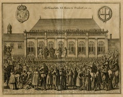
The Beheading of the King of England; Enthauptung des Königs in England
Located in Middletown, NY
The execution of Charles I (1600-1649) at Whitehall, January 30th 1649, in front of the Banqueting House. The executioner holding the head of Charles up to the crowd below. Engravin...
Category

Mid-17th Century Old Masters Landscape Prints

Materials

Engraving, Laid Paper

AMERICAE - Sive Novi Orbis, Nova Descriptio
Located in Santa Monica, CA
ABRAHAM ORTELIUS (1527 - 1598) AMERICAE SIVE NOVI ORBIS, NOVA DESCRIPTIO, 1587 (1603) (Van Den Broecke 11, Burden 64; Schwartz & Ehrenberg 69) Engraving. A very good, well printed...
Category

16th Century Old Masters Landscape Prints

Materials

Engraving

The Monumental Tablet
Located in Fairlawn, OH
The Monumental Tablet Etching, engraving, drypoint and burnishing, c. 1748 Series: Grotteschi (Grotesques, 4 plates) Original, unwashed condition. Excellent. Second edition first is...
Category

1740s Old Masters Landscape Prints

Materials

Etching

View of Castello dell'Acqua Felice - Etching by G. B. Piranesi - 1751
Located in Roma, IT
View of Castel of Acqua Felice is an original etching realized by the italian artist Giovanni Battista Piranesi in 1751. Very precoius and rare lifetime impression. Roman edition. I...
Category

1750s Old Masters Landscape Prints

Materials

Etching

Arcadian riverscape with different figures by a tree [Arcadisch rivierlandschap]
Located in Middletown, NY
A beautiful Arcadian landscape after Johannes Glauber. Amsterdam: 1721. Etching on handmade laid paper with an intact fleur-de-lis watermark. 203 x 275 mm; 8 x 10 7/8 inches, trimm...
Category

18th Century Old Masters Landscape Prints

Materials

Handmade Paper, Laid Paper, Etching

Vedute di Roma (3rd state) (Frontispiece of series, with Statue of Minerva)
Located in Chicago, IL
Views of Rome (Vedute di Roma): Frontispiece for the whole series, with Statue of Minerva. A fine impression of the rare 3rd state (of seven) of this m...
Category

Mid-17th Century Old Masters Landscape Prints

Materials

Etching

The Deluge - JOSEPH MALLORD WILLIAM TURNER (1775 - 1851)
Located in Santa Monica, CA
(after) JOSEPH MALLORD WILLIAM TURNER (1775 - 1851) THE DELUGE, 1828. Mezzotint, Engraved by I. P. Quilly after a painting by J. M.W. Turner R.A.. Image ...
Category

1820s Old Masters Landscape Prints

Materials

Mezzotint

Basilica of San Lorenzo in Rome: A Framed 18th Century Etching by Piranesi
Located in Alamo, CA
This large framed 18th century etching by Giovanni Battista Piranesi entitled "Veduta della Basilica di S. Lorenzo fuor della mura" (Basilica of San Lorenzo Outside the Walls), published in Rome in 1750 in Piranesi's Vedute di Roma (Views of Rome), This etching depicts the Basilica of San Lorenzo Outside the Walls, which is a Roman Catholic papal basilica and parish church, located in Rome, Italy. The Basilica is one of the Seven Pilgrim Churches of Rome and one of the five "papal basilicas". It was built as a shrine to the martyred Roman deacon St. Lawrence. This Piranesi etching is held by many museums and institutions, including: The Metropolitan Museum, The British Museum, The National Gallery of Art, The Yale University Art Gallery, and The Harvard Museum of Art. This magnificent etching is presented in a brown-colored wood frame and a tan French...
Category

1750s Old Masters Landscape Prints

Materials

Etching

Venus Lamenting over the Death of Adonis
Located in Middletown, NY
c. 1654. Etching with engraving on thin laid paper with an early and large unidentified watermark with a sundial and a many-pointed star, and an unidentified collector's stamp in the...
Category

Mid-17th Century Old Masters Landscape Prints

Materials

Handmade Paper, Engraving, Etching

Europe: An Original 18th Century Hand-colored Map by E. Bowen
Located in Alamo, CA
This is an original 18th century hand-colored map entitled "A New & Accurate Map of Europe Drawn from the Best Authorities Assisted by the Most Improved Modern Charts and Maps." by E...
Category

Mid-18th Century Old Masters Landscape Prints

Materials

Engraving

Vaso Anzio di Marmo press S.E. il Sig. Schowvaloff-Etching by G.B. Piranesi-1778
Located in Roma, IT
Artist proof, printed on contemporary filigree paper, large margins, representing an antique marble vase , whose details are described in the ending note . The piece is dedicated to ...
Category

1770s Old Masters Landscape Prints

Materials

Etching

Asia Declineatio: A 17th Century Hand-colored Map of Asia by Justus Danckerts
Located in Alamo, CA
This is a scarce 17th century beautifully hand-colored copperplate engraved map of Asia entitled “Exactissima Asiae Delineatio in Praecipuas Regiones Caerterasque Partes divisa et de...
Category

Late 17th Century Old Masters Landscape Prints

Materials

Engraving

Artemis Goddess - Etching by Giovanni Morghen - 18th Century
Located in Roma, IT
Artemis Goddess from "Antiquities of Herculaneum" is an etching on paper realized by Giovanni Morghen in the 18th Century. Signed on the plate. Good conditions with some folding. ...
Category

Late 18th Century Old Masters Landscape Prints

Materials

Etching

Ancient Roman Temple Architecture: An 18th Century Framed Etching by Piranesi
Located in Alamo, CA
This is an 18th century etching by Giovanni Battista Piranesi entitled "Veduta del Tempio detto della Tosse su la Via Tiburtina, un miglio vicino a Tivoli" (View of the so-called Tem...
Category

1760s Old Masters Landscape Prints

Materials

Etching

Liber Veritatis - Original B/W Etching after Claude Lorrain - 1815
Located in Roma, IT
Image dimensions: 21 x 27 cm. Liber Veritatis - Plate 190 is a beautiful black and white etching and aquatint on paper realized by the Italian artist Ludovico Caracciolo, after Clau...
Category

1810s Old Masters Landscape Prints

Materials

Etching, Aquatint

The Pump House, Notre Dame, Paris
Located in Storrs, CT
La Pompe Notre Dame. (The Pumphouse, Notre Dame). Schneiderman catalog 26.x. 1861. Etching. Image 6 3/4 x 10. Edition of 30 in this state. Series: Eaux-Fortes sur Paris . Initial...
Category

Mid-19th Century Old Masters Landscape Prints

Materials

Etching

The Trajan's Column - Offset by G.B. Piranesi - 1990s
Located in Roma, IT
A beautiful reproduction of one of the most celebrated Piranesi's masterpieces, realized in a limited edition of a few hundreds in 1990s. The Trajan's Column is the last remaining n...
Category

1990s Old Masters Landscape Prints

Materials

Etching

Map of the World: An Original 18th Century Hand-colored Map by E. Bowen
Located in Alamo, CA
This is an original 18th century hand-colored map entitled "A New & Correct Chart of All The Known World Laid down according to Mercator's Projection" by Emanuel Bowen. It was published in 1744 in London in John Harris's "Navigantium atque Itinerantium Bibliotheca" or "A Complete Collection of Voyages and Travels". This highly detailed and colorful map depicts the world. as it was known in the mid 18th century. A majority of the northern and central portions of Canada and America are left blank due to the purity of knowledge at the time this map was published. The map is embellished with four Compass Roses in the lower left, lower center, lower right and center, along with many rhumb lines. There a is a decorative title cartouche in the upper left. This colorful, attractive, historical and interesting 1744 map presents the entire world on Mercator's projection as it was understood in the middle part of the 18th century, before the landmark explorations of Captain’s Cook, Vancouver, Wilkes and others. It is an example of a nautical chart, a type of map that was designed specifically for use by mariners. The map is centered on the equator and includes both the Eastern and Western Hemispheres. The continents of North America, South America, Europe, Africa, and Asia are depicted, as well as various islands in the Atlantic, Pacific, and Indian Oceans. The map is laid out according to the Mercator projection, a type of cylindrical map projection that was developed in the 16th century by Flemish cartographer Gerardus Mercator. This projection has the advantage of preserving angles and shapes, making it useful for navigation. The map presents a paucity of inland detail, particularly for the Americas, but major cities, geographical landmarks, and regions are included. Ocean currents and Tradewinds are identified, as well as the magnetic declination lines or magnetic variance, which refers to the difference between true north and compass north. The continents are color coded, enhancing the beauty of this map. The three compass roses indicate the directions of the cardinal points. The depiction of the western coast of America, the Pacific and Australia are interesting. There was very little exploration of Australia between the navigations of William Damper in 1699 and Tobias Furneaux in 1773. Most of the maps detail relies on the 17th century Dutch expeditions to Australia's western coast, by Abel Tasman and William Janszoon. Van Diemen's Land (Tasmania) and New Guinea appear connected to the Australian continent. New Zealand appears as a single landmass. North of New Zealand there is a landmass labelled 'Ter d' St. Esprit' which probably represents the New Hebrides Islands. This map precedes the accurate exploration of the South Pacific and east coast of Australia by Captain James Cook later in the 18th century. The map includes ‘Drakes' Port,' the site where Sir Francis Drake supposedly landed in 1579 during his 1579 circumnavigation of the globe. Here he claimed territory for England, restocked, and repaired his vessels. Drake named the region New Albion. The exact location of Drake's Port is a cartographic mystery. Drake's Harbor is believed to be in the region of San Francisco Bay, Bodega Bay, San Pablo Bay...
Category

Mid-18th Century Old Masters Landscape Prints

Materials

Engraving

St. Jerome in the Desert
Located in Chicago, IL
Engraving by Joannes and Lucas van Doetecum (Deventer active by 1551 - circa 1569 Haarlem) in the manner of Peter Bruegel the Elder
Category

16th Century Old Masters Landscape Prints

Materials

Engraving

16th c. woodcut map - Tabula Asiae Vlll
Located in Santa Monica, CA
SEBASTIAN MUNSTER (1488-1652) ASIAE TABVLA Vlll 1540 (45) Woodcut from Munster's edition of Geographia Universalis, Basel, Henri Petri. 1545 edit...
Category

16th Century Old Masters Landscape Prints

Materials

Woodcut

Landscape with Roman Ruins
By (After) Peter Paul Rubens
Located in Chicago, IL
Engraving after Peter Paul Rubens (Siegen 1577 - 1640 Antwerp), executed by Schelte Adams Bolswert (Bolsward c. 1586 -1659 Antwerp). Bolswert was one of the major printmakers in the ...
Category

17th Century Old Masters Landscape Prints

Materials

Engraving

Vatican Hallway designed by Raphael: 18th C. Hand-colored Engraving by Volpato
Located in Alamo, CA
This is an original 18th century hand-colored copper-plate engraving by Giovanni Volpato after a drawing by Camporesi. It was the frontispiece for volume one of the rare and valuable...
Category

Late 18th Century Old Masters Landscape Prints

Materials

Engraving

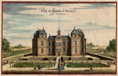
Chateau de Verneuil
Located in Middletown, NY
Engraving with hand coloring and heightening in watercolor on two leaves of expertly conjoined handmade laid paper, one leaf with a large watermark a feathered dragon, 7 1/4 x 11 1/4...
Category

Mid-17th Century Old Masters Landscape Prints

Materials

Watercolor, Handmade Paper, Engraving

North and South America: An 18th Century Hand-colored Map by Johann Homann
Located in Alamo, CA
This early 18th century hand-colored copperplate map of North and South America entitled "Totius Americae Septentrionalis Et Meridionalis Novissima Repraesentatio" was created by Johann Baptist Homann and published in Nuremberg, Germany, between 1710 and 1731. The map details cities, forts, mountains, forests and lakes, as well as districts. There is a decorative cartouche in the lower left which depicts a volcano, scenes representing the people in their native costumes, as well as animals and plants of the Americas. A village is seen in the background on the left. A second smaller decorative cartouche in the upper right includes text and a series of allegorical figures. A large portion if the north central and western portions of North America is left without detail, because the region was largely unexplored at the time this map was created. The map also shows "Terra Esonis Incognita", representing a mythical continuous land bridge from North America to Asia, a northwest passage. The map preceded the French and...
Category

Early 18th Century Old Masters Landscape Prints

Materials

Engraving

AMERICA
Located in Santa Monica, CA
IMPORTANT AMERICAN MAP - ONE OF THE FIRST TO SHOW CALIFORNIA as an ISLAND JOHN SPEED (1552-1629) AMERICA - With Those Known Parts In That Unknown Worlde (sic), 1626-(76) (Burden 217 iv/iv) Engraving, uncolored. Engraved by Abraham Goos and published by Thomas Basset and Richard Chiswell - 4th state of 4 in 1676 15 1/8 x 20 1/2” From “A Prospect of the Most Famous Parts of the World”. Generally good condition. A repaired split in lower centerfold. This is the most common version of this important map...
Category

1620s Old Masters Landscape Prints

Materials

Engraving

AMERICA
AMERICA
$4,000 Sale Price
52% Off
Galleria grande di Statue
Located in Fairlawn, OH
Galleria grande di Statue Etching, 1743 Signed lower left corner of the plate From: Prima Parte, 1743 Second edition: 1750-1778 Watermark: R 37-39 A lifetime impression printed during Piranesi’s life, before the plates are moved to Paris by his sons in the 1790’s Condition: Excellent Image size: 14 5/8 x 9 3/4 inches Reference: Robison 2 iii/V Piranesi In Rome: Prima Parte di Architetture e Prospettive "Although Piranesi studied architecture in Venice, he never was able to find work in the field other than a few jobs involving remodeling in Rome. While Piranesi was struggling to support his architectural endeavors upon his arrival in Rome in 1740, he spent a short period of time in the studio of master painter Giovanni Battista Tiepolo (1696-1770) in addition to his apprenticeship with Giuseppe Vasi. The first production of Piranesi’s early years in Rome and a culmination of his training under Vasi, Tiepolo, and his uncle, was the Prima Parte di Architetture e Prospettive (1743). The Prima Parte was a collection of twelve etchings of imaginary temples, palaces, ruins, and a prison. During this time, Piranesi was still developing the unique style of etching he is known for today, and as such the Prima Parte differs significantly in technique compared to later works. In the Frontispiece of the Prima Parte, Piranesi’s lines are definite and exact with very little flow to them, designed in the form of traditional etching. The detail is immaculate, and yet perspective of the piece is oddly simple and familiar to the viewer. Piranesi’s technique employs miniscule markings and lines, intricately woven together to create a stippling effect. The Prima Parte, described as “rigid” by art historian Jonathan Scott, came to be seen as a stark contrast to his later sketches, which were much lighter and freer. Influenced by the style of Tiepolo, which epitomized the lightness and brightness of the Rococo period, Piranesi adopted some of the more painterly techniques of the masters he apprenticed under. Piranesi made the medium of etching appear as though it was a sketch or a painting, hence a “freer” and more fluid design in his later works. For example, the frontispiece of the Prima Parte read as an etching to Piranesi’s audience, but in his later vedute, the style of etching almost appears to be made of brushstrokes. Moreover, at the same time Piranesi was working on the Prima Parte, he aided the artist Giambattista Nolli. There is a small section of Nolli’s map...
Category

1740s Old Masters Landscape Prints

Materials

Etching

Map of the East Indies: An Original 18th Century Hand-colored Map by E. Bowen
Located in Alamo, CA
This is an original 18th century hand-colored map entitled "An Accurate Map of the East Indies Exhibiting the Course of the European Trade both on the Continent and Islands" by Emanu...
Category

Mid-18th Century Old Masters Landscape Prints

Materials

Engraving

Column of Antoninus Pius, Rome Italy. Jacobs Lauro 17th century engraving
Located in Melbourne, Victoria
Lauro produced a series of engravings of the ancient monuments of Classical Rome with detailed descriptions in Latin below. 180mm by 240mm (plate mark)...
Category

Early 17th Century Old Masters Landscape Prints

Materials

Engraving, Etching

Liber Veritatis - Original B/W Etching after Claude Lorrain - 1815
Located in Roma, IT
Image dimensions: 21 x 27 cm. Liber Veritatis - Plate 176 is a beautiful black and white etching and aquatint on paper realized by the Italian artist ...
Category

1810s Old Masters Landscape Prints

Materials

Etching, Aquatint

Palazzo Ruspoli sul Corso - Etching by G. Vasi - Late 18th century
Located in Roma, IT
Palazzo Ruspoli sul Corso is an original etching of the Late 18th century realized by Giuseppe Vasi. Signed and titled on plate lower margin. Good conditions except for worn margi...
Category

Late 18th Century Old Masters Landscape Prints

Materials

Etching

New Map of the Terraqueous Globe - WORLD MAP - CALIFORNIA AS AN ISLAND
By Edward Wells
Located in Santa Monica, CA
EDWARD WELLS (British 1667- 1727) A NEW MAP of the TERRAQUEOUS GLOBE - according to the latest Discoveries and most general Divisions of it into CONTINENTS and OCEANS, 1700-01 (Shirley 609) Engraved by Michael Burghers, Oxford. Hand-colored, Platemark 14 1/4 x 20 1/8 inches. Central cartouche flanked by figures representing the continents with dedication to William, Duke of Gloucester...
Category

Early 1700s Old Masters Landscape Prints

Materials

Engraving

Canterbury: An Original 16th C. Framed Hand-colored Map by Braun & Hogenberg
Located in Alamo, CA
This is a framed 16th century map and city view of Canterbury, England entitled "Cantuarbury" by Braun & Hogenburg, from their famous landmark atlas of city views 'Civitates Orbis Terrarum' (Atlas of the Cities of the World), which was first published in Cologne, Germany in 1572. The map of Canterbury was first published in 1588. It depicts a detailed birdseye view of the completely walled and fortified city of Canterbury, with its cathedral the most prominent feature. The coat of arms of England, Canterbury, and the Archbishop of Canterbury are included. This beautifully hand-colored map is presented in a gold-colored wood frame with a beaded inner trim and a paprika-colored mat that highlights details in the map. The frame measures 18.75" high by 22.25" wide by 0.875" deep. There is a central vertical fold, as issued. The map is in excellent condition. Braun and Hogenberg's 'The Civitates Orbis Terrarum' was the second atlas of maps ever published and the first atlas of cities and towns of the world. It is one of the most important books published in the 16th century. Most of the maps in the atlas were engraved by Franz Hogenberg and the text, with its descriptions of the history and additional factual information of the cities, was written by a team of writers and edited by Georg Braun. The work contained 546 bird-eye views and map views of cities and towns from all over the world. It gave graphic representation of the main features of the illustrated cities and towns, including the buildings and streets. Although the ordinary buildings are stylized, the principal buildings are reproduced from actual drawings created on location. The principal landmarks and streets can still be recognized today. In addition, the maps often include the heraldic arms of the city, the nature of the surrounding countryside, the important rivers, streams and harbors, even depicting stone bridges, wooden pontoons, flat-bottomed ferries, ships and working boats, wharves and jetties, as well as land-based activities, including horsemen, pedestrians, wagons, coaches, and palanquins. Small vignettes are often included which illustrate the trade, occupations and habits of the local inhabitants, such as agriculture, paper-making and textiles, as well as local forms of punishment, such as gibbets, wheels, floggings etc. Large figures dressed in their local costume are often presented out of proportion in the foreground. The aim of the authors was to give as much information as possible in a pleasing visual form. They succeeded in creating maps that were both informative and decorative works of art. The atlas is a wonderful glimpse of life in medieval Europe. Georg Braun (1541-1622) was German Catholic...
Category

16th Century Old Masters Landscape Prints

Materials

Engraving

Bermuda: An Early 17th Century Hand-colored Map by Henricus Hondius
By Henricus Hondius
Located in Alamo, CA
This attractive and interesting map of Bermuda by Henricus Hondius in 1633 is entitled "Mappa Aestivarum Insularum, Alias Barmudas". It is based on a ...
Category

Early 17th Century Old Masters Landscape Prints

Materials

Engraving

Palazzo Borghese - Etching by Giuseppe Vasi - 1747
Located in Roma, IT
Palazzo Borghese is original black and white etching realized by Giuseppe Vasi . Beautiful etching representing Palazzo Borghese in Rome. Signed and...
Category

Mid-18th Century Old Masters Landscape Prints

Materials

Etching

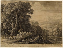
17th century etching black and white landscape scene forest sheep figures sky
Located in Milwaukee, WI
"Shepherd and Shepherdess Conversing in a Landscape (Berger et Bergere Conversant)" is an etching by Claude Gellee (Le Lorrain). This etching is in the collections of the Metropolita...
Category

Mid-17th Century Old Masters Landscape Prints

Materials

Etching

Vienna, Antique Map from "Civitates Orbis Terrarum" - Etching - Old Master
Located in Roma, IT
Braun G., Hogenberg F., "Vienna", from the collection "Civitates Orbis Terrarum", Cologne, T. Graminaeus, 1572-1617. Image Dim: cm 15 x 47, Dim: cm 20 x 53. Wonderful B/W Aquatint r...
Category

Early 17th Century Old Masters Landscape Prints

Materials

Etching, Aquatint

Vue de Mantes - Etching after C. Corot by C. Pinet - 19th Century
Located in Roma, IT
Vue de Mantes is a beautiful artwork realized by Charles Pinet after a painting by Camille Corot in the middle of XIX century. This etching represents a natural landscape with some...
Category

19th Century Old Masters Landscape Prints

Materials

Etching

Rugen Island, Germany: An Early 17th Century Map by Mercator and Hondius
Located in Alamo, CA
This is an early 17th century map entitled "Nova Famigerabilis Insulae Ac Ducatus Rugiae Desciptio" (Map of Rugen Island, Germany) by Gerard Mercator and Henricus and Joducus Hondiu...
Category

Early 17th Century Old Masters Landscape Prints

Materials

Engraving

Chiesa e Monastero delle Vergini - Etching by Giuseppe Vasi - Late 18th Century
Located in Roma, IT
Chiesa e Monastero delle Vergini is an original black and white etching of the Late 18th century realized by Giuseppe Vasi. Signed and titled on plate lower margin. Good condition...
Category

Late 18th Century Old Masters Landscape Prints

Materials

Etching

Narciso and Echo - B/W Etching after Claude Lorrain - 1815
Located in Roma, IT
Beautiful Artist’s Proof, representing the myth of Narcissius and the nymph Eco, draw by "the Metamorphosis" by Publio Ovidio Nasone. This aquatint, by Ludovico Caracciolo (engraver...
Category

1810s Old Masters Landscape Prints

Materials

Etching, Aquatint

Piranesi Etching of Hadrian's Ancient Roman Aqueduct and Baths, "Aquae Virginis"
Located in Alamo, CA
This is a framed Giovanni Battista Piranesi (1720-1778) etching entitled "Orthographia utriusque lateris arcuum ductus Aquae Virginis a specu principe ad Hadriani thermas, effossorum...
Category

Mid-18th Century Old Masters Landscape Prints

Materials

Etching

17th century etching black and white landscape scene forest trees figures sky
Located in Milwaukee, WI
"Le Temps, Apollon, et les Saisons (Time, Apollo, and the Seasons)" is an etching by Claude Gellée (Le Lorrain). This etching is the Fifth state (A). This state is also in collections in Paris (BN, L, PP) and Washington; Mannocci cat. no. 43. The inscription reads: "Apollo in atto di obedire al tempo. La Primavera a cominciare il ballo. Lestate no manca del suo calore. L'aurunno colsuo licore / Seguita. Linvernno tiene la sua staggione, Claudio Gillee inven.Fec.Roma 1662 con licenza de super." A powerful example of Claude's staging of landscape in the classical manner is the etching "Time, Apollo, and the Seasons," done in 1662 after Poussin's painting of 1624-1636, "Dance to the Music of Time...
Category

Mid-17th Century Old Masters Landscape Prints

Materials

Etching

Old Masters landscape prints for sale on 1stDibs.

Find a wide variety of authentic Old Masters landscape prints available for sale on 1stDibs. Works in this style were very popular during the 20th Century, but contemporary artists have continued to produce works inspired by this movement. Many Pop art paintings were created by popular artists on 1stDibs, including Giuseppe Vasi, Giovanni Battista Piranesi, Ludovico Caracciolo, and Frans Hogenberg. Frequently made by artists working with Etching, and Engraving and other materials, all of these pieces for sale are unique and have attracted attention over the years. Not every interior allows for large Old Masters landscape prints, so small editions measuring 2.37 inches across are also available. Prices for landscape prints made by famous or emerging artists can differ depending on medium, time period and other attributes. On 1stDibs, the price for these items starts at $66 and tops out at $45,000, while the average work sells for $655.

Recently Viewed

View All