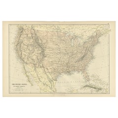
Map Of The Americas
62
to
231
1,821
773
918
883
556
551
461
332
236
235
203
199
128
113
107
103
90
85
73
72
71
61
55
52
51
41
39
30
29
28
26
26
26
21
18
18
17
16
16
14
14
11
11
11
10
9
9
8
7
7
6
6
5
4
3
3
3
2
2
1
1
1
1
103
52
46
42
42
Sort By
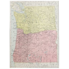
Original Antique Map of the American State of Washington, 1889
Located in St Annes, Lancashire
Great map of Washington
Drawn and Engraved by W. & A.K. Johnston
Published By A & C Black
Category
Antique 1880s Scottish Victorian Maps
Materials
Paper
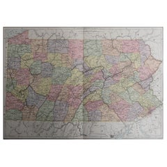
Original Antique Map of the American State of Pennsylvania, 1889
Located in St Annes, Lancashire
Great map of Pennsylvania
Drawn and Engraved by W. & A.K. Johnston
Published By A & C Black
Category
Antique 1880s Scottish Victorian Maps
Materials
Paper
No Reserve
H 10.75 in W 15.75 in D 0.07 in
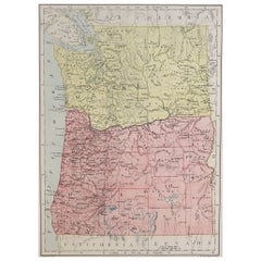
Original Antique Map of the American State of Oregon, 1889
Located in St Annes, Lancashire
Great map of Oregon
Drawn and Engraved by W. & A.K. Johnston
Published By A & C Black, Edinburgh
Category
Antique 1880s Scottish Victorian Maps
Materials
Paper
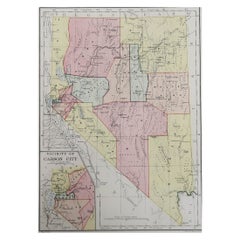
Original Antique Map of the American State of Nevada, 1889
Located in St Annes, Lancashire
Great map of Nevada
Drawn and Engraved by W. & A.K. Johnston
Published By A & C Black
Category
Antique 1880s Scottish Victorian Maps
Materials
Paper
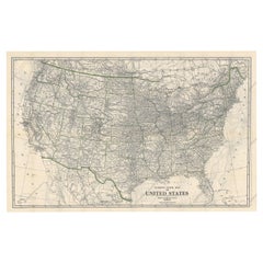
Old Map of the American Railroad Network and All Weather Roads on Verso, 1931
Located in Langweer, NL
This is the “New Census Edition” of Clason’s United States Green Guide. It features two large maps
Category
Vintage 1930s Maps
Materials
Paper
H 20.71 in W 32.8 in D 0 in
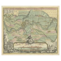
Large Antique Map of the City of Bremen and Surroundings, Germany
Located in Langweer, NL
also made maps of the Americas.
Category
Antique Early 18th Century Maps
Materials
Paper
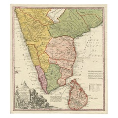
Original Antique Map of Malabar, Coromandel 'India' and Ceylon
Located in Langweer, NL
- 1 July 1724) was a German geographer and cartographer, who also made maps of the Americas. He soon
Category
Antique Mid-18th Century Maps
Materials
Paper
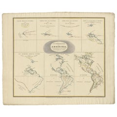
Interesting Antique Map of the Development of the Mapping of the America's, 1841
Located in Langweer, NL
".
Collection of hand-colored engraved maps by D. VEELWAARD on 1 sheet, "Dertiende aflevering, linker blad" from
Category
Antique 1840s Maps
Materials
Paper
H 18.9 in W 23.23 in D 0 in
Antique Map of The United States of North America, 1882
Located in Langweer, NL
This is a historical map titled "The United States of North America, Central Part" from the 1882
Category
Antique 1880s Maps
Materials
Paper
1863 "Lloyd's New Map of the United States, the Canadas, and New Brunswick"
Located in Colorado Springs, CO
Union states. The only indication that the American Civil War was in progress when this map was
Category
Antique 1860s American Maps
Materials
Linen, Wood, Paper
H 37 in W 49.5 in D 1 in
Antique Map of the United States of America, also showing the Caribbean
Located in Langweer, NL
Antique map titled 'Verein-Staaten von Nord-America, Mexico, Yucatan u.a.'. Very detailed map of
Category
Antique Mid-19th Century Maps
Materials
Paper
H 14.38 in W 17.88 in D 0.02 in
Antique Map of North America Including the West Indies
Located in Langweer, NL
Original antique map titled 'Nord-America'. Old map of North America and the West Indies. Also
Category
Antique Mid-19th Century Maps
Materials
Paper
Antique Map of the River Systems of America by Johnston, '1850'
Located in Langweer, NL
Antique map titled 'The River Systems of America showing the boundaries and comparative extent of
Category
Antique Mid-19th Century Maps
Materials
Paper
Antique Map of the United States of North America, c.1882
Located in Langweer, NL
Antique map titled 'United States of North America'. Old map of the United States of North America
Category
Antique 1880s Maps
Materials
Paper
Antique Map of the United States of America by Lapie '1842'
Located in Langweer, NL
Antique map titled 'Carte des États-Unis d'Amérique'. Map of the United States of America (USA
Category
Antique Mid-19th Century Maps
Materials
Paper
Antique Map of British North America, The Dominion of of Canada, 1882
Located in Langweer, NL
This map is titled "British North America, Dominion of Canada," from the 1882 Blackie Atlas. It
Category
Antique 1880s Maps
Materials
Paper
No Reserve
H 14.97 in W 22.45 in D 0 in
Decorative Antique Map of the Southern Part of South America, 1806
Located in Langweer, NL
Description: Antique map titled 'Paraguay, Chili, Terre Magellan?'
Decorative map of the
Category
Antique Early 1800s Maps
Materials
Paper
Original Antique Map of The United States of America, circa 1890
Located in St Annes, Lancashire
Great map of the USA
By The Stanford's Geographical Establishment
Original colour
Unframed.
Category
Antique 1890s English Victorian Maps
Materials
Paper
Antique Map of Central America Showing the Communication Lines, 1850
Located in Langweer, NL
Antique map titled 'Map of Central America Shewing the Different Lines of Atlantic & Pacific
Category
Antique 19th Century Maps
Materials
Paper
Large Original Antique Map of the United States of America. 1891
By Rand McNally & Co.
Located in St Annes, Lancashire
Fabulous map of The United States
Original color
By Rand, McNally & Co.
Dated 1891
Unframed
Category
Antique 1890s American Maps
Materials
Paper
No Reserve
H 20.5 in W 13.5 in D 0.07 in
Antique Map of Central America and the West Indies, 1882
Located in Langweer, NL
Antique map titled 'West India Islands and Central America'. Old map of Central America and the
Category
Antique 19th Century Maps
Materials
Paper
New Map of North America from the Latest Discoveries, 1763
Located in Philadelphia, PA
A fine antique 18th century map of the North American seaboard.
Entitled "A New Map of North
Category
Antique Mid-18th Century English Georgian Maps
Materials
Paper
Scarce Antique Map of South America
Located in Langweer, NL
Antique map titled 'Carte de l'Amérique Méridionale'. Scarce map of South America, published in
Category
Antique Early 19th Century Maps
Materials
Paper
Antique Map of North America, 1821
Located in Langweer, NL
Antique map of America titled 'Carte de l'Amerique septentrionale'. Scarce map of North America
Category
Antique 19th Century Maps
Materials
Paper
Set of 4 Antique Maps of part of the United States of America
Located in Langweer, NL
Set of four individual antique maps of part of the United States. Published as part of a set of six
Category
Antique Mid-19th Century Maps
Materials
Paper
Antique Map of the United States of North America by Wyld '1845'
Located in Langweer, NL
Antique map titled 'Map of The United States of North America'. Original antique map of the United
Category
Antique Mid-19th Century Maps
Materials
Paper
Antique Map of the United States of North America by Johnston '1909'
Located in Langweer, NL
Antique map titled 'United States of North America'. Original antique map of United States of North
Category
Early 20th Century Maps
Materials
Paper
Antique Map of The United States of North America, Pacific States, 1882
Located in Langweer, NL
The map is from the same 1882 Blackie Atlas and focuses on the Pacific States of the United States
Category
Antique 1880s Maps
Materials
Paper
No Reserve
H 14.97 in W 11.03 in D 0 in
1859 "Map of the United States of America..." by J. H. Colton
By J.H. Colton
Located in Colorado Springs, CO
Presented is an 1859 “Map of the United States of America, the British Provinces, Mexico, the West
Category
Antique 1850s American Maps
Materials
Paper
Antique Map of the Northern Part of South America by Fullarton, 1855
Located in Langweer, NL
Antique map titled 'South American States, New Granada & Venezuela'. Detailed map of the northern
Category
Antique 19th Century Maps
Materials
Paper
Antique Map of the Northern Part of South America by Delamarche, 1806
Located in Langweer, NL
Antique map titled 'Terre-Ferme, Perou, Bresil, Pays de L'Amazone.' This map shows the northern
Category
Antique 19th Century Maps
Materials
Paper
Antique Map Showing the Locations of Native American Tribes in 1899
Located in Langweer, NL
Antique map titled 'Map showing the Indian Reservations within the Limits of the United States
Category
Antique Late 19th Century Maps
Materials
Paper
University Chart “Black Map of North America
Located in Chillerton, Isle of Wight
University Chart “Black Map of North America
W&A K Johnston’s Charts of Physical Maps By G W
Category
Early 20th Century Industrial Maps
Materials
Linen
Antique Map of South America with inset of the Quito Highlands, Hand-Colored
Located in Langweer, NL
Antique map titled 'Zuid-Amerika'. Original antique map of South America including Brazil, Peru
Category
Antique Mid-19th Century Maps
Materials
Paper
H 13.51 in W 10.16 in D 0.02 in
Antique Map of America by Vaugondy, 1778
Located in Langweer, NL
Antique map titled 'Amerique ou Indes Occidentales (..)'. Vaugondy's map of America, pre-dating
Category
Antique Late 18th Century Maps
Materials
Paper
Antique Map of South America, c.1840
Located in Langweer, NL
Antique map titled 'South America'. Original, antique map depicting South America. With outline
Category
Antique 19th Century Maps
Materials
Paper
Antique Map of North America with Vignette of the Statue of Liberty, New York
Located in Langweer, NL
Antique map titled 'Amérique du Nord'. Original antique map of North America. Meticulous
Category
Antique Late 19th Century Maps
Materials
Paper
Free Shipping
H 15.44 in W 20.4 in D 0.02 in
Large Antique 1859 Map of North America
Located in Sag Harbor, NY
This Map was made by Augustus Mitchell in 1859 It is in amazing condition for being 163 years old
Category
Antique Mid-19th Century American Maps
Materials
Canvas, Paper
Antique Map of South American, The West Indies & Most of Africa, Ca.1775
Located in Langweer, NL
du Commerce des Europeens dans les deux Indes'.
This map is roughly centered on South America
Category
Antique 1770s Maps
Materials
Paper
H 15.04 in W 19.77 in D 0 in
Authentic Antique Map of the Caribbean, Gulf Coast and Central America, 1787
Located in Langweer, NL
, Gulf Coast and Central America. With inset map of Bermuda. Originates from 'Histoire Philosopgique et
Category
Antique Late 18th Century Maps
Materials
Paper
Free Shipping
H 10.52 in W 16.38 in D 0.02 in
Engraving of a Map of Florida, the Gulf Coast, Caribbean & Central America, 1728
Located in Langweer, NL
This exceptional antique map, titled "Nouvelle Carte Marine de Toute les Cotes de l´Amerique" and
Category
Antique Mid-18th Century European Maps
Materials
Paper
Free Shipping
H 24.61 in W 40.56 in D 0.02 in
Antique Map of the British Possessions in North America by Wyld '1845'
Located in Langweer, NL
Antique map titled 'Map of The British Possessions in North America'. Original antique map of the
Category
Antique Mid-19th Century Maps
Materials
Paper
H 10.24 in W 14.18 in D 0.02 in
Antique Map of the West Indies and Central America by Lowry '1852'
Located in Langweer, NL
Antique map titled 'West Indies and Central America'. Original map of the West Indies and Central
Category
Antique Mid-19th Century Maps
Materials
Paper
Exploring South America's North: Antique Map from the Royal Atlas of 1909
Located in Langweer, NL
The antique map titled 'South America, Northern Sheet' is a historical cartographic representation
Category
Early 20th Century Maps
Materials
Paper
H 19.49 in W 24.41 in D 0.02 in
Antique Map with Hand Coloring of North America and the West Indies
Located in Langweer, NL
Original antique map titled 'Nord-America'. Old map of North America and the West Indies.
This
Category
Antique Late 19th Century Maps
Materials
Paper
Free Shipping
H 15.08 in W 18.78 in D 0.02 in
Interesting Old Map of the Nw Coast of America and the Ne Coast of Asia, ca.1772
Located in Langweer, NL
. Interesting map of the NW Coast of America and the NE Coast of Asia, based upon Jefferys' map of 1768. Prior
Category
Antique 1770s Maps
Materials
Paper
H 13.78 in W 17.13 in D 0 in
Antique Map of the West Coast of America with Island Views, ca.1784
Located in Langweer, NL
Antique print titled 'Views on the West Coast of America (..)'.
Coastal views of various
Category
Antique 1780s Maps
Materials
Paper
Victorian Visions of the New World: A Detailed Tallis Map of North America, 1851
Located in Langweer, NL
America.
Like the other maps in the Tallis series, this one is rich in cultural and historical context
Category
Antique 1850s Maps
Materials
Paper
H 14.26 in W 10.71 in D 0 in
Antique Map of the United States with inset map of the region of Mexico City
Located in Langweer, NL
Antique map titled 'Verein-Staaten von Nord-America, Mexico, Yucatan u.a.'. Very detailed map of
Category
Antique Mid-19th Century Maps
Materials
Paper
H 14.69 in W 17.92 in D 0.02 in
Antique Decorative Coloured Map of North America, 1882
Located in Langweer, NL
This original antique map of North America is from the Blackie & Son Atlas published in 1882. Here
Category
Antique 1880s Maps
Materials
Paper
Set of Two Antique Maps of South America with Inset Maps of Rio de Janeiro
Located in Langweer, NL
Set of two antique maps titled 'Süd-America in zwei Blättern'. Two individual sheets of South
Category
Antique Mid-19th Century Maps
Materials
Paper
Free Shipping
H 14.57 in W 17.88 in D 0.02 in
Vintage Reproduction 17th Century Map of Europe, American, Cartography, Blaeuw
Located in Hele, Devon, GB
This is a vintage reproduction map of Europe. An American, paper stock cartography print in frame
Category
Late 20th Century Central American Mid-Century Modern Maps
Materials
Glass, Wood, Paper
H 30.32 in W 38.39 in D 1.38 in
Antique Map of the West Coast of North America & North East Coast of Asia '1772'
Located in Langweer, NL
'. Map of the West Coast of North America and North-East Coast of Asia, based upon Buache's report of the
Category
Antique Late 18th Century Maps
Materials
Paper
H 13.78 in W 18.78 in D 0.02 in
Map of the Western Coast of South America from Ecuador into Chili, ca.1780
Located in Langweer, NL
Antique map titled 'Carte du Perou avec une partie des pays qui en sont a l'est.'
Map of the
Category
Antique 1780s Maps
Materials
Paper
H 15.16 in W 10.24 in D 0 in
Antique Map of North America by Wyld '1845'
Located in Langweer, NL
Antique map titled 'North America'. Original antique map of North America. This map originates from
Category
Antique Mid-19th Century Maps
Materials
Paper
Antique Map of South America by Wyld, '1845'
Located in Langweer, NL
Antique map titled 'South America'. Original antique map of South America. This map originates from
Category
Antique Mid-19th Century Maps
Materials
Paper
Antique Map of North America by Johnson, '1872'
Located in Langweer, NL
Antique map titled 'Johnson's North America'. Original map of North America, with an inset map of
Category
Antique Late 19th Century Maps
Materials
Paper
Old German Map of the United States, Central America and the West Indies, c.1870
Located in Langweer, NL
, Central America and the West Indies. This map originates from 'H. Kiepert's Kleiner Atlas der Neueren
Category
Antique 19th Century Maps
Materials
Paper
H 13.78 in W 17.68 in D 0 in
Antique Map of South America by Lowry, 1852
Located in Langweer, NL
Antique map titled 'South America'. Original map of South America. This map originates from
Category
Antique Mid-19th Century Maps
Materials
Paper
Antique Map of North America by Lowry '1852'
Located in Langweer, NL
Antique map titled 'North America'. Original map of North America. This map originates from
Category
Antique Mid-19th Century Maps
Materials
Paper
- 1
- ...
Get Updated with New Arrivals
Save "Map Of The Americas", and we’ll notify you when there are new listings in this category.
Questions About Map Of The Americas
- 1stDibs ExpertMarch 22, 2022Josef Albers came to America in 1933 after the Nazis shuttered the Bauhaus. He and his wife, the textile artist Anni Albers, originally settled in North Carolina. During his time there, Albers taught at Black Mountain College. Shop a variety of Josef Albers art on 1stDibs.
- 1stDibs ExpertFebruary 22, 2021Because the United States isn't ruled by a king or queen, the time of 1840–1900 in America is broken down into many different names. There is the timeline surrounding the Civil War: The Antebellum (pre-Civil War), Civil War (1861–1865), Reconstruction (1865–1876). There are other names, including the Industrial Age (post Civil War), the Populist Era (1890's), and the Gilded Age (post-Civil War era of government corruption).
