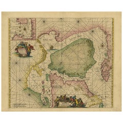
North Sea Map
9
to
35
263
100
147
142
122
76
59
39
38
36
30
29
27
20
20
18
17
17
14
14
11
10
10
8
7
7
6
6
6
5
4
4
3
3
3
2
2
2
2
2
2
2
2
2
2
2
2
1
1
1
1
1
1
1
1
1
1
42
42
20
11
6
Sort By
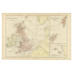
Colorful Detailed Antique Map of The British Islands and `The North Sea, 1882
Located in Langweer, NL
Discover 'The British Islands and The North Sea' Map with Insets of Orkney, Shetland, and Channel
Category
Antique 1880s Maps
Materials
Paper
H 14.97 in W 22.45 in D 0 in
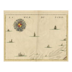
Antique Map of the North Sea and Dunkirk
Located in Langweer, NL
Untitled map of the North Sea, top left a large compass rose, bottom right Dunkirk (Duinkerke
Category
Antique Early 18th Century Maps
Materials
Paper
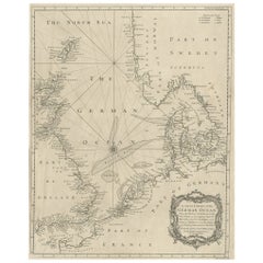
Antique Map of the North Sea From the English Channel to Norway & Sweden, 1746
Located in Langweer, NL
Antique map titled 'A correct Chart of the German Ocean from the North of Scotland to the Start
Category
Antique 1740s Maps
Materials
Paper
H 20.08 in W 15.75 in D 0 in
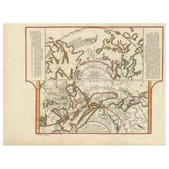
Antique Map of the West Coast of North America & North East Coast of Asia '1772'
Located in Langweer, NL
'. Map of the West Coast of North America and North-East Coast of Asia, based upon Buache's report of the
Category
Antique Late 18th Century Maps
Materials
Paper
H 13.78 in W 18.78 in D 0.02 in
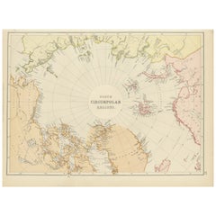
Arctic Exploration: An Original Map of the North Circumpolar Regions, 1882
Located in Langweer, NL
This map, extracted from the 1882 atlas by Blackie & Son, presents the North Circumpolar Regions in
Category
Antique 1880s Maps
Materials
Paper
H 11.03 in W 14.97 in D 0 in
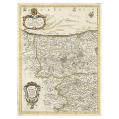
Decorative Original Antique Map of the North of Flanders, Belgium, 1697
Located in Langweer, NL
North Sea, extends through the northern region of France to the cities of Douai and Vieux-Conde located
Category
Antique 1690s Maps
Materials
Paper
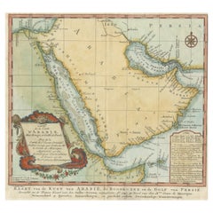
Original Antique Map of Arabia and the Red Sea
Located in Langweer, NL
Dutch version, engraved by J. van Schley, of Bellin's map of Arabia and the Red Sea. The emphasis is the
Category
Antique Mid-18th Century Maps
Materials
Paper
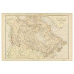
Antique Map of British North America, The Dominion of of Canada, 1882
Located in Langweer, NL
This map is titled "British North America, Dominion of Canada," from the 1882 Blackie Atlas. It
Category
Antique 1880s Maps
Materials
Paper
No Reserve
H 14.97 in W 22.45 in D 0 in
Antique Sea Chart of North America by Ottens, circa 1745
Located in Langweer, NL
Antique map titled 'Septemtrionaliora Americae a Groenlandia (..)'. Sea chart of the northern
Category
Antique Mid-18th Century Maps
Materials
Paper
Free Shipping
H 21.46 in W 25.99 in D 0.02 in
1859 Detailed Map of North West Germany with Bavaria Inset - Blackie's Atlas
Located in Langweer, NL
landscapes, from the North Sea coastline to the densely forested areas of the interior.
2. **Inset Map of
Category
Antique Mid-19th Century Maps
Materials
Paper
H 21.26 in W 14.57 in D 0.02 in
"Nova Barbariae Descriptio", a 17th Century Hand-Colored Map of North Africa
By Johannes Janssonius
Located in Alamo, CA
This original attractive 17th century hand-colored map of North Africa entitled "Nova Barbariae
Category
Antique Mid-17th Century Dutch Maps
Materials
Paper
H 22.38 in W 29 in D 0.13 in
North & South America: A 17th Century Hand-colored Map by Jansson & Goos
By Johannes Janssonius
Located in Alamo, CA
A 17th century hand-colored map of North & South America entitled "Americae Descriptio" by the
Category
Antique 1620s Dutch Maps
Materials
Paper
Rare Sea Chart of the East Frisian Islands or Watten and the North Sea, c.1700
Located in Langweer, NL
Hamburgh.'
Rare and interesting chart of the East Frisian Islands (or Watten) and the North Sea. Above
Category
Antique Early 1700s Maps
Materials
Paper
H 20.95 in W 24.73 in D 0 in
Map of the Laughlan Islands, Rossel Island & Reef North of New Caledonia, 1833
Located in Langweer, NL
the reef north of New Caledonia, d'Entrecasteaux Reef. Islands in the Coral and Solomon Seas. The
Category
Antique 1830s Maps
Materials
Paper
H 25.4 in W 19.02 in D 0 in
Old Color Engraving of Blaeu's first Map of Brazil, North Oriented to the Right
By Willem Blaeu
Located in Langweer, NL
, with north oriented to the right. Includes inset map of Baya de todos Santos, elaborate cartouche, 2
Category
Antique Mid-17th Century Maps
Materials
Paper
H 19.3 in W 22.84 in D 0.02 in
Two Original Antique Engravings with the Dutch and German North Sea Coast, c1650
Located in Langweer, NL
Watten tot de stadt Hamborch toe'.
Two maps with the Dutch and German North Sea coast of Friesland
Category
Antique 1650s Maps
Materials
Paper
H 19.69 in W 23.23 in D 0 in
Antique Engraving of Dutch and German North Sea Coast of Friesland, ca.1680
Located in Langweer, NL
per Vada vulgo de Watten Hamburgum usq.' -
Two maps with the Dutch and German North Sea coast of
Category
Antique 1680s Maps
Materials
Paper
No Reserve
H 23.43 in W 27.96 in D 0 in
Old Decorative & Highly Detailed Sea Chart of the North Dutch-German Coast, 1681
Located in Langweer, NL
, soundings and nany other deails and place names mostly along the coast of the North Sea. Includes a striking
Category
Antique 1680s Maps
Materials
Paper
H 21.38 in W 23.82 in D 0 in
Antique Map of Artois in the North of France by Famous Mapmaker Blaeu, c.1640
Located in Langweer, NL
. Later he started producing map and sea charts, including his first world map in 1605. In 1633 he was
Category
Antique 17th Century Maps
Materials
Paper
No Reserve
H 19.69 in W 23.43 in D 0 in
Old Map of the Sinai Peninsula Showing the Mediterranean and the Red Sea, 1773
Located in Langweer, NL
Antique map of the Sinai Peninsula showing the Mediterranean Sea to the north and the Red Sea to
Category
Antique 1770s Maps
Materials
Paper
H 17.05 in W 21.19 in D 0 in
Bird's Eye View of Dabhol as Seen from the Sea, North of Goa, India, 1727
Located in Langweer, NL
Antique print titled 'De Bay ende Stadt Dabul'.
Bird's eye view of Dabhol as seen from the sea
Category
Antique 1720s Maps
Materials
Paper
Free Shipping
H 11.82 in W 16.15 in D 0 in
Antique Map of the Region Between the Black and Caspian Sea by Cellarius, 1731
Located in Langweer, NL
respectively in the Balkans and Spain. To the east north of the Caspian Sea are the warlike Scythians, much
Category
Antique 18th Century Maps
Materials
Paper
H 9.45 in W 14.18 in D 0 in
Old Map of the Gulf of Bothnia, the Northernmost Arm of the Baltic Sea, 1759
Located in Langweer, NL
Antique map titled 'Carte du Golphe de Bothnie'.
Original antique map of the Gulf of Bothnia
Category
Antique 1750s Maps
Materials
Paper
H 9.85 in W 7.49 in D 0 in
Decorative Antique Map of Central Asia
Located in Langweer, NL
(Tartary). Covers from the Black Sea south to China, north to Russia, and south to Persia and India. Drawn
Category
Antique Late 18th Century Maps
Materials
Paper
Antique Map of the Sinai Peninsula, '1895'
Located in Langweer, NL
the north and the Red Sea to the south, and is a land bridge between Asia and Africa. Published by D
Category
Antique Late 19th Century Maps
Materials
Paper
Antique Map of Persia with Dedication Cartouche
Located in Langweer, NL
Region, with the Red Sea and the Persian Gulf in the South and Caspian and Tartaria in the North. With
Category
Antique Mid-17th Century Maps
Materials
Paper
Original Antique Map of the Duchy of Holstein
By Willem Blaeu
Located in Langweer, NL
North Sea approaching the sandbars suggests the importance of trade to the region. Relief depicted
Category
Antique Mid-17th Century Maps
Materials
Paper
Historical Map Depicting the Continent of Asia, 1882
Located in Langweer, NL
This 1882 map presents a meticulously detailed representation of the continent of Asia, a testament
Category
Antique 1880s Maps
Materials
Paper
Antique Map of Denmark by Hall, circa 1820
Located in Langweer, NL
, Baltic Sea, Kattegatt and North Sea, south east Sweden). Sheet XXV from an unidentified English atlas
Category
Antique 19th Century Maps
Materials
Paper
Antique Map of Buru Island, Indonesia, c.1725
Located in Langweer, NL
Indonesia. It lies between the Banda Sea to the south and Seram Sea to the north, west of Ambon and Seram
Category
Antique 18th Century Maps
Materials
Paper
Striking Antique Map Centered on the Malay Peninsula
By Pieter Van Der Aa
Located in Langweer, NL
Antique map titled 'D'Indiaanze Landschappen Zeen en Eylanden, van Couchin af tot in de Moluccos
Category
Antique Early 18th Century Maps
Materials
Paper
Antique Decorative Coloured Map Marocco, Algeria and Tunis, 1882
Located in Langweer, NL
The maps is from the 1882 atlas by Blackie & Son and offers a detailed view of the North African
Category
Antique 1880s Maps
Materials
Paper
Free Shipping
H 14.97 in W 22.45 in D 0 in
Antique Map of Western Russia by Covens & Mortier, 1740
Located in Langweer, NL
the White Sea in the north. The top portion of the map includes St. Petersburg just west of Lake
Category
Antique Mid-18th Century Maps
Materials
Paper
Large Decorative Antique Map of the Mediterranean, ca.1770
Located in Langweer, NL
Antique map titled 'Carte de la Mer Mediterranee en Douze Feuilles'.
First map out of twelve
Category
Antique 1770s Maps
Materials
Paper
Antique Uncommon Dutch Map of Ancient Israel, c.1730
Located in Langweer, NL
.' Uncommon map of ancient Israel. This map shows Israel from Hethelon in the north to Kades, just south of
Category
Antique 18th Century Maps
Materials
Paper
Antique Map of Juan Fernandez Island by Anson '1749'
Located in Langweer, NL
de Zuid Zee (..)'. This map depicts Juan Fernandez Island in the Southern Sea. This map originates
Category
Antique Mid-18th Century Maps
Materials
Paper
Antique Map of The Harbour of Acapulco in Mexico, 1749
Located in Langweer, NL
(..)'. Original antique map of the Port of Acapulco on the coast of Mexico in the Southern Sea, at 16°.45'. North
Category
Antique 1740s Maps
Materials
Paper
Antique Map of the Port of Acapulco in Mexico, 1749
Located in Langweer, NL
antique map of the Port of Acapulco on the coast of Mexico in the Southern Sea, at 16°.45'. North latitude
Category
Antique 18th Century Maps
Materials
Paper
Rare Antique Map of Friesland in Roman Times, Published 1778
Located in Langweer, NL
Schotanus de Sterringa. Rare map illustrating Friesland (The Netherlands). The North Sea is depicted on top
Category
Antique 18th Century Maps
Materials
Paper
Free Shipping
H 13.86 in W 16.54 in D 0 in
Topographical and Infrastructure Map of the Province of Valencia, 1901
Located in Langweer, NL
A historical map of the province of Valencia, dated 1901. The map includes intricate details such
Category
Antique Early 1900s Maps
Materials
Paper
Free Shipping
H 20.08 in W 14.77 in D 0 in
Persia Unveiled: Antique Map of Iran, Afghanistan, and Beyond, 1852
Located in Langweer, NL
Sea in the north to the Persian Gulf in the south.
- The map also includes parts of adjacent
Category
Antique Mid-19th Century Maps
Materials
Paper
Antique Map of Persia, Also Showing the Indus River, circa 1673
By Joan (Johannes) Blaeu
Located in Langweer, NL
Region, with the Red Sea and the Persian Gulf in the South and Caspian and Tartaria in the North
Category
Antique Late 17th Century Maps
Materials
Paper
No Reserve
H 21.07 in W 24.53 in D 0.02 in
Antique Map of Spain and Portugal by Tardieu, circa 1795
Located in Langweer, NL
labeled as "Mare Internum", the Atlantic Ocean to the west, and the Cantabrian Sea in the north. Borders
Category
Antique Late 18th Century Maps
Materials
Paper
Mediterranean Tapestry: A 19th Century Map of the Mediterranean Shores, 1882
Located in Langweer, NL
This map, titled "The Shores of the Mediterranean," is part of the 1882 atlas by Blackie & Son, and
Category
Antique 1880s Maps
Materials
Paper
H 11.03 in W 14.97 in D 0 in
Old Antique Map of the Banda Islands (Southeast), Indonesia & Northern Australia
By F. Valentijn
Located in Langweer, NL
Original antique map titled 'Kaart van de Zuyd-Ooster Eylanden van Banda'. Important map of the
Category
Antique Early 18th Century Maps
Materials
Paper
No Reserve
H 20.28 in W 24.02 in D 0.02 in
Interesting Map of Great Britain and Northern Europe with various Illustrations
Located in Langweer, NL
Antique map titled 'Itinera Varia Auctoris'. Very interesting map of Great Britain and Northern
Category
Antique Mid-18th Century Maps
Materials
Paper
H 11.23 in W 8.9 in D 0.02 in
Charming Miniature Map of Thrace or Thrake in Southeast Europe, 1685
Located in Langweer, NL
bounded by the Balkan Mountains to the north, the Aegean Sea to the south, and the Black Sea to the east
Category
Antique 1680s Maps
Materials
Paper
Antique Map of Western and Eastern Barbary in Africa, c.1744
Located in Langweer, NL
of the Eastern Parts of Barbary'. Decorative maps of North Africa and the Southern Mediterranean
Category
Antique 18th Century Maps
Materials
Paper
Orignal Hand-Colored Antique Map of Chili by W. Blaeu, 1658
By Willem Blaeu
Located in Langweer, NL
Copiapo southward to the island of Chiloé with ships and sea monsters adorning the sea. The map is
Category
Antique Mid-17th Century Maps
Materials
Paper
Free Shipping
H 21.86 in W 25.99 in D 0.02 in
Antique Hand-Colored Map of Western Russia and Ukraine, c.1680
Located in Langweer, NL
northern tip of the Black and Caspian Seas to the Mare Mosovia and Nova Zembla in the North and from Arz
Category
Antique 1680s Maps
Materials
Paper
Antique Map of the Moluccas in Indonesia by Janssonius, C.1650
By Johannes Janssonius
Located in Langweer, NL
vessels, sea monsters, two elaborate compass roses with north oriented to the right, and a native couple
Category
Antique 17th Century Maps
Materials
Paper
1859 Vintage Maps of England and Wales: Blackie's Imperial Geographic Detail
Located in Langweer, NL
Irish Sea, and the North Sea.
6. **Artistic and Aesthetic Elements**: In line with the Victorian era's
Category
Antique Mid-19th Century Maps
Materials
Paper
H 14.57 in W 21.26 in D 0.02 in
Territories of Antiquity: The Northern Division of Syria, A Detailed 1882 Map
Located in Langweer, NL
This 19th-century map from the atlas published by Blackie and Son in 1882 is titled "SYRIA (NORTH
Category
Antique 1880s Maps
Materials
Paper
H 14.97 in W 11.03 in D 0 in
Imperial Splendor: Antique Map of the Ottoman Empire by Blaeu, circa 1640
Located in Langweer, NL
the west to the Black and Caspian Seas in the north, and from the Gulf of Aden, Red Sea, and the
Category
Antique Mid-17th Century Maps
Materials
Paper
No Reserve
H 17.33 in W 21.54 in D 0.02 in
Antique Map of China, Tartary and Central Asia by Blaeu, c.1645
Located in Langweer, NL
journals of Marco Polo. The map covers from the Caspian Sea and the Volga River east as far as the China
Category
Antique 17th Century Maps
Materials
Paper
Beautiful Antique Map of the Moluccas or Spice Islands, Indonesia, ca.1650
Located in Langweer, NL
vessels, sea monsters, two elaborate compass roses with north oriented to the right, and a native couple
Category
Antique 1650s Maps
Materials
Paper
H 20.87 in W 22.64 in D 0 in
California, Alaska and Mexico: 18th Century Hand-Colored Map by de Vaugondy
By Didier Robert de Vaugondy
Located in Alamo, CA
This an 18th century hand-colored map of the western portions of North America entitled "Carte de
Category
Antique 1770s French Maps
Materials
Paper
H 13.75 in W 16.63 in D 0.13 in
Hand-Colored 18th Century Homann Map of the Danube, Italy, Greece, Croatia
By Johann Baptist Homann
Located in Alamo, CA
Black Sea, as well as the Adriatic and Aegean Seas. It extends from Bohemia in the north to Crete in the
Category
Antique Early 18th Century German Maps
Materials
Paper
H 20 in W 23.88 in D 0.07 in
Antique Sea Chart of the Western Coast of Africa
Located in Langweer, NL
Antique map titled 'Nieuwe Paskaert van de Kust van Genehoa (..)'. This attractive sea chart covers
Category
Antique Late 17th Century Maps
Materials
Paper
1859 Denmark and Schleswig-Holstein Map: A Historical View from Blackie's Atlas
Located in Langweer, NL
, the North Sea and Baltic Sea coastlines, and important rivers and lakes are likely to be highlighted
Category
Antique Mid-19th Century Maps
Materials
Paper
H 14.57 in W 10.63 in D 0.02 in
- 1
Get Updated with New Arrivals
Save "North Sea Map", and we’ll notify you when there are new listings in this category.
More Ways To Browse
L Pierre
Safe Herring
18th Century Sicily
Lifebuoy Vintage
Green Oran
Used Furniture Cabo San Lucas
Vintage Toothpaste
Miniature Center Antique Table
Baja Mexico
Corsair Yacht
Map Jamaica
Donkey Moroccan
Alexander Roux
Maps Cambridge England
Snake Fountain
Vintage Furniture Lincolnshire
Carry On Movie Poster
Hippocampus Sculpture
