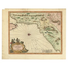
East India Map
3
to
40
202
24
192
111
77
46
39
22
21
18
16
10
10
7
7
6
6
6
6
5
5
5
4
4
3
3
3
3
3
3
2
2
2
2
2
1
1
1
1
1
1
1
1
1
20
9
3
2
2
Sort By
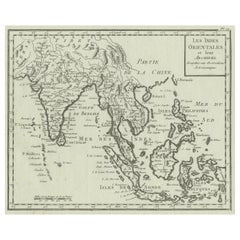
Antique Map of India, the East Indies and the Philippines
Located in Langweer, NL
Antique map titled 'Les Indes Orientales et leur Archipel'. Original antique map of India, the East
Category
Antique Mid-18th Century Maps
Materials
Paper
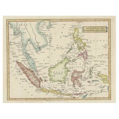
Original Antique Map of the East India Islands 'Indonesia', ca.1820
Located in Langweer, NL
Antique map titled 'A Chart of the East India Islands'.
Old map of the East Indies. This map
Category
Antique 1820s Maps
Materials
Paper
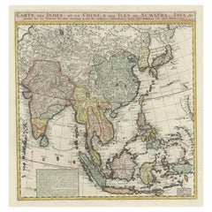
Detailed Original Antique Map of India, Southeast Asia and the Far East, 1719
Located in Langweer, NL
of India, Southeast Asia and the Far East, extending from Gujerat to the supposed "Terre De Yeco
Category
Antique 1710s Maps
Materials
Paper
H 26.38 in W 22.25 in D 0 in
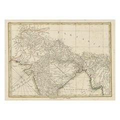
Old Map of North India From Kandahar East to Burma 'Pegu' and South to Goa, 1776
Located in Langweer, NL
Description: Antique map titled 'Indes Iere Feuille'.
Old map of northern India. Covers the
Category
Antique 1770s Maps
Materials
Paper
H 14.77 in W 19.1 in D 0 in
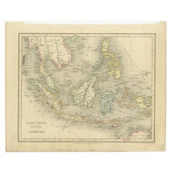
Antique Map of the East Indies by Dower, 1832
Located in Langweer, NL
Antique map titled 'East India Isles'. Old map of the East Indies. This map originates from 'A
Category
Antique 19th Century Maps
Materials
Paper
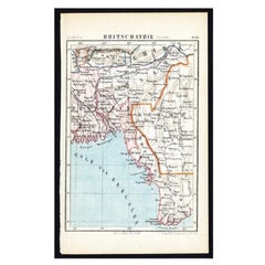
Antique Map of Eastern India by Kuyper, C.1880
Located in Langweer, NL
Plate 55 : 'Britsch-Indie, Oost.' (British Indies, East). This lithographed map originates from
Category
Antique 19th Century Maps
Materials
Paper
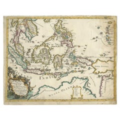
Antique Map of the East Indies by Rossi, 1683
Located in Langweer, NL
Antique map titled 'Isole Dell'India cioe le Molucche la Filippine e della Sonda Parte de Paesi di
Category
Antique 17th Century Maps
Materials
Paper
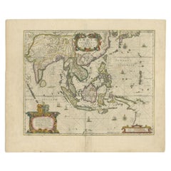
Antique Map of the East Indies by Janssonius, c.1644
By Johannes Janssonius
Located in Langweer, NL
Antique map titled 'India quae Orientalis dicitur, et Insulae adiacentes'. Old map of the East
Category
Antique 17th Century Maps
Materials
Paper
Antique Map of Choromandel, Golconda and Orixa, Malabar, India, 1744
By Philip Baldaeus
Located in Langweer, NL
Orixa, published in 'The True and Exact Description of the Most Celebrated East - India Coast of Malabar
Category
Antique 18th Century Maps
Materials
Paper
Superb, Large Map of British India, Chinese Empire, Indochina, Malaysia, 1860
Located in Langweer, NL
Antique map titled 'Indes, colonies Anglaises.'
Large map of the East Indies, British Colonies
Category
Antique 1860s Maps
Materials
Paper
H 22.8 in W 31.07 in D 0 in
Antique German Map of India and Sri Lanka or Ceylon, 1902
By Meyer
Located in Langweer, NL
Antique map titled 'Ostindien.' (Map of India with an inset map of East-Bengal.) This attractive
Category
20th Century Maps
Materials
Paper
Antique Map of the East Indies by A & C. Black, 1870
Located in Langweer, NL
Antique map titled 'Indian Archipelago and Further India including Burmah, Siam, Anam &c'. Original
Category
Antique Late 19th Century Maps
Materials
Paper
Large Antique Map of the East Indies, with Inset of the Philippines
Located in Langweer, NL
Antique map titled 'A Map of the East Indies (..)'. Large antique map of Southeast Asia, India, and
Category
Antique Late 18th Century Maps
Materials
Paper
Old Antique Map of the East Indies and Southeast Asia, ca.1644
Located in Langweer, NL
Antique map titled 'India quae Orientalis dicitur, et Insulae adiacentes'.
Old map of the East
Category
Antique 1640s Maps
Materials
Paper
Antique Map of Southeast Asia 'India, Indonesia' by N. Visscher, circa 1670
Located in Langweer, NL
Antique map titled 'Indiae Orientalis, nec non Insularum Adiacentium Nova Descriptio.' The map
Category
Antique Mid-17th Century Maps
Materials
Paper
H 20.75 in W 25.04 in D 0.02 in
Original Antique Map of the East Indies (Indonesia) by Janssonius, c.1644
By Johannes Janssonius
Located in Langweer, NL
Antique map titled 'India quae Orientalis dicitur, et Insulae adiacentes'. Old map of the East
Category
Antique 17th Century Maps
Materials
Paper
H 18.51 in W 23.43 in D 0 in
Map of East Friesland, The Netherlands & the Area Emden & Norden, Germany, 1635
Located in Langweer, NL
Antique map titled 'Typus Frisiae Orientalis.'
Map of East Friesland and the area around Emden
Category
Antique 1630s Maps
Materials
Paper
H 20.48 in W 24.34 in D 0 in
Antique Map of South East Asia, Australia and the Indian Ocean, 1726
By F. Valentijn
Located in Langweer, NL
of Australia, based on the discoveries of explorers working for the Dutch East India Company (the VOC
Category
Antique Mid-18th Century Dutch Maps
Materials
Paper
Free Shipping
H 20.67 in W 27.17 in D 0.02 in
Decorative Antique Map of the Malay Archipelago or East Indies Island, 1851
Located in Langweer, NL
Antique map Indonesia titled 'Malay Archipelago, or East India Islands'. With vignettes of Victoria
Category
Antique 1850s Maps
Materials
Paper
No Reserve
H 10.44 in W 14.18 in D 0 in
Original Antique Hand-Colored Map of The East Indies and Southeast Asia, c.1644
Located in Langweer, NL
Antique map titled 'India quae Orientalis dicitur, et Insulae adiacentes'.
Old map of the East
Category
Antique 1640s Maps
Materials
Paper
H 19.69 in W 23.23 in D 0 in
Antique Map of the Islands Near Batavia, Capital of the Dutch East Indies, 1682
Located in Langweer, NL
East India Company (or VOC) - between 1660 and 1667 he occupied posts in India and on Ceylon - he then
Category
Antique 17th Century Maps
Materials
Paper
H 11.82 in W 7.49 in D 0 in
Map of Tapi or Tapti River in Central India and Along the Arabian Sea, 1726
Located in Langweer, NL
it. One of the main rivers in India, the Tapti runs east to west, and the map features rhumb lines
Category
Antique 1720s Maps
Materials
Paper
H 8.67 in W 15.16 in D 0 in
Original Blaeu Map of Southeast Asia from India to Tibet and Japan to New Guinea
Located in Langweer, NL
Antique map titled 'India quae Orientalis dicitur et Insulae Adiacentes'.
Beautiful map of
Category
Antique 1640s Maps
Materials
Paper
H 19.49 in W 23.63 in D 0 in
Antique Map Made After a Roman Papyrus Travel Map, Known as Peutinger Map, 1773
Located in Langweer, NL
, Persia, and India. According to one hypothesis, the existing map is based on a document of the 4th or 5th
Category
Antique 18th Century Maps
Materials
Paper
H 15.56 in W 18.51 in D 0 in
Large Antique Map of Ceylon, Sri Lanka
Located in Langweer, NL
-Indien, a book about the history of the Dutch East India Company and the countries of the Far East.
Category
Antique Mid-18th Century Maps
Materials
Paper
Antique Map of Asia by Dussy, 1778
Located in Langweer, NL
'. Depicting South-East Asia including Hindustan, India and China. This map originates from "Nouvel Atlas
Category
Antique Late 18th Century French Maps
Materials
Paper
Antique Map of Persia with Dedication Cartouche
Located in Langweer, NL
Dutch East India Company. Later in life, Joan would modify and greatly expand his father’s Atlas novus
Category
Antique Mid-17th Century Maps
Materials
Paper
Antique Map of Stavoren by Blaeu, 1649
Located in Langweer, NL
cartographer of the Dutch East India Company. Around 1649 Joan Blaeu published a collection of Dutch city maps
Category
Antique 17th Century Maps
Materials
Paper
Antique Map of Stavoren by Blaeu, 1649
Located in Langweer, NL
cartographer of the Dutch East India Company. Around 1649 Joan Blaeu published a collection of Dutch city maps
Category
Antique 17th Century Maps
Materials
Paper
Antique Map of Stavoren by Blaeu, 1649
Located in Langweer, NL
cartographer of the Dutch East India Company. Around 1649 Joan Blaeu published a collection of Dutch city maps
Category
Antique 17th Century Maps
Materials
Paper
Very Attractive Handcolored Antique Plan of Cochin in India, 1744
By Philip Baldaeus
Located in Langweer, NL
Antique map titled 'The City of Cochin (..).' Plan of Cochin, Malabar Coast, India, during the
Category
Antique 18th Century Maps
Materials
Paper
1726 Valentyn's Map of Bali and Lombok, Original Engraving
Located in Langweer, NL
was a Dutch minister and author who worked for the Dutch East India Company, and his maps are well
Category
Antique Early 18th Century Maps
Materials
Paper
Antique Map of Prussia by Blaeu, c.1680
Located in Langweer, NL
cartographer of the Dutch East India Company. Around 1649 Joan Blaeu published a collection of Dutch city maps
Category
Antique 17th Century Maps
Materials
Paper
Original Antique Map of Southern Asia, Published in 1833
Located in Langweer, NL
Antique map titled 'Carte de l'Inde'. Detailed map extending from India in the west to Vietnam and
Category
Antique Mid-19th Century Maps
Materials
Paper
Antique Map of the Gaspar Strait by Huddart, '1788'
Located in Langweer, NL
. Originates from 'East India Pilot' by Laurie & Whittle. Engraved by J. Huddart, 1788.
Category
Antique Late 18th Century Maps
Materials
Paper
Antique Map of the Malabar Coast by Baldaeus, 1744
By Philip Baldaeus
Located in Langweer, NL
was published in 'The True and Exact Description of the Most Celebrated East - India Coast of Malabar
Category
Antique 18th Century Maps
Materials
Paper
Road Map, John Ogilby, No 54, London, Yarmouth, Britannia
By John Ogilby
Located in BUNGAY, SUFFOLK
the wider-world. In 1667, he issued 'An Embassy from the East India Company of the United Provinces to
Category
Antique 1670s English Baroque Maps
Materials
Paper
Antique Map of the City of Grave by Blaeu, 1649
Located in Langweer, NL
studio after their father died in 1638. Joan became the official cartographer of the Dutch East India
Category
Antique 17th Century Maps
Materials
Paper
Antique Map of the City of Goch by Blaeu, 1649
Located in Langweer, NL
. Joan became the official cartographer of the Dutch East India Company. Around 1649 Joan Blaeu published
Category
Antique 17th Century Maps
Materials
Paper
Antique Map of the City of Geldern by Blaeu, 1649
Located in Langweer, NL
cartographer of the Dutch East India Company. Around 1649 Joan Blaeu published a collection of Dutch city maps
Category
Antique 17th Century Maps
Materials
Paper
Antique Map of the City of Sneek by Blaeu, 1649
Located in Langweer, NL
cartographer of the Dutch East India Company. Around 1649 Joan Blaeu published a collection of Dutch city maps
Category
Antique 17th Century Maps
Materials
Paper
Antique Map of the City of Tiel by Blaeu, 1649
Located in Langweer, NL
in 1638. Joan became the official cartographer of the Dutch East India Company. Around 1649 Joan
Category
Antique 17th Century Maps
Materials
Paper
Antique Map of the City of Workum by Blaeu, 1649
Located in Langweer, NL
after their father died in 1638. Joan became the official cartographer of the Dutch East India Company
Category
Antique 17th Century Maps
Materials
Paper
Antique Map of the City of Sneek by Blaeu, 1652
Located in Langweer, NL
. Joan became the official cartographer of the Dutch East India Company. Around 1649 Joan Blaeu published
Category
Antique 17th Century Maps
Materials
Paper
Antique Map of the City of Emden by Blaeu, 1649
Located in Langweer, NL
cartographer of the Dutch East India Company. Around 1649 Joan Blaeu published a collection of Dutch city maps
Category
Antique 17th Century Maps
Materials
Paper
Antique Map of the City of Coevorden by Blaeu, 1649
Located in Langweer, NL
cartographer of the Dutch East India Company. Around 1649 Joan Blaeu published a collection of Dutch city maps
Category
Antique 17th Century Maps
Materials
Paper
Antique Map of the City of Franeker by Blaeu, 1652
Located in Langweer, NL
cartographer of the Dutch East India Company. Around 1649 Joan Blaeu published a collection of Dutch city maps
Category
Antique 17th Century Maps
Materials
Paper
Antique Map of the City of Franeker by Blaeu, 1652
Located in Langweer, NL
cartographer of the Dutch East India Company. Around 1649 Joan Blaeu published a collection of Dutch city maps
Category
Antique 17th Century Maps
Materials
Paper
Antique Map of Sloten, IJlst, Workum & Hindeloopen by Blaeu, 1652
Located in Langweer, NL
cartographer of the Dutch East India Company. Around 1649 Joan Blaeu published a collection of Dutch city maps
Category
Antique 17th Century Maps
Materials
Paper
Antique Map of the City of Franeker by Blaeu, 1649
Located in Langweer, NL
studio after their father died in 1638. Joan became the official cartographer of the Dutch East India
Category
Antique 17th Century Maps
Materials
Paper
1654 Joan Blaeu Map the Sutherland, Scotland, Entitled "Southerlandia, "Ric0007
Located in Norton, MA
Gerritsz's position as the official chartmaker of the Dutch East India Company, although little is known of
Category
Antique 17th Century Dutch Maps
Materials
Paper
H 20.36 in W 23.23 in D 0.4 in
Antique Print of the Malabar Coast of India showing the VOC establishments, 1726
Located in Langweer, NL
India. It features the most significant VOC (Dutch East India Company) establishments along this coast
Category
Antique 1720s Maps
Materials
Paper
H 13.39 in W 16.74 in D 0 in
Antique Map of Ambon Island in the Moluccas, Indonesia, c.1760
Located in Langweer, NL
Moluccas Islands, better known as the Spice Islands. Ambon was the headquarters of the Dutch East India
Category
Antique 18th Century Maps
Materials
Paper
1643 Willem&Joan Blaeu Map NW Flanders "Flandriae Teutonicae Pars Prientalior
Located in Norton, MA
appointed Hydrographer for the Dutch East India Company (VOC). His most famous work was the Atlas Novus or
Category
Antique 17th Century Dutch Maps
Materials
Paper
H 19.3 in W 22.45 in D 0.4 in
Antique Map of the Hesse Region of Germany by Blaeu, 1665
Located in Langweer, NL
after their father died in 1638. Joan became the official cartographer of the Dutch East India Company
Category
Antique 17th Century Maps
Materials
Paper
Antique Map of the Bay of Bengal Printed for Robert Sayer, 1787
Located in Langweer, NL
and northwest by India, on the north by Bangladesh, and on the east by Myanmar and the Andaman and
Category
Antique Late 18th Century Maps
Materials
Paper
Antique Engraving of a Print with a View of Masulipatam, India, 1672
Located in Langweer, NL
Antique print titled 'Masulipatam'.
Original antique print showing a view of Masulipatam, India
Category
Antique 1670s Maps
Materials
Paper
Antique Map of The Kingdom of Alexander the Great, Published in 1880
Located in Langweer, NL
Greece across the Near East to parts of India.
This map is particularly interesting for its depiction of
Category
Antique 1880s Maps
Materials
Paper
Free Shipping
H 15.56 in W 18.51 in D 0 in
Antique Map of the City of Dokkum by Blaeu, c.1650
Located in Langweer, NL
cartographer of the Dutch East India Company. Around 1649 Joan Blaeu published a collection of Dutch city maps
Category
Antique 17th Century Maps
Materials
Paper
Original Old Map of Leeuwarden, European Cultural Capital 2018, Holland, 1649
Located in Langweer, NL
after their father died in 1638. Joan became the official cartographer of the Dutch East India Company
Category
Antique 1640s Maps
Materials
Paper
H 20.87 in W 25.79 in D 0 in
- 1
Get Updated with New Arrivals
Save "East India Map", and we’ll notify you when there are new listings in this category.
East India Map For Sale on 1stDibs
Find many varieties of an authentic east india map available at 1stDibs. Frequently made of paper, fabric and animal skin, every east india map was constructed with great care. You’ve searched high and low for the perfect east india map — we have versions that date back to the 18th Century alongside those produced as recently as the 20th Century are available. A east india map is a generally popular piece of furniture, but those created in Baroque styles are sought with frequency. You’ll likely find more than one east india map that is appealing in its simplicity, but F. Valentijn, Philip Baldaeus and Johannes Janssonius produced versions that are worth a look.
How Much is an East India Map?
The average selling price for a east india map at 1stDibs is $764, while they’re typically $60 on the low end and $6,200 for the highest priced.
More Ways To Browse
Flore Chain
Antique Map Of Dublin
Map Of Prussia
Johan Peter Johan
Prussia Map
Antique South East Asia Map
Bali Offering
Antique Maps Of Russian Empire
Original Antique Map Of Persia
Malabar Map
Antique Surveyor Compass
Antique Navigation Charts
Antique Elfs
Arabian Peninsula
New Guinea African
Elf Antique
Richard Wentworth
Saudi Arabia Map
