Map Of Rome
11
to
65
237
125
162
128
106
54
51
47
43
34
20
20
16
15
13
11
9
8
8
7
7
6
6
6
5
5
4
4
4
4
4
4
3
2
2
2
2
2
2
2
2
1
1
1
1
1
1
1
1
1
33
10
8
7
5
Sort By
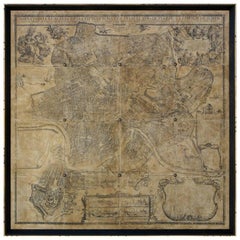
Map of Rome
Located in Los Angeles, CA
A reproduction of an antique map of Rome. Can be sold framed or unframed.
Category
2010s American Victorian Drawings
Materials
Wood, Paper
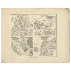
Antique Map of Rome and Athens by Perthes, 1848
Located in Langweer, NL
Antique map titled 'Roma Vetus, Athenae, Urbs, Campus Trojae'. Old map of Rome, Athens and
Category
Antique 19th Century Maps
Materials
Paper
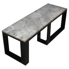
Tom Lollar and Jane Manus "Map of Rome" Rectangular Coffee Table, 2010
By Thomas W. Lollar, Jane Manus
Located in New York, NY
Contemporary artists Tom Lollar and Jane Manus' "Map of Rome" Rectangular Coffee Table. Hand-carved
Category
21st Century and Contemporary American Modern Coffee and Cocktail Tables
Materials
Marble, Aluminum
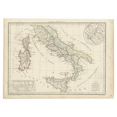
Antique Map of Italy with an Inset of Rome, 1812
Located in Langweer, NL
of Rome. This map originates from 'Atlas Supplementaire du Precis de la Geographie Universelle de M
Category
Antique 19th Century Maps
Materials
Paper
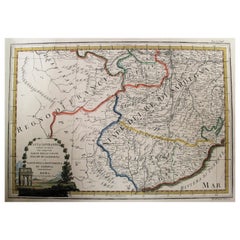
Map of the Kingdom of Sardinia and Part of the Kingdom of Genoa, Rome
By Giovanni Maria Cassini
Located in Hamilton, Ontario
18th century map by Italian engraver Giovanni Maria Cassini (Italy 1745-1824). Map of Part of the
Category
Antique 18th Century Italian Maps
Materials
Paper
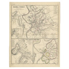
Detailed Original Antique Map of the Region of Rome in Italy, c.1870
By Heinrich Kiepert
Located in Langweer, NL
Antique map titled 'Roma Urbs'. Old map of Italy, it shows three inset maps of the region of Rome
Category
Antique 19th Century Maps
Materials
Paper
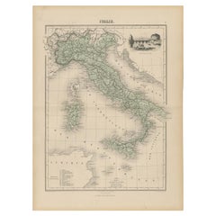
Antique Map of Italy with Vignette of Saint Angu Castle in Rome, 1880
Located in Langweer, NL
Saint Angu castle in Rome. This map originates from 'Géographie Universelle Atlas-Migeon' by J. Migeon
Category
Antique 19th Century Maps
Materials
Paper
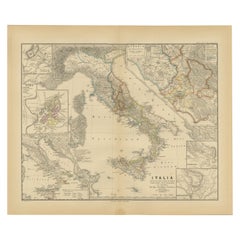
Antique Map of Italy with Insets of Rome and Major Cities, Published in 1880
Located in Langweer, NL
locales, such as a detailed plan of Rome, showcasing the city's layout during the Roman era.
The map is
Category
Antique 1880s Maps
Materials
Paper
No Reserve
H 15.56 in W 18.51 in D 0 in
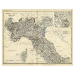
Old Coloure Map of North & Central Italy & Corsica with an Inset of Rome, c.1860
Located in Langweer, NL
Central Italy, and the island of Corsica. With an inset map of the region of Rome. Originates from 'The
Category
Antique 1860s Maps
Materials
Paper
H 19.38 in W 24.41 in D 0 in
Old Map of Ancient Rome Illustrating Major Monuments and the Seven Hills, c.1704
Located in Langweer, NL
Antique map Rome titled 'Omnia Romanae cedant Miracula Terrae (..)'. Map of Ancient Rome
Category
Antique 18th Century Maps
Materials
Paper
H 9.65 in W 14.18 in D 0 in
Ancient Italy: Regions and Rome in the Roman Empire, Published in 1880
Located in Langweer, NL
. **Inset Map of Rome (ROMA)**: There is an inset map of ancient Rome, with color-coding to highlight
Category
Antique 1880s Maps
Materials
Paper
No Reserve
H 15.56 in W 18.51 in D 0 in
Antique Map of The City of Rome by Sebastian Münster, 1549
By Sebastian Münster
Located in Larchmont, NY
Sebastian Münster (German, 1488-1552)
LA SITUATION DE LA VILLE DE ROME
Antique Map of Rome, 1549
Category
1960s Realist Figurative Prints
Materials
Woodcut
Antique Map of Italy and Corsica, c.1860
Located in Langweer, NL
Central Italy, and the island of Corsica. With an inset map of the region of Rome. Originates from 'The
Category
Antique 19th Century Maps
Materials
Paper
Antique Map of the East Indies by Rossi, 1683
Located in Langweer, NL
-seventeenth century it was the best-known printing house in Rome. For his maps, Giovanni worked with Giacomo
Category
Antique 17th Century Maps
Materials
Paper
Original Antique Plan of the Harbor of Nettuno, Near Rome, by Munster, c.1580
By Sebastian Münster
Located in Langweer, NL
Antique map titled 'Der Statt Neptun (.).' Detailed plan of the Harbor of Nettuno, near Rome, from
Category
Antique 16th Century Maps
Materials
Paper
H 12.6 in W 8.15 in D 0 in
Original Copper Engraving of a Map of Syria and Lebanon, 1698
Located in Langweer, NL
Antique map titled 'Syriae, sive Soriae, Nova et Accurata Descriptio.'
Map of Syria and Lebanon
Category
Antique 1690s Maps
Materials
Paper
Free Shipping
H 12.41 in W 14.45 in D 0 in
Antique Italian Map of Viaggio da Roma a Napoli 1775
Located in Roma, IT
An original print from 1775 showing an early route map of the journey from Rome to Naples. This
Category
Antique 1770s Italian Maps
Materials
Parchment Paper
Map of The Italian Peninsula with the islands of Sicily, Sardinia, Corsica, 1880
Located in Langweer, NL
military campaigns, which were instrumental in Rome's expansion.
This map would be particularly useful for
Category
Antique 1880s Maps
Materials
Paper
Free Shipping
H 15.56 in W 18.51 in D 0 in
Remarkable Antique Map of West Europe by Scherer, circa 1703
Located in Langweer, NL
Antique map of Western Europe. Depicting Bergen, Stockholm, Dublin, Paris, Wien, Madrid, Rome
Category
Antique 18th Century Maps
Materials
Paper
Antique Map of Northern Italy by J. Tallis, circa 1851
Located in Langweer, NL
A highly decorative mid-19th century map of Northern Italy which was drawn and engraved by John
Category
Antique Mid-19th Century Maps
Materials
Paper
Scarce Map of the Mediterranean and Parts of Europe, Africa & Middle East, 1725
Located in Langweer, NL
Antique map titled: Byzondere afbeelding der landschappen, van de Apostelen bevaren en doorwandelt
Category
Antique 1720s Maps
Materials
Paper
H 15.75 in W 18.51 in D 0 in
Antique Map of Western Europe and Spain by Scherer, circa 1703
Located in Langweer, NL
Untitled map of Western Europe and Spain. Depicting Rome, Edinburgh, Paris, Madrid, Stockholm and
Category
Antique 18th Century Maps
Materials
Paper
Large Italian Map of Islands of Oceania, incl Papua, Timor, Banda, Ceram, 1855
Located in Langweer, NL
Description: Antique map titled 'Carta di una parte dell'Oceania'. Beautiful large map of the
Category
Antique 1850s Maps
Materials
Paper
H 29.14 in W 21.26 in D 0 in
Rare Antique Bible Map of Southern Europe by A. Schut, 1743
Located in Langweer, NL
Rome. This map originates from ‘Biblia Sacra, dat is, de H. Schriftuer van het Oude, en het Nieuwe
Category
Antique Mid-18th Century Maps
Materials
Paper
18th Century Map of the Southern Balkans by Giovanni Maria Cassini
By Giovanni Maria Cassini
Located in Hamilton, Ontario
18th century map by Italian engraver Giovanni Maria Cassini (Italy 1745-1824).
Map of the Southern
Category
Antique 18th Century Italian Maps
Materials
Paper
Antique Map of North and Central Italy and the Island of Corsica, c.1860
Located in Langweer, NL
Central Italy, and the island of Corsica. With an inset map of the region of Rome. Originates from 'The
Category
Antique 19th Century Maps
Materials
Paper
Original Italian Antique Map of Asia Minor and Cyprus and Neighboring Regions
Located in Langweer, NL
century it was the best-known printing house in Rome.
For his maps, Giovanni worked with Giacomo
Category
Antique Late 17th Century Maps
Materials
Paper
H 19.02 in W 24.22 in D 0.02 in
Imperium Romanum: A Detailed Map of the Roman Empire in its Zenith, 1880
Located in Langweer, NL
This original antique map, titled "IMPERIVM ROMANVM", is a detailed depiction of the Roman Empire
Category
Antique 1880s Maps
Materials
Paper
Free Shipping
H 15.56 in W 18.51 in D 0 in
Antique Map of Oceania and the Pacific Ocean, Australia and New Zealand, 1826
Located in Langweer, NL
Geneva, Venice, and Rome. Walch published several atlases and sheet maps. As with his atlases, many of
Category
Antique 19th Century Maps
Materials
Paper
H 8.47 in W 9.85 in D 0 in
Antique Map of the Danube River and Surroundings by Homann Heirs, c.1730
By Homann Heirs
Located in Langweer, NL
Antique map titled 'Danubii Fluminus (a fontibus prope Doneschingam usq Posonium urbem defignati
Category
Antique 18th Century Maps
Materials
Paper
H 21.15 in W 25.01 in D 0 in
1847 “World at One View” Antique Hand-Colored Wall Map of the World
Located in Colorado Springs, CO
This is a highly desirable hanging wall map of the "World at One View", published in 1847 by Ensign
Category
Antique 19th Century American Maps
Materials
Paper
Highly Decorative Map of The Eastern Mediterranean and The Middle East, ca.1700
Located in Langweer, NL
from Jerusalem to Rome. The map is filled with mountains, forests, and oases, and is decorated with a
Category
Antique Early 1700s Maps
Materials
Paper
Free Shipping
H 16.74 in W 19.89 in D 0 in
Old Map of Mediterranean Powers: Pompey to Actium (66-31 BC), Published in 1880
Located in Langweer, NL
This is a historical map that depicts the Mediterranean region during a specific timeframe in Roman
Category
Antique 1880s Maps
Materials
Paper
Free Shipping
H 15.56 in W 18.51 in D 0 in
Antique Detailed Map of Jerusalem in Israël with Extensive Key and Scale, 1698
Located in Langweer, NL
Antique map titled 'Jerusalem.'
Plan of the ancient city of Jerusalem. With extensive key and
Category
Antique 17th Century Maps
Materials
Paper
H 15.16 in W 12.01 in D 0 in
Black Sea in Antiquity: Pontus Euxinus Map, Published in 1880
Located in Langweer, NL
This map, titled "PONTUS EUXINUS," depicts the Black Sea region, historically known as the Pontus
Category
Antique 1880s Maps
Materials
Paper
Free Shipping
H 15.56 in W 18.51 in D 0 in
Ancient Realms of Northeast Africa: Arabia, Ethiopia, and Egypt, Published 1880
Located in Langweer, NL
This map, titled "ARABIA, AETHIOPIA, AEGYPTUS," illustrates the regions of ancient Arabia, Ethiopia
Category
Antique 1880s Maps
Materials
Paper
Free Shipping
H 15.56 in W 18.51 in D 0 in
The Roman Empire from the Time of Constantine the Great, Published in 1880
Located in Langweer, NL
Antique map titled: "IMPERIUM ROMANORUM inde a Constantini Magni tempore," which translates to "The
Category
Antique 1880s Maps
Materials
Paper
No Reserve
H 15.56 in W 18.51 in D 0 in
Atlas of Fernão Vaz Dourado / One-Time Only Limited Edition Facsimile
Located in BARCELONA, ES
tanned leather.
In the mid-16th century, while Rome, Venice, Leuven and Antwerp printed hundreds of
Category
2010s Portuguese Renaissance Maps
Materials
Leather
Free Shipping
H 23.23 in W 16.54 in D 2.37 in
Panoramic Antique View of Bandar-Abbas 'Formerly Gamron, Persia' in Iran, 1714
Located in Langweer, NL
. Best known as a landscape artist, Le Bruyn travelled widely from a young age to Vienna, on to Rome then
Category
Antique 1710s Maps
Materials
Paper
H 6.7 in W 15.16 in D 0 in
North African Coasts: Marmarica to Mauretania in Roman Times, Published in 1880
Located in Langweer, NL
The map with the title "MARMARICA, CYRENAICA, AFRICA, NUMIDIA, MAURETANIA secundum Italiam Poetarum
Category
Antique 1880s Maps
Materials
Paper
Free Shipping
H 15.56 in W 18.51 in D 0 in
Roman Balkans: Pannonia, Illyricum, Dacia, Moesia, Thracia, Macedonia and Thyris
Located in Langweer, NL
This original antique map showcases the Roman provinces in the Balkan region and parts of Central
Category
Antique 1880s Maps
Materials
Paper
Free Shipping
H 15.56 in W 18.51 in D 0 in
Plates of Old Testament- Etching by Antonio Tempesta - 17th Century
By Antonio Tempesta
Located in Roma, IT
, frescoing some maps of Rome in the Vatican, including the famous Map of Rome (1593). In the pontifical
Category
17th Century Modern Figurative Prints
Materials
Etching
H 25.6 in W 33.47 in D 0.6 in
Old Testament Plates - Original Etching by Antonio Tempesta - 17th Century
By Antonio Tempesta
Located in Roma, IT
, frescoing some maps of Rome in the Vatican, including the famous Map of Rome (1593). In the pontifical
Category
17th Century Modern Figurative Prints
Materials
Etching
H 21.66 in W 29.73 in D 0.79 in
Roman Hills, Aqueducts and Roads: An Early 18th Century Map by Jan Goeree
Located in Alamo, CA
This richly engraved map of Rome and its environs entitled "Urbis Cum Vicis Seu Pagis Adiacentibus
Category
Early 18th Century Old Masters Landscape Prints
Materials
Engraving
Dog - Etching by Antonio Tempesta - 1610s
By Antonio Tempesta
Located in Roma, IT
, frescoing some maps of Rome in the Vatican, including the famous Map of Rome (1593). In the pontifical
Category
Early 17th Century Figurative Prints
Materials
Etching
Dog - Etching by Antonio Tempesta - 1610s
By Antonio Tempesta
Located in Roma, IT
, frescoing some maps of Rome in the Vatican, including the famous Map of Rome (1593). In the pontifical
Category
Early 17th Century Figurative Prints
Materials
Etching
The Horse - Etching by Antonio Tempesta - 1610s
By Antonio Tempesta
Located in Roma, IT
worked for Pope Gregory XIII, frescoing some maps of Rome in the Vatican, including the famous Map of
Category
Early 17th Century Figurative Prints
Materials
Etching
H 13.39 in W 19.69 in D 0.04 in
Goat - Etching by Antonio Tempesta - 1610s
By Antonio Tempesta
Located in Roma, IT
, frescoing some maps of Rome in the Vatican, including the famous Map of Rome (1593). In the pontifical
Category
Early 17th Century Figurative Prints
Materials
Etching
The Buffalo - Etching by Antonio Tempesta - 1610s
By Antonio Tempesta
Located in Roma, IT
worked for Pope Gregory XIII, frescoing some maps of Rome in the Vatican, including the famous Map of
Category
Early 17th Century Figurative Prints
Materials
Etching
H 13.39 in W 19.69 in D 0.04 in
The Horse - Etching by Antonio Tempesta - 1610s
By Antonio Tempesta
Located in Roma, IT
Palazzo Vecchio.
Moving to Rome in 1573, he worked for Pope Gregory XIII, frescoing some maps of Rome in
Category
Early 17th Century Figurative Prints
Materials
Etching
H 13.39 in W 19.69 in D 0.04 in
The Horse - Etching by Antonio Tempesta - 1610s
By Antonio Tempesta
Located in Roma, IT
Palazzo Vecchio.
Moving to Rome in 1573, he worked for Pope Gregory XIII, frescoing some maps of Rome in
Category
Early 17th Century Figurative Prints
Materials
Etching
H 13.39 in W 19.69 in D 0.04 in
The Monkey - Etching by Antonio Tempesta - 1610s
By Antonio Tempesta
Located in Roma, IT
, frescoing some maps of Rome in the Vatican, including the famous Map of Rome (1593). In the pontifical
Category
Early 17th Century Figurative Prints
Materials
Etching
H 13.39 in W 19.69 in D 0.04 in
The Fawn - Etching by Antonio Tempesta - 1610s
By Antonio Tempesta
Located in Roma, IT
.
Moving to Rome in 1573, he worked for Pope Gregory XIII, frescoing some maps of Rome in the Vatican
Category
Early 17th Century Figurative Prints
Materials
Etching
H 13.39 in W 19.69 in D 0.04 in
Ox - Etching by Antonio Tempesta - 1610s
By Antonio Tempesta
Located in Roma, IT
Palazzo Vecchio.
Moving to Rome in 1573, he worked for Pope Gregory XIII, frescoing some maps of Rome in
Category
Early 17th Century Figurative Prints
Materials
Etching
Bull - Etching by Antonio Tempesta - 1610s
By Antonio Tempesta
Located in Roma, IT
Palazzo Vecchio.
Moving to Rome in 1573, he worked for Pope Gregory XIII, frescoing some maps of Rome in
Category
Early 17th Century Figurative Prints
Materials
Etching
Dog - Etching by Antonio Tempesta - 1610s
By Antonio Tempesta
Located in Roma, IT
, frescoing some maps of Rome in the Vatican, including the famous Map of Rome (1593). In the pontifical
Category
Early 17th Century Figurative Prints
Materials
Etching
Mule - Etching by Antonio Tempesta - 1610s
By Antonio Tempesta
Located in Roma, IT
, frescoing some maps of Rome in the Vatican, including the famous Map of Rome (1593). In the pontifical
Category
Early 17th Century Figurative Prints
Materials
Etching
Dog - Etching by Antonio Tempesta - 1610s
By Antonio Tempesta
Located in Roma, IT
, frescoing some maps of Rome in the Vatican, including the famous Map of Rome (1593). In the pontifical
Category
Early 17th Century Figurative Prints
Materials
Etching
Dog - Etching by Antonio Tempesta - 1610s
By Antonio Tempesta
Located in Roma, IT
, frescoing some maps of Rome in the Vatican, including the famous Map of Rome (1593). In the pontifical
Category
Early 17th Century Figurative Prints
Materials
Etching
The Donkey - Etching by Antonio Tempesta - 1610s
By Antonio Tempesta
Located in Roma, IT
worked for Pope Gregory XIII, frescoing some maps of Rome in the Vatican, including the famous Map of
Category
Early 17th Century Figurative Prints
Materials
Etching
H 13.39 in W 19.69 in D 0.04 in
- 1
Get Updated with New Arrivals
Save "Map Of Rome", and we’ll notify you when there are new listings in this category.
Map Of Rome For Sale on 1stDibs
Choose from an assortment of styles, material and more with respect to the map of rome you’re looking for at 1stDibs. A map of rome — often made from paper and wood — can elevate any home. There are 9 variations of the antique or vintage map of rome you’re looking for, while we also have 2 modern editions of this piece to choose from as well. Your living room may not be complete without a map of rome — find older editions for sale from the 18th Century and newer versions made as recently as the 21st Century. A map of rome, designed in the Victorian style, is generally a popular piece of furniture. A well-made map of rome has long been a part of the offerings for many furniture designers and manufacturers, but those produced by Giovanni Maria Cassini and Heinrich Kiepert are consistently popular.
How Much is a Map Of Rome?
Prices for a map of rome can differ depending upon size, time period and other attributes — at 1stDibs, they begin at $173 and can go as high as $3,800, while the average can fetch as much as $795.
Questions About Map Of Rome
- 1stDibs ExpertApril 5, 2022The Piazza di Spagna Dolce & Gabbana is open and its hours are from 10:30am to 7:30pm, seven days a week. On 1stDibs, find a collection of authentic Dolce & Gabbana pieces from some of the world’s top sellers, all from the comfort of your home.
More Ways To Browse
Dolce Gabbana Silk
Pearl Button
Tall Paneled French Doors
Oak Architectural Panel
Painted Wood Ceiling
Japanese Ceramic Table
Used Lava Lamp
Used Lava Lamps
Commercial Door
French Panel Room Divider
Small Ceramic Table Light
Long Chinese Cabinet
Scholar Table
Antique Italian Safe
Chinese Wood Glass Doors
English 19th Century Picture Frame
Antique Style Ceiling Light
Baroque Ceiling
