Maps
321
5,426
3
2
to
1,145
5,184
240
5,431
5,431
5,431
48
34
16
9
7
6
5
4
4
2
1
1
1
2,892
2,122
412
5
228
31
11
84
7
57
7
3
3
4
5
2
5,344
88
31
31
25
477
263
170
117
110
106
63
28
26
16
Maps For Sale
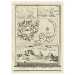
Old Print with a View of the Cape of Good Hope and Table Bay, South Africa, 1750
Located in Langweer, NL
Antique print titled 'Gezigt van de Kaap de Goede-Hoop'.
Old print with a view of the Cape of Good Hope and Table Bay. Engraved by J. van Schley for a Du...
Category
1750s Antique Maps
Materials
Paper
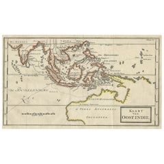
Map of The East Indies with the Route of Capt. William Dampier's Voyage, 1698
Located in Langweer, NL
Antique map titled 'Kaart van Oost Indie'.
Old map of the East Indies. It shows the routes of Captain William Dampier's voyage throughout the regio...
Category
1690s Antique Maps
Materials
Paper
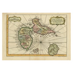
Antique Map of Guadeloupe, Island in the Caribbean, c.1757
Located in Langweer, NL
Antique map titled 'Carte de L'Isle de la Guadeloupe'.
A very decorative map of Guadeloupe in the Caribbean, adorned with rhumb lines, fleur-de-lys, and two decorative rococo-style...
Category
18th Century Antique Maps
Materials
Paper
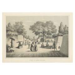
Original Antique Print of a Street Scene in Naha, Okinawa in Japan, 1856
Located in Langweer, NL
Antique print titled ‘Street in Napha Lew-Chew'.
Antique print of a street scene in Naha, the capital city of the Okinawa Prefecture, Japan. Okinawa used to be called Great Lew C...
Category
1850s Antique Maps
Materials
Paper
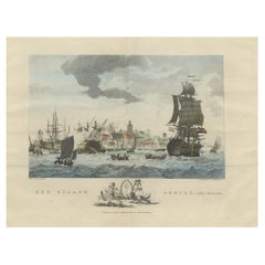
Beautiful View of Pulau 'Island' Onrust, Batavia 'Jakarta, Indonesia', ca.1805
Located in Langweer, NL
Antique print titled 'Het Eiland Onrust'. Beautiful view of the sea near Onrust Island, also known as Pulau Onrust or Pulau Kapal (ship island), Indonesia. Published by E. Maaskamp, ...
Category
Early 1800s Antique Maps
Materials
Paper
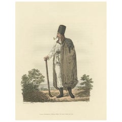
Original Hand-Colored Antique Costume Print of a Peasant from Hungary, 1804
Located in Langweer, NL
Old print of a Hungarian peasant. This print originates from 'The Costume of the Hereditary States of the House of Austria' by William Miller.
Artists and Engravers: Engraved by William Ellis.
Category
Early 1800s Antique Maps
Materials
Paper
Antique Map of Modern Day Ukraine and Russia Titled Moscovie 'Moscow', Ca.1683
Located in Langweer, NL
Antique map of modern day Ukraine and Russia titled ‚Moscovie‘. Miniature map of the Moscovia region by A.M. Mallet.
Artists and Engravers: Alain Manneson Mallet (1630-1706) spent...
Category
1680s Antique Maps
Materials
Paper
Ancient Babylon with The Tower of Babel According to Herodotus & Kircherus, 1730
Located in Langweer, NL
Antique print titled 'Platte Grond van de Stad Babilon, volgens Herodotus en A. Kircherus'.
This original antique print shows a view of ancient Babylon with the tower of Babel...
Category
1730s Antique Maps
Materials
Paper
Historical Antique Map of Russia, Examining the History of Russia, 1838
Located in Langweer, NL
Antique map titled 'Sketch of the acquisitions of Russia since the Accession of Peter 1st to the Throne'.
Historical map of Russia, examining the history o...
Category
1830s Antique Maps
Materials
Paper
Large Antique Map of Gaul under Roman Rule, ca.1760
Located in Langweer, NL
Antique map titled 'Gallia Augustiniana in suas provincias divisa (..)'. Large antique map of Roman Gaul, it refers to Gaul under provincial rule in ...
Category
1760s Antique Maps
Materials
Paper
The Biblical Kingdom of Israel under the Kings Saul, David and Solomon, Ca.1758
Located in Langweer, NL
Antique map titled 'De IVde Landkaart vertoonende het Koningryk Israels benevens deszelfs overheerde Landschappen (..).'
Map of the biblical Kingdom of Israel under the Kings Sau...
Category
1750s Antique Maps
Materials
Paper
Old Steel Engraved Map of the Western Part of the Madras Presidency, 1831
Located in Langweer, NL
Antique map titled 'India II Madras Presidency'.
Old steel engraved map of the western part of the Madras Presidency. The Madras Presidency, or the Presidency of Fort St. George, a...
Category
1830s Antique Maps
Materials
Paper
Antique Print of the Bolshoi Theatre in Saint Petersburg, Russia, ca.1810
Located in Langweer, NL
Description: Antique print titled 'The Stone Theatre at St. Petgersbourg'. View ofthe Bolshoi Theatre in Saint Petersburg, Russia. In 1886 the building was declared unsafe and, at th...
Category
1810s Antique Maps
Materials
Paper
Antique Map Made After a Roman Papyrus Travel Map, Known as Peutinger Map, 1773
Located in Langweer, NL
Old Dutch engraving with title: 'Romeinsche Reis Kaart van K. Peutinger'.
Rare antique map based on the original 'Peutinger' map, the map has the shape of papyrus scrolls. Originat...
Category
18th Century Antique Maps
Materials
Paper
Original Antique Map the Imperial States of the Habsburg Netherlands, 1609
Located in Langweer, NL
Antique map titled 'Belgii inferioris descriptio (..)'.
Old map of the Seventeen Provinces, the Imperial states of the Habsburg Netherlands in the 16th century. They roughly cove...
Category
Early 1600s Antique Maps
Materials
Paper
Original Antique Map of Hungary and Transylvania 'Modern Day Romania', C.1710
Located in Langweer, NL
Antique map titled 'Hungary and Transilvania'.
Original antique map of Hungary and Transylvania (modern day Romania), centered on Budapest.
Artists and Engravers: Herman Moll ...
Category
1710s Antique Maps
Materials
Paper
Antique Map of the Island of Tahiti, Polynesia, 1803
Located in Langweer, NL
Antique map Tahiti titled 'Kaart van het Eiland Otahiti'.
Antique map of the Island of Tahiti, Polynesia. Originates from 'Reizen Rondom de Waereld door James Cook (..)'.
Art...
Category
Early 1800s Antique Maps
Materials
Paper
Highly Decorative Map of The Eastern Mediterranean and The Middle East, ca.1700
Located in Langweer, NL
Antique map titled 'Byzondere Kaart van de Landen Daar de Apostelen Het Evangelium Gepredikt Hebben (..).'
Highly decorative map of the eastern Mediterranean...
Category
Early 1700s Antique Maps
Materials
Paper
Antique Map of Edom, an Ancient Kingdom in Transjordan, 1773
Located in Langweer, NL
Antique print titled 'Idumea, of thet Land der Philistynen'. Old map of Edom, an ancient kingdom in Transjordan located between Moab to the northeast, the Arabah to the west and the ...
Category
18th Century Antique Maps
Materials
Paper
Old Map of the Great Lakes and Upper Mississippi Valley, Northern America, c1780
Located in Langweer, NL
Antique map titled 'Partie Occidentale du Canada'.
A fine example of Rigobert Bonne and Guilleme Raynal's 1780 map of the Great Lakes and upper Mississippi Valley.
A map of c...
Category
1780s Antique Maps
Materials
Paper
Original Antique Map of the Northwestern Part of Russia in Europe, 1753
Located in Langweer, NL
Antique map titled 'Partie septentrionale de la Russie Européenne'.
Detailed map of the Northwestern part of Russia, from the Gulf of Finland and Poland, to the western part of Asian Russia.
Artists and Engravers: Gilles Robert de Vaugondy (1688-1766) was the head of a leading family of geographers in eighteenth century France. Gilles got his start when he jointly inherited the shop of Pierre-Moullart Sanson, grandson of the famous geographer Nicholas Sanson. The inheritance included the business, its stock of plates, and a roller press...
Category
1750s Antique Maps
Materials
Paper
Antique Chart of the Banda Islands or The Spice Islands, Indonesia, 1726
Located in Langweer, NL
Antique map titled 'Nieuwe Caart der Eylanden van Banda'.
Beautiful chart of the Banda Islands including Banda Api, Banda Neira, Banda Besar, Pulau Hatta (Rosengain), Pulau Ai an...
Category
1720s Antique Maps
Materials
Paper
Antique Print of the Stowe House in Stowe, Buckinghamshire, England, c.1785
Located in Langweer, NL
Antique print titled 'Plan actuel du Chateau de Stowe'.
Copper engraving showing a plan and elements of the Stowe House.
Stowe House is a grade I l...
Category
18th Century Antique Maps
Materials
Paper
Old Original Hand-Colored Print of a Peasant of Little Russia, 1804
Located in Langweer, NL
Old print of a peasant of Little Russia.
This print originates from 'The Costume of the Hereditary States of the House of Austria' by William Miller....
Category
Early 1800s Antique Maps
Materials
Paper
Original Antique Print of Byzantine Decorative Art, 1869
Located in Langweer, NL
Old print of Byzantine decorative art. This print originates from 'L'Ornement polychrome'. A beautiful work containing about 2000 patterns of all the styles of Art old and Asian, mid...
Category
19th Century Antique Maps
Materials
Paper
Antique Map of France by Kitchin, c.1770
Located in Langweer, NL
Antique map titled 'France'. Original antique map of France. Source unknown, to be determined.
Artists and Engravers: Thomas Kitchin (or Thomas Kitchen (1718 - 1784) was an Englis...
Category
18th Century Antique Maps
Materials
Paper
Old Engraved Map of Hungary, European Balkan Countries, Greece and Crete, 1806
Located in Langweer, NL
Antique map titled 'Hongrie, Turquie Europe'.
Decorative map of Hungary, southeast European countries in the Balkan peninsula and Greece by Robert de Vaugondy, revised and publis...
Category
19th Century Antique Maps
Materials
Paper
Château de Versailles 'Paris, France' with a View from the Park/Garden, 1861
Located in Langweer, NL
Antique print titled 'Château de Versailles'.
This print depicts Versailles (Paris, France) with a view from the park/garden. This print originates from 'Paris dans sa splendeur'...
Category
1860s Antique Maps
Materials
Paper
Rare Antique Copper Engraving of a Map of Pegu and Arakan, Burma (Myanmar), 1714
Located in Langweer, NL
Antique map Myanmar (Birma) titled 'Les Royaumes de Pegu et d'Aracan'.
Rare map of Pegu and Arakan made after a map engraved by Pieter van den Keere and published in the 1628 edi...
Category
1710s Antique Maps
Materials
Paper
Antique Map of Asia Showing Its Political Divisions, 1874
Located in Langweer, NL
Antique map titled 'Map of Asia showing its Gt. Political Divisions and also the various routes of Travel between London & India, China & Japan & c'. This map covers from the Arabian...
Category
19th Century Antique Maps
Materials
Paper
Antique Map of Brazil of Southern Brazil, Uruguay, and Northern Argentina, c1780
Located in Langweer, NL
Antique map titled 'Carte de la Partie Méridionale du Bresil (..)'. This antique map of Brazil depicts southern Brazil, Uruguay, and northern Argentina, including Rio de Janeiro, Montevideo, and Buenos Aires. Published by R. Bonne.
Artists and engravers: Rigobert Bonne (October 6, 1727 - September 2, 1794) was one of the most important French cartographers of the late 18th century. Bonne was born in Ardennes à Raucourt, France. He taught himself mathematics and by eighteen was a working engineer. During the War of the Austrian Succession...
Category
1780s Antique Maps
Materials
Paper
Danube River Incl Serbia, Moldavia, Transylvania, Romania, Bulgaria Etc, ca.1720
Located in Langweer, NL
Antique map titled 'Danubii Fluminis (..)'.
Regional map of the Donau river, Shows the Danube river from Belgrade in Serbia, along the border between ...
Category
1720s Antique Maps
Materials
Paper
Old Bird's Eye View of the European Trading Posts at Sabi, Benin, Africa, 1748
Located in Langweer, NL
Antique print titled 'Vue des comtoirs Europeins de Xavier ou Sabi (..) - Gezigt der Europese Faktooryen, te Xavier of Sabi (..)'.
Bird's eye view of the European trading posts a...
Category
1740s Antique Maps
Materials
Paper
Old Map of Indonesian Islands Borneo, Celebes, New Guinea & New Britain, 1792
Located in Langweer, NL
Antique map titled 'Partie de la Nouvelle Grande Carte des Indes Orientales, contenant les Isles de Borneo, Iava, Celebes, Mindanao (..)'.
Detailed map of the Indonesian islands Bo...
Category
1790s Antique Maps
Materials
Paper
Colourful Old Map of the Austrian Empire, with an Inset Map of Vienna, 1846
Located in Langweer, NL
Antique map titled 'Austrian Empire'.
Old map of the Austrian Empire, with an inset map of Vienna. This map originates from 'A New Universal Atlas Co...
Category
1840s Antique Maps
Materials
Paper
Beautiful Antique Map of the Moluccas or Spice Islands, Indonesia, ca.1650
Located in Langweer, NL
Antique map titled 'Insularum Moluccarum Nova Descriptio.'
Beautiful map of the Moluccas. The famous Spice Islands, the cornerstone of the Dutc...
Category
1650s Antique Maps
Materials
Paper
Original Copperplate Engraved Detailed Map of South Africa, ca.1680
Located in Langweer, NL
Antique map titled 'Pays et Coste des Caffres Empires de Monomotapa (..)'.
Detailed map of South Africa. Engraved by Antoine d'Winter for a Dutch edition of Sanson's pocket atlas...
Category
1680s Antique Maps
Materials
Paper
Antique Map of Cuba, Haiti and Porto Rico by W. G. Blackie, 1859
Located in Langweer, NL
Antique map titled 'The Leeward or North Caribbean Islands'. Original antique map of Cuba, Haiti and Porto Rico. This map originates from ‘The Imperial Atla...
Category
Mid-19th Century Antique Maps
Materials
Paper
Antique Map of the Siege of Syracuse, Sicilia, Italy, 'ca.1675'
Located in Langweer, NL
Antique map titled 'Syracus beseeged by the Athenians.' This original uncommon antique map shows the siege of Syracuse, Italy, by the Athenians. Key top left.
The siege of Syracus...
Category
1670s Antique Maps
Materials
Paper
Engraving of Amalia, Princess of Orange, 1757
Located in Langweer, NL
Rare antique portrait ( proof print circa 1750) with title Amelia, Gravinne van Solms, gemalinne van Frederik Hendrik, Prins van Oranje etc.
Engraving of Amalia, Princess of Orange. Half length with curled hair with pearl ropes, pearl earrings and necklace, low gown, and jewelled bodice.
Artists and Engravers: Jakob Houbraken was a very productive Dutch 18th century engraver...
Category
1750s Antique Maps
Materials
Paper
Antique Engraved Map of Hungary and Transylvania or Romania, c.1710
Located in Langweer, NL
Antique map titled 'Hungary and Transilvania'. Original antique map of Hungary and Transylvania (modern day Romania), centered on Budapest. Artists and ...
Category
18th Century Antique Maps
Materials
Paper
Steel Engraved Map of Part of the Bengal Presidency 'India & Bangladesh', 1831
Located in Langweer, NL
Antique map titled 'India Bengal Presidency'. Old steel engraved map of part of the Bengal Presidency. The Bengal Presidency (1757–1912), later reorganized as the Bengal Province (19...
Category
1830s Antique Maps
Materials
Paper
Decorative Original Antique Print Depicting the Cavalry Marching in China, 1665
Located in Langweer, NL
Antique print titled ‘Kryghs-Ordre in het Marseren. L’Ordre de la Cavallerie en Marchant’.
Decorative print depicting the cavalry. This print originates from ‘Joan Nieuhof, Het G...
Category
1660s Antique Maps
Materials
Paper
Original Hand-Coloured Nautical Chart of West-Africa, c.1680
Located in Langweer, NL
NIEUWE PASKAERT VAN DE KUST VAN GENEHOA (Senegal) alsmede een gedeelte van Gambia beginnende an C. Blanco tot C. Verde (...). Amsterdam, Johannus van Keulen, c. 1680.
Large folio...
Category
17th Century Antique Maps
Materials
Paper
Antique Map of Greece and Crete, Rhodus and A Part of Asia Minor , ca. 1730
Located in Langweer, NL
Antique engraved map of Greece.
Title: "GRÆCIÆ ANTIQUÆ Tabula Nova".
Year: c. 1730.
Coloured engraved map by G. Delisle of Greece and Part of the Aegean.
Condition is good. Sm...
Category
1720s Antique Maps
Materials
Paper
Antique Print of Ornamental Decorations of Door & Ceiling of a Paris Hotel, 1877
Located in Langweer, NL
Antique print titled 'Antichambre. Hotel rue du Faubg. St. Honore No. 131. a Paris. Face du cote de la Porte et Plafond. Par M. M. Croiseau et Letrosne, architectes et Denuelle, pein...
Category
19th Century Antique Maps
Materials
Paper
Print of Various Ceremonies 'Marriage, Funeral, Baptism, Magic' of Finland, 1726
Located in Langweer, NL
Antique print titled 'Mariage des Lapons (..)'.
Old print of various ceremonies (marriage, funeral, baptism, magic) of Finland. This print originates from 'Ceremonies et costumes...
Category
1720s Antique Maps
Materials
Paper
Detailed Original Antique Plan of the City and Fort of Malacca, Malaysia, 1764
Located in Langweer, NL
Description: Antique map titled 'Plan de la Ville et Forteresse de Malaca'. Detailed plan of the city and fort of Malacca on the southern Malay Peninsula, commanding the strategic st...
Category
1760s Antique Maps
Materials
Paper
Colourful Antique Map of England and Wales Divided in Counties, 1854
Located in Langweer, NL
Antique map titled 'A Map Shewing the Places in England & Wales Sending Members to Parliament with the numbers returned, divisions of counties and population, places of county electi...
Category
19th Century Antique Maps
Materials
Paper
Original Antique Map Covering the Russian Empire in Asia, 1880
Located in Langweer, NL
Antique map titled 'Sibérie ou Russie d'Asie'.
Migeon's map covers the Russian empire in Asia from european Russia and the Ural Mountains to the Bering Strait and from the Arctic...
Category
1880s Antique Maps
Materials
Paper
Vintage Framed United States Map
Located in New York, NY
Vintage aged paper map of the United States mounted on particle board and framed in a simple wooden frame.
Category
20th Century American Mid-Century Modern Maps
Materials
Wood, Paper
Antique Bird's-Eye Plan of Tutecoryn (Tuticorin or Thoothukudi), India, 1672
Located in Langweer, NL
Antique map, titled: 'Tutecoryn.'
Bird's-eye plan of map of Tutecoryn (Tuticorin or Thoothukudi), India. This map originates from 'Naauwkeurige Beschryvinge van Malabar en Choroman...
Category
1670s Antique Maps
Materials
Paper
Old Original Map of Pozzuoli Near Naples in the Campania Region, Italy, ca.1740
Located in Langweer, NL
Antique map titled 'Hic Jacent Puteolorum Bajarum (..)'. Old map of the region of Pozzuoli showing the topographic and architectural features of interest. Pozzuoli is a city and comu...
Category
1740s Antique Maps
Materials
Paper
Old Portrait of Henry Frederick, Prince of Wales, c.1750
Located in Langweer, NL
Antique portrait titled 'Henry, Prince of Wales, Son of K. James I'.
Old portrait of Henry Frederick. Henry Frederick, Prince of Wales (1594-1612) was the elder son of James VI and I, King of England and Scotland, and his wife, Anne of Denmark. Prince Henry was widely seen as a bright and promising heir to his father's thrones. However, at the age of 18, he predeceased his father when he died of typhoid fever. His younger brother Charles succeeded him as heir apparent to the English, Irish and Scottish thrones...
Category
1750s Antique Maps
Materials
Paper
Antique Map of Manipa and Other Maluku Islands, Indonesia, 1726
Located in Langweer, NL
Antique map titled 'Caart van het Eyland Manipa, Noessa-Laoet, Honimoa, Oma. Der Manipesen dracht, een Orangkaya van Manipa.'
Four maps of islands and two figures in native dress...
Category
18th Century Antique Maps
Materials
Paper
Old Handcolored Antique Map of Pays De Caux in Normandy, France, ca.1640
Located in Langweer, NL
Antique map titled 'Le Pais de Caux'.
Old map of Pays de Caux, France. Pays de Caux is an area in Normandy occupying the greater part of the French département of Seine Maritime ...
Category
1640s Antique Maps
Materials
Paper
Antique Map of Israel Filled with Biblical Scenes, Published in 1748
Located in Langweer, NL
Antique map Holy Land titled 'Het beloofde landt Canaan doorwandelt van onsen Saligmaker Jesu Christo neffens zyne Apostelen'.
Antique map of Israel ...
Category
1740s Antique Maps
Materials
Paper
Map of the West African coast from the North of Mauretania to Guinee, 1788
Located in Langweer, NL
Antique map titled 'Particular Map of the Western Coast of Africa, from Cape Blanco to Cape de Verga, and of the Course of the Rivers Senega and Gambia.'
Map of the African coast...
Category
1780s Antique Maps
Materials
Paper
Recently Viewed
View AllMore Ways To Browse
Antique Sailing Map
Antique Sailing Maps
Bay Area Antique Furniture
West Coat Of Arms
Greek Asia Minor
Hemisphere World Map
Speed Map
Antique Maps Canada
Antique Map Canada
Canada Antique Map
Malaysian Antique
West Indies Map
Blaeu World Map
Charing Cross
Antique Maps Of Canada
Bali Map
Antique Portuguese Plates
Map Of Brazil
