Maps
to
1,667
2,084
56
2,142
26
3
3
2
1
1
1
2,926
2,181
476
3
289
34
10
127
7
35
9
2
5
3
4
2
2,119
28
15
11
10
176
110
80
23
20
2,142
2,142
2,142
24
16
13
12
12
Maps For Sale
Period: Early 20th Century
Period: 18th Century
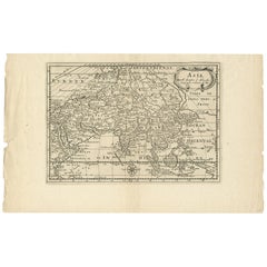
Antique Map of Asia by Sanson, circa 1705
Located in Langweer, NL
Dutch edition of Sanson's map of Asia. Shows a large, dramatic version of Terre de Jesso, drawn from the discoveries of the Maarten de Vries expedition of 1643.
Category
Early 18th Century Dutch Antique Maps
Materials
Paper
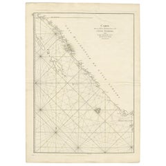
Antique Coastal Map of Sumatra by De La Haye, circa 1780
Located in Langweer, NL
Antique map titled 'Carte de la Côte Occidentale de l'Isle Sumatra'. Sea chart of the part of the south-western coast of Sumatra with the Nassau (Nias) and Fortune isles. Engraved by...
Category
Late 18th Century French Antique Maps
Materials
Paper
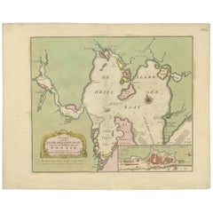
Antique Map of the Bahia Todos Santos 'Brazil' by Tirion, circa 1750
Located in Langweer, NL
Antique map titled 'Kaart Van De Aller-Heiligen Baay Waar aan de Hoofdstad legt van Brazil.', Detailed map of the Bahia Todos Santos in Brazil, with a lar...
Category
Mid-18th Century Antique Maps
Materials
Paper
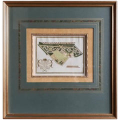
Antique Plan of Duin en Berg 'the Netherlands' by H. de Leth circa 1732
Located in Langweer, NL
Antique plan titled 'Beschrijving Duin en Berg, de Lustplaets van den Heere Wilhem Hendrik Kerckrinck in Platten Gront'. Decorative cartouche with Dutch and French text. This plan or...
Category
Mid-18th Century Antique Maps
Materials
Paper
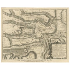
Antique Print of the Battle of Oudenard by I. Basire, 1751
Located in Langweer, NL
Plan of the Battle of Oudenard, fought during the war of the Spanish Succession (1701-1714), in which the Allies, led by Marlborough and Prince Eugene of Savoy, beat the French under the leadership of Louis Joseph, duc de Vendôme, and Louis, duc de Bourgogne (later the Dauphin, but died of measles at 29). The French commanders had quarrelled, resulting in a divided force that was easily beaten. Nicholas Tindal (1687-1774), at one time Chaplain to Greenwich Hospital...
Category
Mid-18th Century Antique Maps
Materials
Paper
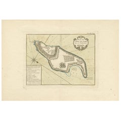
Antique Map of Gorée Island ‘Senegal’ by J.N. Bellin, 1764
Located in Langweer, NL
Nautical antique chart of Gorée Senegal including a letter key to the island's fortifications. Gorée is known as the location of the House of Slaves built by an Afro-French Métis fam...
Category
Mid-18th Century Antique Maps
Materials
Paper
Antique Map of the Course of the Amazon River by E. Van Harrevelt, 1773
Located in Langweer, NL
Detailed regional map, showing the course of the Amazon River from the Andes to the Atlantic. This map originates from 'Atlas portatif pour servir à l'intelligence de l'histoire phil...
Category
Late 18th Century Antique Maps
Materials
Paper
Antique Map of the Mouth of the Yangtze River 'China' by J.N. Bellin, 1764
Located in Langweer, NL
This detailed regional map of China is a historical cartographic work from the mid-18th century and is attributed to Antoine-François Prévost, a prominent French cartographer and geo...
Category
Mid-18th Century Antique Maps
Materials
Paper
Antique Map of the Eastern Part of Brazil by A. Van Krevelt, 1772
Located in Langweer, NL
Rare edition of this accurate map of eastern part of Brazil. This map originates from 'Atlas Portatif pour servir a l'intelligence de l'Histoire Philosophique et Politique des etabli...
Category
Late 18th Century Antique Maps
Materials
Paper
Antique Print of the Bay of the Island of St. Vincent by Van Schley (1747)
Located in Langweer, NL
Antique print titled 'Oppervlakte van de Baaije van 't Eiland St. Vincent (..)'. View of the Bay of the Island of St. Vincent, one of the Capeverdian Islands. Originates from a Dutch...
Category
Mid-18th Century Antique Maps
Materials
Paper
Antique Map of Nova Zembla ‘Russia’ by J.N. Bellin, 1758
Located in Langweer, NL
An interesting map of Nova Zembla and surrounding areas. With details on the eastern tip of Nova Zembla of the place where the stranded Dutch sailors under Willem Barentsz spent the ...
Category
Mid-18th Century Antique Maps
Materials
Paper
Antique Map of Moscovy 'Russia' by E. Bowen, 1747
Located in Langweer, NL
Beautiful map of European Russia by the English cartographer Emmanuel Bowen. It depicts the European portion of Russia extending from the Gulf of Finland to the Ural Mountains. The m...
Category
Mid-18th Century Antique Maps
Materials
Paper
Original Hand-colored Antique Map of Denmark by S. Neele, 1790
Located in Langweer, NL
Antique very decorative engraving of Denmark engraved by S. Neele. Published in November 1790 by John Trusler. Tape on verso.
Category
Late 18th Century Antique Maps
Materials
Paper
Antique Map of Denmark by Covens & Mortier, 1730
Located in Langweer, NL
Antique Map of Denmark from: 'Atlas Nouveau ... Par Guillaume de l'Isle' Amsterdam, Covens & Mortier, 1730.
Category
Mid-18th Century Antique Maps
Materials
Paper
Antique Coastal Map of West Sumatra 'Indonesia' by J. Mannevillette, 1745
Located in Langweer, NL
Antique map titled 'Carte de la côte occidentale de l'isle Sumatra depuis la ligne équinoctiale jusqu'au détroit de la Sonde'. Beautiful coastal map of We...
Category
Mid-18th Century Antique Maps
Materials
Paper
Framed 1731 Color Engraving, Map of Rotterdam by Matthaus Seutter, "Roterodami"
Located in Bridgeport, CT
"Roterodami". Seutter (1678-1757) was an important German 18th century map maker. Bird's eye view of the city above with full details, neoclassi...
Category
18th Century European Renaissance Antique Maps
Materials
Glass, Wood, Paper
1918 American Frohse Anatomical Chart, A. J. Nystrom, Max Brodel Illustrator
By A.J. Nystrom & Co, Max Brödel
Located in Buffalo, NY
Antique American Frohse Anatomical pull down chart, by A. J. Nystrom, ,revised and augmented by Max Brodel illustrator... Amazing color, patina, age appropriate wear. dated 1918..
Max (Paul Heinrich) Brödel
1870-1941
Brödel, an illustrator and the first director of the Art as Applied to Medicine program at Johns Hopkins...
Category
1910s American Steampunk Vintage Maps
Materials
Wood, Paper
Mamaroneck New York Harbor Chart from 1901
Located in Norwell, MA
Original harbor chart by George Eldridge in 1801 of Mamaroneck New York. Showing Oriental Hen Island, Rye Point, Scotch Caps, Crane Island, Decency Point, etc.. Showing local water d...
Category
Early 1900s North American Antique Maps
Materials
Paper
Imperial map of Northern Russia with Archangel, Lapland and Permia, c.1730
Located in Langweer, NL
Imperial map of Northern Russia with Archangel, Lapland, and Permia, c.1730
Description:
This intricately engraved and hand-colored map presents the northern reaches of the Russian ...
Category
Early 18th Century German Antique Maps
Materials
Paper
1912 "Panoramic View of New York City and Vicinity" by Jacob Ruppert
Located in Colorado Springs, CO
This is an attractive and very scarce map of New York, published by the Yorkville brewer Jacob Ruppert in 1912. The map shows an expansive view of the region reaching from Sandy Hook in the south and Yonkers to the north, to Hicksville in the east and past Newark to the west. This beautifully colored birds eye view shows waterways with all shipping traffic, boroughs, and clearly labeled railroad routes. It is presented on period dowels and backed on its original linen.
Jacob Ruppert was born in New York City in 1842 to Bavarian immigrants. His father owned a brewery in Manhattan where young Jacob learned the business of brewing. In 1862, Jacob established the Jacob...
Category
1910s American Vintage Maps
Materials
Paper
Mid-18th Century Hand Drawn English Farm Map on Vellum, circa 1740s
Located in San Francisco, CA
Mid-18th century hand drawn English farm map on Vellum circa 1740s
Henry Maxted & Isaac Terry, Surveyors.
A Map of a Farm in the Parish of Blean in the County of KENT: Belonging to Mrs Elizabeth Hodgson circa 1743.
A beautiful hand drawn map...
Category
Mid-18th Century English Antique Maps
Materials
Lambskin
Antique Coach Road Map, East Devon, English, Framed, Cartography, Georgian, 1720
Located in Hele, Devon, GB
This is an antique coach road map of East Devon. An English, framed lithograph engraving of regional interest, dating to the early 18th century and later.
Fascinating 18th century h...
Category
Early 18th Century British Georgian Antique Maps
Materials
Wood
Antique Lithography Map, Cumbria, English, Framed Cartography Interest, Georgian
Located in Hele, Devon, GB
This is an antique lithography map of Cumbria. An English, framed engraving of cartographic interest, dating to the early 18th century and later.
...
Category
Early 18th Century British Georgian Antique Maps
Materials
Wood
Matthaus Seutter, Framed 1730 Color Engraving Map of "Belgium Fonderatum"
Located in Bridgeport, CT
Label on verso. From Grosser Atlas. The name Belgium comes from the ancient designation "Gallis Belgica". Figural decoration upper left. M. Seutter was a famed German mapmaker in the...
Category
18th Century European Renaissance Antique Maps
Materials
Brass
Antique French Map of Asia Including China Indoneseia India, 1783
Located in Amsterdam, Noord Holland
Very nice map of Asia. 1783 Dedie au Roy.
Additional information:
Country of Manufacturing: Europe
Period: 18th century Qing (1661 - 1912)
Condition: Overall Condition B (Good Used)...
Category
18th Century European Antique Maps
Materials
Paper
Super Rare Antique French Map of Chine and the Chinese Empire, 1780
Located in Amsterdam, Noord Holland
Super Rare Antique French Map of Chine and the Chinese Empire, 1780
Very nice map of Asia. 1780 Made by Bonne.
Additional information:
Type: Map
...
Category
18th Century European Antique Maps
Materials
Paper
1762 Berri, Nivernois Bourbonois, Lyonois, Bourgogine, Bresse, et, Franche - Com
Located in Norton, MA
1762 Vaugondy map, entitled
"Berrl Nivernois Bourbonois Lyonois, Bourgone, Bresse, Et Franche-Comte,"
Ric.b003
About this Item
A fine Copperplate Engraving with original han...
Category
18th Century Unknown Antique Maps
Materials
Paper
1751 Map of Spain Castilla Robert De Vaugondy 1st Edition, Ric.a001
Located in Norton, MA
Large Spain Castilla Robert De Vaugondy
1751 1st Edition
-Colored- Ric.a001
Coming from a family of cartographers, a descendant of the famous Nicolas Sanson and ordinary geographer of the king, Gilles Robert de Vaugondy makes himself known by his maps of the French provinces.
He published an Essay on the History of Geography (1755) from which he excluded the physical geography "too systematic". After a Small Atlas (1748), he draws a universal Atlas (1758), a portable Atlas (1762).
His Atlas of the revolutions of the globe remains unpublished. His warnings and prefaces, his book reviews reveal a Cartesian mind and solid knowledge.
Very early, he associates with his works his son Didier who publishes, since 1742, the methodical tables of Nicolas Sanson, two Globes, one terrestrial, the other celestial (1752).
He is credited with a map of Poland...
Category
18th Century Unknown Antique Maps
Materials
Paper
1714 Henri Chatelain "Nouvelle Carte Des Etatas Du Grand.Duc De Mos Moscovie Eur
Located in Norton, MA
A 1714 Henri Chatelain map, entitled
"Nouvelle Carte Des Etatas Du Grand Duc De Moscovie En Europe,"
Ricb001
Henri Abraham Chatelain (1684-1743) was a Huguenot pastor of Parisi...
Category
Early 18th Century Dutch Antique Maps
Materials
Paper
Vintage Swedish School Map of Vastergötland, Made in Sweden 1920
Located in Los Angeles, CA
Vintage Swedish School Map of Vastergötland, Made in Sweden 1920
Västergötland also known as West Gothland or the Latinized version Westrogothia in older literature, is one of the...
Category
1920s Swedish Vintage Maps
Materials
Linen, Wood, Paper
18th Century Map of the Southern Balkans by Giovanni Maria Cassini
Located in Hamilton, Ontario
18th century map by Italian engraver Giovanni Maria Cassini (Italy 1745-1824).
Map of the Southern Balkans: Rome. Hand colored and copper engraved print done in the year 1788. It in...
Category
18th Century Italian Antique Maps
Materials
Paper
Northwest Coast and Isle of Man Map
Located in Cheshire, GB
Greenville Collins Northwest Coast and Isle of Man. hand coloured chart, encased in an ebonised frame.
Dimensions
Height 26.5 Inches
Width 30 Inches
Depth 1 Inches
Category
Early 20th Century British Maps
Materials
Paper
Mariners Chart of Quicks Hole and Tarpaulin Cove by George Eldridge 1901
Located in Norwell, MA
Nautical chart showing the harbor and local waters of Naushon Island Quick Holes. The chart display depths buoys, lightness, etc., The chart shows the cove in Naushon with ships stor...
Category
Early 1900s North American Antique Maps
Materials
Paper
University Chart “Black Map of North America
Located in Godshill, Isle of Wight
University Chart “Black Map of North America
W&A K Johnston’s Charts of Physical Maps By G W Bacon,
This is a Black Physical map of North A...
Category
Early 20th Century Industrial Maps
Materials
Linen
Colossal Terrestrian Globe Hand Painted, French, First Half of the 18th Century
Located in Saint-Ouen, FR
Colossal Terrestrian globe hand painted, French, first half of the 18th century.
Mounted in a 19th century pedestal wood.
Category
1730s French Antique Maps
Materials
Beech
Large University Chart “Political Map of North America” by Bacon
Located in Godshill, Isle of Wight
Large University Chart “Political Map of North America” by Bacon
W&A K Johnston’s Charts of Physical Maps By G W Bacon,
This is colourful Physical map ...
Category
Early 20th Century American Empire Maps
Materials
Linen
Large University Chart “Political Map of North America” by Bacon
Located in Godshill, Isle of Wight
Large University chart “Political Map of North America” by Bacon
W&A K Johnston’s Charts of Political Maps by G W Bacon,
This is colorful Physical ...
Category
Early 20th Century American Empire Maps
Materials
Linen
Amsterdam city plan - Joost van Sassen
Located in UTRECHT, UT
“Afbeeldinge der Stad Amsterdam, gelyk deselve in den jaren 1536 door Cornelis Antonisz na ’t leven is geschildert, en Ao 1544 in druk uytgegeven.”, engraved by Joost van Sassen and ...
Category
1720s Dutch Other Antique Maps
Materials
Paper
London 1744 Published Watercolour Antique Map of East Africa by Eman Bowen
Located in West Sussex, Pulborough
We are delighted to offer for sale this New and Accurate Map of Nubia & Abissinia, together with all the Kingdoms Tributary Thereto, and bordering upon them published in 1744 by Emanuel Bowen
This is a decorative antique engraved map of East Africa...
Category
1740s English George III Antique Maps
Materials
Paper
Very Large Hand-Drawn View of St Iago Cape Verde, by Frederici, 1783
Located in Amsterdam, NL
Johann Christian Friderici [= Frederici] (Heldburg 1766 - Cape Town 1804)
Prospect van het eyland, en de rheede van St. Iago. Geteekend van Johann Christian Friderici / Verbeelding van de inwoonders op St Iago
(View of the island, and the roadstead of St. Iago. Drawn by Johann Christian Friderci / Depiction of the inhabitants on St Iago)
?Porto Praia, Cape Verde...
Category
Late 18th Century Cape Verdean Dutch Colonial Antique Maps
Materials
Paper
Map Bedfordshire General Framed
Located in BUNGAY, SUFFOLK
A general map of Bedfordshire with its hundreds
A scale of 5 miles
in the original green mount and traditional black and gold frame. Measures: 36cm 14" high.
Category
18th Century English Georgian Antique Maps
Materials
Paper
Large University Chart “Africa Physical ” by Bacon
Located in Godshill, Isle of Wight
Large University chart “Africa Physical ” by Bacon
W&A K Johnston’s charts of physical maps by G W Bacon,
This is a Physical map of Africa, it is lithograph set on Linen mounte...
Category
Early 20th Century Beaux Arts Maps
Materials
Linen
Map North Wales Robert Marsden Anglesey
Located in BUNGAY, SUFFOLK
Map of North Wales by Robert Marsden
Including Anglesey
Charming topography and detail and colouring
just purchased more information to follow.
Category
18th Century English Georgian Antique Maps
Materials
Paper
Essex John Cary 1787 Cary's New & Correct English Atlas 40cm 16" long gilt frame
By John Cary
Located in BUNGAY, SUFFOLK
Map of Essex by John Cary Engraver
London published as the act directs Sept 1st 1787 by J Cary Engraver Map & Printseller no 188 the corner of Arundel Str...
Category
18th Century English Georgian Antique Maps
Materials
Paper
Large University Chart “Physical Map of Africa” by Bacon
Located in Godshill, Isle of Wight
Large university chart “Physical Map of Africa” by Bacon
W&A K Johnston’s Charts of Physical Maps By G W Bacon,
This is colorful Physical map of North America, it is large lithograph set...
Category
Early 20th Century Folk Art Maps
Materials
Linen
Map Lancashire 1793 John Cary engraver 37cm 14 1/2" high
Located in BUNGAY, SUFFOLK
Map of Lancashire by John Cary engraver
published 1st Jan 1793 by J Cary Engraver & Mapseller Strand
in original black and gold classic map frame
Category
18th Century English Georgian Antique Maps
Materials
Paper
Map Southern Scotland Thomas Conder Alex Hogg 1795
Located in BUNGAY, SUFFOLK
A new map of the southern part of Scotland containing the counties of Stirling, Lanerk, Renfrew, Linlithgow, Edinburgh, Peebles, Haddingtoun, Berwick, Selkirk, Roxburgh, Dumfries, Wigtoun, Kirkudbright & Air
Published by Alex Hogg at the Kings Arms...
Category
18th Century English Georgian Antique Maps
Materials
Paper
Map Shropshire Joseph Ellis Robert Sayer Carington Bowles Framed
Located in BUNGAY, SUFFOLK
A modern map of Shropshire Drawn from the latest surveys corrected and improved by the best authorities.
Artist Joseph Ellis sculptor.
Joseph Ellis was an engraver and publisher from Clerkenwell in London and was apprenticed to Richard William Seale in 1749. He is best know to county map collectors for The New English Atlas published in 1765 which was later reissued as Ellis's English Atlas in 1766, 1768 1777, 1786, 1790 and 1796.
Maker carington bowles 1724 - 1793.
Carington Bowles worked in London as a publisher in partnership with his father John Bowles from about 1752 until 1763. Carington Bowles worked as a publisher in partnership with his father John Bowles from about 1752 until 1763 before taking over his uncle's business. His address was 69 St. Pauls Church Yard, London. He worked with a number of well known cartographers of the day including Emanuel Bowen, Thomas Kitchin, Robert Sayer...
Category
18th Century English Georgian Antique Maps
Materials
Paper
Map Bedfordshire No 3 General Framed
Located in BUNGAY, SUFFOLK
A general map of Bedfordshire with its hundreds. Measure: 37cm 14 1/2" high
A scale of 5 miles.
in the original green mount and traditional black and gold frame.
charming map with...
Category
18th Century English Georgian Antique Maps
Materials
Paper
Map Turkey in Europe & Hungary Thomas Kitchin, 1783
Located in BUNGAY, SUFFOLK
Thomas Kitchen (1718 - 1784) : Map of Turkey in Europe & Hungary 1783
Visible sheet within the cream mount 25.5cm., 10" height 20cm., 8"
In an ebonised frame length 33cm. 13", height 28cm., 11"
Kitchin, Thomas (1718 - 1784)
Thomas Kitchin (August 4, 1718 – June 23, 1784) was a London based engraver, cartographer, and publisher. He was born in London to a hat-dyer of the same name. At 14, Kitchin apprenticed under Emanuel Bowen, under whom he mastered the art of engraving. He married Bowen daughter, Sarah Bowen, and later inherited much of his preceptor's prosperous business. Their son, Thomas Bowen Kitchin, also an engraver joined the family business, which thereafter published in Thomas Kitchin and Son. From 1858 or so Kitchin was the engraver to the Duke of York, and from about 1773 acquired the title, 'Royal Hydrographer to King George III.' He is responsible for numerous maps published in the The Star, Gentleman's Magazine, and London Magazine, as well as partnering with, at various times, with Thomas Jefferys, Emmanuel Bowen, Thomas Hinton, Issac Tayor, Andrew Dury, John Rocque, Louis de la Rochette, and Alexander Hogg, among others. Kitchin passed his business on to his son, Thomas Bowen Kitchin, who continued to republish many of his maps well after his death. Kitchin's apprentices included George Rollos...
Category
18th Century English Georgian Antique Maps
Materials
Paper
Map "Estuary- Mouth of the Thames"
Located in Alessandria, Piemonte
ST/426 - Antique French Map of the estuary of the Thames, map dated 1769 -
"Mape of the entrance of the Thames. Designed by filing of Navy cards fo...
Category
Mid-18th Century French Other Antique Maps
Materials
Paper
18th Century Emanuel Bowen Map of County of York, c.1740
Located in Royal Tunbridge Wells, Kent
Antique 18th century British rare and original Emanuel Bowen (1694-1767) map of the County of York divided into its Ridings and subdivided into wapontakes, mounted in solid wood fram...
Category
Early 18th Century British Antique Maps
Materials
Paper
Map Jersey Guernsey Scilly Islands Alderney
Located in BUNGAY, SUFFOLK
Rare map of The Islands of Guernsey and Jersey, including Alderney & the Scilly Islands
just purchased more information to follow
In the original cream mount and gilded frame.
Category
18th Century English Georgian Antique Maps
Materials
Paper
Map Kyle Carrick Aireshire Thomas Kitchen 1749
Located in BUNGAY, SUFFOLK
A Map of Kyle & Carrick Aireshire Thomas Kitchen 1749
In original black and gold frame
Just purchased more information to follow
MAKER Thomas Kitchin (1718-1784) English engrave...
Category
18th Century English Georgian Antique Maps
Materials
Paper
