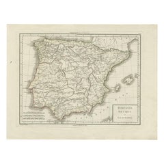
Atlantic Ocean Map
2
to
7
113
44
91
66
34
29
26
23
21
21
21
18
16
14
11
11
11
8
7
4
3
3
3
3
3
2
2
2
2
2
2
2
1
1
1
1
1
1
1
1
16
11
4
4
3
Sort By
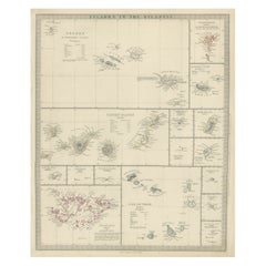
Antique Map of the Islands in the Atlantic Ocean including Bermuda & Cape Verde
Located in Langweer, NL
Antique map titled 'Islands in the Atlantic'. Steel engraved map of the islands in the Atlantic
Category
Antique Mid-19th Century Maps
Materials
Paper
H 17.05 in W 14.38 in D 0.02 in
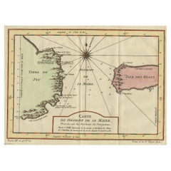
Antique Map of the Passage Between the Atlantic and Pacific Oceans, circa 1753
Located in Langweer, NL
passage between the Atlantic and Pacific oceans. Jacob Le Maire and Willem Schouten discovered the strait
Category
Antique 18th Century Maps
Materials
Paper
H 9.61 in W 12.8 in D 0 in
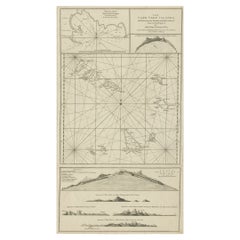
Map & Views of the Cape Verde Islands, in the Atlantic Ocean, West-Africa, 1775
Located in Langweer, NL
view of Praya Bay (..)'.
Map and views of the Cape Verde islands, in the Atlantic Ocean west of
Category
Antique 1770s Maps
Materials
Paper
H 21.46 in W 14.57 in D 0 in
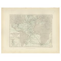
Antique Physical Chart of the Atlantic Ocean by Johnston '1850'
Located in Langweer, NL
Antique map titled 'Physical Chart of the Atlantic Ocean showing the form and direction of the
Category
Antique Mid-19th Century Maps
Materials
Paper
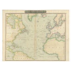
Interesting Map of the Atlantic Showing Nelson's and Trade Routes, 1817
By John Thomson
Located in Langweer, NL
Antique map titled 'Chart of the North Atlantic Ocean with Tracks of the Shipping to West Indies
Category
Antique 19th Century Maps
Materials
Paper
Free Shipping
H 21.26 in W 27.76 in D 0 in
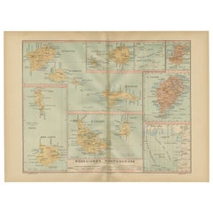
Islands of Diversity: Portugal's Atlantic Archipelagos in 1903
Located in Langweer, NL
The image is an original historical map from 1903 depicting Portuguese possessions in the Atlantic
Category
Antique Early 1900s Maps
Materials
Paper
Free Shipping
H 14.77 in W 20.08 in D 0 in
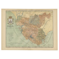
Cádiz 1901: Nautical Crossroads of the Atlantic and Mediterranean
Located in Langweer, NL
Atlantic Ocean and the Mediterranean Sea, including the Strait of Gibraltar. Blue lines mark the rivers
Category
Antique Early 1900s Maps
Materials
Paper
Free Shipping
H 14.77 in W 20.08 in D 0 in
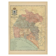
Huelva 1901: A Cartographic Presentation of Andalusia's Atlantic Frontier
Located in Langweer, NL
significant coastline along the Atlantic Ocean, which contributes to its economy through fishing, salt
Category
Antique Early 1900s Maps
Materials
Paper
Free Shipping
H 20.08 in W 14.77 in D 0 in
Antique Map of Spain and Portugal by Tardieu, circa 1795
Located in Langweer, NL
labeled as "Mare Internum", the Atlantic Ocean to the west, and the Cantabrian Sea in the north. Borders
Category
Antique Late 18th Century Maps
Materials
Paper
Antique Map Dedicated to British Merchants Trading to North America, ca.1746
Located in Langweer, NL
. Insets of the Atlantic Ocean, Quebec City, Fort Dauphin and a plan of Louisbourg add to the map
Category
Antique 1740s Maps
Materials
Paper
H 13.98 in W 19.69 in D 0 in
1899 Poole Brothers Antique Railroad Map of the Illinois Central Railroad
Located in Colorado Springs, CO
, published by the Poole Brothers. The map focuses on the continuous United States from the Atlantic to the
Category
Antique 1890s American Maps
Materials
Paper
1856 U.S. Coast Survey Map of Chesapeake Bay and Delaware Bay
Located in Colorado Springs, CO
Carolina. It also shows from Richmond and Petersburg, Virginia to the Atlantic Ocean. The map is highly
Category
Antique 1850s American Maps
Materials
Paper
An Old Illustrated Tallis Map of Central America with Volcanic Vignettes, 1851
Located in Langweer, NL
include coastlines on both the Atlantic and Pacific Oceans, mountain ranges, volcanoes, and rainforests
Category
Antique 1850s Maps
Materials
Paper
H 10.71 in W 14.26 in D 0 in
California, Alaska and Mexico: 18th Century Hand-Colored Map by de Vaugondy
By Didier Robert de Vaugondy
Located in Alamo, CA
Atlantic Oceans, whose existence many explorers attempted to prove, and which The smaller inset map shows
Category
Antique 1770s French Maps
Materials
Paper
H 13.75 in W 16.63 in D 0.13 in
Antique Map of Canada, The Province of Ontario and Part of Quebec, 1882
Located in Langweer, NL
and the Atlantic Ocean.
An inset in the top left corner provides a more detailed street map of the
Category
Antique 1880s Maps
Materials
Paper
Free Shipping
H 14.97 in W 22.45 in D 0 in
Antique Map of Africa with a Decorative Dedication to the Dauphin, 1717
Located in Langweer, NL
characteristic thickened west coast. Unusual islands appear in the Atlantic and Indian Oceans including a
Category
Antique 18th Century Maps
Materials
Paper
Crossroads of Empires: A John Tallis Map of the Isthmus of Panama, 1851
Located in Langweer, NL
region was under significant scrutiny for its potential to connect the Atlantic and Pacific oceans
Category
Antique 1850s Maps
Materials
Paper
1859 "Map of the United States of America..." by J. H. Colton
By J.H. Colton
Located in Colorado Springs, CO
across the Caribbean and South America. A large inset map on the lower left shows the Atlantic Ocean and
Category
Antique 1850s American Maps
Materials
Paper
North & South America: A 17th Century Hand-colored Map by Jansson & Goos
By Johannes Janssonius
Located in Alamo, CA
Atlantic and Pacific Oceans, many of which do not exist. The St. Lawrence River is greatly elongated
Category
Antique 1620s Dutch Maps
Materials
Paper
A Tallis Map of British Guiana with Colonial Vignettes and Other Landmarks, 1851
Located in Langweer, NL
on the continent.
**The Countries:**
Guyana is bordered by the Atlantic Ocean, Brazil, Suriname, and
Category
Antique 1850s Maps
Materials
Paper
H 14.26 in W 10.71 in D 0 in
1863 "Lloyd's New Map of the United States, the Canadas, and New Brunswick"
Located in Colorado Springs, CO
from the Atlantic Ocean and extends as far west as the 103 meridian, to “Dacotah,” Nebraska, Kansas
Category
Antique 1860s American Maps
Materials
Linen, Wood, Paper
H 37 in W 49.5 in D 1 in
Antique Map of the Harbour of Praia, Santiago Island, Cape Verde, c.1750
Located in Langweer, NL
of Santiago, Cape Verde. It is situated in a natural bay of the Atlantic Ocean. Since the latest
Category
Antique 18th Century Maps
Materials
Paper
Cartographic Survey of Pontevedra, 1902: Crossroads of Galicia"
Located in Langweer, NL
province is bordered by the Atlantic Ocean to the west and Portugal to the south. It is a region known for
Category
Antique Early 1900s Maps
Materials
Paper
Free Shipping
H 20.08 in W 14.77 in D 0 in
Ornate Cartography of Colonial Grandeur: The West India Islands around 1851
Located in Langweer, NL
North Atlantic Ocean in the Caribbean that consists of the island countries and surrounding waters of
Category
Antique 1850s Maps
Materials
Paper
No Reserve
H 10.71 in W 14.26 in D 0 in
Minho: A Legacy of Lush Landscapes and Living Traditions in Portugal, 1903
Located in Langweer, NL
network of roads and railways. The Minho region is bordered by the Atlantic Ocean to the west and is well
Category
Antique Early 1900s Maps
Materials
Paper
Free Shipping
H 20.08 in W 14.77 in D 0 in
Islands of Fire and Whispers: The Canary Islands in 1902
Located in Langweer, NL
Islands are located in the Atlantic Ocean, off the northwest coast of Africa, and are known for their
Category
Antique Early 1900s Maps
Materials
Paper
La Coruña 1901: A Cartographic View of Galicia's Maritime Province
Located in Langweer, NL
Atlantic Ocean, which is detailed on the map, including the distinctive rías (coastal inlets). Blue lines
Category
Antique Early 1900s Maps
Materials
Paper
Free Shipping
H 20.08 in W 14.77 in D 0 in
Colonial Crossroads: Angola and Mozambique in 1903
Located in Langweer, NL
The image for sale is an original historical map from 1903 that shows the Portuguese colonies of
Category
Antique Early 1900s Maps
Materials
Paper
Cartographic Treasures: A Journey Through the Gascogne and Guyenne Regions, 1680
Located in Langweer, NL
details.
7. **Coastlines:** The coastlines along the Bay of Biscay and the Atlantic Ocean are detailed
Category
Antique Late 17th Century Maps
Materials
Paper
Free Shipping
H 20.08 in W 23.82 in D 0.02 in
1859 Antique Arctic Vista: Greenland, Iceland and Faroe Islands, Blackie's Atlas
Located in Langweer, NL
regions, the map likely details coastal features, sea routes, and possibly ocean currents, reflecting the
Category
Antique Mid-19th Century Maps
Materials
Paper
H 14.57 in W 10.63 in D 0.02 in
Vintage Geographic Splendor: 1859 Spain and Portugal
Located in Langweer, NL
Atlantic Ocean and the Mediterranean Sea.
2. **Political Boundaries**: Reflecting the political divisions
Category
Antique Mid-19th Century Maps
Materials
Paper
The Atlantic Ocean - Original Etching by A. Stieler - 1857
Located in Roma, IT
The Atlantic Ocean is an original colored print realized in 1857.
Hand-colored engraving made in
Category
1950s Figurative Prints
Materials
Etching
H 14.3 in W 17.33 in D 0.08 in
Original Vintage Travel Poster See The Lands Of The Vikings Atlantic Sailing Map
By Benjamin Blessum
Located in London, GB
full sail decorated in an Old Norse style pattern sailing over the Atlantic Ocean from the United
Category
Vintage 1930s Swedish Posters
Materials
Paper
H 39.38 in W 24.81 in D 0.04 in
Antique Map of the Southern Oceans, South America and Africa
Located in Larchmont, NY
Antique Map of the South Atlantic, c. 1800s
Engraving
20 x 28 in.
Framed: 25 3/4 x 33 3/4 in.
Category
19th Century Realist Figurative Prints
Materials
Engraving
H 25.75 in W 33.75 in D 0.75 in
Original Vintage Rail Travel Map Poster France Map SNCF National French Railway
Located in London, GB
Mediterranean Sea / Mer Mediterranee and Atlantic Ocean Atlantique with the English Channel / Manche next to the
Category
Vintage 1950s French Posters
Materials
Paper
H 39.38 in W 24.41 in D 0.04 in
Map of the World: An Original 18th Century Hand-colored Map by E. Bowen
Located in Alamo, CA
, Pacific, and Indian Oceans. The map is laid out according to the Mercator projection, a type of
Category
Mid-18th Century Old Masters Landscape Prints
Materials
Engraving
Antique 1798 James Colnett A Voyage to the South Atlantic & Round Cape Hope Book
Located in Hamilton, Ontario
This antique book titled "A Voyage to the South Atlantic and Round Cape Horn into the Pacific Ocean
Category
Antique Late 18th Century English Georgian Books
Materials
Leather, Paper
H 1 in W 10 in D 1 in
California: 18th Century Hand-colored Map by de Vaugondy
By Didier Robert de Vaugondy
Located in Alamo, CA
Atlantic Oceans, whose existence many explorers attempted to prove, and which The smaller inset map shows
Category
1770s Landscape Prints
Materials
Engraving
Original Vintage Travel Poster Rhodesia Pictorial Map Southern Africa Zimbabwe
Located in London, GB
decorative compass point. A smaller framed map below marking the area and the South Atlantic Ocean and Indian
Category
Vintage 1930s British Posters
Materials
Paper
H 39.38 in W 24.41 in D 0.04 in
Original Vintage Poster Telegraph British Marconi Radio Modernism Map Design
By A.E. Halliwell
Located in London, GB
communication text on arrows to Canada and America with radial radio waves in white over the blue Atlantic Ocean
Category
Vintage 1930s British Posters
Materials
Paper
H 30.32 in W 20.08 in D 0.04 in
Original Vintage Illustrated Map Poster Railway Travel Normandy Brittany Paris
By Lucien Boucher
Located in London, GB
boats and ships following route lines to England and across the Atlantic Ocean towards Canada and
Category
Vintage 1930s French Posters
Materials
Paper
H 39.38 in W 24.61 in D 0.04 in
An original poster featuring an illustrated map of Tenerife - La Lucha
Located in PARIS, FR
forms part of the Canary Islands archipelago in the Atlantic Ocean.
It is not only the largest island
Category
1950s Prints and Multiples
Materials
Paper, Lithograph
H 18.51 in W 26.38 in
Original Vintage Poster French Equatorial Africa Map Afrique Chad Congo Francais
Located in London, GB
including tigers, camels, horses, antelopes, ostriches, giraffes, elephants and fish in the Atlantic Ocean
Category
Vintage 1950s French Posters
Materials
Paper
H 46.86 in W 31.5 in D 0.04 in
Original Vintage Poster Union Of South Africa Map Natural & Industrial Resources
Located in London, GB
boats along the coast at sea by the Atlantic Ocean and Indian Ocean labelled in stylised lettering, an
Category
Vintage 1940s British Posters
Materials
Paper
H 19.69 in W 29.53 in D 0.04 in
Original Vintage Travel Poster Air France World Map Postal Network Reseau Aerian
Located in London, GB
continents, countries, cities and oceans with a plane flying over the Atlantic Ocean and the Air France
Category
Vintage 1940s French Posters
Materials
Paper
H 25.6 in W 39.77 in D 0.04 in
Original Antique Poster Norvege Norway Midnight Sun Stavkirke Church Travel Map
Located in London, GB
and the building reflected in the calm water next to a route map marking travel over the Atlantic
Category
Antique 1610s Norwegian Posters
Materials
Paper
H 38.98 in W 25.6 in D 0.04 in
Original Vintage Poster French West Africa Map Afrique Occidentale Francaise Art
By alain cornic
Located in London, GB
, deer, crocodile, lions, elephant and birds with fish on the Atlantic Ocean and Gulf of Guinea within an
Category
Vintage 1950s French Posters
Materials
Paper
H 31.5 in W 47.25 in D 0.04 in
Original Vintage Travel Poster Pan Am Flying Clipper Ships South America Map
Located in London, GB
stylised title text over the PAA logo in a scroll style banner above the Atlantic Ocean with colourful
Category
Vintage 1940s American Posters
Materials
Paper
H 23.82 in W 18.9 in D 0.04 in
Original Vintage Travel Poster Map of Ireland Showing Places of Note & Interest
Located in London, GB
with the place names and the surrounding North Channel, St George's Channel, Irish Sea, Atlantic Ocean
Category
Vintage 1950s British Posters
Materials
Paper
H 40.16 in W 50.01 in D 0.04 in
North & South America: A 17th Century Hand-colored Map by Jansson & Goos
By Johannes Jansson
Located in Alamo, CA
Atlantic and Pacific Oceans, many of which do not exist. The St. Lawrence River is greatly elongated
Category
1620s Landscape Prints
Materials
Engraving
Original Vintage WWII Poster De Dollarpoliep The US Dollar Polyp Octopus War Map
Located in London, GB
from the Atlantic and Pacific Oceans with sunken ships at sea and a sword marked with a rising sun
Category
Vintage 1940s Dutch Posters
Materials
Paper
H 17.72 in W 23.23 in D 0.04 in
Original Vintage Travel Poster Amerique Du Sud Par Les Chargeurs Reunis Cruise
Located in London, GB
les Chargeurs Reunis featuring a ship sailing on the Atlantic Ocean between map shapes of Europe and
Category
Vintage 1930s French Posters
Materials
Paper
H 23.63 in W 15.75 in D 0.04 in
Original Vintage Travel Poster BOAC World Air Routes Western Hemisphere Design
By E.O. Seymour
Located in London, GB
, mountain ranges, animals and ships at sea with a decorative compass point on the Atlantic Ocean, the
Category
Vintage 1940s British Posters
Materials
Paper
H 30.71 in W 20.48 in D 0.04 in
Original Vintage World War Two Poster Lick Them Over There WWII Canada Soldier
Located in London, GB
over the Atlantic Ocean on a map on the globe below, a peaceful church and village in Canada by his
Category
Vintage 1940s Canadian Posters
Materials
Paper
H 18.12 in W 12.01 in D 0.04 in
Original Antique WWI Recruitment Poster Britishers You're Needed Come Across Now
By Lloyd Myers
Located in London, GB
) stretching a hand across the Atlantic Ocean to shake hands with a civilian wearing a suit and hat in the
Category
Vintage 1910s American Posters
Materials
Paper
H 41.34 in W 28.35 in D 0.04 in
The Grand Waterway of Languedoc: Mapping the Canal du Midi, 1697
Located in Langweer, NL
engineering designed to link the Atlantic Ocean and the Mediterranean Sea through southern France and was
Category
Antique 1690s Prints
Materials
Paper
Free Shipping
H 26.78 in W 40.16 in D 0 in
Choke: Gibraltar – Land (left) Water (right)
By Gregor Turk
Located in Atlanta, GA
connects the Atlantic Ocean to the Mediterranean Sea.
Category
21st Century and Contemporary Contemporary Mixed Media
Materials
Rubber, Wood
Rare Original French National and Southern Railway Cross Channel Services Poster
Located in London, GB
- Bordeaux on the Atlantic Ocean coast to Spain and Algeria via Dax - Biarritz - Pau - Toulouse in a striking
Category
Vintage 1930s French Posters
Materials
Paper
H 39.18 in W 24.61 in D 0.04 in
Antique Print of Church Valley on the Island of St. Helena and a Hunting Scene
By Johannes Nieuhof
Located in Langweer, NL
Valley on the island of St. Helena in the Atlantic Ocean. Below a warthog and a hunting scene with
Category
Antique 18th Century Prints
Materials
Paper
H 13.31 in W 8.08 in D 0 in
A truly delightful miniature terrestrial pocket globe
By Nathaniel Mills
Located in ZWIJNDRECHT, NL
drawn – Anson led a squadron of eight ships on a mission to disrupt or capture the Pacific Ocean
Category
Antique Mid-18th Century British Dutch Colonial Globes
Materials
Other
- 1
Get Updated with New Arrivals
Save "Atlantic Ocean Map", and we’ll notify you when there are new listings in this category.
More Ways To Browse
Hermes Ocean Scarf
Oliver Native American Hermes
Hermes Attire
Hermes Scarf Ameriques
Vintage Maroc
Hermes Scarf Artist Texas
Hermes Early America Silk Scarf
Vintage Horse Plow
Planisphere Poster
Map Jamaica
Vintage Union Pacific Railroad
San Pablo Bay
Hermes Scarf Designer Texas
Silk Screen Ocean
Hermes Les Ameriques
Janeiro Map
Baja Mexico
W 10th Street
