Map Of European War
1
to
19
141
139
206
166
43
37
33
24
23
21
19
14
13
11
11
10
9
9
8
7
7
5
4
4
3
3
2
2
2
2
2
1
1
1
1
1
1
1
1
1
1
1
42
42
33
10
9
Sort By
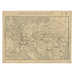
Eason's War Map of Europe, circa 1914
Located in Langweer, NL
Antique map titled 'Eason's War Map of Europe'. Printed in Ireland. Source unknown, to be
Category
20th Century Maps
Materials
Paper
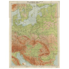
Antique European War Folding Map, ‘circa 1915’
Located in Langweer, NL
Antique folding map of the European War (1914-1915) titled 'The Eastern Campaign '. From Petrograd
Category
Early 20th Century Maps
Materials
Paper
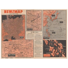
Antique Map of the War Situation in Europe and Asia, 1944
Located in Langweer, NL
, measuring nearly 4 feet by 3 feet, includes five inset maps of the war situation in both Europe and Asia
Category
20th Century Maps
Materials
Paper
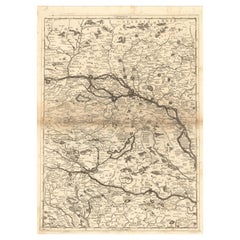
Old Map Showing Info Related to the Ottoman Wars including Conflict Dates, c1690
Located in Langweer, NL
, Vincenzo Maria
Subject: Central Europe, Danube River
Period: 1690 (circa)
Publication:
Color: Black
Category
Antique 1690s Maps
Materials
Paper
H 24.02 in W 17.8 in D 0 in
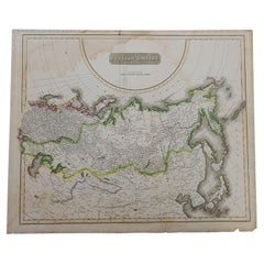
1814 Map of "Russian Empire" Ric.r032
Located in Norton, MA
1814 Map of
"Russian Empire"
Ric.r032
Russian Empire. Description: This is an 1814 John
Category
Antique 19th Century Unknown Maps
Materials
Paper
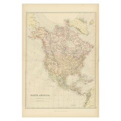
Antique Decorative Coloured Map of North America, 1882
Located in Langweer, NL
This original antique map of North America is from the Blackie & Son Atlas published in 1882. Here
Category
Antique 1880s Maps
Materials
Paper
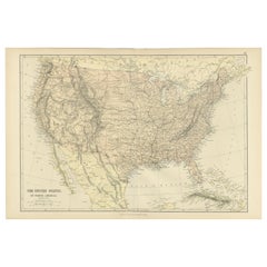
Antique Map of The United States of North America, 1882
Located in Langweer, NL
This is a historical map titled "The United States of North America, Central Part" from the 1882
Category
Antique 1880s Maps
Materials
Paper
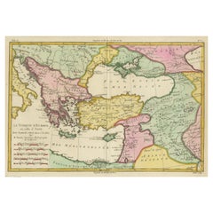
Antique Map of the Eastern Mediterranean and the Balkans
Located in Langweer, NL
Antique map titled 'La Turquie d'Europe et celle d'Asie'. Attractive double page map of the Eastern
Category
Antique Late 18th Century Maps
Materials
Paper
Antique Decorative Coloured Map of South Africa and Madagascar, 1882
Located in Langweer, NL
The map of South Africa is from the Blackie & Son Atlas, published in 1882. This historical map is
Category
Antique 1880s Maps
Materials
Paper
Free Shipping
H 14.97 in W 22.45 in D 0 in
Original Antique Map of the Island of Dominica in the West Indies, 1794
Located in Langweer, NL
during this period. This historical tug-of-war is reflected in the map's place names, which bear witness
Category
Antique 1790s Maps
Materials
Paper
1847 Ornamental Map of the United States & Mexico by H. Phelps
Located in Colorado Springs, CO
Offered is an original 1847 ornamental map of the U.S. entitled "Ornamental Map of the United
Category
Antique 1840s American Maps
Materials
Paper
Senex Map of Castile, Leon & La Mancha in The Spanish Heartland, 1714
Located in Langweer, NL
This antique map, titled "A Map of Old & New Castile from the Observations of Rodrigo Mendes Silva
Category
Antique Early 18th Century Maps
Materials
Paper
H 19.81 in W 26.89 in D 0.02 in
Copper Engraved Grenada Map by John Thompson Published in 1810
Located in Langweer, NL
John Thomson's original antique map of Grenada, dating back to 1810 and hailing from Edinburgh
Category
Antique Early 19th Century Maps
Materials
Paper
Large Sea Chart of the British Islands, 1918
Located in Langweer, NL
Antique map titled 'The British Islands'.
Large sea chart of the British Islands. It shows
Category
Vintage 1910s Maps
Materials
Paper
Ancient Gaul: A Cartographic Overview of Gallic Tribes and Roman Provinces, 1880
Located in Langweer, NL
The print titled "GALLIA," is a historical map of ancient Gaul, which corresponds to modern-day
Category
Antique 1880s Maps
Materials
Paper
Free Shipping
H 15.56 in W 18.51 in D 0 in
Roman Italy and Provinces: A Cartographic Snapshot, 1880
Located in Langweer, NL
The map titled "ITALIA, Gallia Cisalpina, Sicilia, Sardinia, Corsica" focuses on Italy and its
Category
Antique 1880s Maps
Materials
Paper
Europe 1960s Cold War - mixed media passport map print hand painted
By Yanko Tihov
Located in London, GB
Yanko Tihov is a painter and printmaker who trained in Sofia and works in London. In his passport series the design is determined by the colours and motifs of each country’s passport...
Category
2010s Contemporary More Prints
Materials
Gold Leaf
H 25.2 in W 34.06 in D 1.58 in
Original Antique World War One Humoros Wap Map Of The World WWI Japan Caricature
Located in London, GB
Original antique World War One satirical map of Europe and Asia portraying the outbreak of WWI
Category
Vintage 1910s Japanese Posters
Materials
Paper
H 18.51 in W 24.81 in D 0.04 in
Large European 1930's Nautical Map Reader Magnifying Glass
Located in Haddonfield, NJ
This European set of two nautical magnifying glass map-readers are quite unusual and rarely found
Category
Vintage 1930s German Industrial Nautical Objects
Materials
Metal
Original Vintage WWII Poster Handen Weg! Europa Hands Off Europe War Netherlands
Located in London, GB
Original vintage World War Two poster - Hands off Europe / Handen weg! Europa - featuring a
Category
Vintage 1940s Dutch Posters
Materials
Paper
H 41.34 in W 29.93 in D 0.04 in
Original Vintage WWII Poster De Dollarpoliep The US Dollar Polyp Octopus War Map
Located in London, GB
dollars instead of bullets! By exploiting European wars, America's traditional policy is to enrich itself
Category
Vintage 1940s Dutch Posters
Materials
Paper
H 17.72 in W 23.23 in D 0.04 in
Original Antique Poster French Infantry In Battle WWI Hindenburg Line Europe Map
Located in London, GB
bayonet rifle gun in front of a map of Europe showing the Hindenburg Line in red with the title text below
Category
Vintage 1910s French Posters
Materials
Paper
H 47.25 in W 31.5 in D 0.04 in
Original Antique World War One Poster Hark The Dogs Do Bark WWI Dogs Of War
Located in London, GB
- featuring a serio-comic map of Europe at war with military soldier caricature portraits and some countries
Category
Vintage 1910s British Posters
Materials
Paper
H 22.05 in W 29.93 in D 0.04 in
"The Story Map Of The West Indies" 1936
Located in Bristol, CT
Chicago and the Military Panoramap of the Theatre of War. These depart markedly form the 'Story Map' model
Category
1930s More Prints
Materials
Paper
European City
By Dong Kingman
Located in Missouri, MO
European City
By Dong Kingman (American, 1911-2000)
Signed Lower Right
Unframed: 15" x 22"
Framed
Category
20th Century American Modern Landscape Drawings and Watercolors
Materials
Watercolor
Carte D'Europe
Located in Bristol, CT
Classic colour French post-war c1946 map of Western Europe by Pierre Herault (LR)
Editions Jacque
Category
1940s Figurative Prints
Materials
Lithograph
Watercolour Drawing by Kenneth Stevens MacIntire of a Nautical Map
By Kenneth Stevens MacIntire
Located in Norwich, GB
A watercolour drawing of a three-fold screen design, depicting a nautical map of the Atlantic
Category
20th Century American American Classical Paintings
Materials
Paper
Antique Print of Gibraltar, Spanish Colony in Europe 1858
Located in Langweer, NL
. This print originates from 'The History Of The War With Russia: Giving Full Details Of The Operations
Category
Antique 19th Century Prints
Materials
Paper
1749 Jacques Nicolas Bellin Map of the Great Wall of China Near Kiang-nan fu
Located in Langweer, NL
War Planters."
The map showcases the detailed topography around segments of the Great Wall and labels
Category
Antique 1750s Prints
Materials
Paper
H 9.97 in W 7.05 in D 0 in
View of Emden, Germany: A 16th Century Hand-colored Map by Braun & Hogenberg
By Franz Hogenberg
Located in Alamo, CA
This is a 16th century original hand-colored copperplate engraved map of a bird's-eye View of
Category
16th Century Old Masters Landscape Prints
Materials
Engraving
1938 original map titled "Carte du réseau aérien français" Air France
Located in PARIS, FR
that encapsulated the excitement and possibilities of air travel in the pre-war era.
Map - Airline
Category
1930s Prints and Multiples
Materials
Linen, Paper, Lithograph
The War: An Intimate History, 1941-1945 Hardcover Book by Ken Burns
Located in North Hollywood, CA
were shipped off to Europe, the Pacific, and North Africa.
Enriched by maps and hundreds of
Category
Early 2000s American Mid-Century Modern Books
Materials
Paper
Mexico City & Cusco Antique Map, Civitates Orbis Terrarum by Braun & Hogenberg
By Franz Hogenberg
Located in Roma, IT
the 30-40 years after their conquest by Europeans. A little faded on top.
Dimensions : 40,5x52 cm
Category
16th Century Landscape Prints
Materials
Etching
H 15.95 in W 20.48 in D 0.04 in
North and South America: An 18th Century Hand-colored Map by Johann Homann
By Johann Baptist Homann
Located in Alamo, CA
Germany and an important entity in the European map market. Homann's maps were prized for their high level
Category
Early 18th Century Old Masters Landscape Prints
Materials
Engraving
Interior of a Japanese House
By Harry Humphrey Moore
Located in New York, NY
Harry Humphrey Moore led a cosmopolitan lifestyle, dividing his time between Europe, New York City
Category
Late 19th Century Interior Paintings
Materials
Oil, Wood Panel
Rare Pair of Table Globes by Cary, Each Dated 1816
By John & William Cary
Located in Lymington, Hampshire
an international diplomatic conference to reconstitute the European political order after the
Category
Antique 1810s English Globes
Materials
Brass
Siege of Szigetvár, 1566: Lafreri's Rare Handcolored Engraving Published in 1585
Located in Langweer, NL
Ottoman-Habsburg wars. The use of color enhances the illustration, highlighting different regiments and
Category
Antique 16th Century Prints
Materials
Paper
Free Shipping
H 14.57 in W 19.1 in D 0 in
'Lieutenant Crovers Despatch – Return of Governor Stevens to Fort Benton'
By John Mix Stanley
Located in Milwaukee, WI
: to produce topographical maps, to document flora and fauna, and to document natural resources to
Category
1850s Romantic Landscape Prints
Materials
Lithograph
Genuine Antique Print of a Knight Armed with A Martel in Old Hand-Coloring, 1842
Located in Langweer, NL
hauberk, hood, chausses, and carries a buckler and martel de fer (war hammer). This print originates from
Category
Antique 19th Century Prints
Materials
Paper
H 14.57 in W 10.44 in D 0 in
Rabbi, Cup of Tea, Shtetl Americana Judaica Lithograph WPA Social Realist Artist
By William Gropper
Located in Surfside, FL
Side of New York or East European Shtetl. Orthodox Jewish Rabbi having a glass of tea.
The New-York
Category
Mid-20th Century Modern Figurative Prints
Materials
Lithograph
Epic of America by Jt Adams First Edition Re-Print
Located in Dallas, TX
consisted in the provision of maps and the selection of plans and atlases that should be acquired by the War
Category
Early 20th Century American American Classical Books
Materials
Paper
Animal painting of a 'Tamanuâguacû (Ant-eater)' late 17th/18th century, Brazil
Located in Amsterdam, NL
Governor of the Cape of Good Hope in the service of the VOC. During the Thirty-Year War in Germany Wagener
Category
Early 18th Century Old Masters Animal Drawings and Watercolors
Materials
Paper, India Ink, Gouache
Free Shipping
H 10.83 in W 17.13 in D 0.04 in
'Distribution of Goods to the Assiniboines' original John Mix Stanley lithograph
By John Mix Stanley
Located in Milwaukee, WI
: to produce topographical maps, to document flora and fauna, and to document natural resources to
Category
1850s Romantic Landscape Prints
Materials
Lithograph
Antoine Lafrery Set of 6 Engraving "Speculun Romanae Magnificen" 16th Century
Located in Beuzevillette, FR
confirmed 4 years later). He sold maps and prints, which allowed his reputation to spread to Europe. Between
Category
Antique 16th Century Italian Renaissance Picture Frames
Materials
Paper
H 19.3 in W 13.78 in D 0.4 in
'Distribution of Goods to the Gros Ventres' lithograph by John Mix Stanley
By John Mix Stanley
Located in Milwaukee, WI
: to produce topographical maps, to document flora and fauna, and to document natural resources to
Category
1850s Romantic Landscape Prints
Materials
Lithograph
Four original etchings of women from 'Aula Veneris' series by Wenceslaus Hollar
By Wenceslaus Hollar
Located in Milwaukee, WI
Presented here as a group are four original etchings of women in European national dress from the
Category
17th Century Old Masters Figurative Prints
Materials
Etching, Paper
Black Glaze Spanish Manises Ceramic Horse Head 1980s
By Gimeno Rios Manises
Located in VALENCIA, ES
.
Manises ceramics are highly prestigious in Spain and all along Europe. Manises is a small town next to
Category
Vintage 1980s Spanish Mid-Century Modern Animal Sculptures
Materials
Ceramic
Stalingrad to Berlin The German Defeat in the East by Earl Ziemke, Stated 1st Ed
Located in valatie, NY
completed of 3 projected books covering military operations on the Eastern Front of World War II in Europe
Category
Vintage 1960s American Books
Materials
Paper
H 10 in W 7.25 in D 1.5 in
Original 1944 "Back 'Em Up Buy Extra Bonds" Eisenhower vintage poster
Located in Spokane, WA
Original vintage poster: Buy Extra Bonds!, the 1944 U.S. World War II (WWII) War Bonds poster
Category
1940s American Realist Portrait Prints
Materials
Offset
H 28 in W 22 in D 0.05 in
"Erycinids, " an Original Color Lithograph signed by Louis Prang
By Louis Prang
Located in Milwaukee, WI
. Prang and Company in 1860 and became successful and known for their Civil War maps. After studying in
Category
Late 19th Century American Realist Animal Prints
Materials
Lithograph
Francesco Hayez The Kiss Il Bacio Lovers Hidalgo Painting on Linen 50"
Located in Dayton, OH
the map of Europe. Italy had a very marginal role compared to other European countries and was slated
Category
Late 20th Century Romantic Paintings
Materials
Linen, Paint
Invader 3D Little Big Space 2022 Sculpture MINT SEALED
By Invader
Located in Pembroke Pines, FL
records it as an "invasion" and creates accompanying maps and reference books to indicate the location of
Category
2010s Pop Art Sculptures
Materials
Wood, Vinyl
Free Shipping
H 11 in W 7.4 in D 1.6 in
"Rhinoceros, " an Original Color Chromolithograph by Louis Prang
By Louis Prang
Located in Milwaukee, WI
maps. After studying in Europe in 1864, he began creating Christmas cards and also published
Category
1880s Animal Prints
Materials
Lithograph
H 18.375 in W 15.5 in
Gathering Flowers
Located in Wiscasett, ME
. During the Second World War, Robertson Craig served in the intelligence branch, forging maps and
Category
1950s Impressionist Landscape Paintings
Materials
Oil
"Weaver Birds, " Original Color Lithograph by Louis Prang
By Louis Prang
Located in Milwaukee, WI
became successful and known for their Civil War maps. After studying in Europe in 1864, he began creating
Category
Late 19th Century American Realist Animal Prints
Materials
Lithograph
"Resplendent Trogon, " Original Color Lithograph by Louis Prang
By Louis Prang
Located in Milwaukee, WI
. Prang and Company in 1860 and became successful and known for their Civil War maps. After studying in
Category
Late 19th Century American Realist Animal Prints
Materials
Lithograph
H 20.25 in W 17.5 in
Jewish Shtetl Klezmer Wedding Tanz Judaica Lithograph WPA Yiddish Social Realist
By William Gropper
Located in Surfside, FL
Side of New York or East European Shtetl. Jewish Shtetl Klezmer Musicians. humorous Yiddish art.
The
Category
Mid-20th Century Modern Figurative Prints
Materials
Lithograph
Jewish Shtetl Hasidic Wedding Dance Judaica Lithograph Yiddish Social Realism
By William Gropper
Located in Surfside, FL
Side of New York or East European Shtetl. Jewish Shtetl Hasidic Klezmer Musicians. humorous Yiddish
Category
Mid-20th Century Modern Figurative Prints
Materials
Lithograph
Jewish Shtetl Peddlar Americana Judaica Lithograph WPA Yiddish Social Realist
By William Gropper
Located in Surfside, FL
Side of New York or East European Shtetl. Jewish Shtetl Peddler Merchant. humorous Yiddish art.
The New
Category
Mid-20th Century Modern Figurative Prints
Materials
Lithograph
Jewish Shtetl Peddlar Americana Judaica Lithograph WPA Yiddish Social Realist
By William Gropper
Located in Surfside, FL
Side of New York or East European Shtetl. Jewish Shtetl Peddler Merchant. humorous Yiddish art.
The New
Category
Mid-20th Century Modern Figurative Prints
Materials
Lithograph
- 1
Get Updated with New Arrivals
Save "Map Of European War", and we’ll notify you when there are new listings in this category.
Map Of European War For Sale on 1stDibs
Surely you’ll find the exact map of european war you’re seeking on 1stDibs — we’ve got a vast assortment for sale. In our selection of items, you can find modern examples as well as a Impressionist version. You’re likely to find the perfect map of european war among the distinctive items we have available, which includes versions made as long ago as the 18th Century as well as those made as recently as the 21st Century. If you’re looking to add a map of european war to create new energy in an otherwise neutral space in your home, you can find a work on 1stDibs that features elements of gray, brown, blue, black and more. A map of european war from (after) Henri Matisse, Henri Matisse, William Gropper, Louis Prang and John Mix Stanley — each of whom created distinctive versions of this kind of work — is worth considering. Artworks like these — often created in lithograph, paint and oil paint — can elevate any room of your home.
How Much is a Map Of European War?
The price for an artwork of this kind can differ depending upon size, time period and other attributes — a map of european war in our inventory may begin at $79 and can go as high as $275,000, while the average can fetch as much as $1,500.
More Ways To Browse
Hungary Antique Map
Dior 33mm
Antique Map Desk
Antique Moroccan Lantern
Israel Map
Mediterranean Sea Map
Dwight D Eisenhower
Antique Moroccan Lanterns
Map Of Israel
Maps Of Israel
Austria Bulldog
Richard Hornby
Large Dog Bed
Compass Rose Table
Huge Antique Map
Antique Map San Francisco
Antique Maps San Francisco
Antique Post Cards
