Map Of Southern Europe
3
to
22
138
65
97
86
51
49
31
29
27
22
19
16
12
10
10
10
8
8
6
6
6
4
4
4
3
3
3
2
2
2
2
2
2
2
2
2
2
1
1
1
1
1
1
1
42
42
19
16
10
Sort By
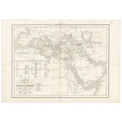
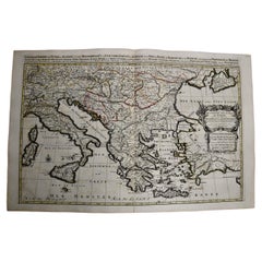
Antique Map of Southern Europe by F. Delamarche, 1837
Located in Langweer, NL
exquisite antique map offers a unique glimpse into the historical and biblical geography as understood in
Category
Antique Mid-19th Century Maps
Materials
Paper
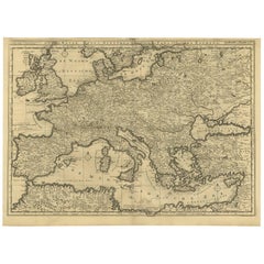
Rare Antique Bible Map of Southern Europe by A. Schut, 1743
Located in Langweer, NL
Antique map of the Mediterranean and a large part of Europe, illustrating the voyage of St. Paul to
Category
Antique Mid-18th Century Maps
Materials
Paper
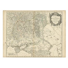
Detailed Antique Map of the Southern Part of European Russia and Ukraine, 1752
Located in Langweer, NL
Antique map titled 'Partie meridionale de la Russie Européenne'.
Detailed map of the southern
Category
Antique 1750s Maps
Materials
Paper
H 19.69 in W 25.99 in D 0 in
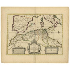
Antique Map of the Northern Coast of Africa and Southern Europe, circa 1745
By Covens & Mortier
Located in Langweer, NL
Antique map titled 'In Notitiam Ecclesiasticam Africae Tabula Geographica'. Very decorative hand
Category
Antique Mid-18th Century Maps
Materials
Paper
H 21.07 in W 25.4 in D 0.02 in
Southern & Eastern Europe: A Large 17th C. Hand-colored Map by Sanson & Jaillot
By Nicolas Sanson
Located in Alamo, CA
This large hand-colored map entitled "Estats de L'Empire des Turqs en Europe, ou sont les
Category
Antique 1690s French Maps
Materials
Paper
H 24.88 in W 38 in D 0.13 in
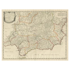
Large Map of Castile's Southern Realms - Granada, Andalusia, and Murcia, 1652
Located in Langweer, NL
This antique map, titled 'Les Etats de la Couronne de Castille', represents the southern regions of
Category
Antique Mid-17th Century Maps
Materials
Paper
H 17.64 in W 23.75 in D 0.02 in
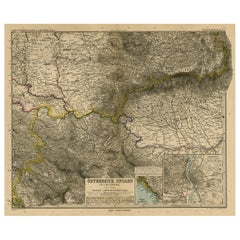
Antique Map of Eastern Europe, Incl Montenegro & Serbia & a Budapest Map, 1890
Located in Langweer, NL
Antique map titled 'Osterreich-Ungarn in 4 Blattern, Blatt 4.'
Map of Eastern Europe, with
Category
Antique 1890s Maps
Materials
Paper
H 15.63 in W 19.22 in D 0 in
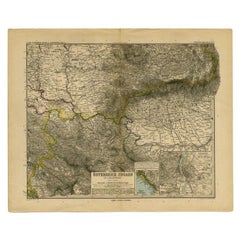
Antique Map of Eastern Europe by Stieler, 1890
Located in Langweer, NL
Antique map titled 'Osterreich-Ungarn in 4 Blattern, Blatt 4.' Map of Eastern Europe, with
Category
Antique 19th Century Maps
Materials
Paper
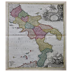
The Kingdom of Naples and Southern Italy: A Hand-Colored 18th Century Homann Map
By Johann Baptist Homann
Located in Alamo, CA
hand colored map of southern Italy and the ancient Kingdom of Naples created by Johann Baptist Homann
Category
Antique Early 18th Century German Maps
Materials
Paper
H 20 in W 23.88 in D 0.07 in
Finely Engraved Antique Map of Europe with inset of America, c.1745
By Guillaume De L'Isle
Located in Langweer, NL
Antique map titled 'Theatrum Historicum pars Occidentalis.' Finely engraved historical map with a
Category
Antique 18th Century Maps
Materials
Paper
Circa 1940 Original Political poster - To defend the imperial heritage - Colony
Located in PARIS, FR
.
It shows a sailor standing at attention, protecting a maritime map of southern Europe and Africa
Category
1940s Prints and Multiples
Materials
Paper, Lithograph
Wonderful Small Map of the Coasts of Arabia, Persia and Western India, ca. 1710
Located in Langweer, NL
Wonderful small map covering the coasts of Arabia, Persia and western India. It illustrates the
Category
Antique Early 18th Century European Maps
Materials
Paper
H 5.9 in W 8.9 in D 0.002 in
Antique Map of The United States of North America, 1882
Located in Langweer, NL
This is a historical map titled "The United States of North America, Central Part" from the 1882
Category
Antique 1880s Maps
Materials
Paper
Antique Map of Alentejo: Land of Tradition and Tranquility, 1903
Located in Langweer, NL
The image is a historical original antique map of the Alentejo region in Portugal. This map
Category
Antique Early 1900s Maps
Materials
Paper
Free Shipping
H 20.08 in W 14.77 in D 0 in
Hand Colored Antique Map of the Department of L'allier, France
By Victor Levasseur
Located in Langweer, NL
Southern Europe where the freshwater grayling occurs in a natural habitat. The whole is surrounded by
Category
Antique Mid-19th Century Maps
Materials
Paper
Original Antique Map of Malabar, Coromandel 'India' and Ceylon
Located in Langweer, NL
(..)'. Large and attractive original hand colored map of Sri Lanka and the Southern part of the Indian
Category
Antique Mid-18th Century Maps
Materials
Paper
Antique Map of Allier ‘France’ by V. Levasseur, 1854
By Victor Levasseur
Located in Langweer, NL
Southern Europe where the freshwater grayling, known in French as ombre des rivières, occurs in a natural
Category
Antique Mid-19th Century Maps
Materials
Paper
Antique Map of North Africa by Ortelius, c.1580
Located in Langweer, NL
is shown as a separate kingdom, and the adjoining parts of southern Europe can also be seen
Category
Antique 16th Century Maps
Materials
Paper
Antique Map of the Berchtesgaden Region by Scherer, 1699
Located in Langweer, NL
Antique map titled 'Principat et praepositura Berchtesgadensis (..).' Detailed uncommon map of the
Category
Antique 17th Century Maps
Materials
Paper
Antique Map of the Turkish Empire by Tirion 'c.1760'
Located in Langweer, NL
Southern Europe, the Middle East, Arabia, and Northeastern Africa. Published by I. Tirion, circa 1760.
Category
Antique Mid-18th Century Maps
Materials
Paper
Original Hand-coloured Antique Map of Pomerania by Sanson '1684'
By Nicolas Sanson
Located in Langweer, NL
Pomerania. Pomerania is a historical region on the southern shore of the Baltic Sea in Central Europe, split
Category
Antique Late 17th Century Maps
Materials
Paper
Antique Map of the Islands Within the Queen Charlotte's Islands
Located in Langweer, NL
Antique map titled 'Cote Septentrional de la plus grande des Isles de la Reine Charlotte (..)'. Map
Category
Antique Late 18th Century Maps
Materials
Paper
Map of Polynesia Highlighting Cultural Landscapes and Maritime Activities, 1851
Located in Langweer, NL
John Tallis & Company was a London-based map publisher that flourished during the 19th century
Category
Antique 1850s Maps
Materials
Paper
H 10.71 in W 14.26 in D 0 in
Map of Sevilla Province, 1901: A Depiction of The Spanish Cultural Heartland
Located in Langweer, NL
The print for sale here depicts a historical map of the province of Sevilla (Seville) from the year
Category
Antique Early 1900s Maps
Materials
Paper
Free Shipping
H 14.77 in W 20.08 in D 0 in
Burgos 1902: Geographic Map of Castile's Historic Heartland in Spain
Located in Langweer, NL
The map of the province of Burgos in the autonomous community of Castile and León in Spain, dated
Category
Antique Early 1900s Maps
Materials
Paper
Free Shipping
H 14.77 in W 20.08 in D 0 in
Antique Map of Sweden, Norway and Denmark by Johnson, 1872
Located in Langweer, NL
The image is an antique map, a two-page spread from "Johnson's New Illustrated Family Atlas of the
Category
Antique Late 19th Century Maps
Materials
Paper
Mediterranean Tapestry: A 19th Century Map of the Mediterranean Shores, 1882
Located in Langweer, NL
Europe down to the northern coastlines of Africa.
The map is a vivid document of the time, with each
Category
Antique 1880s Maps
Materials
Paper
H 11.03 in W 14.97 in D 0 in
Original Old Composite of Several Maps of the Ancient World on One Sheet, 1880
Located in Langweer, NL
Europe, North Africa, and parts of Asia, reflecting the Roman Empire at its extent.
The map includes
Category
Antique 1880s Maps
Materials
Paper
Free Shipping
H 15.56 in W 18.51 in D 0 in
"Nova Barbariae Descriptio", a 17th Century Hand-Colored Map of North Africa
By Johannes Janssonius
Located in Alamo, CA
adjacent countries in southern Europe, including Portugal, Spain, Italy, Greece and Asia Minor. The map is
Category
Antique Mid-17th Century Dutch Maps
Materials
Paper
H 22.38 in W 29 in D 0.13 in
Captain Cook's Exploration of Tahiti 18th C. Hand-Colored Map by Bellin
By Jacques-Nicolas Bellin
Located in Alamo, CA
This beautiful 18th century hand-colored copper plate engraved map is entitled "Carte de l'Isle de
Category
Antique Mid-18th Century French Maps
Materials
Paper
H 11.38 in W 17.5 in D 0.13 in
Antique Map of Central Asia Wiht Nova Zembla as an Island, C.1700
Located in Langweer, NL
Antique map titled 'Asiae Pars Potissima.' Attractive map focusing on the central part of Asia but
Category
Antique 18th Century Maps
Materials
Paper
Authentique Map by Pilon of The French Colonies in The West Indies, 1876
Located in Langweer, NL
The 1876 map titled "Carte des Colonies Françaises aux Antilles" represents a significant
Category
Antique Late 19th Century Maps
Materials
Paper
H 14.38 in W 16.54 in D 0 in
Antique Map of the Journey from Zhe-Hol in Tartary to Beijing and Hang-Tchoo Foo
Located in Langweer, NL
Europeans valuable new information on China's geography and social customs.
This map originates from 'An
Category
Antique Late 18th Century Maps
Materials
Paper
No Reserve
H 26.78 in W 20.08 in D 0.02 in
"Africa Vetus": a 17th Century Hand-Colored Map by Sanson
By Nicolas Sanson
Located in Alamo, CA
This original hand-colored copperplate engraved map of Africa entitled "Africa Vetus, Nicolai
Category
Antique Late 17th Century French Maps
Materials
Paper
Map Silk Embroidered Western Eastern Hemisphere New Old World Asia America Afri
Located in BUNGAY, SUFFOLK
A rare, late-18th century, silk, embroidered, double hemisphere, world map, blackwork, sampler
Category
Antique 18th Century British Georgian Maps
Materials
Silk
H 0.4 in W 0.4 in D 0.4 in
North & South America: A 17th Century Hand-colored Map by Jansson & Goos
By Johannes Janssonius
Located in Alamo, CA
route between Europe and Asia. The map includes portions of Japan, as well as multiple islands in the
Category
Antique 1620s Dutch Maps
Materials
Paper
Africa: A Large 17th Century Hand-Colored Map by Sanson and Jaillot
By Nicolas Sanson
Located in Alamo, CA
of Southern Europe and northeastern South America, including portions of Brazil and Paraguay. The
Category
Antique 1690s French Maps
Materials
Paper
California, Alaska and Mexico: 18th Century Hand-Colored Map by de Vaugondy
By Didier Robert de Vaugondy
Located in Alamo, CA
This an 18th century hand-colored map of the western portions of North America entitled "Carte de
Category
Antique 1770s French Maps
Materials
Paper
H 13.75 in W 16.63 in D 0.13 in
Ornate Cartography of Colonial Grandeur: The West India Islands around 1851
Located in Langweer, NL
empires of Europe, including the British Empire.
The screenshots from the map show various detailed
Category
Antique 1850s Maps
Materials
Paper
No Reserve
H 10.71 in W 14.26 in D 0 in
Southern & Eastern Europe: A Large 17th C. Hand-colored Map by Sanson & Jaillot
By Nicholas Sanson d'Abbeville
Located in Alamo, CA
This large hand-colored map entitled "Estats de L'Empire des Turqs en Europe, ou sont les
Category
1690s Landscape Prints
Materials
Engraving
Europa Regnorum Provinciarum: 18th Century Hand-colored Map of Europe by Lotter
By Tobias Conrad Lotter
Located in Alamo, CA
engraved hand-colored map of Europe is printed on a sheet that measures 20.88" high and 24" wide, with good
Category
Mid-18th Century Landscape Prints
Materials
Engraving
Europe Map Vintage Rollable Mural Countrystyle Wall Chart Decoration
Located in Berghuelen, DE
The vintage pull-down map shows the European continent / Europe. Published by Haack-Painke, Justus
Category
Vintage 1970s German Country Prints
Materials
Canvas, Wood, Paper
Travelers Mind Map
Located in New Orleans, LA
him on his other travels from Europe to US. Enchanted by the old and mestizo city, he returned to
Category
2010s Contemporary Paintings
Materials
Fabric, Oil, Acrylic
Captain Cook's Exploration of Tahiti: 18th C. Hand-colored Map by Bellin
By Jacques-Nicolas Bellin
Located in Alamo, CA
This beautiful 18th century hand-colored copper plate engraved map is entitled "Carte de l'Isle de
Category
Late 18th Century Landscape Prints
Materials
Engraving
The Map - Contemporary, 21st Century, Polaroid, Figurative
By Stefanie Schneider
Located in Morongo Valley, CA
The Map (Stage of Consciousness) - 2007
20x24cm,
Edition of 10,
Archival C-Print, artist
Category
Early 2000s Contemporary Portrait Photography
Materials
Photographic Paper, C Print, Color, Polaroid
H 7.88 in W 9.45 in D 0.04 in
California: 18th Century Hand-colored Map by de Vaugondy
By Didier Robert de Vaugondy
Located in Alamo, CA
This is an 18th century hand-colored map of the western portions of North America entitled "Carte
Category
1770s Landscape Prints
Materials
Engraving
"Africa Vetus": A 17th Century Hand-colored Map By Sanson
By Nicholas Sanson d'Abbeville
Located in Alamo, CA
This original hand-colored copperplate engraved map of Africa entitled "Africa Vetus, Nicolai
Category
1690s Landscape Prints
Materials
Engraving
New France and Labrador - Graphite Drawing, Landscape, On Antiqued Map
By Don Pollack
Located in Chicago, IL
Coeur d’Alenes trail in Northern Idaho. It is a place of rugged and stark beauty barely on the old maps
Category
21st Century and Contemporary Contemporary Landscape Paintings
Materials
Canvas, Oil
North & South America: A 17th Century Hand-colored Map by Jansson & Goos
By Johannes Jansson
Located in Alamo, CA
route between Europe and Asia. The map includes portions of Japan, as well as multiple islands in the
Category
1620s Landscape Prints
Materials
Engraving
Vintage Mural Rollable Map Wall Chart France Benelux Countries South England
Located in Berghuelen, DE
A cottagecore pull-down wall chart map illustrating France and the Benelux countries (the
Category
Mid-20th Century German Country Prints
Materials
Canvas, Wood, Paper
H 75.99 in W 61.03 in D 0.79 in
Africa: A Large 17th Century Hand-colored Map By Sanson and Jaillot
By Nicholas Sanson d'Abbeville
Located in Alamo, CA
of Southern Europe and northeastern South America, including portions of Brazil and Paraguay. The
Category
1690s Landscape Prints
Materials
Engraving
An exceptional pair of BLAEU table globes
By Willem Blaeu
Located in ZWIJNDRECHT, NL
maps, atlases and instruments. Blaeu’s globes were luxury items for wealthy and intellectual merchants
Category
Antique 17th Century European Dutch Colonial Globes
Materials
Other
Signs of disorientation
By Patrick Beaulieu
Located in Montreal, Quebec
neighborhood. A series of artworks (installations, video, photographs, geopoetic maps and writings) emerged
Category
2010s Contemporary Figurative Photography
Materials
Digital
Signs of disorientation
By Patrick Beaulieu
Located in Montreal, Quebec
neighborhood. A series of artworks (installations, video, photographs, geopoetic maps and writings) emerged
Category
2010s Contemporary Figurative Photography
Materials
Digital
Signs of disorientation
By Patrick Beaulieu
Located in Montreal, Quebec
neighborhood. A series of artworks (installations, video, photographs, geopoetic maps and writings) emerged
Category
2010s Contemporary Figurative Photography
Materials
Digital
Signs of disorientation
By Patrick Beaulieu
Located in Montreal, Quebec
neighborhood. A series of artworks (installations, video, photographs, geopoetic maps and writings) emerged
Category
2010s Contemporary Figurative Photography
Materials
Digital
Signs of disorientation
By Patrick Beaulieu
Located in Montreal, Quebec
neighborhood. A series of artworks (installations, video, photographs, geopoetic maps and writings) emerged
Category
2010s Contemporary Figurative Photography
Materials
Digital
Signs of disorientation
By Patrick Beaulieu
Located in Montreal, Quebec
neighborhood. A series of artworks (installations, video, photographs, geopoetic maps and writings) emerged
Category
2010s Contemporary Figurative Photography
Materials
Digital
Signs of disorientation
By Patrick Beaulieu
Located in Montreal, Quebec
neighborhood. A series of artworks (installations, video, photographs, geopoetic maps and writings) emerged
Category
2010s Contemporary Figurative Photography
Materials
Digital
Signs of disorientation
By Patrick Beaulieu
Located in Montreal, Quebec
neighborhood. A series of artworks (installations, video, photographs, geopoetic maps and writings) emerged
Category
2010s Contemporary Figurative Photography
Materials
Digital
- 1
Get Updated with New Arrivals
Save "Map Of Southern Europe", and we’ll notify you when there are new listings in this category.
Map Of Southern Europe For Sale on 1stDibs
Choose from an assortment of styles, material and more with respect to the map of southern Europe you’re looking for at 1stDibs. Frequently made of paper and wood, every map of southern Europe was constructed with great care. There are 32 variations of the antique or vintage map of southern Europe you’re looking for, while we also have 1 modern editions of this piece to choose from as well. You’ve searched high and low for the perfect map of southern Europe — we have versions that date back to the 18th Century alongside those produced as recently as the 21st Century are available. Many designers have produced at least one well-made map of southern Europe over the years, but those crafted by Nicolas Sanson, Johann Baptist Homann and Johannes Janssonius are often thought to be among the most beautiful.
How Much is a Map Of Southern Europe?
Prices for a map of southern Europe start at $35 and top out at $135,000 with the average selling for $1,400.
More Ways To Browse
George Nelson Folding Table
19 Th Century Landscapes
1984 Orwell
American Colonization Society
Jacqueline Kennedy Auction Catalogue
Garrett Price
18 Th Century Cross
Fire Island Pines
C Ford Riley
20 Th Century Portrait
City Of Oran
Ford Riley
Coronado Monterey
18 Th Century Oil On Canvas
Fumo Set
Del Coronado
Grizzly Bear Painting
Vintage Map Of Cape Cod
