Antique World Map Print
11
to
121
1,389
157
863
636
471
253
123
51
51
45
35
32
30
28
26
23
20
18
15
14
12
11
11
10
9
9
9
7
7
6
6
6
5
5
4
4
4
4
4
4
3
3
3
2
2
2
2
1
1
1
94
27
16
14
13
Sort By
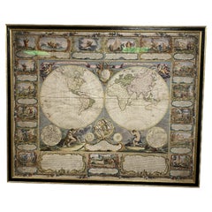
Colored wall map of the WORLD
By Chambon
Located in ZWIJNDRECHT, NL
huge wall map of the world in two hemispheres printed on two sheets, depicting the Eastern and Western
Category
Mid-18th Century French French Provincial Antique World Map Print
Materials
Wood, Paper
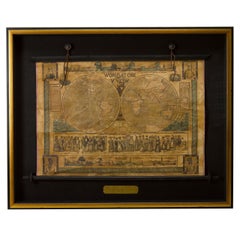
1847 “World at One View” Antique Hand-Colored Wall Map of the World
Located in Colorado Springs, CO
This is a highly desirable hanging wall map of the "World at One View", published in 1847 by Ensign
Category
19th Century American Antique World Map Print
Materials
Paper
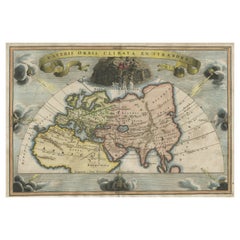
Decorative Ancient World Map with Large Parts of the World Still Unknown, c 1731
Located in Langweer, NL
Interesting ancient map of the world, based upon Strabo. The Southern tip of Africa is undiscovered
Category
1730s Antique World Map Print
Materials
Paper
H 9.45 in W 14.57 in D 0 in
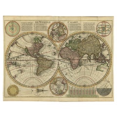
Antique Double Hemisphere World Map with California as an Island, 1710
Located in Langweer, NL
hemisphere world map from a Dutch bible by Cornelis Dankerts (Danckerts), engraved by Albert Schut, printed
Category
1710s Antique World Map Print
Materials
Paper
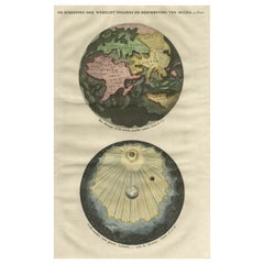
Beautiful Original Print of The Creation of the World According to Moses, 1725
Located in Langweer, NL
maps on one sheet showing the creation of the world according to Moses. The upper depiction shows the
Category
1720s Antique World Map Print
Materials
Paper
H 15.75 in W 9.93 in D 0 in
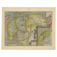
Antique Map of Friesland Also Know as the Peacock Map, C.1580
Located in Langweer, NL
established a business in dealing with books and drawing maps. His first remarkable map was a 8 sheet world
Category
18th Century Antique World Map Print
Materials
Paper
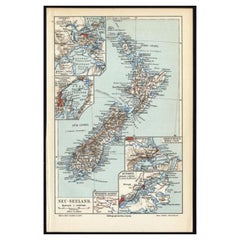
Antique Map of New Zealand, 1895
Located in Langweer, NL
attractive original old antique print / plate / map originates from 1885-1907 editions of a famous German
Category
19th Century Antique World Map Print
Materials
Paper
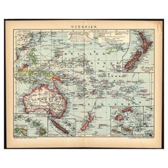
German Antique Map of Oceania, 1895
Located in Langweer, NL
Antique map titled 'Oceanie.' Map of Oceania. This attractive original old antique print / plate
Category
19th Century Antique World Map Print
Materials
Paper
Antique Map of New Ireland, 1774
Located in Langweer, NL
Antique print titled 'Neu Irrland (..)'. Antique map of New Ireland with 7 coastal profiles, Papua
Category
18th Century Antique World Map Print
Materials
Paper
Antique Map of the Coromandel Peninsula, 1754
Located in Langweer, NL
Coromandel printed for the London Magazine.
Artists and Engravers: This map is not attributed, so it may
Category
18th Century Antique World Map Print
Materials
Paper
Antique Map of Buckinghamshire in England, 1743
Located in Langweer, NL
tradition by using the prints of other publishers, notably the maps of Blaeu and Jansson. Only when these
Category
18th Century Antique World Map Print
Materials
Paper
Antique Map of Siberia by Reclus, 1881
Located in Langweer, NL
Antique map titled 'Itineraires en Siberie.' This map shows the itineraries of famous explorers in
Category
19th Century Antique World Map Print
Materials
Paper
German Antique Map of Australia, Meyers, 1885
Located in Langweer, NL
original old antique print / plate / map originates from 1885-1907 editions of a famous German encyclopedia
Category
19th Century Antique World Map Print
Materials
Paper
Antique Map of Asia by Larousse, 1897
Located in Langweer, NL
maps to collectors, historians, educators and interior decorators all over the world. Our collection
Category
19th Century Antique World Map Print
Materials
Paper
Antique Map of China by Larousse, 1897
By Pierre Larousse
Located in Langweer, NL
interior decorators all over the world. Our collection includes a wide range of authentic antique maps from
Category
19th Century Antique World Map Print
Materials
Paper
Antique Map of Switzerland by Barlow, 1807
Located in Langweer, NL
Antique map titled 'Switzerland with its subjects & allies from the best authorities'. Small map of
Category
19th Century Antique World Map Print
Materials
Paper
Antique Map of Oceania by Johnston, 1882
Located in Langweer, NL
Antique map titled 'Oceania'. Old map of Oceania with inset maps of Western Australia, Tasmania and
Category
19th Century Antique World Map Print
Materials
Paper
Antique Map of Spain and Portugal, 1882
Located in Langweer, NL
"Antique map titled 'Spain & Portugal'.
Old map of Spain and Portugal. This map originates from
Category
19th Century Antique World Map Print
Materials
Paper
Antique Map of Friesland by Guicciardini, 1613
Located in Langweer, NL
over the world. Our collection includes a wide range of authentic antique maps from the 16th to the
Category
17th Century Antique World Map Print
Materials
Paper
Antique Map of Switzerland by Johnston, 1882
Located in Langweer, NL
Antique map titled 'Switzerland and the Alps of Savoy and Piedmont'. Old map of Switzerland and the
Category
19th Century Antique World Map Print
Materials
Paper
Antique Map of Sumatra by Bellin, 1764
Located in Langweer, NL
Antique map Sumatra titled 'Carte de l'Isle de Sumatra'. Old map of Sumatra, Malaysia and the
Category
18th Century Antique World Map Print
Materials
Paper
Antique Map of Deventer in the Netherlands, 1691
Located in Langweer, NL
interior decorators all over the world. Our collection includes a wide range of authentic antique maps from
Category
17th Century Antique World Map Print
Materials
Paper
Antique Map of Coevorden in the Netherlands, 1691
Located in Langweer, NL
interior decorators all over the world. Our collection includes a wide range of authentic antique maps from
Category
17th Century Antique World Map Print
Materials
Paper
Antique Map of Northwestern India by Weller, 1857
Located in Langweer, NL
years 1856 and 1862 included in each edition a map of a part of the world. During this period a total of
Category
19th Century Antique World Map Print
Materials
Paper
Antique Map of South Australia by Tallis, 1851
By Thomas Kitchin
Located in Langweer, NL
published the Illustrated World Atlas, one of the last series of decorative world maps ever produced. The
Category
19th Century Antique World Map Print
Materials
Paper
Antique Map of the Holy Land, c.1717
Located in Langweer, NL
maps to collectors, historians, educators and interior decorators all over the world. Our collection
Category
18th Century Antique World Map Print
Materials
Paper
Antique Map of France with Decorative Border, 1766
Located in Langweer, NL
over the world. Our collection includes a wide range of authentic antique maps from the 16th to the
Category
18th Century Antique World Map Print
Materials
Paper
Antique Map of Novaya Zemlya by Bellin, 1758
Located in Langweer, NL
Antique map titled 'Partie de la Mer Glaciale Contenant la Nouvelle Zemle et le Pais des Samoiedes
Category
18th Century Antique World Map Print
Materials
Paper
Antique Map of South America by Johnston, 1861
Located in Langweer, NL
Antique map titled 'South America'.
Old map of South America, with an inset map of the Galapagos
Category
19th Century Antique World Map Print
Materials
Paper
Antique Map of South America by Johnston, 1882
Located in Langweer, NL
Antique map titled 'South America'. Old map of South America, with an inset map of the Galapagos
Category
19th Century Antique World Map Print
Materials
Paper
Antique Map of South Australia by Johnston, 1882
By Thomas Kitchin
Located in Langweer, NL
Antique map titled 'South Australia, New South Wales, Victoria & Queensland'. Old map of Southern
Category
19th Century Antique World Map Print
Materials
Paper
Antique Map of Northern India by Johnston, 1882
Located in Langweer, NL
Antique map titled 'India (Northern Sheet)'. Old map of Northern India. This map originates from
Category
19th Century Antique World Map Print
Materials
Paper
Antique Map of South America, Southern Part, 1882
Located in Langweer, NL
Antique map titled 'South America'. Old map of South America. This map originates from 'The Royal
Category
19th Century Antique World Map Print
Materials
Paper
Antique Map of Southern Russia by Johnston, 1882
Located in Langweer, NL
"Antique map titled 'South-West Russia'. Old map of southern Russia, also showing the extent of the
Category
19th Century Antique World Map Print
Materials
Paper
Antique Map of Northern Asia by Mallet, 1719
Located in Langweer, NL
star maps, maps of the ancient and modern world, and a synopsis of the customs, religion and government
Category
18th Century Antique World Map Print
Materials
Paper
Antique Map of Southern Scotland by Johnston, 1882
Located in Langweer, NL
"Antique map titled 'Scotland'. Old map of Southern Scotland. This map originates from 'The Royal
Category
19th Century Antique World Map Print
Materials
Paper
Antique Map of Northern Scotland by Johnston, 1882
Located in Langweer, NL
Antique map titled 'Scotland'. Old map of Northern Scotland. This map originates from 'The Royal
Category
19th Century Antique World Map Print
Materials
Paper
Genuine Antique Engraved Map of Helvetia or Switzerland, 1729
Located in Langweer, NL
request.
We ship our antique maps and prints carefully packed across the world with Express Service
Category
1720s Antique World Map Print
Materials
Paper
Original 1882 Map of Arabia, Red Sea & Persian Gulf
Located in Langweer, NL
This print is a historically significant map titled "Arabia, the Red Sea, and the Persian Gulf
Category
1880s Antique World Map Print
Materials
Paper
Antique Map of the Malabar Coast by Baldaeus, 1744
By Philip Baldaeus
Located in Langweer, NL
first printed in English', printed in 1744 for Henry Lintot and John Osborn. This map originates from
Category
18th Century Antique World Map Print
Materials
Paper
Antique Map of the Cocos or Keeling Islands, 1778
Located in Langweer, NL
Antique map titled 'Die Cocos Insel vom Capt. Wallis Bosawren. Die Verrather Islel von Capt. Wallis
Category
18th Century Antique World Map Print
Materials
Paper
Antique Map Depiciting a Horizon or Hemisphere c.1703
Located in Langweer, NL
Antique map depiciting a horizon/hemisphere. Printed for Scherer's 'Atlas Novus' (1702-1710
Category
18th Century Antique World Map Print
Materials
Paper
Antique Map of a Hemisphere by Scherer, c.1703
Located in Langweer, NL
Antique map depiciting a horizon/hemisphere. Printed for Scherer's 'Atlas Novus' (1702-1710
Category
18th Century Antique World Map Print
Materials
Paper
Antique Map of East Frisia by Ortelius, c.1595
Located in Langweer, NL
Antique print, titled: 'Frisia Orientalis.' Map of East Frisia originating from 'Theatrum Orbis
Category
16th Century Antique World Map Print
Materials
Paper
Antique Map Illustrating Solar Eclipses by Scherer, C.1703
Located in Langweer, NL
maps to collectors, historians, educators and interior decorators all over the world. Our collection
Category
18th Century Antique World Map Print
Materials
Paper
Antique Map of the Asian Continent by Johnston, 1885
Located in Langweer, NL
original antique maps to collectors, historians, educators and interior decorators all over the world. Our
Category
19th Century Antique World Map Print
Materials
Paper
Antique Map of Northern India by Blackie & Son, 1860
Located in Langweer, NL
Antique map titled 'India'. Old map depicting northern India. This map originates from 'The
Category
19th Century Antique World Map Print
Materials
Paper
Antique Map of the Pacific Ocean by Rienzi, 1836
Located in Langweer, NL
antique maps to collectors, historians, educators and interior decorators all over the world. Our
Category
19th Century Antique World Map Print
Materials
Paper
Antique Map of the Low Countries by Cary, 1813
Located in Langweer, NL
general map of the Low Countries published by the English cartographer John Cary (1755-1835). Printed on 4
Category
19th Century Antique World Map Print
Materials
Paper
Antique Map of the Holy Land by Schut, 1710
Located in Langweer, NL
-. print- and map-seller. (He called himself 'Papiere, konst en caertverkoper.') His sons Dancker II and
Category
18th Century Antique World Map Print
Materials
Paper
Antique Map of Asia Minor by Malte-Brun, 1847
Located in Langweer, NL
Antique map titled 'Asie Mineure Ancienne'. This is an original antique map of Asia Minor from
Category
19th Century Antique World Map Print
Materials
Paper
1633 Map Entitled "Beauvaisis Comitatus Belova Cium, Ric.0002
Located in Norton, MA
/Ashley) * 1590 World Map in two hemispheres illustrating Drake\\\\\\\\\\\\\\\'s circumnavigation * c
Category
17th Century Dutch Antique World Map Print
Materials
Paper
Antique Map of Spain and Portugal by Mitchell, 1846
Located in Langweer, NL
Antique map titled 'Kingdom of Spain and Portugal'. Old map of Spain and Portugal, with an inset
Category
19th Century Antique World Map Print
Materials
Paper
Antique Map of Sweden and Norway by Mitchell, 1846
Located in Langweer, NL
Universal Atlas Containing Maps of the various Empires, Kingdoms, States and Republics Of The World (..) by
Category
19th Century Antique World Map Print
Materials
Paper
Antique Map of the Buton Strait by Philippe, 1787
Located in Langweer, NL
Celebes, Indonesia. This map originates from 'World atlas for the study of geography and ancient and
Category
18th Century Antique World Map Print
Materials
Paper
German Antique Map of the Indian Oceaan, Meyers, 1895
Located in Langweer, NL
This attractive original old antique print / plate / map originates from 1885-1907 editions of a
Category
19th Century Antique World Map Print
Materials
Paper
Antique Map of Russia in Asia by Weller, 1882
Located in Langweer, NL
Antique map titled 'Russia in Asia'. Old map of Russia originating from Blackie's The Comprehensive
Category
19th Century Antique World Map Print
Materials
Paper
Antique Map of Southern Zeeland by Von Reilly, 1790
Located in Langweer, NL
' (Wien: Reilly, 1791-1806), a world atlas in 830 maps by Franz Joseph Johann von Reilly. Artists and
Category
18th Century Antique World Map Print
Materials
Paper
Antique Map of Sweden and Norway by Johnston, 1882
Located in Langweer, NL
Antique map titled 'Sweden & Norway (Scandinavia)'. Old map of Sweden and Norway, with inset map of
Category
19th Century Antique World Map Print
Materials
Paper
Antique Map of Gelderland and Overijssel by Guicciardini, 1613
Located in Langweer, NL
Antique map titled 'Geldria et Transisulania.' (Map of the provinces of Gelderland and Overijssel
Category
17th Century Antique World Map Print
Materials
Paper
- 1
- ...
Get Updated with New Arrivals
Save "Antique World Map Print", and we’ll notify you when there are new listings in this category.
Antique World Map Print For Sale on 1stDibs
Choose from an assortment of styles, material and more with respect to the antique world map print you’re looking for at 1stDibs. An antique world map print — often made from paper, wood and metal — can elevate any home. Your living room may not be complete without an antique world map print — find older editions for sale from the 18th Century and newer versions made as recently as the 20th Century. When you’re browsing for the right antique world map print, those designed in Baroque, Georgian and Victorian styles are of considerable interest. A well-made antique world map print has long been a part of the offerings for many furniture designers and manufacturers, but those produced by Cook, Pieter Van Der Aa and Jacques-Nicolas Bellin are consistently popular.
How Much is a Antique World Map Print?
An antique world map print can differ in price owing to various characteristics — the average selling price 1stDibs is $318, while the lowest priced sells for $58 and the highest can go for as much as $142,836.
More Ways To Browse
Antique Map Israel
Malabar Map
Antique Surveyor Compass
Mitchell Antique Maps
Antique Map Palestine
Antique Map Boston
Antique Mace
Richard Wentworth
Map Panama
Afghanistan Antique Map
Map Alps
Cyprus Antique Maps
Antique Map Of Cyprus
Map Of Alps
Antique New Orleans Maps
Antique Map New Orleans
Antique Map Of New Orleans
Antique Maps Of New Orleans
