Engraved More Furniture and Collectibles

to
340
612
270
895
5
5
22
16
13
12
12
12
10
7
4
2
2
2
1
1
1
1
513
240
142
10
66
33
25
7
4
3
5
6
1
4
10
3
4
674
196
98
78
40
356
103
78
70
63
905
905
905
10
9
9
8
5
Technique: Engraved
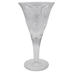
English 1953 Elizabeth II Coronation Glass Goblet by Webb
Located in Chapel Hill, NC
1953 Elizabeth II Coronation Glass Goblet by Webb, England. Rose & Thistle engraving. Hand-blown. Signed: Webb, England. Drawn trumpet form. St. Edward's Crown & the symbols of Engla...
Category

1950s English Vintage Engraved More Furniture and Collectibles

Materials

Glass

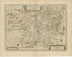
Historic Map of the Bishopric of Paderborn by Blaeu, a Masterpiece of 1645
Located in Langweer, NL
This hand-colored map, titled "Paderbornensis Episcopatus Descriptio Nova," depicts the Bishopric of Paderborn, a historical ecclesiastical territory within the Holy Roman Empire, lo...
Category

1640s Antique Engraved More Furniture and Collectibles

Materials

Paper

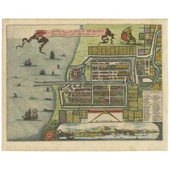
Antique Map of Batavia 'Jakarta, Indonesia' by Montanus, 1679
Located in Langweer, NL
Fine early plan of Batavia (Jakarta), published by Arnoldus Montanus. This map has a vignette at the bottom showing Jakarta from the sea with the volcanoes Mount Gede, Mount Pangrnago and Mount Salak in the background. The plan is based on the earlier, much larger map of Batavia published by Clement de Jonghe...
Category

Late 17th Century Unknown Antique Engraved More Furniture and Collectibles

Materials

Paper

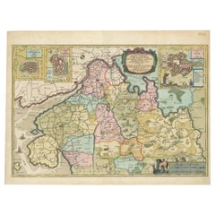
The 17th Century Map of Northern Dithmarschen and Its Towns in Germany
Located in Langweer, NL
This is a detailed colored copperplate engraving depicting northern Dithmarschen, accompanied by town plans of Weßlingburen (now Wesselburen), Lunden, and Heyde (now Heide) at the to...
Category

1640s Antique Engraved More Furniture and Collectibles

Materials

Paper

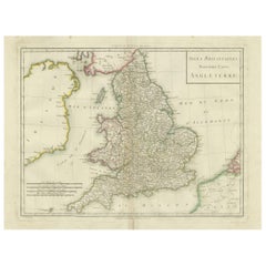
Map of England and Surrounding Regions: Early 19th Century - 1802 Tardieu Atlas
Located in Langweer, NL
Title: Isles Britanniques. Troisieme Carte, Angleterre Publication Details: - **Atlas Title:** Nouvel Atlas Universel de Géographie Ancienne et Moderne - **Purpose:** For the Nouve...
Category

Early 1800s Antique Engraved More Furniture and Collectibles

Materials

Paper

The Valley of Inspruck: An 18th-Century Engraved Perspective, 1792
Located in Langweer, NL
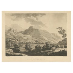
Title: "The Valley of Inspruck: An 18th-Century Engraved Perspective" This elegant original antique engraving, titled "The Valley of Inspruck," showcases a serene view of the Innsbruck Valley. The artwork is delicately rendered, capturing the grandeur of the mountains and the pastoral tranquility of the valley. The print depicts a detailed landscape scene, replete with towering craggy peaks that loom over a peaceful settlement nestled in the valley. A striking feature is the contrast between the ruggedness of the natural environment and the cultivated lands and architecture, indicating a harmonious coexistence of humanity with nature. It was published as directed on January 1, 1792, by T & G Egerton of Whitehall for the author. Albanis Beaumont is credited with the original design ('Del.' for delineavit, indicating he drew the initial illustration), and Cornelis Apostool is noted for the engraving work ('Sculp.' for sculpsit, indicating he engraved the image). The publication of this print during the late 18th century aligns with a time when there was a heightened interest in natural beauty and the picturesque, reflected in the art and literature of the Romantic period. This print would have appealed to those with an appreciation for both the aesthetic and the sublime qualities of the European landscape. The publication by T & G Egerton, a reputable firm known for their work in the arts, and the involvement of a skilled artist and engraver like Beaumont and Apostool, respectively, underline the quality and desirability of the print. It is a piece that would attract collectors of fine engravings and admirers of European landscapes, offering a window into the aesthetic values and artistic endeavors of the late 18th century. As a historical piece, this print offers a view into the past, inviting contemplation of the rich cultural and natural heritage of the Innsbruck area. It is a valuable collectible for enthusiasts of antique maps and prints...
Category

Late 18th Century Antique Engraved More Furniture and Collectibles

Materials

Paper

Antique Map of Tartary and Northeast Asia by Bellin, circa 1750
Located in Langweer, NL
Antique map titled 'Carte de la Tartarie Occidentale'. Map of Tartary and northeast Asia, from Lake Baykal, Partie du Siberia in the north, Pays des Kalkas at the center, as well as ...
Category

Mid-18th Century European Antique Engraved More Furniture and Collectibles

Materials

Paper

Battle of Wimpfen, 1622: Engraving by Matthäus Merian (ca. 1645)
Located in Langweer, NL
Title: Battle of Wimpfen, 1622: Engraving by Matthäus Merian (ca. 1645) Description: This antique copper engraving, created by the renowned Swiss-German engraver Matthäus Merian aro...
Category

1640s Antique Engraved More Furniture and Collectibles

Materials

Paper

Black Sea & Eastern Mediterranean Map: Eastern Roman Empire, Tardieu Atlas, 1802
Located in Langweer, NL
Antique Map with Title: "Partie Orientale de l'Empire Romain ou du Monde connu des Anciens" Publication Details: - **Atlas Title:** Nouvel Atlas Universel de Géographie Ancienne e...
Category

Early 1800s Antique Engraved More Furniture and Collectibles

Materials

Paper

Original 1806 Engraved Map of Asia and Surrounding Regions by John Cary
Located in Langweer, NL
The map titled "A New Map of Asia, From the Latest Authorities" was published in 1806. It is a detailed and comprehensive depiction of the continent of Asia, extending from Europe and the Arabian Peninsula in the west to Japan and the Pacific Islands in the east, and from the Arctic regions in the north to parts of New Holland (Australia) and the Indian Ocean in the south. The map is finely engraved, with political boundaries delineated using color to distinguish different empires, kingdoms, and colonial possessions of the time. Key geographical features such as mountain ranges, rivers, and major cities are clearly marked. It also includes significant maritime routes and islands across the Indian and Pacific Oceans, reflecting the global trade and exploration activities of the early 19th century. Notable Features: - Asia is represented with its vast and diverse regions, including the extensive Russian Empire in the north, the Ottoman Empire in the west, the Qing Dynasty's control over China, and the Mughal Empire's influence in India, which is under increasing British control. - India is shown with its numerous princely states, many of which are under British influence or control. - Southeast Asia includes the colonial possessions of European powers, particularly the Dutch East Indies, Spanish Philippines...
Category

Early 1800s Antique Engraved More Furniture and Collectibles

Materials

Paper

California, Alaska and Mexico: 18th Century Hand-Colored Map by de Vaugondy
By Didier Robert de Vaugondy
Located in Alamo, CA
This an 18th century hand-colored map of the western portions of North America entitled "Carte de la Californie et des Pays Nord-Ouest separés de l'Asie par le détroit d'Anian, extra...
Category

1770s French Antique Engraved More Furniture and Collectibles

Materials

Paper

The 1649 Haderschleben Map of Western Jutland and North Sea Islands
Located in Langweer, NL
This is a beautiful example of an antique map, titled "Westertheil des Amptes Haderschleben Zusambt Rieben und dem Loehmcloster Anno 1649." It's a hand-colored copper etching by Matt...
Category

1640s Antique Engraved More Furniture and Collectibles

Materials

Paper

Imperii Persici Delineatio: A 1722 Cartographic Masterpiece of Persia by Schenk
Located in Langweer, NL
Title: IMPERII PERCICI delineatio ex scriptis potissimum geographicis Arabum et Persarum Cartographer: Petrus Schenk (Pieter Schenk), 1722 An original antique hand-colored engraved...
Category

1720s Antique Engraved More Furniture and Collectibles

Materials

Paper

Coronation of King George vi and Queen Elizabeth Glass Tankard
Located in New Orleans, LA
Intricate engravings symbolic of the English monarchy decorate this limited edition glass tankard commemorating the 1937 coronation of King George VI and Queen Elizabeth...
Category

20th Century English Engraved More Furniture and Collectibles

Materials

Glass

Midcentury Sterling Silver West Indies Cricket Control Board Presentation Tray
Located in Hamilton, Ontario
This sterling silver footed presentation tray was made by the well-known English maker, Barker Ellis in circa 1967 in an Edwardian style. The tray is...
Category

Mid-20th Century English Edwardian Engraved More Furniture and Collectibles

Materials

Sterling Silver

Antique Bird's Eye-view Atjien or Atjeh in Aceh in Northern Sumatra, Indonesia
Located in Langweer, NL
Description: Antique print Indonesia titled 'Atsjien'. Bird's eye-view of the Town of Atjien on the northernmost point of Sumatra. This print originates from 'Oud en Nieuw Oost-Indië...
Category

1720s Antique Engraved More Furniture and Collectibles

Materials

Paper

Ancient Course of the Ganges: A First Ptolemaic Map of India by Mercator, c.1584
Located in Langweer, NL
This remarkable map, titled "Asiae X Tab:", is a significant historical artifact that represents the convergence of knowledge and craftsmanship from two of the most esteemed figures in the history of geography and cartography. Created by Gerard Mercator and based on the geographical insights of Claudius Ptolemy, this map is part of the rare first issue published in Brussels in 1578. The map itself meticulously delineates the region between the Indus and Ganges rivers, an area of immense historical and geographical importance. It is an excellent representation of Ptolemy's second-century geographical data, which was fundamental in shaping the modern principles of mapmaking. Mercator, renowned for his precision and dedication to adhering closely to Ptolemy's original intentions, showcases this commitment through the detailed depiction of this significant Asian landscape. This edition stands out not only for its historical accuracy but also for its artistic execution. Gerard Mercator, who was also an innovator in the use of the italic hand for map lettering, first introduced this style in his "Literarum latinarum" in 1540. The use of italics in this map enhances its legibility and aesthetic appeal, which became a hallmark of the finest sixteenth and seventeenth-century Dutch maps, largely attributed to Mercator’s influence. The map measures 13 ½ x 18 inches and features fine hand coloring, which has been preserved in almost excellent condition alttough there some browning due to age. As a splendid example of the first issue from Mercator’s definitive edition of Ptolemy’s "Geographia", it not only serves as a testament to the rich history of geographical exploration but also stands as a beacon of the enduring legacy of its makers, shaping the future of cartographic design and precision. The map "Asiae X Tab:", focusing on the region between the Indus and Ganges rivers, highlights several areas and cities of historical and geographical importance that are likely of interest to scholars, historians, and collectors. Here are key locations depicted on the map: 1. **Indus River**: As one of the major rivers of Asia and a cradle of ancient civilizations like the Indus Valley Civilization, the Indus River holds significant historical importance. 2. **Ganges River**: Another crucial river not just for its cultural and religious significance in India, but also as a vital geographic feature in ancient and medieval maps...
Category

16th Century Antique Engraved More Furniture and Collectibles

Materials

Paper

Late 19th Century Continental Silver Kiddush Cup
Located in New York, NY
Hand engraved silver Kiddush cup, 1894. Engraved with Hebrew text: "This cup of Blessing donated by Max Freined for "Aid for sick" society, Rosh Ha'Shana, ...
Category

1890s European Antique Engraved More Furniture and Collectibles

Materials

Silver

1638 Plancius Detailed Map of Sri Lanka or Ceylon with Decorative Cartouches
Located in Langweer, NL
"1638 Plancius Detailed Map of Sri Lanka with Decorative Cartouches" This beautifully detailed map of Sri Lanka, titled "Ins. Ceilan," was engraved by P. Plancius from a design by C...
Category

1630s Antique Engraved More Furniture and Collectibles

Materials

Paper

English Art Nouveau Floral Brass Table Bookstand/ Easel
Located in West Palm Beach, FL
English Art Nouveau Floral Brass Table Bookstand/Easel England, 20th century  A magnificent example of English Art Nouveau is this exquisite brass table bookstand/easel. Made in Eng...
Category

20th Century English Art Nouveau Engraved More Furniture and Collectibles

Materials

Brass

1817 Large Northern Hindostan Map by J. Thomson – New General Atlas
Located in Langweer, NL
1817 Thomson Map of Northern Hindoostan – Detailed British Cartography of India This map, titled "A New Map of Hindoostan from the Latest Authorities," was drawn and engraved for Jo...
Category

1810s Antique Engraved More Furniture and Collectibles

Materials

Paper

Cartographic Depiction of Flensburg and Surrounding Territories, Anno 1648
Located in Langweer, NL
Title: Landtcarte Vonn dem Ambte Flensborg, ohne Nordgoeßherde. Anno 1648. Description: This exquisitely detailed and old coloured map of Flensburg was crafted by the noted cartogr...
Category

1640s Antique Engraved More Furniture and Collectibles

Materials

Paper

Circa 1659 Blaeu Family Map: Glogau and the Odra River Valley, Silesia
Located in Langweer, NL
Circa 1659 Blaeu Family Map: Glogau and the Odra River Valley, Silesia This hand-colored map from circa 1659 by the Blaeu Family, titled "Ducatus Silesiae Glogani Vera Delineatio," provides a detailed view of the Odra River valley in western Poland, centered around the city of Glogau. The map, based on the work of Silesian cartographer Jonas Scultetus, is oriented with north to the left. It intricately details forests, rivers, lakes, and numerous small villages. A large decorative title cartouche features an ornate coat of arms and a key to the map's symbols. The bottom right includes a finely crafted scale of miles cartouche, adorned with calipers and a pair of falcons. Published between 1659 and 1672, the map has Spanish text on the verso. Measuring 19.9 inches wide by 16.4 inches high, it is in good condition with full contemporary color on a bright sheet, a watermark of the god Atlas, some marginal soiling, and a few short tears along the edges. Keywords: - Blaeu Family map - Silesia historical map - Glogau map - Odra River valley - 17th-century Poland map - Jonas Scultetus - Decorative cartouches - Historical cartography - Antique maps of Poland...
Category

1650s Antique Engraved More Furniture and Collectibles

Materials

Paper

French Pair of World War I Brass Heron Engraved Shells Casing Trench Artillery
Located in Labrit, Landes
Antique French pair of shell casings from the World War I. Trench Artillery Brass engraved representing a heron in a pond surrounded by rushes on each c...
Category

Early 20th Century French French Provincial Engraved More Furniture and Collectibles

Materials

Brass

Large Mid-Century Era Metal Cigarette Case with World Globe & Compass Decoration
Located in Hamilton, Ontario
This large cigarette case was made by the well known Wadsworth's of Canada and dates to approximately 1970 and done in the period Mid-Century Modern style. The box is composed of eng...
Category

Mid-20th Century Canadian Mid-Century Modern Engraved More Furniture and Collectibles

Materials

Metal

18th Century German Pewter Passover Plate
Located in New York, NY
Pewter passover tray, Germany, 18th century. The outer rim has wriggle- work engraving of the order of the Seder service, along with a pair of birds fl...
Category

Late 18th Century German Antique Engraved More Furniture and Collectibles

Materials

Pewter

1634 Mercator/Jansson Map: Eastern Austria with Vienna, Hand-Colored
Located in Langweer, NL
1634 Mercator/Jansson Map: Eastern Austria with Vienna, Hand-Colored This hand-colored map from 1634, titled "Austria Archiducatus," by Mercator and Jansson, depicts the eastern reg...
Category

1630s Antique Engraved More Furniture and Collectibles

Materials

Paper

Fabulous Original Antique two-sheet Map of the Caspian Sea, ca.1723
Located in Langweer, NL
Carte Marine de la Mer Caspiene... [and] Coste de Perse sur la Mer Caspiene et Partie de Celles de Tartarie", Delisle, Guillaume (2 maps) Subject: Caspian Sea ...
Category

1720s Antique Engraved More Furniture and Collectibles

Materials

Paper

Elizabeth II Commemorative Coronation Tyg
Located in New Orleans, LA
Created to commemorate the coronation of Queen Elizabeth II, this engraved glass tyg is a beautiful celebration of this historic event. Held at Westminster Abb...
Category

20th Century English Other Engraved More Furniture and Collectibles

Materials

Glass

Architectural Antique Print of Various Garden Temples by Le Rouge, c.1785
Located in Langweer, NL
Untitled antique print showing various garden temples. This print originates from 'Jardins Anglo-Chinois à la Mode' by Georg Louis le Rouge. Artists and ...
Category

18th Century Antique Engraved More Furniture and Collectibles

Materials

Paper

Map of Choromandel & Malabar, Incl Kerala, Tamil Nadu & Part of Sri Lanka, 1726
Located in Langweer, NL
Antique map titled 'Nieuwe kaart van Choromandel ende Malabar.' Original antique map of Southern India documenting the VOC's areas of influence. Included is Kerala, Tamil Nadu...
Category

1720s Antique Engraved More Furniture and Collectibles

Materials

Paper

Antique Map of Peloponnesus, Greece by Pierre Antoine Tardieu, 1797
Located in Langweer, NL
This antique map, titled "Carte Ancienne d'Allemagne," represents ancient Germany and surrounding regions. It was published by the well-known Parisian mapmakers and publishers Jean-Baptiste-Louis Clouet and Alexandre Aimé Vuillemin in the late 18th century, specifically in 1787. The map covers the extensive geographical area of ancient Germany, highlighting various tribes and regions known at the time. Key features include: 1. **Geographical Boundaries**: The map outlines the territorial extents of ancient Germany, bordered by Gallia (France) to the west, Sarmatia (parts of Eastern Europe) to the east, and the Italian regions to the south. The northern boundary reaches the Oceanus Germanicus (North Sea) and the Sarmatian Sea (Baltic Sea). 2. **Tribal Regions**: It details numerous ancient Germanic...
Category

1790s Antique Engraved More Furniture and Collectibles

Materials

Paper

Old Antique Map of the East Indies and Southeast Asia, ca.1644
Located in Langweer, NL
Antique map titled 'India quae Orientalis dicitur, et Insulae adiacentes'. Old map of the East Indies and Southeast Asia showing the area between India in the West and parts of Japan, the Marianas and New Guinea/Australia in the East. This map is dedicated to D. Christophorus Thisius by Henricus...
Category

1640s Antique Engraved More Furniture and Collectibles

Materials

Paper

Bird’s-Eye View Map of Gallipoli: Fortified Ionian Gem by Mattheus Merian, 1688
Located in Langweer, NL
Bird’s-Eye View Map of Gallipoli: Fortified Ionian Gem by Mattheus Merian Description: This exquisitely detailed map of Gallipoli, crafted by the renowned engraver Mattheus Merian,...
Category

1680s Antique Engraved More Furniture and Collectibles

Materials

Paper

Gallipoli Fortifications: A 1688 Engraved Bird’s-Eye Map by Mattheus Merian
Located in Langweer, NL
Gallipoli Fortifications: A 1688 Bird’s-Eye Map by Mattheus Merian Description: This exquisitely detailed map of Gallipoli, crafted by the renowned engraver Mattheus Merian, offers ...
Category

1680s Antique Engraved More Furniture and Collectibles

Materials

Paper

Map of Amersfoort and Surroundings by Covens & Mortier, published in 1747
Located in Langweer, NL
Map of Amersfoort and Surroundings by Covens & Mortier, published in 1747 Hand-coloured copper engraving titled *Carte Particulière des Environs de Amersfoort*, created by Jean Cove...
Category

1740s Antique Engraved More Furniture and Collectibles

Materials

Paper

Genuine Antique Engraved Map of Helvetia or Switzerland, 1729
Located in Langweer, NL
Decorative early 18th century engraved map of Switzerland. Title: Helvetia Conterminarumq terra rum antiqua. Translated from Latin: Switzerland is an ancient land Description: Switzerland, antique copperplate engraved map with hand coloring and a decorative title cartouche. Two figures greatly enhances visual appeal. Author: Phillip Cluver, or Philip Cluverius, Philipp Clüver, Latinized as Philippus Cluverius studied law in Leiden and settled over there in 1615. We only sell Guaranteed Absolutely Original authentic Maps and Prints. A Certificate of Authenticity ( COA ) will be supplied on request. We ship our antique maps and prints...
Category

1720s Antique Engraved More Furniture and Collectibles

Materials

Paper

Antique Map of Asian Turkey, Levant, and Mesopotamia by Tardieu, circa 1802
Located in Langweer, NL
This is an original antique map titled "Carte de la Turquie Asiatique," depicting the Asian territories of the Ottoman Empire. Created by Pierre Antoine Tardieu, this map illustrates...
Category

Early 1800s Antique Engraved More Furniture and Collectibles

Materials

Paper

Bonne Map of Philippines, Formosa, Siam, Indochina & South China, 1780
Located in Langweer, NL
Bonne Map of Philippines, Formosa, Siam, Indochina & South China, 1780 Les Isles Philippines, celle de Formose, le Sud de la Chine, les Royaumes de Tunkin, de Cochinchine, de Cambog...
Category

1780s Antique Engraved More Furniture and Collectibles

Materials

Paper

1698 Mercator Ptolemaic Map of Asia East of the Ganges
Located in Langweer, NL
**Catalogue Description:** **Title:** Tab. XI. Asiae, comprehendens Indiam extra Gangem. **Description:** This is an exquisite Ptolemaic map depicting Asia east of the Ganges, ti...
Category

1680s Antique Engraved More Furniture and Collectibles

Materials

Paper

Antique Map of Southern Syria by Fullarton & Co, circa 1860
Located in Langweer, NL
Antique map titled 'Syria south part'. Published by Fullarton & Co, Glasgow, circa 1860. - **Title**: Syria South Part - **Publisher**: Fullarton & Co, Glasgow - **Date of Publicati...
Category

Mid-19th Century Antique Engraved More Furniture and Collectibles

Materials

Paper

Antique Map of the Area Around Venice in Italy by H. Hondius, circa 1606
By Jodocus Hondius, Gerard Mercator
Located in Langweer, NL
Attractive and early map of the area around Venice, Italy. With South-Tirol in the North, areas of Krain (Slovenia), Croatia, Ferrara, Modena and Piacenza. In the east with areas aro...
Category

Early 17th Century Dutch Antique Engraved More Furniture and Collectibles

Materials

Paper

Detailed Antique Map of Jamaica - Published in Weimar, 1825
Located in Langweer, NL
This map of Jamaica is an interesting historical document. This map is part of an atlas that was issued in six editions in English, French, and German ...
Category

1820s Antique Engraved More Furniture and Collectibles

Materials

Paper

20th Century Italian Solid Silver Holy Water Stoup with Tap
Located in VALENZA, IT
Holy water stoup in 800 solid silver. Made entirely by hand, embossed and chiseled with leaves and pods motif. The lid is removable to allow water to ...
Category

1970s Italian Other Vintage Engraved More Furniture and Collectibles

Materials

Silver

1636 Jansson Map of Ireland Entitled "Comitatus Lageniae, " Ric.a007
Located in Norton, MA
1646 Jansson map entitled "Procinvia connactiae," Ric.a006 Description: The PROVINCE of CONNAVGT 490 x 380From vol 4 of Jansson's Atlas Novus 1646, published in Amsterdam with...
Category

17th Century Unknown Antique Engraved More Furniture and Collectibles

Materials

Paper

Large1852 Map "Russian Empire" Ric.r0011
Located in Norton, MA
Large 1852 map "Russian Empire" George Phillips & Son 1852 Ric.r0011 Dimension: Paper: 67 cm W x 52 cm H ; Sight: 60cm W x 50 cm H Condition: Good Condition with aged tonin...
Category

19th Century Unknown Antique Engraved More Furniture and Collectibles

Materials

Paper

Cartographic Elegance: The Art and Science of 17th-Century Asian Maps, ca.1681
Located in Langweer, NL
This original antique map is an artifact from a pivotal era in cartography, reflecting not only the geographical knowledge of its time but also the intertwining of art and science in...
Category

1680s Antique Engraved More Furniture and Collectibles

Materials

Paper

18th Century Antique Engraving of the Southern Hemisphere by G. de L'Isle
Located in Langweer, NL
Antique map titled 'Hemisphere Meridional pour voir plus distinctement Les Terres Australes'. Hemispherical map of the southern hemisphere centered on ...
Category

Late 18th Century Antique Engraved More Furniture and Collectibles

Materials

Paper

Western Roman Empire Map: British Isles & Gaul - 1802 Tardieu Atlas
Located in Langweer, NL
Antique Map Description and title: "Partie Occidentale de l'Empire Romain ou du Monde connu des Anciens d'Après d'Anville" Publication Details: - **Atlas Title:** Nouvel Atlas Univ...
Category

Early 1800s Antique Engraved More Furniture and Collectibles

Materials

Paper

Large Rhine River Map, Moselle and Meuse, by Willem Blaeu, Hand-coloured - 1640
Located in Langweer, NL
Rhine River & Tributaries Antique Map by Willem Blaeu, c.1640 This spectacular mid-seventeenth-century copper-engraved map, titled in Latin “Rhenus Fluvio...
Category

Mid-17th Century Dutch Antique Engraved More Furniture and Collectibles

Materials

Paper

Antique English Nine Karat Yellow Gold Football or Soccer Medals & Two Plated
Located in Hamilton, Ontario
This group of antique English football medals are sugned by an unknown maker, and date to approximately 1914 and done in the period Georgie V style. The three larger medals are each ...
Category

Early 20th Century English Georgian Engraved More Furniture and Collectibles

Materials

Gold

Physical & Political Map of Switzerland: Late 18th Century - Mentelle Atlas
Located in Langweer, NL
Antique Map with Title: 'Carte Physique et Politique de la Suisse' **Publication Details:** - **Atlas Title:** Nouvel Atlas Universel de Géographie Ancienne et Moderne - **Purpose:...
Category

1790s Antique Engraved More Furniture and Collectibles

Materials

Paper

Historical Map of Ancient Germany (1787): Tribes and Territories by Mentele
Located in Langweer, NL
This antique map, titled "Carte Ancienne d'Allemagne," represents ancient Germany and surrounding regions. It was published by the well-known Parisian mapmakers and publishers Jean-Baptiste-Louis Clouet and Alexandre Aimé Vuillemin in the late 18th century, specifically in 1787. The map covers the extensive geographical area of ancient Germany, highlighting various tribes and regions known at the time. Key features include: 1. **Geographical Boundaries**: The map outlines the territorial extents of ancient Germany, bordered by Gallia (France) to the west, Sarmatia (parts of Eastern Europe) to the east, and the Italian regions to the south. The northern boundary reaches the Oceanus Germanicus (North Sea) and the Sarmatian Sea (Baltic Sea). 2. **Tribal Regions**: It details numerous ancient Germanic...
Category

1780s Antique Engraved More Furniture and Collectibles

Materials

Paper

Old Map of the Arabian Peninsula with Parts of Egypt, Sudan, Eritrea & Ethiopia
Located in Langweer, NL
"Carte de l'Arabie, du Golfe Persique, et de la Mer Rouge, avec l'Egypte, la Nubie et l'Abissinie", Bonne, Rigobert Subject: Arabia Period: 1780 (circa) Publication: Atlas de Toutes...
Category

1780s Antique Engraved More Furniture and Collectibles

Materials

Paper

Martinique Island in the Caribbean by Bellin Original Original Antique Map, 1780
Located in Langweer, NL
This mid-18th century map, "Carte de l'Isle de la Martinique pour servir a l'historie generale des voyages," was issued in 1780 by M. Bellin in Paris. It presents a detailed and visually captivating depiction of the Island of Martinique within the context of the Caribbean and the Lesser Antilles. **Title:** Carte de l'Isle de la Martinique pour servir a l'historie generale des voyages **Issuer:** M. Bellin **Date:** 1780 **Location Coverage:** North America, Caribbean, Martinique, Lesser Antilles This engraved map is notable for its pleasing aesthetics, featuring lovely hand coloring that enhances its visual appeal. The inclusion of a scroll cartouche, an ornamental frame, and measurement lines adds a distinctive and visually appealing quality to the map. Martinique, situated within the Lesser Antilles in the Caribbean, is presented with meticulous detail, showcasing geographical features, coastlines, settlements, and other notable landmarks. Bellin, known for his accuracy in cartography, crafted this map to serve as a geographical reference within the broader context of historical voyages and exploration. The combination of detailed cartographic information and artistic embellishments, such as hand coloring and decorative elements, makes this map not only a valuable geographical document but also a visually pleasing piece of cartographic art...
Category

Late 18th Century Antique Engraved More Furniture and Collectibles

Materials

Paper

WWI German Trench Artillery Brass Shell Casing with Engraved Foliage Motifs
Located in Dallas, TX
Decorate a man's office or a study display shelf with this antique trench art shell casing. Created in Germany, and dated 1918, this World War I artillery shell casing...
Category

Early 20th Century German Engraved More Furniture and Collectibles

Materials

Brass

Authentic Old Map of Persia with Original Border Coloring, 1745
Located in Langweer, NL
Title: "Kaartje van Persien na de stelling van den Heer Guillaume de L'Isle" Translates to "Map of Persia based on the work of Mr. Guillaume de L'Isle." Guillaume de L'Isle was a p...
Category

1740s Antique Engraved More Furniture and Collectibles

Materials

Paper

Antique Hand-Colored Map of Western Russia and Ukraine, c.1680
Located in Langweer, NL
Description: Antique map titled 'Novissima et Accuratissima Totius Russiae vulgo Muscoviae Tabula'. Antique map of Western Russia and Ukraine, published by Justus Danckerts. The ma...
Category

1680s Antique Engraved More Furniture and Collectibles

Materials

Paper

Antique English Dart Game Trophy Award Shield Oak Plaque Silver Plate c1909
Located in Shreveport, LA
Antique English Dart Game Trophy Award Shield Oak Plaque Silver Plate c1909. Direct from England, just arrived in our most recent container, we have several ...
Category

Early 1900s British Sporting Art Antique Engraved More Furniture and Collectibles

Materials

Silver Plate

Antique Map op Siberia and Chinese Tartary with original hand coloring, 1732
Located in Langweer, NL
Antique map titled 'Nieuwe Kaart van Tartarie na de alderlaatste ontdekking int ligt gebragt'. Map op Siberia and Chinese tartary. In the north Novaya Zemlya curls back to attach its...
Category

Mid-18th Century Antique Engraved More Furniture and Collectibles

Materials

Paper

Read More

Medal-Worthy Memorabilia from Epic Past Olympic Games

Get into the games! These items celebrate the events, athletes, host countries and sporting spirit.

Ahoy! You’ve Never Seen a Collection of Sailor Art and Kitsch Quite Like This

French trendsetter and serial collector Daniel Rozensztroch tells us about his obsession with objects related to seafaring men.

39 Incredible Swimming Pools

It's hard to resist the allure of a beautiful pool. So, go ahead and daydream about whiling away your summer in paradise.

Pamela Shamshiri Shares the Secrets behind Her First-Ever Book and Its Effortlessly Cool Interiors

The sought-after designer worked with the team at Hoffman Creative to produce a monograph that beautifully showcases some of Studio Shamshiri's most inspiring projects.

Moroccan Artworks and Objects Take Center Stage in an Extraordinary Villa in Tangier

Italian writer and collector Umberto Pasti opens the doors to his remarkable cave of wonders in North Africa.

Montecito Has Drawn Royalty and Celebrities, and These Homes Are Proof of Its Allure

Hollywood A-listers, ex-pat aristocrats and art collectors and style setters of all stripes appreciate the allure of the coastal California hamlet — much on our minds after recent winter floods.

Whaam! Blam! Pow! — a New Book on Pop Art Packs a Punch

Publishing house Assouline and writer Julie Belcove have teamed up to trace the history of the genre, from Roy Lichtenstein, Andy Warhol and Yayoi Kusama to Mickalene Thomas and Jeff Koons.

The Sparkling Legacy of Tiffany & Co. Explained, One Jewel at a Time

A gorgeous new book celebrates — and memorializes — the iconic jeweler’s rich heritage.
Recently Viewed

View All