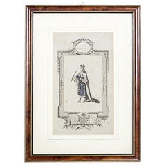
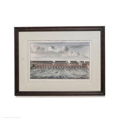
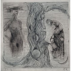
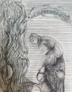
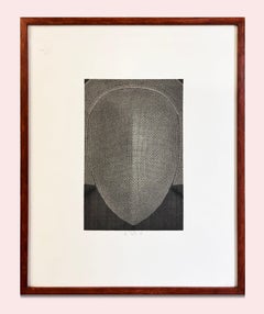
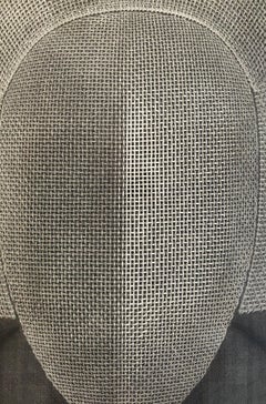
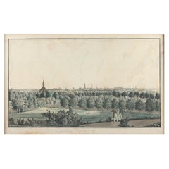
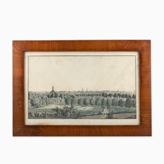
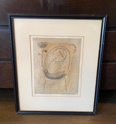
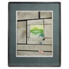
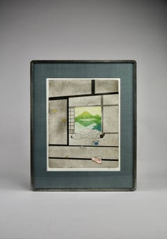
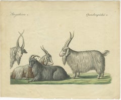
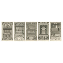
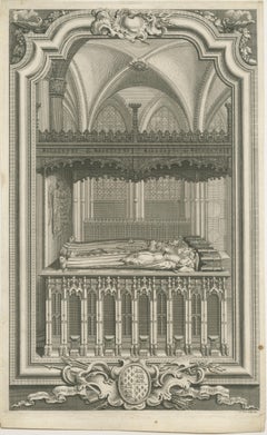
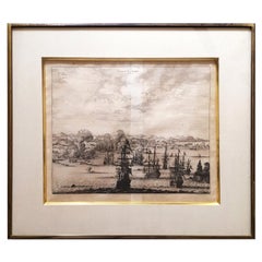
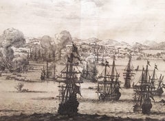
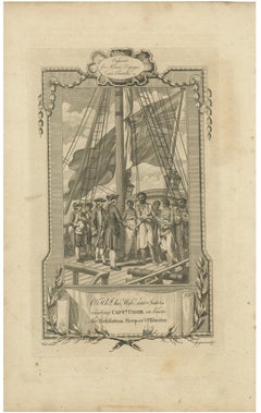
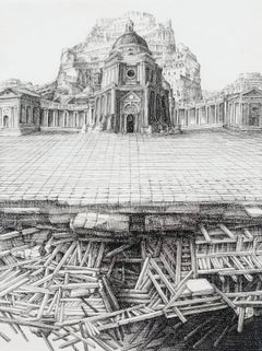
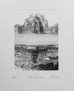
Copperplate Map

2
to
16
115
74
124
54
53
51
30
29
26
23
15
13
13
13
12
11
10
5
5
5
4
4
3
3
3
3
3
2
2
2
1
1
1
1
1
9
6
5
5
4
Sort By
Essex John Cary 1787 Cary's New & Correct English Atlas 40cm 16" long gilt frame
By John Cary
Located in BUNGAY, SUFFOLK
Engraver Map & Printseller no 188 the corner of Arundel Street Strand Antique engraved copperplate map with
Category

Antique 18th Century English Georgian Maps

Materials

Paper

England, Scotland & Ireland: A Hand Colored Map of Great Britain by Tirion
By Isaak Tirion
Located in Alamo, CA
This is a hand-colored double page copperplate map of Great Britain entitled "Nieuwe Kaart van de
Category

Antique Mid-18th Century Dutch Maps

Materials

Paper

Map of Duchy of Brabant Centered on Fortress of Louvain or Leuven, Belgium, 1720
Located in Langweer, NL
Sylvae Ducis et Merchliniae Dominia.' This fully engraved copperplate map covers important Duchy of
Category

Antique 1720s Maps

Materials

Paper

Original Copperplate Engraved Detailed Map of South Africa, ca.1680
Located in Langweer, NL
Antique map titled 'Pays et Coste des Caffres Empires de Monomotapa (..)'. Detailed map of
Category

Antique 1680s Maps

Materials

Paper

Antique Print of the King of Barsalli & the Yamyamakunda Factory, Gambia, C1730
Located in Langweer, NL
. Type: Antique copperplate map. Produced probably around 1730.
Category

Antique 1730s Prints

Materials

Paper

Old Copperplate Engraving of Fort St. James on the Gambra River, Africa, c.1760
Located in Langweer, NL
Plan de l’Isle James sur la Gambra en 1732 (…). Copperplate engraving/etching on Hand laid
Category

Antique 1760s Maps

Materials

Paper

Genuine Antique Engraved Map of Helvetia or Switzerland, 1729
Located in Langweer, NL
, antique copperplate engraved map with hand coloring and a decorative title cartouche. Two figures greatly
Category

Antique 1720s Maps

Materials

Paper

Antique Map of Friesland by De Wit, c.1690
Located in Langweer, NL
Antique map titled 'Tabula Comitatus Frisiae'. Old map of the province of Friesland, the
Category

Antique 17th Century Maps

Materials

Paper

Antique Map of Friesland by De Wit, c.1690
H 20.87 in W 24.41 in D 0 in
1590 Mercator Map Entitled "France Picardie Champaigne, Ric.0001
Located in Norton, MA
Engravers: Map : 'France Picardie Champaigne cum regionibus adiacentibus'. (Map of the french provinces of
Category

Antique 16th Century Dutch Maps

Materials

Paper

Antique Map of Portugal by P. Schenk, circa 1700
Located in Langweer, NL
Antique map titled 'Portugalliae et Algarbia'. Striking example of Schenk's rare map of Portugal
Category

Antique Early 18th Century Maps

Materials

Paper

"Africa Vetus": a 17th Century Hand-Colored Map by Sanson
By Nicolas Sanson
Located in Alamo, CA
This original hand-colored copperplate engraved map of Africa entitled "Africa Vetus, Nicolai
Category

Antique Late 17th Century French Maps

Materials

Paper

Cartographic Elegance of Touraine: A 17th-Century Map Showing French Heritage
Located in Langweer, NL
"Ducatus Turonensis - Touraine," is a original antique historical map of the Touraine region, which
Category

Antique 1630s Maps

Materials

Paper

Antique Engraved Map with Original Hand Colour of French Guiana, 1876
Located in Langweer, NL
The 1876 map of French Guiana from the "Grand Atlas Départemental de la France de L'Algérie et des
Category

Antique Late 19th Century Maps

Materials

Paper

Detailed Antique Map of Southeast England, incl Warwickshire and Hampshire, 1690
Located in Langweer, NL
Antique map titled 'Orientalior districtus Regni Angliae (..)'. Detailed map of southeast
Category

Antique 1690s Maps

Materials

Paper

Rare Antique Map of Asia with Cartouche Depicting an Elephant, 1753
Located in Langweer, NL
elephant. Map by Daniel de la Feuille. This very rare old antique copperplate engraved print originates
Category

Antique 18th Century Maps

Materials

Paper

1585 Mercator Map of Ireland, Entitled "Irlandiae Regnvm, " Hand Colored Ric0006
Located in Norton, MA
1585 Mercator map of Ireland, entitled "Irlandiae Regnvm." Hand Colored Description
Category

Antique 16th Century Dutch Maps

Materials

Paper

Map of Friesland with Terschelling, Vlieland, Ameland En Schiermonnikoog, C.1670
Located in Langweer, NL
Antique print, titled: 'Tabula Comitatus Frisiae …' Map of Friesland with the island
Category

Antique 1670s Maps

Materials

Paper

Greece, "Graeciae Antiquae"" A 17th Century Hand-colored Map by Sanson
By Nicolas Sanson
Located in Alamo, CA
This is an original 17th century hand colored copperplate engraved map of Greece entitled "Graeciae
Category

Antique Mid-17th Century French Maps

Materials

Paper

Rare Antique Miniature Map of Pakistan, India and Cambaia, ca.1616
Located in Langweer, NL
Old 17th century miniature antique map of 'Cambaia' , from the 1616 edition of Jadocus Hondius
Category

Antique 17th Century Maps

Materials

Paper

Rare Antique Miniature Map of Pakistan, India and Cambaia, ca.1618
Located in Langweer, NL
Old 17th century miniature antique map of 'Cambaia' , from the 1616 edition of Jadocus Hondius
Category

Antique 17th Century Maps

Materials

Paper

Colorful and Decorative Miniature Map of India, Ceylon by Bertius 1616
Located in Langweer, NL
Old 17th century miniature antique map of India - Ceylon from the 1616 edition of Jadocus Hondius
Category

Antique 17th Century Maps

Materials

Paper

19th Century Large Original Antique Map of Denmark by J. Pinkerton, 1812
By Pinkerton
Located in Langweer, NL
. Pinkerton's maps reflect the fine copperplate engraving work being done in the Britain at the beginning of the
Category

Antique Early 19th Century Maps

Materials

Paper

18th Century Hand Colored Map of Spain and Portugal by Visscher
By Nicolaes Visscher II
Located in Alamo, CA
. The map includes portions of North Africa and the Strait of Gibralter. This copperplate engraved map
Category

Antique Early 18th Century Dutch Maps

Materials

Paper

Map Holy Promise Land Canaan Richard Palmer Richard Blome 1687 Joseph Moxon
Located in BUNGAY, SUFFOLK
Richard Blome. 1687 Blome, Richard, 1641-1705. London. 283 x 452 mm. Copperplate. Probably from an
Category

Antique 17th Century British Baroque Maps

Materials

Paper

17th Century Hand-Colored Map of Southeastern England by Mercator and Hondius
By Gerard Mercator
Located in Alamo, CA
A 17th century copperplate hand-colored map entitled "The Sixt Table of England" by Gerard Mercator
Category

Antique Mid-17th Century Dutch Maps

Materials

Paper

Beautiful Map of Arnhem and the Veluwe Region, Gelderland, The Netherlands, 1690
Located in Langweer, NL
Antique map titled 'Ducatus Geldriae tetrachia Arnhemiensis sive Velavia'. Beautiful map of the
Category

Antique 1690s Maps

Materials

Paper

Cartographic Elegance: The Art and Science of 17th-Century Asian Maps, ca.1681
Located in Langweer, NL
the 17th century for producing maps. The copperplate engraving process involves etching or engraving
Category

Antique 1680s Maps

Materials

Paper

Original Engraved Map of Saint Lucia in the West Indies by Bellin, 1758
Located in Langweer, NL
des Voyages" This finely crafted map is a copperplate engraving, meticulously detailed and enhanced
Category

Antique 1750s Maps

Materials

Paper

North & South America: A 17th Century Hand-colored Map by Jansson & Goos
By Johannes Janssonius
Located in Alamo, CA
, attractive and fascinating copperplate engraved map is printed on laid, chain-linked hand-made paper with
Category

Antique 1620s Dutch Maps

Materials

Paper

Africa: A Large 17th Century Hand-Colored Map by Sanson and Jaillot
By Nicolas Sanson
Located in Alamo, CA
This large original hand-colored copperplate engraved map of Africa entitled "L'Afrique divisee
Category

Antique 1690s French Maps

Materials

Paper

Southeastern Ireland: A 17th Century Hand Colored Map by Mercator and Hondius
By Gerard Mercator
Located in Alamo, CA
A 17th century copperplate hand-colored map entitled "The Second Table of Ireland, Udrone" by
Category

Antique Mid-17th Century Dutch Maps

Materials

Paper

Original Very Old Hand-Colored Map of Limousin or Limoges, France, ca.1600
Located in Langweer, NL
Antique map titled 'Totius Lemovici et Confinium (..).' - A handsome and detailed map of Limousin
Category

Antique Early 1600s Maps

Materials

Paper

Antique Map of Denmark with Details of Fortresses, Cities, Towns Etc, c.1680
Located in Langweer, NL
Antique map of Denmark titled 'Insularum Danicarum ut Zee-Landiae, Fioniae, Langelandiae, Lalandiae
Category

Antique 17th Century Maps

Materials

Paper

Persia, Armenia & Adjacent Regions: A 17th Century Hand-colored Map by De Wit
By Frederick de Wit
Located in Alamo, CA
A large 17th century hand colored copperplate engraved map entitled "Novissima nec non
Category

Antique Late 17th Century Dutch Maps

Materials

Paper

Authentique Map by Pilon of The French Colonies in The West Indies, 1876
Located in Langweer, NL
The 1876 map titled "Carte des Colonies Françaises aux Antilles" represents a significant
Category

Antique Late 19th Century Maps

Materials

Paper

Southern Greece: A Large 17th C. Hand-colored Map by Sanson and Jaillot
By Nicolas Sanson
Located in Alamo, CA
This large original hand-colored copperplate engraved map of southern Greece and the Pelopponese
Category

Antique 1690s French Maps

Materials

Paper

Prussia, Poland, N. Germany, Etc: A Hand-colored 17th Century Map by Janssonius
By Johannes Janssonius
Located in Alamo, CA
This is an attractive hand-colored copperplate engraved 17th century map of Prussia entitled
Category

Antique Mid-17th Century Dutch Maps

Materials

Paper

Old Detailed Trade Route and Shipping Map from Italy to the Low Countries, c1671
Located in Langweer, NL
Antique map of Italy titled 'Carta Nova accurata del Passagio et strada dalli Peis Bassi per via de
Category

Antique 17th Century Maps

Materials

Paper

Antique Map of Austria, Centered Around the Danube from Passau to Vienna, C.1690
Located in Langweer, NL
Antique map of Austria titled 'Circuli Austriaci pars septentrionalis in quia archiducatus Austriae
Category

Antique 1690s Maps

Materials

Paper

Engraved Map by Bellin of Saint Lucia or Sainte Lucie in the West Indies, 1764
Located in Langweer, NL
finely crafted map is a copperplate engraving, meticulously detailed and enhanced with hand coloring
Category

Antique Late 19th Century Maps

Materials

Paper

Beautiful Large Scale Map of Spain and Portugal Published by Herman Moll in 1711
Located in Langweer, NL
Title: A New and Exact Map of Spain & Portugal Author: Herman Moll Date: 1711 Medium: ?Hand
Category

Antique 1710s Maps

Materials

Paper

18th Century French Map and City View of Joppe/Jaffa 'Tel Aviv' by Sanson
By Nicolas Sanson
Located in Alamo, CA
copperplate and was published in 1709 by his descendants. The map is presented in an ornate brown wood
Category

Antique Early 18th Century French Maps

Materials

Paper

Engraving by Tallis and Rapkin of Map of the West Indies in The Caribbean, 1851
Located in Langweer, NL
John Tallis' 1851 map of the West Indies stands as a striking example of his renowned cartographic
Category

Antique Mid-19th Century Maps

Materials

Paper

Antique Map of the Coast of Angola Up to Port Elizabeth in South Africa, 1675
Located in Langweer, NL
Antique map titled 'Cimbebas et Caffariae Littora a Catenbela ad Promontorium Bonae Spei'. This
Category

Antique 1670s Maps

Materials

Paper

Persia & Afghanistan: A Framed Hand-colored 17th Century Map by John Cary
By John Cary
Located in Alamo, CA
This colorful and detailed early 18th century copperplate map by John Cary entitled "A New Map of
Category

Early 19th Century Old Masters More Prints

Materials

Engraving

Barados and St Christopher or St Kitts and Nevis Islands in the Caribbean, 1748
Located in Langweer, NL
This original map, a copperplate engraving by Le Rouge, presents two significant areas in the
Category

Antique Mid-18th Century Maps

Materials

Paper

L'isle De La Martinique Caribbean Copper Engraving Original Handcoloring, 1704
Located in Langweer, NL
The original hand-colored map titled "Isle de la Martinique," published in 1704 and part of De
Category

Antique Late 19th Century Maps

Materials

Paper

Original Engraving of the West Indies, Gulf of Mexico, Antilles, Caribbean, 1780
Located in Langweer, NL
Rigobert Bonne and G. Raynal's 1780 map of the West Indies, Gulf of Mexico, Antilles, and the
Category

Antique Late 18th Century Maps

Materials

Paper

1762 Berri, Nivernois Bourbonois, Lyonois, Bourgogine, Bresse, et, Franche - Com
Located in Norton, MA
1762 Vaugondy map, entitled "Berrl Nivernois Bourbonois Lyonois, Bourgone, Bresse, Et Franche
Category

Antique 18th Century Unknown Maps

Materials

Paper

Persia, Armenia & Adjacent Regions: A Hand-colored 17th Century Map by De Wit
By Frederick de Wit
Located in Alamo, CA
This colorful and detailed 17th century copperplate map by Frederick De Wit was published in
Category

Late 17th Century Old Masters More Prints

Materials

Engraving

L'Isle de France: A Hand-colored 17th Century Map by De Wit
By Frederick de Wit
Located in Alamo, CA
This colorful and detailed 17th century hand-colored copperplate map by Frederick De Wit was
Category

Early 18th Century Old Masters More Prints

Materials

Engraving

Northern Italy: A 16th Century Hand-colored Map by Abraham Ortelius
By Abraham Ortelius
Located in Alamo, CA
This is a framed 16th century hand-colored copperplate map of northern Italy entitled "Veronae
Category

16th Century Old Masters Landscape Prints

Materials

Engraving

North and South America: An 18th Century Hand-colored Map by Johann Homann
By Johann Baptist Homann
Located in Alamo, CA
This early 18th century hand-colored copperplate map of North and South America entitled "Totius
Category

Early 18th Century Old Masters Landscape Prints

Materials

Engraving

The Grand Waterway of Languedoc: Mapping the Canal du Midi, 1697
Located in Langweer, NL
This large original antique engraving is part of a colored copperplate map of the Canal du Midi
Category

Antique 1690s Prints

Materials

Paper

Copperplate Set 5 Gentlemans Recreation in Two Parts Richard Blome SRoycroft L35
Located in BUNGAY, SUFFOLK
Sounds' The backs bearing a label Baynton-Williams, dealer old maps and prints In original black
Category

Antique 17th Century English Baroque Prints

Materials

Paper

Great Britain Scandinavia Northern France Netherland Germany Mural Map
Located in Berghuelen, DE
The vintage pull-down cottagecore mural map illustrates the North Sea countries with Great Britain
Category

Vintage 1970s German Country Posters

Materials

Canvas, Wood, Paper

Europe Map Vintage Rollable Mural Countrystyle Wall Chart Decoration
Located in Berghuelen, DE
The vintage pull-down map shows the European continent / Europe. Published by Haack-Painke, Justus
Category

Vintage 1970s German Country Prints

Materials

Canvas, Wood, Paper

Vintage Rollable Map Mediterranean Countries Wall Chart Mural Poster
Located in Berghuelen, DE
A decorative countrycore pull-down map depiciting countries surrounding the Mediterranean sea
Category

Vintage 1970s German Country Prints

Materials

Canvas, Wood, Paper

Vintage German Map Rhineland Rollable Wall Chart Poster Print
Located in Berghuelen, DE
A country core vintage pull-down map illustrating the popular German region of the Rhineland
Category

Vintage 1960s German Country Prints

Materials

Canvas, Wood, Paper

Vintage Rollable Map Southeast Asia China Japan Wall Chart
Located in Berghuelen, DE
A classical pull-down school map showing the popular region of Southeast Asia with China and Japan
Category

Late 20th Century German Country Prints

Materials

Canvas, Wood, Paper

  • 1
Get Updated with New Arrivals
Save "Copperplate Map", and we’ll notify you when there are new listings in this category.

Copperplate Map For Sale on 1stDibs

With a vast inventory of beautiful furniture at 1stDibs, we’ve got just the copperplate map you’re looking for. A copperplate map — often made from paper, wood and canvas — can elevate any home. Whether you’re looking for an older or newer copperplate map, there are earlier versions available from the 18th Century and newer variations made as recently as the 20th Century. A copperplate map, designed in the Baroque, Georgian or neoclassical style, is generally a popular piece of furniture. You’ll likely find more than one copperplate map that is appealing in its simplicity, but Nicolas Sanson, Frederick de Wit and Gerard Mercator produced versions that are worth a look.

How Much is a Copperplate Map?

The average selling price for a copperplate map at 1stDibs is $630, while they’re typically $165 on the low end and $150,000 for the highest priced.