Navigation Tools
3
to
15
59
42
39
39
39
27
20
15
13
11
9
8
8
8
7
6
5
4
4
3
3
2
2
2
2
2
2
2
1
1
1
1
1
1
1
1
21
15
8
3
2
Sort By
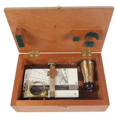
1960s Nautical Rangefinder Signed Kelvin Hughes Antique Marine Navigation Tool
Located in Milan, IT
Nautical rangefinder signed Made in Great Britan by Kelvin Hughes a divison of Smiths Industries Limited made in the 1960s, complete with original mahogany box. AP 498 Stuats Marine ...
Category
Vintage 1960s British Nautical Objects
Materials
Metal
H 2.37 in W 8.27 in D 5.12 in
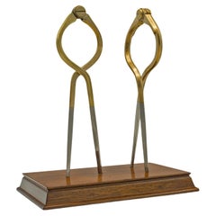
Vintage Captain's Dividers, Display Ornament, Brass, Cartography, Navigation
Located in Hele, Devon, GB
This is a vintage captain's dividers display ornament. An English, brass cartography navigation
Category
Late 20th Century British Desk Sets
Materials
Brass
H 7.49 in W 6.5 in D 3.94 in
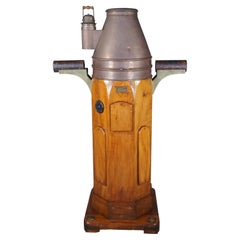
W. Hartmann Antique Oak & Copper Ships Binnacle Nautical Maritime Compass
By A. Lietz Co.
Located in Dayton, OH
Late 19th Century Ships Binnacle by W. Hartmann. Binnacles are an important navigation tool. They
Category
Antique Late 19th Century Late Victorian Nautical Objects
Materials
Brass, Copper
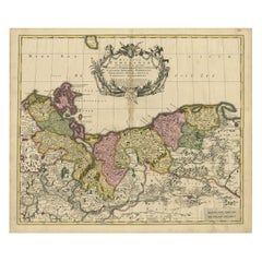
Antique Map of Pomerania by Schenk, circa 1750
Located in Langweer, NL
is not only a navigational tool but also a work of art, featuring an elaborate cartouche—a decorative
Category
Antique Mid-18th Century Maps
Materials
Paper
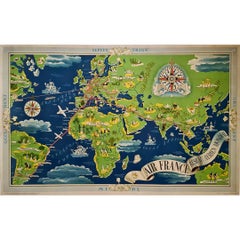
1937 Original planisphere by Lucien boucher - World map
By Lucien Boucher
Located in PARIS, FR
Aérien Mondial." This extraordinary planisphere is not merely a navigational tool but a visual symphony
Category
1930s Prints and Multiples
Materials
Linen, Lithograph, Paper
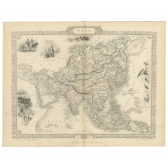
Mid-19th Century Decorative Map of Asia with Cultural and Natural Vignettes
Located in Langweer, NL
just as navigational tools but as works of art and historical documents. They represent a Victorian
Category
Antique 1850s Maps
Materials
Paper
H 10.71 in W 14.26 in D 0 in
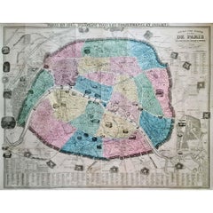
1861 Original vintage map of Paris - Historical cartography
Located in PARIS, FR
its practical function as an urban navigation tool. It is a window on the past, allowing us to
Category
1860s Prints and Multiples
Materials
Paper, Lithograph
H 33.86 in W 42.92 in
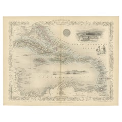
Ornate Cartography of Colonial Grandeur: The West India Islands around 1851
Located in Langweer, NL
time it was made. The presence of these artistic elements makes Tallis maps not just navigational tools
Category
Antique 1850s Maps
Materials
Paper
No Reserve
H 10.71 in W 14.26 in D 0 in
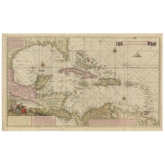
Engraving of a Map of Florida, the Gulf Coast, Caribbean & Central America, 1728
Located in Langweer, NL
as a navigational tool but also as a work of art, reflecting the skill and dedication of its creator
Category
Antique Mid-18th Century European Maps
Materials
Paper
Free Shipping
H 24.61 in W 40.56 in D 0.02 in
Antique Map of the City of Leuven, Belgium, with Original Coloring, 1609
Located in Langweer, NL
features would have made it not just a navigational tool but also a piece of artwork, capturing the essence
Category
Antique Early 17th Century Maps
Materials
Paper
H 11.74 in W 13.94 in D 0.02 in
T. Cooke London Brass Prismatic Nautical Maritime Navigation Compass
By T. Cooke & Sons Ltd.
Located in Dayton, OH
.
"A prismatic compass is a compact and portable instrument primarily used for navigation and
Category
Mid-20th Century Nautical Objects
Materials
Brass
T. Cooke London Brass Prismatic Nautical Navigation Compass with Stand
By T. Cooke & Sons Ltd.
Located in Dayton, OH
navigation and directional measurements. A prismatic compass consists of a magnetic needle, a prism, and a
Category
Mid-20th Century Nautical Objects
Materials
Brass
H 2.75 in W 2.75 in D 3.875 in
Gold Rush Era Masterpiece: The Tallis & Rapkin Rare Map of Pre-Queensland, 1851
Located in Langweer, NL
craftsmanship to the map, making it not just a navigational tool but also a piece of art.
6. **Publisher's
Category
Antique 1850s Maps
Materials
Paper
No Reserve
H 104.34 in W 14.26 in D 0 in
Map of Rhône: Culture and Commerce in Lyon's Silk and Wine Legacy, 1852
Located in Langweer, NL
only a tool for navigation but also an educational resource, providing insights into the department's
Category
Antique 1850s Maps
Materials
Paper
Authentic 1644 Janssonius Map of the Champagne Region (Campania) in France
Located in Langweer, NL
. This map is not only a navigational tool but also a snapshot of a region rich in history and tradition
Category
Antique 1640s Maps
Materials
Paper
Free Shipping
H 21.86 in W 25.99 in D 0 in
19th Century Illustrated Map of Ceylon (Sri Lanka) with Notable Landmarks
Located in Langweer, NL
navigational tools but also as works of art and historical documents. They represent a time when the British
Category
Antique 1850s Maps
Materials
Paper
H 14.26 in W 10.71 in D 0 in
Antique Map of The United States of North America, 1882
Located in Langweer, NL
, suggests it was a comprehensive educational or navigational tool for its time. The map's scale and grid of
Category
Antique 1880s Maps
Materials
Paper
An Ornate and Historical Tallis Map of Jamaica with Decorative Vignettes, 1851
Located in Langweer, NL
the period. These picturesque and detailed insets would serve to make the map not just a navigational
Category
Antique 1850s Maps
Materials
Paper
H 10.71 in W 14.26 in D 0 in
Mapping History: The Decorative Cartography of Indre-et-Loire by Levasseur, 1856
Located in Langweer, NL
captured, making this map not only a navigational tool but also a work of art.
The addition of outline
Category
Antique 1850s Maps
Materials
Paper
H 20.67 in W 14.34 in D 0 in
Vintage wooden and brass ship's compass with side weights, Italy
Located in Cuneo, Italy (CN)
side weights, very fascinating navigation work tool, from Italy from the 1900s. maximum measurement cm
Category
20th Century Italian Nautical Objects
Materials
Walnut
Antique Neoclassical Style Bronze Fire Insert
Located in Wormelow, Herefordshire
.
To the top is a cherub or angel, depicted holding a sextant, representing navigation and travel. To
Category
20th Century English Neoclassical Fireplaces and Mantels
Materials
Metal, Bronze, Iron
Griffin's 1955 Northern Ireland original map - Tourism - Geography
Located in PARIS, FR
roadways. The use of vibrant colors and intricate details makes it not only a practical tool for navigation
Category
1950s Prints and Multiples
Materials
Linen, Lithograph, Paper
Antique 19th Century Map of China by Blackie & Son, 1882
Located in Langweer, NL
navigation and location. Various cities and towns are marked and labeled throughout, suggesting a
Category
Antique 1880s Maps
Materials
Paper
Navigating History: An Allegorical Frontispiece Honoring Captain Cook, ca.1788
Located in Langweer, NL
personifications could be the various peoples and cultures Cook encountered, and the tools of navigation and
Category
Antique 1780s Prints
Materials
Paper
Free Shipping
H 15.36 in W 9.85 in D 0 in
Decorative Antique Map of Eastern Canada, Published in 1882
Located in Langweer, NL
the geographical features all indicate that this map was a practical tool for education and navigation
Category
Antique 1880s Maps
Materials
Paper
Free Shipping
H 14.97 in W 22.45 in D 0 in
Large Sea Chart of the British Islands, 1918
Located in Langweer, NL
of the coastlines, inlets, bays, and capes, providing valuable information for navigation and
Category
Vintage 1910s Maps
Materials
Paper
Antique Decorative Coloured Map Marocco, Algeria and Tunis, 1882
Located in Langweer, NL
vast expanse of the Sahara Desert. Such detail would have been critical for navigation, trade, and
Category
Antique 1880s Maps
Materials
Paper
Free Shipping
H 14.97 in W 22.45 in D 0 in
Victorian Visions of the New World: A Detailed Tallis Map of North America, 1851
Located in Langweer, NL
-century maps that were not only tools for navigation but also for education and display, reflecting the
Category
Antique 1850s Maps
Materials
Paper
H 14.26 in W 10.71 in D 0 in
Champagne: The Sparkling Heart of France - A Blaeu Cartographic Engraving, c1650
Located in Langweer, NL
. This map would have served as an important tool for navigation and territorial understanding in the
Category
Antique 1650s Maps
Materials
Paper
Free Shipping
H 20.08 in W 23.82 in D 0 in
Seminal guide to the East and West Indies, with 42 coloured maps and plates
By Jan Huygen van Linschoten
Located in ZWIJNDRECHT, NL
la navigation ... aux Indes Orientales ... Avec annotations de B. Paludanus, ... Troixiesme edition
Category
Antique Early 17th Century Dutch Dutch Colonial Books
Materials
Paper
Free Shipping
H 12.6 in W 8.27 in D 1.58 in
Detailed Antique Cartography of Asian Russia, 1882
Located in Langweer, NL
navigation and study.
Blackie and Son, a Glasgow-based publishing house known for educational texts and
Category
Antique 1880s Maps
Materials
Paper
Cartographic Elegance: The British Raj's India, 1882 Atlas by Blackie and Son
Located in Langweer, NL
their navigational utility. The legends and notations, written in English, provide information about the
Category
Antique 1880s Maps
Materials
Paper
H 14.97 in W 22.45 in D 0 in
Decorative Original HandColoredAntique Map of South America by J.B. Elwe, 1792
By J.B. Elwe
Located in Langweer, NL
craftsmanship suggests it was created in a time when maps were not just tools for navigation but also works of
Category
Antique Late 18th Century Maps
Materials
Paper
Free Shipping
H 21.46 in W 25.6 in D 0.02 in
18th Century Cartographic Depiction of Upper India and Ceylon, 1835
Located in Langweer, NL
, whether as an educational tool, a decorative masterpiece, or a tribute to the rich history of cartography
Category
Antique 1830s Maps
Materials
Paper
Free Shipping
H 10.04 in W 14.57 in D 0 in
A Tallis Map of British Guiana with Colonial Vignettes and Other Landmarks, 1851
Located in Langweer, NL
empire's global reach. The maps served not only as tools for education and reference but also as symbols of
Category
Antique 1850s Maps
Materials
Paper
H 14.26 in W 10.71 in D 0 in
Old Map of Vaucluse, France: A Cartographic Celebration of Viticulture, 1852
Located in Langweer, NL
only a tool for navigation but also an educational resource, providing insights into the department's
Category
Antique 1850s Maps
Materials
Paper
H 14.18 in W 20.99 in D 0 in
1852 Map of Haut-Rhin: An Illustrated Gateway to Alsace's Viticultural Splendors
Located in Langweer, NL
only a tool for navigation but also an educational resource, providing insights into the department's
Category
Antique 1850s Maps
Materials
Paper
H 14.18 in W 20.75 in D 0 in
The Roman Empire from the Time of Constantine the Great, Published in 1880
Located in Langweer, NL
well as possibly latitude and longitude lines, providing a sense of scale and aiding in navigation and
Category
Antique 1880s Maps
Materials
Paper
No Reserve
H 15.56 in W 18.51 in D 0 in
Shagreen Etui by W & S Jones Opticians with Scientific Instruments Circa, 1800
Located in London, GB
company that introduced the idea of a pocket sextant for navigation and mechanical miniaturization. They
Category
Antique 19th Century British Boxes and Cases
Free Shipping
W 2.76 in L 7.09 in
Landline #14
By Sonny Assu
Located in Montreal, Quebec
tools of navigation, tracing invisible lines of memory and kinship.
Category
2010s Contemporary Figurative Drawings and Watercolors
Materials
Ink, Archival Paper
Landline #15
By Sonny Assu
Located in Montreal, Quebec
tools of navigation, tracing invisible lines of memory and kinship.
Category
2010s Contemporary Figurative Drawings and Watercolors
Materials
Ink, Archival Paper
Landline #10
By Sonny Assu
Located in Montreal, Quebec
tools of navigation, tracing invisible lines of memory and kinship.
Category
2010s Contemporary Figurative Drawings and Watercolors
Materials
Ink, Archival Paper
Landline #9
By Sonny Assu
Located in Montreal, Quebec
tools of navigation, tracing invisible lines of memory and kinship.
Category
2010s Contemporary Figurative Drawings and Watercolors
Materials
Ink, Archival Paper
Landline #2
By Sonny Assu
Located in Montreal, Quebec
tools of navigation, tracing invisible lines of memory and kinship.
Category
2010s Contemporary Figurative Drawings and Watercolors
Materials
Archival Paper, Ink
Landline #11
By Sonny Assu
Located in Montreal, Quebec
tools of navigation, tracing invisible lines of memory and kinship.
Category
2010s Contemporary Figurative Drawings and Watercolors
Materials
Ink, Archival Paper
Landline #12
By Sonny Assu
Located in Montreal, Quebec
tools of navigation, tracing invisible lines of memory and kinship.
Category
2010s Contemporary Figurative Drawings and Watercolors
Materials
Archival Paper, Ink
Landline #7
By Sonny Assu
Located in Montreal, Quebec
tools of navigation, tracing invisible lines of memory and kinship.
Category
2010s Contemporary Figurative Drawings and Watercolors
Materials
Archival Paper, Ink
Landline #6
By Sonny Assu
Located in Montreal, Quebec
tools of navigation, tracing invisible lines of memory and kinship.
Category
2010s Contemporary Figurative Drawings and Watercolors
Materials
Ink, Archival Paper
Landline #5
By Sonny Assu
Located in Montreal, Quebec
tools of navigation, tracing invisible lines of memory and kinship.
Category
2010s Contemporary Figurative Drawings and Watercolors
Materials
Ink, Archival Paper
Landline #3
By Sonny Assu
Located in Montreal, Quebec
tools of navigation, tracing invisible lines of memory and kinship.
Category
2010s Contemporary Figurative Drawings and Watercolors
Materials
Archival Paper, Ink
Landline #2
By Sonny Assu
Located in Montreal, Quebec
tools of navigation, tracing invisible lines of memory and kinship.
Category
2010s Contemporary Figurative Drawings and Watercolors
Materials
Archival Paper, Ink
Landline #1
By Sonny Assu
Located in Montreal, Quebec
tools of navigation, tracing invisible lines of memory and kinship.
Category
2010s Contemporary Figurative Drawings and Watercolors
Materials
Ink, Archival Paper
The Illustrated Map of the Var Department from the Atlas National Illustré, 1856
Located in Langweer, NL
boundaries makes the map not only a tool for navigation but also an educational resource, providing insights
Category
Antique 1850s Maps
Materials
Paper
H 14.18 in W 20.87 in D 0 in
1644 Janssonius Original Wine Regions Map: The Ducal and Comital Burgundy
Located in Langweer, NL
not only practical tools for navigation and territorial understanding but also works of art and
Category
Antique 1640s Maps
Materials
Paper
Free Shipping
H 19.1 in W 22.84 in D 0 in
Levasseur's 1852 Cartographic Portrait of Gironde: Celebrating the Bordeaux Wine
Located in Langweer, NL
only a tool for navigation but also an educational resource, providing insights into the department's
Category
Antique 1850s Maps
Materials
Paper
H 20.67 in W 14.06 in D 0 in
Antique Map of Alaska '1904'
Located in Langweer, NL
Navigation Use**: With its detailed topographic information, the map would have served important functions
Category
Early 20th Century Maps
Materials
Paper
Retroflag
Located in New York, NY
intuitive navigation is paralleled in his creative process. On the subject of this artistic conversion
Category
2010s Contemporary Color Photography
Materials
Photographic Paper, Plexiglass, Archival Paper, Archival Pigment
Messages #49, Mixed media on board, neutral earth tones, round painting
By Lisa Pressman
Located in New York, NY
Never Said,” this work evolved from her previous “Navigation” series of encaustics, which similarly
Category
2010s Abstract Abstract Paintings
Materials
Ink, Mixed Media, Board, Pigment
Things That Were Never Said, encaustic on wood panel
By Lisa Pressman
Located in New York, NY
evolved from her previous “Navigation” series of encaustics, which similarly manifest themes of transience
Category
2010s Abstract Abstract Paintings
Materials
Ink, Mixed Media, Handmade Paper, Pigment
Messages #36, Mixed media on handmade paper
By Lisa Pressman
Located in New York, NY
. Entitled “Things That Were Never Said,” this work evolved from her previous “Navigation” series of
Category
2010s Abstract Abstract Paintings
Materials
Ink, Mixed Media, Handmade Paper, Pigment
- 1
Get Updated with New Arrivals
Save "Navigation Tools", and we’ll notify you when there are new listings in this category.
Navigation Tools For Sale on 1stDibs
There is a broad range of navigation tools for sale on 1stDibs. Finding the ideal abstract, contemporary or modern examples of these works for your living room, whether you’re looking for small- or large-size pieces, is no easy task — start by shopping our selection today. There are many variations of these items available, from those made as long ago as the 20th Century to those made as recently as the 21st Century. Navigation tools available on 1stDibs span a range of colors that includes gray, beige, brown, black and more. Lisa Pressman, Sonny Assu, Lilya Vorobey and David Collins took a thoughtful approach to this subject that are worth considering. Frequently made by artists working in ink, paper and mixed media, all of these available pieces are unique and have attracted attention over the years.
How Much are Navigation Tools?
Prices for art of this kind can differ depending upon size, time period and other attributes — navigation tools in our inventory begin at $323 and can go as high as $15,500, while the average can fetch as much as $1,130.
More Ways To Browse
Patek Philippe 1970 Models
Patek Philippe Iconic Model
Patek Philippe Geneve Black
Patek Philippe Geneve Swiss Made
Vintage Rangefinder
Vintage Rangefinders
Maritime Lantern
White And Brass Radial
Map Iowa
Vintage Dividers Tools
Prospect Table
Antique Spy Glass
Antique Wooden Walker
Map Of Connecticut
Map Connecticut
Map Venezuela
Kansas Map
Patek Philippe Left Handed
