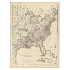
Population Map
4
to
17
105
73
81
46
41
36
30
27
17
15
11
10
7
7
7
7
6
6
6
5
5
4
4
3
2
2
2
2
1
1
1
1
1
1
1
1
1
16
11
7
5
2
Sort By
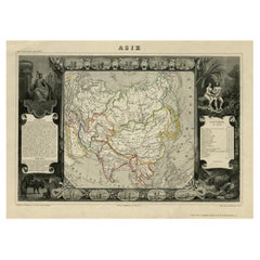
Nicely Decorated Antique Map of Asia, incl Population Figures, 1854
Located in Langweer, NL
Antique map titled 'Asie'. Map of the main Asian continent. The decorated border shows various
Category
Antique 19th Century Maps
Materials
Paper
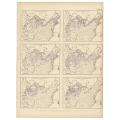
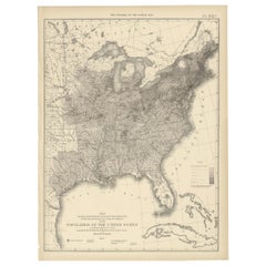
Pl. 28 Antique Chart of British American, English (..) US Population, 1874
Located in Langweer, NL
Antique chart titled 'Maps showing the distribution, within the territory of the United States
Category
Antique Late 19th Century Maps
Materials
Paper
H 21.66 in W 16.15 in D 0.02 in
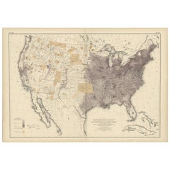
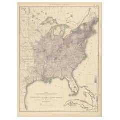
Antique Chart of the US Population in 1870, published in 1874
Located in Langweer, NL
Antique chart titled 'Map showing, in five degrees of density, the distribution, within the
Category
Antique Late 19th Century Maps
Materials
Paper
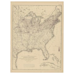
Pl. 25 Antique Chart of the US Foreign Population in 1870, '1874'
Located in Langweer, NL
Antique chart titled 'Map showing five degrees of density the distribution of the foreign
Category
Antique Late 19th Century Maps
Materials
Paper
Pl. 17A Antique Chart of the US Population 1860 by Walker, '1874'
Located in Langweer, NL
Antique chart titled 'Map showing in five degrees of density, the distribution, within the
Category
Antique Late 19th Century Maps
Materials
Paper
Pl. 17 Antique Chart of the US Population 1850 by Walker, 1874
Located in Langweer, NL
Antique chart titled 'Map showing in five degrees of density, the distribution, within the
Category
Antique Late 19th Century Maps
Materials
Paper
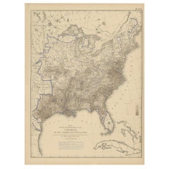
Pl. 26 Antique Chart of the US Foreign Population Proportion in 1870, '1874'
Located in Langweer, NL
Antique chart titled 'Map showing the proportion of the foreign to the aggregate population
Category
Antique Late 19th Century Maps
Materials
Paper
H 21.66 in W 16.15 in D 0.02 in
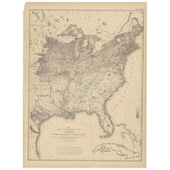
Pl. 22 Antique Chart of the US Colored Population Proportion in 1870, '1874'
Located in Langweer, NL
Antique chart titled 'Map showing the proportion of the colored to the aggregate population
Category
Antique Late 19th Century Maps
Materials
Paper
H 21.66 in W 16.15 in D 0.02 in
Pl. 21 Antique Chart of the US Colored Population Density in 1870, '1874'
Located in Langweer, NL
Antique chart titled 'Map showing in five degrees of density the distribution of the colored
Category
Antique Late 19th Century Maps
Materials
Paper
H 21.66 in W 16.15 in D 0.02 in
Pl. 16A Antique Chart of the US Population 1830-1840 by Walker, 1874
Located in Langweer, NL
Antique chart titled 'Map showing, in five degrees of density, the distribution, within the
Category
Antique Late 19th Century Maps
Materials
Paper
Pl. 16 Antique Chart of the US Population 1790-1820 by Walker, '1874'
Located in Langweer, NL
Antique chart titled 'The progress of the nation, 1790-1820. Maps showing in five degrees of
Category
Antique Late 19th Century Maps
Materials
Paper
H 21.66 in W 16.15 in D 0.02 in
Pl. 27 Antique Chart of the US Irish and German Population in 1870, '1874'
Located in Langweer, NL
Antique chart titled 'Maps showing the distribution, within the territory of the United States
Category
Antique Late 19th Century Maps
Materials
Paper
H 21.66 in W 16.15 in D 0.02 in
"Clason's Guide Map of Montana" by The Clason Map Company, Circa 1920s
Located in Colorado Springs, CO
help viewers find towns on the map. It also provides population data by town, for any town with a
Category
Vintage 1920s American Art Deco Maps
Materials
Paper
H 23.13 in W 33.88 in D 1.5 in
Large Antique 1859 Map of North America
Located in Sag Harbor, NY
This Map was made by Augustus Mitchell in 1859 It is in amazing condition for being 163 years old
Category
Antique Mid-19th Century American Maps
Materials
Canvas, Paper
Antique Map of Asia by V. Levasseur, 1854
By Victor Levasseur
Located in Langweer, NL
Antique map titled 'Asie'. Map of the main Asian continent. The decorated border shows various
Category
Antique Mid-19th Century Maps
Materials
Paper
1908 "Map of Texas" by The Kenyon Company
Located in Colorado Springs, CO
rivers. Incredibly informative, the reverse side of the map contains population statistics for all
Category
Antique Early 1900s American Maps
Materials
Paper
Antique Map of the Queen Charlotte Islands, Haida Gwaii
Located in Langweer, NL
Antique map titled 'Isles de la Reine Charlotte (..)'. Original old map of the Queen Charlotte
Category
Antique Late 18th Century Maps
Materials
Paper
Antique Map of South America by Wyld, circa 1850
By J. Wyld
Located in Langweer, NL
Beautiful folding map of South America titled 'Colombia Prima or South America Drawn from the Large
Category
Antique Mid-19th Century British Maps
Materials
Paper
French Geographical, Statistical and Historical Map of Pensylvania, 1825
Located in Langweer, NL
of Pennsylvania from Lucas' 1822 map, which breaks down county populations by Whites and Free Blacks
Category
Antique 1820s Maps
Materials
Paper
H 20.08 in W 25.99 in D 0 in
1866 Ensign & Bridgman's Rail Road Map of the United States
Located in Colorado Springs, CO
, revolutionizing transportation, industry, and shifting populations seemingly overnight. This map reflects this
Category
Antique 1860s American Late Victorian Maps
Materials
Paper
Original Antique Map of Pennsylvania Showing Interesting Statistics Etc, 1825
Located in Langweer, NL
Attractive map of Pennsylvania with bordercoloring of the county and showing the various towns
Category
Antique 1820s Maps
Materials
Paper
H 12 in W 17 in D 0.002 in
Antique Map of The United States of North America, 1882
Located in Langweer, NL
This is a historical map titled "The United States of North America, Central Part" from the 1882
Category
Antique 1880s Maps
Materials
Paper
Antique Map of Luzon of Luconia in the Philippines, 1726
Located in Langweer, NL
Description: Antique map titled 'Lucon of Luconia'.
Luzon is the largest and most populous island
Category
Antique 1720s Maps
Materials
Paper
Antique Map of Sweden, Norway and Denmark by Johnson, 1872
Located in Langweer, NL
The image is an antique map, a two-page spread from "Johnson's New Illustrated Family Atlas of the
Category
Antique Late 19th Century Maps
Materials
Paper
Plan of Paris, France, by A. Vuillemin, Antique Map, 1845
Located in Colorado Springs, CO
This large and detailed plan of Paris was published by Alexandre Vuillemin in 1845. The map conveys
Category
Antique 1840s American Maps
Materials
Paper
1903 Antique National Publishing Road Map of New Jersey Geological Survey
Located in Dayton, OH
1903 antique New Jersey road map by The National Publishing Company of Boston Massachusettes, No
Category
Antique Early 1900s Victorian Maps
Materials
Paper
Colourful Antique Map of England and Wales Divided in Counties, 1854
Located in Langweer, NL
Antique map titled 'A Map Shewing the Places in England & Wales Sending Members to Parliament with
Category
Antique 19th Century Maps
Materials
Paper
An Antique Map of Extremadura: Crossroads of History and Nature, 1903
Located in Langweer, NL
The image is a historical map of Extremadura, an autonomous community of Spain, from an unspecified
Category
Antique Early 1900s Maps
Materials
Paper
Free Shipping
H 20.08 in W 14.77 in D 0 in
"The United States from the Latest Authorities" Antique Wall Map, 1835
Located in Colorado Springs, CO
This is a 1835 map of “The United States from the Latest Authorities” by Ezra Strong. A hand
Category
Antique 1830s American Maps
Materials
Paper
Antique Map of Jura, a Famous Wine Area in France, 1854
Located in Langweer, NL
Antique map titled 'Dépt. du Jura'. Map of the French department Jura, France.
Jura is a
Category
Antique 19th Century Maps
Materials
Paper
1859 Vintage Maps of England and Wales: Blackie's Imperial Geographic Detail
Located in Langweer, NL
marked. The map provides a view of the urban distribution and key population centers, highlighting the
Category
Antique Mid-19th Century Maps
Materials
Paper
H 14.57 in W 21.26 in D 0.02 in
1847 Ornamental Map of the United States & Mexico by H. Phelps
Located in Colorado Springs, CO
Offered is an original 1847 ornamental map of the U.S. entitled "Ornamental Map of the United
Category
Antique 1840s American Maps
Materials
Paper
Detailed German Map of Australia Including Statistics of 1841, Published in 1854
Located in Langweer, NL
feature of this map is the inclusion of a statistical table that gives a snapshot of the population
Category
Antique 1850s Maps
Materials
Paper
Free Shipping
H 14.06 in W 17.52 in D 0 in
Empire's Crossroads: An 1882 Map of Turkey in Asia by Blackie & Son
Located in Langweer, NL
diversity of the empire's population centers.
In the lower inset, a detailed map of the environs of the
Category
Antique 1880s Maps
Materials
Paper
Antique Map of The United States of North America, Pacific States, 1882
Located in Langweer, NL
The map is from the same 1882 Blackie Atlas and focuses on the Pacific States of the United States
Category
Antique 1880s Maps
Materials
Paper
No Reserve
H 14.97 in W 11.03 in D 0 in
1859 Detailed Map of North West Germany with Bavaria Inset - Blackie's Atlas
Located in Langweer, NL
population centers in northwestern Germany.
5. **Transportation Networks**: The map may illustrate the
Category
Antique Mid-19th Century Maps
Materials
Paper
H 21.26 in W 14.57 in D 0.02 in
Antique Map of Anjouan or Ndzuani Island, Part of The Comoros, 1749
Located in Langweer, NL
Antique map titled ‘Carte de L’Isle D’Anjouan - Kaart van 't Eiland Anjouan’. Original antique map
Category
Antique 18th Century Maps
Materials
Paper
1859 Denmark and Schleswig-Holstein Map: A Historical View from Blackie's Atlas
Located in Langweer, NL
The "Antique Map of Denmark with Schleswig & Holstein" from 'The Imperial Atlas of Modern Geography
Category
Antique Mid-19th Century Maps
Materials
Paper
H 14.57 in W 10.63 in D 0.02 in
Antique Map of the City of Algiers and Surroundings in Northern Africa, 1773
Located in Langweer, NL
Antique print titled 'Plan van de Stad Algiers'. Old map of Algiers, also depicting surrounding
Category
Antique 18th Century Maps
Materials
Paper
H 10.44 in W 8.08 in D 0 in
1847 “World at One View” Antique Hand-Colored Wall Map of the World
Located in Colorado Springs, CO
This is a highly desirable hanging wall map of the "World at One View", published in 1847 by Ensign
Category
Antique 19th Century American Maps
Materials
Paper
1842 Wall Map of the United States by J. H. Young, Published by S. A. Mitchell
Located in Colorado Springs, CO
mountains and rivers, and state population and area statistical tables fill the map’s border.
At top is
Category
Antique 1840s American Maps
Materials
Paper
H 45 in W 38 in D 1 in
Pl. 29 Antique Chart of the US Illiteracy in 1870, '1874'
Located in Langweer, NL
Antique chart titled 'Map showing the illiteracy of the aggregate population. Compiled from the
Category
Antique Late 19th Century Maps
Materials
Paper
Antique Chart of the US Adult Male Illiteracy in 1870, '1874'
Located in Langweer, NL
Antique chart titled 'Map showing the illiteracy of the adult white male population. Compiled from
Category
Antique Late 19th Century Maps
Materials
Paper
Antique Chart of the US Foreign Parentage Proportion in 1870, '1874'
Located in Langweer, NL
Antique chart titled 'Map showing the proportion to the aggregate population, of persons having one
Category
Antique Late 19th Century Maps
Materials
Paper
British Possessions on the North West Coast of South America, 1860
Located in Langweer, NL
British possessions on the northwest coast of South America during that time. It features a detailed map
Category
Antique 1860s Maps
Materials
Paper
Free Shipping
H 18.51 in W 12.41 in D 0 in
Antique Chart of the US Predominating Sex, 1874
Located in Langweer, NL
Antique chart titled 'Map of predominating sex showing the local excess of males or of females in
Category
Antique Late 19th Century Maps
Materials
Paper
Levasseur's 1852 Cartographic Portrait of Gironde: Celebrating the Bordeaux Wine
Located in Langweer, NL
This original hand-colored map is from the "Atlas National Illustré," a work by Victor Levasseur, a
Category
Antique 1850s Maps
Materials
Paper
H 20.67 in W 14.06 in D 0 in
1879 "United States of America, Western Part" by O. J. Stuart
Located in Colorado Springs, CO
This colorful original map, titled “United States of America, Western Part,” was issued in Volume
Category
Antique 1870s American Maps
Materials
Paper
Zamora: A Mosaic of Romanesque Heritage and Natural Wonders in Spain, 1901
Located in Langweer, NL
This authentic antique print is a historical map of the province of Zamora, Spain, from the year
Category
Antique Early 1900s Maps
Materials
Paper
Free Shipping
H 14.77 in W 20.08 in D 0 in
Pl. 40 Antique Chart of the US Birth Rate, 1874
Located in Langweer, NL
Antique chart titled 'Map showing, in five degrees of density, the birth rate prevailing in the
Category
Antique Late 19th Century Maps
Materials
Paper
Pl. 23 Antique Chart of the US Foreign Parentage in 1870, '1874'
Located in Langweer, NL
Antique chart titled 'Map showing, in five degrees of density, the distribution, within the
Category
Antique Late 19th Century Maps
Materials
Paper
Echoes of Empire: Spanish Territories in West Africa, 1903
Located in Langweer, NL
This is a historical map showing Spanish possessions in West Africa from the year 1903. The map
Category
Antique Early 1900s Maps
Materials
Paper
Antique Engraving of the Island Nzwani or Anzuany of the Comoros Islands, 1726
Located in Langweer, NL
Historical titles: Ansjouan, Ansuany, Anjouan, Anzuani, Anzuany
Country: Comoros
The map is taken
Category
Antique 1720s Maps
Materials
Paper
H 13.39 in W 8.27 in D 0 in
Antique Town Plan of Emden ‘Germany’ by Braun & Hogenberg, 1597
Located in Langweer, NL
Antique map titled 'Embdena (..)'. Old, antique bird's-eye view plan of Emden, Germany. This bird's
Category
Antique 16th Century Maps
Materials
Paper
The Map of A Myth I
Located in MADRID, ES
Using fragments of maps of my hometown, Hong Kong, this series of paintings reflects a first-person
Category
2010s Abstract Abstract Paintings
Materials
Canvas, Oil, Acrylic
The Map of A Myth II
Located in MADRID, ES
the puzzling promises for the city’s future.
Reference: Satellite map of Kowloon, where 40% of the
Category
2010s Abstract Paintings
Materials
Oil, Acrylic
Italian Contemporary Handcolored Old Map Printed on Canvas "The Americas"
Located in Scandicci, Florence
populations.
We can see with what mastery of joints and vivid colours the author depicts lands, , maps and
Category
21st Century and Contemporary Italian Prints
Materials
Cotton, Paper
H 31.5 in W 44.49 in D 0.12 in
Italian Contemporary Handcolored Old Map Printed on Canvas "Planisphere Ethnics"
Located in Scandicci, Florence
and vivid colours the author depicts lands, , maps and different populations.
The planisfers are
Category
21st Century and Contemporary Italian Prints
Materials
Cotton, Paper
H 28.75 in W 41.34 in D 0.12 in
Original Vintage Advertising Poster Unilever Overseas India Illustrated Map
Located in London, GB
Original vintage advertising poster for Unilever Overseas India. Great illustrated map of India
Category
Vintage 1950s British Posters
Materials
Paper
H 29.53 in W 20.08 in D 0.04 in
Original Vintage Poster Pictorial Map Of Yorkshire British Railways Train Travel
Located in London, GB
Original vintage train travel poster - Pictorial Map of Yorkshire by British Railways - featuring a
Category
Vintage 1950s British Posters
Materials
Paper
H 40.16 in W 49.61 in D 0.04 in
- 1
Get Updated with New Arrivals
Save "Population Map", and we’ll notify you when there are new listings in this category.
Population Map For Sale on 1stDibs
At 1stDibs, there are many versions of the ideal population map for your home. A population map — often made from paper, wood and metal — can elevate any home. There are 105 variations of the antique or vintage population map you’re looking for, while we also have 2 modern editions of this piece to choose from as well. There are many kinds of the population map you’re looking for, from those produced as long ago as the 18th Century to those made as recently as the 21st Century. When you’re browsing for the right population map, those designed in mid-century modern, modern and Victorian styles are of considerable interest. A well-made population map has long been a part of the offerings for many furniture designers and manufacturers, but those produced by J. Wyld, Rand McNally & Co. and Alain Cornic are consistently popular.
How Much is a Population Map?
Prices for a population map start at $49 and top out at $120,000 with the average selling for $1,431.
More Ways To Browse
Antique Map Of Illinois
Malay Archipelago Map
Pilgrim Period Furniture
The Malay Archipelago
Map Prussia Germany
Metis Cree
Original Vintage Poster Spain
Mitchell Gold Co
Butte County
Guyana Antique Map
Antique Map Tuscany
Plains Cree
Talcum Powder
Antique Furniture Denver Co
Map Of Quebec
Antique Map Of Colombia
Colombia Map Antique
Frontier Map
