School Map

to
15
127
63
190
1
1
20
8
2
2
1
5
56
128
2
16
65
32
1
6
3
6
16
18
5
1
112
74
52
37
20
91
37
37
32
22
190
190
190
7
2
2
2
2
Sort By
Vintage Swedish School Map of Vastergötland, Made in Sweden 1920
Located in Los Angeles, CA
Vintage Swedish School Map of Vastergötland, Made in Sweden 1920 Västergötland also known as
Category

Vintage 1920s Swedish Maps

Materials

Linen, Wood, Paper

Vintage Swedish Topographic School Map of European Alps, Made in Sweden 1922
Located in Los Angeles, CA
Vintage Swedish Topographic School map of European Alps, Made in Sweden 1922 This vintage
Category

Vintage 1920s Swedish Maps

Materials

Linen, Wood, Paper

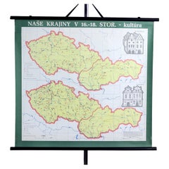
Vintage School Map of Czechoslovakia, 1960s
Located in Zohor, SK
This is a great vintage school map produced in Czechoslovakia by Skolske pomucky n.p., which was a
Category

Vintage 1960s Slovak Mid-Century Modern Posters

Materials

Paper

Vintage School Map of Czechoslovakia, 1960s
H 33.08 in W 48.82 in D 0.79 in
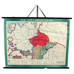
Vintage School Map Of Czech State, Czechoslovakia 1960s
Located in Zohor, SK
This is a great vintage school map of "Czech State1526-1648". The map was produced by a National
Category

Vintage 1960s Czech Mid-Century Modern Prints

Materials

Wood, Paper

Vintage mid-century school map “Digestion”, Germany ca. 1960
Located in Meulebeke, BE
Germany / 1960 / school map / canvas, wood / Mid-century / Vintage A school wall map of the
Category

Vintage 1960s German Mid-Century Modern Posters

Materials

Canvas, Wood

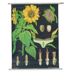
Large Vintage School Map Sunflower Jung Koch Quentell 117cm
By Jung Koch Quentell 1
Located in Poperinge, BE
Beautiful large vintage school map, school poster about the sunflower, paper on linen, by Jung Koch
Category

Vintage 1970s German Posters

Materials

Metal

Large Vintage School Map The Honeybee Jung Koch Quentell
Located in Poperinge, BE
Beautiful large vintage school map, school poster about the honey bee, paper on linen, by Jung Koch
Category

Vintage 1960s German Posters

Materials

Canvas, Wood, Paper

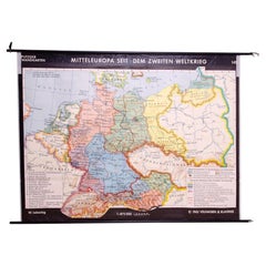
German Vintage school map of Central Europe, 1961
Located in Prague 8, CZ
Old Vintage school paper map of Central Europe. It was produced in 1961 in Germany. Map has on top
Category

Mid-20th Century German Mid-Century Modern Posters

Materials

Wood, Paper

Vintage school wall map of Europe 1815-1871, Belgium 1950s
Located in Meulebeke, BE
Belgium / 1950 / school map Europe 1815-1871 / canvas, wood / Mid-century / vintage Vintage school
Category

Vintage 1950s Belgian Mid-Century Modern Posters

Materials

Canvas, Wood

Antique Map of France from an Old Dutch School Atlas, 1852
Located in Langweer, NL
Antique map titled 'Frankrijk'. Map of France. This map originates from 'School-Atlas van alle
Category

Antique 19th Century Maps

Materials

Paper

Antique Map of Europe from an Old Dutch School-Atlas, 1852
Located in Langweer, NL
Antique map titled 'Europa'. Map of Europe. This map originates from 'School-Atlas van alle deelen
Category

Antique 19th Century Maps

Materials

Paper

Antique Map of Asia from a German School Atlas, c.1870
Located in Langweer, NL
Antique map titled 'Asien'. Old map of the Asian continent. This map originates from 'H. Kiepert's
Category

Antique 19th Century Maps

Materials

Paper

Antique Map of Greece from an Old French School Atlas, 1880
Located in Langweer, NL
Antique map titled 'Grèce Moderne '. Old map of Greece and surroundings. This map originates from
Category

Antique 19th Century Maps

Materials

Paper

Original Antique Map of Austria from an Old Dutch School Atlas, 1852
Located in Langweer, NL
Antique map titled 'Het Keizerrijk Oostenrijk'. Map of the Austrian Empire. This map originates
Category

Antique 1850s Maps

Materials

Paper

Antique Map of North America from an Old Dutch School Atlas, 1852
Located in Langweer, NL
Antique map titled 'Noord-Amerika'. Map of North America. This map originates from 'School-Atlas
Category

Antique 19th Century Maps

Materials

Paper

Antique Map of the Asian Continent from a German School Atlas, 1862
Located in Langweer, NL
Antique map titled 'Asien Politische Ubersicht'. Old map of the Asian continent. Originates from
Category

Antique 19th Century Maps

Materials

Paper

Antique Map of Germany and Switzerland from an Old Dutch School Atlas, 1852
Located in Langweer, NL
Antique map titled 'Duitschland en Zwitersland'. Map of Germany and Switzerland. This map
Category

Antique 19th Century Maps

Materials

Paper

Antique Map of Germany and Switzerland from an Old Dutch School Atlas, c.1873
Located in Langweer, NL
map originates from 'School-Atlas van alle Deelen der Aarde'. Artists and Engravers: Published by O
Category

Antique 19th Century Maps

Materials

Paper

1853 "Texas" Map by Daniel Burgess
Located in Colorado Springs, CO
-Hidalgo. Created as a school atlas map, the map is filled with rivers, place names, locations of eight
Category

Antique 1850s American Victorian Maps

Materials

Paper

1853 "Texas" Map by Daniel Burgess
H 15.63 in W 13.63 in D 1 in
Antique Map of Turkey and Greece, 1852
Located in Langweer, NL
Antique map titled 'Europisch Turkije en Griekenland'. Map of Turkey in Europe and Greece. This map
Category

Antique 19th Century Maps

Materials

Paper

Antique Map of Turkey and Greece, 1852
H 13.59 in W 10.63 in D 0 in
Antique Map of Overijssel by Bachiene, 1758
Located in Langweer, NL
Geography at the 'Illustere School'. This map was engraved by Jacobus Harrewijn-Harrewyn (1660-1727) after I
Category

Antique 18th Century Maps

Materials

Paper

Antique Map of the Netherlands by Petri, 1852
Located in Langweer, NL
map originates from 'School-Atlas van alle deelen der Aarde' by Otto Petri. Artists and Engravers
Category

Antique 19th Century Maps

Materials

Paper

Antique Map of South America by Petri, 1852
By Thomas Kitchin
Located in Langweer, NL
Antique map titled 'Zuid-Amerika'. Map of South America. This map originates from 'School-Atlas van
Category

Antique 19th Century Maps

Materials

Paper

Antique Map of the United Kingdom and Ireland, 1852
Located in Langweer, NL
Antique map titled 'Groot-Brittanje en Ierland'. Map of the United Kingdom and Ireland. This map
Category

Antique 19th Century Maps

Materials

Paper

Antique Mercator Projection World Map by Petri, c.1873
Located in Langweer, NL
Antique world map titled 'Wereldkaart naar Mercator's Projectie'. Old map of the world. This map
Category

Antique 19th Century Maps

Materials

Paper

Antique Map of Africa with European Language Borders, 1852
Located in Langweer, NL
Antique map titled 'Afrika'. Map of Africa. This map originates from 'School-Atlas van alle deelen
Category

Antique 19th Century Maps

Materials

Paper

Antique Map of Italy with Hand-Colored Borders, 1852
Located in Langweer, NL
Antique map titled 'Italië'. Map of Italy. This map originates from 'School-Atlas van alle deelen
Category

Antique 19th Century Maps

Materials

Paper

Antique Map of Asia Showing Its Political Divisions, 1874
Located in Langweer, NL
company had specialized in the production of school atlases and wall maps of America. They were one of the
Category

Antique 19th Century Maps

Materials

Paper

Antique Map of South America by Petri, c.1873
By Thomas Kitchin
Located in Langweer, NL
highland of Quito. This map originates from 'School-Atlas van alle Deelen der Aarde'. Artists and Engravers
Category

Antique 19th Century Maps

Materials

Paper

Antique Map of Russia and Poland by Petri, 1852
Located in Langweer, NL
Antique map titled 'Europeesch Rusland en Polen'. Map of Russia in Europe and Poland. This map
Category

Antique 19th Century Maps

Materials

Paper

Antique Map of Northern Germany by Petri, c.1873
Located in Langweer, NL
Antique map titled 'Noord-Duitschland'. Old map depicting northern Germany. This map originates
Category

Antique 19th Century Maps

Materials

Paper

Antique Map of the Austrian Empire by Petri, 1852
Located in Langweer, NL
Antique map titled 'Het Keizerrijk Oostenrijk'. Map of the Austrian Empire. This map originates
Category

Antique 19th Century Maps

Materials

Paper

Antique Map of Spain and Portugal by Petri, 1852
Located in Langweer, NL
Antique map titled 'Spanje en Portugal'. Map of Spain and Portugal. This map originates from
Category

Antique 19th Century Maps

Materials

Paper

Antique Map of Sweden and Norway by Petri, 1852
Located in Langweer, NL
Antique map titled 'Zweden en Noorwegen'. Map of Sweden and Norway. This map originates from
Category

Antique 19th Century Maps

Materials

Paper

FRAME DRIVING SCHOOL 70 S 20th Century
Located in Madrid, ES
Large Globe 50S THE GLOBE IS IN PLASTIC AND THE FOOT IN WOOD. 1950s. IT HAS LIGHT. GOOD CONDITION WITH CENTURIES OF USE. MEASUREMENTS: 110 CM IN HEIGHT AND 60 CM IN DIAMETER good con...
Category

20th Century English Modern Maps

Materials

Plastic, Wood

Antique Map of Turkey and Greece by Petri, c.1873
Located in Langweer, NL
Greece. This map originates from 'School-Atlas van alle Deelen der Aarde'. Artists and Engravers
Category

Antique 19th Century Maps

Materials

Paper

Antique Map of the United Kingdom and Ireland, c.1873
Located in Langweer, NL
, with inset maps of London and factory districts of the UK. This map originates from 'School-Atlas van
Category

Antique 19th Century Maps

Materials

Paper

Antique Map of Denmark with An Inset of Iceland, 1852
Located in Langweer, NL
Antique map titled 'Denemarken'. Map of Denmark, with a small inset map of Iceland. This map
Category

Antique 19th Century Maps

Materials

Paper

Antique Map of the Kingdom of Prussia by Petri, 1852
Located in Langweer, NL
Antique map titled 'Het Koningrijk Pruissen'. Map of the Kingdom of Prussia. This map originates
Category

Antique 19th Century Maps

Materials

Paper

Antique Map of Russia in Europe by Petri, c.1873
Located in Langweer, NL
Antique map titled 'Rusland in Europa'. Old map depicting Russia in Europe. This map originates
Category

Antique 19th Century Maps

Materials

Paper

Antique Map of Spain and Portugal by Petri, c.1873
Located in Langweer, NL
Antique map titled 'Spanje en Portugal'. Old map depicting Spain and Portugal. This map originates
Category

Antique 19th Century Maps

Materials

Paper

Antique Map of Sweden and Norway by Petri, c.1873
Located in Langweer, NL
Antique map titled 'Zweden en Noorwegen'. Old map depicting Sweden and Norway. This map originates
Category

Antique 19th Century Maps

Materials

Paper

Antique Map of the Austrian Empire by Petri, c.1873
Located in Langweer, NL
Antique map titled 'Het Keizerrijk Oostenrijk'. Old map depicting the Austrian Empire. This map
Category

Antique 19th Century Maps

Materials

Paper

Original Antique Map of the Township of Uithuizermeeden, the Netherlands, 1862
Located in Langweer, NL
Groningen: Gemeente Oldenzijl-Oosternieland-de Roode School-Uithuizermeeden. These scarse detailed
Category

Antique 19th Century Maps

Materials

Paper

Antique Map of Asia Showing the European Language Areas, c.1873
Located in Langweer, NL
Antique map titled 'Asia'. Old map depicting the Asian continent. This map originates from 'School
Category

Antique 19th Century Maps

Materials

Paper

Antique Linen Anatomical School Poster from the Cow, 1950s
Located in Leuven, Vlaams Gewest
1950s didactical anatomical school poster of the cow. Used to explain and show the anatomical
Category

Vintage 1950s Belgian Maps

Materials

Linen

Antique Map of the Netherlands, Belgium and Luxembourg by Petri, c.1873
Located in Langweer, NL
, Luxembourg and Belgium. With an inset map of Amsterdam. This map originates from 'School-Atlas van alle
Category

Antique 19th Century Maps

Materials

Paper

Antique Map of Denmark with Insets of Iceland and the Faroe Islands, c.1873
Located in Langweer, NL
inset maps of Iceland and the Faroe Islands. This map originates from 'School-Atlas van alle Deelen der
Category

Antique 19th Century Maps

Materials

Paper

Antique Map of Russia in Europe and Poland from an d Old Dutch Atlas, 1852
Located in Langweer, NL
Poland. This map originates from 'School-Atlas van alle deelen der Aarde' by Otto Petri. Artists and
Category

Antique 1850s Maps

Materials

Paper

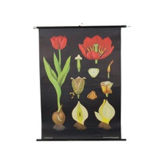
Large Vintage School Chart Tulip Flowers Jung Koch Quentell 117cm
By Jung Koch Quentell 1
Located in Poperinge, BE
Beautiful large vintage school map, school poster about the tulip, paper on linen, originally from
Category

Vintage 1970s German Posters

Materials

Linen, Wood, Paper

Vintage historical wall map of Europe around 1812, Belgium 1950s
Located in Meulebeke, BE
Belgium / 1950 / school map Europe 1812 / canvas, wood / Mid-century / vintage Beautiful vintage
Category

Vintage 1950s Belgian Mid-Century Modern Posters

Materials

Canvas, Wood

Large Vintage School Card The Butterfly Jung Koch Quentell 118cm
By Jung Koch Quentell 1
Located in Poperinge, BE
Beautiful large vintage school map, school poster about the butterfly, paper on linen, by Jung Koch
Category

Vintage 1960s German Posters

Materials

Canvas, Wood, Paper

Large Vintage School Chart Ergot Mold Jung Koch Quentell
By Jung Koch Quentell 1
Located in Poperinge, BE
Beautiful large vintage school map, school poster about ergot (Claviceps purpurea), a fungus that
Category

Vintage 1970s German Posters

Materials

Canvas, Wood, Paper

Dutch Municipality of Uithuizermeeden in Groningen, Kuyper, 1865
Located in Langweer, NL
Groningen: Gemeente Oldenzijl, Oosternieland, de Roode School, Uithuizermeeden. These scarse
Category

Antique 19th Century Maps

Materials

Paper

Vintage Rollable Map Southeast Asia China Japan Wall Chart
Located in Berghuelen, DE
A classical pull-down school map showing the popular region of Southeast Asia with China and Japan
Category

Late 20th Century German Country Prints

Materials

Canvas, Wood, Paper

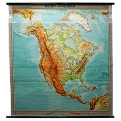
North America Vintage Map Pull-Down Wall Chart Poster Countrycore Print
Located in Berghuelen, DE
A traditional vintage pull-down school map illustrating North America, published by Westermann
Category

Late 20th Century German Country Prints

Materials

Canvas, Wood, Paper

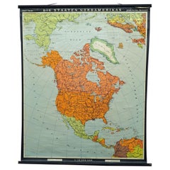
Vintage Map Wall Chart Countries of North America Rollable Mural Poster
Located in Berghuelen, DE
The vintage pull-down school map illustrates the countries / states of North America. Published by
Category

Late 20th Century German Country Prints

Materials

Canvas, Wood, Paper

Vintage Rollable Map Wall Chart South America Brasilia and Neighbour States
Located in Berghuelen, DE
A classical pull-down school map showing South America with Brasilia and its neighbor states
Category

Mid-20th Century German Country Prints

Materials

Canvas, Wood, Paper

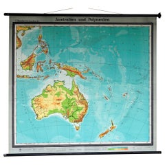
Map Mural Rollable Poster Vintage Wall Chart Australia New Zealand Polynesia
Located in Berghuelen, DE
school map illustrating the popular region of Australia and Polynesia. Used as teaching material in
Category

Vintage 1970s German Country Posters

Materials

Canvas, Wood, Paper

Middle East Saudia Arabia Israel India Map Rollable Mural Vintage Wall Chart
Located in Berghuelen, DE
The pull-down school map is depicting the region of the Middle East (Turkey, Israel, Egypt, Saudi
Category

Late 20th Century German Country Prints

Materials

Canvas, Wood, Paper

  • 1
Get Updated with New Arrivals
Save "School Map", and we’ll notify you when there are new listings in this category.

School Map For Sale on 1stDibs

Find many varieties of an authentic school map available at 1stDibs. Each school map for sale was constructed with extraordinary care, often using paper, wood and fabric. Whether you’re looking for an older or newer school map, there are earlier versions available from the 19th Century and newer variations made as recently as the 20th Century. A school map is a generally popular piece of furniture, but those created in Mid-Century Modern, Industrial and Art Deco styles are sought with frequency. Many designers have produced at least one well-made school map over the years, but those crafted by Jung Koch Quentell, Denoyer-Geppert and Dr. Friedrich Quentell are often thought to be among the most beautiful.

How Much is a School Map?

The average selling price for a school map at 1stDibs is $498, while they’re typically $240 on the low end and $3,750 for the highest priced.