Antique Map Of Switzerland

to
46
71
2
41
28
21
17
12
12
6
5
5
4
4
4
3
3
3
3
3
2
2
2
2
1
1
1
1
1
1
1
1
1
1
3
2
1
1
Sort By
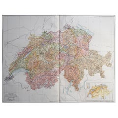
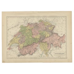
Large Original Vintage Map of Switzerland, circa 1920
Located in St Annes, Lancashire
Great map of Switzerland Original color. Good condition Published by Alexander Gross
Category

1920s English Antique Map Of Switzerland

Materials

Paper

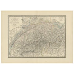
Antique Map of Switzerland by Lapie, 1842
Located in Langweer, NL
Antique map titled 'Carte de la Suisse ou Helvetie'. Map of Switzerland. This map originates from
Category

Mid-19th Century Antique Map Of Switzerland

Materials

Paper

Antique Map of Switzerland by Lapie, 1842
$470 Sale Price
20% Off
H 19.89 in W 26.78 in D 0.02 in
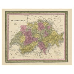
Colourful Antique Map of Switzerland, 1846
Located in Langweer, NL
Antique map titled 'Switzerland'. Old map of Switzerland. This map originates from 'A New
Category

1840s Antique Map Of Switzerland

Materials

Paper

Colourful Antique Map of Switzerland, 1846
$206 Sale Price
20% Off
H 13.78 in W 17.13 in D 0 in
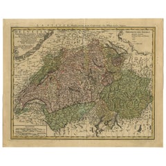
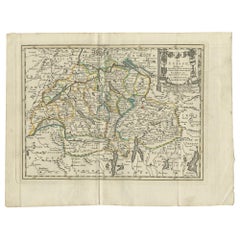
Antique Map of Switzerland by J.B. Homann, 1751
By Johann Baptist Homann
Located in Langweer, NL
Decorative example of Homann's map of Switzerland, with decorative cartouche and the coat of arms
Category

Mid-18th Century Antique Map Of Switzerland

Materials

Paper

Antique Map of Switzerland by J.B. Homann, 1751
$554 Sale Price
20% Off
H 19.3 in W 23.82 in D 0.02 in
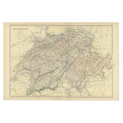
Antique Map of Switzerland by A & C. Black, 1870
Located in Langweer, NL
Antique map titled 'Switzerland'. Original antique map of Switzerland. This map originates from
Category

Late 19th Century Antique Map Of Switzerland

Materials

Paper

Antique Map of Switzerland by A & C. Black, 1870
$164 Sale Price
20% Off
H 13 in W 17.52 in D 0.02 in
Original Antique Map of Switzerland, 1882
Located in Langweer, NL
Embark on a historical journey with an original Antique Map of Switzerland from the renowned
Category

1880s Antique Map Of Switzerland

Materials

Paper

Original Antique Map of Switzerland, 1882
$216 Sale Price
20% Off
H 14.97 in W 22.45 in D 0 in
Antique Map of Switzerland by Keizer & de Lat, 1788
Located in Langweer, NL
Antique map titled 'La Suisse (..)'. Uncommon original antique map of Switzerland. This map
Category

Late 18th Century Antique Map Of Switzerland

Materials

Paper

Antique Map of Switzerland by Keizer & de Lat, 1788
$329 Sale Price
20% Off
H 8.08 in W 10.63 in D 0.02 in
Original Antique Map of Switzerland, Engraved By Barlow, Dated 1807
Located in St Annes, Lancashire
Great map of Switzerland Copper-plate engraving by Barlow Published by Brightly & Kinnersly
Category

Early 1800s English Antique Map Of Switzerland

Materials

Paper

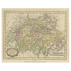
Small Original Antique Map of Switzerland and Surroundings, 1807
Located in Langweer, NL
Antique map titled 'Switzerland with its subjects & allies from the best authorities'. Small
Category

Early 1800s Antique Map Of Switzerland

Materials

Paper

Small Original Antique Map of Switzerland and Surroundings, 1807
$122 Sale Price
20% Off
H 8.08 in W 10.24 in D 0 in
Decorative and Detailed Original Antique Map of Switzerland, 1657
Located in Langweer, NL
Antique map of Switzerland titled 'Helvetiae Rhetiae & Valesiae'. Decorative and detailed map
Category

1650s Antique Map Of Switzerland

Materials

Paper

Decorative and Detailed Original Antique Map of Switzerland, 1657
$808 Sale Price
20% Off
H 19.69 in W 23.63 in D 0 in
Antique Map of Switzerland by Janssonius, 1657
Located in Langweer, NL
Antique map of Switzerland titled 'Helvetiae Rhetiae & Valesiae'. Decorative and detailed map of
Category

17th Century Antique Map Of Switzerland

Materials

Paper

Antique Map of Switzerland by Janssonius, 1657
$492 Sale Price
20% Off
H 19.69 in W 23.63 in D 0 in
Antique Map of Switzerland by Cluver, 1685
Located in Langweer, NL
Antique map titled 'Helvetiae Conterminarumque Terrarii, antiqua descriptio.' Miniature map of
Category

17th Century Antique Map Of Switzerland

Materials

Paper

Antique Map of Switzerland by Cluver, 1685
$108 Sale Price
20% Off
H 5.12 in W 5.63 in D 0 in
1859 Antique Swiss Panorama: Blackie's Detailed Map of Switzerland
Located in Langweer, NL
The "Antique Map of Switzerland" is a distinguished piece from 'The Imperial Atlas of Modern
Category

Mid-19th Century Antique Map Of Switzerland

Materials

Paper

1859 Antique Swiss Panorama: Blackie's Detailed Map of Switzerland
$205 Sale Price
30% Off
H 14.57 in W 21.26 in D 0.02 in
Original Hand-Colored Antique Regional Map of Switzerland, 1753
Located in Langweer, NL
Antique map Switzerland titled 'Territorium Reipublicae liberae Helveticae Scaphusiensis
Category

1750s Antique Map Of Switzerland

Materials

Paper

Original Hand-Colored Antique Regional Map of Switzerland, 1753
$554 Sale Price
20% Off
H 19.3 in W 23.43 in D 0 in
Antique Map of Switzerland by J. Tallis, circa 1851
Located in Langweer, NL
A decorative and detailed mid-19th century map of Switzerland which was drawn and engraved by J
Category

Mid-19th Century Antique Map Of Switzerland

Materials

Paper

Antique Map of Switzerland by J. Tallis, circa 1851
$258 Sale Price
20% Off
H 10.48 in W 14.69 in D 0.02 in
Antique Map of Switzerland by N. Visscher, circa 1690
Located in Langweer, NL
Beautifully detailed map of Switzerland and surrounding regions in present-day France, Germany, and
Category

Late 17th Century Antique Map Of Switzerland

Materials

Paper

Antique Map of Switzerland by N. Visscher, circa 1690
$639 Sale Price
20% Off
H 20.79 in W 24.97 in D 0.02 in
Antique Map of Switzerland by Homann, 1753
Located in Langweer, NL
Antique map Switzerland titled 'Territorium Reipublicae liberae Helveticae Scaphusiensis
Category

18th Century Antique Map Of Switzerland

Materials

Paper

Antique Map of Switzerland by Homann, 1753
$280 Sale Price
20% Off
H 19.3 in W 23.43 in D 0 in
Antique Map of Switzerland by Johnston, 1882
Located in Langweer, NL
Antique map titled 'Switzerland and the Alps of Savoy and Piedmont'. Old map of Switzerland and the
Category

19th Century Antique Map Of Switzerland

Materials

Paper

Antique Map of Switzerland by Johnston, 1882
$122 Sale Price
20% Off
H 24.26 in W 19.14 in D 0 in
1584 Ortelius Map of Switzerland: A Cartographic Reversal
Located in Langweer, NL
This is a fine example of Ortelius' map of Switzerland from his *Theatrum Orbis Terrarum
Category

16th Century Antique Map Of Switzerland

Materials

Paper

1584 Ortelius Map of Switzerland: A Cartographic Reversal
$905 Sale Price
30% Off
H 17.33 in W 21.46 in D 0 in
Swiss Splendor: Antique Map of Switzerland and Its Cantons, 1852
Located in Langweer, NL
The antique map titled 'Carte de la Suisse' is an attractive map of Switzerland. Here are the key
Category

Mid-19th Century Antique Map Of Switzerland

Materials

Paper

Swiss Splendor: Antique Map of Switzerland and Its Cantons, 1852
$131 Sale Price
20% Off
H 10.12 in W 13.39 in D 0.02 in
Antique Map of Switzerland by Homann Heirs, c.1732
Located in Langweer, NL
Antique map titled 'Potentissimae Helvetiorum Reipublicae (..)'. Beautiful detailed map of
Category

18th Century Antique Map Of Switzerland

Materials

Paper

Antique Map of Switzerland by Homann Heirs, c.1732
$369 Sale Price
20% Off
H 20.87 in W 24.02 in D 0 in
Beautiful Antique Handcolored Map of Switzerland with 33 Coats of Arms, ca.1705
Located in Langweer, NL
(..)'. Beautiful map of Switzerland with 33 coats of arms. The map is dedicated to the Duke of Burgundy and is
Category

Early 1700s Antique Map Of Switzerland

Materials

Paper

Beautiful Antique Handcolored Map of Switzerland with 33 Coats of Arms, ca.1705
$1,504 Sale Price
20% Off
H 52.5 in W 63.5 in D 0.002 in
Map of Switzerland by Justus Danckerts, Hand-Colored Engraving ca. 1690
Located in Langweer, NL
Map of Switzerland by Justus Danckerts, Hand-Colored Engraving ca. 1690 This detailed and
Category

Late 17th Century Antique Map Of Switzerland

Materials

Paper

Antique Map of Switzerland and the Alps of Savoy & Piedmont, 1903 Edition
Located in Langweer, NL
Title: Antique Map of Switzerland and the Alps of Savoy & Piedmont, 1903, with Intricate
Category

Early 20th Century Antique Map Of Switzerland

Materials

Paper

Antique Map of Switzerland by N. Visscher, circa 1690
Located in Langweer, NL
Antique map titled 'Tabula Geogaphica qua Pars Meridionalis sive Superior Rheni, Mosae, et Mosellae
Category

Late 17th Century Antique Map Of Switzerland

Materials

Paper

Antique Map of Switzerland by N. Visscher, circa 1690
$625 Sale Price
20% Off
H 21.03 in W 24.22 in D 0.02 in
Physical & Political Map of Switzerland: Late 18th Century - Mentelle Atlas
Located in Langweer, NL
areas. **Map Features:** - **Regions Displayed:** Entire territory of Switzerland, including all its
Category

1790s Antique Map Of Switzerland

Materials

Paper

Physical & Political Map of Switzerland: Late 18th Century - Mentelle Atlas
$498 Sale Price
20% Off
H 16.23 in W 22.25 in D 0.01 in
Antique Map of Switzerland by J. van Waesbergen, circa 1680
Located in Langweer, NL
Antique map titled 'Vera totius marchionatus Badensis, et Hochbergensis ; ceterorumque ducatuum
Category

Late 17th Century Antique Map Of Switzerland

Materials

Paper

Antique Map of Switzerland by J. van Waesbergen, circa 1680
$771 Sale Price
20% Off
H 20.67 in W 33.39 in D 0.02 in
Map of Switzerland - Etching - 19th Century
Located in Roma, IT
This map of Netherlands is an etching realized in 19th century. The state of preservation of the
Category

19th Century Antique Map Of Switzerland

Materials

Etching

Map of Switzerland - Etching - 19th Century
$264 Sale Price
25% Off
H 9.85 in W 11.82 in D 0.04 in
CIRCA 1850 MALBY & CO MAP OF SWiTZERLAND BY BAUERKELLER BURR WALNUT CHESS TABLE
By Malby & Co.
Located in West Sussex, Pulborough
and unique 3D made of Switzerland by Bauerkeller Please note the delivery fee listed is just a guide
Category

1850s Swiss Early Victorian Antique Map Of Switzerland

Materials

Walnut

CIRCA 1850 MALBY & CO MAP OF SWiTZERLAND BY BAUERKELLER BURR WALNUT CHESS TABLE
$6,533 Sale Price
20% Off
H 27.76 in W 30.32 in D 23.63 in
Antique Map of the Region of Aargau by Janssonius, '1657'
By Johannes Janssonius
Located in Langweer, NL
Antique map 'Argow cum parte merid. Zurichgow'. Detailed map of Switzerland showing Aargau with the
Category

Mid-17th Century Antique Map Of Switzerland

Materials

Paper

Antique Map of the Region of Aargau by Janssonius, '1657'
$564 Sale Price
20% Off
H 14.97 in W 19.69 in D 0.02 in
Genuine Antique Engraved Map of Helvetia or Switzerland, 1729
Located in Langweer, NL
Decorative early 18th century engraved map of Switzerland. Title: Helvetia Conterminarumq terra
Category

1720s Antique Map Of Switzerland

Materials

Paper

Genuine Antique Engraved Map of Helvetia or Switzerland, 1729
$366 Sale Price
20% Off
H 9.85 in W 14.18 in D 0 in
Circa 1659 Willem Blaeu Map: Southwestern Switzerland with Geneva & Lakes
Located in Langweer, NL
Circa 1659 Willem Blaeu Map: Southwestern Switzerland with Geneva & Lakes This detailed map from
Category

1650s Antique Map Of Switzerland

Materials

Paper

Circa 1659 Willem Blaeu Map: Southwestern Switzerland with Geneva & Lakes
$1,166 Sale Price
20% Off
H 15.1 in W 19.9 in D 0.002 in
Antique Map of the Region of Lake Geneva by Janssonius '1657'
By Johannes Janssonius
Located in Langweer, NL
Antique map 'Das Wiflispur Gergow'. Detailed map of Switzerland showing Waadt and the Lake of
Category

Mid-17th Century Antique Map Of Switzerland

Materials

Paper

Antique Map of the Region of Lake Geneva by Janssonius '1657'
$517 Sale Price
20% Off
H 14.97 in W 19.69 in D 0.02 in
Switzerland Map 1778 – Striking Hand-Colored Copperplate of the Thirteen Cantons
Located in Langweer, NL
Switzerland Map 1778 – Faden’s Hand-Colored Copperplate of the Thirteen Cantons This striking
Category

Late 18th Century European Antique Map Of Switzerland

Materials

Paper

Map of Northwestern Switzerland (Basel and Zurich Region) by Willem & Jan Blaeu
Located in Langweer, NL
Map of Northwestern Switzerland by Willem & Jan Blaeu (Circa 1650) This is a detailed map of
Category

1650s Antique Map Of Switzerland

Materials

Paper

Antique Map of Northern Switzerland by Janssonius '1657'
By Johannes Janssonius
Located in Langweer, NL
Antique map 'Zurichgow et Basiliensis provincia'. Detailed map of northern Switzerland, including
Category

Mid-17th Century Antique Map Of Switzerland

Materials

Paper

Antique Map of Northern Switzerland by Janssonius '1657'
$517 Sale Price
20% Off
H 14.97 in W 19.69 in D 0.02 in
Antique Map of Germany and Switzerland by Lowry, '1852'
Located in Langweer, NL
Antique map titled 'Germany and Switzerland'. Four individual sheets of Germany and Switzerland
Category

Mid-19th Century Antique Map Of Switzerland

Materials

Paper

Antique Map of Germany and Switzerland by Lowry, '1852'
$235 Sale Price / set
20% Off
H 12.21 in W 9.65 in D 0.02 in
Map of Avenches Region Switzerland by Mercator, Original 1585 Engraving
Located in Langweer, NL
western Switzerland, bordering Lake Geneva. The map is engraved in Mercator’s meticulous style and
Category

16th Century Dutch Antique Map Of Switzerland

Materials

Paper

Antique Map of Southern Germany and Switzerland by Cluver, 1685
Located in Langweer, NL
map of south Germany and Switzerland in Celtic times, From the pocket atlas 'Introductionis in
Category

17th Century Antique Map Of Switzerland

Materials

Paper

Antique Map of Southern Germany and Switzerland by Cluver, 1685
$117 Sale Price
20% Off
H 5.12 in W 5.44 in D 0 in
18th-Century Map of the Swiss Confederation by Robert de Vaugondy
Located in Langweer, NL
Title: 18th-Century Map of the Swiss Confederation by Robert de Vaugondy Description: This
Category

1750s Antique Map Of Switzerland

Materials

Paper

Antique Map of the Kanton Luzerne 'Switzerland' by Homann Heirs, 1763
Located in Langweer, NL
Antique map titled 'Canton Lucern (..)'. Fine decorative copper plate engraved antique map of the
Category

Mid-18th Century Antique Map Of Switzerland

Materials

Paper

Antique Map of the Kanton Luzerne 'Switzerland' by Homann Heirs, 1763
$460 Sale Price
20% Off
H 20.67 in W 25.4 in D 0.02 in
Antique Map of Germany, the Netherlands, Bohemia, Bavaria and Switzerland, 1785
Located in Langweer, NL
Antique map titled 'Germany and the Netherlands from the latest authorities'. Depicts Germany, the
Category

18th Century Antique Map Of Switzerland

Materials

Paper

Map of Doubs France with Besançon and Swiss Border Landscape, 19th Century
Located in Langweer, NL
Map of Doubs France with Besançon and Swiss Border Landscape, 19th Century Description: This
Category

Mid-19th Century French Antique Map Of Switzerland

Materials

Paper

Beautiful Original Copper Engraved Map of Lake Geneva in Switzerland, 1613
Located in Langweer, NL
Description: Antique map titled 'Lacus Lemanus'. Old map of Lake Geneva with good detail of
Category

1610s Antique Map Of Switzerland

Materials

Paper

Map of the Region of Basel and Northern Switzerland by Ortelius, circa 1603
Located in Langweer, NL
Two original antique maps on one sheet titled 'Basiliensis Territorii Descriptio Nova [with
Category

Early 17th Century Antique Map Of Switzerland

Materials

Paper

Map of the Region of Basel and Northern Switzerland by Ortelius, circa 1603
$517 Sale Price
20% Off
H 17.72 in W 22.05 in D 0.02 in
Antique Map of Germany and Switzerland from an Old Dutch School Atlas, 1852
Located in Langweer, NL
Antique map titled 'Duitschland en Zwitersland'. Map of Germany and Switzerland. This map
Category

19th Century Antique Map Of Switzerland

Materials

Paper

Antique Map of Germany and Switzerland from an Old Dutch School Atlas, 1852
$112 Sale Price
20% Off
H 10.63 in W 13.59 in D 0 in
Very Old Original Hand-Colored Map of the Basel Region, Switzerland, Ca.1578
Located in Langweer, NL
Antique print titled 'Basiliensis territorii descriptio nova'. Old map of the Basel region
Category

16th Century Antique Map Of Switzerland

Materials

Paper

Antique Map of Germany and Switzerland from an Old Dutch School Atlas, c.1873
Located in Langweer, NL
Antique map titled 'Deutschland en Zwitserland'. Old map depicting Germany and Switzerland. This
Category

19th Century Antique Map Of Switzerland

Materials

Paper

Antique Map of Switzerland by Jaillot, c.1705
Located in Langweer, NL
(..)'. Beautiful map of Switzerland with 33 coats of arms. The map is dedicated to the Duke of Burgundy and is
Category

18th Century Antique Map Of Switzerland

Materials

Paper

Antique Map of Switzerland by Jaillot, c.1705
$811
H 20.67 in W 25.01 in D 0 in
Antique Map of Switzerland by Tirion, c.1760
Located in Langweer, NL
Antique map titled 'Nieuwe Kaart van Zwitserland.' Very detailed map of Switzerland illustrating
Category

18th Century Antique Map Of Switzerland

Materials

Paper

Antique Map of Switzerland by Tirion, c.1760
$264
H 14.97 in W 16.54 in D 0 in
Antique Map of Switzerland and Liechtenstein by Petri, c.1873
Located in Langweer, NL
Antique map titled 'Zwitserland en het vorstendom Lichtenstein'. Old map depicting Switzerland and
Category

19th Century Antique Map Of Switzerland

Materials

Paper

Original Antique Map of Switzerland, circa 1800
Located in St Annes, Lancashire
Great map of Switzerland Copper plate engraving Published in The Barclays Dictionary, circa
Category

Early 1800s English Other Antique Map Of Switzerland

Materials

Paper

Original Antique Map of Switzerland, Arrowsmith, 1820
Located in St Annes, Lancashire
Great map of Switzerland Drawn under the direction of Arrowsmith Copper-plate engraving
Category

1820s English Antique Map Of Switzerland

Materials

Paper

Original Antique Map of Switzerland, circa 1840
Located in St Annes, Lancashire
Great map of Switzerland Printed on paper laid on to linen Steel engraving by R.Scott
Category

1840s Scottish Other Antique Map Of Switzerland

Materials

Paper

Antique Map of Switzerland by Levasseur '1875'
Located in Langweer, NL
Antique map titled 'Carte de la Suisse (..)'. Large map of Switzerland. This map originates from
Category

Late 19th Century Antique Map Of Switzerland

Materials

Paper

Antique Map of Switzerland by Levasseur '1875'
$470
H 18.71 in W 24.02 in D 0.02 in
Large Original Antique Map of Switzerland, 1861
Located in St Annes, Lancashire
Great map of Switzerland Drawn and engraved by Edward Weller Original color outline
Category

1860s English Victorian Antique Map Of Switzerland

Materials

Paper

Original Antique Map of Switzerland by Thomas Clerk, 1817
Located in St Annes, Lancashire
Great map of Switzerland Copper-plate engraving Drawn and engraved by Thomas Clerk, Edinburgh
Category

1810s English Antique Map Of Switzerland

Materials

Paper

Antique Map of Switzerland by Covens & Mortier, 1749
By Covens & Mortier
Located in Langweer, NL
'. Old map of Switzerland by Covens and Mortier, 1749. Shows Lake Como and Lake Geneva or Lac Leman, as
Category

Mid-18th Century Antique Map Of Switzerland

Materials

Paper

Antique Map of Switzerland by Covens & Mortier, 1749
$597
H 20.67 in W 26.38 in D 0.02 in
  • 1
Get Updated with New Arrivals
Save "Antique Map Of Switzerland", and we’ll notify you when there are new listings in this category.

Antique Map Of Switzerland For Sale on 1stDibs

Find many varieties of an authentic antique map of switzerland available at 1stDibs. Each antique map of switzerland for sale was constructed with extraordinary care, often using paper. There are many kinds of the antique map of switzerland you’re looking for, from those produced as long ago as the 18th Century to those made as recently as the 20th Century. When you’re browsing for the right antique map of switzerland, those designed in Victorian styles are of considerable interest. Covens & Mortier, Johann Baptist Homann and Johannes Janssonius each produced at least one beautiful antique map of switzerland that is worth considering.

How Much is a Antique Map Of Switzerland?

Prices for an antique map of switzerland can differ depending upon size, time period and other attributes — at 1stDibs, they begin at $50 and can go as high as $1,754, while the average can fetch as much as $274.